2011 Edition
CIA World Factbook 2011 Archive (HTML)
Introduction
Background
The Portuguese began to trade with the island of Timor in the early 16th century and colonized it in mid-century. Skirmishing with the Dutch in the region eventually resulted in an 1859 treaty in which Portugal ceded the western portion of the island. Imperial Japan occupied Portuguese Timor from 1942 to 1945, but Portugal resumed colonial authority after the Japanese defeat in World War II. East Timor declared itself independent from Portugal on 28 November 1975 and was invaded and occupied by Indonesian forces nine days later. It was incorporated into Indonesia in July 1976 as the province of Timor Timur (East Timor). An unsuccessful campaign of pacification followed over the next two decades, during which an estimated 100,000 to 250,000 individuals lost their lives. On 30 August 1999, in a UN-supervised popular referendum, an overwhelming majority of the people of Timor-Leste voted for independence from Indonesia. Between the referendum and the arrival of a multinational peacekeeping force in late September 1999, anti-independence Timorese militias - organized and supported by the Indonesian military - commenced a large-scale, scorched-earth campaign of retribution. The militias killed approximately 1,400 Timorese and forcibly pushed 300,000 people into western Timor as refugees. Most of the country's infrastructure, including homes, irrigation systems, water supply systems, and schools, and nearly 100% of the country's electrical grid were destroyed. On 20 September 1999, the Australian-led peacekeeping troops of the International Force for East Timor (INTERFET) deployed to the country and brought the violence to an end. On 20 May 2002, Timor-Leste was internationally recognized as an independent state. In late April 2006, internal tensions threatened the new nation's security when a military strike led to violence and a near breakdown of law and order. At Dili's request, an Australian-led International Stabilization Force (ISF) deployed to Timor-Leste in late May. In August, the UN Security Council established the UN Integrated Mission in Timor-Leste (UNMIT), which included an authorized police presence of over 1,600 personnel. The ISF and UNMIT restored stability, allowing for presidential and parliamentary elections in April and June 2007 in a largely peaceful atmosphere. In February 2008, a rebel group staged an unsuccessful attack against the president and prime minister. The ringleader was killed in the attack and most of the rebels surrendered in April 2008. Since the unsuccessful attacks the government has enjoyed one of its longest periods of post-independence stability.
Geography
Area
- 14,874 sq km 14,874 sq km 0 sq km
- total
- 14,874 sq km
- water
- 0 sq km
Area - comparative
slightly larger than Connecticut
Climate
tropical; hot, humid; distinct rainy and dry seasons
Coastline
706 km
Elevation extremes
- Timor Sea, Savu Sea, and Banda Sea 0 m Foho Tatamailau 2,963 m
- highest point
- Foho Tatamailau 2,963 m
- lowest point
- Timor Sea, Savu Sea, and Banda Sea 0 m
Environment - current issues
widespread use of slash and burn agriculture has led to deforestation and soil erosion
Environment - international agreements
- Biodiversity, Climate Change, Climate Change-Kyoto Protocol, Desertification none of the selected agreements
- party to
- Biodiversity, Climate Change, Climate Change-Kyoto Protocol, Desertification
- signed, but not ratified
- none of the selected agreements
Geographic coordinates
8 50 S, 125 55 E
Geography - note
Timor comes from the Malay word for "East"; the island of Timor is part of the Malay Archipelago and is the largest and easternmost of the Lesser Sunda Islands
Irrigated land
140 sq km (2008)
Land boundaries
- 228 km Indonesia 228 km
- border countries
- Indonesia 228 km
- total
- 228 km
Land use
- 8.2% 4.57% 87.23% (2005)
- arable land
- 8.2%
- other
- 87.23% (2005)
- permanent crops
- 4.57%
Location
Southeastern Asia, northwest of Australia in the Lesser Sunda Islands at the eastern end of the Indonesian archipelago; note - Timor-Leste includes the eastern half of the island of Timor, the Oecussi (Ambeno) region on the northwest portion of the island of Timor, and the islands of Pulau Atauro and Pulau Jaco
Map references
Southeast Asia
Maritime claims
- 12 nm 24 nm 200 nm
- contiguous zone
- 24 nm
- exclusive fishing zone
- 200 nm
- territorial sea
- 12 nm
Natural hazards
floods and landslides are common; earthquakes; tsunamis; tropical cyclones
Natural resources
gold, petroleum, natural gas, manganese, marble
Terrain
mountainous
People and Society
Age structure
- 33.8% (male 202,431/female 195,895) 62.5% (male 374,659/female 361,983) 3.6% (male 20,160/female 22,706) (2011 est.)
- 0-14 years
- 33.8% (male 202,431/female 195,895)
- 15-64 years
- 62.5% (male 374,659/female 361,983)
- 65 years and over
- 3.6% (male 20,160/female 22,706) (2011 est.)
Birth rate
25.7 births/1,000 population (2011 est.)
Children under the age of 5 years underweight
40.6% (2002)
Death rate
5.89 deaths/1,000 population (July 2011 est.)
Drinking water source
- urban: 86% of population rural: 63% of population total: 69% of population urban: 14% of population rural: 37% of population total: 31% of population (2008)
- rural
- 37% of population
- total
- 31% of population (2008)
- urban
- 14% of population
Education expenditures
16.8% of GDP (2009)
Ethnic groups
Austronesian (Malayo-Polynesian), Papuan, small Chinese minority
Health expenditures
12.3% of GDP (2009)
HIV/AIDS - adult prevalence rate
NA
HIV/AIDS - deaths
NA
HIV/AIDS - people living with HIV/AIDS
NA
Infant mortality rate
- 38.01 deaths/1,000 live births 43.79 deaths/1,000 live births 31.95 deaths/1,000 live births (2011 est.)
- female
- 31.95 deaths/1,000 live births (2011 est.)
- total
- 38.01 deaths/1,000 live births
Languages
Tetum (official), Portuguese (official), Indonesian, English there are about 16 indigenous languages; Tetum, Galole, Mambae, and Kemak are spoken by a significant portion of the population
Life expectancy at birth
- 67.95 years 65.54 years 70.47 years (2011 est.)
- female
- 70.47 years (2011 est.)
- total population
- 67.95 years
Literacy
- age 15 and over can read and write 58.6% NA NA (2002)
- definition
- age 15 and over can read and write
- female
- NA (2002)
- male
- NA
- total population
- 58.6%
Major cities - population
DILI (capital) 166,000 (2009)
Major infectious diseases
- very high bacterial and protozoal diarrhea, hepatitis A, and typhoid fever chikungunya, dengue fever and malaria (2009)
- degree of risk
- very high
- food or waterborne diseases
- bacterial and protozoal diarrhea, hepatitis A, and typhoid fever
- vectorborne diseases
- chikungunya, dengue fever and malaria (2009)
Maternal mortality rate
370 deaths/100,000 live births (2008)
Median age
- 22.5 years 22.5 years 22.5 years (2011 est.)
- female
- 22.5 years (2011 est.)
- male
- 22.5 years
- total
- 22.5 years
Nationality
- Timorese Timorese
- adjective
- Timorese
- noun
- Timorese
Net migration rate
0 migrant(s)/1,000 population (2011 est.)
Physicians density
0.1 physicians/1,000 population (2004)
Population
1,177,834 other estimates range as low as 800,000 (July 2011 est.)
Population growth rate
1.981% (2011 est.)
Religions
Roman Catholic 98%, Muslim 1%, Protestant 1% (2005)
Sanitation facility access
- urban: 76% of population rural: 40% of population total: 50% of population urban: 24% of population rural: 60% of population total: 50% of population (2008)
- rural
- 60% of population
- total
- 50% of population (2008)
- urban
- 24% of population
School life expectancy (primary to tertiary education)
- 11 years (2004)
- total
- 11 years (2004)
Sex ratio
- 1.05 male(s)/female 1.03 male(s)/female 1.04 male(s)/female 0.9 male(s)/female 1.03 male(s)/female (2011 est.)
- 15-64 years
- 1.04 male(s)/female
- 65 years and over
- 0.9 male(s)/female
- at birth
- 1.05 male(s)/female
- total population
- 1.03 male(s)/female (2011 est.)
- under 15 years
- 1.03 male(s)/female
Total fertility rate
3.13 children born/woman (2011 est.)
Urbanization
- 28% of total population (2010) 5% annual rate of change (2010-15 est.)
- rate of urbanization
- 5% annual rate of change (2010-15 est.)
- urban population
- 28% of total population (2010)
Government
Administrative divisions
13 administrative districts; Aileu, Ainaro, Baucau, Bobonaro (Maliana), Cova-Lima (Suai), Dili, Ermera (Gleno), Lautem (Los Palos), Liquica, Manatuto, Manufahi (Same), Oecussi (Ambeno), Viqueque administrative divisions have the same names as their administrative centers (exceptions have the administrative center name following in parentheses)
Capital
- Dili 8 35 S, 125 36 E UTC+9 (14 hours ahead of Washington, DC during Standard Time)
- geographic coordinates
- 8 35 S, 125 36 E
- name
- Dili
- time difference
- UTC+9 (14 hours ahead of Washington, DC during Standard Time)
Constitution
20 May 2002 (effective date)
Country name
- Democratic Republic of Timor-Leste (pronounced TEE-mor LESS-tay) Timor-Leste Republika Demokratika Timor Lorosa'e [Tetum]; Republica Democratica de Timor-Leste [Portuguese] Timor Lorosa'e [Tetum]; Timor-Leste [Portuguese] East Timor, Portuguese Timor
- conventional long form
- Democratic Republic of Timor-Leste (pronounced TEE-mor LESS-tay)
- conventional short form
- Timor-Leste
- former
- East Timor, Portuguese Timor
- local long form
- Republika Demokratika Timor Lorosa'e [Tetum]; Republica Democratica de Timor-Leste [Portuguese]
- local short form
- Timor Lorosa'e [Tetum]; Timor-Leste [Portuguese]
Diplomatic representation from the US
- Ambassador Judith R. FERGIN Avenida de Portugal, Praia dos Conqueiros, Dili US Department of State, 8250 Dili Place, Washington, DC 20521-8250 (670) 332-4684 (670) 331-3206
- chief of mission
- Ambassador Judith R. FERGIN
- embassy
- Avenida de Portugal, Praia dos Conqueiros, Dili
- FAX
- (670) 331-3206
- mailing address
- US Department of State, 8250 Dili Place, Washington, DC 20521-8250
- telephone
- (670) 332-4684
Diplomatic representation in the US
- Ambassador Constancio da Conceicao PINTO 4201 Connecticut Avenue NW, Suite 504,Washington, DC 20008 [1] (202) 966-3202 [1] (202) 966-3205
- chancery
- 4201 Connecticut Avenue NW, Suite 504,Washington, DC 20008
- chief of mission
- Ambassador Constancio da Conceicao PINTO
- FAX
- [1] (202) 966-3205
- telephone
- [1] (202) 966-3202
Executive branch
- President Jose RAMOS-HORTA (since 20 May 2007); note - the president plays a largely symbolic role but is able to veto legislation, dissolve parliament, and call national elections Prime Minister Kay Rala Xanana GUSMAO (since 8 August 2007); note - he formerly used the name Jose Alexandre GUSMAO; Vice Prime Minister Jose Luis GUTERRES (since 8 August 2007) Council of Ministers president elected by popular vote for a five-year term (eligible for a second term); election last held on 9 April 2007 with run-off on 8 May 2007 (next to be held in March 2012); following elections, president appoints leader of majority party or majority coalition as prime minister Jose RAMOS-HORTA elected president; percent of vote - Jose RAMOS-HORTA 69.2%, Francisco GUTTERES 30.8%
- cabinet
- Council of Ministers
- chief of state
- President Jose RAMOS-HORTA (since 20 May 2007); note - the president plays a largely symbolic role but is able to veto legislation, dissolve parliament, and call national elections
- election results
- Jose RAMOS-HORTA elected president; percent of vote - Jose RAMOS-HORTA 69.2%, Francisco GUTTERES 30.8%
- elections
- president elected by popular vote for a five-year term (eligible for a second term); election last held on 9 April 2007 with run-off on 8 May 2007 (next to be held in March 2012); following elections, president appoints leader of majority party or majority coalition as prime minister
- head of government
- Prime Minister Kay Rala Xanana GUSMAO (since 8 August 2007); note - he formerly used the name Jose Alexandre GUSMAO; Vice Prime Minister Jose Luis GUTERRES (since 8 August 2007)
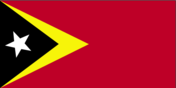
Flag description
red, with a black isosceles triangle (based on the hoist side) superimposed on a slightly longer yellow arrowhead that extends to the center of the flag; a white star - pointing to the upper hoist-side corner of the flag - is in the center of the black triangle; yellow denotes the colonialism in Timor-Leste's past; black represents the obscurantism that needs to be overcome; red stands for the national liberation struggle; the white star symbolizes peace and serves as a guiding light
Government type
republic
Independence
28 November 1975 (independence proclaimed from Portugal); note - 20 May 2002 is the official date of international recognition of Timor-Leste's independence from Indonesia
International law organization participation
has not submitted an ICJ jurisdiction declaration; accepts ICCt jurisdiction
International organization participation
ACP, ADB, AOSIS, ARF, ASEAN (observer), CPLP, FAO, G-77, IBRD, ICAO, ICRM, IDA, IFAD, IFC, IFRCS, ILO, IMF, IMO, Interpol, IOC, IOM, IPU, ITU, MIGA, NAM, OPCW, PIF (observer), UN, UNCTAD, UNESCO, UNIDO, Union Latina, UNWTO, UPU, WCO, WHO, WMO
Judicial branch
Supreme Court of Justice - constitution calls for one judge to be appointed by National Parliament and rest appointed by Superior Council for Judiciary; note - until Supreme Court is established, Court of Appeals is highest court
Legal system
civil law system based on the Indonesian model; note - new penal code based on the Portuguese model was passed by Parliament and promulgated in 2009; new civil code expected to be promulgated in 2011
Legislative branch
- unicameral National Parliament (number of seats can vary from 52 to 65; members elected by popular vote to serve five-year terms) last held on 30 June 2007 (next elections due by June 2012) percent of vote by party - FRETILIN 29%, CNRT 24.1%, ASDT-PSD 15.8%, PD 11.3%, PUN 4.5%, KOTA-PPT (Democratic Alliance) 3.2%, UNDERTIM 3.2%, others 8.9%; seats by party - FRETILIN 21, CNRT 18, ASDT-PSD 11, PD 8, PUN 3, KOTA-PPT 2, UNDERTIM 2
- election results
- percent of vote by party - FRETILIN 29%, CNRT 24.1%, ASDT-PSD 15.8%, PD 11.3%, PUN 4.5%, KOTA-PPT (Democratic Alliance) 3.2%, UNDERTIM 3.2%, others 8.9%; seats by party - FRETILIN 21, CNRT 18, ASDT-PSD 11, PD 8, PUN 3, KOTA-PPT 2, UNDERTIM 2
- elections
- last held on 30 June 2007 (next elections due by June 2012)
National anthem
- "Patria" (Fatherland) Fransisco Borja DA COSTA/Afonso DE ARAUJO adopted 2002; the song was first used as an anthem when Timor-Leste declared its independence from Portugal in 1975; the lyricist, Fransisco Borja DA COSTA, was killed in an Indonesian invasion just days after independence was declared
- lyrics/music
- Fransisco Borja DA COSTA/Afonso DE ARAUJO
- name
- "Patria" (Fatherland)
National holiday
Independence Day, 28 November (1975)
Political parties and leaders
Democratic Party or PD [Fernando de ARAUJO]; National Congress for Timorese Reconstruction or CNRT [Xanana GUSMAO]; National Democratic Union of Timorese Resistance or UNDERTIM [Cornelio DA Conceicao GAMA]; National Unity Party or PUN [Fernanda BORGES]; People's Party of Timor or PPT [Jacob XAVIER]; Revolutionary Front of Independent Timor-Leste or FRETILIN [Mari ALKATIRI]; Social Democratic Association of Timor or ASDT [Francisco Xavier do AMARAL]; Social Democratic Party or PSD [Zacarias Albano da COSTA]; Sons of the Mountain Warriors or KOTA [Manuel TILMAN] (also known as Association of Timorese Heroes)
Political pressure groups and leaders
NA
Suffrage
17 years of age; universal
Economy
Agriculture - products
coffee, rice, corn, cassava, sweet potatoes, soybeans, cabbage, mangoes, bananas, vanilla
Budget
- $900 million $800 million (2010 est.)
- expenditures
- $800 million (2010 est.)
- revenues
- $900 million
Commercial bank prime lending rate
11% (31 December 2010 est.) 11.2% (31 December 2009 est.)
Current account balance
$1.161 billion (2007 est.)
Distribution of family income - Gini index
31.9 (2007 est.) 38 (2002 est.)
Economy - overview
In late 1999, about 70% of the economic infrastructure of Timor-Leste was laid waste by Indonesian troops and anti-independence militias. Three hundred thousand people fled westward. Over the next three years a massive international program, manned by 5,000 peacekeepers (8,000 at peak) and 1,300 police officers, led to substantial reconstruction in both urban and rural areas. By the end of 2005, refugees had returned or had settled in Indonesia. The country continues to face great challenges in rebuilding its infrastructure, strengthening the civil administration, and generating jobs for young people entering the work force. The development of oil and gas resources in offshore waters has greatly supplemented government revenues. This technology-intensive industry, however, has done little to create jobs for the unemployed because there are no production facilities in Timor-Leste. Gas is piped to Australia. In June 2005, the National Parliament unanimously approved the creation of a Petroleum Fund to serve as a repository for all petroleum revenues and to preserve the value of Timor-Leste's petroleum wealth for future generations. The Fund held assets of US$6.6 billion as of October 2010. The economy continues to recover strongly from the mid-2006 outbreak of violence and civil unrest, which disrupted both private and public sector economic activity. The government in 2008 resettled tens of thousands of an estimated 100,000 internally displaced persons (IDPs); most IDPs returned home by early 2009. Government spending increased markedly in 2009 and 2010, primarily on basic infrastructure, including electricity and roads. Limited experience in procurement and infrastructure building has hampered these projects. The underlying economic policy challenge the country faces remains how best to use oil-and-gas wealth to lift the non-oil economy onto a higher growth path and to reduce poverty.
Electricity - consumption
NA kWh (2008 est.)
Electricity - exports
0 kWh (2009 est.)
Electricity - imports
0 kWh (2009 est.)
Electricity - production
NA kWh (2008 est.)
Exchange rates
the US dollar is used
Exports
$9.2 million (2009 est.) $10 million (2005 est.) excludes oil
Exports - commodities
coffee, sandalwood, marble; note - potential for oil and vanilla exports
GDP - composition by sector
- 27.9% 18% 54.1% (2010 est.)
- agriculture
- 27.9%
- industry
- 18%
- services
- 54.1% (2010 est.)
GDP - per capita (PPP)
$2,600 (2010 est.) $2,500 (2009 est.) $2,300 (2008 est.) data are in 2010 US dollars
GDP - real growth rate
6.1% (2010 est.) 12.9% (2009 est.) 11% (2008 est.)
GDP (official exchange rate)
$628 million (2010 est.)
GDP (purchasing power parity)
$3.051 billion (2010 est.) $2.877 billion (2009 est.) $2.547 billion (2008 est.) data are in 2010 US dollars
Household income or consumption by percentage share
- 4% 27% (2007)
- highest 10%
- 27% (2007)
- lowest 10%
- 4%
Imports
$384.9 million (2009 est.) $202 million (2004 est.)
Imports - commodities
food, gasoline, kerosene, machinery
Industrial production growth rate
8.5% (2004 est.)
Industries
printing, soap manufacturing, handicrafts, woven cloth
Inflation rate (consumer prices)
6.9% (2010 est.) 0.7% (2009 est.)
Investment (gross fixed)
38.4% of GDP (2010 est.)
Labor force
414,200 (2007)
Labor force - by occupation
- 90% NA% NA% (2006 est.)
- agriculture
- 90%
- industry
- NA%
- services
- NA% (2006 est.)
Market value of publicly traded shares
$NA
Natural gas - consumption
0 cu m (2009 est.)
Natural gas - exports
0 cu m (2009 est.)
Natural gas - imports
0 cu m (2009 est.)
Natural gas - production
0 cu m (2009 est.)
Natural gas - proved reserves
200 billion cu m (1 January 2006 est.)
Oil - consumption
2,600 bbl/day (2010 est.)
Oil - exports
86,000 bbl/day (2009 est.)
Oil - imports
2,205 bbl/day (2009 est.)
Oil - production
87,500 bbl/day (2010 est.)
Oil - proved reserves
553.8 million bbl (1 January 2011 est.)
Population below poverty line
42% (2003 est.)
Reserves of foreign exchange and gold
$406.2 million (31 December 2010 est.) $249.9 million (31 December 2009 est.)
Stock of broad money
$294 million (31 December 2010 est.) $269.7 million (31 December 2009 est.)
Stock of domestic credit
$127.1 million (31 December 2008 est.) $100 million (31 December 2007 est.)
Stock of narrow money
$142.6 million (31 December 2010 est.) $157.4 million (31 December 2009 est.)
Unemployment rate
20% (2006 est.) data are for rural areas, unemployment rises to more than 40% among urban youth
Communications
Broadcast media
1 public TV broadcast station broadcasting nationally and 1 public radio broadcaster with stations in each of the 13 administrative districts; one commercial TV broadcast station broadcasting in parts of Dili only, a few commercial radio stations, and roughly a dozen community radio stations (2009)
Internet country code
.tl
Internet hosts
206 (2010)
Internet users
2,100 (2009)
Telephone system
- rudimentary service in urban and some rural areas system suffered significant damage during the violence associated with independence; limited fixed-line services; mobile-cellular services and coverage available in urban and some rural areas country code - 670; international service is available in major urban centers
- domestic
- system suffered significant damage during the violence associated with independence; limited fixed-line services; mobile-cellular services and coverage available in urban and some rural areas
- general assessment
- rudimentary service in urban and some rural areas
- international
- country code - 670; international service is available in major urban centers
Telephones - main lines in use
2,400 (2010)
Telephones - mobile cellular
600,600 (2010)
Transportation
Airports
6 (2010)
Airports - with paved runways
- 1 (2010)
- 1,524 to 2,437 m
- 1 (2010)
- 2,438 to 3,047 m
- 1
- total
- 2
Airports - with unpaved runways
- 2 (2010)
- 914 to 1,523 m
- 2
- total
- 4
- under 914 m
- 2 (2010)
Heliports
8 (2010)
Merchant marine
- passenger/cargo 1 (2010)
- total
- 1
Ports and terminals
Dili
Roadways
- 6,040 km 2,600 km 3,440 km (2005)
- total
- 6,040 km
- unpaved
- 3,440 km (2005)
Military and Security
Manpower available for military service
- 305,643 293,052 (2010 est.)
- females age 16-49
- 293,052 (2010 est.)
- males age 16-49
- 305,643
Manpower fit for military service
- 243,120 251,061 (2010 est.)
- females age 16-49
- 251,061 (2010 est.)
- males age 16-49
- 243,120
Manpower reaching militarily significant age annually
- 12,737 12,389 (2010 est.)
- female
- 12,389 (2010 est.)
- male
- 12,737
Military branches
- Timor-Leste Defense Force (Forcas de Defesa de Timor-L'este, Falintil (F-FDTL)): Army, Navy (Armada) (2010)
- Timor-Leste Defense Force (Forcas de Defesa de Timor-L'este, Falintil (F-FDTL))
- Army, Navy (Armada) (2010)
Military expenditures
NA
Military service age and obligation
18 years of age for voluntary military service; no conscription; 18-month service obligation (2011)
Transnational Issues
Disputes - international
Timor-Leste-Indonesia Boundary Committee has resolved all but some sections of border along Timor-Leste's Oecussi exclave; maritime boundaries with Indonesia remain unresolved; many refugees who left Timor-Leste in 2003 still reside in Indonesia and refuse repatriation; in 2007, Australia and Timor-Leste signed a 50-year development zone and revenue sharing agreement in lieu of a maritime boundary
Illicit drugs
NA
Refugees and internally displaced persons
- 100,000 (2007)
- IDPs
- 100,000 (2007)