1996 Edition
CIA World Factbook 1996 (Project Gutenberg)
Introduction
Description
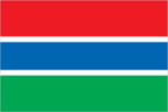
three equal horizontal bands of red (top), blue with white edges, and green
Location
13 28 N, 16 34 W -- Western Africa, bordering the North Atlantic Ocean and Senegal Flag ----
Geography
Area
- comparative area
- slightly more than twice the size of Delaware
- land area
- 10,000 sq km
- total area
- 11,300 sq km
Climate
tropical; hot, rainy season (June to November); cooler, dry season (November to May)
Coastline
80 km
Environment
- current issues
- deforestation; desertification; water-borne diseases prevalent
- international agreements
- party to - Biodiversity, Climate Change, Endangered Species, Law of the Sea, Nuclear Test Ban, Ozone Layer Protection, Ship Pollution, Whaling; signed, but not ratified - Desertification
- natural hazards
- rainfall has dropped by 30% in the last 30 years
Geographic coordinates
13 28 N, 16 34 W
Geographic note
almost an enclave of Senegal; smallest country on the continent of Africa
International disputes
short section of boundary with Senegal is indefinite
Irrigated land
120 sq km (1989 est.)
Land boundaries
- border country
- Senegal 740 km
- total
- 740 km
Land use
- arable land
- 16%
- forest and woodland
- 20%
- meadows and pastures
- 9%
- other
- 55%
- permanent crops
- 0%
Location
Western Africa, bordering the North Atlantic Ocean and Senegal
Map references
Africa
Maritime claims
- contiguous zone
- 18 nm
- continental shelf
- not specified
- exclusive fishing zone
- 200 nm
- territorial sea
- 12 nm
Natural resources
fish
Terrain
- flood plain of the Gambia River flanked by some low hills
- highest point
- unnamed location 53 m
- lowest point
- Atlantic Ocean 0 m
People and Society
Age structure
0-14 years: 46% (male 276,782; female 275,683) 15-64 years: 51% (male 307,405; female 312,736) 65 years and over: 3% (male 17,278; female 15,100) (July 1996 est.)
Birth rate
44.44 births/1,000 population (1996 est.)
Death rate
13.66 deaths/1,000 population (1996 est.)
Ethnic divisions
African 99% (Mandinka 42%, Fula 18%, Wolof 16%, Jola 10%, Serahuli 9%, other 4%), non-Gambian 1%
Infant mortality rate
80.5 deaths/1,000 live births (1996 est.)
Languages
English (official), Mandinka, Wolof, Fula, other indigenous vernaculars
Life expectancy at birth
- female
- 55.24 years (1996 est.)
- male
- 50.74 years
- total population
- 52.96 years
Literacy
- age 15 and over can read and write (1995 est.)
- female
- 24.9%
- male
- 52.8%
- total population
- 38.6%
Nationality
- adjective
- Gambian
- noun
- Gambian(s)
Net migration rate
4.72 migrant(s)/1,000 population (1996 est.)
Population
1,204,984 (July 1996 est.)
Population growth rate
3.55% (1996 est.)
Religions
Muslim 90%, Christian 9%, indigenous beliefs 1%
Sex ratio
- all ages
- 1 male(s)/female (1996 est.)
- at birth
- 1.03 male(s)/female
- under 15 years
- 1 male(s)/female 15-64 years: 0.98 male(s)/female 65 years and over: 1.14 male(s)/female
Total fertility rate
6.06 children born/woman (1996 est.)
Government
Administrative divisions
5 divisions and 1 city*; Banjul*, Lower River, MacCarthy Island, North Bank, Upper River, Western
Capital
Banjul
Constitution
24 April 1970; suspended July 1994
Data code
GA
Diplomatic representation in US
- chancery
- Suite 1000, 1155 15th Street NW, Washington, DC 20005
- chief of mission
- Ambassador (vacant); Counselor, Charge d'Affaires ad interim Tombong SAIDY
- telephone
- [1] (202) 785-1399, 1379, 1425
Executive branch
- cabinet
- Cabinet normally is appointed by the president from members of the House of Representatives (present cabinet appointed by Chairman of the Armed Forces Provisional Ruling Council)
- chief of state and head of government
- Chairman of the Armed Forces Provisional Ruling Council Capt. Yahya A. J. J. JAMMEH (since the military coup of 22 July 1994); Vice Chairman of the Armed Forces Provisional Ruling Council Capt. Edward SINGHATEH (since March 1995); last popular election held on 29 April 1992; results - Sir Dawda JAWARA (PPP) 58.5%, Sherif Mustapha DIBBA (NCP) 22.2%, Assan Musa CAMARA (GPP) 8.0% (prior to the 22 July 1994 coup, next election had been scheduled for April 1997)
FAX
- [1] (202) 785-1430
- [220] 392475
Flag
three equal horizontal bands of red (top), blue with white edges, and green
House of Representatives
- last popular election held on 29 April 1992 (next to be held NA April 1997); results - PPP won 58.1% of votes; seats - (43 total, 36 elected) PPP 30, NCP 6
- note
- following the military coup on 22 July 1994, all elective offices were dissolved; in April 1996, the military government announced that voter registrations would begin in May and democratic elections would be held in October 1996
Independence
18 February 1965 (from UK; The Gambia and Senegal signed an agreement on 12 December 1981 that called for the creation of a loose confederation to be known as Senegambia, but the agreement was dissolved on 30 September 1989)
International organization participation
ACP, AfDB, C, CCC, ECA, ECOWAS, FAO, G-77, IBRD, ICAO, ICFTU, ICRM, IDA, IDB, IFAD, IFC, IFRCS, ILO, IMF, IMO, Intelsat (nonsignatory user), Interpol, IOC, ITU, NAM, OAU, OIC, UN, UNCTAD, UNESCO, UNIDO, UPU, WCL, WFTU, WHO, WIPO, WMO, WToO
Judicial branch
Supreme Court
Legal system
based on a composite of English common law, Koranic law, and customary law; accepts compulsory ICJ jurisdiction, with reservations
Legislative branch
unicameral
Name of country
- conventional long form
- Republic of The Gambia
- conventional short form
- The Gambia
National holiday
Independence Day, 18 February (1965)
Political parties and leaders
- the following political parties were active on 22 July 1994, after which time political activity was
- banned by the military government
- People's Progressive Party (PPP), Dawda K. JAWARA (in exile), secretary general; National Convention Party (NCP), Sheriff DIBBA (in exile); Gambian People's Party (GPP), Hassan Musa CAMARA; United Party (UP), leader NA; People's Democratic Organization of Independence and Socialism (PDOIS), leader NA; People's Democratic Party (PDP), Jabel SALLAH
Suffrage
21 years of age; universal
Type of government
republic under multiparty democratic rule note:: nominally a republic, The Gambia has had a military government since 22 July 1994; the military authority has promised to return control to a democratically-elected government in July 1996
US diplomatic representation
- chief of mission
- Ambassador Gerald A. SCOTT
- embassy
- Fajara, Kairaba Avenue, Banjul
- mailing address
- P. M. B. No. 19, Banjul
- telephone
- [220] 392856, 392858, 391970, 391971
Economy
Agriculture
peanuts, millet, sorghum, rice, corn, cassava (tapioca), palm kernels; cattle, sheep, goats; forest and fishing resources not fully exploited
Budget
- expenditures
- $90 million, including capital expenditures of $NA (FY95/96 est.)
- revenues
- $91.4 million
Currency
1 dalasi (D) = 100 butut
Economic aid
- recipient
- ODA, $NA
Economic overview
The Gambia has no important mineral or other natural resources and has a limited agricultural base. About 75% of the population is engaged in crop production and livestock raising. Small-scale manufacturing activity features the processing of peanuts, fish, and hides. A sustained structural adjustment program, including a liberalized trade policy, had fostered a respectable 4% annual rate of growth in 1990-93. Reexport trade normally constitutes one-third of economic activity; however, border closures associated with Senegal's monetary crisis in late 1993 led to a halving of reexport trade, reducing government revenues in turn. The 50% devaluation of the CFA franc in January 1994 has made Senegalese goods more competitive and apparently prompted a relaxation of Senegalese controls, paving the way for a comeback in reexports. But, in response to the military's takeover in July 1994, cuts in foreign trade and a decline in tourism have undermined economic growth.
Electricity
- capacity
- 30,000 kW
- consumption per capita
- 64 kWh (1993)
- production
- 70 million kWh
Exchange rates
dalasi (D) per US$1 - 9.555 (August 1996), 9.576 (1994), 9.129 (1993), 8.888 (1992), 8.803 (1991)
Exports
- $35 million (f.o.b., 1994 est.)
- commodities
- peanuts and peanut products, fish, cotton lint, palm kernels
- partners
- Japan 60%, Europe 29%, Africa 5%, US 1%, other 5% (1989)
External debt
$386 million (1993 est.)
Fiscal year
1 July - 30 June
GDP
purchasing power parity - $1.1 billion (1995 est.)
GDP composition by sector
- agriculture
- 27%
- industry
- 15%
- services
- 58% (1993)
GDP per capita
$1,100 (1995 est.)
GDP real growth rate
2% (1995 est.)
Imports
- $209 million (f.o.b., 1994 est.)
- commodities
- foodstuffs, manufactures, raw materials, fuel, machinery and transport equipment
- partners
- Europe 57%, Asia 25%, USSR and Eastern Europe 9%, US 6%, other 3% (1989)
Industrial production growth rate
NA%
Industries
processing peanuts, fish, and hides; tourism; beverages; agricultural machinery assembly, woodworking, metalworking; clothing
Inflation rate (consumer prices)
1.7% (1994)
Labor force
- 400,000 (1986 est.)
- by occupation
- agriculture 75.0%, industry, commerce, and services 18.9%, government 6.1%
Unemployment rate
NA%
Communications
Branches
Army, Navy, National Police
Defense expenditures
exchange rate conversion - $14 million, 3.8% of GDP (FY93/94)
Manpower availability
- males age 15-49
- 267,188
- males fit for military service
- 134,611 (1996 est.)
Radio broadcast stations
AM 3, FM 2, shortwave 0
Radios
180,000 (1993 est.)
Telephone system
- domestic
- adequate network of microwave radio relay and open wire
- international
- microwave radio relay links to Senegal and Guinea-Bissau; satellite earth station - 1 Intelsat (Atlantic Ocean)
Telephones
11,000 (1991 est.)
Television broadcast stations
NA
Televisions
NA Defense
Transportation
Airports
- total
- 1
- with paved runways over 3 047 m
- 1 (1995 est.)
Highways
- paved
- 764 km
- total
- 2,386 km
- unpaved
- 1,622 km (1990 est.)
Merchant marine
none
Ports
Banjul
Railways
0 km
Waterways
400 km