2012 Edition
CIA World Factbook 2012 Archive (HTML)
Introduction
Background
After three decades as part of the UN Trust Territory of the Pacific under US administration, this westernmost cluster of the Caroline Islands opted for independence in 1978 rather than join the Federated States of Micronesia. A Compact of Free Association with the US was approved in 1986 but not ratified until 1993. It entered into force the following year when the islands gained independence.
Geography
Area
- 459 sq km 459 sq km 0 sq km
- total
- 459 sq km
- water
- 0 sq km
Area - comparative
slightly more than 2.5 times the size of Washington, DC
Climate
tropical; hot and humid; wet season May to November
Coastline
1,519 km
Elevation extremes
- Pacific Ocean 0 m Mount Ngerchelchuus 242 m
- highest point
- Mount Ngerchelchuus 242 m
- lowest point
- Pacific Ocean 0 m
Environment - current issues
inadequate facilities for disposal of solid waste; threats to the marine ecosystem from sand and coral dredging, illegal fishing practices, and overfishing
Environment - international agreements
- Biodiversity, Climate Change, Climate Change-Kyoto Protocol, Desertification, Law of the Sea, Ozone Layer Protection, Wetlands, Whaling none of the selected agreements
- party to
- Biodiversity, Climate Change, Climate Change-Kyoto Protocol, Desertification, Law of the Sea, Ozone Layer Protection, Wetlands, Whaling
- signed, but not ratified
- none of the selected agreements
Geographic coordinates
7 30 N, 134 30 E
Geography - note
westernmost archipelago in the Caroline chain, consists of six island groups totaling more than 300 islands; includes World War II battleground of Beliliou (Peleliu) and world-famous rock islands
Irrigated land
NA
Land boundaries
0 km
Land use
- 8.7% 4.35% 86.95% (2005)
- arable land
- 8.7%
- other
- 86.95% (2005)
- permanent crops
- 4.35%
Location
Oceania, group of islands in the North Pacific Ocean, southeast of the Philippines
Map references
Oceania
Maritime claims
- 3 nm 200 nm
- exclusive fishing zone
- 200 nm
- territorial sea
- 3 nm
Natural hazards
typhoons (June to December)
Natural resources
forests, minerals (especially gold), marine products, deep-seabed minerals
Terrain
varying geologically from the high, mountainous main island of Babelthuap to low, coral islands usually fringed by large barrier reefs
People and Society
Age structure
- 21% (male 2,281/ female 2,140) 72.3% (male 8,411/ female 6,803) 6.6% (male 402/ female 995) (2012 est.)
- 0-14 years
- 21% (male 2,281/ female 2,140)
- 15-64 years
- 72.3% (male 8,411/ female 6,803)
- 65 years and over
- 6.6% (male 402/ female 995) (2012 est.)
Birth rate
10.79 births/1,000 population (2012 est.)
Death rate
7.89 deaths/1,000 population (July 2012 est.)
Education expenditures
NA
Ethnic groups
Palauan (Micronesian with Malayan and Melanesian admixtures) 69.9%, Filipino 15.3%, Chinese 4.9%, other Asian 2.4%, white 1.9%, Carolinian 1.4%, other Micronesian 1.1%, other or unspecified 3.2% (2000 census)
Health expenditures
11.2% of GDP (2009)
HIV/AIDS - adult prevalence rate
NA
HIV/AIDS - deaths
NA
HIV/AIDS - people living with HIV/AIDS
NA
Hospital bed density
4.9 beds/1,000 population (2009)
Infant mortality rate
- 12.1 deaths/1,000 live births 13.7 deaths/1,000 live births 10.4 deaths/1,000 live births (2012 est.)
- female
- 10.4 deaths/1,000 live births (2012 est.)
- total
- 12.1 deaths/1,000 live births
Languages
Palauan (official on most islands) 64.7%, Filipino 13.5%, English (official) 9.4%, Chinese 5.7%, Carolinian 1.5%, Japanese 1.5%, other Asian 2.3%, other languages 1.5% (2000 census) Sonsoral (Sonsoralese and English are official), Tobi (Tobi and English are official), and Angaur (Angaur, Japanese, and English are official)
Life expectancy at birth
- 72.06 years 68.9 years 75.4 years (2012 est.)
- female
- 75.4 years (2012 est.)
- total population
- 72.06 years
Literacy
- age 15 and over can read and write 92% 93% 90% (1980 est.)
- definition
- age 15 and over can read and write
- female
- 90% (1980 est.)
- male
- 93%
- total population
- 92%
Median age
- 32.8 years 32.4 years 33.6 years (2012 est.)
- female
- 33.6 years (2012 est.)
- male
- 32.4 years
- total
- 32.8 years
Nationality
- Palauan(s) Palauan
- adjective
- Palauan
- noun
- Palauan(s)
Net migration rate
0.71 migrant(s)/1,000 population (2012 est.)
Physicians density
1.3 physicians/1,000 population (2006)
Population
21,032 (July 2012 est.)
Population growth rate
0.361% (2012 est.)
Religions
Roman Catholic 41.6%, Protestant 23.3%, Modekngei 8.8% (indigenous to Palau), Seventh-Day Adventist 5.3%, Jehovah's Witnesses 0.9%, Mormon 0.6%, other 3.1%, unspecified or none 16.4% (2000 census)
Sanitation facility access
- urban: 92% of population rural: 52% of population total: 80% of population urban: 8% of population rural: 48% of population total: 20% of population
- rural
- 48% of population
- total
- 20% of population
- urban
- 8% of population
School life expectancy (primary to tertiary education)
- 15 years 14 years 15 years (2001)
- female
- 15 years (2001)
- male
- 14 years
- total
- 15 years
Sex ratio
- 1.06 male(s)/female 1.07 male(s)/female 1.24 male(s)/female 0.4 male(s)/female 1.12 male(s)/female (2011 est.)
- 15-64 years
- 1.24 male(s)/female
- 65 years and over
- 0.4 male(s)/female
- at birth
- 1.06 male(s)/female
- total population
- 1.12 male(s)/female (2011 est.)
- under 15 years
- 1.07 male(s)/female
Total fertility rate
1.72 children born/woman (2012 est.)
Urbanization
- 83% of total population (2010) 1.4% annual rate of change (2010-15 est.)
- rate of urbanization
- 1.4% annual rate of change (2010-15 est.)
- urban population
- 83% of total population (2010)
Government
Administrative divisions
16 states; Aimeliik, Airai, Angaur, Hatohobei, Kayangel, Koror, Melekeok, Ngaraard, Ngarchelong, Ngardmau, Ngatpang, Ngchesar, Ngeremlengui, Ngiwal, Peleliu, Sonsorol
Capital
- Melekeok 7 29 N, 134 38 E UTC+9 (14 hours ahead of Washington, DC during Standard Time)
- geographic coordinates
- 7 29 N, 134 38 E
- name
- Melekeok
- time difference
- UTC+9 (14 hours ahead of Washington, DC during Standard Time)
Constitution
1 January 1981
Country name
- Republic of Palau Palau Beluu er a Belau Belau Trust Territory of the Pacific Islands, Palau District
- conventional long form
- Republic of Palau
- conventional short form
- Palau
- former
- Trust Territory of the Pacific Islands, Palau District
- local long form
- Beluu er a Belau
- local short form
- Belau
Diplomatic representation from the US
- Ambassador Helen P. REED-ROWE Koror (no street address) P. O. Box 6028, Republic of Palau 96940 [680] 488-2920, 2990 [680] 488-2911
- chief of mission
- Ambassador Helen P. REED-ROWE
- embassy
- Koror (no street address)
- FAX
- [680] 488-2911
- mailing address
- P. O. Box 6028, Republic of Palau 96940
- telephone
- [680] 488-2920, 2990
Diplomatic representation in the US
- Ambassador Hersey KYOTA 1701 Pennsylvania Avenue NW, Suite 300, Washington, DC 20006 [1] (202) 452-6814 [1] (202) 452-6281 Tamuning (Guam)
- chancery
- 1701 Pennsylvania Avenue NW, Suite 300, Washington, DC 20006
- chief of mission
- Ambassador Hersey KYOTA
- consulate(s)
- Tamuning (Guam)
- FAX
- [1] (202) 452-6281
- telephone
- [1] (202) 452-6814
Executive branch
- President Tommy REMENGESAU (since 17 January 2013); Vice President Kerai MARIUR (since 15 January 2009); note - the president is both the chief of state and head of government President Tommy REMENGESAU (since 17 January 2013); Vice President Kerai MARIUR (since 15 January 2009) NA president and vice president elected on separate tickets by popular vote for four-year terms (eligible for a second term); election last held on 6 November 2012 (next to be held in November 2016) percent of vote - Tommy REMENGESAU 58%, Johnson TORIBIONG 42%
- cabinet
- NA
- chief of state
- President Tommy REMENGESAU (since 17 January 2013); Vice President Kerai MARIUR (since 15 January 2009); note - the president is both the chief of state and head of government
- election results
- percent of vote - Tommy REMENGESAU 58%, Johnson TORIBIONG 42%
- elections
- president and vice president elected on separate tickets by popular vote for four-year terms (eligible for a second term); election last held on 6 November 2012 (next to be held in November 2016)
- head of government
- President Tommy REMENGESAU (since 17 January 2013); Vice President Kerai MARIUR (since 15 January 2009)
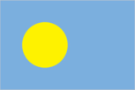
Flag description
light blue with a large yellow disk shifted slightly to the hoist side; the blue color represents the ocean, the disk represents the moon; Palauans consider the full moon to be the optimum time for human activity; it is also considered a symbol of peace, love, and tranquility
Government type
constitutional government in free association with the US; the Compact of Free Association entered into force on 1 October 1994
Independence
1 October 1994 (from the US-administered UN trusteeship)
International law organization participation
has not submitted an ICJ jurisdiction declaration; non-party state to the ICCt
International organization participation
ACP, ADB, AOSIS, FAO, IAEA, IBRD, ICAO, ICRM, IDA, IFC, IFRCS, ILO, IMF, IMO, IMSO, IOC, IPU, MIGA, OPCW, PIF, Sparteca, SPC, UN, UNAMID, UNCTAD, UNESCO, WHO
Judicial branch
Supreme Court; Court of Common Pleas; Land Court
Legal system
mixed legal system of civil, common, and customary law
Legislative branch
- bicameral National Congress or Olbiil Era Kelulau (OEK) consists of the Senate (9 seats; members elected by popular vote on a population basis to serve four-year terms) and the House of Delegates (16 seats; members elected by popular vote to serve four-year terms) Senate - last held on 4 November 2008 (next to be held in November 2012); House of Delegates - last held on 4 November 2008 (next to be held in November 2012) Senate - percent of vote - NA; seats - independents 9; House of Delegates - percent of vote - NA; seats - independents 16
- election results
- Senate - percent of vote - NA; seats - independents 9; House of Delegates - percent of vote - NA; seats - independents 16
- elections
- Senate - last held on 4 November 2008 (next to be held in November 2012); House of Delegates - last held on 4 November 2008 (next to be held in November 2012)
National anthem
- "Belau rekid" (Our Palau) multiple/Ymesei O. EZEKIEL adopted 1980
- lyrics/music
- multiple/Ymesei O. EZEKIEL
- name
- "Belau rekid" (Our Palau)
National holiday
Constitution Day, 9 July (1979)
Political parties and leaders
none
Political pressure groups and leaders
NA
Suffrage
18 years of age; universal
Economy
Agriculture - products
coconuts, copra, cassava (tapioca), sweet potatoes; fish
Budget
- $89 million $94.3 million (2010 est.)
- expenditures
- $94.3 million (2010 est.)
- revenues
- $89 million
Budget surplus (+) or deficit (-)
-3.2% of GDP (2010 est.)
Current account balance
-$20.8 million (2010 est.) $15.09 million (FY03/04)
Debt - external
$0 (FY99/00)
Economy - overview
The economy consists primarily of tourism, subsistence agriculture, and fishing. The government is the major employer of the work force relying heavily on financial assistance from the US. The Compact of Free Association with the US, entered into after the end of the UN trusteeship on 1 October 1994, provided Palau with up to $700 million in US aid for the following 15 years in return for furnishing military facilities. Business and tourist arrivals numbered 85,000 in 2007. The population enjoys a per capita income roughly double that of the Philippines and much of Micronesia. Long-run prospects for the key tourist sector have been greatly bolstered by the expansion of air travel in the Pacific, the rising prosperity of leading East Asian countries, and the willingness of foreigners to finance infrastructure development.
Exchange rates
the US dollar is used, 1 (2011)
Exports
$12.3 million (2010 est.) $5.882 million (2004 est.)
Exports - commodities
shellfish, tuna, copra, garments
Fiscal year
1 October - 30 September
GDP - composition by sector
- 3.2% 20% 76.8% (2009 est.)
- agriculture
- 3.2%
- industry
- 20%
- services
- 76.8% (2009 est.)
GDP - per capita (PPP)
$8,100 (2008 est.) $7,600 (2005 est.)
GDP - real growth rate
5.5% (2005 est.)
GDP (official exchange rate)
$164 million (2008)
GDP (purchasing power parity)
$164 million (2008 est.) $124.5 million (2004 est.) data are in 2012 US dollars GDP estimate includes US subsidy
Household income or consumption by percentage share
- NA% NA%
- highest 10%
- NA%
- lowest 10%
- NA%
Imports
$113.4 million (2010 est.) $107.3 million (2004 est.)
Imports - commodities
machinery and equipment, fuels, metals; foodstuffs
Industrial production growth rate
NA%
Inflation rate (consumer prices)
2.7% (2011 est.) 1.6% (2010 est.)
Labor force
9,777 (2005)
Labor force - by occupation
- 20% (1990) (1990) (1990)
- agriculture
- 20%
- industry
- (1990)
- services
- (1990) (1990)
Market value of publicly traded shares
$NA
Population below poverty line
NA%
Taxes and other revenues
54.3% of GDP (2010 est.)
Unemployment rate
4.2% (2005 est.)
Communications
Broadcast media
no TV stations; a cable TV network covers the major islands and provides access to rebroadcasts, on a delayed basis, of a number of US stations as well as access to a number of real-time satellite TV channels; about a half dozen radio stations with 1 government-owned (2009)
Internet country code
.pw
Internet hosts
4 (2012)
Telephone system
- NA fixed-line and mobile-cellular services available with a combined subscribership of roughly 100 per 100 persons country code - 680; satellite earth station - 1 Intelsat (Pacific Ocean)
- domestic
- fixed-line and mobile-cellular services available with a combined subscribership of roughly 100 per 100 persons
- general assessment
- NA
- international
- country code - 680; satellite earth station - 1 Intelsat (Pacific Ocean)
Telephones - main lines in use
6,900 (2011)
Telephones - mobile cellular
15,400 (2011)
Transportation
Airports
3 (2012)
Airports - with paved runways
- 1 (2012)
- 1,524 to 2,437 m
- 1 (2012)
- total
- 1
Airports - with unpaved runways
- 2 (2012)
- 1,524 to 2,437 m
- 2 (2012)
- total
- 2
Ports and terminals
Koror
Military and Security
Manpower available for military service
- 6,987 (2010 est.)
- males age 16-49
- 6,987 (2010 est.)
Manpower fit for military service
- 5,272 3,969 (2010 est.)
- females age 16-49
- 3,969 (2010 est.)
- males age 16-49
- 5,272
Manpower reaching militarily significant age annually
- 222 (2010 est.)
- female
- 222 (2010 est.)
- male
- 216
Military - note
defense is the responsibility of the US; under a Compact of Free Association between Palau and the US, the US military is granted access to the islands for 50 years, but it has not stationed any military forces there (2008)
Military branches
no regular military forces; Palau National Police (2009)
Military expenditures
NA
Transnational Issues
Disputes - international
maritime delineation negotiations continue with Philippines, Indonesia