1996 Edition
CIA World Factbook 1996 (Project Gutenberg)
Introduction
Description
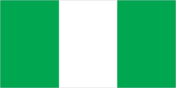
three equal vertical bands of green (hoist side), white, and green
Location
10 00 N, 8 00 E -- Western Africa, bordering the Gulf of Guinea, between Benin and Cameroon Flag ----
Geography
Area
- comparative area
- slightly more than twice the size of California
- land area
- 910,770 sq km
- total area
- 923,770 sq km
Climate
varies; equatorial in south, tropical in center, arid in north
Coastline
853 km
Environment
- current issues
- soil degradation; rapid deforestation; desertification; recent droughts in north severely affecting marginal agricultural activities
- international agreements
- party to - Biodiversity, Climate Change, Endangered Species, Hazardous Wastes, Law of the Sea, Marine Dumping, Marine Life Conservation, Nuclear Test Ban, Ozone Layer Protection, Whaling; signed, but not ratified - Desertification
- natural hazards
- periodic droughts
Geographic coordinates
10 00 N, 8 00 E
International disputes
demarcation of international boundaries in vicinity of Lake Chad, the lack of which led to border incidents in the past, is completed and awaits ratification by Cameroon, Chad, Niger, and Nigeria; dispute with Cameroon over land and maritime boundaries in the vicinity of the Bakasi Peninsula has been referred to the ICJ
Irrigated land
8,650 sq km (1989 est.)
Land boundaries
- border countries
- Benin 773 km, Cameroon 1,690 km, Chad 87 km, Niger 1,497 km
- total
- 4,047 km
Land use
- arable land
- 31%
- forest and woodland
- 15%
- meadows and pastures
- 23%
- other
- 28%
- permanent crops
- 3%
Location
Western Africa, bordering the Gulf of Guinea, between Benin and Cameroon
Map references
Africa
Maritime claims
- continental shelf
- 200-m depth or to the depth of exploitation
- exclusive economic zone
- 200 nm
- territorial sea
- 30 nm
Natural resources
petroleum, tin, columbite, iron ore, coal, limestone, lead, zinc, natural gas
Terrain
- southern lowlands merge into central hills and plateaus; mountains in southeast, plains in north
- highest point
- Chappal Waddi 2,419 m
- lowest point
- Atlantic Ocean 0 m
People and Society
Age structure
0-14 years: 45% (male 23,455,266; female 23,245,099) 15-64 years: 52% (male 27,645,106; female 26,553,135) 65 years and over: 3% (male 1,522,862; female 1,491,021) (July 1996 est.)
Birth rate
42.89 births/1,000 population (1996 est.)
Death rate
12.71 deaths/1,000 population (1996 est.)
Ethnic divisions
- non-Africans 27,000
- north
- Hausa and Fulani
- note
- Hausa and Fulani, Yoruba, and Ibos together make up 65% of population
- southeast
- Ibos
- southwest
- Yoruba
Infant mortality rate
72.4 deaths/1,000 live births (1996 est.)
Languages
English (official), Hausa, Yoruba, Ibo, Fulani
Life expectancy at birth
- female
- 55.65 years (1996 est.)
- male
- 53.06 years
- total population
- 54.34 years
Literacy
- age 15 and over can read and write (1995 est.)
- female
- 47.3%
- male
- 67.3%
- total population
- 57.1%
Nationality
- adjective
- Nigerian
- noun
- Nigerian(s)
Net migration rate
0.34 migrant(s)/1,000 population (1996 est.)
Population
103,912,489 (July 1996 est.)
Population growth rate
3.05% (1996 est.)
Religions
Muslim 50%, Christian 40%, indigenous beliefs 10%
Sex ratio
- all ages
- 1.03 male(s)/female (1996 est.)
- at birth
- 1.03 male(s)/female
- under 15 years
- 1.01 male(s)/female 15-64 years: 1.04 male(s)/female 65 years and over: 1.02 male(s)/female
Total fertility rate
6.24 children born/woman (1996 est.)
Government
Administrative divisions
30 states and 1 territory*; Abia, Abuja Capital Territory*, Adamawa, Akwa Ibom, Anambra, Bauchi, Benue, Borno, Cross River, Delta, Edo, Enugu, Imo, Jigawa, Kaduna, Kano, Katsina, Kebbi, Kogi, Kwara, Lagos, Niger, Ogun, Ondo, Osun, Oyo, Plateau, Rivers, Sokoto, Taraba, Yobe; note - some new administrative units may have been created
Capital
- Abuja
- note
- on 12 December 1991 the capital was officially moved from Lagos to Abuja; many government offices remain in Lagos pending completion of facilities in Abuja
Constitution
1979 constitution still in force; plan for 1989 constitution to take effect in 1993 was not implemented
Data code
NI
Diplomatic representation in US
- chancery
- 1333 16th Street NW, Washington, DC 20036
- chief of mission
- Ambassador Zubair Mahmud KAZAURE
- consulate(s) general
- New York
- telephone
- [1] (202) 986-8400
Executive branch
- cabinet
- Federal Executive Council
- chief of state and head of government
- Chairman of the Provisional Ruling Council and Commander in Chief of Armed Forces and Defense Minister Gen. Sani ABACHA (since 17 November 1993); Vice Chairman of the Provisional Ruling Council Oladipo DIYA (since 17 November 1993)
FAX
[234] (1) 261-0257
Flag
three equal vertical bands of green (hoist side), white, and green
House of Representatives
suspended after military takeover of 17 November 1993
Independence
1 October 1960 (from UK)
International organization participation
ACP, AfDB, C (suspended), CCC, ECA, ECOWAS, FAO, G-15, G-19, G-24, G-77, IAEA, IBRD, ICAO, ICC, ICRM, IDA, IFAD, IFC, IFRCS, ILO, IMF, IMO, Inmarsat, Intelsat, Interpol, IOC, ITU, MINURSO, NAM, OAU, OPEC, PCA, UN, UN Security Council (temporary), UNAMIR, UNAVEM III, UNCRO, UNCTAD, UNESCO, UNHCR, UNIDO, UNIKOM, UNPREDEP, UNPROFOR, UNU, UPU, WCL, WFTU, WHO, WIPO, WMO, WToO, WTrO
Judicial branch
Supreme Court, judges appointed by the Armed Forces Ruling Council; Federal Court of Appeal, judges are appointed by the federal government on the advice of the Advisory Judicial Committee
Legal system
based on English common law, Islamic law, and tribal law
Legislative branch
bicameral National Assembly
Name of country
- conventional long form
- Federal Republic of Nigeria
- conventional short form
- Nigeria
National holiday
Independence Day, 1 October (1960)
Political parties and leaders
- note
- political party system suspended after the military takeover of 17 November 1993; the military regime has made successive promises to allow political parties to register at various times in 1996
Senate
suspended after military takeover of 17 November 1993
Suffrage
21 years of age; universal
Type of government
military government; Nigeria has been ruled by one military regime after another since 31 December 1983; on 1 October 1995, the present military government announced it will turn power over to democratically elected civilian authorities in October 1998
US diplomatic representation
- chief of mission
- Ambassador Walter C. CARRINGTON
- embassy
- 2 Eleke Crescent, Lagos
- mailing address
- P. O. Box 554, Lagos
- telephone
- [234] (1) 261-0097
Economy
Agriculture
cocoa, peanuts, palm oil, rubber, corn, rice, sorghum, millet, cassava (tapioca), yams; cattle, sheep, goats, pigs; fishing and forest resources extensively exploited
Budget
- expenditures
- $6.4 billion, including capital expenditures of $1.8 billion (1994 est.)
- revenues
- $2.7 billion
Currency
1 naira (N) = 100 kobo
Economic aid
- recipient
- ODA, $NA
Economic overview
The oil-rich Nigerian economy continues to be hobbled by political instability, corruption, and poor macroeconomic management. Nigeria's unpopular military rulers failed to make significant progress in diversifying the economy away from overdependence on the capital intensive oil sector which provides almost all foreign exchange earnings and about 80% of budgetary revenues. Regime officials also appear divided on how to redress fundamental economic imbalances that result in troublesome inflation, the steady depreciation of the naira, and the discouragement of investors. The government's domestic and international arrears continue to limit economic growth and prevent an agreement with the IMF and bilateral creditors on debt relief. The largely subsistence agricultural sector has failed to keep up with rapid population growth, and Nigeria, once a large net exporter of food, now must import food.
Electricity
- capacity
- 4,570,000 kW
- consumption per capita
- 109 kWh (1993)
- production
- 11.3 billion kWh
Exchange rates
naira (N) per US$1 - 21.886 (January 1996), 21.895 (1995), 21.996 (1994), 22.065 (1993), 17.298 (1992), 9.909 (1991)
Exports
- $9.9 billion (f.o.b., 1993)
- commodities
- oil 98%, cocoa, rubber
- partners
- US 52%, EC 34%
External debt
$32.5 billion (1993)
Fiscal year
calendar year
GDP
purchasing power parity - $135.9 billion (1995 est.)
GDP composition by sector
- agriculture
- 38%
- industry
- 22%
- services
- 40% (1994 est.)
GDP per capita
$1,300 (1995 est.)
GDP real growth rate
2.6% (1995 est.)
Illicit drugs
passenger and cargo air hub for West Africa; facilitates movement of heroin en route from Southeast and Southwest Asia to Western Europe and North America; increasingly a transit route for cocaine from South America intended for West European, East Asian, and North American markets
Imports
- $7.5 billion (c.i.f., 1993)
- commodities
- machinery, transportation equipment, manufactured goods, chemicals, food and animals
- partners
- EC 50%, US 13%, Japan 7%
Industrial production growth rate
NA%
Industries
crude oil, coal, tin, columbite, palm oil, peanuts, cotton, rubber, wood, hides and skins, textiles, cement and other construction materials, food products, footwear, chemicals, fertilizer, printing, ceramics, steel
Inflation rate (consumer prices)
57% (1994 est.)
Labor force
- 42.844 million
- by occupation
- agriculture 54%, industry, commerce, and services 19%, government 15%
Unemployment rate
28% (1992 est.)
Communications
Branches
Army, Navy, Air Force, paramilitary Police Force
Defense expenditures
exchange rate conversion - $172 million, about 1% of GDP (1992)
Manpower availability
- males age 15-49
- 23,739,192
- males fit for military service
- 13,587,780
- males reach military age (18) annually
- 1,065,410 (1996 est.)
Radio broadcast stations
AM 35, FM 17, shortwave 0
Radios
20 million (1992 est.)
Telephone system
- average system limited by poor maintenance; major expansion in progress
- domestic
- microwave radio relay, coaxial cable, and 20 domestic satellite earth stations carry intercity traffic
- international
- satellite earth stations - 3 Intelsat (2 Atlantic Ocean and 1 Indian Ocean); 1 coaxial submarine cable
Telephones
492,204 (1990 est.)
Television broadcast stations
28
Televisions
3.8 million (1992 est.) Defense
Transportation
Airports
- total
- 66
- with paved runways 1 524 to 2 437 m
- 10
- with paved runways 2 438 to 3 047 m
- 10
- with paved runways 914 to 1 523 m
- 8
- with paved runways over 3 047 m
- 6
- with paved runways under 914 m
- 18
- with unpaved runways 1 524 to 2 437 m
- 1
- with unpaved runways 914 to 1 523 m
- 12 (1995 est.)
- with unpaved runways over 3 047 m
- 1
Heliports
1 (1995 est.)
Highways
- paved
- 31,500 km
- total
- 112,140 km
- unpaved
- 80,640 km (1991 est.)
Merchant marine
- ships by type
- bulk 1, cargo 16, chemical tanker 3, oil tanker 12, roll-on/roll-off cargo 1 (1995 est.)
- total
- 33 ships (1,000 GRT or over) totaling 387,552 GRT/636,578 DWT
Pipelines
crude oil 2,042 km; petroleum products 3,000 km; natural gas 500 km
Ports
Calabar, Lagos, Onne, Port Harcourt, Sapele, Warri
Railways
- narrow gauge
- 3,505 km 1.067-m gauge
- standard gauge
- 52 km 1.435-m gauge
- total
- 3,557 km (1995)
Waterways
8,575 km consisting of the Niger and Benue rivers and smaller rivers and creeks