1984 Edition
CIA World Factbook 1984 (Internet Archive)
Geography
Agriculture
commercial — cowpeas, groundnuts, cotton; main food crops— millet, sorghum, rice
Area
1,266,510 km2; 7.6% permanent meadow and pasture, 2.6% arable; 2.3% forest and woodland; .02% inland water; 87% other; remainder desert
Branches
executive authority exercised by Supreme Military Council (SMC) composed of army officers; office of prime minister created January 1983; since November 1983, civilians have held all cabinet portfolios except Defense and Interior
Budget
(1981/82 prov.) revenue $234 million, current expenditure $190 million, capital expenditure $38 million, extrabudgetary expenditure $215 million
Capital
Niamey
Communists
no Communist party; some sympathizers in outlawed Sawaba party
Elections
popular elections currently allowed only for choosing representatives for village Development Councils, which advise on local economic development Political parties and leaders: political parties banned
Electric power
120,000 kW capacity (1983); 1 10 million kWh produced (1983), 20 kWh per capita
Ethnic divisions
56% Hausa; 22% Djerma; 8.5% Fula; 8% Tuareg; 4.3% Beri Beri (Kanouri); 1.2% Arab, Toubou, and Gourmantche; about 4,000 French expatriates
Exports
$362 million (f.o.b., 1982); about 75% uranium in 1982, rest livestock, cowpeas, onions, hides, skins; exports understated because much regional trade not recorded
Fiscal year
1 October-30 September Communications
GDP
$2.0 billion (1982), $425 per capita; annual real growth rate -0.8% (1970-1980)
Government leader
Brig. Gen. Seyni KOUNTCHE, President of Supreme Military Council, Chief of State, Minister of Defense, and Minister of Interior
Highways
8,547 km total; 3,001 km paved bituminous, 2,658 km gravel, 2,888 km unimproved earth
Imports
$438 million (f.o.b., 1982); petroleum products, primary materials, machinery, vehicles and parts, electronic equipment, Pharmaceuticals, chemical products, cereals, foodstuffs
Labor force
2.5 million (1982) wage earners; 90% agriculture, 6% industry and commerce, 4% government
Land boundaries
5,745 km People
Language
French (official); Hausa, Djerma
Legal system
based on French civil law system and customary law; constitution adopted 1960, suspended 1974; committee appointed January 1984 to "reflect" on a new national charter; judicial review of legislative acts in Constitutional Chamber of the Supreme Court; has not accepted compulsory ICJ jurisdiction
Literacy
5%
Major industries
cement plant, brick factory, rice mill, small cotton gins, oil presses, slaughterhouse, and a few other small light industries; uranium production began in
Major trade partners
France (about half), other EC countries, Nigeria, UDEAC countries; US (3.8%, 1981); preferential tariff to EC and franc zone countries
Member of
AfDB, APC, CEAO, KAMA, EGA, ECOWAS, Entente, FAO, G-77, GATT, IAEA, IBRD, ICAO, IDA, IDE— Islamic Development Bank, IFAD, IFC, ILO, IMF, INTELSAT, INTERPOL, IPU, ITU, Lake Chad Basin Commission, Niger River Commission, NAM, OAU, OCAM, QIC, UN, UNESCO, UPU, WHO, WIPO, WMO Economy
Monetary conversion rate
422.25 Communaute Financiere Africaine francs=US$l (February 1984)
National holidays
Independence Day, 3 August; Republic Day, 18 December
Nationality
noun — Nigerien(s) adjective — Nigerien
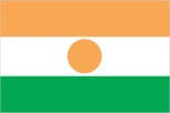
Official name
Republic of Niger
Organized labor
negligible Government
Political subdivisions
1 departments, 32 arrondissements
Population
6,284,000 (July 1984), average annual growth rate 3.3%
Railroads
none
Religion
80% Muslim, remainder indigenous beliefs and Christians
Suffrage
universal adult
Type
republic; military regime in power since April 1974