2017 Edition
CIA World Factbook 2017 Archive (HTML)
Introduction
Background
- The Dutch began to colonize Indonesia in the early 17th century; Japan occupied the islands from 1942 to 1945. Indonesia declared its independence shortly before Japan's surrender, but it required four years of sometimes brutal fighting, intermittent negotiations, and UN mediation before the Netherlands agreed to transfer sovereignty in 1949. A period of sometimes unruly parliamentary democracy ended in 1957 when President SOEKARNO declared martial law and instituted "Guided Democracy." After an abortive coup in 1965 by alleged communist sympathizers, SOEKARNO was gradually eased from power. From 1967 until 1998, President SUHARTO ruled Indonesia with his "New Order" government. After street protests toppled SUHARTO in 1998, free and fair legislative elections took place in 1999. Indonesia is now the world's third most populous democracy, the world's largest archipelagic state, and the world's largest Muslim-majority nation. Current issues include: alleviating poverty, improving education, preventing terrorism, consolidating democracy after four decades of authoritarianism, implementing economic and financial reforms, stemming corruption, reforming the criminal justice system, addressing climate change, and controlling infectious diseases, particularly those of global and regional importance. In 2005, Indonesia reached a historic peace agreement with armed separatists in Aceh, which led to democratic elections in Aceh in December 2006. Indonesia continues to face low intensity armed resistance in Papua by the separatist Free Papua Movement.
- The Dutch began to colonize Indonesia in the early 17th century; Japan occupied the islands from 1942 to 1945. Indonesia declared its independence shortly before Japan's surrender, but it required four years of sometimes brutal fighting, intermittent nego
- alleviating poverty, improving education, preventing terrorism, consolidating democracy after four decades of authoritarianism, implementing economic and financial reforms, stemming corruption, reforming the criminal justice system, addressing climate change, and controlling infectious diseases, particularly those of global and regional importance. In 2005, Indonesia reached a historic peace agreement with armed separatists in Aceh, which led to democratic elections in Aceh in December 2006. Indonesia continues to face low intensity armed resistance in Papua by the separatist Free Papua Movement.
Geography
Area
- 1,904,569 sq km 1,811,569 sq km 93,000 sq km
- land
- 1,811,569 sq km
- total
- 1,904,569 sq km
- water
- 93,000 sq km
Area - comparative
slightly less than three times the size of Texas
Climate
tropical; hot, humid; more moderate in highlands
Coastline
54,716 km
Elevation
- 367 m lowest point: Indian Ocean 0 m highest point: Puncak Jaya 4,884 m
- elevation extremes
- lowest point: Indian Ocean 0 m
- highest point
- Puncak Jaya 4,884 m
- mean elevation
- 367 m
Environment - current issues
deforestation; water pollution from industrial wastes, sewage; air pollution in urban areas; smoke and haze from forest fires
Environment - international agreements
- Biodiversity, Climate Change, Climate Change-Kyoto Protocol, Desertification, Endangered Species, Hazardous Wastes, Law of the Sea, Ozone Layer Protection, Ship Pollution, Tropical Timber 83, Tropical Timber 94, Wetlands Marine Life Conservation
- party to
- Biodiversity, Climate Change, Climate Change-Kyoto Protocol, Desertification, Endangered Species, Hazardous Wastes, Law of the Sea, Ozone Layer Protection, Ship Pollution, Tropical Timber 83, Tropical Timber 94, Wetlands
- signed, but not ratified
- Marine Life Conservation
Geographic coordinates
5 00 S, 120 00 E
Geography - note
according to Indonesia's National Coordinating Agency for Survey and Mapping, the total number of islands in the archipelago is 13,466, of which 922 are permanently inhabited (Indonesia is the world's largest country comprised solely of islands); the country straddles the equator and occupies a strategic location astride or along major sea lanes from the Indian Ocean to the Pacific Ocean; despite having the fourth largest population in the world, Indonesia is the most heavily forested region on earth after the Amazon
Irrigated land
67,220 sq km (2012)
Land boundaries
- 2,958 km Malaysia 1,881 km, Papua New Guinea 824 km, Timor-Leste 253 km
- border countries (3)
- Malaysia 1,881 km, Papua New Guinea 824 km, Timor-Leste 253 km
- total
- 2,958 km
Land use
- 31.2% arable land 13%; permanent crops 12.1%; permanent pasture 6.1% 51.7% 17.1% (2011 est.)
- agricultural land
- 31.2%
- forest
- 51.7%
- other
- 17.1% (2011 est.)
Location
Southeastern Asia, archipelago between the Indian Ocean and the Pacific Ocean
Map references
Southeast Asia
Maritime claims
- measured from claimed archipelagic straight baselines 12 nm 200 nm
- exclusive economic zone
- 200 nm
- territorial sea
- 12 nm
Natural hazards
- occasional floods; severe droughts; tsunamis; earthquakes; volcanoes; forest fires Indonesia contains the most volcanoes of any country in the world - some 76 are historically active; significant volcanic activity occurs on Java, Sumatra, the Sunda Islands, Halmahera Island, Sulawesi Island, Sangihe Island, and in the Banda Sea; Merapi (2,968 m), Indonesia's most active volcano and in eruption since 2010, has been deemed a Decade Volcano by the International Association of Volcanology and Chemistry of the Earth's Interior, worthy of study due to its explosive history and close proximity to human populations; other notable historically active volcanoes include Agung, Awu, Karangetang, Krakatau (Krakatoa), Makian, Raung, and Tambora
- volcanism
- Indonesia contains the most volcanoes of any country in the world - some 76 are historically active; significant volcanic activity occurs on Java, Sumatra, the Sunda Islands, Halmahera Island, Sulawesi Island, Sangihe Island, and in the Banda Sea; Merapi (2,968 m), Indonesia's most active volcano and in eruption since 2010, has been deemed a Decade Volcano by the International Association of Volcanology and Chemistry of the Earth's Interior, worthy of study due to its explosive history and close proximity to human populations; other notable historically active volcanoes include Agung, Awu, Karangetang, Krakatau (Krakatoa), Makian, Raung, and Tambora
Natural resources
petroleum, tin, natural gas, nickel, timber, bauxite, copper, fertile soils, coal, gold, silver
Population - distribution
major concentration on the island of Java, which is considered one of the most densely populated places on earth; of the outer islands (those surrounding Java and Bali), Sumatra contains some of the most significant clusters, particularly in the south near the Selat Sunda, and along the northeastern coast near Medan; the cities of Makasar (Sulawesi), Banjarmasin (Kalimantan) are also heavily populated
Terrain
mostly coastal lowlands; larger islands have interior mountains
People and Society
Age structure
- 25.02% (male 33,205,805/female 31,994,844) 16.99% (male 22,537,842/female 21,738,210) 42.4% (male 56,493,414/female 53,980,979) 8.58% (male 10,192,430/female 12,177,931) 7.01% (male 7,954,795/female 10,304,489) (2017 est.)
- 0-14 years
- 25.02% (male 33,205,805/female 31,994,844)
- 15-24 years
- 16.99% (male 22,537,842/female 21,738,210)
- 25-54 years
- 42.4% (male 56,493,414/female 53,980,979)
- 55-64 years
- 8.58% (male 10,192,430/female 12,177,931)
- 65 years and over
- 7.01% (male 7,954,795/female 10,304,489) (2017 est.)
Birth rate
16.2 births/1,000 population (2017 est.)
Children under the age of 5 years underweight
19.9% (2013)
Contraceptive prevalence rate
61.1% (2015)
Death rate
6.5 deaths/1,000 population (2017 est.)
Dependency ratios
- 49.2 41.6 7.6 13.2 (2015 est.)
- elderly dependency ratio
- 7.6
- potential support ratio
- 13.2 (2015 est.)
- total dependency ratio
- 49.2
- youth dependency ratio
- 41.6
Drinking water source
- urban: 94.2% of population rural: 79.5% of population total: 87.4% of population urban: 5.8% of population rural: 20.5% of population total: 12.6% of population (2015 est.)
- rural
- 20.5% of population
- total
- 12.6% of population (2015 est.)
- urban
- 5.8% of population
Education expenditures
3.3% of GDP (2014)
Ethnic groups
Javanese 40.1%, Sundanese 15.5%, Malay 3.7%, Batak 3.6%, Madurese 3%, Betawi 2.9%, Minangkabau 2.7%, Buginese 2.7%, Bantenese 2%, Banjarese 1.7%, Balinese 1.7%, Acehnese 1.4%, Dayak 1.4%, Sasak 1.3%, Chinese 1.2%, other 15% (2010 est.)
Health expenditures
2.8% of GDP (2014)
HIV/AIDS - adult prevalence rate
0.4% (2016 est.)
HIV/AIDS - deaths
38,000 (2016 est.)
HIV/AIDS - people living with HIV/AIDS
620,000 (2016 est.)
Hospital bed density
0.9 beds/1,000 population (2012)
Infant mortality rate
- 22.7 deaths/1,000 live births 26.6 deaths/1,000 live births 18.6 deaths/1,000 live births (2017 est.)
- female
- 18.6 deaths/1,000 live births (2017 est.)
- male
- 26.6 deaths/1,000 live births
- total
- 22.7 deaths/1,000 live births
Languages
- Bahasa Indonesia (official, modified form of Malay), English, Dutch, local dialects (of which the most widely spoken is Javanese) more than 700 languages are used in Indonesia
- note
- more than 700 languages are used in Indonesia
Life expectancy at birth
- 73 years 70.4 years 75.7 years (2017 est.)
- female
- 75.7 years (2017 est.)
- male
- 70.4 years
- total population
- 73 years
Literacy
- age 15 and over can read and write 95.4% 97.2% 93.6% (2016 est.)
- definition
- age 15 and over can read and write
- female
- 93.6% (2016 est.)
- male
- 97.2%
- total population
- 95.4%
Major infectious diseases
- very high bacterial diarrhea, hepatitis A, and typhoid fever dengue fever and malaria (2016)
- degree of risk
- very high
- food or waterborne diseases
- bacterial diarrhea, hepatitis A, and typhoid fever
- vectorborne diseases
- dengue fever and malaria (2016)
Major urban areas - population
JAKARTA (capital) 10.323 million; Surabaya 2.853 million; Bandung 2.544 million; Medan 2.204 million; Semarang 1.63 million; Makassar 1.489 million (2015)
Maternal mortality rate
126 deaths/100,000 live births (2015 est.)
Median age
- 30.2 years 29.6 years 30.8 years (2017 est.)
- female
- 30.8 years (2017 est.)
- male
- 29.6 years
- total
- 30.2 years
Mother's mean age at first birth
- 22.8 years median age at first birth among women 25-29 (2012 est.)
- note
- median age at first birth among women 25-29 (2012 est.)
Nationality
- Indonesian(s) Indonesian
- adjective
- Indonesian
- noun
- Indonesian(s)
Net migration rate
-1.1 migrant(s)/1,000 population (2017 est.)
Obesity - adult prevalence rate
6.9% (2016)
Physicians density
0.2 physicians/1,000 population (2012)
Population
260,580,739 (July 2017 est.)
Population distribution
major concentration on the island of Java, which is considered one of the most densely populated places on earth; of the outer islands (those surrounding Java and Bali), Sumatra contains some of the most significant clusters, particularly in the south near the Selat Sunda, and along the northeastern coast near Medan; the cities of Makasar (Sulawesi), Banjarmasin (Kalimantan) are also heavily populated
Population growth rate
0.86% (2017 est.)
Religions
Muslim 87.2%, Protestant 7%, Roman Catholic 2.9%, Hindu 1.7%, other 0.9% (includes Buddhist and Confucian), unspecified 0.4% (2010 est.)
Sanitation facility access
- urban: 72.3% of population rural: 47.5% of population total: 60.8% of population urban: 27.7% of population rural: 52.5% of population total: 39.2% of population (2015 est.)
- rural
- 52.5% of population
- total
- 39.2% of population (2015 est.)
- urban
- 27.7% of population
School life expectancy (primary to tertiary education)
- 13 years 13 years 13 years (2014)
- female
- 13 years (2014)
- male
- 13 years
- total
- 13 years
Sex ratio
- 1.05 male(s)/female 1.04 male(s)/female 1.04 male(s)/female 1.04 male(s)/female 0.84 male(s)/female 0.77 male(s)/female 1 male(s)/female (2016 est.)
- 0-14 years
- 1.04 male(s)/female
- 15-24 years
- 1.04 male(s)/female
- 25-54 years
- 1.04 male(s)/female
- 55-64 years
- 0.84 male(s)/female
- 65 years and over
- 0.77 male(s)/female
- at birth
- 1.05 male(s)/female
- total population
- 1 male(s)/female (2016 est.)
Total fertility rate
2.11 children born/woman (2017 est.)
Unemployment, youth ages 15-24
- 22.6% 22.3% 23.1% (2015 est.)
- female
- 23.1% (2015 est.)
- male
- 22.3%
- total
- 22.6%
Urbanization
- 55.2% of total population (2017) 2.3% annual rate of change (2015-20 est.)
- rate of urbanization
- 2.3% annual rate of change (2015-20 est.)
- urban population
- 55.2% of total population (2017)
Government
Administrative divisions
- 31 provinces (provinsi-provinsi, singular - provinsi), 1 autonomous province*, 1 special region** (daerah-daerah istimewa, singular - daerah istimewa), and 1 national capital district*** (daerah khusus ibukota); Aceh*, Bali, Banten, Bengkulu, Gorontalo, Jakarta Raya***, Jambi, Jawa Barat (West Java), Jawa Tengah (Central Java), Jawa Timur (East Java), Kalimantan Barat (West Kalimantan), Kalimantan Selatan (South Kalimantan), Kalimantan Tengah (Central Kalimantan), Kalimantan Timur (East Kalimantan), Kalimantan Utara (North Kalimantan), Kepulauan Bangka Belitung (Bangka Belitung Islands), Kepulauan Riau (Riau Islands), Lampung, Maluku, Maluku Utara (North Maluku), Nusa Tenggara Barat (West Nusa Tenggara), Nusa Tenggara Timur (East Nusa Tenggara), Papua, Papua Barat (West Papua), Riau, Sulawesi Barat (West Sulawesi), Sulawesi Selatan (South Sulawesi), Sulawesi Tengah (Central Sulawesi), Sulawesi Tenggara (Southeast Sulawesi), Sulawesi Utara (North Sulawesi), Sumatera Barat (West Sumatra), Sumatera Selatan (South Sumatra), Sumatera Utara (North Sumatra), Yogyakarta** following the implementation of decentralization beginning on 1 January 2001, regencies and municipalities have become the key administrative units responsible for providing most government services
- note
- following the implementation of decentralization beginning on 1 January 2001, regencies and municipalities have become the key administrative units responsible for providing most government services
Capital
- Jakarta 6 10 S, 106 49 E UTC+7 (12 hours ahead of Washington, DC, during Standard Time) Indonesia has three time zones
- geographic coordinates
- 6 10 S, 106 49 E
- name
- Jakarta
- note
- Indonesia has three time zones
- time difference
- UTC+7 (12 hours ahead of Washington, DC, during Standard Time)
Citizenship
- no at least one parent must be a citizen of Indonesia no 5 continuous years
- citizenship by birth
- no
- citizenship by descent only
- at least one parent must be a citizen of Indonesia
- dual citizenship recognized
- no
- residency requirement for naturalization
- 5 continuous years
Constitution
drafted July to August 1945, effective 17 August 1945, abrogated by 1949 and 1950 constitutions, 1945 constitution restored 5 July 1959; amended several times, last in 2002; note - an amendment on "national character building and national consciousness awareness" was pending parliamentary review in early 2016 (2016)
Country name
- Republic of Indonesia Indonesia Republik Indonesia Indonesia Netherlands East Indies, Dutch East Indies the name is an 18th-century construct of two Greek words, "Indos" (India) and "nesoi" (islands), meaning "Indian islands"
- conventional long form
- Republic of Indonesia
- conventional short form
- Indonesia
- etymology
- the name is an 18th-century construct of two Greek words, "Indos" (India) and "nesoi" (islands), meaning "Indian islands"
- former
- Netherlands East Indies, Dutch East Indies
- local long form
- Republik Indonesia
- local short form
- Indonesia
Diplomatic representation from the US
- Ambassador Joseph R. DONOVAN, Jr. (since 12 January 2017) Jalan Medan Merdeka Selatan 3-5, Jakarta 10110 Unit 8129, Box 1, FPO AP 96520 [62] (21) 3435-9000 [62] (21) 386-2259 Surabaya Medan
- chief of mission
- Ambassador Joseph R. DONOVAN, Jr. (since 12 January 2017)
- consulate
- Medan
- consulate general
- Surabaya
- embassy
- Jalan Medan Merdeka Selatan 3-5, Jakarta 10110
- FAX
- [62] (21) 386-2259
- mailing address
- Unit 8129, Box 1, FPO AP 96520
- telephone
- [62] (21) 3435-9000
Diplomatic representation in the US
- Ambassador Budi BOWOLEKSONO (since 21 May 2014) 2020 Massachusetts Avenue NW, Washington, DC 20036 [1] (202) 775-5200 [1] (202) 775-5365 Chicago, Houston, Los Angeles, New York, San Francisco
- chancery
- 2020 Massachusetts Avenue NW, Washington, DC 20036
- chief of mission
- Ambassador Budi BOWOLEKSONO (since 21 May 2014)
- consulate(s) general
- Chicago, Houston, Los Angeles, New York, San Francisco
- FAX
- [1] (202) 775-5365
- telephone
- [1] (202) 775-5200
Executive branch
- President Joko WIDODO (since 20 October 2014); Vice President Jusuf KALLA (since 20 October 2014); note - the president is both chief of state and head of government President Joko WIDODO (since 20 October 2014); Vice President Jusuf KALLA (since 20 October 2014) Cabinet appointed by the president president and vice president directly elected by absolute majority popular vote for a 5-year term (eligible for a second term); election last held on 9 July 2014 (next to be held in 2019) Joko WIDODO elected president; percent of vote - Joko WIDODO (PDI-P) 53.2%, PRABOWO Subianto (GERINDRA) 46.8%
- cabinet
- Cabinet appointed by the president
- chief of state
- President Joko WIDODO (since 20 October 2014); Vice President Jusuf KALLA (since 20 October 2014); note - the president is both chief of state and head of government
- election results
- Joko WIDODO elected president; percent of vote - Joko WIDODO (PDI-P) 53.2%, PRABOWO Subianto (GERINDRA) 46.8%
- elections/appointments
- president and vice president directly elected by absolute majority popular vote for a 5-year term (eligible for a second term); election last held on 9 July 2014 (next to be held in 2019)
- head of government
- President Joko WIDODO (since 20 October 2014); Vice President Jusuf KALLA (since 20 October 2014)
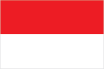
Flag description
- two equal horizontal bands of red (top) and white; the colors derive from the banner of the Majapahit Empire of the 13th-15th centuries; red symbolizes courage, white represents purity similar to the flag of Monaco, which is shorter; also similar to the flag of Poland, which is white (top) and red
- note
- similar to the flag of Monaco, which is shorter; also similar to the flag of Poland, which is white (top) and red
Government type
presidential republic
Independence
17 August 1945 (declared independence from the Netherlands)
International law organization participation
has not submitted an ICJ jurisdiction declaration; non-party state to the ICCt
International organization participation
ADB, APEC, ARF, ASEAN, BIS, CD, CICA (observer), CP, D-8, EAS, EITI (compliant country), FAO, G-11, G-15, G-20, G-77, IAEA, IBRD, ICAO, ICC (national committees), ICRM, IDA, IDB, IFAD, IFC, IFRCS, IHO, ILO, IMF, IMO, IMSO, Interpol, IOC, IOM (observer), IORA, IPU, ISO, ITSO, ITU, ITUC (NGOs), MIGA, MINURSO, MINUSTAH, MONUSCO, MSG (associate member), NAM, OECD (enhanced engagement), OIC, OPCW, PIF (partner), UN, UNAMID, UNCTAD, UNESCO, UNIDO, UNIFIL, UNISFA, UNMIL, UNWTO, UPU, WCO, WFTU (NGOs), WHO, WIPO, WMO, WTO
Judicial branch
- Supreme Court or Mahkamah Agung (51 judges divided into 8 chambers); Constitutional Court or Mahkamah Konstitusi (consists of 9 judges) Supreme Court judges nominated by Judicial Commission, appointed by president with concurrence of parliament; judges serve until retirement at age 65; Constitutional Court judges - 3 nominated by president, 3 by Supreme Court, and 3 by parliament; judges appointed by the president; judges serve until mandatory retirement at age 70 High Courts of Appeal, district courts, religious courts
- highest court(s)
- Supreme Court or Mahkamah Agung (51 judges divided into 8 chambers); Constitutional Court or Mahkamah Konstitusi (consists of 9 judges)
- judge selection and term of office
- Supreme Court judges nominated by Judicial Commission, appointed by president with concurrence of parliament; judges serve until retirement at age 65; Constitutional Court judges - 3 nominated by president, 3 by Supreme Court, and 3 by parliament; judges appointed by the president; judges serve until mandatory retirement at age 70
- subordinate courts
- High Courts of Appeal, district courts, religious courts
Legal system
civil law system based on the Roman-Dutch model and influenced by customary law
Legislative branch
- bicameral People's Consultative Assembly or Majelis Permusyawaratan Rakyat consists of the Regional Representative Council or Dewan Perwakilan Daerah (132 seats; non-partisan members directly elected in multi-seat constituencies - 4 each from the country's 33 electoral districts - by proportional representation vote to serve 5-year terms) and the House of Representatives or Dewan Perwakilan Rakyat (560 seats; members directly elected in multi-seat constituencies by single non-transferable vote to serve 5-year terms); note - the Regional Council has no legislative authority last held on 9 April 2014 (next to be held in 2019) Regional Representative Council - all seats elected on a non-partisan basis; House of Representatives - percent of vote by party - PDI-P 19.0%, Golkar 14.8%, Gerindra 11.8%, PD 10.2%, PKB 9.0%, PAN 2.6%, PKS 6.8%, NasDem 6.7%, PPP 6.5%, Hanura 5.3%, other 7.9%; seats by party - PDI-P 109, Golkar 91, Gerindra 73, PD 61, PAN 48, PKB 47, PKS 40, PPP 39, NasDem 36, Hanura 16
- description
- bicameral People's Consultative Assembly or Majelis Permusyawaratan Rakyat consists of the Regional Representative Council or Dewan Perwakilan Daerah (132 seats; non-partisan members directly elected in multi-seat constituencies - 4 each from the country's 33 electoral districts - by proportional representation vote to serve 5-year terms) and the House of Representatives or Dewan Perwakilan Rakyat (560 seats; members directly elected in multi-seat constituencies by single non-transferable vote to serve 5-year terms); note - the Regional Council has no legislative authority
- election results
- Regional Representative Council - all seats elected on a non-partisan basis; House of Representatives - percent of vote by party - PDI-P 19.0%, Golkar 14.8%, Gerindra 11.8%, PD 10.2%, PKB 9.0%, PAN 2.6%, PKS 6.8%, NasDem 6.7%, PPP 6.5%, Hanura 5.3%, other 7.9%; seats by party - PDI-P 109, Golkar 91, Gerindra 73, PD 61, PAN 48, PKB 47, PKS 40, PPP 39, NasDem 36, Hanura 16
- elections
- last held on 9 April 2014 (next to be held in 2019)
National anthem
- "Indonesia Raya" (Great Indonesia) Wage Rudolf SOEPRATMAN adopted 1945
- lyrics/music
- Wage Rudolf SOEPRATMAN
- name
- "Indonesia Raya" (Great Indonesia)
- note
- adopted 1945
National holiday
Independence Day, 17 August (1945)
National symbol(s)
- garuda (mythical bird); national colors: red, white
- garuda (mythical bird); national colors
- red, white
Political parties and leaders
Democrat Party or PD [Susilo Bambang YUDHOYONO] Functional Groups Party or GOLKAR [Setya NOVANTO] Great Indonesia Movement Party or GERINDRA [PRABOWO Subianto Djojohadikusumo] Indonesia Democratic Party-Struggle or PDI-P [MEGAWATI Sukarnoputri] National Awakening Party or PKB [Muhaiman ISKANDAR] National Democratic Party or Nasdem [Surya PALOH] National Mandate Party or PAN [Zulkifli HASAN] People's Conscience Party or HANURA [WIRANTO] Prosperous Justice Party or PKS [Muhammad Sohibul IMAN] United Development Party or PPP [Muhammad ROMAHURMUZIY]
Political pressure groups and leaders
Commission for the "Disappeared" and Victims of Violence or KontraS Indonesia Corruption Watch or ICW Indonesian Forum for the Environment or WALHI
Suffrage
17 years of age; universal and married persons regardless of age
Economy
Agriculture - products
rubber and similar products, palm oil, poultry, beef, forest products, shrimp, cocoa, coffee, medicinal herbs, essential oil, fish and its similar products, and spices
Budget
- $116.9 billion $140.1 billion (2016 est.)
- expenditures
- $140.1 billion (2016 est.)
- revenues
- $116.9 billion
Budget surplus (+) or deficit (-)
-2.5% of GDP (2016 est.)
Central bank discount rate
- 6.37% (31 December 2010) 6.46% (31 December 2009) this figure represents the 3-month SBI rate; the Bank of Indonesia has not employed the one-month SBI since September 2010
- note
- this figure represents the 3-month SBI rate; the Bank of Indonesia has not employed the one-month SBI since September 2010
Commercial bank prime lending rate
- 11.89% (31 December 2016 est.) 12.66% (31 December 2015 est.) these figures represent the average annualized rate on working capital loans
- note
- these figures represent the average annualized rate on working capital loans
Current account balance
$-16.77 billion (2016 est.) $-17.52 billion (2015 est.)
Debt - external
$316.5 billion (31 December 2016 est.) $308.5 billion (31 December 2015 est.)
Distribution of family income - Gini index
36.8 (2009) 39.4 (2005)
Economy - overview
Indonesia, the largest economy in Southeast Asia, has seen a slowdown in growth since 2012, mostly due to the end of the commodities export boom. During the global financial crisis, Indonesia outperformed its regional neighbors and joined China and India as the only G20 members posting growth. Indonesia’s annual budget deficit is capped at 3% of GDP, and the Government of Indonesia lowered its debt-to-GDP ratio from a peak of 100% shortly after the Asian financial crisis in 1999 to less than 27 percent today. While Fitch and Moody's Investors upgraded Indonesia's credit rating to investment grade in December 2011, Standard & Poor’s has yet to raise Indonesia’s rating to this status amid several constraints to foreign direct investment in the country, such as a high level of protectionism. Indonesia still struggles with poverty and unemployment, inadequate infrastructure, corruption, a complex regulatory environment, and unequal resource distribution among its regions. President Joko WIDODO - elected in July 2014 – seeks to develop Indonesia’s maritime resources and pursue other infrastructure development, including significantly increasing its electrical power generation capacity. Fuel subsidies were significantly reduced in early 2015, a move which has helped the government redirect its spending to development priorities. Indonesia, with the nine other ASEAN members, will continue to move towards participation in the ASEAN Economic Community, though full implementation of economic integration has not yet materialized.
Exchange rates
Indonesian rupiah (IDR) per US dollar - 13,483 (2016 est.) 13,389.4 (2015 est.) 13,389.4 (2014 est.) 11,865.2 (2013 est.) 9,386.63 (2012 est.)
Exports
$144.4 billion (2016 est.) $149.1 billion (2015 est.)
Exports - commodities
mineral fuels, animal or vegetable fats (includes palm oil), electrical machinery, rubber, machinery and mechanical appliance parts
Exports - partners
China 11.6%, US 11.2%, Japan 11.1%, Singapore 7.8%, India 7%, Malaysia 4.9%, South Korea 4.8% (2016)
Fiscal year
calendar year
GDP - composition, by end use
- 57.7% 9.5% 32.6% -0.5% 19.1% -18.3% (2016 est.)
- exports of goods and services
- 19.1%
- government consumption
- 9.5%
- household consumption
- 57.7%
- imports of goods and services
- -18.3% (2016 est.)
- investment in fixed capital
- 32.6%
- investment in inventories
- -0.5%
GDP - composition, by sector of origin
- 14% 40.8% 45.3% (2016 est.)
- agriculture
- 14%
- industry
- 40.8%
- services
- 45.3% (2016 est.)
GDP - per capita (PPP)
- $11,700 (2016 est.) $11,300 (2015 est.) $10,900 (2014 est.) data are in 2016 dollars
- note
- data are in 2016 dollars
GDP - real growth rate
5% (2016 est.) 4.9% (2015 est.) 5% (2014 est.)
GDP (official exchange rate)
$932.4 billion (2016 est.)
GDP (purchasing power parity)
- $3.031 trillion (2016 est.) $2.85 trillion (2015 est.) $2.688 trillion (2014 est.) data are in 2016 dollars
- note
- data are in 2016 dollars
Gross national saving
32.5% of GDP (2016 est.) 32.1% of GDP (2015 est.) 31.5% of GDP (2014 est.)
Household income or consumption by percentage share
- 3.4% 28.2% (2010)
- highest 10%
- 28.2% (2010)
- lowest 10%
- 3.4%
Imports
$129 billion (2016 est.) $135.1 billion (2015 est.)
Imports - commodities
mineral fuels, boilers, machinery, and mechanical parts, electric machinery, iron and steel, foodstuffs
Imports - partners
China 22.9%, Singapore 10.8%, Japan 9.6%, Thailand 6.4%, US 5.4%, Malaysia 5.4%, South Korea 5% (2016)
Industrial production growth rate
3.9% (2016 est.)
Industries
petroleum and natural gas, textiles, automotive, electrical appliances, apparel, footwear, mining, cement, medical instruments and appliances, handicrafts, chemical fertilizers, plywood, rubber, processed food, jewelry, and tourism
Inflation rate (consumer prices)
3.5% (2016 est.) 6.4% (2015 est.)
Labor force
125.4 million (2016 est.)
Labor force - by occupation
- 32% 21% 47% (2016 est.)
- agriculture
- 32%
- industry
- 21%
- services
- 47% (2016 est.)
Market value of publicly traded shares
$428.2 billion (31 December 2016 est.) $353.3 billion (31 December 2015 est.) $422.1 billion (31 December 2014 est.)
Population below poverty line
10.9% (2016 est.)
Public debt
31.5% of GDP (2016 est.) 29.4% of GDP (2015 est.)
Reserves of foreign exchange and gold
$116.4 billion (31 December 2016 est.) $105.9 billion (31 December 2015 est.)
Stock of broad money
$372.5 billion (31 December 2016 est.) $329.7 billion (31 December 2015 est.)
Stock of direct foreign investment - abroad
$18.42 billion (31 December 2016 est.) $30.17 billion (31 December 2015 est.)
Stock of direct foreign investment - at home
$229.1 billion (31 December 2016 est.) $224.8 billion (31 December 2015 est.)
Stock of domestic credit
$397.7 billion (31 December 2016 est.) $354.4 billion (31 December 2015 est.)
Stock of narrow money
$92.11 billion (31 December 2016 est.) $76.51 billion (31 December 2015 est.)
Taxes and other revenues
12.5% of GDP (2016 est.)
Unemployment rate
5.6% (2016 est.) 6.2% (2015 est.)
Energy
Carbon dioxide emissions from consumption of energy
442 million Mt (2013 est.)
Crude oil - exports
289,300 bbl/day (2014 est.)
Crude oil - imports
507,900 bbl/day (2014 est.)
Crude oil - production
831,100 bbl/day (2016 est.)
Crude oil - proved reserves
3.23 billion bbl (1 January 2017 es)
Electricity - consumption
199.3 billion kWh (2015 est.)
Electricity - exports
0 kWh (2016 est.)
Electricity - from fossil fuels
85.1% of total installed capacity (2015 est.)
Electricity - from hydroelectric plants
9.4% of total installed capacity (2015 est.)
Electricity - from nuclear fuels
0% of total installed capacity (2015 est.)
Electricity - from other renewable sources
5.9% of total installed capacity (2015 est.)
Electricity - imports
13 million kWh (2015 est.)
Electricity - installed generating capacity
57.35 million kW (2015 est.)
Electricity - production
221.3 billion kWh (2015 est.)
Electricity access
- 48,700,000 81% 94% 66% (2013)
- electrification - rural areas
- 66% (2013)
- electrification - total population
- 81%
- electrification - urban areas
- 94%
- population without electricity
- 48,700,000
Natural gas - consumption
53.15 billion cu m (2015 est.)
Natural gas - exports
30.29 billion cu m (2015 est.)
Natural gas - imports
1.8 billion cu m (2014 est.)
Natural gas - production
72.8 billion cu m (2015 est.)
Natural gas - proved reserves
2.775 trillion cu m (1 January 2017 es)
Refined petroleum products - consumption
1.708 million bbl/day (2015 est.)
Refined petroleum products - exports
98,780 bbl/day (2014 est.)
Refined petroleum products - imports
668,500 bbl/day (2014 est.)
Refined petroleum products - production
990,700 bbl/day (2014 est.)
Communications
Broadcast media
mixture of about a dozen national TV networks - 2 public broadcasters, the remainder private broadcasters - each with multiple transmitters; more than 100 local TV stations; widespread use of satellite and cable TV systems; public radio broadcaster operates 6 national networks, as well as regional and local stations; overall, more than 700 radio stations with more than 650 privately operated (2008)
Internet country code
.id
Internet users
- 65,525,226 25.4% (July 2016 est.)
- percent of population
- 25.4% (July 2016 est.)
- total
- 65,525,226
Telephone system
- domestic service includes an interisland microwave system, an HF radio police net, and a domestic satellite communications system; international service good coverage provided by existing network has been expanded by use of over 200,000 telephone kiosks many located in remote areas; mobile-cellular subscribership growing rapidly country code - 62; landing point for both the SEA-ME-WE-3 and SEA-ME-WE-4 submarine cable networks that provide links throughout Asia, the Middle East, and Europe; satellite earth stations - 2 Intelsat (1 Indian Ocean and 1 Pacific Ocean) (2015)
- domestic
- coverage provided by existing network has been expanded by use of over 200,000 telephone kiosks many located in remote areas; mobile-cellular subscribership growing rapidly
- general assessment
- domestic service includes an interisland microwave system, an HF radio police net, and a domestic satellite communications system; international service good
- international
- country code - 62; landing point for both the SEA-ME-WE-3 and SEA-ME-WE-4 submarine cable networks that provide links throughout Asia, the Middle East, and Europe; satellite earth stations - 2 Intelsat (1 Indian Ocean and 1 Pacific Ocean) (2015)
Telephones - fixed lines
- 10,372,912 4 (July 2016 est.)
- subscriptions per 100 inhabitants
- 4 (July 2016 est.)
- total subscriptions
- 10,372,912
Telephones - mobile cellular
- 385,573,398 149 (July 2016 est.)
- subscriptions per 100 inhabitants
- 149 (July 2016 est.)
- total
- 385,573,398
Transportation
Airports
673 (2013)
Airports - with paved runways
- 37 (2017)
- 1,524 to 2,437 m
- 51
- 2,438 to 3,047 m
- 21
- 914 to 1,523 m
- 72
- over 3,047 m
- 5
- total
- 186
- under 914 m
- 37 (2017)
Airports - with unpaved runways
- 460 (2013)
- 1,524 to 2,437 m
- 4
- 914 to 1,523 m
- 23
- total
- 487
- under 914 m
- 460 (2013)
Civil aircraft registration country code prefix
PK (2016)
Heliports
76 (2013)
Merchant marine
- 1,340 bulk carrier 105, cargo 618, chemical tanker 69, container 120, liquefied gas 28, passenger 49, passenger/cargo 77, petroleum tanker 244, refrigerated cargo 6, roll on/roll off 12, specialized tanker 1, vehicle carrier 11 69 (China 1, France 1, Greece 1, Japan 8, Jordan 1, Malaysia 1, Norway 3, Singapore 46, South Korea 2, Taiwan 1, UK 2, US 2) 95 (Bahamas 2, Cambodia 2, China 2, Hong Kong 10, Liberia 4, Marshall Islands 1, Mongolia 2, Panama 10, Singapore 60, Tuvalu 1, unknown 1) (2010)
- by type
- bulk carrier 105, cargo 618, chemical tanker 69, container 120, liquefied gas 28, passenger 49, passenger/cargo 77, petroleum tanker 244, refrigerated cargo 6, roll on/roll off 12, specialized tanker 1, vehicle carrier 11
- foreign-owned
- 69 (China 1, France 1, Greece 1, Japan 8, Jordan 1, Malaysia 1, Norway 3, Singapore 46, South Korea 2, Taiwan 1, UK 2, US 2)
- registered in other countries
- 95 (Bahamas 2, Cambodia 2, China 2, Hong Kong 10, Liberia 4, Marshall Islands 1, Mongolia 2, Panama 10, Singapore 60, Tuvalu 1, unknown 1) (2010)
- total
- 1,340
National air transport system
- 88,685,767 747,473,207 mt-km (2015)
- annual freight traffic on registered air carriers
- 747,473,207 mt-km (2015)
- annual passenger traffic on registered air carriers
- 88,685,767
- inventory of registered aircraft operated by air carriers
- 550
- number of registered air carriers
- 29
Pipelines
condensate 1,064 km; condensate/gas 150 km; gas 11,702 km; liquid petroleum gas 119 km; oil 7,767 km; oil/gas/water 77 km; refined products 728 km; unknown 53 km; water 44 km (2013)
Ports and terminals
- Banjarmasin, Belawan, Kotabaru, Krueg Geukueh, Palembang, Panjang, Sungai Pakning, Tanjung Perak, Tanjung Priok Belawan (1,197,000), Tanjung Priok (5,154,000) (2015) Bontang, Tangguh Arun, Lampung, West Java
- container port(s) (TEUs)
- Belawan (1,197,000), Tanjung Priok (5,154,000) (2015)
- LNG terminal(s) (export)
- Bontang, Tangguh
- LNG terminal(s) (import)
- Arun, Lampung, West Java
- major seaport(s)
- Banjarmasin, Belawan, Kotabaru, Krueg Geukueh, Palembang, Panjang, Sungai Pakning, Tanjung Perak, Tanjung Priok
Railways
- 8,159 km 8,159 km 1.067-m gauge (565 km electrified) 4,816 km operational (2014)
- narrow gauge
- 8,159 km 1.067-m gauge (565 km electrified)
- note
- 4,816 km operational (2014)
- total
- 8,159 km
Roadways
- 496,607 km 283,102 km 213,505 km (2011)
- paved
- 283,102 km
- total
- 496,607 km
- unpaved
- 213,505 km (2011)
Waterways
21,579 km (2011)
Military and Security
Maritime threats
the International Maritime Bureau continues to report the territorial and offshore waters in the Strait of Malacca and South China Sea as high risk for piracy and armed robbery against ships; attacks declined dramatically from 108 incidents in 2015 to 49 in 2016, although Indonesian waters remained the most dangerous in the world; in 2016, 45 commercial vessels were boarded and one hijacked; during 2016 37 crew members were taken hostage; hijacked vessels are often disguised and cargo diverted to ports in East Asia; crews have been murdered or cast adrift; Indonesia remains the most dangerous area during the first half of 2017 with more than 20% of all incidents reported world-wide
Military branches
- Indonesian Armed Forces (Tentara Nasional Indonesia, TNI): Army (TNI-Angkatan Darat (TNI-AD)), Navy (TNI-Angkatan Laut (TNI-AL), includes marines (Korps Marinir, KorMar), naval air arm), Air Force (TNI-Angkatan Udara (TNI-AU)), National Air Defense Command (Kommando Pertahanan Udara Nasional (Kohanudnas)) (2013)
- Indonesian Armed Forces (Tentara Nasional Indonesia, TNI)
- Army (TNI-Angkatan Darat (TNI-AD)), Navy (TNI-Angkatan Laut (TNI-AL), includes marines (Korps Marinir, KorMar), naval air arm), Air Force (TNI-Angkatan Udara (TNI-AU)), National Air Defense Command (Kommando Pertahanan Udara Nasional (Kohanudnas)) (2013)
Military expenditures
0.88% of GDP (2016) 0.89% of GDP (2015) 0.78% of GDP (2014) 0.92% of GDP (2013) 0.71% of GDP (2012)
Military service age and obligation
18-45 years of age for voluntary military service, with selective conscription authorized; 2-year service obligation, with reserve obligation to age 45 (officers); Indonesian citizens only (2012)
Transnational Issues
Disputes - international
Indonesia has a stated foreign policy objective of establishing stable fixed land and maritime boundaries with all of its neighbors; three stretches of land borders with Timor-Leste have yet to be delimited, two of which are in the Oecussi exclave area, and no maritime or Exclusive Economic Zone (EEZ) boundaries have been established between the countries; all borders between Indonesia and Australia have been agreed upon bilaterally, but a 1997 treaty that would settle the last of their maritime and EEZ boundary has yet to be ratified by Indonesia's legislature; Indonesian groups challenge Australia's claim to Ashmore Reef; Australia has closed parts of the Ashmore and Cartier Reserve to Indonesian traditional fishing and placed restrictions on certain catches; land and maritime negotiations with Malaysia are ongoing, and disputed areas include the controversial Tanjung Datu and Camar Wulan border area in Borneo and the maritime boundary in the Ambalat oil block in the Celebes Sea; Indonesia and Singapore continue to work on finalizing their 1973 maritime boundary agreement by defining unresolved areas north of Indonesia's Batam Island; Indonesian secessionists, squatters, and illegal migrants create repatriation problems for Papua New Guinea; maritime delimitation talks continue with Palau; EEZ negotiations with Vietnam are ongoing, and the two countries in Fall 2011 agreed to work together to reduce illegal fishing along their maritime boundary
Illicit drugs
illicit producer of cannabis largely for domestic use; producer of methamphetamine and ecstasy; President WIDODO's war on drugs has led to an increase in death sentences and executions, particularly of foreign drug traffickers
Refugees and internally displaced persons
- 7,100 (inter-communal, inter-faith, and separatist violence between 1998 and 2004 in Aceh and Papua; religious attacks and land conflicts in 2012 and 2013; most IDPs in Aceh, Maluku, East Nusa Tengarra) (2016) (2011)
- IDPs
- 7,100 (inter-communal, inter-faith, and separatist violence between 1998 and 2004 in Aceh and Papua; religious attacks and land conflicts in 2012 and 2013; most IDPs in Aceh, Maluku, East Nusa Tengarra) (2016) (2011)