1998 Edition
CIA World Factbook 1998 (Internet Archive)
Geography
Area
total: 28,050 sq km land: 28,050 sq km water: 0 sq km
Area-comparative
slightly smaller than Maryland
Climate
tropical; always hot, humid
Coastline
296 km
Elevation extremes
lowest point: Atlantic Ocean 0 m highest point: Mount Malabo 3,008 m
Environment-current issues
tap water is not potable; desertification
Environment-international agreements
party to: Biodiversity, Desertification, Endangered Species, Law of the Sea, Nuclear Test Ban, Ship Pollution signed, but not ratified: none of the selected agreements
Geographic coordinates
2 00 N, 10 00 E
Geography-note
insular and continental regions rather widely separated
Irrigated land
NA sq km
Land boundaries
total: 539 km border countries: Cameroon 189 km, Gabon 350 km
Land use
arable land: 5% permanent crops: 4% permanent pastures: 4% forests and woodland: 46% other: 41% (1993 est.)
Location
Western Africa, bordering the Bight of Biafra, between Cameroon and Gabon
Map references
Africa
Maritime claims
exclusive economic zone: 200 nm territorial sea: 12 nm
Natural hazards
violent windstorms
Natural resources
timber, petroleum, small unexploited deposits of gold, manganese, uranium
Terrain
coastal plains rise to interior hills; islands are volcanic
People and Society
Age structure
0-14 years: 43% (male 97,993; female 97,470) 15-64 years: 53% (male 114,960; female 126,453) 65 years and over: 4% (male 7,597; female 9,528) (July 1998 est.)
Birth rate
38.9 births/1,000 population (1998 est.)
Death rate
13.32 deaths/1,000 population (1998 est.)
Ethnic groups
Bioko (primarily Bubi, some Fernandinos), Rio Muni (primarily Fang), Europeans less than 1,000, mostly Spanish
Infant mortality rate
93.45 deaths/1,000 live births (1998 est.)
Languages
Spanish (official), French (official), pidgin English, Fang, Bubi, Ibo
Life expectancy at birth
total population: 53.93 years male: 51.61 years female: 56.31 years (1998 est.)
Literacy
definition: age 15 and over can read and write total population: 78.5% male: 89.6% female: 68.1% (1995 est.)
Nationality
noun: Equatorial Guinean(s) or Equatoguinean(s) adjective: Equatorial Guinean or Equatoguinean
Net migration rate
0 migrant(s)/1,000 population (1998 est.)
Population
454,001 (July 1998 est.)
Population growth rate
2.56% (1998 est.)
Religions
nominally Christian and predominantly Roman Catholic, pagan practices
Sex ratio
at birth: 1.03 male(s)/female under 15 years: 1 male(s)/female 15-64 years: 0.9 male(s)/female 65 years and over: 0.79 male(s)/female (1998 est.)
Total fertility rate
5.06 children born/woman (1998 est.)
Government
Administrative divisions
7 provinces (provincias, singular-provincia); Annobon, Bioko Norte, Bioko Sur, Centro Sur, Kie-Ntem, Litoral, Wele-Nzas
Constitution
approved by national referendum 17 November 1991; emended January 1995
Country name
conventional long form: Republic of Equatorial Guinea conventional short form: Equatorial Guinea local long form: Republica de Guinea Ecuatorial local short form: Guinea Ecuatorial former: Spanish Guinea
Data code
EK
Executive branch
chief of state: President Brig. Gen. (Ret.) Teodoro OBIANG NGUEMA MBASOGO (since 3 August 1979) head of government: Prime Minister Serafin Seriche DOUGAN (since April 1996); First Vice Prime Minister for Foreign Affairs Miguel OYONO (since January 1998); Second Vice Prime Minister for Internal Affairs Demetrio Elo NDONG NGEFUMU (since January 1998) cabinet: Council of Ministers appointed by the president elections: president elected by popular vote to a seven-year term; election last held 25 February 1996 (next to be held NA February 2003) election results: President OBIANG NGUEMA MBASOGO reelected without opposition; percent of popular vote-98%
FAX
[1] (202) 393-0348 Diplomatic representation from the US: the US does not have an embassy in Equatorial Guinea (embassy closed September 1995); US relations with Equatorial Guinea are handled through the US Embassy in Yaounde, Cameroon
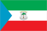
Flag description
three equal horizontal bands of green (top), white, and red with a blue isosceles triangle based on the hoist side and the coat of arms centered in the white band; the coat of arms has six yellow six-pointed stars (representing the mainland and five offshore islands) above a gray shield bearing a silk-cotton tree and below which is a scroll with the motto UNIDAD, PAZ, JUSTICIA (Unity, Peace, Justice)
Government type
republic in transition to multiparty democracy
Independence
12 October 1968 (from Spain)
International organization participation
ACCT, ACP, AfDB, BDEAC, CEEAC, ECA, FAO, FZ, G-77, IBRD, ICAO, ICRM, IDA, IFAD, IFC, IFRCS, ILO, IMF, IMO, Intelsat, Interpol, IOC, ITU, NAM, OAS (observer), OAU, UDEAC, UN, UNCTAD, UNESCO, UNIDO, UPU, WHO, WToO, WTrO (applicant) Diplomatic representation in the US: chief of mission: Ambassador Pastor Micha ONDO BILE chancery: Suite 405, 1511 K Street NW, Washington, DC 20005 telephone: [1] (202) 393-0525
Judicial branch
Supreme Tribunal Political parties and leaders: ruling party: Democratic Party for Equatorial Guinea or PDGE [Brig. Gen. (Ret.) Teodoro OBIANG NGUEMA MBASOGO] opposition parties: Convergence Party for Social Democracy or CPDS [Santiago OBAMA, president; Placido Miko ABOGO, secretary-general]; Democratic Social Union or UDS [Camelo MODU, general secretary]; Liberal Democratic Convention or CLD [Alfonso Nsue MIFUMU, president]; Liberal Party or PL [Santos PASCUAL]; National Democratic Union or UDENA [Jose MECHEBA Ikaka, president]; National Movement of the Liberation of Equatorial Guinea or MONALIGE [Dr. Aldolfo Obrang BIKO, president]; Party of the Social Democratic Coalition or PCSD [Buenaventura Moswi M'Asumu, general coordinator]; Party of Progress or PP [Mocache MEINGA, interim chairman]; Popular Action of Equatorial Guinea or APGE [Casiano Masi Edu]; Popular Union or UP [Juan BITUI, president]; Party for Progress of Equatorial Guinea or PPGE [Basilio Ava Eworo and Domingo ABUY]; Progressive Democratic Alliance or ADP [Antonio-Ebang Mbele Abang, president]; Social Democratic and Popular Convergence or CSDP [Secundino Oyono Agueng Ada, general secretary]; Social Democratic Party or PSD [Benjamin-Gabriel Balingha Balinga Alene, general secretary]; Socialist Party of Equatorial Guinea or PSGE [Tomas MICHEBE Fernandez, general secretary]
Legal system
partly based on Spanish civil law and tribal custom
Legislative branch
unicameral House of Peoples Representatives or Camara de Representantes del Pueblo (80 seats; members are directly elected by popular vote to serve five-year terms) elections: last held 21 November 1993 (next to be held NA 1998) election results: percent of vote by party-NA; seats by party-PDGE 68, CSDP 6, UDS 5, CLD 1
National capital
Malabo
National holiday
Independence Day, 12 October (1968)
Suffrage
18 years of age; universal adult
Economy
Agriculture-products
coffee, cocoa, rice, yams, cassava (tapioca), bananas, palm oil nuts, manioc; livestock; timber
Budget
revenues: $47 million expenditures: $43 million, including capital expenditures of $7 million (1996 est.)
Currency
1 Communaute Financiere Africaine franc (CFAF) = 100 centimes
Debt-external
$254 million (1996 est.)
Economic aid
recipient: ODA, $NA
Economy-overview
The discovery and exploitation of large oil reserves have contributed to dramatic economic growth in recent years. Farming, forestry, and fishing are also major components of GDP. Subsistence farming predominates. Although pre-independence Equatorial Guinea counted on cocoa production for hard currency earnings, the deterioration of the rural economy under successive brutal regimes has diminished potential for agriculture-led growth. A number of aid programs sponsored by the World Bank and the IMF have been cut off since 1993 because of the government's gross corruption and mismanagement. Businesses, for the most part, are owned by government officials and their family members. Undeveloped natural resources include titanium, iron ore, manganese, uranium, and alluvial gold. The country responded favorably to the devaluation of the CFA franc in January 1994.
Electricity-capacity
5,000 kW (1995)
Electricity-consumption per capita
48 kWh (1995)
Electricity-production
20 million kWh (1995)
Exchange rates
CFA francs (CFAF) per US$1-608.36 (January 1998), 583.67 (1997), 511.55 (1996), 499.15 (1995), 555.20 (1994), 283.16 (1993) note: beginning 12 January 1994, the CFA franc was devalued to CFAF 100 per French franc from CFAF 50 at which it had been fixed since 1948
Exports
total value: $197 million (f.o.b., 1996 est.) commodities: petroleum, timber, cocoa partners: US 34%, Japan 17%, Spain 13%, China 13%, Nigeria
Fiscal year
1 April-31 March Communications
GDP
purchasing power parity-$660 million (1997 est.)
GDP-composition by sector
agriculture: 46% industry: 33% services: 21% (1995 est.)
GDP-per capita
purchasing power parity-$1,500 (1997 est.)
GDP-real growth rate
NA%
Imports
total value: $248 million (c.i.f., 1996 est.) commodities: petroleum, food, beverages, clothing, machinery partners: Cameroon 40%, Spain 18%, France 14%, US 8%
Industrial production growth rate
7.4% (1994 est.)
Industries
fishing, sawmilling
Inflation rate-consumer price index
6% (1996 est.)
Labor force
NA
Radio broadcast stations
AM 2, FM 0, shortwave 0
Radios
NA
Telephone system
poor system with adequate government services domestic: NA international: international communications from Bata and Malabo to African and European countries; satellite earth station-1 Intelsat (Indian Ocean)
Telephones
2,000 (1987 est.)
Television broadcast stations
1
Televisions
4,000 (1992 est.)
Unemployment rate
NA%
Transportation
Airports
3 (1997 est.) Airports-with paved runways: total: 2 2,438 to 3,047 m: 1 1,524 to 2,437 m: 1 (1997 est.) Airports-with unpaved runways: total: 1 under 914 m: 1 (1997 est.)
Highways
total: 2,820 km paved: 0 km unpaved: 2,820 km (1995 est.) Ports and harbors: Bata, Luba, Malabo
Merchant marine
total: 19 ships (1,000 GRT or over) totaling 66,766 GRT/84,780 DWT ships by type: bulk 1, cargo 16, passenger 1, passenger-cargo 1 (1997 est.)
Railways
total: 0 km
Military and Security
Military branches
Army, Navy, Air Force, Rapid Intervention Force, National Police
Military expenditures-dollar figure
$2.5 million (FY93/94)
Military expenditures-percent of GDP
NA%
Military manpower-availability
males age 15-49: 98,960 (1998 est.) Military manpower-fit for military service: males: 50,308 (1998 est.)
Transnational Issues
Disputes-international
maritime boundary dispute with Gabon because of disputed sovereignty over islands in Corisco Bay; maritime boundary dispute with Nigeria because of disputed jurisdiction over oil-rich areas in the Gulf of Guinea Introduction
Historical perspective
On 29 May 1991, ISAIAS Afworki, secretary general of the People's Front for Democracy and Justice (PFDJ), which then served as the country's legislative body, announced the formation of the Provisional Government in Eritrea (PGE) in preparation for the 23-25 April 1993 referendum on independence for the Autonomous Region of Eritrea; the referendum resulted in a landslide vote for independence, which was proclaimed on 27 April 1993.