2015 Edition
CIA World Factbook 2015 Archive (Wayback Machine ZIP)
Introduction
Background
Colombia was one of the three countries that emerged from the collapse of Gran Colombia in 1830 (the others are Ecuador and Venezuela). A nearly five-decade-long conflict between government forces and antigovernment insurgent groups, principally the Revolutionary Armed Forces of Colombia (FARC) heavily funded by the drug trade, escalated during the 1990s. More than 31,000 former paramilitaries had demobilized by the end of 2006 and the United Self Defense Forces of Colombia as a formal organization had ceased to function. In the wake of the paramilitary demobilization, emerging criminal groups arose, whose members include some former paramilitaries. The insurgents lack the military or popular support necessary to overthrow the government, but continue attacks against civilians. Large areas of the countryside are under guerrilla influence or are contested by security forces. In November 2012, the Colombian Government started formal peace negotiations with the FARC aimed at reaching a definitive bilateral cease-fire and incorporating demobilized FARC members into mainstream society and politics. The Colombian Government has stepped up efforts to reassert government control throughout the country, and now has a presence in every one of its administrative departments. Despite decades of internal conflict and drug related security challenges, Colombia maintains relatively strong democratic institutions characterized by peaceful, transparent elections and the protection of civil liberties.
Geography
Area
- land
- 1,038,700 sq km
- note
- includes Isla de Malpelo, Roncador Cay, and Serrana Bank
- total
- 1,138,910 sq km
- water
- 100,210 sq km
Area - comparative
slightly less than twice the size of Texas
Climate
tropical along coast and eastern plains; cooler in highlands
Coastline
3,208 km (Caribbean Sea 1,760 km, North Pacific Ocean 1,448 km)
Elevation extremes
- highest point
- Pico Cristobal Colon 5,775 m
- lowest point
- Pacific Ocean 0 m
- note
- nearby Pico Simon Bolivar also has the same elevation
Environment - current issues
deforestation; soil and water quality damage from overuse of pesticides; air pollution, especially in Bogota, from vehicle emissions
Environment - international agreements
- party to
- Antarctic Treaty, Biodiversity, Climate Change, Climate Change-Kyoto Protocol, Desertification, Endangered Species, Hazardous Wastes, Marine Life Conservation, Ozone Layer Protection, Ship Pollution, Tropical Timber 83, Tropical Timber 94, Wetlands
- signed, but not ratified
- Law of the Sea
Freshwater withdrawal (domestic/industrial/agricultural)
- per capita
- 308 cu m/yr (2010)
- total
- 12.65 cu km/yr (55%/4%/41%)
Geographic coordinates
4 00 N, 72 00 W
Geography - note
only South American country with coastlines on both the North Pacific Ocean and Caribbean Sea
Irrigated land
10,870 sq km (2011)
Land boundaries
- border countries (5)
- Brazil 1,790 km, Ecuador 708 km, Panama 339 km, Peru 1,494 km, Venezuela 2,341 km
- total
- 6,672 km
Land use
- arable land 1.4%; permanent crops 1.6%; permanent pasture 34.5%
- agricultural land
- 37.5%
- forest
- 54.4%
- other
- 8.1% (2011 est.)
Location
Northern South America, bordering the Caribbean Sea, between Panama and Venezuela, and bordering the North Pacific Ocean, between Ecuador and Panama
Map references
South America
Maritime claims
- continental shelf
- 200-m depth or to the depth of exploitation
- exclusive economic zone
- 200 nm
- territorial sea
- 12 nm
Natural hazards
- highlands subject to volcanic eruptions; occasional earthquakes; periodic droughts
- volcanism
- Galeras (elev. 4,276 m) is one of Colombia's most active volcanoes, having erupted in 2009 and 2010 causing major evacuations; it has been deemed a Decade Volcano by the International Association of Volcanology and Chemistry of the Earth's Interior, worthy of study due to its explosive history and close proximity to human populations; Nevado del Ruiz (elev. 5,321 m), 129 km (80 mi) west of Bogota, erupted in 1985 producing lahars (mudflows) that killed 23,000 people; the volcano last erupted in 1991; additionally, after 500 years of dormancy, Nevado del Huila reawakened in 2007 and has experienced frequent eruptions since then; other historically active volcanoes include Cumbal, Dona Juana, Nevado del Tolima, and Purace
Natural resources
petroleum, natural gas, coal, iron ore, nickel, gold, copper, emeralds, hydropower
Terrain
flat coastal lowlands, central highlands, high Andes Mountains, eastern lowland plains (Llanos)
Total renewable water resources
2,132 cu km (2011)
People and Society
Age structure
- 0-14 years
- 24.94% (male 5,967,860/female 5,688,106)
- 15-24 years
- 17.81% (male 4,234,564/female 4,087,134)
- 25-54 years
- 41.71% (male 9,653,094/female 9,841,546)
- 55-64 years
- 8.62% (male 1,885,481/female 2,141,618)
- 65 years and over
- 6.93% (male 1,349,613/female 1,887,712) (2015 est.)
Birth rate
16.47 births/1,000 population (2015 est.)
Child labor - children ages 5-14
- note
- data represents children ages 5-17 (2009 est.)
- percentage
- 9%
- total number
- 988,362
Children under the age of 5 years underweight
3.4% (2010)
Contraceptive prevalence rate
79.1% (2009/10)
Death rate
5.4 deaths/1,000 population (2015 est.)
Demographic profile
- Colombia is in the midst of a demographic transition resulting from steady declines in its fertility, mortality, and population growth rates. The birth rate has fallen from more than 6 children per woman in the 1960s to just above replacement level today as a result of increased literacy, family planning services, and urbanization. However, income inequality is among the worst in the world, and more than a third of the population lives below the poverty line.
- Colombia experiences significant legal and illegal economic emigration and refugee flows. Large-scale labor emigration dates to the 1960s; Venezuela and the United States continue to be the main host countries. Colombia is the largest source of Latin American refugees in Latin America, nearly 400,000 of whom live primarily in Venezuela and Ecuador. Forced displacement remains prevalent because of violence among guerrillas, paramilitary groups, and Colombian security forces. Afro-Colombian and indigenous populations are disproportionately affected. A leading NGO estimates that 5.2 million people have been displaced since 1985, while the Colombian Government estimates 3.6 million since 2000. These estimates may undercount actual numbers because not all internally displaced persons are registered. Historically, Colombia also has one of the world's highest levels of forced disappearances. About 30,000 cases have been recorded over the last four decades - although the number is likely to be much higher - including human rights activists, trade unionists, Afro-Colombians, indigenous people, and farmers in rural conflict zones.
Dependency ratios
- elderly dependency ratio
- 10.2%
- potential support ratio
- 9.8% (2015 est.)
- total dependency ratio
- 45.6%
- youth dependency ratio
- 35.4%
Drinking water source
- urban: 96.8% of population
- rural: 73.8% of population
- total: 91.4% of population
- urban: 3.2% of population
- rural: 26.2% of population
- total: 8.6% of population (2015 est.)
Education expenditures
4.9% of GDP (2013)
Ethnic groups
mestizo and white 84.2%, Afro-Colombian (includes multatto, Raizal, and Palenquero) 10.4%, Amerindian 3.4%, Roma
Health expenditures
6.8% of GDP (2013)
HIV/AIDS - adult prevalence rate
0.4% (2014 est.)
HIV/AIDS - deaths
4,700 (2014 est.)
HIV/AIDS - people living with HIV/AIDS
124,400 (2014 est.)
Hospital bed density
1.5 beds/1,000 population (2012)
Infant mortality rate
- female
- 11.3 deaths/1,000 live births (2015 est.)
- male
- 17.68 deaths/1,000 live births
- total
- 14.58 deaths/1,000 live births
Languages
Spanish (official)
Life expectancy at birth
- female
- 78.8 years (2015 est.)
- male
- 72.34 years
- total population
- 75.48 years
Literacy
- definition
- age 15 and over can read and write
- female
- 94.8% (2015 est.)
- male
- 94.6%
- total population
- 94.7%
Major infectious diseases
- degree of risk
- high
- food or waterborne diseases
- bacterial diarrhea
- vectorborne diseases
- dengue fever, malaria, and yellow fever (2013)
Major urban areas - population
BOGOTA (capital) 9.765 million; Medellin 3.911 million; Cali 2.646 million; Barranquilla 1.991 million; Bucaramanga 1.215 million; Cartagena 1.092 million (2015)
Median age
- female
- 30.3 years (2015 est.)
- male
- 28.3 years
- total
- 29.3 years
Nationality
- adjective
- Colombian
- noun
- Colombian(s)
Net migration rate
-0.64 migrant(s)/1,000 population (2015 est.)
Obesity - adult prevalence rate
20.7% (2014)
Physicians density
1.47 physicians/1,000 population (2010)
Population
46,736,728 (July 2015 est.)
Population growth rate
1.04% (2015 est.)
Religions
Roman Catholic 90%, other 10%
Sanitation facility access
- urban: 85.2% of population
- rural: 67.9% of population
- total: 81.1% of population
- urban: 14.8% of population
- rural: 32.1% of population
- total: 18.9% of population (2015 est.)
School life expectancy (primary to tertiary education)
- female
- 14 years (2010)
- male
- 13 years
- total
- 14 years
Sex ratio
- 0-14 years
- 1.05 male(s)/female
- 15-24 years
- 1.04 male(s)/female
- 25-54 years
- 0.98 male(s)/female
- 55-64 years
- 0.88 male(s)/female
- 65 years and over
- 0.72 male(s)/female
- at birth
- 1.06 male(s)/female
- total population
- 0.98 male(s)/female (2015 est.)
Total fertility rate
2.04 children born/woman (2015 est.)
Unemployment, youth ages 15-24
- female
- 28.9% (2011 est.)
- male
- 17%
- total
- 21.9%
Urbanization
- rate of urbanization
- 1.66% annual rate of change (2010-15 est.)
- urban population
- 76.4% of total population (2015)
Government
Administrative divisions
32 departments (departamentos, singular - departamento) and 1 capital district* (distrito capital); Amazonas, Antioquia, Arauca, Atlantico, Bogota*, Bolivar, Boyaca, Caldas, Caqueta, Casanare, Cauca, Cesar, Choco, Cordoba, Cundinamarca, Guainia, Guaviare, Huila, La Guajira, Magdalena, Meta, Narino, Norte de Santander, Putumayo, Quindio, Risaralda, Archipielago de San Andres, Providencia y Santa Catalina (colloquially San Andres y Providencia), Santander, Sucre, Tolima, Valle del Cauca, Vaupes, Vichada
Capital
- geographic coordinates
- 4 36 N, 74 05 W
- name
- Bogota
- time difference
- UTC-5 (same time as Washington, DC, during Standard Time)
Constitution
several previous; latest promulgated 5 July 1991; amended many times, last in 2011 (2013)
Country name
- conventional long form
- Republic of Colombia
- conventional short form
- Colombia
- local long form
- Republica de Colombia
- local short form
- Colombia
Diplomatic representation from the US
- chief of mission
- Ambassador Kevin WHITAKER (since 11 June 2014)
- embassy
- Calle 24 Bis No. 48-50, Bogota, D.C.
- FAX
- [57] (1) 275-4600
- mailing address
- Carrera 45 No. 24B-27, Bogota, D.C.
- telephone
- [57] (1) 275-2000
Diplomatic representation in the US
- chancery
- 2118 Leroy Place NW, Washington, DC 20008
- chief of mission
- Ambassador Juan Carlos PINZON Bueno (since 3 August 2015)
- consulate(s)
- Boston, Chicago, San Francisco
- consulate(s) general
- Atlanta, Houston, Los Angeles, Miami, New York, Newark (NJ), Orlando, San Juan (Puerto Rico)
- FAX
- [1] (202) 232-8643
- telephone
- [1] (202) 387-8338
Executive branch
- cabinet
- Cabinet appointed by the president
- chief of state
- President Juan Manuel SANTOS Calderon (since 7 August 2010); Vice President Angelino GARZON (since 7 August 2010); note - the president is both chief of state and head of government
- election results
- Juan Manuel SANTOS Calderon reelected president in runoff; percent of vote - Juan Manuel SANTOS Calderon (U Party) 51.0%, Oscar Ivan ZULUAGA (CD) 45.0%, other 4.0%
- elections/appointments
- president directly elected by absolute majority vote in two rounds if needed for a 4-year term (eligible for a second term); election last held on 25 May 2014 with a runoff election 15 on June 2014 (next to be held on 27 May 2018)
- head of government
- President Juan Manuel SANTOS Calderon (since 7 August 2010); Vice President Angelino GARZON (since 7 August 2010)
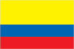
Flag description
- three horizontal bands of yellow (top, double-width), blue, and red; the flag retains the three main colors of the banner of Gran Colombia, the short-lived South American republic that broke up in 1830; various interpretations of the colors exist and include: yellow for the gold in Colombia's land, blue for the seas on its shores, and red for the blood spilled in attaining freedom; alternatively, the colors have been described as representing more elemental concepts such as sovereignty and justice (yellow), loyalty and vigilance (blue), and valor and generosity (red); or simply the principles of liberty, equality, and fraternity
- note
- similar to the flag of Ecuador, which is longer and bears the Ecuadorian coat of arms superimposed in the center
Government type
republic; executive branch dominates government structure
Independence
20 July 1810 (from Spain)
International law organization participation
has not submitted an ICJ jurisdiction declaration; accepts ICCt jurisdiction
International organization participation
BCIE, BIS, CAN, Caricom (observer), CD, CDB, CELAC, EITI (candidate country), FAO, G-3, G-24, G-77, IADB, IAEA, IBRD, ICAO, ICC (national committees), ICCt, ICRM, IDA, IFAD, IFC, IFRCS, IHO, ILO, IMF, IMO, IMSO, Interpol, IOC, IOM, IPU, ISO, ITSO, ITU, ITUC (NGOs), LAES, LAIA, Mercosur (associate), MIGA, NAM, OAS, OPANAL, OPCW, Pacific Alliance, PCA, UN, UNASUR, UNCTAD, UNESCO, UNHCR, UNIDO, Union Latina, UNWTO, UPU, WCO, WFTU (NGOs), WHO, WIPO, WMO, WTO
Judicial branch
- highest court(s)
- Supreme Court of Justice or Corte Suprema de Justicia (consists of the Civil-Agrarian and Labor Chambers each with 7 judges, and the Penal Chamber with 9 judges); Constitutional Court (consists of 9 magistrates); Council of State (consists of 31 members); Superior Judiciary Council (consists of 13 magistrates)
- judge selection and term of office
- Supreme Court judges appointed by the Supreme Court members from candidates submitted by the Superior Judiciary Council; judges elected for individual 8-year terms; Constitutional Court magistrates - nominated by the president, by the Supreme Court, and elected by the Senate; judges elected for individual 8-year terms; Council of State members appointed by the State Council plenary from lists nominated by the Superior Judiciary Council
- subordinate courts
- Superior Tribunals (appellate courts for each of the judicial districts); regional courts; civil municipal courts; Superior Military Tribunal; first instance administrative courts
Legal system
civil law system influenced by the Spanish and French civil codes
Legislative branch
- description
- bicameral Congress or Congreso consists of the Senate or Senado (102 seats; 100 members elected nationally - not by district or state - and two elected on a special ballot for indigenous communities to serve 4-year terms) and the Chamber of Representatives or Camara de Representantes (166 seats; members elected in multi-seat constituencies by proportional representation vote to serve 4-year terms)
- election results
- Senate - percent of vote by party - NA; seats by party - U Party 21, CD 20, PC 18, PL 17, CR 9, PDA 5, Green Party 5, other 7; Chamber of Representatives - percent of vote by party - NA; seats by party - PL 39, U Party 37, PC 27, CD 19, CR 16, Green Party 6, PDA 3, other 19
- elections
- Senate - last held on 9 March 2014 (next to be held in March 2018); Chamber of Representatives - last held on 9 March 2014 (next to be held in March 2018)
National anthem
- lyrics/music
- Rafael NUNEZ/Oreste SINDICI
- name
- "Himno Nacional de la Republica de Colombia" (National Anthem of the Republic of Colombia)
- note
- adopted 1920; the anthem was created from an inspirational poem written by President Rafael NUNEZ
National holiday
Independence Day, 20 July (1810)
National symbol(s)
Andean condor; national colors: yellow, blue, red
Political parties and leaders
- Alternative Democratic Pole or PDA [Clara LOPEZ]
- Conservative Party or PC [David BARGUIL]
- Democratic Center Party or CD [Alvaro URIBE Velez, Oscar Ivan ZULUAGA]
- Green Alliance [Jorge LONDONO, Antonio SANGUINO, Luis AVELLANEDA, Camilo ROMERO]
- Liberal Party or PL [Horacio SERPA]
- Citizens Option (Opcion Ciudadana) or OC (formerly known as the National Integration Party or PIN) [Angel ALIRIO Moreno]
- Radical Change or CR [Carlos Fernando GALAN]
- Social National Unity Party or U Party [Roy BARRERAS, Jose David NAME]
- note
- Colombia has eight major political parties, and numerous smaller movements
Political pressure groups and leaders
- Central Union of Workers or CUT
- Colombian Confederation of Workers or CTC
- General Confederation of Workers or CGT
- National Liberation Army or ELN
- Revolutionary Armed Forces of Colombia or FARC
- note
- FARC and ELN are the two largest insurgent groups active in Colombia
Suffrage
18 years of age; universal
Economy
Agriculture - products
coffee, cut flowers, bananas, rice, tobacco, corn, sugarcane, cocoa beans, oilseed, vegetables; shrimp; forest products
Budget
- expenditures
- $120.2 billion (2014 est.)
- revenues
- $114.1 billion
Budget surplus (+) or deficit (-)
-1.5% of GDP (2014 est.)
Central bank discount rate
- 4.75% (31 December 2011)
- 5% (31 December 2010)
Commercial bank prime lending rate
- 10.9% (31 December 2014 est.)
- 11% (31 December 2013 est.)
Current account balance
- -$19.29 billion (2014 est.)
- -$12.28 billion (2013 est.)
Debt - external
- $84 billion (31 December 2014 est.)
- $80.63 billion (31 December 2013 est.)
Distribution of family income - Gini index
- 53.5 (2012)
- 56.9 (1996)
Economy - overview
Colombia's consistently sound economic policies and aggressive promotion of free trade agreements in recent years have bolstered its ability to weather external shocks. Real GDP has grown more than 4% per year for the past four years, continuing almost a decade of strong economic performance. All three major ratings agencies have upgraded Colombia's government debt to investment grade, which helped to attract record levels of investment in 2013 and 2014, mostly in the hydrocarbons sector. Colombia depends heavily on energy and mining exports, making it vulnerable to a drop in commodity prices. Colombia is the world's fourth largest coal exporter and Latin America's fourth largest oil producer. Economic development is stymied by inadequate infrastructure, inequality, poverty, narco-trafficking and an uncertain security situation. Moreover, the unemployment rate of 9.2% in 2014 is still one of Latin America's highest. The SANTOS Administration's foreign policy has focused on bolstering Colombia's commercial ties and boosting investment at home. Colombia has signed or is negotiating Free Trade Agreements (FTA) with more than a dozen countries; the US-Colombia FTA went into force on May 2012. Colombia is also a founding member of the Pacific Alliance - a regional grouping formed in 2012 by Chile, Colombia, Mexico, and Peru to promote regional trade and economic integration. In 2013, Colombia began its ascension process to the OECD. In 2014, Colombia passed a tax reform bill to offset the lost revenue from the global drop in oil prices. The SANTOS administration is also using tax reform to help finance implementation of a peace deal, in the event FARC and the government reach an agreement in 2015. Colombian officials estimate a peace deal may bolster economic growth by almost 2%.
Exchange rates
- Colombian pesos (COP) per US dollar -
- 1,992 (2014 est.)
- 1,868.9 (2013 est.)
- 1,798 (2012 est.)
- 1,848 (2011 est.)
- 1,898.6 (2010 est.)
Exports
- $55 billion (2014 est.)
- $58.03 billion (2013 est.)
Exports - commodities
petroleum, coal, emeralds, coffee, nickel, cut flowers, bananas, apparel
Exports - partners
US 26.3%, China 10.5%, Panama 6.6%, Spain 5.8%, India 5.1% (2014)
Fiscal year
calendar year
GDP - composition, by end use
- (2014 est.)
- exports of goods and services
- 18.5%
- government consumption
- 17%
- household consumption
- 59.8%
- imports of goods and services
- -20.8%
- investment in fixed capital
- 25.5%
- investment in inventories
- 0.1%
GDP - composition, by sector of origin
- agriculture
- 6.1%
- industry
- 37.3%
- services
- 56.6% (2014 est.)
GDP - per capita (PPP)
- $13,400 (2014 est.)
- $12,800 (2013 est.)
- $12,200 (2012 est.)
- note
- data are in 2014 US dollars
GDP - real growth rate
- 4.6% (2014 est.)
- 4.9% (2013 est.)
- 4% (2012 est.)
GDP (official exchange rate)
$384.9 billion (2014 est.)
GDP (purchasing power parity)
- $640.1 billion (2014 est.)
- $612.2 billion (2013 est.)
- $583.4 billion (2012 est.)
- note
- data are in 2014 US dollars
Gross national saving
- 19.4% of GDP (2014 est.)
- 21.2% of GDP (2013 est.)
- 20.8% of GDP (2012 est.)
Household income or consumption by percentage share
- highest 10%
- 42% (2012 est.)
- lowest 10%
- 1.1%
Imports
- $56.75 billion (2014 est.)
- $55.03 billion (2013 est.)
Imports - commodities
industrial equipment, transportation equipment, consumer goods, chemicals, paper products, fuels, electricity
Imports - partners
US 28.5%, China 18.4%, Mexico 8.2% (2014)
Industrial production growth rate
4.2% (2014 est.)
Industries
textiles, food processing, oil, clothing and footwear, beverages, chemicals, cement; gold, coal, emeralds
Inflation rate (consumer prices)
- 2.9% (2014 est.)
- 2% (2013 est.)
Labor force
23.67 million (2014 est.)
Labor force - by occupation
- agriculture
- 17%
- industry
- 21%
- services
- 62% (2011 est.)
Market value of publicly traded shares
- $262.1 billion (31 December 2012 est.)
- $201.3 billion (31 December 2011)
- $208.5 billion (31 December 2010 est.)
Population below poverty line
32.7% (2012 est.)
Public debt
- 41.9% of GDP (2014 est.)
- 43.3% of GDP (2013 est.)
- note
- data cover general government debt, and includes debt instruments issued (or owned) by government entities other than the treasury; the data include treasury debt held by foreign entities; the data include debt issued by subnational entities
Reserves of foreign exchange and gold
- $47.74 billion (31 December 2014 est.)
- $43.16 billion (31 December 2013 est.)
Stock of broad money
- $177.5 billion (31 December 2014 est.)
- $161.7 billion (31 December 2013 est.)
Stock of direct foreign investment - abroad
- $44 billion (31 December 2014 est.)
- $39 billion (31 December 2013 est.)
Stock of direct foreign investment - at home
- $144.8 billion (31 December 2014 est.)
- $127.9 billion (31 December 2013 est.)
Stock of domestic credit
- $177.9 billion (31 December 2014 est.)
- $166.4 billion (31 December 2013 est.)
Stock of narrow money
- $47.31 billion (31 December 2014 est.)
- $44.55 billion (31 December 2013 est.)
Taxes and other revenues
28.5% of GDP (2014 est.)
Unemployment rate
- 9.1% (2014 est.)
- 9.7% (2013 est.)
Energy
Carbon dioxide emissions from consumption of energy
74.9 million Mt (2012 est.)
Crude oil - exports
777,900 bbl/day (2009)
Crude oil - imports
10 bbl/day (2011 est.)
Crude oil - production
1.022 million bbl/day (2013 est.)
Crude oil - proved reserves
2.377 billion bbl (1 January 2014 est.)
Electricity - consumption
50.25 billion kWh (2011 est.)
Electricity - exports
236 million kWh (2012 est.)
Electricity - from fossil fuels
32.4% of total installed capacity (2011 est.)
Electricity - from hydroelectric plants
67.2% of total installed capacity (2011 est.)
Electricity - from nuclear fuels
0% of total installed capacity (2011 est.)
Electricity - from other renewable sources
0.4% of total installed capacity (2011 est.)
Electricity - imports
8.22 billion kWh (2011 est.)
Electricity - installed generating capacity
14.47 million kW (2011 est.)
Electricity - production
59.22 billion kWh (2011 est.)
Natural gas - consumption
9.39 billion cu m (2012 est.)
Natural gas - exports
2.54 billion cu m (2012 est.)
Natural gas - imports
0 cu m (2012 est.)
Natural gas - production
11.93 billion cu m (2012 est.)
Natural gas - proved reserves
198.4 billion cu m (1 January 2014 est.)
Refined petroleum products - consumption
306,000 bbl/day (2013 est.)
Refined petroleum products - exports
92,410 bbl/day (2010 est.)
Refined petroleum products - imports
49,790 bbl/day (2010 est.)
Refined petroleum products - production
313,100 bbl/day (2010 est.)
Communications
Broadcast media
combination of state-owned and privately owned broadcast media provide service; more than 500 radio stations and many national, regional, and local TV stations (2007)
Internet country code
.co
Internet users
- percent of population
- 52.4% (2014 est.)
- total
- 24.3 million
Radio broadcast stations
AM 454, FM 34, shortwave 27 (1999)
Telephone system
- domestic
- fixed-line connections stand at about 15 per 100 persons; mobile cellular telephone subscribership is about 100 per 100 persons; competition among cellular service providers is resulting in falling local and international calling rates and contributing to the steep decline in the market share of fixed-line services
- general assessment
- modern system in many respects with a nationwide microwave radio relay system, a domestic satellite system with 41 earth stations, and a fiber-optic network linking 50 cities; telecommunications sector liberalized during the 1990s; multiple providers of both fixed-line and mobile-cellular services
- international
- country code - 57; multiple submarine cable systems provide links to the US, parts of the Caribbean, and Central and South America; satellite earth stations - 10 (6 Intelsat, 1 Inmarsat, 3 fully digitalized international switching centers) (2011)
Telephones - fixed lines
- subscriptions per 100 inhabitants
- 16 (2014 est.)
- total subscriptions
- 7.2 million
Telephones - mobile cellular
- subscriptions per 100 inhabitants
- 120 (2014 est.)
- total
- 55.3 million
Television broadcast stations
60 (1997)
Transportation
Airports
836 (2013)
Airports - with paved runways
- 1,524 to 2,437 m
- 39
- 2,438 to 3,047 m
- 9
- 914 to 1,523 m
- 53
- over 3,047 m
- 2
- total
- 121
- under 914 m
- 18 (2013)
Airports - with unpaved runways
- 488 (2013)
- 1,524 to 2,437 m
- 25
- 914 to 1,523 m
- 201
- over 3,047 m
- 1
- total
- 715
Heliports
3 (2013)
Merchant marine
- by type
- cargo 9, chemical tanker 1, petroleum tanker 2
- registered in other countries
- 4 (Antigua and Barbuda 1, Panama 2, Portugal 1) (2010)
- total
- 12
Pipelines
gas 4,991 km; oil 6,796 km; refined products 3,429 km (2013)
Ports and terminals
- container port(s) (TEUs)
- Cartagena (1,853,342)
- dry bulk cargo port(s)
- Puerto Bolivar (coal)
- major seaport(s)
- Atlantic Ocean (Caribbean) - Cartagena, Santa Marta, Turbo; Pacific Ocean - Buenaventura
- oil terminal(s)
- Covenas offshore terminal
- river port(s)
- Barranquilla (Rio Magdalena)
Railways
- narrow gauge
- 724 km 0.914-m gauge (2014)
- standard gauge
- 150 km 1.435-m gauge
- total
- 874 km
Roadways
- total
- 141,374 km (2010)
Waterways
24,725 km (18,300 km navigable; the most important waterway, the River Magdalena, of which 1,488 km is navigable, is dredged regularly to ensure safe passage of cargo vessels and container barges) (2012)
Military and Security
Manpower available for military service
- females age 16-49
- 11,727,625 (2010 est.)
- males age 16-49
- 11,692,647
Manpower fit for military service
- females age 16-49
- 9,861,760 (2010 est.)
- males age 16-49
- 9,150,400
Manpower reaching militarily significant age annually
- female
- 413,974 (2010 est.)
- male
- 430,634
Military branches
National Army (Ejercito Nacional), Republic of Colombia Navy (Armada Republica de Colombia, ARC, includes Naval Aviation, Naval Infantry (Infanteria de Marina, IM), and Coast Guard), Colombian Air Force (Fuerza Aerea de Colombia, FAC) (2012)
Military expenditures
- 3.28% of GDP (2012)
- 3.06% of GDP (2011)
- 3.63% of GDP (2010)
Military service age and obligation
18-24 years of age for compulsory and voluntary military service; service obligation is 18 months (2012)
Transnational Issues
Disputes - international
in December 2007, ICJ allocated San Andres, Providencia, and Santa Catalina islands to Colombia under 1928 Treaty but did not rule on 82 degrees W meridian as maritime boundary with Nicaragua; managed dispute with Venezuela over maritime boundary and Venezuelan-administered Los Monjes Islands near the Gulf of Venezuela; Colombian-organized illegal narcotics, guerrilla, and paramilitary activities penetrate all neighboring borders and have caused Colombian citizens to flee mostly into neighboring countries; Colombia, Honduras, Nicaragua, Jamaica, and the US assert various claims to Bajo Nuevo and Serranilla Bank
Illicit drugs
illicit producer of coca, opium poppy, and cannabis; world's leading coca cultivator with 83,000 hectares in coca cultivation in 2011, a 17% decrease over 2010, producing a potential of 195 mt of pure cocaine; the world's largest producer of coca derivatives; supplies cocaine to nearly all of the US market and the great majority of other international drug markets; in 2012, aerial eradication dispensed herbicide to treat over 100,549 hectares combined with manual eradication of 30,486 hectares; a significant portion of narcotics proceeds are either laundered or invested in Colombia through the black market peso exchange; important supplier of heroin to the US market; opium poppy cultivation is estimated to have fallen to 1,100 hectares in 2009 while pure heroin production declined to 2.1 mt; most Colombian heroin is destined for the US market (2013)
Refugees and internally displaced persons
- IDPs
- 6,044,200 (conflict between government and illegal armed groups and drug traffickers since 1985; about 300,000 new IDPs each year since 2000) (2014)
- stateless persons
- 12 (2014)