1996 Edition
CIA World Factbook 1996 (Project Gutenberg)
Introduction
Description
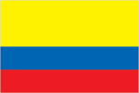
three horizontal bands of yellow (top, double-width), blue, and red; similar to the flag of Ecuador, which is longer and bears the Ecuadorian coat of arms superimposed in the center
Location
4 00 N, 72 00 W -- Northern South America, bordering the Caribbean Sea, between Panama and Venezuela, and bordering the North Pacific Ocean, between Ecuador and Panama Flag ----
Geography
Area
- comparative area
- slightly less than three times the size of Montana
- land area
- 1,038,700 sq km
- note
- includes Isla de Malpelo, Roncador Cay, Serrana Bank, and Serranilla Bank
- total area
- 1,138,910 sq km
Climate
tropical along coast and eastern plains; cooler in highlands
Coastline
3,208 km (Caribbean Sea 1,760 km, North Pacific Ocean 1,448 km)
Environment
- current issues
- deforestation; soil damage from overuse of pesticides; air pollution, especially in Bogota, from vehicle emissions
- international agreements
- party to - Antarctic Treaty, Biodiversity, Climate Change, Endangered Species, Marine Life Conservation, Nuclear Test Ban, Ozone Layer Protection, Ship Pollution, Tropical Timber 83; signed, but not ratified - Antarctic-Environmental Protocol, Desertification, Hazardous Wastes, Law of the Sea, Marine Dumping, Tropical Timber 94
- natural hazards
- highlands subject to volcanic eruptions; occasional earthquakes; periodic droughts
Geographic coordinates
4 00 N, 72 00 W
Geographic note
only South American country with coastlines on both North Pacific Ocean and Caribbean Sea
International disputes
maritime boundary dispute with Venezuela in the Gulf of Venezuela; territorial dispute with Nicaragua over Archipelago de San Andres y Providencia and Quita Sueno Bank
Irrigated land
5,150 sq km (1989 est.)
Land boundaries
- border countries
- Brazil 1,643 km, Ecuador 590 km, Panama 225 km, Peru 2,900 km, Venezuela 2,050 km
- total
- 7,408 km
Land use
- arable land
- 4%
- forest and woodland
- 49%
- meadows and pastures
- 29%
- other
- 16%
- permanent crops
- 2%
Location
Northern South America, bordering the Caribbean Sea, between Panama and Venezuela, and bordering the North Pacific Ocean, between Ecuador and Panama
Map references
South America
Maritime claims
- continental shelf
- 200-m depth or to the depth of exploitation
- exclusive economic zone
- 200 nm
- territorial sea
- 12 nm
Natural resources
petroleum, natural gas, coal, iron ore, nickel, gold, copper, emeralds
Terrain
- flat coastal lowlands, central highlands, high Andes Mountains, eastern lowland plains
- highest point
- Nevado del Huila 5,750 m
- lowest point
- Pacific Ocean 0 m
People and Society
Age structure
0-14 years: 32% (male 5,948,599; female 5,806,450) 15-64 years: 64% (male 11,496,931; female 11,890,875) 65 years and over: 4% (male 741,788; female 928,518) (July 1996 est.)
Birth rate
21.34 births/1,000 population (1996 est.)
Death rate
4.65 deaths/1,000 population (1996 est.)
Ethnic divisions
mestizo 58%, white 20%, mulatto 14%, black 4%, mixed black-Indian 3%, Indian 1%
Infant mortality rate
25.8 deaths/1,000 live births (1996 est.)
Languages
Spanish
Life expectancy at birth
- female
- 75.73 years (1996 est.)
- male
- 69.97 years
- total population
- 72.81 years
Literacy
- age 15 and over can read and write (1995 est.)
- female
- 91.4%
- male
- 91.2%
- total population
- 91.3%
Nationality
- adjective
- Colombian
- noun
- Colombian(s)
Net migration rate
-0.13 migrant(s)/1,000 population (1996 est.)
Population
36,813,161 (July 1996 est.)
Population growth rate
1.66% (1996 est.)
Religions
Roman Catholic 95%
Sex ratio
- all ages
- 0.98 male(s)/female (1996 est.)
- at birth
- 1.03 male(s)/female
- under 15 years
- 1.02 male(s)/female 15-64 years: 0.97 male(s)/female 65 years and over: 0.8 male(s)/female
Total fertility rate
2.35 children born/woman (1996 est.)
Government
Administrative divisions
32 departments (departamentos, singular - departamento) and 1 capital district* (distrito capital); Amazonas, Antioquia, Arauca, Atlantico, Bogota*, Bolivar, Boyaca, Caldas, Caqueta, Casanare, Cauca, Cesar, Choco, Cordoba, Cundinamarca, Guainia, Guaviare, Huila, La Guajira, Magdalena, Meta, Narino, Norte de Santander, Putumayo, Quindio, Risaralda, San Andres y Providencia, Santander, Sucre, Tolima, Valle del Cauca, Vaupes, Vichada
Capital
Bogota
Constitution
5 July 1991
Data code
CO
Diplomatic representation in US
- chancery
- 2118 Leroy Place NW, Washington, DC 20008
- chief of mission
- Ambassador Carlos LLERAS de la Fuente
- telephone
- [1] (202) 387-8338
Executive branch
- cabinet
- Cabinet
- chief of state and head of government
- President Ernesto SAMPER Pizano (since 7 August 1994) elected for a four-year term by popular vote; election last held 29 May 1994 (next to be held NA May 1998) results - no candidate received more than 50% of the total vote; a run-off election to select a president from the two leading candidates was held 19 June 1994; results - Ernesto SAMPER Pizano (Liberal Party) 50.4%, Andres PASTRANA Arango (Conservative Party) 48.6%, blank votes 1%; Humberto de la CALLE Lombana elected vice president for a four-year term by popular vote in a new procedure that replaces the traditional designation of vice presidents by newly elected presidents
FAX
- [1] (202) 232-8643
- [57] (1) 315-2197
- consulate(s)
- Atlanta and Tampa
- consulate(s)
- Barranquilla
- consulate(s) general
- Boston, Chicago, Houston, Los Angeles, Miami, New Orleans, New York, San Francisco, San Juan (Puerto Rico), and Washington, DC
Flag
three horizontal bands of yellow (top, double-width), blue, and red; similar to the flag of Ecuador, which is longer and bears the Ecuadorian coat of arms superimposed in the center
House of Representatives (Camara de Representantes)
elections last held 13 March 1994 (next to be held NA March 1998); seats - (161 total) Liberal Party 89, conservatives (includes PC, MSN, and NDF) 53, AD/M-19 2, other 17
Independence
20 July 1810 (from Spain)
International organization participation
AG, CCC, CDB, ECLAC, FAO, G- 3, G-11, G-24, G-77, IADB, IAEA, IBRD, ICAO, ICC, ICFTU, ICRM, IDA, IFAD, IFC, IFRCS, ILO, IMF, IMO, Intelsat, Interpol, IOC, IOM, ISO, ITU, LAES, LAIA, NAM, OAS, OPANAL, PCA, RG, UN, UNCTAD, UNESCO, UNHCR, UNIDO, UNU, UPU, WCL, WFTU, WHO, WIPO, WMO, WToO, WTrO
Judicial branch
Supreme Court of Justice (Corte Suprema de Justical), highest court of criminal law, judges are selected from the nominees of the Higher Council of Justice for eight-year terms; Council of State, highest court of administrative law, judges are selected from the nominees of the Higher Council of Justice for eight-year terms; Constitutional Court, guards integrity and supremacy of the constitution, rules on constitutionality of laws, amendments to the constitution, and international treaties
Legal system
based on Spanish law; a new criminal code modeled after US procedures was enacted in 1992-93; judicial review of executive and legislative acts; accepts compulsory ICJ jurisdiction, with reservations
Legislative branch
bicameral Congress (Congreso)
Name of country
- conventional long form
- Republic of Colombia
- conventional short form
- Colombia
- local long form
- Republica de Colombia
- local short form
- Colombia
National holiday
Independence Day, 20 July (1810)
Other political or pressure groups
three insurgent groups are active in Colombia - Revolutionary Armed Forces of Colombia (FARC); National Liberation Army (ELN); and dissidents of the recently demobilized People's Liberation Army (EPL/D)
Political parties and leaders
Liberal Party (PL), Luis Fernando JARAMILLO; Conservative Party (PC), Jaime ARIAS; New Democratic Force (NDF), Andres PASTRANA Arango; Democratic Alliance M-19 (AD/M-19) is a coalition of small leftist parties and dissident liberals and conservatives; Patriotic Union (UP) is a legal political party formed by Revolutionary Armed Forces of Colombia (FARC) and Colombian Communist Party (PCC), Aida ABELLA; National Salvation Movement (MSN) Alvaro GOMEZ Hurtado
Senate (Senado)
elections last held 13 March 1994 (next to be held NA March 1998); results - percent of vote by party NA; seats - (102 total) Liberal Party 59, conservatives (includes PC, MSN, and NDF) 31, other 12
Suffrage
18 years of age; universal and compulsory
Type of government
republic; executive branch dominates government structure
US diplomatic representation
- chief of mission
- Ambassador Myles R. R. FRECHETTE
- embassy
- Calle 22D-BIS, No. 47-51, Apartado Aereo 3831
- mailing address
- APO AA 34038
- telephone
- [57] (1) 315-0811
Economy
Agriculture
coffee, cut flowers, bananas, rice, tobacco, corn, sugarcane, cocoa beans, oilseed, vegetables; forest products; shrimp farming
Budget
- expenditures
- $24 billion including capital expenditures of $NA (1996 est.)
- revenues
- $NA
Currency
1 Colombian peso (Col$) = 100 centavos
Economic aid
- recipient
- ODA, $30 million (1993)
Economic overview
Boasting a diversified and stable economy, Colombia has enjoyed Latin America's most consistent record of growth over the last several decades. Gross domestic product (GDP) has expanded every year for more than 25 years, and unlike many other South American countries, Colombia did not default on any of its official debts during the "lost decade" of the 1980s. Since 1990, when Bogota introduced a comprehensive reform program that opened the economy to foreign trade and investment, GDP growth has averaged more than 4% annually. Growth has been fueled in recent years by the expansion of the construction and financial service industries and an influx of foreign capital. Some foreign investors have been deterred by an inadequate energy and transportation infrastructure and the violence stemming from drug trafficking and persistent rural guerrilla warfare, but direct foreign investment, especially in the oil industry, is still rising at a rapid rate. Although oil consequently is overtaking coffee as the main legal export, earnings from illicit drugs probably exceed those from any other export. Non-petroleum economic growth has been slowing, however, in part because the tight monetary policies adopted to offset the inflationary impact of high capital inflows and rising government spending have slowed local sales and investment. Business confidence also has been damaged by a political crisis stemming from allegations that senior government officials, including President SAMPER, solicited contributions from drug traffickers during the 1994 election campaign. The slowdown in the growth of labor-intensive industries such as manufacturing has caused a small rise in unemployment and interfered with President SAMPER'S plans to lower the country's poverty rate, which has remained at about 40% despite the expanding economy. Nevertheless, the booming oil sector, growing foreign investment, and the fundamental stability of the economy promise to keep growth positive for the foreseeable future, barring severe, unpredictable shocks from developments in the political or international arenas.
Electricity
- capacity
- 10,220,000 kW
- consumption per capita
- 890 kWh (1993)
- production
- 33 billion kWh
Exchange rates
Colombian pesos (Col$) per US$1 - 1,011.11 (January 1996), 912.83 (1995), 844.84 (1994), 863.06 (1993), 759.28 (1992), 633.05 (1991)
Exports
- $10.5 billion (f.o.b., 1995 est.)
- commodities
- petroleum, coffee, coal, bananas, fresh cut flowers
- partners
- US 39%, EC 25.7%, Japan 2.9%, Venezuela 8.5% (1992)
External debt
$14 billion (1995 est.)
Fiscal year
calendar year
GDP
purchasing power parity - $192.5 billion (1995 est.)
GDP composition by sector
- agriculture
- 21.5%
- industry
- 29%
- services
- 49.5%
GDP per capita
$5,300 (1995 est.)
GDP real growth rate
5.3% (1995 est.)
Illicit drugs
illicit producer of coca, opium poppies, and cannabis; about 50,900 hectares of coca under cultivation in 1995; the world's largest processor of coca derivatives into cocaine; supplier of cocaine to the US and other international drug markets; active aerial eradication program seeks to virtually eliminate coca and opium crops by 1997
Imports
- $13.5 billion (c.i.f., 1995 est.)
- commodities
- industrial equipment, transportation equipment, consumer goods, chemicals, paper products
- partners
- US 36%, EC 18%, Brazil 4%, Venezuela 6.5%, Japan 8.7% (1992)
Industrial production growth rate
3.5% (1995 est.)
Industries
textiles, food processing, oil, clothing and footwear, beverages, chemicals, cement; gold, coal, emeralds
Inflation rate (consumer prices)
19.5% (1995 est.)
Labor force
- 12 million (1990)
- by occupation
- services 46%, agriculture 30%, industry 24% (1990)
Unemployment rate
9.5% (1995)
Communications
Branches
Army (Ejercito Nacional), Navy (Armada Nacional, includes Marines and Coast Guard), Air Force (Fuerza Aerea Colombiana), National Police (Policia Nacional)
Defense expenditures
exchange rate conversion - $2 billion, 2.8% of GDP (1995)
Manpower availability
- males age 15-49
- 10,067,538
- males fit for military service
- 6,774,105
- males reach military age (18) annually
- 346,372 (1996 est.)
Radio broadcast stations
AM 413 (licensed), FM 217 (licensed), shortwave 28
Radios
NA
Telephone system
- modern system in many respects
- domestic
- nationwide microwave radio relay system; domestic satellite system with 11 earth stations
- international
- satellite earth stations - 2 Intelsat (Atlantic Ocean)
Telephones
1.89 million (1986 est.)
Television broadcast stations
33
Televisions
5.5 million (1993 est.) Defense
Transportation
Airports
- total
- 989
- with paved runways 1 524 to 2 437 m
- 33
- with paved runways 2 438 to 3 047 m
- 9
- with paved runways 914 to 1 523 m
- 35
- with paved runways over 3 047 m
- 2
- with paved runways under 914 m
- 557
- with unpaved runways 1 524 to 2 437 m
- 41
- with unpaved runways 2 438 to 3 047 m
- 1
- with unpaved runways 914 to 1 523 m
- 311 (1995 est.)
Highways
- paved
- 12,600 km
- total
- 107,200 km
- unpaved
- 94,600 km
Merchant marine
- ships by type
- bulk 5, cargo 8, container 3, oil tanker 3 (1995 est.)
- total
- 19 ships (1,000 GRT or over) totaling 97,037 GRT/129,404 DWT
Pipelines
crude oil 3,585 km; petroleum products 1,350 km; natural gas 830 km; natural gas liquids 125 km
Ports
Barranquilla, Buenaventura, Cartagena, Leticia, Puerto Bolivar, San Andres, Santa Marta, Tumaco, Turbo
Railways
- narrow gauge
- 3,236 km 0.914-m gauge (1830 km in use) (1995)
- standard gauge
- 150 km 1.435-m gauge (connects Cerrejon coal mines to maritime port at Bahia Portete)
- total
- 3,386 km
Waterways
14,300 km, navigable by river boats