1998 Edition
CIA World Factbook 1998 (Internet Archive)
Geography
Area
total: 600,370 sq km land: 585,370 sq km water: 15,000 sq km
Area-comparative
slightly smaller than Texas
Climate
semiarid; warm winters and hot summers
Coastline
0 km (landlocked)
Elevation extremes
lowest point: junction of the Limpopo and Shashe Rivers 513 m highest point: Tsodilo Hill 1,489 m
Environment-current issues
overgrazing; desertification; limited fresh water resources
Environment-international agreements
party to: Biodiversity, Climate Change, Desertification, Endangered Species, Law of the Sea, Nuclear Test Ban, Ozone Layer Protection signed, but not ratified: none of the selected agreements
Geographic coordinates
22 00 S, 24 00 E
Geography-note
landlocked; population concentrated in eastern part of the country
Irrigated land
20 sq km (1993 est.)
Land boundaries
total: 4,013 km border countries: Namibia 1,360 km, South Africa 1,840 km, Zimbabwe 813 km
Land use
arable land: 1% permanent crops: 0% permanent pastures: 46% forests and woodland: 47% other: 6% (1993 est.)
Location
Southern Africa, north of South Africa
Map references
Africa
Maritime claims
none (landlocked)
Natural hazards
periodic droughts; seasonal August winds blow from the west, carrying sand and dust across the country, which can obscure visibility
Natural resources
diamonds, copper, nickel, salt, soda ash, potash, coal, iron ore, silver
Terrain
predominately flat to gently rolling tableland; Kalahari Desert in southwest
People and Society
Age structure
0-14 years: 42% (male 310,253; female 302,960) 15-64 years: 54% (male 370,925; female 409,941) 65 years and over: 4% (male 20,637; female 33,738) (July 1998 est.)
Birth rate
32.02 births/1,000 population (1998 est.)
Death rate
20.89 deaths/1,000 population (1998 est.)
Ethnic groups
Batswana 95%, Kalanga, Basarwa, and Kgalagadi 4%, white 1%
Infant mortality rate
59.29 deaths/1,000 live births (1998 est.)
Languages
English (official), Setswana
Life expectancy at birth
total population: 40.09 years male: 39.46 years female: 40.75 years (1998 est.)
Literacy
definition: age 15 and over can read and write total population: 69.8% male: 80.5% female: 59.9% (1995 est.)
Nationality
noun: Motswana (singular), Batswana (plural) adjective: Motswana (singular), Batswana (plural)
Net migration rate
0 migrant(s)/1,000 population (1998 est.)
Population
1,448,454 (July 1998 est.)
Population growth rate
1.11% (1998 est.)
Religions
indigenous beliefs 50%, Christian 50%
Sex ratio
at birth: 1.03 male(s)/female under 15 years: 1.02 male(s)/female 15-64 years: 0.9 male(s)/female 65 years and over: 0.61 male(s)/female (1998 est.)
Total fertility rate
4.03 children born/woman (1998 est.)
Government
Administrative divisions
10 districts and four town councils*; Central, Chobe, Francistown*, Gaborone*, Ghanzi, Kgalagadi, Kgatleng, Kweneng, Lobatse*, Ngamiland, North-East, Selebi-Phikwe*, South-East, Southern
Constitution
March 1965, effective 30 September 1966
Country name
conventional long form: Republic of Botswana conventional short form: Botswana former: Bechuanaland
Data code
BC
Executive branch
chief of state: President Festus MOGAE (since 1 April 1998) note-the president is both the chief of state and head of government head of government: President Festus MOGAE (since 1 April 1998) note-the president is both the chief of state and head of government cabinet: Cabinet appointed by the president elections: president elected by the National Assembly for a five-year term; election last held 15 October 1994 (next to be held NA October 1999); vice president appointed by the president election results: Sir Ketumile MASIRE elected president; percent of National Assembly vote-NA note: President MASIRE resigned on 31 March 1998; Vice President MOGAE assumed the presidency pending elections to be held in 1999; on 2 April 1998, Festus MOGAE, then president, designated S. K. Ian KHAMA to be vice president after he is elected to the National Assembly in accordance with constitutional requirements
FAX
- [1] (202) 244-4164 Diplomatic representation from the US: chief of mission: Ambassador Robert C. KRUEGER embassy: address NA, Gaborone mailing address: P. O. Box 90, Gaborone telephone: [267] 353982
- [267] 356947
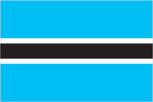
Flag description
light blue with a horizontal white-edged black stripe in the center
Government type
parliamentary republic
Independence
30 September 1966 (from UK)
International organization participation
ACP, AfDB, C, CCC, ECA, FAO, G-77, IBRD, ICAO, ICFTU, ICRM, IDA, IFAD, IFC, IFRCS, ILO, IMF, Intelsat, Interpol, IOC, ITU, NAM, OAU, SACU, SADC, UN, UNCTAD, UNESCO, UNIDO, UPU, WCL, WFTU, WHO, WMO, WToO, WTrO Diplomatic representation in the US: chief of mission: Ambassador Archibald Mooketsa MOGWE chancery: Suite 7M, 3400 International Drive NW, Washington, DC 20008 telephone: [1] (202) 244-4990, 4991
Judicial branch
High Court; Court of Appeal Political parties and leaders: Botswana Democratic Party or BDP [Festus MOGAE]; Botswana Freedom Party or BFP [leader NA]; Botswana National Front or BNF [Kenneth KOMA]; Botswana People's Party or BPP [Knight MARIPE]; Independence Freedom Party or IFP [Motsamai MPHO]; Unified Action Party or UAP [Lepetu SETSHWEALD]
Legal system
based on Roman-Dutch law and local customary law; judicial review limited to matters of interpretation; has not accepted compulsory ICJ jurisdiction
Legislative branch
bicameral Parliament consists of the House of Chiefs (a largely advisory 15-member body consisting of the chiefs of the eight principal tribes, four elected subchiefs, and three members selected by the other 12) and the National Assembly (44 seats, 40 members are directly elected by popular vote and 4 appointed by the majority party; members serve five-year terms) elections: National Assembly-elections last held 15 October 1994 (next to be held October 1999) election results: percent of vote by party-NA; seats by party-BDP 27, BNF 13
National capital
Gaborone
National holiday
Independence Day, 30 September (1966)
Suffrage
18 years of age; universal
Economy
Agriculture-products
sorghum, maize, millet, pulses, groundnuts (peanuts), beans, cowpeas, sunflower seed; livestock
Budget
revenues: $1.6 billion expenditures: $1.8 billion, including capital expenditures of $560 million (FY96/97)
Currency
1 pula (P) = 100 thebe
Debt-external
$619 million (1996)
Economic aid
recipient: ODA, $189 million (1993)
Economy-overview
Agriculture still provides a livelihood for more than 80% of the population but supplies only about 50% of food needs and accounts for only 4% of GDP. Subsistence farming and cattle raising predominate. Diamond mining and tourism also are important to the economy. The sector is plagued by erratic rainfall and poor soils. Substantial mineral deposits were found in the 1970s and the mining sector grew from 25% of GDP in 1980 to 35% in 1997. Unemployment officially is 21% but unofficial estimates place it closer to 40%. On the plus side is the substantial positive trade balance.
Electricity-capacity
217,000 kW (1995)
Electricity-consumption per capita
962 kWh (1995)
Electricity-production
1 billion kWh (1995)
Exchange rates
pula (P) per US$1-3.8547 (January 1998), 3.6508 (1997), 3.3242 (1996), 2.7716 (1995), 2.6831 (1994), 2.4190 (1993)
Exports
total value: $2.31 billion (f.o.b. 1996 est.) commodities: diamonds 71%, copper and nickel 5%, meat 3% partners: Europe 74%, Southern African Customs Union (SACU) 22%, Zimbabwe 3%
Fiscal year
1 April-31 March Communications
GDP
purchasing power parity-$5 billion (1997 est.)
GDP-composition by sector
agriculture: 4% industry: 45% (including 35% mining) services: 51% (1997 est.)
GDP-per capita
purchasing power parity-$3,300 (1997 est.)
GDP-real growth rate
6% (1997 est.)
Imports
total value: $1.6 billion (c.i.f., 1996 est.) commodities: foodstuffs, vehicles and transport equipment, textiles, petroleum products partners: Southern African Customs Union (SACU) 74%, Europe 8%, Zimbabwe 6%
Industrial production growth rate
4.6% (FY92/93)
Industries
diamonds, copper, nickel, coal, salt, soda ash, potash; livestock processing
Inflation rate-consumer price index
10% (1996 est.)
Labor force
total: 235,000 formal sector employees (1995) by occupation: 100,000 public sector; 135,000 private sector, including 14,300 who are employed in various mines in South Africa; most others engaged in cattle raising and subsistence agriculture (1995 est.)
Radio broadcast stations
AM 7, FM 13, shortwave 0
Radios
NA
Telephone system
sparse system domestic: small system of open-wire lines, microwave radio relay links, and a few radiotelephone communication stations international: microwave radio relay links to Zambia, Zimbabwe and South Africa; satellite earth station-1 Intelsat (Indian Ocean)
Telephones
19,109 (1985 est.)
Television broadcast stations
0 (1988 est.)
Televisions
13,800 (1993 est.)
Unemployment rate
20-40% (1997 est.)
Transportation
Airports
92 (1997 est.) Airports-with paved runways: total: 12 over 3,047 m: 1 2,438 to 3,047 m: 1 1,524 to 2,437 m: 9 914 to 1,523 m: 1 (1997 est.) Airports-with unpaved runways: total: 80 1,524 to 2,437 m: 3 914 to 1,523 m: 55 under 914 m: 22 (1997 est.)
Highways
total: 18,482 km paved: 4,343 km unpaved: 14,139 km (1996 est.) Ports and harbors: none
Railways
total: 971 km narrow gauge: 971 km 1.067-m gauge (1995)
Military and Security
Military branches
Botswana Defense Force (includes Army and Air Wing), Botswana National Police
Military expenditures-dollar figure
$199 million (FY93/94)
Military expenditures-percent of GDP
5.2% (FY93/94)
Military manpower-availability
males age 15-49: 335,301 (1998 est.) Military manpower-fit for military service: males: 177,248 (1998 est.)
Military manpower-military age
18 years of age
Military manpower-reaching military age annually
males: 18,148 (1998 est.)
Transnational Issues
Disputes-international
quadripoint with Namibia, Zambia, and Zimbabwe is in disagreement; dispute with Namibia over uninhabited Kasikili (Sidudu) Island in Linyanti (Chobe) River is presently at the ICJ; at least one other island in Linyanti River is contested (territory of Norway)