Interactive Map
Click other countries to navigate
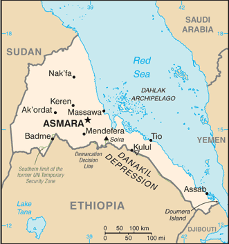
CIA Reference Map
Official geographic reference
Videos about Eritrea
Anthem, travel, geography & more
National Anthem

Ertra, Ertra, Ertra
Click to play video
Explore More on YouTube
Ertra, Ertra, Ertra
Eritrea
0:00
Key Facts
Climate
hot, dry desert strip along Red Sea coast; cooler and wetter in the central highlands (up to 61 cm of rainfall annually, heaviest June to September); semiarid in western hills and lowlands
Coastline
2,234 km (mainland on Red Sea 1,151 km; islands in Red Sea 1,083 km)
Government type
authoritarian
Languages
Tigrinya (official), Arabic (official), English (official), Tigre, Kunama, Afar, other Cushitic languages
Natural resources
gold, potash, zinc, copper, salt, possibly oil and natural gas, fish
Terrain
dominated by extension of Ethiopian north-south trending highlands, descending on the east to a coastal desert plain, on the northwest to hilly terrain and on the southwest to flat-to-rolling plains