1986 Edition
CIA World Factbook 1986 (Internet Archive)
Geography
Agriculture
dominated by coconut production, with subsistence crops of yams, taro, bananas
Aid
(1978) France, European Development Fund, $2.6 million
Airfields
2 total; 2 usable; 1 with permanent-surface runways 1,220-2,439 m
Area
50km MATA-UTU He (Ae» South Pacific Ocean lie Futuna %g~ lie Aloli Land About 207 km2; about the size of New York City Water
Branches
territorial assembly of 20 members; popular election of one deputy to National Assembly in Paris and one senator
Capital
Mata-Utu
Coast/we
1,1 10 km People
Coastline
about 129 km People
Elections
every five years Economy
Electric power
1,000 kW capacity (1985); 1 million kWh produced (1985), 83 kWh per capita
Ethnic divisions
- almost entirely Polynesian
- Arab and Berber
Exports
negligible
Government leaders
Mirhel KUHNMUNCH, Superior Administrator and President of Territorial Assembly (since at least 1984)
Highways
100 km of improved road on Uvea Island (1977)
Imports
$3.4 million (1977); largely foodstuffs and some equipment associated with development programs
Inland waterways
none
Labor force
12,000; 50% animal husbandry and subsistence farming, 50% other Government
Land boundaries
2,086 km Water
Language
Hassaniya Arabic, Moroccan Arabic
Limits of territorial waters
12 nm (200 nm exclusive economic zone)
Limits of territorial waters (claimed)
6 nm (fishing 1 2 nm)
Literacy
among Moroccans, probably nearly 20%; among Saharans, perhaps 5%
Monetary conversion rate
127.05 Colonial Francs Pacifique(CFP)=US$l (December 1982) Communications
Nationality
- noun — Wallisian(s), Futunan(s), or Wallis and Futuna Islanders; adjective — Wallisian, Futunan, or Wallis and Futuna Islander
- noun — Saharan(s), Moroccan(s); adjective — Saharan, Moroccan
Official name
- Territory of the Wallis and Futuna Islands
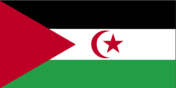
- Western Sahara
Political subdivisions
three districts
Population
- 14,000 (July 1986) average annual growth rate 2.5%
- 92,000 (July 1986), average annual growth rate 1.8%
Ports
2 minor
Railroads
none
Religion
- largely Roman Catholic Government
- Muslim
Suffrage
universal adult
Telecommunications
148 telephones (1.2 per lOOpopl.) Defense Forces Defense is the responsibility of France ' El Aaiun Semara North I Bu Cru Atlantic / Ocean f • Guelta Zemmiff 4Ad Oakht* s Bif Oandus Land 266,770 km2; larger than Utah; nearly all desert
Type
overseas territory of France