2007 Edition
CIA World Factbook 2007 (Project Gutenberg)
Introduction
Administrative divisions
50 states and 1 district*; Alabama, Alaska, Arizona, Arkansas, California, Colorado, Connecticut, Delaware, District of Columbia*, Florida, Georgia, Hawaii, Idaho, Illinois, Indiana, Iowa, Kansas, Kentucky, Louisiana, Maine, Maryland, Massachusetts, Michigan, Minnesota, Mississippi, Missouri, Montana, Nebraska, Nevada, New Hampshire, New Jersey, New Mexico, New York, North Carolina, North Dakota, Ohio, Oklahoma, Oregon, Pennsylvania, Rhode Island, South Carolina, South Dakota, Tennessee, Texas, Utah, Vermont, Virginia, Washington, West Virginia, Wisconsin, Wyoming
Age structure
0-14 years: 20.4% (male 31,095,847/female 29,715,872) 15-64 years: 67.2% (male 100,022,845/female 100,413,484) 65 years and over: 12.5% (male 15,542,288/female 21,653,879) (2006 est.)
Agriculture - products
wheat, corn, other grains, fruits, vegetables, cotton; beef, pork, poultry, dairy products; fish; forest products
Airports
14,858 (2006)
Airports - with paved runways
- over 3,047 m
- 189 2,438 to 3,047 m: 221 1,524 to 2,437 m: 1,426 914 to 1,523 m: 2,337
- total
- 5,119
- under 914 m
- 946 (2006)
Airports - with unpaved runways
- over 3,047 m
- 1 2,438 to 3,047 m: 6 1,524 to 2,437 m: 157 914 to 1,523 m: 1,728
- total
- 9,739
- under 914 m
- 7,847 (2006)
Area
- total - 6,959.41 sq km; emergent land - 22.41 sq km; submerged - 6,937 sq km
- land
- 9,161,923 sq km
- note
- includes only the 50 states and District of Columbia
- total
- 9,826,630 sq km
- water
- 664,707 sq km
Area - comparative
about half the size of Russia; about three-tenths the size of Africa; about half the size of South America (or slightly larger than Brazil); slightly larger than China; almost two and a half times the size of the European Union
Background
- Britain's American colonies broke with the mother country in 1776 and were recognized as the new nation of the United States of America following the Treaty of Paris in 1783. During the 19th and 20th centuries, 37 new states were added to the original 13 as the nation expanded across the North American continent and acquired a number of overseas possessions. The two most traumatic experiences in the nation's history were the Civil War (1861-65) and the Great Depression of the 1930s. Buoyed by victories in World Wars I and II and the end of the Cold War in 1991, the US remains the world's most powerful nation state. The economy is marked by steady growth, low unemployment and inflation, and rapid advances in technology. Geography United States
- The following US Pacific island territories constitute the Pacific Remote Islands National Wildlife Refuge Complex and as such are managed by the Fish and Wildlife Service of the US Department of Interior. These remote refuges are the most widespread collection of marine- and terrestrial-life protected areas on the planet under a single country's jurisdiction. They protect many endemic species including corals, fish, shellfish, marine mammals, seabirds, water birds, land birds, insects, and vegetation not found elsewhere.
Baker Island
- The US took possession of the island in 1857, and its guano deposits were mined by US and British companies during the second half of the 19th century. In 1935, a short-lived attempt at colonization began on this island but was disrupted by World War II and thereafter abandoned. The island was established as a National Wildlife Refuge in 1974.
- atoll in the North Pacific Ocean 1,830 nm (3,389 km) southwest of Honolulu, about half way between Hawaii and Australia
- 0 13 N, 176 28 W
- total - 129 sq km; emergent land - 2.1 sq km; submerged - 127 sq km
- about two and a half times the size of The Mall in Washington, DC
- 4.8 km
- one abandoned World War II runway of 1,665 m covered with vegetation and unusable
Baker, Howland, and Jarvis Islands
- equatorial; scant rainfall, constant wind, burning sun
- the narrow fringing reef surrounding the island can be a maritime hazard
- scattered vegetation consisting of grasses, prostrate vines, and low growing shrubs; primarily a nesting, roosting, and foraging habitat for seabirds, shorebirds, and marine wildlife
Baker, Howland, and Jarvis Islands, and Johnston Atoll
no natural fresh water resources
Baker, Howland, and Jarvis Islands, and Kingman Reef
none; offshore anchorage only
Birth rate
14.14 births/1,000 population (2006 est.)
Budget
- expenditures
- $2.66 trillion; including capital expenditures of $NA (2006 est.)
- revenues
- $2.409 trillion
Capital
- daylight saving time
- +1hr, begins second Sunday in March; ends first Sunday in November
- geographic coordinates
- 38 53 N, 77 02 W
- name
- Washington, DC (capital)
- note
- the United States is divided into six time zones
- time difference
- UTC-5 (during Standard Time)
Climate
mostly temperate, but tropical in Hawaii and Florida, arctic in Alaska, semiarid in the great plains west of the Mississippi River, and arid in the Great Basin of the southwest; low winter temperatures in the northwest are ameliorated occasionally in January and February by warm chinook winds from the eastern slopes of the Rocky Mountains
Coastline
19,924 km
Constitution
17 September 1787, effective 4 March 1789
Country name
- abbreviation
- US or USA
- conventional long form
- United States of America
- conventional long form
- none
- conventional short form
- United States
- conventional short form
- Baker Island; Howland Island; Jarvis Island; Johnston Atoll; Kingman Reef; Midway Islands; Palmyra Atoll
Currency (code)
US dollar (USD)
Currency code
USD
Current account balance
$-862.3 billion (2006 est.)
Death rate
8.26 deaths/1,000 population (2006 est.)
Debt - external
$10.04 trillion (30 June 2006 est.)
Dependency status
- unincorporated territories of the US; administered from Washington, DC, by the Fish and Wildlife Service of the US Department of the Interior as part of the National Wildlife Refuge system
- note on Palmyra Atoll
- incorporated Territory of the US; partly privately owned and partly federally owned; administered from Washington, DC, by the Fish and Wildlife Service of the US Department of the Interior; the Office of Insular Affairs of the US Department of the Interior continues to administer nine excluded areas comprising certain tidal and submerged lands within the 12 nm territorial sea or within the lagoon
Dependent areas
- American Samoa, Baker Island, Guam, Howland Island, Jarvis Island, Johnston Atoll, Kingman Reef, Midway Islands, Navassa Island, Northern Mariana Islands, Palmyra Atoll, Puerto Rico, Virgin Islands, Wake Island
- note
- from 18 July 1947 until 1 October 1994, the US administered the Trust Territory of the Pacific Islands; it entered into a political relationship with all four political units: the Northern Mariana Islands is a commonwealth in political union with the US (effective 3 November 1986); the Republic of the Marshall Islands signed a Compact of Free Association with the US (effective 21 October 1986); the Federated States of Micronesia signed a Compact of Free Association with the US (effective 3 November 1986); Palau concluded a Compact of Free Association with the US (effective 1 October 1994)
Disputes - international
- the U.S. has intensified domestic security measures and is collaborating closely with its neighbors, Canada and Mexico, to monitor and control legal and illegal personnel, transport, and commodities across the international borders; abundant rainfall in recent years along much of the Mexico-US border region has ameliorated periodically strained water-sharing arrangements; 1990 Maritime Boundary Agreement in the Bering Sea still awaits Russian Duma ratification; managed maritime boundary disputes with Canada at Dixon Entrance, Beaufort Sea, Strait of Juan de Fuca, and around the disputed Machias Seal Island and North Rock; The Bahamas and US have not been able to agree on a maritime boundary; US Naval Base at Guantanamo Bay is leased from Cuba and only mutual agreement or US abandonment of the area can terminate the lease; Haiti claims US-administered Navassa Island; US has made no territorial claim in Antarctica (but has reserved the right to do so) and does not recognize the claims of any other states; Marshall Islands claims Wake Island; Tokelau included American Samoa's Swains Island among the islands listed in its 2006 draft constitution
- none This page was last updated on 8 February, 2007
Distribution of family income - Gini index
45 (2004)
Economic aid - donor
ODA, $6.9 billion (1997)
Economy - overview
- The US has the largest and most technologically powerful economy in the world, with a per capita GDP of $43,500. In this market-oriented economy, private individuals and business firms make most of the decisions, and the federal and state governments buy needed goods and services predominantly in the private marketplace. US business firms enjoy greater flexibility than their counterparts in Western Europe and Japan in decisions to expand capital plant, to lay off surplus workers, and to develop new products. At the same time, they face higher barriers to enter their rivals' home markets than foreign firms face entering US markets. US firms are at or near the forefront in technological advances, especially in computers and in medical, aerospace, and military equipment; their advantage has narrowed since the end of World War II. The onrush of technology largely explains the gradual development of a "two-tier labor market" in which those at the bottom lack the education and the professional/technical skills of those at the top and, more and more, fail to get comparable pay raises, health insurance coverage, and other benefits. Since 1975, practically all the gains in household income have gone to the top 20% of households. The response to the terrorist attacks of 11 September 2001 showed the remarkable resilience of the economy. The war in March-April 2003 between a US-led coalition and Iraq, and the subsequent occupation of Iraq, required major shifts in national resources to the military. The rise in GDP in 2004-06 was undergirded by substantial gains in labor productivity. Hurricane Katrina caused extensive damage in the Gulf Coast region in August 2005, but had a small impact on overall GDP growth for the year. Soaring oil prices in 2005 and 2006 threatened inflation and unemployment, yet the economy continued to grow through year-end 2006. Imported oil accounts for about two-thirds of US consumption. Long-term problems include inadequate investment in economic infrastructure, rapidly rising medical and pension costs of an aging population, sizable trade and budget deficits, and stagnation of family income in the lower economic groups.
- no economic activity Transportation United States Pacific Island Wildlife Refuges
Electricity - consumption
3.717 trillion kWh (2004)
Electricity - exports
22.9 billion kWh (2004)
Electricity - imports
34.21 billion kWh (2004)
Electricity - production
3.979 trillion kWh (2004)
Electricity - production by source
- fossil fuel
- 71.4%
- hydro
- 5.6%
- nuclear
- 20.7%
- other
- 2.3% (2001)
Elevation extremes
- highest point
- Mount McKinley 6,194 m
- highest point
- Baker Island, unnamed location - 8 m; Howland Island, unnamed location - 3 m; Jarvis Island, unnamed location - 7 m; Johnston Atoll, Sand Island - 10 m; Kingman Reef, unnamed location - less than 1 m; Midway Islands, unnamed location - 13 m; Palmyra Atoll, unnamed location - 2 m
- lowest point
- Death Valley -86 m
- lowest point
- Pacific Ocean 0 m
Environment - current issues
air pollution resulting in acid rain in both the US and Canada; the US is the largest single emitter of carbon dioxide from the burning of fossil fuels; water pollution from runoff of pesticides and fertilizers; limited natural fresh water resources in much of the western part of the country require careful management; desertification
Environment - international agreements
- party to
- Air Pollution, Air Pollution-Nitrogen Oxides, Antarctic-Environmental Protocol, Antarctic-Marine Living Resources, Antarctic Seals, Antarctic Treaty, Climate Change, Desertification, Endangered Species, Environmental Modification, Marine Dumping, Marine Life Conservation, Ozone Layer Protection, Ship Pollution, Tropical Timber 83, Tropical Timber 94, Wetlands, Whaling
- signed, but not ratified
- Air Pollution-Persistent Organic Pollutants, Air Pollution-Volatile Organic Compounds, Biodiversity, Climate Change-Kyoto Protocol, Hazardous Wastes
Ethnic groups
- white 81.7%, black 12.9%, Asian 4.2%, Amerindian and Alaska native 1%, native Hawaiian and other Pacific islander 0.2% (2003 est.)
- note
- a separate listing for Hispanic is not included because the US Census Bureau considers Hispanic to mean a person of Latin American descent (including persons of Cuban, Mexican, or Puerto Rican origin) living in the US who may be of any race or ethnic group (white, black, Asian, etc.)
Exchange rates
British pounds per US dollar - 0.5500 (2005), 0.5462 (2004), 0.6125 (2003), 0.6672 (2002), 0.6947 (2001); Canadian dollars per US dollar - 1.2118 (2005), 1.3010 (2004), 1.4011 (2003), 1.5693 (2002), 1.5488 (2001); Japanese yen per US dollar - 110.22 (2005), 108.19 (2004), 115.93 (2003), 125.39 (2002), 121.53 (2001); euros per US dollar - 0.8041 (2005), 0.8054 (2004), 0.8866 (2003), 1.0626 (2002), 1.1175 (2001); Chinese yuan per US dollar - 8.1943 (2005), 8.2768 (2004), 8.2770 (2003), 8.2770 (2002), 8.2271 (2001)
Executive branch
- cabinet
- Cabinet appointed by the president with Senate approval
- chief of state
- President George W. BUSH (since 20 January 2001); Vice President Richard B. CHENEY (since 20 January 2001); note - the president is both the chief of state and head of government
- election results
- George W. BUSH reelected president; percent of popular vote - George W. BUSH (Republican Party) 50.9%, John KERRY (Democratic Party) 48.1%, other 1.0%
- elections
- president and vice president elected on the same ticket by a college of representatives who are elected directly from each state; president and vice president serve four-year terms (eligible for a second term); election last held 2 November 2004 (next to be held 4 November 2008)
- head of government
- President George W. BUSH (since 20 January 2001); Vice President Richard B. CHENEY (since 20 January 2001)
Exports
$1.024 trillion f.o.b. (2006 est.)
Exports - commodities
agricultural products (soybeans, fruit, corn) 9.2%, industrial supplies (organic chemicals) 26.8%, capital goods (transistors, aircraft, motor vehicle parts, computers, telecommunications equipment) 49.0%, consumer goods (automobiles, medicines) 15.0% (2003)
Exports - partners
Canada 23.4%, Mexico 13.3%, Japan 6.1%, China 4.6%, UK 4.3% (2005)
Fiscal year
1 October - 30 September Communications United States
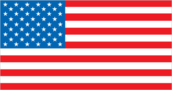
Flag description
- 13 equal horizontal stripes of red (top and bottom) alternating with white; there is a blue rectangle in the upper hoist-side corner bearing 50 small, white, five-pointed stars arranged in nine offset horizontal rows of six stars (top and bottom) alternating with rows of five stars; the 50 stars represent the 50 states, the 13 stripes represent the 13 original colonies; known as Old Glory; the design and colors have been the basis for a number of other flags, including Chile, Liberia, Malaysia, and Puerto Rico Economy United States
- the flag of the US is used Economy United States Pacific Island Wildlife Refuges
GDP - composition by sector
- agriculture
- 0.9%
- industry
- 20.4%
- services
- 78.6% (2006 est.)
GDP - per capita (PPP)
$43,500 (2006 est.)
GDP - real growth rate
3.2% (2006 est.)
GDP (official exchange rate)
$13.22 trillion (2006 est.)
GDP (purchasing power parity)
$12.98 trillion (2006 est.)
Geographic coordinates
38 00 N, 97 00 W
Geography - note
world's third-largest country by size (after Russia and Canada) and by population (after China and India); Mt. McKinley is highest point in North America and Death Valley the lowest point on the continent People United States
Government type
Constitution-based federal republic; strong democratic tradition
Heliports
149 (2006)
HIV/AIDS - adult prevalence rate
0.6% (2003 est.)
HIV/AIDS - deaths
14,000 (2003 est.)
HIV/AIDS - people living with HIV/AIDS
950,000 (2003 est.)
Household income or consumption by percentage share
- highest 10%
- 30.5% (1997)
- lowest 10%
- 1.8%
Howland Island
- Discovered by the US early in the 19th century, the island was officially claimed by the US in 1857. Both US and British companies mined for guano until about 1890. In 1935, a short-lived attempt at colonization began on this island, similar to the effort on nearby Baker Island, but was disrupted by World War II and thereafter abandoned. The famed American aviatrix Amelia EARHART disappeared while seeking out Howland Island as a refueling stop during her 1937 round-the-world flight; Earhart Light, a day beacon near the middle of the west coast, was named in her memory. The island was established as a National Wildlife Refuge in 1974.
- island in the North Pacific Ocean 1,815 nm (3,361 km) southwest of Honolulu, about half way between Hawaii and Australia
- 0 48 N, 176 38 W
- total - 139 sq km; emergent land - 2.6 sq km; submerged - 136 sq km
- about three times the size of The Mall in Washington, DC
- 6.4 km
- airstrip constructed in 1937 for scheduled refueling stop on the round-the-world flight of Amelia EARHART and Fred NOONAN; the aviators left Lae, New Guinea, for Howland Island but were never seen again; the airstrip is no longer serviceable
Illicit drugs
world's largest consumer of cocaine, shipped from Colombia through Mexico and the Caribbean; consumer of heroin, marijuana, and increasingly methamphetamine from Mexico; consumer of high-quality Southeast Asian heroin; illicit producer of cannabis, marijuana, depressants, stimulants, hallucinogens, and methamphetamine; money-laundering center This page was last updated on 8 February, 2007
Imports
$1.869 trillion f.o.b. (2006 est.)
Imports - commodities
agricultural products 4.9%, industrial supplies 32.9% (crude oil 8.2%), capital goods 30.4% (computers, telecommunications equipment, motor vehicle parts, office machines, electric power machinery), consumer goods 31.8% (automobiles, clothing, medicines, furniture, toys) (2003)
Imports - partners
Canada 16.9%, China 15%, Mexico 10%, Japan 8.2%, Germany 5% (2005)
Independence
4 July 1776 (from Great Britain)
Industrial production growth rate
4.2% (2006 est.)
Industries
leading industrial power in the world, highly diversified and technologically advanced; petroleum, steel, motor vehicles, aerospace, telecommunications, chemicals, electronics, food processing, consumer goods, lumber, mining
Infant mortality rate
- female
- 5.74 deaths/1,000 live births (2006 est.)
- male
- 7.09 deaths/1,000 live births
- total
- 6.43 deaths/1,000 live births
Inflation rate (consumer prices)
2.5% (2006 est.)
International organization participation
AfDB, ANZUS, APEC, Arctic Council, ARF, AsDB, ASEAN (dialogue partner), Australia Group, BIS, BSEC (observer), CBSS (observer), CE (observer), CERN (observer), CP, EAPC, EBRD, FAO, G-5, G-7, G- 8, G-10, IADB, IAEA, IBRD, ICAO, ICC, ICRM, IDA, IEA, IFAD, IFC, IFRCS, IHO, ILO, IMF, IMO, Interpol, IOC, IOM, ISO, ITU, ITUC, MIGA, MINUSTAH, NAFTA, NATO, NEA, NSG, OAS, OECD, OPCW, OSCE, Paris Club, PCA, PIF (partner), SAARC (observer), SECI (observer), SPC, UN, UN Security Council, UNCTAD, UNESCO, UNHCR, UNITAR, UNMEE, UNMIL, UNMOVIC, UNOMIG, UNRWA, UNTSO, UPU, WCL, WCO, WHO, WIPO, WMO, WTO, ZC
Internet country code
.us
Internet hosts
195,138,696 (2005)
Internet Service Providers (ISPs)
7,000 (2002 est.)
Internet users
205,326,680 (2005) Transportation United States
Investment (gross fixed)
16.6% of GDP (2006 est.)
Irrigated land
223,850 sq km (2003)
Jarvis Island
- First discovered by the British in 1821, the uninhabited island was annexed by the US in 1858, but abandoned in 1879 after tons of guano had been removed. The UK annexed the island in 1889, but never carried out plans for further exploitation. The US occupied and reclaimed the island in 1935 until it was abandoned in 1942 during World War II. The island was established as a National Wildlife Refuge in 1974.
- island in the South Pacific Ocean 1,305 nm (2,417 km) south of Honolulu, about half way between Hawaii and the Cook Islands
- 0 23 S, 160 01 W
- total - 152 sq km; emergent land - 5 sq km; submerged - 147 sq km
- about eight times the size of The Mall in Washington, DC
- 8 km
Johnston Atoll
- Both the US and the Kingdom of Hawaii annexed Johnston Atoll in 1858, but it was the US that mined the guano deposits until the late 1880s. Johnston and Sand Islands were designated wildlife refuges in 1926. The US Navy took over the atoll in 1934, and subsequently the US Air Force assumed control in 1948. The site was used for high-altitude nuclear tests in the 1950s and 1960s, and until late in 2000 the atoll was maintained as a storage and disposal site for chemical weapons. Munitions destruction is now complete. Cleanup and closure of the facility was completed by May 2005. The Fish and Wildlife Service and the US Air Force are currently discussing future management options; in the interim, Johnston Atoll and the three-mile Naval Defensive Sea around it remain under the jurisdiction and administrative control of the US Air Force.
- atoll in the North Pacific Ocean 717 nm (1,328 km) southwest of Honolulu, about one-third of the way from Hawaii to the Marshall Islands
- 16 45 N, 169 31 W
- total - 276.6 sq km; emergent land - 2.6 sq km; submerged - 274 sq km
- about four and a half times the size of The Mall in Washington, DC
- 34 km
- Johnston Island and Sand Island are natural islands, which have been expanded by coral dredging; North Island (Akau) and East Island (Hikina) are manmade islands formed from coral dredging; the egg-shaped reef is 34 km in circumference
- in previous years, an average of 1,100 US military and civilian contractor personnel were present; as of May 2005 all US government personnel had left the island
- 1 - closed and not maintained
- Johnston Island
Johnston Atoll and Kingman Reef
tropical, but generally dry; consistent northeast trade winds with little seasonal temperature variation
Judicial branch
Supreme Court (nine justices; nominated by the president and confirmed with the advice and consent of the Senate; appointed to serve for life); United States Courts of Appeal; United States District Courts; State and County Courts
Kingman Reef
- The US annexed the reef in 1922. Its sheltered lagoon served as a way station for flying boats on Hawaii-to-American Samoa flights during the late 1930s. There are no terrestrial plants on the reef, which is frequently awash, but it does support abundant and diverse marine fauna and flora. In 2001, the waters surrounding the reef out to 12 nm were designated a US National Wildlife Refuge.
- reef in the North Pacific Ocean 930 nm (1,722 km) south of Honolulu, about half way between Hawaii and American Samoa
- 6 23 N, 162 25 W
- total - 1,958.01 sq km; emergent land - 0.01 sq km; submerged - 1,958 sq km
- a little more than one and a half times the size of The Mall in Washington, DC
- 3 km
- wet or awash most of the time, maximum elevation of less than 1 m makes Kingman Reef a maritime hazard
- none
- barren coral atoll with deep interior lagoon; closed to the public
- lagoon was used as a halfway station between Hawaii and American Samoa by Pan American Airways for flying boats in 1937 and 1938
Labor force
151.4 million (includes unemployed) (2006)
Labor force - by occupation
- farming, forestry, and fishing 0.7%, manufacturing, extraction, transportation, and crafts 22.9%, managerial, professional, and technical 34.9%, sales and office 25%, other services 16.5%
- note
- figures exclude the unemployed (2006)
Land boundaries
- none
- border countries
- Canada 8,893 km (including 2,477 km with Alaska), Mexico 3,141 km
- note
- US Naval Base at Guantanamo Bay, Cuba is leased by the US and is part of Cuba; the base boundary is 28 km
- total
- 12,034 km
Land use
- arable land
- 18.01%
- arable land
- 0%
- other
- 81.78% (2005)
- other
- 100% (2005)
- permanent crops
- 0.21%
- permanent crops
- 0%
Languages
- English 82.1%, Spanish 10.7%, other Indo-European 3.8%, Asian and Pacific island 2.7%, other 0.7% (2000 census)
- note
- Hawaiian is an official language in the state of Hawaii
Legal system
- federal court system based on English common law; each state has its own unique legal system, of which all but one (Louisiana's) is based on English common law; judicial review of legislative acts
- the laws of the US, where applicable, apply
Legislative branch
- bicameral Congress consists of the Senate (100 seats, one-third are renewed every two years; 2 members are elected from each state by popular vote to serve six-year terms) and the House of Representatives (435 seats; members are directly elected by popular vote to serve two-year terms)
- election results
- Senate - percent of vote by party - NA; seats by party - Democratic Party 49, Republican Party 49, independent 2; House of Representatives - percent of vote by party - NA; seats by party - Democratic Party 233, Republican Party 202
- elections
- Senate - last held 7 November 2006 (next to be held on November 2008); House of Representatives - last held 7 November 2006 (next to be held on November 2008)
Life expectancy at birth
- female
- 80.82 years (2006 est.)
- male
- 75.02 years
- total population
- 77.85 years
Literacy
- definition
- age 15 and over can read and write
- female
- 99% (2003 est.) Government United States
- male
- 99%
- total population
- 99%
Location
- North America, bordering both the North Atlantic Ocean and the North Pacific Ocean, between Canada and Mexico
- Oceania
Manpower available for military service
- females age 18-49
- 67,070,144 (2005 est.)
- males age 18-49
- 67,742,879
Manpower fit for military service
- females age 18-49
- 54,696,706 (2005 est.)
- males age 18-49
- 54,609,050
Manpower reaching military service age annually
- females age 18-49
- 2,036,201 (2005 est.)
- males age 18-49
- 2,143,873
Map references
- North America
- Oceania
Maritime claims
- contiguous zone
- 24 nm
- continental shelf
- not specified
- exclusive economic zone
- 200 nm
- exclusive economic zone
- 200 nm
- territorial sea
- 12 nm
- territorial sea
- 12 nm
Median age
- female
- 37.8 years (2006 est.)
- male
- 35.1 years
- total
- 36.5 years
Merchant marine
- by type
- barge carrier 7, bulk carrier 67, cargo 91, chemical tanker 20, container 76, passenger 19, passenger/cargo 58, petroleum tanker 76, refrigerated cargo 3, roll on/roll off 27, specialized tanker 1, vehicle carrier 20
- foreign-owned
- 51 (Australia 2, Canada 4, Denmark 24, Germany 2, Greece 1, Malaysia 4, Netherlands 4, Norway 2, Singapore 2, Sweden 5, Taiwan 1)
- registered in other countries
- 700 (Antigua and Barbuda 7, Australia 3, Bahamas 121, Belize 5, Bermuda 27, Cambodia 8, Canada 2, Cayman Islands 41, Comoros 2, Cyprus 7, Greece 1, Honduras 1, Hong Kong 21, Ireland 2, Isle of Man 3, Italy 15, North Korea 3, South Korea 7, Liberia 93, Luxembourg 3, Malta 3, Marshall Islands 143, Netherlands 13, Netherlands Antilles 1, Norway 13, Panama 94, Peru 1, Philippines 8, Portugal 1, Puerto Rico 3, Qatar 1, Russia 1, Saint Vincent and the Grenadines 21, Sierra Leone 1, Singapore 7, Spain 7, Sweden 1, Trinidad and Tobago 1, UK 6, Vanuatu 1, Wallis and Futuna 1) (2006)
- total
- 465 ships (1000 GRT or over) 10,590,325 GRT/13,273,133 DWT
Midway Islands
- The US took formal possession of the islands in 1867. The laying of the trans-Pacific cable, which passed through the islands, brought the first residents in 1903. Between 1935 and 1947, Midway was used as a refueling stop for trans-Pacific flights. The US naval victory over a Japanese fleet off Midway in 1942 was one of the turning points of World War II. The islands continued to serve as a naval station until closed in 1993. Today the islands are a National Wildlife Refuge and are the site of the world's largest Laysan albatross colony.
- atoll in the North Pacific Ocean 1,260 nm (2,334 km) northwest of Honolulu near the end of the Hawaiian Archipelago, about one-third of the way from Honolulu to Tokyo
- 28 12 N, 177 22 W
- total - 2,355.2 sq km; emergent land - 6.2 sq km; submerged - 2,349 sq km
- about nine times the size of The Mall in Washington, DC
- 15 km
- subtropical with cool, moist winters (December to February) and warm, dry summers (May to October); moderated by prevailing easterly winds; most of the 1,067 mm (42 in) of annual rainfall occurs during the winter
- a coral atoll managed as a national wildlife refuge and open to the public for wildlife-related recreation in the form of wildlife observation and photography
- approximately 40 people make up the staff of US Fish and Wildlife Service and their services contractor living at the atoll
- 3 - one operational (2,409 m paved); no fuel for sale except emergencies
- Sand Island
Midway Islands and Palmyra Atoll
NA
Midway Islands, Johnston, and Palmyra Atolls
NA
Military - note
defense is the responsibility of the US Transnational Issues United States Pacific Island Wildlife Refuges
Military branches
Army, Navy and Marine Corps, Air Force, and Coast Guard; note - Coast Guard administered in peacetime by the Department of Homeland Security, but in wartime reports to the Department of the Navy
Military expenditures - dollar figure
$518.1 billion (FY04 est.) (2005 est.)
Military expenditures - percent of GDP
4.06% (FY03 est.) (2005 est.) Transnational Issues United States
Military service age and obligation
18 years of age; 17 years of age with written parental consent (2006)
National holiday
Independence Day, 4 July (1776)
Nationality
- adjective
- American
- noun
- American(s)
Natural gas - consumption
635.1 billion cu m (2004 est.)
Natural gas - exports
24.18 billion cu m (2004 est.)
Natural gas - imports
120.6 billion cu m (2004 est.)
Natural gas - production
531.1 billion cu m (2004 est.)
Natural gas - proved reserves
5.451 trillion cu m (1 January 2005 est.)
Natural hazards
tsunamis, volcanoes, and earthquake activity around Pacific Basin; hurricanes along the Atlantic and Gulf of Mexico coasts; tornadoes in the midwest and southeast; mud slides in California; forest fires in the west; flooding; permafrost in northern Alaska, a major impediment to development
Natural resources
- coal, copper, lead, molybdenum, phosphates, uranium, bauxite, gold, iron, mercury, nickel, potash, silver, tungsten, zinc, petroleum, natural gas, timber
- terrestrial and aquatic wildlife
Net migration rate
3.18 migrant(s)/1,000 population (2006 est.)
Oil - consumption
20.73 million bbl/day (2004 est.)
Oil - exports
1.048 million bbl/day (2004)
Oil - imports
13.15 million bbl/day (2004)
Oil - production
7.61 million bbl/day (2005 est.)
Oil - proved reserves
22.45 billion bbl (1 January 2002)
Palmyra Atoll
- The Kingdom of Hawaii claimed the atoll in 1862, and the US included it among the Hawaiian Islands when it annexed the archipelago in 1898. The Hawaii Statehood Act of 1959 did not include Palmyra Atoll, which is now partly privately owned by the Nature Conservancy with the rest owned by the Federal government and managed by the US Fish and Wildlife Service. These organizations are managing the atoll as a wildlife refuge. The lagoons and surrounding waters within the 12 nm US territorial seas were transferred to the US Fish and Wildlife Service and designated as a National Wildlife Refuge in January 2001. Geography United States Pacific Island Wildlife Refuges
- atoll in the North Pacific Ocean 960 nm (1,778 km) south of Honolulu, about half way between Hawaii and American Samoa
- 5 53 N, 162 05 W
- total - 1,949.9 sq km; emergent land - 3.9 sq km; submerged - 1,946 sq km
- about 20 times the size of The Mall in Washington, DC
- 14.5 km
- equatorial, hot; located within the low pressure area of the Intertropical Convergence Zone (ITCZ) where the northeast and southeast trade winds meet, it is extremely wet with between 4,000-5,000 mm (160-200 in) of rainfall each year
- the high rainfall and resulting lush vegetation make the environment of this atoll unique among the US Pacific Island territories; it supports one of the largest remaining undisturbed stands of Pisonia beach forest in the Pacific People United States Pacific Island Wildlife Refuges
- four to 20 Nature Conservancy and US Fish and Wildlife staff Government United States Pacific Island Wildlife Refuges
- 1 - 1,846 m unpaved runway; privately owned (2006)
- West Lagoon Military United States Pacific Island Wildlife Refuges
Pipelines
petroleum products 244,620 km; natural gas 548,665 km (2003)
Political parties and leaders
Democratic Party [Howard DEAN]; Green Party; Libertarian Party [Steve DAMERELL]; Republican Party [Ken MEHLMAN]
Political pressure groups and leaders
NA
Population
- 298,444,215 (July 2006 est.)
- no indigenous inhabitants
- note
- public entry is by special-use permit from US Fish and Wildlife Service only and generally restricted to scientists and educators; visited annually by US Fish and Wildlife Service
Population below poverty line
12% (2004 est.)
Population growth rate
0.91% (2006 est.)
Ports and terminals
- Corpus Christi, Duluth, Hampton Roads, Houston, Long Beach, Los Angeles, New Orleans, New York, Philadelphia, Tampa, Texas City
- note
- 13 ports north of New Orleans (South Louisiana Ports) on the Mississippi River handle 290,000,000 tons of cargo annually Military United States
Public debt
64.7% of GDP (2005 est.)
Radio broadcast stations
AM 4,789, FM 8,961, shortwave 19 (2006)
Radios
575 million (1997)
Railways
- standard gauge
- 226,605 km 1.435-m gauge (2004)
- total
- 226,605 km
Refugees and internally displaced persons
- refugees (country of origin)
- the US admitted 62,643 refugees during FY04/05 including, 10,586 (Somalia), 8,549 (Laos), 6,666 (Russia), 6,479 (Cuba), 3,100 (Haiti), 2,136 (Iran) (2006)
Religions
Protestant 52%, Roman Catholic 24%, Mormon 2%, Jewish 1%, Muslim 1%, other 10%, none 10% (2002 est.)
Reserves of foreign exchange and gold
$69.19 billion (August 2006 est.)
Roadways
- paved
- 4,165,110 km (including 75,009 km of expressways)
- total
- 6,430,366 km
- unpaved
- 2,265,256 km (2005)
Sex ratio
- at birth
- 1.05 male(s)/female
- total population
- 0.97 male(s)/female (2006 est.)
- under 15 years
- 1.05 male(s)/female 15-64 years: 1 male(s)/female 65 years and over: 0.72 male(s)/female
Suffrage
18 years of age; universal
Telephone system
- domestic
- a large system of fiber-optic cable, microwave radio relay, coaxial cable, and domestic satellites carries every form of telephone traffic; a rapidly growing cellular system carries mobile telephone traffic throughout the country
- general assessment
- a large, technologically advanced, multipurpose communications system
- international
- country code - 1; 24 ocean cable systems in use; satellite earth stations - 61 Intelsat (45 Atlantic Ocean and 16 Pacific Ocean), 5 Intersputnik (Atlantic Ocean region), and 4 Inmarsat (Pacific and Atlantic Ocean regions) (2000)
Telephones - main lines in use
268 million (2003)
Telephones - mobile cellular
219.4 million (2005)
Television broadcast stations
2,218 (2006)
Televisions
219 million (1997)
Terrain
- vast central plain, mountains in west, hills and low mountains in east; rugged mountains and broad river valleys in Alaska; rugged, volcanic topography in Hawaii
- low and nearly level sandy coral islands with narrow fringing reefs that have developed at the top of submerged volcanic mountains, which in most cases rise steeply from the ocean floor
Total fertility rate
2.09 children born/woman (2006 est.)
Unemployment rate
4.6% (2006)
Waterways
- 41,009 km (19,312 km used for commerce)
- note
- Saint Lawrence Seaway of 3,769 km, including the Saint Lawrence River of 3,058 km, shared with Canada (2004)