2016 Edition
CIA World Factbook 2016 Archive (HTML)
Introduction
Background
The United Kingdom has historically played a leading role in developing parliamentary democracy and in advancing literature and science. At its zenith in the 19th century, the British Empire stretched over one-fourth of the earth's surface. The first half of the 20th century saw the UK's strength seriously depleted in two world wars and the Irish Republic's withdrawal from the union. The second half witnessed the dismantling of the Empire and the UK rebuilding itself into a modern and prosperous European nation. As one of five permanent members of the UN Security Council and a founding member of NATO and the Commonwealth, the UK pursues a global approach to foreign policy. The Scottish Parliament, the National Assembly for Wales, and the Northern Ireland Assembly were established in 1999. The latter was suspended until May 2007 due to wrangling over the peace process, but devolution was fully completed in March 2010. The UK was an active member of the EU from 1973 to 2016, although it chose to remain outside the Economic and Monetary Union. However, frustrated by a remote bureaucracy in Brussels and massive migration into the country, UK citizens on 23 June 2016 narrowly voted to leave the EU. The so-called “Brexit” will take years to carry out but could be the signal for referenda in other EU countries where skepticism of EU membership benefits is strong.
Geography
Area
- 243,610 sq km 241,930 sq km 1,680 sq km includes Rockall and Shetland Islands
- land
- 241,930 sq km
- note
- includes Rockall and Shetland Islands
- total
- 243,610 sq km
- water
- 1,680 sq km
Area - comparative
twice the size of Pennsylvania; slightly smaller than Oregon
Climate
temperate; moderated by prevailing southwest winds over the North Atlantic Current; more than one-half of the days are overcast
Coastline
12,429 km
Elevation
- 162 m lowest point: The Fens -4 m highest point: Ben Nevis 1,343 m
- elevation extremes
- lowest point: The Fens -4 m
- highest point
- Ben Nevis 1,343 m
- mean elevation
- 162 m
Environment - current issues
continues to reduce greenhouse gas emissions; by 2005 the government reduced the amount of industrial and commercial waste disposed of in landfill sites to 85% of 1998 levels and recycled or composted at least 25% of household waste, increasing to 33% by 2015
Environment - international agreements
- Air Pollution, Air Pollution-Nitrogen Oxides, Air Pollution-Persistent Organic Pollutants, Air Pollution-Sulfur 94, Air Pollution-Volatile Organic Compounds, Antarctic-Environmental Protocol, Antarctic-Marine Living Resources, Antarctic Seals, Antarctic Treaty, Biodiversity, Climate Change, Climate Change-Kyoto Protocol, Desertification, Endangered Species, Environmental Modification, Hazardous Wastes, Law of the Sea, Marine Dumping, Marine Life Conservation, Ozone Layer Protection, Ship Pollution, Tropical Timber 83, Tropical Timber 94, Wetlands, Whaling none of the selected agreements
- party to
- Air Pollution, Air Pollution-Nitrogen Oxides, Air Pollution-Persistent Organic Pollutants, Air Pollution-Sulfur 94, Air Pollution-Volatile Organic Compounds, Antarctic-Environmental Protocol, Antarctic-Marine Living Resources, Antarctic Seals, Antarctic Treaty, Biodiversity, Climate Change, Climate Change-Kyoto Protocol, Desertification, Endangered Species, Environmental Modification, Hazardous Wastes, Law of the Sea, Marine Dumping, Marine Life Conservation, Ozone Layer Protection, Ship Pollution, Tropical Timber 83, Tropical Timber 94, Wetlands, Whaling
- signed, but not ratified
- none of the selected agreements
Geographic coordinates
54 00 N, 2 00 W
Geography - note
lies near vital North Atlantic sea lanes; only 35 km from France and linked by tunnel under the English Channel (the Channel Tunnel or Chunnel); because of heavily indented coastline, no location is more than 125 km from tidal waters
Irrigated land
950 sq km (2012)
Land boundaries
- 443 km Ireland 443 km
- border countries (1)
- Ireland 443 km
- total
- 443 km
Land use
- 71% arable land 25.1%; permanent crops 0.2%; permanent pasture 45.7% 11.9% 17.1% (2011 est.)
- agricultural land
- 71%
- forest
- 11.9%
- other
- 17.1% (2011 est.)
Location
Western Europe, islands - including the northern one-sixth of the island of Ireland - between the North Atlantic Ocean and the North Sea; northwest of France
Map references
Europe
Maritime claims
- 12 nm 200 nm as defined in continental shelf orders or in accordance with agreed upon boundaries
- continental shelf
- as defined in continental shelf orders or in accordance with agreed upon boundaries
- exclusive fishing zone
- 200 nm
- territorial sea
- 12 nm
Natural hazards
winter windstorms; floods
Natural resources
coal, petroleum, natural gas, iron ore, lead, zinc, gold, tin, limestone, salt, clay, chalk, gypsum, potash, silica sand, slate, arable land
Population - distribution
the core of the population lies in and around London, with significant clusters found in central Britain around Manchester and Liverpool, in the Scotish lowlands between Endinburgh and Glasgow, southern Wales in and around Cardiff, and far eastern Northern Ireland centered on Belfast
Terrain
mostly rugged hills and low mountains; level to rolling plains in east and southeast
People and Society
Age structure
- 17.44% (male 5,761,311/female 5,476,649) 12.15% (male 3,997,150/female 3,830,268) 40.74% (male 13,367,242/female 12,883,674) 11.77% (male 3,760,020/female 3,820,525) 17.9% (male 5,170,542/female 6,363,047) (2016 est.)
- 0-14 years
- 17.44% (male 5,761,311/female 5,476,649)
- 15-24 years
- 12.15% (male 3,997,150/female 3,830,268)
- 25-54 years
- 40.74% (male 13,367,242/female 12,883,674)
- 55-64 years
- 11.77% (male 3,760,020/female 3,820,525)
- 65 years and over
- 17.9% (male 5,170,542/female 6,363,047) (2016 est.)
Birth rate
12.1 births/1,000 population (2016 est.)
Contraceptive prevalence rate
- 84% percent of women aged 16-49 (2008/09)
- note
- percent of women aged 16-49 (2008/09)
Death rate
9.4 deaths/1,000 population (2016 est.)
Dependency ratios
- 55.1% 27.6% 27.6% 3.6% (2015 est.)
- elderly dependency ratio
- 27.6%
- potential support ratio
- 3.6% (2015 est.)
- total dependency ratio
- 55.1%
- youth dependency ratio
- 27.6%
Drinking water source
- urban: 100% of population rural: 100% of population total: 100% of population urban: 0% of population rural: 0% of population total: 0% of population (2015 est.)
- rural
- 0% of population
- total
- 0% of population (2015 est.)
- urban
- 0% of population
Education expenditures
6.7% of GDP (2013)
Ethnic groups
- white 87.2%, black/African/Caribbean/black British 3%, Asian/Asian British: Indian 2.3%, Asian/Asian British: Pakistani 1.9%, mixed 2%, other 3.7% (2011 est.)
- white 87.2%, black/African/Caribbean/black British 3%, Asian/Asian British
- Indian 2.3%, Asian/Asian British: Pakistani 1.9%, mixed 2%, other 3.7% (2011 est.)
Health expenditures
9.1% of GDP (2014)
HIV/AIDS - adult prevalence rate
0.33% (2013 est.)
HIV/AIDS - deaths
fewer than 600 (2013 est.)
HIV/AIDS - people living with HIV/AIDS
126,700 (2013 est.)
Hospital bed density
2.9 beds/1,000 population (2011)
Infant mortality rate
- 4.3 deaths/1,000 live births 4.7 deaths/1,000 live births 3.9 deaths/1,000 live births (2016 est.)
- female
- 3.9 deaths/1,000 live births (2016 est.)
- male
- 4.7 deaths/1,000 live births
- total
- 4.3 deaths/1,000 live births
Languages
- English the following are recognized regional languages: Scots (about 30% of the population of Scotland), Scottish Gaelic (about 60,000 in Scotland), Welsh (about 20% of the population of Wales), Irish (about 10% of the population of Northern Ireland), Cornish (some 2,000 to 3,000 in Cornwall) (2012 est.)
- note
- the following are recognized regional languages: Scots (about 30% of the population of Scotland), Scottish Gaelic (about 60,000 in Scotland), Welsh (about 20% of the population of Wales), Irish (about 10% of the population of Northern Ireland), Cornish (some 2,000 to 3,000 in Cornwall) (2012 est.)
Life expectancy at birth
- 80.7 years 78.5 years 83 years (2016 est.)
- female
- 83 years (2016 est.)
- male
- 78.5 years
- total population
- 80.7 years
Major urban areas - population
LONDON (capital) 10.313 million; Manchester 2.646 million; Birmingham 2.515 million; Glasgow 1.223 million; Southampton/Portsmouth 882,000; Liverpool 870,000 (2015)
Maternal mortality rate
9 deaths/100,000 live births (2015 est.)
Median age
- 40.5 years 39.3 years 41.7 years (2016 est.)
- female
- 41.7 years (2016 est.)
- male
- 39.3 years
- total
- 40.5 years
Mother's mean age at first birth
- 28.1 data represent England and Wales only (2012 est.)
- note
- data represent England and Wales only (2012 est.)
Nationality
- Briton(s), British (collective plural) British
- adjective
- British
- noun
- Briton(s), British (collective plural)
Net migration rate
2.5 migrant(s)/1,000 population (2016 est.)
Obesity - adult prevalence rate
29.8% (2014)
Physicians density
2.81 physicians/1,000 population (2013)
Population
64,430,428 (July 2016 est.)
Population distribution
the core of the population lies in and around London, with significant clusters found in central Britain around Manchester and Liverpool, in the Scotish lowlands between Endinburgh and Glasgow, southern Wales in and around Cardiff, and far eastern Northern Ireland centered on Belfast
Population growth rate
0.53% (2016 est.)
Religions
Christian (includes Anglican, Roman Catholic, Presbyterian, Methodist) 59.5%, Muslim 4.4%, Hindu 1.3%, other 2%, unspecified 7.2%, none 25.7% (2011 est.)
Sanitation facility access
- urban: 99.1% of population rural: 99.6% of population total: 99.2% of population urban: 0.9% of population rural: 0.4% of population total: 0.8% of population (2015 est.)
- rural
- 0.4% of population
- total
- 0.8% of population (2015 est.)
- urban
- 0.9% of population
School life expectancy (primary to tertiary education)
- 18 years 17 years 18 years (2014)
- female
- 18 years (2014)
- male
- 17 years
- total
- 18 years
Sex ratio
- 1.05 male(s)/female 1.05 male(s)/female 1.04 male(s)/female 1.04 male(s)/female 0.98 male(s)/female 0.81 male(s)/female 0.99 male(s)/female (2016 est.)
- 0-14 years
- 1.05 male(s)/female
- 15-24 years
- 1.04 male(s)/female
- 25-54 years
- 1.04 male(s)/female
- 55-64 years
- 0.98 male(s)/female
- 65 years and over
- 0.81 male(s)/female
- at birth
- 1.05 male(s)/female
- total population
- 0.99 male(s)/female (2016 est.)
Total fertility rate
1.89 children born/woman (2016 est.)
Unemployment, youth ages 15-24
- 16.9% 18.9% 14.8% (2014 est.)
- female
- 14.8% (2014 est.)
- male
- 18.9%
- total
- 16.9%
Urbanization
- 82.6% of total population (2015) 0.88% annual rate of change (2010-15 est.)
- rate of urbanization
- 0.88% annual rate of change (2010-15 est.)
- urban population
- 82.6% of total population (2015)
Government
Administrative divisions
- 27 two-tier counties, 32 London boroughs and 1 City of London or Greater London, 36 metropolitan districts, 56 unitary authorities (including 4 single-tier counties*) Buckinghamshire, Cambridgeshire, Cumbria, Derbyshire, Devon, Dorset, East Sussex, Essex, Gloucestershire, Hampshire, Hertfordshire, Kent, Lancashire, Leicestershire, Lincolnshire, Norfolk, North Yorkshire, Northamptonshire, Nottinghamshire, Oxfordshire, Somerset, Staffordshire, Suffolk, Surrey, Warwickshire, West Sussex, Worcestershire Barking and Dagenham, Barnet, Bexley, Brent, Bromley, Camden, Croydon, Ealing, Enfield, Greenwich, Hackney, Hammersmith and Fulham, Haringey, Harrow, Havering, Hillingdon, Hounslow, Islington, Kensington and Chelsea, Kingston upon Thames, Lambeth, Lewisham, City of London, Merton, Newham, Redbridge, Richmond upon Thames, Southwark, Sutton, Tower Hamlets, Waltham Forest, Wandsworth, Westminster Barnsley, Birmingham, Bolton, Bradford, Bury, Calderdale, Coventry, Doncaster, Dudley, Gateshead, Kirklees, Knowlsey, Leeds, Liverpool, Manchester, Newcastle upon Tyne, North Tyneside, Oldham, Rochdale, Rotherham, Salford, Sandwell, Sefton, Sheffield, Solihull, South Tyneside, St. Helens, Stockport, Sunderland, Tameside, Trafford, Wakefield, Walsall, Wigan, Wirral, Wolverhampton Bath and North East Somerset, Blackburn with Darwen, Bedford, Blackpool, Bournemouth, Bracknell Forest, Brighton and Hove, City of Bristol, Central Bedfordshire, Cheshire East, Cheshire West and Chester, Cornwall, Darlington, Derby, Durham County*, East Riding of Yorkshire, Halton, Hartlepool, Herefordshire*, Isle of Wight*, Isles of Scilly, City of Kingston upon Hull, Leicester, Luton, Medway, Middlesbrough, Milton Keynes, North East Lincolnshire, North Lincolnshire, North Somerset, Northumberland*, Nottingham, Peterborough, Plymouth, Poole, Portsmouth, Reading, Redcar and Cleveland, Rutland, Shropshire, Slough, South Gloucestershire, Southampton, Southend-on-Sea, Stockton-on-Tees, Stoke-on-Trent, Swindon, Telford and Wrekin, Thurrock, Torbay, Warrington, West Berkshire, Wiltshire, Windsor and Maidenhead, Wokingham, York 5 borough councils, 4 district councils, 2 city councils Antrim and Newtownabbey; Ards and North Down; Armagh, Banbridge, and Craigavon; Causeway Coast and Glens; Mid and East Antrim Derry and Strabane; Fermanagh and Omagh; Mid Ulster; Newry, Murne, and Down Belfast; Lisburn and Castlereagh 32 council areas Aberdeen City, Aberdeenshire, Angus, Argyll and Bute, Clackmannanshire, Dumfries and Galloway, Dundee City, East Ayrshire, East Dunbartonshire, East Lothian, East Renfrewshire, City of Edinburgh, Eilean Siar (Western Isles), Falkirk, Fife, Glasgow City, Highland, Inverclyde, Midlothian, Moray, North Ayrshire, North Lanarkshire, Orkney Islands, Perth and Kinross, Renfrewshire, Shetland Islands, South Ayrshire, South Lanarkshire, Stirling, The Scottish Borders, West Dunbartonshire, West Lothian 22 unitary authorities Blaenau Gwent, Bridgend, Caerphilly, Cardiff, Carmarthenshire, Ceredigion, Conwy, Denbighshire, Flintshire, Gwynedd, Isle of Anglesey, Merthyr Tydfil, Monmouthshire, Neath Port Talbot, Newport, Pembrokeshire, Powys, Rhondda Cynon Taff, Swansea, The Vale of Glamorgan, Torfaen, Wrexham
- borough councils
- Antrim and Newtownabbey; Ards and North Down; Armagh, Banbridge, and Craigavon; Causeway Coast and Glens; Mid and East Antrim
- city councils
- Belfast; Lisburn and Castlereagh
- council areas
- Aberdeen City, Aberdeenshire, Angus, Argyll and Bute, Clackmannanshire, Dumfries and Galloway, Dundee City, East Ayrshire, East Dunbartonshire, East Lothian, East Renfrewshire, City of Edinburgh, Eilean Siar (Western Isles), Falkirk, Fife, Glasgow City, Highland, Inverclyde, Midlothian, Moray, North Ayrshire, North Lanarkshire, Orkney Islands, Perth and Kinross, Renfrewshire, Shetland Islands, South Ayrshire, South Lanarkshire, Stirling, The Scottish Borders, West Dunbartonshire, West Lothian
- district councils
- Derry and Strabane; Fermanagh and Omagh; Mid Ulster; Newry, Murne, and Down
- England
- 27 two-tier counties, 32 London boroughs and 1 City of London or Greater London, 36 metropolitan districts, 56 unitary authorities (including 4 single-tier counties*)
- London boroughs and City of London or Greater London
- Barking and Dagenham, Barnet, Bexley, Brent, Bromley, Camden, Croydon, Ealing, Enfield, Greenwich, Hackney, Hammersmith and Fulham, Haringey, Harrow, Havering, Hillingdon, Hounslow, Islington, Kensington and Chelsea, Kingston upon Thames, Lambeth, Lewisham, City of London, Merton, Newham, Redbridge, Richmond upon Thames, Southwark, Sutton, Tower Hamlets, Waltham Forest, Wandsworth, Westminster
- metropolitan districts
- Barnsley, Birmingham, Bolton, Bradford, Bury, Calderdale, Coventry, Doncaster, Dudley, Gateshead, Kirklees, Knowlsey, Leeds, Liverpool, Manchester, Newcastle upon Tyne, North Tyneside, Oldham, Rochdale, Rotherham, Salford, Sandwell, Sefton, Sheffield, Solihull, South Tyneside, St. Helens, Stockport, Sunderland, Tameside, Trafford, Wakefield, Walsall, Wigan, Wirral, Wolverhampton
- Northern Ireland
- 5 borough councils, 4 district councils, 2 city councils
- Scotland
- 32 council areas
- two-tier counties
- Buckinghamshire, Cambridgeshire, Cumbria, Derbyshire, Devon, Dorset, East Sussex, Essex, Gloucestershire, Hampshire, Hertfordshire, Kent, Lancashire, Leicestershire, Lincolnshire, Norfolk, North Yorkshire, Northamptonshire, Nottinghamshire, Oxfordshire, Somerset, Staffordshire, Suffolk, Surrey, Warwickshire, West Sussex, Worcestershire
- unitary authorities
- Blaenau Gwent, Bridgend, Caerphilly, Cardiff, Carmarthenshire, Ceredigion, Conwy, Denbighshire, Flintshire, Gwynedd, Isle of Anglesey, Merthyr Tydfil, Monmouthshire, Neath Port Talbot, Newport, Pembrokeshire, Powys, Rhondda Cynon Taff, Swansea, The Vale of Glamorgan, Torfaen, Wrexham
- Wales
- 22 unitary authorities
Capital
- London 51 30 N, 0 05 W UTC 0 (5 hours ahead of Washington, DC, during Standard Time) +1hr, begins last Sunday in March; ends last Sunday in October applies to the United Kingdom proper, not to its overseas dependencies or territories
- daylight saving time
- +1hr, begins last Sunday in March; ends last Sunday in October
- geographic coordinates
- 51 30 N, 0 05 W
- name
- London
- note
- applies to the United Kingdom proper, not to its overseas dependencies or territories
- time difference
- UTC 0 (5 hours ahead of Washington, DC, during Standard Time)
Citizenship
- no at least one parent must be a citizen of the United Kingdom yes 5 years
- citizenship by birth
- no
- citizenship by descent only
- at least one parent must be a citizen of the United Kingdom
- dual citizenship recognized
- yes
- residency requirement for naturalization
- 5 years
Constitution
unwritten; partly statutes, partly common law and practice; note - recent additions include the Human Rights Act of 1998, the Constitutional Reform and Governance Act 2010, the Parliamentary Voting System and Constituencies Act 2011, the Fixed-term Parliaments Act 2011, and the House of Lords (Expulsion and Suspension) Act 2015 (2016)
Country name
- United Kingdom of Great Britain and Northern Ireland; note - the island of Great Britain includes England, Scotland, and Wales United Kingdom UK self-descriptive country name; the designation "Great Britain," in the sense of "Larger Britain," dates back to medieval times and was used to distinguish the island from "Little Britain," or Brittany in modern France; the name Ireland derives from the Gaelic "Eriu," the matron goddess of Ireland (goddess of the land)
- abbreviation
- UK
- conventional long form
- United Kingdom of Great Britain and Northern Ireland; note - the island of Great Britain includes England, Scotland, and Wales
- conventional short form
- United Kingdom
- etymology
- self-descriptive country name; the designation "Great Britain," in the sense of "Larger Britain," dates back to medieval times and was used to distinguish the island from "Little Britain," or Brittany in modern France; the name Ireland derives from the Gaelic "Eriu," the matron goddess of Ireland (goddess of the land)
Dependent areas
Anguilla, Bermuda, British Indian Ocean Territory, British Virgin Islands, Cayman Islands, Falkland Islands, Gibraltar, Montserrat, Pitcairn Islands, Saint Helena, Ascension, and Tristan da Cunha, South Georgia and the South Sandwich Islands, Turks and Caicos Islands
Diplomatic representation from the US
- Ambassador Matthew Winthrop BARZUN (since 27 November 2013) 24 Grosvenor Square, London, W1K 6AH; note - a new embassy is scheduled to open by the end of 2017 in the Nine Elms area of Wandsworth PSC 801, Box 40, FPO AE 09498-4040 [44] (0) 20 7499-9000 [44] (0) 20 7629-9124 Belfast, Edinburgh
- chief of mission
- Ambassador Matthew Winthrop BARZUN (since 27 November 2013)
- consulate(s) general
- Belfast, Edinburgh
- embassy
- 24 Grosvenor Square, London, W1K 6AH; note - a new embassy is scheduled to open by the end of 2017 in the Nine Elms area of Wandsworth
- FAX
- [44] (0) 20 7629-9124
- mailing address
- PSC 801, Box 40, FPO AE 09498-4040
- telephone
- [44] (0) 20 7499-9000
Diplomatic representation in the US
- Ambassador Sir Nigel Kim DARROCH (since 28 January 2016) 3100 Massachusetts Avenue NW, Washington, DC 20008 [1] (202) 588-6500 [1] (202) 588-7870 Atlanta, Boston, Chicago, Denver, Houston, Los Angeles, Miami, New York, San Francisco Orlando (FL), San Juan (PR)
- chancery
- 3100 Massachusetts Avenue NW, Washington, DC 20008
- chief of mission
- Ambassador Sir Nigel Kim DARROCH (since 28 January 2016)
- consulate(s)
- Orlando (FL), San Juan (PR)
- consulate(s) general
- Atlanta, Boston, Chicago, Denver, Houston, Los Angeles, Miami, New York, San Francisco
- FAX
- [1] (202) 588-7870
- telephone
- [1] (202) 588-6500
Executive branch
- Queen ELIZABETH II (since 6 February 1952); Heir Apparent Prince CHARLES (son of the queen, born 14 November 1948) Prime Minister Theresa MAY (since 13 July 2016) Cabinet of Ministers appointed by the prime minister the monarchy is hereditary; following legislative elections, the leader of the majority party or majority coalition usually becomes the prime minister; Theresea MAY (Conservative) assumed office 13 July 2016
- cabinet
- Cabinet of Ministers appointed by the prime minister
- chief of state
- Queen ELIZABETH II (since 6 February 1952); Heir Apparent Prince CHARLES (son of the queen, born 14 November 1948)
- elections/appointments
- the monarchy is hereditary; following legislative elections, the leader of the majority party or majority coalition usually becomes the prime minister; Theresea MAY (Conservative) assumed office 13 July 2016
- head of government
- Prime Minister Theresa MAY (since 13 July 2016)
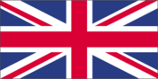
Flag description
blue field with the red cross of Saint George (patron saint of England) edged in white superimposed on the diagonal red cross of Saint Patrick (patron saint of Ireland), which is superimposed on the diagonal white cross of Saint Andrew (patron saint of Scotland); properly known as the Union Flag, but commonly called the Union Jack; the design and colors (especially the Blue Ensign) have been the basis for a number of other flags including other Commonwealth countries and their constituent states or provinces, and British overseas territories
Government type
parliamentary constitutional monarchy; a Commonwealth realm
Independence
- 12 April 1927 (Royal and Parliamentary Titles Act establishes current name of the United Kingdom of Great Britain and Northern Ireland); notable earlier dates: 927 (minor English kingdoms united); 3 March 1284 (enactment of the Statute of Rhuddlan uniting England and Wales); 1536 (Act of Union formally incorporates England and Wales); 1 May 1707 (Acts of Union formally unite England and Scotland as Great Britain); 1 January 1801 (Acts of Union formally unite Great Britain and Ireland as the United Kingdom of Great Britain and Ireland); 6 December 1921 (Anglo-Irish Treaty formalizes partition of Ireland; six counties remain part of the United Kingdom and Northern Ireland)
- 12 April 1927 (Royal and Parliamentary Titles Act establishes current name of the United Kingdom of Great Britain and Northern Ireland); notable earlier dates
- 927 (minor English kingdoms united); 3 March 1284 (enactment of the Statute of Rhuddlan uniting England and Wales); 1536 (Act of Union formally incorporates England and Wales); 1 May 1707 (Acts of Union formally unite England and Scotland as Great Britain); 1 January 1801 (Acts of Union formally unite Great Britain and Ireland as the United Kingdom of Great Britain and Ireland); 6 December 1921 (Anglo-Irish Treaty formalizes partition of Ireland; six counties remain part of the United Kingdom and Northern Ireland)
International law organization participation
accepts compulsory ICJ jurisdiction with reservations; accepts ICCt jurisdiction
International organization participation
ADB (nonregional member), AfDB (nonregional member), Arctic Council (observer), Australia Group, BIS, C, CBSS (observer), CD, CDB, CE, CERN, EAPC, EBRD, ECB, EIB, EITI (implementing country), ESA, EU, FAO, FATF, G-5, G-7, G-8, G-10, G-20, IADB, IAEA, IBRD, ICAO, ICC (national committees), ICCt, ICRM, IDA, IEA, IFAD, IFC, IFRCS, IGAD (partners), IHO, ILO, IMF, IMO, IMSO, Interpol, IOC, IOM, IPU, ISO, ITSO, ITU, ITUC (NGOs), MIGA, MINUSMA, MONUSCO, NATO, NEA, NSG, OAS (observer), OECD, OPCW, OSCE, Pacific Alliance (observer), Paris Club, PCA, PIF (partner), SELEC (observer), SICA (observer), UN, UNCTAD, UNESCO, UNFICYP, UNHCR, UNMISS, UNRWA, UNSC (permanent), UPU, WCO, WHO, WIPO, WMO, WTO, ZC
Judicial branch
- Supreme Court (consists of 12 justices including the court president and deputy president); note - the Supreme Court was established by the Constitutional Reform Act 2005 and implemented in October 2009, replacing the Appellate Committee of the House of Lords as the highest court in the United Kingdom judge candidates selected by an independent committee of several judicial commissions, followed by their recommendations to the prime minister, and appointed by Her Majesty The Queen; justices appointed for life England and Wales - Court of Appeal (civil and criminal divisions); High Court; Crown Court; County Courts; Magistrates' Courts; Scotland - Court of Sessions; Sheriff Courts; High Court of Justiciary; tribunals; Northern Ireland - Court of Appeal in Northern Ireland; High Court; county courts; magistrates' courts; specialized tribunals
- highest court(s)
- Supreme Court (consists of 12 justices including the court president and deputy president); note - the Supreme Court was established by the Constitutional Reform Act 2005 and implemented in October 2009, replacing the Appellate Committee of the House of Lords as the highest court in the United Kingdom
- judge selection and term of office
- judge candidates selected by an independent committee of several judicial commissions, followed by their recommendations to the prime minister, and appointed by Her Majesty The Queen; justices appointed for life
- subordinate courts
- England and Wales - Court of Appeal (civil and criminal divisions); High Court; Crown Court; County Courts; Magistrates' Courts; Scotland - Court of Sessions; Sheriff Courts; High Court of Justiciary; tribunals; Northern Ireland - Court of Appeal in Northern Ireland; High Court; county courts; magistrates' courts; specialized tribunals
Legal system
common law system; has nonbinding judicial review of Acts of Parliament under the Human Rights Act of 1998
Legislative branch
- bicameral Parliament consists of the House of Lords (760 seats - membership not fixed (there are 815 lords eligible for taking part in the work of the House of Lords consisting of 701 life peers, 88 hereditary peers, and 26 clergy - as of October 2015; members appointed by the monarch on the advice of the prime minister and non-party political members recommended by the House of Lords Appointments Commission) and the House of Commons (650 seats; members directly elected in single-seat constituencies by first-past-the-post vote to serve 5-year terms unless the House is dissolved earlier) House of Lords - no elections (note - in 1999, as provided by the House of Lords Act, elections were held in the House of Lords to determine the 92 hereditary peers who would remain there; elections are held only as vacancies in the hereditary peerage arise); House of Commons - last held on 8 May 2015 (next to be held by May 2020) House of Commons - percent of vote by party - Conservative 36.8%, Labor 30.5%, UKIP 12.7%, Lib Dems 7.9%, SNP 4.7%, Greens 3.8%, DUP 0.6%, Sinn Fein 0.6%, Plaid Cymru 0.6%, SDLP 0.3%, Ulster Unionist Party 0.4%, other 1.1%; seats by party - Conservative 330, Labor 232, SNP 56, Lib Dems 8, DUP 8, Sinn Fein 4, Plaid Cymru 3, SDLP 3, Ulster Unionist Party 2, UKIP 1, Greens 1, other 2
- description
- bicameral Parliament consists of the House of Lords (760 seats - membership not fixed (there are 815 lords eligible for taking part in the work of the House of Lords consisting of 701 life peers, 88 hereditary peers, and 26 clergy - as of October 2015; members appointed by the monarch on the advice of the prime minister and non-party political members recommended by the House of Lords Appointments Commission) and the House of Commons (650 seats; members directly elected in single-seat constituencies by first-past-the-post vote to serve 5-year terms unless the House is dissolved earlier)
- election results
- House of Commons - percent of vote by party - Conservative 36.8%, Labor 30.5%, UKIP 12.7%, Lib Dems 7.9%, SNP 4.7%, Greens 3.8%, DUP 0.6%, Sinn Fein 0.6%, Plaid Cymru 0.6%, SDLP 0.3%, Ulster Unionist Party 0.4%, other 1.1%; seats by party - Conservative 330, Labor 232, SNP 56, Lib Dems 8, DUP 8, Sinn Fein 4, Plaid Cymru 3, SDLP 3, Ulster Unionist Party 2, UKIP 1, Greens 1, other 2
- elections
- House of Lords - no elections (note - in 1999, as provided by the House of Lords Act, elections were held in the House of Lords to determine the 92 hereditary peers who would remain there; elections are held only as vacancies in the hereditary peerage arise); House of Commons - last held on 8 May 2015 (next to be held by May 2020)
National anthem
- "God Save the Queen" unknown in use since 1745; by tradition, the song serves as both the national and royal anthem of the UK; it is known as either "God Save the Queen" or "God Save the King," depending on the gender of the reigning monarch; it also serves as the royal anthem of many Commonwealth nations
- lyrics/music
- unknown
- name
- "God Save the Queen"
- note
- in use since 1745; by tradition, the song serves as both the national and royal anthem of the UK; it is known as either "God Save the Queen" or "God Save the King," depending on the gender of the reigning monarch; it also serves as the royal anthem of many Commonwealth nations
National holiday
the UK does not celebrate one particular national holiday
National symbol(s)
- lion (Britain in general); lion, Tudor rose, oak (England); lion, unicorn, thistle (Scotland); dragon, daffodil, leek (Wales); shamrock, flax (Northern Ireland); national colors: red, white, blue (Britain in general); red, white (England); blue, white (Scotland); red, white, green (Wales)
- lion (Britain in general); lion, Tudor rose, oak (England); lion, unicorn, thistle (Scotland); dragon, daffodil, leek (Wales); shamrock, flax (Northern Ireland); national colors
- red, white, blue (Britain in general); red, white (England); blue, white (Scotland); red, white, green (Wales)
Political parties and leaders
Alliance Party (Northerm Ireland) [David FORD] Conservative and Unionist Party [Theresea MAY] Democratic Unionist Party or DUP (Northern Ireland) [Peter ROBINSON; note - expected to be replaced by Arlene FOSTER around 11 January 2016] Green Party of England and Wales or Greens [Caroline LUCAS and Jonathan BARTLEY] Labor Party [Jeremy CORBYN] Liberal Democrats (Lib Dems) [Tim FARRON] Party of Wales (Plaid Cymru) [Leanne WOOD] Scottish National Party or SNP [Nicola STURGEON] Sinn Fein (Northern Ireland) [Gerry ADAMS] Social Democratic and Labor Party or SDLP (Northern Ireland) [Colum EASTWOOD] Ulster Unionist Party (Northern Ireland) [Mike NESBITT] UK Independence Party or UKIP [Nigel FARAGE]
Political pressure groups and leaders
Campaign for Nuclear Disarmament Confederation of British Industry National Farmers' Union Trades Union Congress
Suffrage
18 years of age; universal
Economy
Agriculture - products
cereals, oilseed, potatoes, vegetables; cattle, sheep, poultry; fish
Budget
- $1.107 trillion $1.232 trillion (2015 est.)
- expenditures
- $1.232 trillion (2015 est.)
- revenues
- $1.107 trillion
Budget surplus (+) or deficit (-)
-4.4% of GDP (2015 est.)
Central bank discount rate
0.5% (31 December 2014) 0.5% (31 December 2013)
Commercial bank prime lending rate
4.51% (31 December 2015 est.) 4.45% (31 December 2014 est.)
Current account balance
-$123.5 billion (2015 est.) -$152.2 billion (2014 est.)
Debt - external
$9.219 trillion (31 December 2014 est.) $9.411 trillion (31 December 2013 est.)
Distribution of family income - Gini index
32.4 (2012) 33.4 (2010)
Economy - overview
The UK, a leading trading power and financial center, is the third largest economy in Europe after Germany and France. Agriculture is intensive, highly mechanized, and efficient by European standards, producing about 60% of food needs with less than 2% of the labor force. The UK has large coal, natural gas, and oil resources, but its oil and natural gas reserves are declining; the UK has been a net importer of energy since 2005. Services, particularly banking, insurance, and business services, are key drivers of British GDP growth. Manufacturing, meanwhile, has declined in importance but still accounts for about 10% of economic output. In 2008, the global financial crisis hit the economy particularly hard, due to the importance of its financial sector. Falling home prices, high consumer debt, and the global economic slowdown compounded Britain's economic problems, pushing the economy into recession in the latter half of 2008 and prompting the then BROWN (Labour) government to implement a number of measures to stimulate the economy and stabilize the financial markets. Facing burgeoning public deficits and debt levels, in 2010 the CAMERON-led coalition government (between Conservatives and Liberal Democrats) initiated an austerity program, which has continued under the new Conservative majority government. However, the deficit still remains one of the highest in the G7, standing at 5.1% of GDP as of mid-2015. London intends to eliminate its deficit by 2020, primarily through additional cuts to public spending and welfare benefits. It has also pledged to lower its corporation tax from 20% to 18% by 2020. In 2012, weak consumer spending and subdued business investment weighed on the economy, however, GDP grew 1.7% in 2013 and 2.8% in 2014, accelerating because of greater consumer spending and a recovering housing market. As of late 2015, the Bank of England is examining when to begin raising interest rates from historically low levels while being cautious not to damage economic growth. While the UK is one of the fastest growing economies in the G7, economists are concerned about the potential negative impact if the UK votes to leave the EU. The UK has an extensive trade relationship with other EU members through its access to the single market and economic observers have warned an exit could jeopardize its position as the central location for European financial services.
Exchange rates
British pounds (GBP) per US dollar - 0.6542 (2015 est.) 0.607 (2014 est.) 0.6391 (2013 est.) 0.6324 (2012 est.) 0.624 (2011 est.)
Exports
$436.2 billion (2015 est.) $483.4 billion (2014 est.)
Exports - commodities
manufactured goods, fuels, chemicals; food, beverages, tobacco
Exports - partners
US 14.6%, Germany 10.1%, Switzerland 7%, China 6%, France 5.9%, Netherlands 5.8%, Ireland 5.5% (2015)
Fiscal year
6 April - 5 April
GDP - composition, by end use
- 65% 19.3% 16.9% 0.8% 27.3% -29.4% (2015 est.)
- exports of goods and services
- 27.3%
- government consumption
- 19.3%
- household consumption
- 65%
- imports of goods and services
- -29.4% (2015 est.)
- investment in fixed capital
- 16.9%
- investment in inventories
- 0.8%
GDP - composition, by sector of origin
- 0.7% 19.4% 80% (2015 est.)
- agriculture
- 0.7%
- industry
- 19.4%
- services
- 80%
GDP - per capita (PPP)
- $41,200 (2015 est.) $40,600 (2014 est.) $39,800 (2013 est.) data are in 2015 US dollars
- note
- data are in 2015 US dollars
GDP - real growth rate
2.2% (2015 est.) 2.9% (2014 est.) 2.2% (2013 est.)
GDP (official exchange rate)
$2.849 trillion (2015 est.)
GDP (purchasing power parity)
- $2.679 trillion (2015 est.) $2.62 trillion (2014 est.) $2.548 trillion (2013 est.) data are in 2015 US dollars
- note
- data are in 2015 US dollars
Gross national saving
12.4% of GDP (2015 est.) 12.4% of GDP (2014 est.) 12.2% of GDP (2013 est.)
Household income or consumption by percentage share
- 1.7% 31.1% (2012)
- highest 10%
- 31.1% (2012)
- lowest 10%
- 1.7%
Imports
$627.7 billion (2015 est.) $685.8 billion (2014 est.)
Imports - commodities
manufactured goods, machinery, fuels; foodstuffs
Imports - partners
Germany 14.8%, China 9.8%, US 9.2%, Netherlands 7.5%, France 5.8%, Belgium 5% (2015)
Industrial production growth rate
2% (2015 est.)
Industries
machine tools, electric power equipment, automation equipment, railroad equipment, shipbuilding, aircraft, motor vehicles and parts, electronics and communications equipment, metals, chemicals, coal, petroleum, paper and paper products, food processing, textiles, clothing, other consumer goods
Inflation rate (consumer prices)
0% (2015 est.) 1.5% (2014 est.)
Labor force
33.06 million (2015 est.)
Labor force - by occupation
- 1.3% 15.2% 83.5% (2014 est.)
- agriculture
- 1.3%
- industry
- 15.2%
- services
- 83.5% (2014 est.)
Market value of publicly traded shares
$3.019 trillion (31 December 2012 est.) $2.903 trillion (31 December 2011 est.) $3.107 trillion (31 December 2010 est.)
Population below poverty line
15% (2013 est.)
Public debt
- 89% of GDP (2015 est.) 87.9% of GDP (2014 est.) data cover general government debt, and include debt instruments issued (or owned) by government entities other than the treasury; the data include treasury debt held by foreign entities; the data include debt issued by subnational entities, as well as intra-governmental debt; intra-governmental debt consists of treasury borrowings from surpluses in the social funds, such as for retirement, medical care, and unemployment; debt instruments for the social funds are not sold at public auctions
- note
- data cover general government debt, and include debt instruments issued (or owned) by government entities other than the treasury; the data include treasury debt held by foreign entities; the data include debt issued by subnational entities, as well as intra-governmental debt; intra-governmental debt consists of treasury borrowings from surpluses in the social funds, such as for retirement, medical care, and unemployment; debt instruments for the social funds are not sold at public auctions
Reserves of foreign exchange and gold
$129.6 billion (31 December 2015 est.) $107.7 billion (31 December 2014 est.)
Stock of broad money
$3.567 trillion (31 December 2014 est.) $3.491 trillion (31 December 2013 est.)
Stock of direct foreign investment - abroad
$1.959 trillion (31 December 2015 est.) $2.146 trillion (31 December 2014 est.)
Stock of direct foreign investment - at home
$2.04 trillion (31 December 2015 est.) $1.915 trillion (31 December 2014 est.)
Stock of domestic credit
$3.195 trillion (31 December 2015 est.) $3.366 trillion (31 December 2014 est.)
Stock of narrow money
$106.7 billion (31 December 2015 est.) $106.4 billion (31 December 2014 est.)
Taxes and other revenues
38.8% of GDP (2015 est.)
Unemployment rate
5.4% (2015 est.) 6.2% (2014 est.)
Energy
Carbon dioxide emissions from consumption of energy
568.3 million Mt (2013 est.)
Crude oil - exports
699,700 bbl/day (2015 est.)
Crude oil - imports
1.047 million bbl/day (2015 est.)
Crude oil - production
893,300 bbl/day (2015 est.)
Crude oil - proved reserves
2.8 billion bbl (1 January 2016 es)
Electricity - consumption
309 billion kWh (2014 est.)
Electricity - exports
2.72 billion kWh (2014 est.)
Electricity - from fossil fuels
71.1% of total installed capacity (2014 est.)
Electricity - from hydroelectric plants
5.1% of total installed capacity (2014 est.)
Electricity - from nuclear fuels
11.7% of total installed capacity (2014 est.)
Electricity - from other renewable sources
12.2% of total installed capacity (2014 est.)
Electricity - imports
20.5 billion kWh (2014 est.)
Electricity - installed generating capacity
96 million kW (2014 est.)
Electricity - production
335 billion kWh (2014 est.)
Electricity access
- 100% (2016)
- electrification - total population
- 100% (2016)
Natural gas - consumption
70.45 billion cu m (2014 est.)
Natural gas - exports
10.55 billion cu m (2014 est.)
Natural gas - imports
42.83 billion cu m (2014 est.)
Natural gas - production
38.58 billion cu m (2014 est.)
Natural gas - proved reserves
205.4 billion cu m (1 January 2016 es)
Refined petroleum products - consumption
1.545 million bbl/day (2015 est.)
Refined petroleum products - exports
490,700 bbl/day (2015 est.)
Refined petroleum products - imports
660,600 bbl/day (2015 est.)
Refined petroleum products - production
1.308 million bbl/day (2015 est.)
Communications
Broadcast media
public service broadcaster, British Broadcasting Corporation (BBC), is the largest broadcasting corporation in the world; BBC operates multiple TV networks with regional and local TV service; a mixed system of public and commercial TV broadcasters along with satellite and cable systems provide access to hundreds of TV stations throughout the world; BBC operates multiple national, regional, and local radio networks with multiple transmission sites; a large number of commercial radio stations, as well as satellite radio services are available (2008)
Internet country code
.uk
Internet users
- 58.961 million 92% (July 2015 est.)
- percent of population
- 92% (July 2015 est.)
- total
- 58.961 million
Telephone system
- technologically advanced domestic and international system equal mix of buried cables, microwave radio relay, and fiber-optic systems country code - 44; numerous submarine cables provide links throughout Europe, Asia, Australia, the Middle East, and US; satellite earth stations - 10 Intelsat (7 Atlantic Ocean and 3 Indian Ocean), 1 Inmarsat (Atlantic Ocean region), and 1 Eutelsat; at least 8 large international switching centers (2015)
- domestic
- equal mix of buried cables, microwave radio relay, and fiber-optic systems
- general assessment
- technologically advanced domestic and international system
- international
- country code - 44; numerous submarine cables provide links throughout Europe, Asia, Australia, the Middle East, and US; satellite earth stations - 10 Intelsat (7 Atlantic Ocean and 3 Indian Ocean), 1 Inmarsat (Atlantic Ocean region), and 1 Eutelsat; at least 8 large international switching centers (2015)
Telephones - fixed lines
- 33.613 million 52 (July 2015 est.)
- subscriptions per 100 inhabitants
- 52 (July 2015 est.)
- total subscriptions
- 33.613 million
Telephones - mobile cellular
- 80.284 million 125 (July 2015 est.)
- subscriptions per 100 inhabitants
- 125 (July 2015 est.)
- total
- 80.284 million
Transportation
Airports
460 (2013)
Airports - with paved runways
- 66 (2013)
- 1,524 to 2,437 m
- 89
- 2,438 to 3,047 m
- 29
- 914 to 1,523 m
- 80
- over 3,047 m
- 7
- total
- 271
- under 914 m
- 66 (2013)
Airports - with unpaved runways
- 160 (2013)
- 1,524 to 2,437 m
- 3
- 914 to 1,523 m
- 26
- total
- 189
- under 914 m
- 160 (2013)
Civil aircraft registration country code prefix
G (2016)
Heliports
9 (2013)
Merchant marine
- bulk carrier 33, cargo 76, carrier 4, chemical tanker 58, container 178, liquefied gas 6, passenger 7, passenger/cargo 66, petroleum tanker 18, refrigerated cargo 2, roll on/roll off 31, vehicle carrier 25 271 (Australia 1, Bermuda 6, China 7, Denmark 43, France 39, Germany 59, Hong Kong 12, Ireland 1, Italy 3, Japan 5, Netherlands 1, Norway 32, Sweden 28, Taiwan 11, Tanzania 1, UAE 8, US 14) 308 (Algeria 15, Antigua and Barbuda 1, Argentina 2, Australia 5, Bahamas 18, Barbados 6, Belgium 2, Belize 4, Bermuda 14, Bolivia 1, Brunei 2, Cabo Verde 1, Cambodia 1, Cayman Islands 2, Comoros 1, Cook Islands 2, Cyprus 7, Georgia 5, Gibraltar 6, Greece 6, Honduras 1, Hong Kong 33, Indonesia 2, Italy 2, Liberia 22, Liberia 32, Luxembourg 5, Malta 21, Marshall Islands 12, Marshall Islands 3, Moldova 3, Nigeria 2, NZ 1, Panama 37, Panama 5, Saint Kitts and Nevis 1, Saint Vincent and the Grenadines 6, Sierra Leone 1, Singapore 6, Thailand 6, Tonga 1, US 4, unknown 1) (2010)
- by type
- bulk carrier 33, cargo 76, carrier 4, chemical tanker 58, container 178, liquefied gas 6, passenger 7, passenger/cargo 66, petroleum tanker 18, refrigerated cargo 2, roll on/roll off 31, vehicle carrier 25
- foreign-owned
- 271 (Australia 1, Bermuda 6, China 7, Denmark 43, France 39, Germany 59, Hong Kong 12, Ireland 1, Italy 3, Japan 5, Netherlands 1, Norway 32, Sweden 28, Taiwan 11, Tanzania 1, UAE 8, US 14)
- registered in other countries
- 308 (Algeria 15, Antigua and Barbuda 1, Argentina 2, Australia 5, Bahamas 18, Barbados 6, Belgium 2, Belize 4, Bermuda 14, Bolivia 1, Brunei 2, Cabo Verde 1, Cambodia 1, Cayman Islands 2, Comoros 1, Cook Islands 2, Cyprus 7, Georgia 5, Gibraltar 6, Greece 6, Honduras 1, Hong Kong 33, Indonesia 2, Italy 2, Liberia 22, Liberia 32, Luxembourg 5, Malta 21, Marshall Islands 12, Marshall Islands 3, Moldova 3, Nigeria 2, NZ 1, Panama 37, Panama 5, Saint Kitts and Nevis 1, Saint Vincent and the Grenadines 6, Sierra Leone 1, Singapore 6, Thailand 6, Tonga 1, US 4, unknown 1) (2010)
- total
- 504
National air transport system
- 1,242 131,449,680 5,466,504,676 mt-km (2015)
- annual freight traffic on registered air carriers
- 5,466,504,676 mt-km (2015)
- annual passenger traffic on registered air carriers
- 131,449,680
- inventory of registered aircraft operated by air carriers
- 1,242
- number of registered air carriers
- 28
Pipelines
condensate 502 km; condensate/gas 9 km; gas 28,603 km; liquid petroleum gas 59 km; oil 5,256 km; oil/gas/water 175 km; refined products 4,919 km; water 255 km (2013)
Ports and terminals
- Dover, Felixstowe, Immingham, Liverpool, London, Southampton, Teesport (England); Forth Ports (Scotland); Milford Haven (Wales) Fawley Marine terminal, Liverpool Bay terminal (England); Braefoot Bay terminal, Finnart oil terminal, Hound Point terminal (Scotland) Felixstowe (3,248,592), London (1,932,000), Southampton (1,324,581) Isle of Grain, Milford Haven, Teesside
- container port(s) (TEUs)
- Felixstowe (3,248,592), London (1,932,000), Southampton (1,324,581)
- LNG terminal(s) (import)
- Isle of Grain, Milford Haven, Teesside
- major seaport(s)
- Dover, Felixstowe, Immingham, Liverpool, London, Southampton, Teesport (England); Forth Ports (Scotland); Milford Haven (Wales)
- oil terminals
- Fawley Marine terminal, Liverpool Bay terminal (England); Braefoot Bay terminal, Finnart oil terminal, Hound Point terminal (Scotland)
Railways
- 16,837 km 303 km 1.600-m gauge (in Northern Ireland) 16,534 km 1.435-m gauge (5,357 km electrified) (2015)
- broad gauge
- 303 km 1.600-m gauge (in Northern Ireland)
- standard gauge
- 16,534 km 1.435-m gauge (5,357 km electrified) (2015)
- total
- 16,837 km
Roadways
- 394,428 km 394,428 km (includes 3,519 km of expressways) (2009)
- paved
- 394,428 km (includes 3,519 km of expressways) (2009)
- total
- 394,428 km
Waterways
3,200 km (620 km used for commerce) (2009)
Military and Security
Military branches
Army, Royal Navy (includes Royal Marines), Royal Air Force (2013)
Military expenditures
2.07% of GDP (2015) 2.2% of GDP (2014) 2.3% of GDP (2013) 2.49% of GDP (2012) 2.48% of GDP (2011)
Military service age and obligation
16-33 years of age (officers 17-28) for voluntary military service (with parental consent under 18); no conscription; women serve in military services including some ground combat roles; the UK’s Defense Ministry is expected to further ease existing women's restrictions by the end of 2016; must be citizen of the UK, Commonwealth, or Republic of Ireland; reservists serve a minimum of 3 years, to age 45 or 55; 17 years 6 months of age for voluntary military service by Nepalese citizens in the Brigade of Gurkhas; 16-34 years of age for voluntary military service by Papua New Guinean citizens (2016)
Transnational Issues
Disputes - international
in 2002, Gibraltar residents voted overwhelmingly by referendum to reject any "shared sovereignty" arrangement between the UK and Spain; the Government of Gibraltar insisted on equal participation in talks between the two countries; Spain disapproved of UK plans to grant Gibraltar greater autonomy; Mauritius and Seychelles claim the Chagos Archipelago (British Indian Ocean Territory); in 2001, the former inhabitants of the archipelago, evicted 1967 - 1973, were granted UK citizenship and the right of return, followed by Orders in Council in 2004 that banned rehabitation, a High Court ruling reversed the ban, a Court of Appeal refusal to hear the case, and a Law Lords' decision in 2008 denied the right of return; in addition, the UK created the world's largest marine protection area around the Chagos islands prohibiting the extraction of any natural resources therein; UK rejects sovereignty talks requested by Argentina, which still claims the Falkland Islands (Islas Malvinas) and South Georgia and the South Sandwich Islands; territorial claim in Antarctica (British Antarctic Territory) overlaps Argentine claim and partially overlaps Chilean claim; Iceland, the UK, and Ireland dispute Denmark's claim that the Faroe Islands' continental shelf extends beyond 200 nm
Illicit drugs
producer of limited amounts of synthetic drugs and synthetic precursor chemicals; major consumer of Southwest Asian heroin, Latin American cocaine, and synthetic drugs; money-laundering center
Refugees and internally displaced persons
- 12,383 (Eritrea); 12,667 (Iran); 9,045 (Zimbabwe); 9,354 (Afghanistan); 6,977 (Somalia); 6,319 (Pakistan); 5,279 (Sri Lanka); 6,076 (Sudan); 6,496 (Syria) (2015) 41 (2015)
- refugees (country of origin)
- 12,383 (Eritrea); 12,667 (Iran); 9,045 (Zimbabwe); 9,354 (Afghanistan); 6,977 (Somalia); 6,319 (Pakistan); 5,279 (Sri Lanka); 6,076 (Sudan); 6,496 (Syria) (2015)
- stateless persons
- 41 (2015)