2023 Edition
CIA World Factbook 2023 (factbook.json @ 0d4fa4984ecb)
Introduction
Background
An ancient crossroads for various migrations, Uganda has as many as 65 ethnic groups that speak languages from three of Africa’s four major linguistic families. As early as 1200, fertile soils and regular rainfall in the south fostered the formation of several large centralized kingdoms, including Buganda, from which the country derives its name. Muslim traders from Egypt reached northern Uganda in the 1820s, and Swahili merchants from the Indian Ocean coast arrived in the south by the 1840s. The area attracted the attention of British explorers seeking the source of the Nile River in the 1860s, and this influence expanded in subsequent decades with the arrival of Christian missionaries and trade agreements; Uganda was declared a British protectorate in 1894. Buganda and other southern kingdoms negotiated agreements with Britain to secure privileges and a level of autonomy that were rare during the colonial period in Africa. The colonial boundaries demarcating Uganda grouped together a wide range of ethnic groups with different political systems and cultures, and the disparities between how Britain governed southern and northern areas compounded these differences, complicating efforts to establish a cohesive independent country.Uganda gained independence in 1962 with one of the more developed economies and one of the strongest education systems in Sub-Saharan Africa, but it descended within a few years into political turmoil and internal conflict that lasted more than two decades. In 1966, Prime Minister Milton OBOTE suspended the constitution and violently deposed President Edward MUTESA, who was also the king of Buganda. Idi AMIN seized power in 1971 through a military coup and led the country into economic ruin and rampant mass atrocities that killed as many as 500,000 civilians. AMIN’s annexation of Tanzanian territory in 1979 provoked Tanzania to invade Uganda, depose AMIN, and install a coalition government. In the aftermath, Uganda continued to experience atrocities, looting, and political instability and had four different heads of state between 1979 and 1980. OBOTE regained the presidency in 1980 through a controversial election that sparked renewed guerrilla warfare, killing as an estimated 300,000 civilians. Gen. Tito OKELLO seized power in a coup in 1985, but his rule was short-lived, with Yoweri MUSEVENI becoming president in 1986 after his insurgency captured the capital. MUSEVENI is widely credited with restoring relative stability and economic growth to Uganda but has resisted calls to leave office. In 2017, parliament approved the removal of presidential age limits, making it possible for MUSEVENI to remain in office for life. Uganda faces numerous challenges that could affect future stability, including explosive population growth, power and infrastructure constraints, corruption, underdeveloped democratic institutions, and human rights deficits.
Geography
Area
- land
- 197,100 sq km
- total
- 241,038 sq km
- water
- 43,938 sq km
Area - comparative
slightly more than two times the size of Pennsylvania; slightly smaller than Oregon
Climate
tropical; generally rainy with two dry seasons (December to February, June to August); semiarid in northeast
Coastline
0 km (landlocked)
Elevation
- highest point
- Margherita Peak on Mount Stanley 5,110 m
- lowest point
- Albert Nile 614 m
Geographic coordinates
1 00 N, 32 00 E
Geography - note
landlocked; fertile, well-watered country with many lakes and rivers; Lake Victoria, the world's largest tropical lake and the second largest fresh water lake, is shared among three countries: Kenya, Tanzania, and Uganda
Irrigated land
105 sq km (2013)
Land boundaries
- border countries
- Democratic Republic of the Congo 877 km; Kenya 814 km; Rwanda 172 km; South Sudan 475 km; Tanzania 391 km
- total
- 2,729 km
Land use
- agricultural land
- 71.2% (2018 est.)
- agricultural land: arable land
- arable land: 34.3% (2018 est.)
- agricultural land: permanent crops
- permanent crops: 11.3% (2018 est.)
- agricultural land: permanent pasture
- permanent pasture: 25.6% (2018 est.)
- forest
- 14.5% (2018 est.)
- other
- 14.3% (2018 est.)
Location
East-Central Africa, west of Kenya, east of the Democratic Republic of the Congo
Major lakes (area sq km)
- fresh water lake(s)
- Lake Victoria (shared with Tanzania and Kenya) - 62,940 sq km; Lake Albert (shared with Democratic Republic of Congo) - 5,590 sq km; Lake Kyoga - 4,430 sq km; Lake Edward (shared with Democratic Republic of Congo) - 2,150 sq km
Major rivers (by length in km)
Nile (shared with Rwanda [s], Tanzania, South Sudan, Sudan, and Egypt [m]) - 6,650 kmnote – [s] after country name indicates river source; [m] after country name indicates river mouth
Major watersheds (area sq km)
Atlantic Ocean drainage: Congo (3,730,881 sq km), (Mediterranean Sea) Nile (3,254,853 sq km)
Map references
Africa
Maritime claims
none (landlocked)
Natural hazards
droughts; floods; earthquakes; landslides; hailstorms
Natural resources
copper, cobalt, hydropower, limestone, salt, arable land, gold
Population distribution
population density is relatively high in comparison to other African nations; most of the population is concentrated in the central and southern parts of the country, particularly along the shores of Lake Victoria and Lake Albert; the northeast is least populated as shown in this population distribution map
Terrain
mostly plateau with rim of mountains
People and Society
Age structure
- 0-14 years
- 47.3% (male 11,439,303/female 11,136,111)
- 15-64 years
- 50.31% (male 11,335,543/female 12,679,044)
- 65 years and over
- 2.39% (2023 est.) (male 484,782/female 655,169)
Alcohol consumption per capita
- beer
- 0.85 liters of pure alcohol (2019 est.)
- other alcohols
- 5.46 liters of pure alcohol (2019 est.)
- spirits
- 0.5 liters of pure alcohol (2019 est.)
- total
- 6.82 liters of pure alcohol (2019 est.)
- wine
- 0.01 liters of pure alcohol (2019 est.)
Birth rate
40.3 births/1,000 population (2023 est.)
Child marriage
- men married by age 18
- 5.5% (2016 est.)
- women married by age 15
- 7.3%
- women married by age 18
- 34%
Children under the age of 5 years underweight
7.6% (2019/20)
Contraceptive prevalence rate
50.2% (2021)
Current health expenditure
4% of GDP (2020)
Currently married women (ages 15-49)
58.3% (2023 est.)
Death rate
4.9 deaths/1,000 population (2023 est.)
Demographic profile
Uganda has one of the youngest and most rapidly growing populations in the world; its total fertility rate is among the world’s highest at close to 5.5 children per woman in 2022. Except in urban areas, actual fertility exceeds women’s desired fertility by one or two children, which is indicative of the widespread unmet need for contraception, lack of government support for family planning, and a cultural preference for large families. High numbers of births, short birth intervals, and the early age of childbearing contribute to Uganda’s high maternal mortality rate. Gender inequities also make fertility reduction difficult; women on average are less-educated, participate less in paid employment, and often have little say in decisions over childbearing and their own reproductive health. However, even if the birth rate were significantly reduced, Uganda’s large pool of women entering reproductive age ensures rapid population growth for decades to come. Unchecked, population increase will further strain the availability of arable land and natural resources and overwhelm the country’s limited means for providing food, employment, education, health care, housing, and basic services. The country’s north and northeast lag even further behind developmentally than the rest of the country as a result of long-term conflict (the Ugandan Bush War 1981-1986 and more than 20 years of fighting between the Lord’s Resistance Army (LRA) and Ugandan Government forces), ongoing inter-communal violence, and periodic natural disasters. Uganda has been both a source of refugees and migrants and a host country for refugees. In 1972, then President Idi AMIN, in his drive to return Uganda to Ugandans, expelled the South Asian population that composed a large share of the country’s business people and bankers. Since the 1970s, thousands of Ugandans have emigrated, mainly to southern Africa or the West, for security reasons, to escape poverty, to search for jobs, and for access to natural resources. The emigration of Ugandan doctors and nurses due to low wages is a particular concern given the country’s shortage of skilled health care workers. Africans escaping conflicts in neighboring states have found refuge in Uganda since the 1950s; the country currently struggles to host tens of thousands from the Democratic Republic of the Congo, South Sudan, and other nearby countries.
Dependency ratios
- elderly dependency ratio
- 3.2
- potential support ratio
- 31.7 (2021 est.)
- total dependency ratio
- 88.2
- youth dependency ratio
- 85.1
Drinking water source
- improved: rural
- rural: 80% of population
- improved: total
- total: 83.1% of population
- improved: urban
- urban: 92.5% of population
- unimproved: rural
- rural: 20% of population
- unimproved: total
- total: 16.9% of population (2020 est.)
- unimproved: urban
- urban: 7.5% of population
Education expenditures
2.7% of GDP (2021 est.)
Ethnic groups
Baganda 16.5%, Banyankole 9.6%, Basoga 8.8%, Bakiga 7.1%, Iteso 7%, Langi 6.3%, Bagisu 4.9%, Acholi 4.4%, Lugbara 3.3%, other 32.1% (2014 est.)
Gross reproduction rate
2.59 (2023 est.)
Hospital bed density
0.5 beds/1,000 population
Infant mortality rate
- female
- 26 deaths/1,000 live births
- male
- 32.8 deaths/1,000 live births
- total
- 29.4 deaths/1,000 live births (2023 est.)
Languages
English (official language, taught in schools, used in courts of law and by most newspapers and some radio broadcasts), Ganda or Luganda (most widely used of the Niger-Congo languages and the language used most often in the capital), other Niger-Congo languages, Nilo-Saharan languages, Swahili (official), Arabic
Life expectancy at birth
- female
- 71.6 years
- male
- 67.1 years
- total population
- 69.3 years (2023 est.)
Literacy
- definition
- age 15 and over can read and write
- female
- 74.3% (2021)
- male
- 84%
- total population
- 79%
Major infectious diseases
- animal contact diseases
- rabies
- degree of risk
- very high (2023)
- food or waterborne diseases
- bacterial and protozoal diarrhea, hepatitis A and E, and typhoid fever
- vectorborne diseases
- malaria, dengue fever, and Trypanosomiasis-Gambiense (African sleeping sickness)
- water contact diseases
- schistosomiasis
Major urban areas - population
3.846 million KAMPALA (capital) (2023)
Maternal mortality ratio
284 deaths/100,000 live births (2020 est.)
Median age
- female
- 16.9 years
- male
- 15.3 years
- total
- 16.1 years (2023 est.)
Mother's mean age at first birth
- 19.4 years (2016 est.)
- note
- note: data represents median age at first birth among women 20-49
Nationality
- adjective
- Ugandan
- noun
- Ugandan(s)
Net migration rate
-3.2 migrant(s)/1,000 population (2023 est.)
Obesity - adult prevalence rate
5.3% (2016)
Physicians density
0.15 physicians/1,000 population (2020)
Population
47,729,952 (2023 est.)
Population distribution
population density is relatively high in comparison to other African nations; most of the population is concentrated in the central and southern parts of the country, particularly along the shores of Lake Victoria and Lake Albert; the northeast is least populated as shown in this population distribution map
Population growth rate
3.22% (2023 est.)
Religions
Protestant 45.1% (Anglican 32.0%, Pentecostal/Born Again/Evangelical 11.1%, Seventh Day Adventist 1.7%, Baptist .3%), Roman Catholic 39.3%, Muslim 13.7%, other 1.6%, none 0.2% (2014 est.)
Sanitation facility access
- improved: rural
- rural: 27.5% of population
- improved: total
- total: 37.4% of population
- improved: urban
- urban: 67.3% of population
- unimproved: rural
- rural: 72.5% of population
- unimproved: total
- total: 62.6% of population (2020 est.)
- unimproved: urban
- urban: 32.7% of population
Sex ratio
- 0-14 years
- 1.03 male(s)/female
- 15-64 years
- 0.89 male(s)/female
- 65 years and over
- 0.74 male(s)/female
- at birth
- 1.03 male(s)/female
- total population
- 0.95 male(s)/female (2023 est.)
Tobacco use
- female
- 3.7% (2020 est.)
- male
- 13% (2020 est.)
- total
- 8.4% (2020 est.)
Total fertility rate
5.26 children born/woman (2023 est.)
Urbanization
- rate of urbanization
- 5.41% annual rate of change (2020-25 est.)
- urban population
- 26.8% of total population (2023)
Government
Administrative divisions
134 districts and 1 capital city*; Abim, Adjumani, Agago, Alebtong, Amolatar, Amudat, Amuria, Amuru, Apac, Arua, Budaka, Bududa, Bugiri, Bugweri, Buhweju, Buikwe, Bukedea, Bukomansimbi, Bukwo, Bulambuli, Buliisa, Bundibugyo, Bunyangabu, Bushenyi, Busia, Butaleja, Butambala, Butebo, Buvuma, Buyende, Dokolo, Gomba, Gulu, Hoima, Ibanda, Iganga, Isingiro, Jinja, Kaabong, Kabale, Kabarole, Kaberamaido, Kagadi, Kakumiro, Kalaki, Kalangala, Kaliro, Kalungu, Kampala*, Kamuli, Kamwenge, Kanungu, Kapchorwa, Kapelebyong, Karenga, Kasese, Kasanda, Katakwi, Kayunga, Kazo, Kibaale, Kiboga, Kibuku, Kikuube, Kiruhura, Kiryandongo, Kisoro, Kitagwenda, Kitgum, Koboko, Kole, Kotido, Kumi, Kwania, Kween, Kyankwanzi, Kyegegwa, Kyenjojo, Kyotera, Lamwo, Lira, Luuka, Luwero, Lwengo, Lyantonde, Madi-Okollo, Manafwa, Maracha, Masaka, Masindi, Mayuge, Mbale, Mbarara, Mitooma, Mityana, Moroto, Moyo, Mpigi, Mubende, Mukono, Nabilatuk, Nakapiripirit, Nakaseke, Nakasongola, Namayingo, Namisindwa, Namutumba, Napak, Nebbi, Ngora, Ntoroko, Ntungamo, Nwoya, Obongi, Omoro, Otuke, Oyam, Pader, Pakwach, Pallisa, Rakai, Rubanda, Rubirizi, Rukiga, Rukungiri, Rwampara, Sembabule, Serere, Sheema, Sironko, Soroti, Tororo, Wakiso, Yumbe, Zombo
Capital
- etymology
- the site of the original British settlement was referred to by its native name as Akasozi ke'Empala ("hill of the impala" [plural]); over time this designation was shortened to K'empala and finally Kampala
- geographic coordinates
- 0 19 N, 32 33 E
- name
- Kampala
- time difference
- UTC+3 (8 hours ahead of Washington, DC, during Standard Time)
Citizenship
- citizenship by birth
- no
- citizenship by descent only
- at least one parent or grandparent must be a native-born citizen of Uganda
- dual citizenship recognized
- yes
- residency requirement for naturalization
- an aggregate of 20 years and continuously for the last 2 years prior to applying for citizenship
Constitution
- amendments
- proposed by the National Assembly; passage requires at least two-thirds majority vote of the Assembly membership in the second and third readings; proposals affecting "entrenched clauses," including the sovereignty of the people, supremacy of the constitution, human rights and freedoms, the democratic and multiparty form of government, presidential term of office, independence of the judiciary, and the institutions of traditional or cultural leaders, also requires passage by referendum, ratification by at least two-thirds majority vote of district council members in at least two thirds of Uganda's districts, and assent of the president of the republic; amended several times, last in 2018
- history
- several previous; latest adopted 27 September 1995, promulgated 8 October 1995
Country name
- conventional long form
- Republic of Uganda
- conventional short form
- Uganda
- etymology
- from the name "Buganda," adopted by the British as the designation for their East African colony in 1894; Buganda had been a powerful East African state during the 18th and 19th centuries
Diplomatic representation from the US
- chief of mission
- Ambassador Natalie E. BROWN (since 17 November 2020)
- email address and website
- KampalaUScitizen@state.govhttps://ug.usembassy.gov/
- embassy
- 1577 Ggaba Road, Kampala
- FAX
- [256] (0) 414-259-794
- mailing address
- 2190 Kampala Place, Washington DC 20521-2190
- telephone
- [256] (0) 312-306-001
Diplomatic representation in the US
- chancery
- 5911 16th Street NW, Washington, DC 20011
- chief of mission
- Ambassador Robinah KAKONGE (since 12 December 2022)
- email address and website
- washington@mofa.go.ug; info@ugandaembassyus.orghttps://washington.mofa.go.ug/
- FAX
- [1] (202) 726-1727
- telephone
- [1] (202) 726-7100
Executive branch
- cabinet
- Cabinet appointed by the president from among elected members of the National Assembly or persons who qualify to be elected as members of the National Assembly
- chief of state
- President Yoweri Kaguta MUSEVENI (since 26 January 1986); Vice President Jessica Rose Epel ALUPO (since 21 June 2021); Prime Minister Robinah NABBANJA (since 21 June 2021); First Deputy Prime Minister Rebecca KADAGA (since 24 June 2021); Second Deputy Prime Minister Moses ALI (since 21 June 2021); note - the president is both chief of state and head of government
- election results
- 2021: Yoweri Kaguta MUSEVENI reelected president in the first round; percent of vote - Yoweri Kaguta MUSEVENI (NRM) 58.6%, Bobi WINE (NUP) 34.8%, Patrick Oboi AMURIAT (FDC) 3.2%, other 3.4%2016: Yoweri Kaguta MUSEVENI reelected president in the first round; percent of vote - Yoweri Kaguta MUSEVENI (NRM) 60.6%, Kizza BESIGYE (FDC) 35.6%, other 3.8%
- elections/appointments
- president directly elected by absolute majority popular vote in 2 rounds if needed for a 5-year term (no term limits); election last held on 14 January 2021 (next to be held in 2026)
- head of government
- President Yoweri Kaguta MUSEVENI (since 26 January 1986); Vice President Jessica Rose Epel ALUPO (since 21 June 2021); Prime Minister Robinah NABBANJA (since 21 June 2021); First Deputy Prime Minister Rebecca KADAGA (since 24 June 2021); Second Deputy Prime Minister Moses ALI (since 21 June 2021)
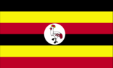
Flag description
six equal horizontal bands of black (top), yellow, red, black, yellow, and red; a white disk is superimposed at the center and depicts a grey crowned crane (the national symbol) facing the hoist side; black symbolizes the African people, yellow sunshine and vitality, red African brotherhood; the crane was the military badge of Ugandan soldiers under the UK
Government type
presidential republic
Independence
9 October 1962 (from the UK)
International law organization participation
accepts compulsory ICJ jurisdiction; accepts ICCt jurisdiction
International organization participation
ACP, AfDB, ATMIS, AU, C, COMESA, EAC, EADB, FAO, G-77, IAEA, IBRD, ICAO, ICC (national committees), ICCt, IDA, IDB, IFAD, IFC, IFRCS, IGAD, ILO, IMF, IMO, Interpol, IOC, IOM, IPU, ISO (correspondent), ITC, ITSO, ITU, ITUC (NGOs), MIGA, NAM, OIC, OPCW, PCA, UN, UNCDF, UNCTAD, UNECA, UNDP, UNFPA, UNESCO, UNHCR, UNICEF, UNIDO, UNISFA, UNOCI, UNOPS, UNSOM, UNWTO, UPU, WCO, WFP, WFTU (NGOs), WHO, WIPO, WMO, WTO
Judicial branch
- highest court(s)
- Supreme Court of Uganda (consists of the chief justice and at least 6 justices)
- judge selection and term of office
- justices appointed by the president of the republic in consultation with the Judicial Service Commission, an 8-member independent advisory body, and approved by the National Assembly; justices serve until mandatory retirement at age 70
- subordinate courts
- Court of Appeal (also acts as the Constitutional Court); High Court (includes 12 High Court Circuits and 8 High Court Divisions); Industrial Court; Chief Magistrate Grade One and Grade Two Courts throughout the country; qadhis courts; local council courts; family and children courts
Legal system
mixed legal system of English common law and customary law
Legislative branch
- description
- unicameral National Assembly or Parliament (556 seats; 353 members directly elected in single-seat constituencies by simple majority vote, 146 for women directly elected in single-seat districts by simple majority vote, and 30 "representatives" reserved for special interest groups - army 10, disabled 5, youth 5, labor 5, older persons 5; 27 ex officio members appointed by the president; members serve 5-year terms)
- election results
- percent of vote by party - NA; seats by party - NRM 336, NUP 57, FDC 32, DP 9, UPDF 10, UPC 9, independent 76 (excludes 27 ex-officio members); composition - men 368, women 188, percent of women 33.8%
- elections
- last held on 14 January 2021 (next to be held in February 2026)
National anthem
- lyrics/music
- George Wilberforce KAKOMOA
- name
- "Oh Uganda, Land of Beauty!"
- note
- note: adopted 1962
National heritage
- selected World Heritage Site locales
- Bwindi Impenetrable National Park (n); Rwenzori Mountains National Park (n); Tombs of Buganda Kings at Kasubi (c)
- total World Heritage Sites
- 3 (1 cultural, 2 natural)
National holiday
Independence Day, 9 October (1962)
National symbol(s)
grey crowned crane; national colors: black, yellow, red
Political parties and leaders
Democratic Party or DP [Norbert MAO]Forum for Democratic Change or FDC [Patrick Oboi AMURIAT]Justice Forum or JEEMA [Asuman BASALIRWA]National Resistance Movement or NRM [Yoweri MUSEVENI]National Unity Platform [Robert Kyagulanyi SSENTAMU, known as Bobi WINE]People's Progressive Party or PPP [Jaberi Bidandi SSALI]Uganda People's Congress or UPC [James AKENA]note: only parties with seats in Parliament listed
Suffrage
18 years of age; universal
Economy
Agricultural products
sugar cane, plantains, cassava, maize, sweet potatoes, milk, vegetables, beans, bananas, sorghum
Average household expenditures
- on alcohol and tobacco
- 1% of household expenditures (2018 est.)
- on food
- 44.2% of household expenditures (2018 est.)
Budget
- expenditures
- $6.896 billion (2019 est.)
- revenues
- $5.088 billion (2019 est.)
Budget surplus (+) or deficit (-)
-4.1% (of GDP) (2017 est.)
Credit ratings
- Fitch rating
- B+ (2015)
- Moody's rating
- B2 (2016)
- note
- note: The year refers to the year in which the current credit rating was first obtained.
- Standard & Poors rating
- B (2014)
Current account balance
- Current account balance 2019
- -$2.508 billion (2019 est.)
- Current account balance 2020
- -$3.552 billion (2020 est.)
- Current account balance 2021
- -$3.553 billion (2021 est.)
Debt - external
- Debt - external 2018
- $12.187 billion (2018 est.)
- Debt - external 2019
- $13.85 billion (2019 est.)
- Debt - external 31 December 2016
- $6.241 billion (31 December 2016 est.)
Economic overview
low-income, primarily agrarian East African economy; COVID-19 hurt economic growth and poverty reduction; lower oil prices threaten prior sector investments; endemic corruption; natural resource rich; high female labor force participation but undervalued
Exchange rates
- Currency
- Ugandan shillings (UGX) per US dollar -
- Exchange rates 2017
- 3,611.224 (2017 est.)
- Exchange rates 2018
- 3,727.069 (2018 est.)
- Exchange rates 2019
- 3,704.049 (2019 est.)
- Exchange rates 2020
- 3,718.249 (2020 est.)
- Exchange rates 2021
- 3,587.052 (2021 est.)
Exports
- Exports 2019
- $6.172 billion (2019 est.)
- Exports 2020
- $5.562 billion (2020 est.) note: data are in current year dollars
- Exports 2021
- $6.177 billion (2021 est.) note: data are in current year dollars
Exports - commodities
gold, coffee, milk, fish and fish products, tobacco (2019)
Exports - partners
United Arab Emirates 58%, Kenya 9% (2019)
Fiscal year
1 July - 30 June
GDP - composition, by end use
- exports of goods and services
- 18.8% (2017 est.)
- government consumption
- 8% (2017 est.)
- household consumption
- 74.3% (2017 est.)
- imports of goods and services
- -25.1% (2017 est.)
- investment in fixed capital
- 23.9% (2017 est.)
- investment in inventories
- 0.3% (2017 est.)
GDP - composition, by sector of origin
- agriculture
- 28.2% (2017 est.)
- industry
- 21.1% (2017 est.)
- services
- 50.7% (2017 est.)
GDP (official exchange rate)
$34.683 billion (2019 est.)
Gini Index coefficient - distribution of family income
- Gini Index coefficient - distribution of family income 2019
- 42.7 (2019 est.)
Household income or consumption by percentage share
- highest 10%
- 36.1% (2009 est.)
- lowest 10%
- 2.4%
Imports
- Imports 2019
- $9.795 billion (2019 est.)
- Imports 2020
- $10.197 billion (2020 est.) note: data are in current year dollars
- Imports 2021
- $10.705 billion (2021 est.) note: data are in current year dollars
Imports - commodities
packaged medicines, aircraft, delivery trucks, cars, wheat (2019)
Imports - partners
China 19%, India 17%, Kenya 16%, United Arab Emirates 7%, Japan 5% (2019)
Industrial production growth rate
3.47% (2021 est.)
Industries
sugar processing, brewing, tobacco, cotton textiles; cement, steel production
Inflation rate (consumer prices)
- Inflation rate (consumer prices) 2019
- 2.87% (2019 est.)
- Inflation rate (consumer prices) 2020
- 3.31% (2020 est.)
- Inflation rate (consumer prices) 2021
- 2.2% (2021 est.)
Labor force
16.995 million (2021 est.)
Population below poverty line
21.4% (2016 est.)
Public debt
- Public debt 2018
- 34.67% of GDP (2018 est.)
- Public debt 2019
- 38.48% of GDP (2019 est.)
- Public debt 2020
- 44.19% of GDP (2020 est.)
Real GDP (purchasing power parity)
- note
- note: data are in 2017 dollars
- Real GDP (purchasing power parity) 2019
- $96.636 billion (2019 est.)
- Real GDP (purchasing power parity) 2020
- $99.488 billion (2020 est.)
- Real GDP (purchasing power parity) 2021
- $103.007 billion (2021 est.)
Real GDP growth rate
- Real GDP growth rate 2019
- 6.44% (2019 est.)
- Real GDP growth rate 2020
- 2.95% (2020 est.)
- Real GDP growth rate 2021
- 3.54% (2021 est.)
Real GDP per capita
- note
- note: data are in 2017 dollars
- Real GDP per capita 2019
- $2,300 (2019 est.)
- Real GDP per capita 2020
- $2,200 (2020 est.)
- Real GDP per capita 2021
- $2,200 (2021 est.)
Reserves of foreign exchange and gold
- note
- note: excludes gold
- Reserves of foreign exchange and gold 31 December 2017
- $3.721 billion (31 December 2017 est.)
- Reserves of foreign exchange and gold 31 December 2018
- $3.359 billion (31 December 2018 est.)
Taxes and other revenues
11.39% (of GDP) (2020 est.)
Unemployment rate
- Unemployment rate 2019
- 1.92% (2019 est.)
- Unemployment rate 2020
- 2.77% (2020 est.)
- Unemployment rate 2021
- 2.94% (2021 est.)
Youth unemployment rate (ages 15-24)
- female
- 5.3%
- male
- 3.4%
- total
- 4.3% (2021 est.)
Energy
Carbon dioxide emissions
- from coal and metallurgical coke
- 0 metric tonnes of CO2 (2019 est.)
- from consumed natural gas
- 0 metric tonnes of CO2 (2019 est.)
- from petroleum and other liquids
- 5.841 million metric tonnes of CO2 (2019 est.)
- total emissions
- 5.841 million metric tonnes of CO2 (2019 est.)
Coal
- consumption
- 0 metric tons (2020 est.)
- exports
- 0 metric tons (2020 est.)
- imports
- 0 metric tons (2020 est.)
- production
- 0 metric tons (2020 est.)
- proven reserves
- 0 metric tons (2019 est.)
Electricity
- consumption
- 4,207,040,000 kWh (2019 est.)
- exports
- 299.2 million kWh (2019 est.)
- imports
- 104.2 million kWh (2019 est.)
- installed generating capacity
- 2.397 million kW (2020 est.)
- transmission/distribution losses
- 1.157 billion kWh (2019 est.)
Electricity access
- electrification - rural areas
- 35.9% (2021)
- electrification - total population
- 45.2% (2021)
- electrification - urban areas
- 72.2% (2021)
- population without electricity
- 34 million (2020)
Electricity generation sources
- biomass and waste
- 10.8% of total installed capacity (2020 est.)
- fossil fuels
- 1.3% of total installed capacity (2020 est.)
- geothermal
- 0% of total installed capacity (2020 est.)
- hydroelectricity
- 86.4% of total installed capacity (2020 est.)
- nuclear
- 0% of total installed capacity (2020 est.)
- solar
- 1.6% of total installed capacity (2020 est.)
- tide and wave
- 0% of total installed capacity (2020 est.)
- wind
- 0% of total installed capacity (2020 est.)
Energy consumption per capita
- Total energy consumption per capita 2019
- 2.943 million Btu/person (2019 est.)
Natural gas
- consumption
- 0 cubic meters (2021 est.)
- exports
- 0 cubic meters (2021 est.)
- imports
- 0 cubic meters (2021 est.)
- production
- 0 cubic meters (2021 est.)
- proven reserves
- 14.158 billion cubic meters (2021 est.)
Petroleum
- crude oil and lease condensate exports
- 0 bbl/day (2018 est.)
- crude oil and lease condensate imports
- 0 bbl/day (2018 est.)
- crude oil estimated reserves
- 2.5 billion barrels (2021 est.)
- refined petroleum consumption
- 40,900 bbl/day (2019 est.)
- total petroleum production
- 0 bbl/day (2021 est.)
Refined petroleum products - exports
0 bbl/day (2015 est.)
Refined petroleum products - imports
31,490 bbl/day (2015 est.)
Refined petroleum products - production
0 bbl/day (2015 est.)
Communications
Broadband - fixed subscriptions
- subscriptions per 100 inhabitants
- 0.1 (2020 est.)
- total
- 58,594 (2020 est.)
Broadcast media
public broadcaster, Uganda Broadcasting Corporation (UBC), operates radio and TV networks; 31 Free-To-Air (FTA) TV stations, 2 digital terrestrial TV stations, 3 cable TV stations, and 5 digital satellite TV stations; 258 operational FM stations
Internet country code
.ug
Internet users
- percent of population
- 10% (2021 est.)
- total
- 4.6 million (2021 est.)
Telecommunication systems
- domestic
- fixed-line less than 1 per 100 and mobile cellular systems teledensity is 66 per 100 persons (2021)
- general assessment
- a series of reforms within Uganda’s telecom sector have provided the country with one of the most competitive markets in the region; in line with the regulator’s licensing requirements by which Uganda-based companies should be broadly owned by Ugandans by mid-2022; fixed-line infrastructure remains poor, with low penetration, and as a result fixed-line broadband penetration is also particularly low; consumers have largely depended on mobile infrastructure to provide voice and broadband services; there is sufficient capacity with LTE infrastructure to match data demand during the next few years; Uganda has anticipated the migration to 5G, having held trials in early 2020 though the roll out of 5G is not expected until later in 2022 (2022)
- international
- country code - 256; satellite earth stations - 1 Intelsat (Atlantic Ocean) and 1 Inmarsat; analog and digital links to Kenya and Tanzania
Telephones - fixed lines
- subscriptions per 100 inhabitants
- (2021 est.) less than 1
- total subscriptions
- 110,000 (2021 est.)
Telephones - mobile cellular
- subscriptions per 100 inhabitants
- 66 (2021 est.)
- total subscriptions
- 30 million (2021 est.)
Transportation
Airports
47 (2021)
Airports - with paved runways
- 5
- note
- note: paved runways have a concrete or asphalt surface but not all have facilities for refueling, maintenance, or air traffic control; the length of a runway required for aircraft to safely operate depends on a number of factors including the type of aircraft, the takeoff weight (including passengers, cargo, and fuel), engine types, flap settings, landing speed, elevation of the airport, and average maximum daily air temperature; paved runways can reach a length of 5,000 m (16,000 ft.), but the “typical” length of a commercial airline runway is between 2,500-4,000 m (8,000-13,000 ft.)
Airports - with unpaved runways
- 42
- note
- note: unpaved runways have a surface composition such as grass or packed earth and are most suited to the operation of light aircraft; unpaved runways are usually short, often less than 1,000 m (3,280 ft.) in length; airports with unpaved runways often lack facilities for refueling, maintenance, or air traffic control
Civil aircraft registration country code prefix
5X
National air transport system
- annual passenger traffic on registered air carriers
- 21,537 (2018)
- inventory of registered aircraft operated by air carriers
- 26
- number of registered air carriers
- 6 (2020)
Ports and terminals
- lake port(s)
- Entebbe, Jinja, Port Bell (Lake Victoria)
Railways
- narrow gauge
- 1,244 km (2014) 1.000-m gauge
- total
- 1,244 km (2014)
Roadways
- paved
- 4,257 km (2017)
- total
- 20,544 km (2017) (excludes local roads)
- unpaved
- 16,287 km (2017)
Waterways
907 km (2022) (there are no long navigable stretches of river in Uganda; parts of the Albert Nile ( 210 km) that flow out of Lake Albert (160 km) in the northwestern part of the country are navigable; several lakes including Lake Victoria (337 km) and Lake Kyoga (199.5) have substantial traffic; Lake Albert is navigable along a 200-km stretch from its northern tip to its southern shores)
Military and Security
Military - note
the UPDF’s missions include defending the sovereignty and territorial integrity of Uganda, assisting the civilian authorities in emergencies and natural disasters, and participating in socio-economic development projects; it supports the police in maintaining internal security and participates in African and UN peacekeeping missions; it is a key contributor to the East Africa Standby Force; the UPDF also has considerable political influence; it is constitutionally granted seats in parliament and is widely viewed as a key constituency for MUSEVENI; it has been used by MUSEVENI and his political party to break up rallies, raid opposition offices, and surveil rival candidates the UPDF is viewed as a well-equipped force with considerable operational experience; from 2012-2017, it led regional efforts to pursue the Lord’s Resistance Army (LRA), a small, violent group of Ugandan origin that conducted widespread attacks against civilians in much of Central Africa; Uganda intervened in the South Sudan civil war in 2013-2016, and UPDF forces have clashed with South Sudanese forces along the border as recently as 2020; it is also conducting operations along the border with the Democratic Republic of the Congo (DRC) against a DRC-based (and formerly based in western Uganda) Ugandan rebel group, the Allied Democratic Front (ADF), which has been designated by the US as the Islamic State of Iraq and ash-Sham in the DRC (see Appendix T); in December 2022, Uganda sent about 1,000 UPDF troops to the DRC as part of a regional force to assist the DRC Government in combating the M23 rebel group; in addition, elements of the UPDF are deployed in the northeast region of Karamoja against cattle rustlers and criminal gangsthe Land Force has 5 light infantry divisions, including one trained for mountain warfare; it also has independent armored, artillery, and motorized infantry brigades, as well as a marine force for patrolling Uganda’s lakes and rivers; the special forces command has armor, artillery, commandos, motorized infantry, and presidential guard forces; the Air Force has small numbers of largely Russian-made combat aircraft and helicopters the military traces its history back to the formation of the Uganda Rifles in 1895 under the British colonial government; the Uganda Rifles were merged with the Central Africa Regiment and the East Africa Rifles to form the King’s African Rifles (KAR) in 1902, which participated in both world wars, as well as the Mau Mau rebellion in Kenya (1952-1960); in 1962, the Ugandan battalion of the KAR was transformed into the country's first military force, the Uganda Rifles, which was subsequently renamed the Uganda Army; the UPDF was established in 1995 from the former rebel National Resistance Army following the enactment of the 1995 Constitution of Uganda (2023)
Military and security forces
- Uganda People's Defense Force (UPDF): Land Force (includes marines), Air Force, Special Forces Command, Reserve Force Ministry of Internal Affairs: Uganda Police Force (2023)
- note
- note 1: the Special Forces Command is a separate branch within the UPDF; it evolved from the former Presidential Guard Brigade and has continued to retain presidential protection duties in addition to its traditional missions, such as counterinsurgencynote 2: the Uganda Police Force includes air, field, territorial, and marine units, as well as a presidential guard forcenote 3: in 2018, President MUSEVENI created a volunteer force of Local Defense Units under the military to beef up local security in designated parts of the country
Military and security service personnel strengths
approximately 45-50,000 active-duty troops (2023)
Military deployments
- approximately 6,500 Somalia (625 for UNSOM; the remainder under ATMIS; note - foreign troop contingents in Somalia under ATMIS are drawing down towards a final withdrawal in December 2024); 250 Equatorial Guinea (training mission) (2023)
- note
- note: in December 2022, Uganda sent approximately 1,000 troops to the eastern part of the Democratic Republic of the Congo (DRC) as part of a newly formed East Africa Community Regional Force (EACRF) to assist the DRC military against the rebel group M23
Military equipment inventories and acquisitions
the UPDF's inventory is mostly older Russian/Soviet-era equipment with a limited mix of more modern Russian- and Western-origin arms; in recent years, Belarus and Russia have been the leading supplier of arms to the UPDF; Uganda has a small but growing defense industry that can manufacture light armored vehicles and perform maintenance on some military equipment, including its Russian-made helicopters (2023)
Military expenditures
- Military Expenditures 2018
- 1.2% of GDP (2018 est.)
- Military Expenditures 2019
- 1.7% of GDP (2019 est.)
- Military Expenditures 2020
- 2.5% of GDP (2020 est.)
- Military Expenditures 2021
- 2.5% of GDP (2021 est.)
- Military Expenditures 2022
- 2.2% of GDP (2022 est.)
Military service age and obligation
18-25 years of age for voluntary military duty for men and women; 18-30 for those with degrees/diplomas in specialized fields such as medicine, engineering, chemistry, and education, or possess qualifications in some vocational skills; 9-year service obligation (2023)
Transnational Issues
Disputes - international
Uganda is subject to armed fighting among hostile ethnic groups, rebels, armed gangs, militias, and various government forces that extend across its bordersUganda-Kenya: Kenya and Uganda began a joint demarcation of the boundary in 2021; Uganda and Kenya both claim Migingo Island, a tiny island in the middle of Lake Victoria, which offers good fishingUganda-Rwanda: a joint technical committee established in 2007 to demarcate sections of the borderUganda-Democratic Republic of Congo (DROC): Uganda rejects the DROC claim to Margherita Peak in the Rwenzori mountains and considers it a boundary divide; there is tension and violence on Lake Albert over prospective oil reserves at the mouth of the Semliki River; Rukwanzi Island in Lake Albert is claimed by both countriesUganda-South Sudan: Government of South Sudan protests Lord's Resistance Army operations in western Equatorial State, displacing and driving out local populations and stealing grain storesUganda-Sudan: none identified
Refugees and internally displaced persons
- refugees (country of origin)
- 917,232 (South Sudan) (refugees and asylum seekers), 502,487 (Democratic Republic of the Congo), 41,420 (Somalia), 39,330 (Burundi), 34,368 (Eritrea), 23,388 (Rwanda), 8,936 (Ethiopia), 5,776 (Sudan) (2023)
- stateless persons
- 67,000 (2022)
Space
Space agency/agencies
no national agency; the space program resides under the Ministry of Science, Technologies, and Innovation (MoSTI) (2023)
Space program overview
- has a nascent program focused on acquiring remote sensing (RS) satellites for monitoring agricultural usage, land, natural disasters, water bodies, and weather, as well as border security, infrastructure planning, and mineral mapping; has sent personnel to universities in Japan and Russia for technical training for space applications; building a ground station at Mpoma in Mukono for command, control, and management of satellites (2023)
- note
- note: further details about the key activities, programs, and milestones of the country’s space program, as well as government spending estimates on the space sector, appear in Appendix S
Terrorism
Terrorist group(s)
- al-Shabaab; Islamic State of Iraq and ash-Sham - Democratic Republic of Congo (ISIS-DRC)
- note
- note: details about the history, aims, leadership, organization, areas of operation, tactics, targets, weapons, size, and sources of support of the group(s) appear(s) in Appendix-T
Environment
Air pollutants
- carbon dioxide emissions
- 5.68 megatons (2016 est.)
- methane emissions
- 30.24 megatons (2020 est.)
- particulate matter emissions
- 31.31 micrograms per cubic meter (2019 est.)
Climate
tropical; generally rainy with two dry seasons (December to February, June to August); semiarid in northeast
Environment - current issues
draining of wetlands for agricultural use; deforestation; overgrazing; soil erosion; water pollution from industrial discharge and water hyacinth infestation in Lake Victoria; widespread poaching
Environment - international agreements
- party to
- Biodiversity, Climate Change, Climate Change-Kyoto Protocol, Climate Change-Paris Agreement, Comprehensive Nuclear Test Ban, Desertification, Endangered Species, Hazardous Wastes, Law of the Sea, Marine Life Conservation, Nuclear Test Ban, Ozone Layer Protection, Ship Pollution, Wetlands
- signed, but not ratified
- Environmental Modification
Food insecurity
- severe localized food insecurity
- due to weather extremes, civil insecurity, and high food prices - the latest analysis, conducted in the northeastern agro-pastoral Karamoja region, estimates that about 582,000 million people are facing acute food insecurity between April and August 2023; these conditions reflect the adverse impact of weather shocks, crop and livestock diseases, civil insecurity and high food prices; the significant deterioration of the food security situation during the last 12 months in Karamoja Region is mainly due to protracted insecurity that has caused livelihood losses and consecutive poor local harvests; in 2023, the national average price of maize increased by 20% between January and May 2023, with seasonal patterns compounded by a fast depletion of stocks due to a drought‑reduced production in 2022 (2023)
Land use
- agricultural land
- 71.2% (2018 est.)
- agricultural land: arable land
- arable land: 34.3% (2018 est.)
- agricultural land: permanent crops
- permanent crops: 11.3% (2018 est.)
- agricultural land: permanent pasture
- permanent pasture: 25.6% (2018 est.)
- forest
- 14.5% (2018 est.)
- other
- 14.3% (2018 est.)
Major lakes (area sq km)
- fresh water lake(s)
- Lake Victoria (shared with Tanzania and Kenya) - 62,940 sq km; Lake Albert (shared with Democratic Republic of Congo) - 5,590 sq km; Lake Kyoga - 4,430 sq km; Lake Edward (shared with Democratic Republic of Congo) - 2,150 sq km
Major rivers (by length in km)
Nile (shared with Rwanda [s], Tanzania, South Sudan, Sudan, and Egypt [m]) - 6,650 kmnote – [s] after country name indicates river source; [m] after country name indicates river mouth
Major watersheds (area sq km)
Atlantic Ocean drainage: Congo (3,730,881 sq km), (Mediterranean Sea) Nile (3,254,853 sq km)
Revenue from coal
0% of GDP (2018 est.)
Revenue from forest resources
7.32% of GDP (2018 est.)
Total renewable water resources
60.1 billion cubic meters (2020 est.)
Total water withdrawal
- agricultural
- 260 million cubic meters (2020 est.)
- industrial
- 50 million cubic meters (2020 est.)
- municipal
- 330 million cubic meters (2020 est.)
Urbanization
- rate of urbanization
- 5.41% annual rate of change (2020-25 est.)
- urban population
- 26.8% of total population (2023)
Waste and recycling
- municipal solid waste generated annually
- 7,045,050 tons (2016 est.)
- municipal solid waste recycled annually
- 422,703 tons (2017 est.)
- percent of municipal solid waste recycled
- 6% (2017 est.)