2007 Edition
CIA World Factbook 2007 (Project Gutenberg)
Introduction
Administrative divisions
- 56 districts; Adjumani, Apac, Arua, Bugiri, Bundibugyo, Bushenyi, Busia, Gulu, Hoima, Iganga, Jinja, Kabale, Kabarole, Kaberamaido, Kalangala, Kampala, Kamuli, Kamwenge, Kanungu, Kapchorwa, Kasese, Katakwi, Kayunga, Kibale, Kiboga, Kisoro, Kitgum, Kotido, Kumi, Kyenjojo, Lira, Luwero, Masaka, Masindi, Mayuge, Mbale, Mbarara, Moroto, Moyo, Mpigi, Mubende, Mukono, Nakapiripirit, Nakasongola, Nebbi, Ntungamo, Pader, Pallisa, Rakai, Rukungiri, Sembabule, Sironko, Soroti, Tororo, Wakiso, Yumbe
- note
- as of a July 2005, 13 new districts were reportedly added bringing the total up to 69; the new districts are Amolatar, Amuria, Budaka, Butaleja, Ibanda, Kaabong, Kabingo, Kaliro, Kiruhura, Koboko, Manafwa, Mityana, Nakaseke; a total of ten more districts are in the process of being added
Age structure
0-14 years: 50% (male 7,091,763/female 6,996,385) 15-64 years: 47.8% (male 6,762,071/female 6,727,230) 65 years and over: 2.2% (male 266,931/female 351,374) (2006 est.)
Agriculture - products
coffee, tea, cotton, tobacco, cassava (tapioca), potatoes, corn, millet, pulses, cut flowers; beef, goat meat, milk, poultry
Airports
31 (2006)
Airports - with paved runways
- over 3,047 m
- 3 1,524 to 2,437 m: 1 914 to 1,523 m: 1 (2006)
- total
- 5
Airports - with unpaved runways
- total
- 26 2,438 to 3,047 m: 1 1,524 to 2,437 m: 6 914 to 1,523 m: 11
- under 914 m
- 8 (2006)
Area
- land
- 199,710 sq km
- total
- 236,040 sq km
- water
- 36,330 sq km
Area - comparative
slightly smaller than Oregon
Background
The colonial boundaries created by Britain to delimit Uganda grouped together a wide range of ethnic groups with different political systems and cultures. These differences prevented the establishment of a working political community after independence was achieved in 1962. The dictatorial regime of Idi AMIN (1971-79) was responsible for the deaths of some 300,000 opponents; guerrilla war and human rights abuses under Milton OBOTE (1980-85) claimed at least another 100,000 lives. The rule of Yoweri MUSEVENI since 1986 has brought relative stability and economic growth to Uganda. During the 1990s, the government promulgated non-party presidential and legislative elections. Geography Uganda
Birth rate
47.35 births/1,000 population (2006 est.)
Budget
- expenditures
- $1.994 billion; including capital expenditures of $NA (2006 est.)
- revenues
- $1.943 billion
Capital
- geographic coordinates
- 0 19 N, 32 25 E
- name
- Kampala
- time difference
- UTC+3 (8 hours ahead of Washington, DC during Standard Time)
Climate
tropical; generally rainy with two dry seasons (December to February, June to August); semiarid in northeast
Coastline
0 km (landlocked)
Constitution
8 October 1995; in 2005 the constitution was amended removing presidential term limits and legalizing a multiparty political system
Country name
- conventional long form
- Republic of Uganda
- conventional short form
- Uganda
Currency (code)
Ugandan shilling (UGX)
Currency code
UGX
Current account balance
$-423 million (2006 est.)
Death rate
12.24 deaths/1,000 population (2006 est.)
Debt - external
$1.456 billion (2006 est.)
Diplomatic representation from the US
- chief of mission
- Ambassador Steven BROWNING
- embassy
- 1577 Ggaba Rd., Kampala
- mailing address
- P. O. Box 7007, Kampala
- telephone
- [256] (41) 234-142
Diplomatic representation in the US
- chancery
- 5911 16th Street NW, Washington, DC 20011
- chief of mission
- Ambassador Perezi Karukubiro KAMUNANWIRE
- telephone
- [1] (202) 726-7100 through 7102, 0416
Disputes - international
Uganda is subject to armed fighting among hostile ethnic groups, rebels, armed gangs, militias, and various government forces that extend across its borders; Uganda hosts 209,860 Sudanese, 27,560 Congolese, and 19,710 Rwandan refugees, while Ugandan refugees as well as members of the Lord's Resistance Army (LRA) seek shelter in southern Sudan and the Democratic Republic of the Congo's Garamba National Park; LRA forces have also attacked Kenyan villages across the border
Distribution of family income - Gini index
43 (1999)
Economic aid - recipient
$959 million (2003)
Economy - overview
Uganda has substantial natural resources, including fertile soils, regular rainfall, and sizable mineral deposits of copper and cobalt. Agriculture is the most important sector of the economy, employing over 80% of the work force. Coffee accounts for the bulk of export revenues. Since 1986, the government - with the support of foreign countries and international agencies - has acted to rehabilitate and stabilize the economy by undertaking currency reform, raising producer prices on export crops, increasing prices of petroleum products, and improving civil service wages. The policy changes are especially aimed at dampening inflation and boosting production and export earnings. During 1990-2001, the economy turned in a solid performance based on continued investment in the rehabilitation of infrastructure, improved incentives for production and exports, reduced inflation, gradually improved domestic security, and the return of exiled Indian-Ugandan entrepreneurs. In 2000, Uganda qualified for enhanced Highly Indebted Poor Countries (HIPC) debt relief worth $1.3 billion and Paris Club debt relief worth $145 million. These amounts combined with the original HIPC debt relief added up to about $2 billion. Growth for 2001-02 was solid despite continued decline in the price of coffee, Uganda's principal export. Growth in 2003-06 reflected an upturn in Uganda's export markets.
Electricity - consumption
1.596 billion kWh (2004)
Electricity - exports
165 million kWh (2004)
Electricity - imports
0 kWh (2004)
Electricity - production
1.894 billion kWh (2004)
Electricity - production by source
- fossil fuel
- 0.9%
- hydro
- 99.1%
- nuclear
- 0%
- other
- 0% (2001)
Elevation extremes
- highest point
- Margherita Peak on Mount Stanley 5,110 m
- lowest point
- Lake Albert 621 m
Environment - current issues
draining of wetlands for agricultural use; deforestation; overgrazing; soil erosion; water hyacinth infestation in Lake Victoria; poaching is widespread
Environment - international agreements
- party to
- Biodiversity, Climate Change, Climate Change-Kyoto Protocol, Desertification, Endangered Species, Hazardous Wastes, Law of the Sea, Marine Life Conservation, Ozone Layer Protection, Wetlands
- signed, but not ratified
- Environmental Modification
Ethnic groups
Baganda 17%, Ankole 8%, Basoga 8%, Iteso 8%, Bakiga 7%, Langi 6%, Rwanda 6%, Bagisu 5%, Acholi 4%, Lugbara 4%, Batoro 3%, Bunyoro 3%, Alur 2%, Bagwere 2%, Bakonjo 2%, Jopodhola 2%, Karamojong 2%, Rundi 2%, non-African (European, Asian, Arab) 1%, other 8%
Exchange rates
Ugandan shillings per US dollar - 1,855.59 (2006), 1,780.7 (2005), 1,810.3 (2004), 1,963.7 (2003), 1,797.6 (2002)
Executive branch
- cabinet
- Cabinet appointed by the president from among elected legislators
- chief of state
- President Lt. Gen. Yoweri Kaguta MUSEVENI (since seizing power 26 January 1986); note - the president is both chief of state and head of government
- election results
- Lt. Gen. Yoweri Kaguta MUSEVENI elected president; percent of vote - Lt. Gen. Yoweri Kaguta MUSEVENI 59.3%, Kizza BESIGYE 37.4%, other 3.3%
- elections
- president reelected by popular vote for a five-year term; election last held 23 February 2006 (next to be held in 2011)
- head of government
- President Lt. Gen. Yoweri Kaguta MUSEVENI (since seizing power 29 January 1986); Prime Minister Apollo NSIBAMBI (since 5 April 1999); note - the president is both chief of state and head of government; the prime minister assists the president in the supervision of the cabinet
Exports
$961.7 million f.o.b. (2006 est.)
Exports - commodities
coffee, fish and fish products, tea, cotton, flowers, horticultural products; gold
Exports - partners
Kenya 15.1%, Belgium 9.9%, Netherlands 9.6%, France 7.1%, Germany 5.1% (2005)
FAX
- [1] (202) 726-1727
- [256] (41) 258-451
Fiscal year
1 July - 30 June Communications Uganda
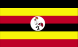
Flag description
six equal horizontal bands of black (top), yellow, red, black, yellow, and red; a white disk is superimposed at the center and depicts a red-crested crane (the national symbol) facing the hoist side Economy Uganda
GDP - composition by sector
- agriculture
- 29.4%
- industry
- 22.1%
- services
- 48.5% (2006 est.)
GDP - per capita (PPP)
$1,800 (2006 est.)
GDP - real growth rate
5% (2006 est.)
GDP (official exchange rate)
$8.502 billion (2006 est.)
GDP (purchasing power parity)
$51.89 billion (2006 est.)
Geographic coordinates
1 00 N, 32 00 E
Geography - note
landlocked; fertile, well-watered country with many lakes and rivers People Uganda
Government type
republic
HIV/AIDS - adult prevalence rate
4.1% (2003 est.)
HIV/AIDS - deaths
78,000 (2003 est.)
HIV/AIDS - people living with HIV/AIDS
530,000 (2001 est.)
Household income or consumption by percentage share
- highest 10%
- 21% (2000)
- lowest 10%
- 4%
IDPs
1.2-1.7 million (350,000 IDPs returned in 2006 following ongoing peace talks between the Lord's Resistance Army (LRA) and Government of Uganda) (2006) This page was last updated on 8 February, 2007
Imports
$1.945 billion f.o.b. (2006 est.)
Imports - commodities
capital equipment, vehicles, petroleum, medical supplies; cereals
Imports - partners
Kenya 32.6%, UAE 8.8%, South Africa 5.8%, India 5.8%, China 5.3%, UK 4.5%, US 4.2%, Japan 4.1% (2005)
Independence
9 October 1962 (from UK)
Industrial production growth rate
5.2% (2006 est.)
Industries
sugar, brewing, tobacco, cotton textiles; cement, steel production
Infant mortality rate
- female
- 62.69 deaths/1,000 live births (2006 est.)
- male
- 69.51 deaths/1,000 live births
- total
- 66.15 deaths/1,000 live births
Inflation rate (consumer prices)
6% (2006 est.)
International organization participation
ACP, AfDB, AU, C, COMESA, EADB, FAO, G-77, IAEA, IBRD, ICAO, ICCt, ICRM, IDA, IDB, IFAD, IFC, IFRCS, IGAD, ILO, IMF, Interpol, IOC, IOM, IPU, ISO (correspondent), ITU, ITUC, MIGA, NAM, OIC, OPCW, PCA, UN, UNCTAD, UNESCO, UNHCR, UNIDO, UNMIS, UNWTO, UPU, WCO, WFTU, WHO, WIPO, WMO, WTO
Internet country code
.ug
Internet hosts
1,365 (2006)
Internet Service Providers (ISPs)
2 (2000)
Internet users
500,000 (2005) Transportation Uganda
Investment (gross fixed)
23.5% of GDP (2006 est.)
Irrigated land
90 sq km (2003)
Judicial branch
Court of Appeal (judges are appointed by the president and approved by the legislature); High Court (judges are appointed by the president)
Labor force
13.76 million (2006 est.)
Labor force - by occupation
- agriculture
- 82%
- industry
- 5%
- services
- 13% (1999 est.)
Land boundaries
- border countries
- Democratic Republic of the Congo 765 km, Kenya 933 km, Rwanda 169 km, Sudan 435 km, Tanzania 396 km
- total
- 2,698 km
Land use
- arable land
- 21.57%
- other
- 69.51% (2005)
- permanent crops
- 8.92%
Languages
English (official national language, taught in grade schools, used in courts of law and by most newspapers and some radio broadcasts), Ganda or Luganda (most widely used of the Niger-Congo languages, preferred for native language publications in the capital and may be taught in school), other Niger-Congo languages, Nilo-Saharan languages, Swahili, Arabic
Legal system
in 1995, the government restored the legal system to one based on English common law and customary law; accepts compulsory ICJ jurisdiction, with reservations
Legislative branch
- unicameral National Assembly (332 members - 215 directly elected by popular vote, 104 nominated by legally established special interest groups [women 79, army 10, disabled 5, youth 5, labor 5], 13 ex officio members; members serve five-year terms)
- election results
- percent of vote by party - NA%; seats by party - NRM 191, FDC 37, UPC 9, DP 8, CD 1, JEEMA 1, Independents 36, other 49
- elections
- last held 23 February 2006 (next to be held in 2011)
Life expectancy at birth
- female
- 53.69 years (2006 est.)
- male
- 51.68 years
- total population
- 52.67 years
Literacy
- definition
- age 15 and over can read and write
- female
- 60.4% (2003 est.) Government Uganda
- male
- 79.5%
- total population
- 69.9%
Location
Eastern Africa, west of Kenya
Major infectious diseases
- degree of risk
- very high
- food or waterborne diseases
- bacterial diarrhea, hepatitis A, and typhoid fever
- vectorborne diseases
- malaria and African trypanosomiasis (sleeping sickness) are high risks in some locations
- water contact disease
- schistosomiasis (2007)
Manpower available for military service
- females age 18-49
- 4,855,858 (2005 est.)
- males age 18-49
- 5,012,620
Manpower fit for military service
- females age 18-49
- 2,780,135 (2005 est.)
- males age 18-49
- 2,889,808
Map references
Africa
Maritime claims
none (landlocked)
Median age
- female
- 15.1 years (2006 est.)
- male
- 14.9 years
- total
- 15 years
Military expenditures - dollar figure
$192.8 million (2005 est.)
Military expenditures - percent of GDP
2.2% (2005 est.) Transnational Issues Uganda
Military service age and obligation
18 years of age for compulsory and voluntary military duty; the government has stated that recruitment below that age could occur with proper consent and that "no person under the apparent age of 13 years shall be enrolled in the armed forces"
National holiday
Independence Day, 9 October (1962)
Nationality
- adjective
- Ugandan
- noun
- Ugandan(s)
Natural gas - consumption
0 cu m (2004 est.)
Natural gas - production
0 cu m (2004 est.)
Natural hazards
NA
Natural resources
copper, cobalt, hydropower, limestone, salt, arable land
Net migration rate
-1.4 migrant(s)/1,000 population (2006 est.)
Oil - consumption
10,890 bbl/day (2004 est.)
Oil - exports
NA bbl/day
Oil - imports
NA bbl/day
Oil - production
0 bbl/day (2004 est.)
Political parties and leaders
- Conservative Party or CP [Ken LUKYAMUZI]; Democratic Party or DP [Kizito SSEBAANA]; Forum for Democratic Change or FDC [Kizza BESIGYE]; Justice Forum or JEEMA [Muhammad Kibirige MAYANJA]; National Democrats Forum [Chapaa KARUHANGA]; National Resistance Movement or NRM [Yoweri MUSEVENI]; Ugandan People's Congress or UPC [Miria OBOTE]
- note
- a national referendum in July 2005 opened the way for Uganda's transition to a multi-party political system
Political pressure groups and leaders
Popular Resistance Against a Life President or PRALP
Population
- 28,195,754
- note
- estimates for this country explicitly take into account the effects of excess mortality due to AIDS; this can result in lower life expectancy, higher infant mortality and death rates, lower population and growth rates, and changes in the distribution of population by age and sex than would otherwise be expected (July 2006 est.)
Population below poverty line
35% (2001 est.)
Population growth rate
3.37% (2006 est.)
Ports and terminals
Entebbe, Jinja, Port Bell Military Uganda
Public debt
29.3% of GDP (2006 est.)
Radio broadcast stations
AM 7, FM 33, shortwave 2 (2001)
Radios
5 million (2001)
Railways
- narrow gauge
- 1,244 km 1.000-m gauge (2005)
- total
- 1,244 km
Refugees and internally displaced persons
- refugees (country of origin)
- 212,857 (Sudan), 20,564 (Democratic Republic of Congo), 20,213 (Rwanda)
Religions
Roman Catholic 33%, Protestant 33%, Muslim 16%, indigenous beliefs 18%
Reserves of foreign exchange and gold
$1.4 billion (2006 est.)
Roadways
- paved
- 16,272 km
- total
- 70,746 km
- unpaved
- 54,474 km (2003)
Sex ratio
- at birth
- 1.03 male(s)/female
- total population
- 1 male(s)/female (2006 est.)
- under 15 years
- 1.01 male(s)/female 15-64 years: 1.01 male(s)/female 65 years and over: 0.76 male(s)/female
Suffrage
18 years of age; universal
Telephone system
- domestic
- intercity traffic by wire, microwave radio relay, and radiotelephone communication stations, fixed and mobile cellular systems for short-range traffic
- general assessment
- seriously inadequate; two cellular systems have been introduced, but a sharp increase in the number of main lines is essential; e-mail and Internet services are available
- international
- country code - 256; satellite earth stations - 1 Intelsat (Atlantic Ocean) and 1 Inmarsat; analog links to Kenya and Tanzania
Telephones - main lines in use
100,800 (2005)
Telephones - mobile cellular
1.525 million (2005)
Television broadcast stations
8 (plus one low-power repeater) (2001)
Televisions
500,000 (2001)
Terrain
mostly plateau with rim of mountains
Total fertility rate
6.71 children born/woman (2006 est.)
Ugandan Peoples' Defense Force (UPDF)
Army, Marine Unit, Air Wing
Unemployment rate
NA%
Waterways
on Lake Victoria, 200 km on Lake Albert, Lake Kyoga, and parts of Albert Nile (2005)