2010 Edition
CIA World Factbook 2010 (Project Gutenberg)
Introduction
Background
Following World War I, France acquired a mandate over the northern portion of the former Ottoman Empire province of Syria. The French administered the area as Syria until granting it independence in 1946. The new country lacked political stability, however, and experienced a series of military coups during its first decades. Syria united with Egypt in February 1958 to form the United Arab Republic. In September 1961, the two entities separated, and the Syrian Arab Republic was reestablished. In November 1970, Hafiz al-ASAD, a member of the Socialist Ba'th Party and the minority Alawite sect, seized power in a bloodless coup and brought political stability to the country. In the 1967 Arab-Israeli War, Syria lost the Golan Heights to Israel. During the 1990s, Syria and Israel held occasional peace talks over its return. Following the death of President al-ASAD, his son, Bashar al-ASAD, was approved as president by popular referendum in July 2000. Syrian troops - stationed in Lebanon since 1976 in an ostensible peacekeeping role - were withdrawn in April 2005. During the July-August 2006 conflict between Israel and Hizballah, Syria placed its military forces on alert but did not intervene directly on behalf of its ally Hizballah. In May 2007 Bashar al-ASAD was elected to his second term as president.
Geography
Area
- land
- 183,630 sq km
- total
- 185,180 sq km
- water
- 1,550 sq km note: includes 1,295 sq km of Israeli-occupied territory
Area - comparative
slightly larger than North Dakota
Climate
mostly desert; hot, dry, sunny summers (June to August) and mild, rainy winters (December to February) along coast; cold weather with snow or sleet periodically in Damascus
Coastline
193 km
Elevation extremes
- highest point
- Mount Hermon 2,814 m
- lowest point
- unnamed location near Lake Tiberias -200 m
Environment - current issues
deforestation; overgrazing; soil erosion; desertification; water pollution from raw sewage and petroleum refining wastes; inadequate potable water
Environment - international agreements
- party to
- Biodiversity, Climate Change, Climate Change-Kyoto Protocol, Desertification, Endangered Species, Hazardous Wastes, Ozone Layer Protection, Ship Pollution, Wetlands signed, but not ratified: Environmental Modification
Freshwater withdrawal (domestic/industrial/agricultural)
- per capita
- 1,048 cu m/yr (2000)
- total
- 19.95 cu km/yr (3%/2%/95%)
Geographic coordinates
35 00 N, 38 00 E
Geography - note
there are 41 Israeli settlements and civilian land use sites in the Israeli-occupied Golan Heights (2010 est.)
Irrigated land
13,330 sq km (2003)
Land boundaries
- border countries
- Iraq 605 km, Israel 76 km, Jordan 375 km, Lebanon 375 km, Turkey 822 km
- total
- 2,253 km
Land use
- arable land
- 24.8%
- other
- 70.73% (2005)
- permanent crops
- 4.47%
Location
Middle East, bordering the Mediterranean Sea, between Lebanon and Turkey
Map references
Middle East
Maritime claims
- contiguous zone
- 24 nm
- territorial sea
- 12 nm
Natural hazards
- dust storms, sandstorms
- volcanism
- Syria's two historically active volcanoes, Es Safa and an unnamed volcano near the Turkish border have not erupted in centuries
Natural resources
petroleum, phosphates, chrome and manganese ores, asphalt, iron ore, rock salt, marble, gypsum, hydropower
Terrain
primarily semiarid and desert plateau; narrow coastal plain; mountains in west
Total renewable water resources
46.1 cu km (1997)
People and Society
Age structure
0-14 years: 36.4% (male 4,063,367/female 3,864,099) 15-64 years: 59.9% (male 6,628,644/female 6,406,864) 65 years and over: 3.7% (male 372,172/female 427,832) (2010 est.)
Birth rate
24.44 births/1,000 population (2010 est.)
Death rate
3.7 deaths/1,000 population (July 2010 est.)
Education expenditures
4.9% of GDP (2007)
Ethnic groups
Arab 90.3%, Kurds, Armenians, and other 9.7%
HIV/AIDS - adult prevalence rate
less than 0.1% (2001 est.)
HIV/AIDS - deaths
fewer than 200 (2003 est.)
HIV/AIDS - people living with HIV/AIDS
fewer than 500 (2003 est.)
Infant mortality rate
- female
- 13.57 deaths/1,000 live births (2010 est.)
- male
- 18.55 deaths/1,000 live births
- total
- 16.14 deaths/1,000 live births
Languages
Arabic (official); Kurdish, Armenian, Aramaic, Circassian widely understood; French, English somewhat understood
Life expectancy at birth
- female
- 76.96 years (2010 est.)
- male
- 72.1 years
- total population
- 74.46 years
Literacy
- definition: age 15 and over can read and write
- female
- 73.6% (2004 census)
- male
- 86%
- total population
- 79.6%
Median age
- female
- 21.7 years (2010 est.)
- male
- 21.3 years
- total
- 21.5 years
Nationality
- adjective
- Syrian
- noun
- Syrian(s)
Net migration rate
-1.2 migrant(s)/1,000 population
Population
22,198,110 (July 2010 est.) note: approximately 19,100 Israeli settlers live in the Golan Heights (2008 est.)
Population growth rate
1.954% (2010 est.)
Religions
Sunni Muslim 74%, other Muslim (includes Alawite, Druze) 16%, Christian (various denominations) 10%, Jewish (tiny communities in Damascus, Al Qamishli, and Aleppo)
Sex ratio
- at birth
- 1.06 male(s)/female under 15 years: 1.05 male(s)/female 15-64 years: 1.03 male(s)/female 65 years and over: 0.86 male(s)/female
- total population
- 1.03 male(s)/female (2010 est.)
Total fertility rate
3.02 children born/woman (2010 est.)
Urbanization
- rate of urbanization
- 3.1% annual rate of change (2005-10 est.)
- urban population
- 54% of total population (2008)
Government
Administrative divisions
14 provinces (muhafazat, singular - muhafazah); Al Hasakah, Al Ladhiqiyah (Latakia), Al Qunaytirah, Ar Raqqah, As Suwayda', Dar'a, Dayr az Zawr, Dimashq, Halab, Hamah, Hims, Idlib, Rif Dimashq (Damascus), Tartus
Capital
- daylight saving time
- +1hr, begins first Friday in April; ends last Friday in October
- geographic coordinates
- 33 30 N, 36 18 E
- name
- Damascus
- time difference
- UTC+2 (7 hours ahead of Washington, DC during Standard Time)
Constitution
13 March 1973
Country name
- conventional long form
- Syrian Arab Republic
- conventional short form
- Syria
- former
- United Arab Republic (with Egypt)
- local long form
- Al Jumhuriyah al Arabiyah as Suriyah
- local short form
- Suriyah
Diplomatic representation from the US
- chief of mission
- Ambassador (vacant); Charge d'Affaires Charles (Chuck) F. HUNTER
- embassy
- Abou Roumaneh, Al-Mansour Street, No. 2, Damascus
- FAX
- [963] (11) 3391-3999
- mailing address
- P. O. Box 29, Damascus
- telephone
- [963] (11) 3391-4444
Diplomatic representation in the US
- chancery
- 2215 Wyoming Avenue NW, Washington, DC 20008
- chief of mission
- Ambassador Imad MOUSTAPHA
- FAX
- [1] (202) 265-4585
- telephone
- [1] (202) 232-6313
Executive branch
- cabinet
- Council of Ministers appointed by the president (For more information visit the World Leaders website )
- chief of state
- President Bashar al-ASAD (since 17 July 2000); Vice President Farouk al-SHARA (since 11 February 2006) oversees foreign policy; Vice President Najah al-ATTAR (since 23 March 2006) oversees cultural policy
- election results
- Bashar al-ASAD approved as president; percent of vote - Bashar al-ASAD 97.6%
- elections
- president approved by popular referendum for a second seven-year term (no term limits); referendum last held on 27 May 2007 (next to be held in May 2014); the president appoints the vice presidents, prime minister, and deputy prime ministers
- head of government
- Prime Minister Muhammad Naji al-UTRI (since 10 September 2003); Deputy Prime Minister for Economic Affairs Abdallah al-DARDARI (since 14 June 2005)
Flag description
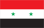
three equal horizontal bands of red (top), white, and black; two small, green, five-pointed stars in a horizontal line centered in the white band; the band colors derive from the Arab Liberation flag and represent oppression (black), overcome through bloody struggle (red), to be replaced by a bright future (white); identical to the former flag of the United Arab Republic (1958-1961) where the two stars represented the constituent states of Syria and Egypt; the current design dates to 1980 note: similar to the flag of Yemen, which has a plain white band, Iraq, which has an Arabic inscription centered in the white band, and that of Egypt, which has a gold Eagle of Saladin centered in the white band
Government type
republic under an authoritarian regime
Independence
17 April 1946 (from League of Nations mandate under French administration)
International organization participation
ABEDA, AFESD, AMF, CAEU, FAO, G-24, G-77, IAEA, IBRD, ICAO, ICC, ICRM, IDA, IDB, IFAD, IFC, IFRCS, IHO, ILO, IMF, IMO, Interpol, IOC, IPU, ISO, ITSO, ITU, LAS, MIGA, NAM, OAPEC, OIC, UN, UNCTAD, UNESCO, UNIDO, UNRWA, UNWTO, UPU, WCO, WFTU, WHO, WIPO, WMO, WTO (observer)
Judicial branch
Supreme Judicial Council (appoints and dismisses judges; headed by the president); national level - Supreme Constitutional Court (adjudicates electoral disputes and rules on constitutionality of laws and decrees; justices appointed for four-year terms by the president); Court of Cassation; Appeals Courts (Appeals Courts represent an intermediate level between the Court of Cassation and local level courts); local level - Magistrate Courts; Courts of First Instance; Juvenile Courts; Customs Courts; specialized courts - Economic Security Courts (hear cases related to economic crimes); Supreme State Security Court (hear cases related to national security); Personal Status Courts (religious; hear cases related to marriage and divorce)
Legal system
based on a combination of French and Ottoman civil law; Islamic law is used in the family court system; has not accepted compulsory ICJ jurisdiction
Legislative branch
- unicameral People's Council or Majlis al-Shaab (250 seats; members elected by popular vote to serve four-year terms)
- election results
- percent of vote by party - NA; seats by party - NPF 172, independents 78
- elections
- last held on 22-23 April 2007 (next to be held in 2011)
National anthem
- lyrics/music
- Khalil Mardam BEY/Mohammad Salim FLAYFEL and Ahmad Salim FLAYFEL note: adopted 1936, restored 1961; between 1958 and 1961, while Syria was a member of the United Arab Republic with Egypt, the country had a different anthem
- name
- "Humat ad-Diyar" (Guardians of the Homeland)
National holiday
Independence Day, 17 April (1946)
Political parties and leaders
- Kurdish parties (considered illegal)
- Azadi Party [Kheirudin MURAD]; Future Party [Masha'l TAMMO]; Kurdish Democratic Alliance (includes four parties); Kurdish Democratic Front (includes three parties); Yekiti Party [Fu'ad ALEYKO]
- legal parties
- National Progressive Front or NPF [President Bashar al-ASAD, Dr. Suleiman QADDAH] (includes Arab Socialist Renaissance (Ba'th) Party [President Bashar al-ASAD]; Socialist Unionist Democratic Party [Fadlallah Nasr Al-DIN]; Syrian Arab Socialist Union or ASU [Safwan al-QUDSI]; Syrian Communist Party (two branches) [Wissal Farha BAKDASH, Yusuf Rashid FAYSAL]; Syrian Social Nationalist Party [As'ad HARDAN]; Unionist Socialist Party [Fayez ISMAIL])
- opposition parties not legally recognized
- Communist Action Party [Fateh al-JAMOUS]; National Democratic Rally [Hasan ABDUL-AZIM, spokesman] (includes five parties - Arab Democratic Socialist Union Party [Hasan ABDUL-AZIM], Arab Socialist Movement, Democratic Ba'th Party [Ibrahim MAKHOS], Democratic People's Party [Riad al TURK], Revolutionary Workers' Party [Abdul Hafez al HAFEZ])
- other parties
- Syrian Democratic Party [Mustafa QALAAJI]
Political pressure groups and leaders
Arab Human Rights Organization in Syria or AHRO; Damascus Declaration Group (a broad alliance of secular, religious, and Kurdish opposition groups); National Salvation Front (alliance between former Vice President Abd al-Halim KHADDAM and other small opposition groups in exile; formerly included the Syrian Muslim Brotherhood); Syrian Center for Media and Freedom of Expression [Mazin DARWISH]; Syrian Human Rights Organization [Muhanad al-HASANI]; Syrian Human Rights Society or HRAS [Fayez FAWAZ]; Syrian Muslim Brotherhood or SMB [Muhammad Riyad al-SHAQFAH] (operates in exile in London)
Suffrage
18 years of age; universal
Economy
Agriculture - products
wheat, barley, cotton, lentils, chickpeas, olives, sugar beets; beef, mutton, eggs, poultry, milk
Central bank discount rate
5% (31 December 2009) 5% (31 December 2008)
Commercial bank prime lending rate
10.04% (31 December 2009 est.) 10.19% (31 December 2008 est.)
Current account balance
$649 million (2010 est.) $394 million (2009 est.)
Debt - external
$7.682 billion (31 December 2010 est.) $7.359 billion (31 December 2009 est.)
Economy - overview
Syrian economic growth slowed to 1.8% in 2009 as the global economic crisis affected oil prices and the economies of Syria's key export partners and sources of investment. Damascus has implemented modest economic reforms in the past few years, including cutting lending interest rates, opening private banks, consolidating all of the multiple exchange rates, raising prices on some subsidized items, most notably gasoline and cement, and establishing the Damascus Stock Exchange - which began operations in 2009. In addition, President ASAD signed legislative decrees to encourage corporate ownership reform, and to allow the Central Bank to issue Treasury bills and bonds for government debt. Nevertheless, the economy remains highly controlled by the government. Long-run economic constraints include declining oil production, high unemployment, rising budget deficits, and increasing pressure on water supplies caused by heavy use in agriculture, rapid population growth, industrial expansion, and water pollution.
Electricity - consumption
27.35 billion kWh (2007 est.)
Electricity - exports
0 kWh (2008 est.)
Electricity - imports
1.4 billion kWh (2007)
Electricity - production
36.5 billion kWh (2007 est.)
Exchange rates
Syrian pounds (SYP) per US dollar - 46.456 (2010), 46.7082 (2009), 46.5281 (2008), 50.0085 (2007), 51.689 (2006)
Exports
$12.84 billion (2010 est.) $11.76 billion (2009 est.)
Exports - commodities
crude oil, minerals, petroleum products, fruits and vegetables, cotton fiber, textiles, clothing, meat and live animals, wheat
Exports - partners
Iraq 30.22%, Lebanon 12.21%, Germany 8.89%, Egypt 6.8%, Saudi Arabia 5.04%, Italy 4.55% (2009)
GDP - composition by sector
- agriculture
- 17.6%
- industry
- 26.8%
- services
- 55.6% (2010 est.)
GDP - per capita (PPP)
$4,800 (2010 est.) $4,700 (2009 est.) $4,600 (2008 est.) note: data are in 2010 US dollars
GDP - real growth rate
4% (2010 est.) 5% (2009 est.) 4.3% (2008 est.)
GDP (official exchange rate)
$59.63 billion (2010 est.)
GDP (purchasing power parity)
$106.4 billion (2010 est.) $102.4 billion (2009 est.) $97.48 billion (2008 est.) note: data are in 2010 US dollars
Household income or consumption by percentage share
lowest 10%: NA% highest 10%: NA%
Imports
$13.57 billion (2010 est.) $12.62 billion (2009 est.)
Imports - commodities
machinery and transport equipment, electric power machinery, food and livestock, metal and metal products, chemicals and chemical products, plastics, yarn, paper
Imports - partners
Saudi Arabia 10.1%, China 9.95%, Turkey 6.97%, Egypt 6.44%, UAE 4.97%, Italy 4.93%, Russia 4.92%, Germany 4.38%, Lebanon 4.12% (2009)
Industrial production growth rate
6% (2010 est.)
Industries
petroleum, textiles, food processing, beverages, tobacco, phosphate rock mining, cement, oil seeds crushing, car assembly
Inflation rate (consumer prices)
5.9% (2010 est.) 2.6% (2009 est.)
Investment (gross fixed)
16.6% of GDP (2010 est.)
Labor force
5.527 million (2010 est.)
Labor force - by occupation
- agriculture
- 17%
- industry
- 16%
- services
- 67% (2008 est.)
Market value of publicly traded shares
$NA
Natural gas - consumption
6.18 billion cu m (2008 est.)
Natural gas - exports
0 cu m (2008 est.)
Natural gas - imports
140 million cu m (2008 est.)
Natural gas - production
6.04 billion cu m (2008 est.)
Natural gas - proved reserves
240.7 billion cu m (1 January 2010 est.)
Oil - consumption
252,000 bbl/day (2009 est.)
Oil - exports
155,000 bbl/day (2008 est.)
Oil - imports
58,710 bbl/day (2007 est.)
Oil - production
400,400 bbl/day (2009 est.)
Oil - proved reserves
2.5 billion bbl (1 January 2010 est.)
Population below poverty line
11.9% (2006 est.)
Public debt
29.8% of GDP (2010 est.) 28.1% of GDP (2009 est.)
Reserves of foreign exchange and gold
$17.96 billion (31 December 2010 est.) $17.44 billion (31 December 2009 est.)
Stock of broad money
$161 billion (31 December 2009) $147.5 billion (31 December 2008)
Stock of domestic credit
$27.14 billion (31 December 2010 est.) $23.58 billion (31 December 2009 est.)
Stock of narrow money
$21.6 billion (31 December 2010 est) $19.53 billion (31 December 2009 est)
Unemployment rate
8.3% (2010 est.) 8.5% (2009 est.)
Communications
Broadcast media
state-run television and radio broadcast networks; state operates 2 TV networks and a satellite channel; roughly two-thirds of Syrian homes have a satellite dish providing access to foreign TV broadcasts; 3 state-run radio channels; first private radio station launched in 2005; private radio broadcasters prohibited from transmitting news or political content (2007)
Internet country code
.sy
Internet hosts
8,114 (2010)
Internet users
4.469 million (2009)
Telephone system
- domestic
- the number of fixed-line connections has increased markedly since 2000; mobile-cellular service growing with telephone subscribership reaching nearly 50 per 100 persons in 2009
- general assessment
- fair system currently undergoing significant improvement and digital upgrades, including fiber-optic technology and expansion of the network to rural areas
- international
- country code - 963; submarine cable connection to Egypt, Lebanon, and Cyprus; satellite earth stations - 1 Intelsat (Indian Ocean) and 1 Intersputnik (Atlantic Ocean region); coaxial cable and microwave radio relay to Iraq, Jordan, Lebanon, and Turkey; participant in Medarabtel
Telephones - main lines in use
3.871 million (2009)
Telephones - mobile cellular
9.697 million (2009)
Transportation
Airports
104 (2010)
Airports - with paved runways
- total
- 29 over 3,047 m: 5 2,438 to 3,047 m: 15 1,524 to 2,437 m: 1 914 to 1,523 m: 3 under 914 m: 5 (2010)
Airports - with unpaved runways
- total
- 75 1,524 to 2,437 m: 1 914 to 1,523 m: 15 under 914 m: 59 (2010)
Heliports
7 (2010)
Merchant marine
- by type
- bulk carrier 7, cargo 30, carrier 3, container 1
- foreign-owned
- 5 (Jordan 2, Lebanon 2, Romania 1)
- registered in other countries
- 199 (Barbados 1, Belize 2, Bolivia 4, Cambodia 22, Comoros 6, Cyprus 1, Dominica 2, Georgia 35, Lebanon 3, Liberia 1, Libya 2, Malta 5, Moldova 3, North Korea 6, Panama 42, Saint Kitts and Nevis 5, Saint Vincent and the Grenadines 13, Sierra Leone 20, Togo 5, unknown 8) (2010)
- total
- 41
Pipelines
gas 3,101 km; oil 1,997 km (2009)
Ports and terminals
Baniyas, Latakia, Tartus
Railways
- narrow gauge
- 251 km 1.050-m gauge (2008)
- standard gauge
- 1,801 km 1.435-m gauge
- total
- 2,052 km
Roadways
- paved
- 19,490 km (includes 1,103 km of expressways)
- total
- 97,401 km
- unpaved
- 77,911 km (2006)
Waterways
900 km (navigable not economically significant) (2010)
Military and Security
Manpower available for military service
males age 16-49: 5,766,853 females age 16-49: 5,540,828 (2010 est.)
Manpower fit for military service
males age 16-49: 4,948,802 females age 16-49: 4,786,596 (2010 est.)
Manpower reaching militarily significant age annually
- female
- 241,777 (2010 est.)
- male
- 253,578
Military branches
- Syrian Armed Forces
- Syrian Arab Army, Syrian Arab Navy, Syrian Arab Air and Air Defense Forces (includes Air Defense Command) (2008)
Military expenditures
5.9% of GDP (2005 est.)
Military service age and obligation
18 years of age for compulsory military service; conscript service obligation - 21 months (18 months in the Syrian Arab Navy); women are not conscripted but may volunteer to serve (2010)
Transnational Issues
Disputes - international
Golan Heights is Israeli-occupied with the almost 1,000-strong UN Disengagement Observer Force (UNDOF) patrolling a buffer zone since 1964; lacking a treaty or other documentation describing the boundary, portions of the Lebanon-Syria boundary are unclear with several sections in dispute; since 2000, Lebanon has claimed Shab'a Farms in the Golan Heights; 2004 Agreement and pending demarcation settles border dispute with Jordan; approximately two million Iraqis have fled the conflict in Iraq with the majority taking refuge in Syria and Jordan
Illicit drugs
a transit point for opiates, hashish, and cocaine bound for regional and Western markets; weak anti-money-laundering controls and bank privatization may leave it vulnerable to money laundering page last updated on January 20, 2011 ======================================================================
Refugees and internally displaced persons
- IDPs
- 305,000 (most displaced from Golan Heights during 1967 Arab-Israeli War) (2007)
- refugees (country of origin)
- 1-1.4 million (Iraq); 522,100 (Palestinian Refugees (UNRWA))
Trafficking in persons
- current situation
- Syria is a destination and transit country for women and children trafficked for commercial sexual exploitation and forced labor; a significant number of women and children in the large and expanding Iraqi refugee community in Syria are reportedly forced into commercial sexual exploitation by Iraqi gangs or, in some cases, their families; women from Indonesia, Sri Lanka, the Philippines, Ethiopia, and Sierra Leone are recruited for work in Syria as domestic servants, but some face conditions of involuntary servitude, including long hours, non-payment of wages, withholding of passports, restrictions on movement, threats, and physical or sexual abuse
- tier rating
- Tier 2 Watch List - Syria again failed to report any law enforcement efforts to punish trafficking offenses in 2007; in addition, the government did not offer protection services to victims of trafficking and may have arrested, prosecuted, or deported some victims for prostitution or immigration violations; Syria has not ratified the 2000 UN TIP Protocol (2008)