1993 Edition
CIA World Factbook 1993 (Project Gutenberg)
Geography
Area
total area: 62,049 km2 land area: 62,049 km2 comparative area: slightly smaller than West Virginia note: includes Spitsbergen and Bjornoya (Bear Island)
Climate
arctic, tempered by warm North Atlantic Current; cool summers, cold winters; North Atlantic Current flows along west and north coasts of Spitsbergen, keeping water open and navigable most of the year
Coastline
3,587 km
Environment
great calving glaciers descend to the sea
International disputes
focus of maritime boundary dispute in the Barents Sea between Norway and Russia
Irrigated land
NA km2
Land boundaries
0 km
Land use
arable land: 0% permanent crops: 0% meadows and pastures: 0% forest and woodland: 0% other: 100% (no trees and the only bushes are crowberry and cloudberry)
Location
in the Arctic Ocean where the Arctic Ocean, Barents Sea, Greenland Sea, and Norwegian Sea meet, 445 km north of Norway
Map references
Arctic Region, Asia, Standard Time Zones of the World
Maritime claims
exclusive fishing zone: 200 nm unilaterally claimed by Norway but not recognized by Russia territorial sea: 4 nm
Natural resources
coal, copper, iron ore, phosphate, zinc, wildlife, fish
Note
northernmost part of the Kingdom of Norway; consists of nine main islands; glaciers and snowfields cover 60% of the total area
Terrain
wild, rugged mountains; much of high land ice covered; west coast clear of ice about half the year; fjords along west and north coasts
People and Society
Birth rate
NA births/1,000 population
Death rate
NA deaths/1,000 population
Ethnic divisions
Russian 64%, Norwegian 35%, other 1% (1981)
Infant mortality rate
NA deaths/1,000 live births
Labor force
NA
Languages
Russian, Norwegian
Life expectancy at birth
total population: NA years male: NA years female: NA years
Literacy
total population: NA% male: NA% female: NA%
Net migration rate
NA migrant(s)/1,000 population
Population
3,209 (July 1993 est.)
Population growth rate
-2.84% (1993 est.)
Total fertility rate
NA children born/woman
Government
Capital
Longyearbyen
Chief of State
King HARALD V (since 17 January 1991)
Digraph
SV
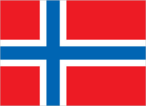
Flag
the flag of Norway is used
Head of Government
Governor (vacant)
Independence
none (territory of Norway)
Legal system
NA
Member of
none
Names
conventional long form: none conventional short form: Svalbard
National holiday
NA
Type
territory of Norway administered by the Ministry of Industry, Oslo, through a governor (sysselmann) residing in Longyearbyen, Spitsbergen; by treaty (9 February 1920) sovereignty was given to Norway
Economy
Budget
revenues $13.3 million; expenditures $13.3 million, including capital expenditures of $NA (1990)
Currency
1 Norwegian krone (NKr) = 100 ore
Electricity
21,000 kW capacity; 45 million kWh produced, 13,860 kWh per capita (1992)
Exchange rates
Norwegian kroner (NKr) per US$1 - 6.8774 (January 1993), 6.2145 (1992), 6.4829 (1991), 6.2597 (1990), 6.9045 (1989), 6.5170 (1988)
Overview
Coal mining is the major economic activity on Svalbard. By treaty (9 February 1920), the nationals of the treaty powers have equal rights to exploit mineral deposits, subject to Norwegian regulation. Although US, UK, Dutch, and Swedish coal companies have mined in the past, the only companies still mining are Norwegian and Russian. The settlements on Svalbard are essentially company towns. The Norwegian state-owned coal company employs nearly 60% of the Norwegian population on the island, runs many of the local services, and provides most of the local infrastructure. There is also some trapping of seal, polar bear, fox, and walrus.
Communications
Airports
total: 4 usable: 4 with permanent-surface runways: 1 with runways over 3,659 m: with runways 2,440-3,659 m: with runways 1,220-2,439 m: 1
Ports
limited facilities - Ny-Alesund, Advent Bay
Telecommunications
5 meteorological/radio stations; local telephone service; broadcast stations - 1 AM, 1 (2 repeaters) FM, 1 TV; satellite communication with Norwegian mainland
Military and Security
Note
demilitarized by treaty (9 February 1920)