2015 Edition
CIA World Factbook 2015 Archive (Wayback Machine ZIP)
Introduction
Background
First explored by the Spaniards in the 16th century and then settled by the English in the mid-17th century, Suriname became a Dutch colony in 1667. With the abolition of African slavery in 1863, workers were brought in from India and Java. The Netherlands granted the colony independence in 1975. Five years later the civilian government was replaced by a military regime that soon declared a socialist republic. It continued to exert control through a succession of nominally civilian administrations until 1987, when international pressure finally forced a democratic election. In 1990, the military overthrew the civilian leadership, but a democratically elected government - a four-party coalition - returned to power in 1991. The coalition expanded to eight parties in 2005 and ruled until August 2010, when voters returned former military leader Desire BOUTERSE and his opposition coalition to power.
Geography
Area
- land
- 156,000 sq km
- total
- 163,820 sq km
- water
- 7,820 sq km
Area - comparative
slightly larger than Georgia
Climate
tropical; moderated by trade winds
Coastline
386 km
Elevation extremes
- highest point
- Juliana Top 1,230 m
- lowest point
- unnamed location in the coastal plain -2 m
Environment - current issues
deforestation as timber is cut for export; pollution of inland waterways by small-scale mining activities
Environment - international agreements
- party to
- Biodiversity, Climate Change, Climate Change-Kyoto Protocol, Desertification, Endangered Species, Law of the Sea, Marine Dumping, Ozone Layer Protection, Ship Pollution, Tropical Timber 94, Wetlands, Whaling
- signed, but not ratified
- none of the selected agreements
Freshwater withdrawal (domestic/industrial/agricultural)
- per capita
- 1,396 cu m/yr (2006)
- total
- 0.67 cu km/yr (6%/4%/90%)
Geographic coordinates
4 00 N, 56 00 W
Geography - note
smallest independent country on South American continent; mostly tropical rain forest; great diversity of flora and fauna that, for the most part, is increasingly threatened by new development; relatively small population, mostly along the coast
Irrigated land
511.8 sq km (2003)
Land boundaries
- border countries (3)
- Brazil 515 km, French Guiana 556 km, Guyana 836 km
- total
- 1,907 km
Land use
- arable land 0.4%; permanent crops 0%; permanent pasture 0.1%
- agricultural land
- 0.5%
- forest
- 94.6%
- other
- 4.9% (2011 est.)
Location
Northern South America, bordering the North Atlantic Ocean, between French Guiana and Guyana
Map references
South America
Maritime claims
- exclusive economic zone
- 200 nm
- territorial sea
- 12 nm
Natural hazards
NA
Natural resources
timber, hydropower, fish, kaolin, shrimp, bauxite, gold, and small amounts of nickel, copper, platinum, iron ore
Terrain
mostly rolling hills; narrow coastal plain with swamps
Total renewable water resources
122 cu km (2011)
People and Society
Age structure
- 0-14 years
- 25.66% (male 75,791/female 72,934)
- 15-24 years
- 17.48% (male 51,657/female 49,662)
- 25-54 years
- 44.3% (male 130,726/female 126,048)
- 55-64 years
- 6.81% (male 19,291/female 20,198)
- 65 years and over
- 5.75% (male 14,395/female 18,931) (2015 est.)
Birth rate
16.34 births/1,000 population (2015 est.)
Child labor - children ages 5-14
- percentage
- 6% (2006 est.)
- total number
- 6,094
Children under the age of 5 years underweight
5.8% (2010)
Contraceptive prevalence rate
47.6% (2010)
Death rate
6.13 deaths/1,000 population (2015 est.)
Demographic profile
- Suriname is a pluralistic society consisting primarily of Creoles (persons of mixed African and European heritage), the descendants of escaped African slaves known as Maroons, and the descendants of Indian and Javanese contract workers. The country overall is in full, post-industrial demographic transition, with a low fertility rate, a moderate mortality rate, and a rising life expectancy. However, the Maroon population of the rural interior lags behind because of lower educational attainment and contraceptive use, higher malnutrition, and significantly less access to electricity, potable water, sanitation, infrastructure, and health care.
- Some 350,000 people of Surinamese descent live in the Netherlands, Suriname's former colonial ruler. In the 19th century, better-educated, largely Dutch-speaking Surinamese began emigrating to the Netherlands. World War II interrupted the outflow, but it resumed after the war when Dutch labor demands grew - emigrants included all segments of the Creole population. Suriname still is strongly influenced by the Netherlands because most Surinamese have relatives living there and it is the largest supplier of development aid. Other emigration destinations include French Guiana and the United States. Suriname's immigration rules are flexible, and the country is easy to enter illegally because rainforests obscure its borders. Since the mid-1980s, Brazilians have settled in Suriname's capital, Paramaribo, or eastern Suriname, where they mine gold. This immigration is likely to slowly re-orient Suriname toward its Latin American roots.
Dependency ratios
- elderly dependency ratio
- 10.4%
- potential support ratio
- 9.6% (2015 est.)
- total dependency ratio
- 50.8%
- youth dependency ratio
- 40.4%
Drinking water source
- urban: 98.1% of population
- rural: 88.4% of population
- total: 94.8% of population
- urban: 1.9% of population
- rural: 11.6% of population
- total: 5.2% of population (2015 est.)
Education expenditures
NA
Ethnic groups
Hindustani (also known locally as "East Indians"; their ancestors emigrated from northern India in the latter part of the 19th century) 37%, Creole (mixed white and black) 31%, Javanese 15%, "Maroons" (their African ancestors were brought to the country in the 17th and 18th centuries as slaves and escaped to the interior) 10%, Amerindian 2%, Chinese 2%, white 1%, other 2%
HIV/AIDS - adult prevalence rate
1.02% (2014 est.)
HIV/AIDS - deaths
200 (2014 est.)
HIV/AIDS - people living with HIV/AIDS
3,800 (2014 est.)
Hospital bed density
3.1 beds/1,000 population (2010)
Infant mortality rate
- female
- 21.65 deaths/1,000 live births (2015 est.)
- male
- 30.48 deaths/1,000 live births
- total
- 26.17 deaths/1,000 live births
Languages
Dutch (official), English (widely spoken), Sranang Tongo (Surinamese, sometimes called Taki-Taki, is native language of Creoles and much of the younger population and is lingua franca among others), Caribbean Hindustani (a dialect of Hindi), Javanese
Life expectancy at birth
- female
- 74.48 years (2015 est.)
- male
- 69.57 years
- total population
- 71.97 years
Literacy
- definition
- age 15 and over can read and write
- female
- 95% (2015 est.)
- male
- 96.1%
- total population
- 95.6%
Major infectious diseases
- degree of risk
- very high
- food or waterborne diseases
- bacterial and protozoal diarrhea, hepatitis A, and typhoid fever
- vectorborne disease
- dengue fever and malaria (2013)
Major urban areas - population
PARAMARIBO (capital) 234,000 (2014)
Maternal mortality rate
155 deaths/100,000 live births (2015 est.)
Median age
- female
- 29.4 years (2015 est.)
- male
- 28.7 years
- total
- 29.1 years
Nationality
- adjective
- Surinamese
- noun
- Surinamer(s)
Net migration rate
0.56 migrant(s)/1,000 population (2015 est.)
Obesity - adult prevalence rate
26.1% (2014)
Population
579,633 (July 2015 est.)
Population growth rate
1.08% (2015 est.)
Religions
Hindu 27.4%, Protestant 25.2% (predominantly Moravian), Roman Catholic 22.8%, Muslim 19.6%, indigenous beliefs 5%
Sanitation facility access
- urban: 88.4% of population
- rural: 61.4% of population
- total: 79.2% of population
- urban: 11.6% of population
- rural: 38.6% of population
- total: 20.8% of population (2015 est.)
Sex ratio
- 0-14 years
- 1.04 male(s)/female
- 15-24 years
- 1.04 male(s)/female
- 25-54 years
- 1.04 male(s)/female
- 55-64 years
- 0.96 male(s)/female
- 65 years and over
- 0.76 male(s)/female
- at birth
- 1.05 male(s)/female
- total population
- 1.01 male(s)/female (2015 est.)
Total fertility rate
1.97 children born/woman (2015 est.)
Unemployment, youth ages 15-24
- female
- 21.7% (2013 est.)
- male
- 11.6%
- total
- 15.3%
Urbanization
- rate of urbanization
- 0.78% annual rate of change (2010-15 est.)
- urban population
- 66% of total population (2015)
Government
Administrative divisions
10 districts (distrikten, singular - distrikt); Brokopondo, Commewijne, Coronie, Marowijne, Nickerie, Para, Paramaribo, Saramacca, Sipaliwini, Wanica
Capital
- geographic coordinates
- 5 50 N, 55 10 W
- name
- Paramaribo
- time difference
- UTC-3 (2 hours ahead of Washington, DC, during Standard Time)
Citizenship
- citizenship by birth
- no
- citizenship by descent only
- at least one parent must be a citizen of Suriname
- dual citizenship recognized
- no
- residency requirement for naturalization
- 5 years
Constitution
previous 1975; latest ratified 30 September 1987, effective 30 October 1987; amended 1992 (2015)
Country name
- conventional long form
- Republic of Suriname
- conventional short form
- Suriname
- former
- Netherlands Guiana, Dutch Guiana
- local long form
- Republiek Suriname
- local short form
- Suriname
Diplomatic representation from the US
- chief of mission
- Ambassador Jay N. ANANIA (since 1 October 2012)
- embassy
- Dr. Sophie Redmondstraat 129, Paramaribo
- FAX
- [597] 410-972
- mailing address
- US Department of State, PO Box 1821, Paramaribo
- telephone
- [597] 472-900
Diplomatic representation in the US
- chancery
- Suite 460, 4301 Connecticut Avenue NW, Washington, DC 20008
- chief of mission
- Ambassador (vacant); Charge d'Affaires Sylvana Elvira SIMSON (since 1 September 2015)
- consulate(s) general
- Miami
- FAX
- [1] (202) 244-5878
- telephone
- [1] (202) 244-7488
Executive branch
- cabinet
- Cabinet of Ministers appointed by the president
- chief of state
- President Desire Delano BOUTERSE (since 12 August 2010); Vice President Ashwin ADHIN (since 12 August 2015); note - the president is both chief of state and head of government
- election results
- Desire Delano BOUTERSE reelected president; National Assembly vote - NA
- elections/appointments
- president and vice president indirectly elected by the National Assembly; president and vice president serve a 5-year term (no term limits); election last held on 25 May 2015 (next to be held on 25 May 2020)
- head of government
- President Desire Delano BOUTERSE (since 12 August 2010); Vice President Ashwin ADHIN (since 12 August 2015)
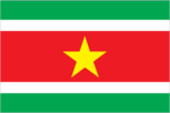
Flag description
five horizontal bands of green (top, double width), white, red (quadruple width), white, and green (double width); a large, yellow, five-pointed star is centered in the red band; red stands for progress and love; green symbolizes hope and fertility; white signifies peace, justice, and freedom; the star represents the unity of all ethnic groups; from its yellow light the nation draws strength to bear sacrifices patiently while working toward a golden future
Government type
constitutional democracy
Independence
25 November 1975 (from the Netherlands)
International law organization participation
accepts compulsory ICJ jurisdiction with reservations; accepts ICCt jurisdiction
International organization participation
ACP, AOSIS, Caricom, CD, CDB, CELAC, FAO, G-77, IADB, IBRD, ICAO, ICCt, ICRM, IDA, IDB, IFAD, IFC, IFRCS, IHO, ILO, IMF, IMO, Interpol, IOC, IOM, IPU, ISO (correspondent), ITU, ITUC (NGOs), LAES, MIGA, NAM, OAS, OIC, OPANAL, OPCW, PCA, Petrocaribe, UN, UNASUR, UNCTAD, UNESCO, UNIDO, UPU, WHO, WIPO, WMO, WTO
Judicial branch
- highest resident court(s)
- High Court of Justice of Suriname (consists of the court president, vice president, and 4 judges); note - Suriname can appeal beyond its High Court to the Caribbean Court of Justice, with final appeal to the Judicial Committee of the Privy Council (in London)
- judge selection and term of office
- court judges appointed by the national president after consultation with the High Court; judges appointed for life
- subordinate courts
- cantonal courts
Legal system
civil law system influenced by Dutch civil law; note - the Commissie Nieuw Surinaamse Burgerlijk Wetboek completed drafting a new civil code in February 2009
Legislative branch
- description
- unicameral National Assembly or Nationale Assemblee (51 seats; members directly elected in multi-seat constituencies by proportional representation vote to serve 5-year terms)
- election results
- percent of vote by party - NDP 45.5%, V7 37.2%, A-Com 10.5%, DOE 4.3%, PALU .7%, other 1.7%; seats by party - NDP 26, V7 18, A-Com 5, DOE 1, PALU 1
- elections
- last held on 25 May 2015 (next to be held in May 2020)
National anthem
- lyrics/music
- Cornelis Atses HOEKSTRA and Henry DE ZIEL/Johannes Corstianus DE PUY
- name
- "God zij met ons Suriname!" (God Be With Our Suriname)
- note
- adopted 1959; originally adapted from a Sunday school song written in 1893 and contains lyrics in both Dutch and Sranang Tongo
National holiday
Independence Day, 25 November (1975)
National symbol(s)
royal palm, faya lobi (flower); national colors: green, white, red, yellow
Political parties and leaders
- Alternative Combination or A-Com (a coalition that includes ABOP, KTPI, PDO)
- Brotherhood and Unity in Politics or BEP [Celsius WATERBERG]
- Democratic Alternative '91 or DA91 [Winston JESSURUN]
- General Liberation and Development Party or ABOP [Ronnie BRUNSWIJK}
- National Democratic Party or NDP [Desire Delano BOUTERSE]
- National Party of Suriname or NPS [Gregory RUSLAND]
- Party for Democracy and Development or PDO [Waldy NAIN]
- Party for Democracy and Development in Unity or DOE [Carl BREEVELD]
- Party for National Unity and Solidarity or KTPI [Willy SOEMITA]
- People's Alliance, Pertjaja Luhur or PL [Paul SOMOHARDJO]
- Progressive Worker and Farmer's Union or PALU [Jim HOK]
- Surinamese Labor Party or SPA [Guno CASTELEN]
- United Reform Party or VHP [Chandrikapersad SANTOKHI]
- Victory 7 or V7 (formerly the New Front for Democracy and Development or NF) (a coalition including NPS, VHP, DA91, PL, SPA) [Chandrikapresad SANTOKHI]
Political pressure groups and leaders
- Association of Indigenous Village Chiefs [Ricardo PANE]
- Association of Saramaccan Authorities or Maroon [Head Captain WASE]
- Women's Parliament Forum or PVF [Iris GILLIAD]
Suffrage
18 years of age; universal
Economy
Agriculture - products
rice, bananas, palm kernels, coconuts, plantains, peanuts; beef, chickens; shrimp; forest products
Budget
- expenditures
- $1.383 billion (2014 est.)
- revenues
- $1.156 billion
Budget surplus (+) or deficit (-)
-4.4% of GDP (2014 est.)
Central bank discount rate
- 10% (2013)
- 9% (2012)
Commercial bank prime lending rate
- 12.28% (31 December 2014 est.)
- 11.99% (31 December 2013 est.)
Current account balance
- -$386 million (2014 est.)
- -$198 million (2013 est.)
Debt - external
- $1.067 billion (31 December 2014 est.)
- $983 million (31 December 2013 est.)
Economy - overview
The economy is dominated by the mining industry, with exports of oil, gold, and alumina accounting for about 85% of exports and 27% of government revenues, making the economy highly vulnerable to mineral price volatility. Economic growth has declined from just under 5% in 2012 and 2013 to 4% in 2014. In January 2011, the government devalued the currency by 20% and raised taxes to reduce the budget deficit. As a result of these measures, inflation receded to less than 4% in 2014. Suriname's economic prospects for the medium term will depend on continued commitment to responsible monetary and fiscal policies and to the introduction of structural reforms to liberalize markets and promote competition. The government's reliance on revenue from extractive industries will temper Suriname's economic outlook, especially if gold prices continue their downward trend.
Exchange rates
- Surinamese dollars (SRD) per US dollar -
- 3.3 (2014 est.)
- 3.3 (2013 est.)
- 3.3 (2012 est.)
- 3.2683 (2011 est.)
- 2.7454 (2010 est.)
Exports
- $2.149 billion (2014 est.)
- $2.395 billion (2013 est.)
Exports - commodities
alumina, gold, crude oil, lumber, shrimp and fish, rice, bananas
Exports - partners
US 32.1%, UAE 16.8%, Belgium 13.4%, Canada 10%, France 6.2%, Netherlands 4.3% (2014)
Fiscal year
calendar year
GDP - composition, by end use
- (2014 est.)
- exports of goods and services
- 26.3%
- government consumption
- 10.7%
- household consumption
- 49.6%
- imports of goods and services
- -28%
- investment in fixed capital
- 11.3%
- investment in inventories
- 30.1%
GDP - composition, by sector of origin
- agriculture
- 6.2%
- industry
- 48.9%
- services
- 44.8% (2014 est.)
GDP - per capita (PPP)
- $16,300 (2014 est.)
- $16,000 (2013 est.)
- $15,500 (2012 est.)
- note
- data are in 2014 US dollars
GDP - real growth rate
- 1.8% (2014 est.)
- 2.8% (2013 est.)
- 3.1% (2012 est.)
GDP (official exchange rate)
$5.21 billion (2014 est.)
GDP (purchasing power parity)
- $8.987 billion (2014 est.)
- $8.825 billion (2013 est.)
- $8.581 billion (2012 est.)
- note
- data are in 2014 US dollars
Gross national saving
- 25.9% of GDP (2014 est.)
- 26% of GDP (2013 est.)
- 30.5% of GDP (2012 est.)
Household income or consumption by percentage share
- highest 10%
- NA%
- lowest 10%
- NA%
Imports
- $1.966 billion (2014 est.)
- $2.126 billion (2013 est.)
Imports - commodities
capital equipment, petroleum, foodstuffs, cotton, consumer goods
Imports - partners
US 31.3%, Netherlands 16.6%, China 10.7%, Trinidad and Tobago 6.9%, Japan 4.2% (2014)
Industrial production growth rate
2.5% (2014 est.)
Industries
bauxite and gold mining, alumina production; oil, lumbering, food processing, fishing
Inflation rate (consumer prices)
- 3.4% (2014 est.)
- 1.9% (2013 est.)
Labor force
165,600 (2007 est.)
Labor force - by occupation
- agriculture
- 11.2%
- industry
- 19.5%
- services
- 69.3% (2010)
Market value of publicly traded shares
$NA
Population below poverty line
70% (2002 est.)
Reserves of foreign exchange and gold
- $625.2 million (31 December 2014 est.)
- $778.8 million (31 December 2013 est.)
Stock of broad money
- $2.885 billion (31 December 2014 est.)
- $2.736 billion (31 December 2013 est.)
Stock of domestic credit
- $2.029 billion (31 December 2014 est.)
- $1.669 billion (31 December 2013 est.)
Stock of narrow money
- $1.409 billion (31 December 2014 est.)
- $1.353 billion (31 December 2013 est.)
Taxes and other revenues
22.2% of GDP (2014 est.)
Unemployment rate
- 8.9% (2014 est.)
- 8.5% (2013 est.)
Energy
Carbon dioxide emissions from consumption of energy
2.268 million Mt (2012 est.)
Crude oil - exports
0 bbl/day (2012 est.)
Crude oil - imports
0 bbl/day (2012 est.)
Crude oil - production
15,000 bbl/day (2014 est.)
Crude oil - proved reserves
88.97 million bbl (1 January 2015 est.)
Electricity - consumption
1.572 billion kWh (2012 est.)
Electricity - exports
0 kWh (2013 est.)
Electricity - from fossil fuels
54.1% of total installed capacity (2012 est.)
Electricity - from hydroelectric plants
45.9% of total installed capacity (2012 est.)
Electricity - from nuclear fuels
0% of total installed capacity (2012 est.)
Electricity - from other renewable sources
0% of total installed capacity (2012 est.)
Electricity - imports
0 kWh (2013 est.)
Electricity - installed generating capacity
412,000 kW (2012 est.)
Electricity - production
1.75 billion kWh (2012 est.)
Natural gas - consumption
0 cu m (2013 est.)
Natural gas - exports
0 cu m (2013 est.)
Natural gas - imports
0 cu m (2013 est.)
Natural gas - production
0 cu m (2013 est.)
Natural gas - proved reserves
0 cu m (1 January 2011 est.)
Refined petroleum products - consumption
17,000 bbl/day (2013 est.)
Refined petroleum products - exports
8,884 bbl/day (2012 est.)
Refined petroleum products - imports
10,070 bbl/day (2012 est.)
Refined petroleum products - production
15,980 bbl/day (2012 est.)
Communications
Broadcast media
2 state-owned TV stations; 1 state-owned radio station; multiple private radio and TV stations (2007)
Internet country code
.sr
Internet users
- percent of population
- 37.1% (2014 est.)
- total
- 212,900
Radio broadcast stations
AM 4, FM 23, shortwave 3 (2008)
Telephone system
- domestic
- combined fixed-line and mobile-cellular teledensity 185 telephones per 100 persons; microwave radio relay network
- general assessment
- international facilities are good
- international
- country code - 597; satellite earth stations - 2 Intelsat (Atlantic Ocean) (2010)
Telephones - fixed lines
- subscriptions per 100 inhabitants
- 15 (2014 est.)
- total subscriptions
- 84,900
Telephones - mobile cellular
- subscriptions per 100 inhabitants
- 162 (2014 est.)
- total
- 927,800
Television broadcast stations
3 (plus 7 repeaters) (2000)
Transportation
Airports
55 (2013)
Airports - with paved runways
- over 3,047 m
- 1
- total
- 6
- under 914 m
- 5 (2013)
Airports - with unpaved runways
- 45 (2013)
- 914 to 1,523 m
- 4
- total
- 49
Pipelines
oil 50 km (2013)
Ports and terminals
- major seaport(s)
- Paramaribo, Wageningen
Roadways
- paved
- 1,130 km
- total
- 4,304 km
- unpaved
- 3,174 km (2003)
Waterways
1,200 km (most navigable by ships with drafts up to 7 m) (2011)
Military and Security
Manpower available for military service
- females age 16-49
- 134,439 (2010 est.)
- males age 16-49
- 134,218
Manpower fit for military service
- females age 16-49
- 112,538 (2010 est.)
- males age 16-49
- 109,445
Manpower reaching militarily significant age annually
- female
- 4,106 (2010 est.)
- male
- 4,119
Military branches
Suriname Armed Forces: Ground Forces, Naval Forces, Air Forces (2010)
Military service age and obligation
18 is the legal minimum age for voluntary military service; no conscription; personnel drawn almost exclusively from the Creole community (2012)
Transnational Issues
Disputes - international
area claimed by French Guiana between Riviere Litani and Riviere Marouini (both headwaters of the Lawa); Suriname claims a triangle of land between the New and Kutari/Koetari rivers in a historic dispute over the headwaters of the Courantyne; Guyana seeks United Nations Convention on the Law of the Sea arbitration to resolve the longstanding dispute with Suriname over the axis of the territorial sea boundary in potentially oil-rich waters
Illicit drugs
growing transshipment point for South American drugs destined for Europe via the Netherlands and Brazil; transshipment point for arms-for-drugs dealing
Trafficking in persons
- current situation
- Suriname is a source and destination country for women, men, and children subjected to sex trafficking and forced labor; women and girls from Suriname, Guyana, Brazil, and the Dominican Republic are subjected to sex trafficking in the country, sometimes in interior mining camps; Surinamese women and girls are also sexually exploited in French Guiana; migrant workers in agriculture and on fishing boats and children working in informal urban sectors and gold mines are vulnerable to forced labor
- tier rating
- Tier 2 Watch List – Suriname does not fully comply with the minimum standards for the elimination of trafficking; however, it is making significant efforts to do so; the government has a written plan that, if implemented, would constitute a significant effort toward meeting the minimum standards for eliminating human trafficking; in 2013, the government prosecuted an increased number of sex trafficking cases but decreased investigations and prosecutions of sex trafficking offenders; authorities failed to investigate, prosecute, or convict labor traffickers; fewer sex trafficking and no forced labor victims were identified; protective services for victims were inadequate, but plans to open a government-run shelter for women and child victims were initiated in 2014; a national strategy to combat human trafficking was also adopted in 2014 (2014)