1998 Edition
CIA World Factbook 1998 (Internet Archive)
Geography
Area
total: 4,066 sq km land: 4,066 sq km water: 0 sq km note: includes Shag Rocks, Clerke Rocks, Bird Island
Area-comparative
slightly larger than Rhode Island
Climate
variable, with mostly westerly winds throughout the year, interspersed with periods of calm; nearly all precipitation falls as snow
Coastline
NA km
Elevation extremes
lowest point: Atlantic Ocean 0 m highest point: Mount Paget 2,915 m
Environment-current issues
NA
Environment-international agreements
party to: NA signed, but not ratified: NA
Geographic coordinates
54 30 S, 37 00 W
Geography-note
the north coast of South Georgia has several large bays, which provide good anchorage; reindeer, introduced early in this century, live on South Georgia
Irrigated land
0 sq km (1993)
Land boundaries
0 km
Land use
arable land: 0% permanent crops: 0% permanent pastures: 0% forests and woodland: 0% other: 100% (largely covered by permanent ice and snow with some sparse vegetation consisting of grass, moss, and lichen)
Location
Southern South America, islands in the South Atlantic Ocean, east of the tip of South America
Map references
Antarctic Region
Maritime claims
exclusive fishing zone: 200 nm territorial sea: 12 nm
Natural hazards
the South Sandwich Islands have prevailing weather conditions that generally make them difficult to approach by ship; they are also subject to active volcanism
Natural resources
fish
Terrain
most of the islands, rising steeply from the sea, are rugged and mountainous; South Georgia is largely barren and has steep, glacier-covered mountains; the South Sandwich Islands are of volcanic origin with some active volcanoes
People and Society
Population
no indigenous population note: there is a small military garrison on South Georgia, and the British Antarctic Survey has a biological station on Bird Island; the South Sandwich Islands are uninhabited
Government
Country name
conventional long form: South Georgia and the South Sandwich Islands conventional short form: none
Data code
SX
Dependency status
dependent territory of the UK, also claimed by Argentina; administered from London by a civil commissioner who is also the governor of the Falkland Islands; Grytviken on South Georgia is the garrison town
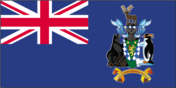
Flag description
the flag of the UK is used
Legal system
NA Diplomatic representation in the US: none (dependent territory of the UK, also claimed by Argentina) Diplomatic representation from the US: none (dependent territory of the UK, also claimed by Argentina)
National capital
none; Grytviken on South Georgia is the garrison town
Economy
Budget
revenues: $291,777 expenditures: $451,000, including capital expenditures of $NA (1988 est.) Communications
Economy-overview
Some fishing takes place in adjacent waters. There is a potential source of income from harvesting fin fish and krill. The islands receive income from postage stamps produced in the UK.
Telephone system
domestic: NA international: coastal radiotelephone station at Grytviken
Transportation
Airports
none
Military and Security
Military-note
defense is the responsibility of the UK
Transnational Issues
Disputes-international
claimed by Argentina