2017 Edition
CIA World Factbook 2017 Archive (HTML)
Introduction
Background
The British set up a trading post near present-day Freetown in the 17th century. Originally the trade involved timber and ivory, but later it expanded into slaves. Following the American Revolution, a colony was established in 1787 and Sierra Leone became a destination for resettling black loyalists who had originally been resettled in Nova Scotia. After the abolition of the slave trade in 1807, British crews delivered thousands of Africans liberated from illegal slave ships to Sierra Leone, particularly Freetown. The colony gradually expanded inland during the course of the 19th century; independence was attained in 1961. Democracy is slowly being reestablished after the civil war (1991-2002) that resulted in tens of thousands of deaths and the displacement of more than 2 million people (about one third of the population). The military, which took over full responsibility for security following the departure of UN peacekeepers at the end of 2005, has developed as a guarantor of the country's stability; the armed forces remained on the sideline during the 2007 and 2012 national elections. In March 2014, the closure of the UN Integrated Peacebuilding Office in Sierra Leone marked the end of more than 15 years of peacekeeping and political operations in Sierra Leone. The government's stated priorities include furthering development - including recovering from the Ebola epidemic - creating jobs, and stamping out endemic corruption.
Geography
Area
- 71,740 sq km 71,620 sq km 120 sq km
- land
- 71,620 sq km
- total
- 71,740 sq km
- water
- 120 sq km
Area - comparative
slightly smaller than South Carolina
Climate
tropical; hot, humid; summer rainy season (May to December); winter dry season (December to April)
Coastline
402 km
Elevation
- 279 m lowest point: Atlantic Ocean 0 m highest point: Loma Mansa (Bintimani) 1,948 m
- elevation extremes
- lowest point: Atlantic Ocean 0 m
- highest point
- Loma Mansa (Bintimani) 1,948 m
- mean elevation
- 279 m
Environment - current issues
rapid population growth pressuring the environment; overharvesting of timber, expansion of cattle grazing, and slash-and-burn agriculture have resulted in deforestation and soil exhaustion; civil war depleted natural resources; overfishing
Environment - international agreements
- Biodiversity, Climate Change, Climate Change-Kyoto Protocol, Desertification, Endangered Species, Law of the Sea, Marine Life Conservation, Ozone Layer Protection, Ship Pollution, Wetlands Environmental Modification
- party to
- Biodiversity, Climate Change, Climate Change-Kyoto Protocol, Desertification, Endangered Species, Law of the Sea, Marine Life Conservation, Ozone Layer Protection, Ship Pollution, Wetlands
- signed, but not ratified
- Environmental Modification
Geographic coordinates
8 30 N, 11 30 W
Geography - note
rainfall along the coast can reach 495 cm (195 inches) a year, making it one of the wettest places along coastal, western Africa
Irrigated land
300 sq km (2012)
Land boundaries
- 1,093 km Guinea 794 km, Liberia 299 km
- border countries (2)
- Guinea 794 km, Liberia 299 km
- total
- 1,093 km
Land use
- 56.2% arable land 23.4%; permanent crops 2.3%; permanent pasture 30.5% 37.5% 6.3% (2011 est.)
- agricultural land
- 56.2%
- forest
- 37.5%
- other
- 6.3% (2011 est.)
Location
Western Africa, bordering the North Atlantic Ocean, between Guinea and Liberia
Map references
Africa
Maritime claims
- 12 nm 24 nm 200 nm 200 nm
- contiguous zone
- 24 nm
- continental shelf
- 200 nm
- exclusive economic zone
- 200 nm
- territorial sea
- 12 nm
Natural hazards
dry, sand-laden harmattan winds blow from the Sahara (December to February); sandstorms, dust storms
Natural resources
diamonds, titanium ore, bauxite, iron ore, gold, chromite
Population - distribution
population clusters are found in the lower elevations of the south and west; the northern third of the country is less populated
Terrain
coastal belt of mangrove swamps, wooded hill country, upland plateau, mountains in east
People and Society
Age structure
- 41.82% (male 1,286,681/female 1,290,924) 18.56% (male 556,478/female 587,454) 32.16% (male 949,264/female 1,032,783) 3.7% (male 106,706/female 121,111) 3.76% (male 96,285/female 135,509) (2017 est.)
- 0-14 years
- 41.82% (male 1,286,681/female 1,290,924)
- 15-24 years
- 18.56% (male 556,478/female 587,454)
- 25-54 years
- 32.16% (male 949,264/female 1,032,783)
- 55-64 years
- 3.7% (male 106,706/female 121,111)
- 65 years and over
- 3.76% (male 96,285/female 135,509) (2017 est.)
Birth rate
36.3 births/1,000 population (2017 est.)
Children under the age of 5 years underweight
18.1% (2013)
Contraceptive prevalence rate
16.6% (2013)
Death rate
10.4 deaths/1,000 population (2017 est.)
Demographic profile
Sierra Leone’s youthful and growing population is driven by its high total fertility rate (TFR) of almost 5 children per woman, which has declined little over the last two decades. Its elevated TFR is sustained by the continued desire for large families, the low level of contraceptive use, and the early start of childbearing. Despite its high TFR, Sierra Leone’s population growth is somewhat tempered by high infant, child, and maternal mortality rates that are among the world’s highest and are a result of poverty, a lack of potable water and sanitation, poor nutrition, limited access to quality health care services, and the prevalence of female genital cutting. Sierra Leone’s large youth cohort – about 60% of the population is under the age of 25 – continues to struggle with high levels of unemployment, which was one of the major causes of the country’s 1991-2002 civil war and remains a threat to stability today. Its estimated 60% youth unemployment rate is attributed to high levels of illiteracy and unskilled labor, a lack of private sector jobs, and low pay. Sierra Leone has been a source of and destination for refugees. Sierra Leone’s civil war internally displaced as many as 2 million people, or almost half the population, and forced almost another half million to seek refuge in neighboring countries (370,000 Sierra Leoneans fled to Guinea and 120,000 to Liberia). The UNHCR has helped almost 180,000 Sierra Leoneans to return home, while more than 90,000 others have repatriated on their own. Of the more than 65,000 Liberians who took refuge in Sierra Leone during their country’s civil war (1989-2003), about 50,000 have been voluntarily repatriated by the UNHCR and others have returned home independently. As of 2015, less than 1,000 Liberians still reside in Sierra Leone.
Dependency ratios
- 82.6 4.6 21.9 (2015 est.)
- elderly dependency ratio
- 4.6
- potential support ratio
- 21.9 (2015 est.)
- total dependency ratio
- 82.6
- youth dependency ratio
- 78
Drinking water source
- urban: 84.9% of population rural: 47.8% of population total: 62.6% of population urban: 15.1% of population rural: 52.2% of population total: 37.4% of population (2015 est.)
- rural
- 52.2% of population
- total
- 37.4% of population (2015 est.)
- urban
- 15.1% of population
Education expenditures
2.7% of GDP (2014)
Ethnic groups
Temne 35%, Mende 31%, Limba 8%, Kono 5%, Kriole 2% (descendants of freed Jamaican slaves who were settled in the Freetown area in the late-18th century; also known as Krio), Mandingo 2%, Loko 2%, other 15% (includes refugees from Liberia's recent civil war, and small numbers of Europeans, Lebanese, Pakistanis, and Indians) (2008 census)
Health expenditures
11.1% of GDP (2014)
HIV/AIDS - adult prevalence rate
1.7% (2016 est.)
HIV/AIDS - deaths
2,800 (2016 est.)
HIV/AIDS - people living with HIV/AIDS
67,000 (2016 est.)
Hospital bed density
0.4 beds/1,000 population (2006)
Infant mortality rate
- 68.4 deaths/1,000 live births 76.6 deaths/1,000 live births 59.8 deaths/1,000 live births (2017 est.)
- female
- 59.8 deaths/1,000 live births (2017 est.)
- male
- 76.6 deaths/1,000 live births
- total
- 68.4 deaths/1,000 live births
Languages
English (official, regular use limited to literate minority), Mende (principal vernacular in the south), Temne (principal vernacular in the north), Krio (English-based Creole, spoken by the descendants of freed Jamaican slaves who were settled in the Freetown area, a lingua franca and a first language for 10% of the population but understood by 95%)
Life expectancy at birth
- 58.6 years 56 years 61.3 years (2017 est.)
- female
- 61.3 years (2017 est.)
- male
- 56 years
- total population
- 58.6 years
Literacy
- age 15 and over can read and write English, Mende, Temne, or Arabic 48.1% 58.7% 37.7% (2015 est.)
- definition
- age 15 and over can read and write English, Mende, Temne, or Arabic
- female
- 37.7% (2015 est.)
- male
- 58.7%
- total population
- 48.1%
Major infectious diseases
- very high bacterial and protozoal diarrhea, hepatitis A, and typhoid fever malaria, dengue fever, and yellow fever schistosomiasis rabies Lassa fever (2016)
- aerosolized dust or soil contact disease
- Lassa fever (2016)
- animal contact disease
- rabies
- degree of risk
- very high
- food or waterborne diseases
- bacterial and protozoal diarrhea, hepatitis A, and typhoid fever
- vectorborne diseases
- malaria, dengue fever, and yellow fever
- water contact disease
- schistosomiasis
Major urban areas - population
FREETOWN (capital) 1.007 million (2015)
Maternal mortality rate
1,360 deaths/100,000 live births (2015 est.)
Median age
- 19 years 18.4 years 19.6 years (2017 est.)
- female
- 19.6 years (2017 est.)
- male
- 18.4 years
- total
- 19 years
Mother's mean age at first birth
- 19.2 years median age at first birth among women 25-29 (2013 est.)
- note
- median age at first birth among women 25-29 (2013 est.)
Nationality
- Sierra Leonean(s) Sierra Leonean
- adjective
- Sierra Leonean
- noun
- Sierra Leonean(s)
Net migration rate
-2.1 migrant(s)/1,000 population (2017 est.)
Obesity - adult prevalence rate
8.7% (2016)
Physicians density
0.02 physicians/1,000 population (2010)
Population
6,163,195 (July 2017 est.)
Population distribution
population clusters are found in the lower elevations of the south and west; the northern third of the country is less populated
Population growth rate
2.38% (2017 est.)
Religions
Muslim 60%, indigenous beliefs 30%, Christian 10%
Sanitation facility access
- urban: 22.8% of population rural: 6.9% of population total: 13.3% of population urban: 77.2% of population rural: 93.1% of population total: 86.7% of population (2015 est.)
- rural
- 93.1% of population
- total
- 86.7% of population (2015 est.)
- urban
- 77.2% of population
Sex ratio
- 1.03 male(s)/female 1 male(s)/female 0.94 male(s)/female 0.92 male(s)/female 0.86 male(s)/female 0.73 male(s)/female 0.95 male(s)/female (2016 est.)
- 0-14 years
- 1 male(s)/female
- 15-24 years
- 0.94 male(s)/female
- 25-54 years
- 0.92 male(s)/female
- 55-64 years
- 0.86 male(s)/female
- 65 years and over
- 0.73 male(s)/female
- at birth
- 1.03 male(s)/female
- total population
- 0.95 male(s)/female (2016 est.)
Total fertility rate
4.73 children born/woman (2017 est.)
Urbanization
- 40.7% of total population (2017) 2.72% annual rate of change (2015-20 est.)
- rate of urbanization
- 2.72% annual rate of change (2015-20 est.)
- urban population
- 40.7% of total population (2017)
Government
Administrative divisions
3 provinces and 1 area*; Eastern, Northern, Southern, Western*
Capital
- Freetown 8 29 N, 13 14 W UTC 0 (5 hours ahead of Washington, DC, during Standard Time)
- geographic coordinates
- 8 29 N, 13 14 W
- name
- Freetown
- time difference
- UTC 0 (5 hours ahead of Washington, DC, during Standard Time)
Citizenship
- no at least one parent or grandparent must be a citizen of Sierra Leone yes 5 years
- citizenship by birth
- no
- citizenship by descent only
- at least one parent or grandparent must be a citizen of Sierra Leone
- dual citizenship recognized
- yes
- residency requirement for naturalization
- 5 years
Constitution
- several previous; latest effective 1 October 1991 proposed by Parliament; passage of amendments requires at least two-thirds majority vote of Parliament in two successive readings and assent by the president of the republic; passage of amendments affecting fundamental rights and freedoms and many other constitutional sections also requires approval in a referendum with participation of at least one-half of qualified voters and at least two-thirds of votes cast; amended several times, last in 2013 (2017)
- amendments
- proposed by Parliament; passage of amendments requires at least two-thirds majority vote of Parliament in two successive readings and assent by the president of the republic; passage of amendments affecting fundamental rights and freedoms and many other constitutional sections also requires approval in a referendum with participation of at least one-half of qualified voters and at least two-thirds of votes cast; amended several times, last in 2013 (2017)
- history
- several previous; latest effective 1 October 1991
Country name
- Republic of Sierra Leone Sierra Leone Republic of Sierra Leone Sierra Leone the Portuguese explorer Pedro de SINTRA named the country "Serra Leoa" (Lion Mountains) for the impressive mountains he saw while sailing the West African coast in 1462
- conventional long form
- Republic of Sierra Leone
- conventional short form
- Sierra Leone
- etymology
- the Portuguese explorer Pedro de SINTRA named the country "Serra Leoa" (Lion Mountains) for the impressive mountains he saw while sailing the West African coast in 1462
- local long form
- Republic of Sierra Leone
- local short form
- Sierra Leone
Diplomatic representation from the US
- Ambassador Maria E. BREWER (since 20 December 2017) Southridge-Hill Station, Freetown use embassy street address [232] 99 1055 00 [232] 99 515 355
- chief of mission
- Ambassador Maria E. BREWER (since 20 December 2017)
- embassy
- Southridge-Hill Station, Freetown
- FAX
- [232] 99 515 355
- mailing address
- use embassy street address
- telephone
- [232] 99 1055 00
Diplomatic representation in the US
- Ambassador Bockari Kortu STEVENS (since 4 April 2008) 1701 19th Street NW, Washington, DC 20009 [1] (202) 939-9261 through 9263 [1] (202) 483-1793
- chancery
- 1701 19th Street NW, Washington, DC 20009
- chief of mission
- Ambassador Bockari Kortu STEVENS (since 4 April 2008)
- FAX
- [1] (202) 483-1793
- telephone
- [1] (202) 939-9261 through 9263
Executive branch
- President Ernest Bai KOROMA (since 17 September 2007); note - the president is both chief of state and head of government President Ernest Bai KOROMA (since 17 September 2007) Ministers of State appointed by the president, approved by Parliament; the cabinet is responsible to the president president directly elected by absolute majority popular vote in 2 rounds if needed for a 5-year term (eligible for a second term); election last held on 17 November 2012 (next to be on 7 March 2018) Ernest Bai KOROMA reelected president; percent of vote - Ernest Bai KOROMA (APC) 58.7%, Julius Maada BIO (SLPP) 37.4%, other 3.9%
- cabinet
- Ministers of State appointed by the president, approved by Parliament; the cabinet is responsible to the president
- chief of state
- President Ernest Bai KOROMA (since 17 September 2007); note - the president is both chief of state and head of government
- election results
- Ernest Bai KOROMA reelected president; percent of vote - Ernest Bai KOROMA (APC) 58.7%, Julius Maada BIO (SLPP) 37.4%, other 3.9%
- elections/appointments
- president directly elected by absolute majority popular vote in 2 rounds if needed for a 5-year term (eligible for a second term); election last held on 17 November 2012 (next to be on 7 March 2018)
- head of government
- President Ernest Bai KOROMA (since 17 September 2007)
Flag description
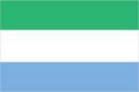
three equal horizontal bands of light green (top), white, and light blue; green symbolizes agriculture, mountains, and natural resources, white represents unity and justice, and blue the sea and the natural harbor in Freetown
Government type
presidential republic
Independence
27 April 1961 (from the UK)
International law organization participation
has not submitted an ICJ jurisdiction declaration; accepts ICCt jurisdiction
International organization participation
ACP, AfDB, AU, C, ECOWAS, EITI (compliant country), FAO, G-77, IAEA, IBRD, ICAO, ICCt, ICRM, IDA, IDB, IFAD, IFC, IFRCS, IHO (pending member), ILO, IMF, IMO, Interpol, IOC, IOM, IPU, ISO (correspondent), ITU, ITUC (NGOs), MIGA, MINUSMA, NAM, OIC, OPCW, UN, UNAMID, UNCTAD, UNESCO, UNIDO, UNIFIL, UNISFA, UNWTO, UPU, WCO, WFTU (NGOs), WHO, WIPO, WMO, WTO
Judicial branch
- Superior Court of Judicature (consists of the Supreme Court - at the apex - with the chief justice and 4 other judges, the Court of Appeal with the chief justice and 7 other judges, and the High Court of Justice with the chief justice and 9 other judges; note – the Judicature has jurisdiction in all civil, criminal, and constitutional matters Supreme Court chief justice and other judges of the Judicature appointed by the president on the advice of the Judicial and Legal Service Commission (a 7-member independent body of judges, presidential appointees, and the Commission chairman) and are subject to the approval of Parliament; all Judicature judges appointed until retirement at age 65 magistrates' courts; District Appeals Court; local courts
- highest court(s)
- Superior Court of Judicature (consists of the Supreme Court - at the apex - with the chief justice and 4 other judges, the Court of Appeal with the chief justice and 7 other judges, and the High Court of Justice with the chief justice and 9 other judges; note – the Judicature has jurisdiction in all civil, criminal, and constitutional matters
- judge selection and term of office
- Supreme Court chief justice and other judges of the Judicature appointed by the president on the advice of the Judicial and Legal Service Commission (a 7-member independent body of judges, presidential appointees, and the Commission chairman) and are subject to the approval of Parliament; all Judicature judges appointed until retirement at age 65
- subordinate courts
- magistrates' courts; District Appeals Court; local courts
Legal system
mixed legal system of English common law and customary law
Legislative branch
- unicameral Parliament (124 seats; 112 members directly elected in single-seat constituencies by simple majority vote and 12 seats filled in separate elections by non-partisan members of Parliament called "paramount chiefs;" members serve 5-year terms) last held on 17 November 2012 (next to be held on 7 March 2018) percent of vote by party - APC 53.7%, SLPP 38.3%, other 8.0%; seats by party - APC 67, SLPP 42
- description
- unicameral Parliament (124 seats; 112 members directly elected in single-seat constituencies by simple majority vote and 12 seats filled in separate elections by non-partisan members of Parliament called "paramount chiefs;" members serve 5-year terms)
- election results
- percent of vote by party - APC 53.7%, SLPP 38.3%, other 8.0%; seats by party - APC 67, SLPP 42
- elections
- last held on 17 November 2012 (next to be held on 7 March 2018)
National anthem
- "High We Exalt Thee, Realm of the Free" Clifford Nelson FYLE/John Joseph AKA adopted 1961
- lyrics/music
- Clifford Nelson FYLE/John Joseph AKA
- name
- "High We Exalt Thee, Realm of the Free"
- note
- adopted 1961
National holiday
Independence Day, 27 April (1961)
National symbol(s)
- lion; national colors: green, white, blue
- lion; national colors
- green, white, blue
Political parties and leaders
All People's Congress or APC [Ernest Bai KOROMA] Sierra Leone People's Party or SLPP [Sumanoh KAPEN] numerous other parties
Political pressure groups and leaders
student unions; trade unions
Suffrage
18 years of age; universal
Economy
Agriculture - products
rice, coffee, cocoa, palm kernels, palm oil, peanuts, cashews; poultry, cattle, sheep, pigs; fish
Budget
- $574.7 million $877.4 million (2016 est.)
- expenditures
- $877.4 million (2016 est.)
- revenues
- $574.7 million
Budget surplus (+) or deficit (-)
-7.6% of GDP (2016 est.)
Central bank discount rate
NA%
Commercial bank prime lending rate
18% (31 December 2016 est.) 18.73% (31 December 2015 est.)
Current account balance
$-733 million (2016 est.) $-744.8 million (2015 est.)
Debt - external
$1.503 billion (31 December 2016 est.) $1.378 billion (31 December 2015 est.)
Distribution of family income - Gini index
34 (2011) 62.9 (1989)
Economy - overview
Sierra Leone is extremely poor and nearly half of the working-age population engages in subsistence agriculture. The country possesses substantial mineral, agricultural, and fishery resources, but it is still recovering from a civil war that destroyed most institutions before ending in the early 2000s. In recent years, economic growth has been driven by mining - particularly iron ore. The country’s principal exports are iron ore, diamonds, and rutile, and the economy is vulnerable to fluctuations in international prices. Until 2014, the government had relied on external assistance to support its budget, but it was gradually becoming more independent. The Ebola outbreak of 2014 and 2015, combined with falling global commodities prices, caused a significant contraction of economic activity in all areas. While the World Health Organization declared an end to the Ebola outbreak in Sierra Leone in November 2015, low commodity prices in 2015-2016 contributed to the country’s biggest fiscal shortfall since 2001. In 2017, increased iron ore exports are expected to support modest economic growth. Non-mining activities will remain constrained by inadequate infrastructure, such as power and roads, even though power sector projects may provide some additional electricity capacity in the near term. Continued economic growth will depend on rising commodities prices and increased efforts to diversify the sources of growth. Pervasive corruption and undeveloped human capital will continue to deter foreign investors. Sustained international donor support in the near future will partially offset these fiscal constraints.
Exchange rates
leones (SLL) per US dollar - 6,289.9 (2016 est.) 6,289.9 (2015 est.) 5,080.8 (2014 est.) 4,524.2 (2013 est.) 4,344 (2012 est.)
Exports
$670 million (2016 est.) $581 million (2015 est.)
Exports - commodities
iron ore, diamonds, rutile, cocoa, coffee, fish
Exports - partners
Cote dIvoire 31.7%, US 28.3%, Belgium 17.7%, China 6.6% (2016)
Fiscal year
calendar year
GDP - composition, by end use
- 102.2% 10.4% 16.8% 1% 23.5% -53.9% (2016 est.)
- exports of goods and services
- 23.5%
- government consumption
- 10.4%
- household consumption
- 102.2%
- imports of goods and services
- -53.9% (2016 est.)
- investment in fixed capital
- 16.8%
- investment in inventories
- 1%
GDP - composition, by sector of origin
- 61.4% 5.9% 32.7% (2016 est.)
- agriculture
- 61.4%
- industry
- 5.9%
- services
- 32.7% (2016 est.)
GDP - per capita (PPP)
- $1,700 (2016 est.) $1,600 (2015 est.) $2,100 (2014 est.) data are in 2016 dollars
- note
- data are in 2016 dollars
GDP - real growth rate
6.1% (2016 est.) -20.5% (2015 est.) 4.6% (2014 est.)
GDP (official exchange rate)
$3.716 billion (2016 est.)
GDP (purchasing power parity)
- $10.9 billion (2016 est.) $10.14 billion (2015 est.) $12.62 billion (2014 est.) data are in 2016 dollars
- note
- data are in 2016 dollars
Gross national saving
-9.3% of GDP (2016 est.) -5.9% of GDP (2015 est.) -7.2% of GDP (2014 est.)
Household income or consumption by percentage share
- 2.6% 33.6% (2003)
- highest 10%
- 33.6% (2003)
- lowest 10%
- 2.6%
Imports
$1.316 billion (2016 est.) $1.347 billion (2015 est.)
Imports - commodities
foodstuffs, machinery and equipment, fuels and lubricants, chemicals
Imports - partners
China 12.5%, US 9.7%, India 7.8%, UAE 7.2%, Senegal 6.2%, Belgium 5.5%, Turkey 5.5%, UK 4.7% (2016)
Industrial production growth rate
26.2% (2016 est.)
Industries
diamond mining; iron ore, rutile and bauxite mining; small-scale manufacturing (beverages, textiles, footwear)
Inflation rate (consumer prices)
11.5% (2016 est.) 6.7% (2015 est.)
Labor force
2.863 million (2016 est.)
Labor force - by occupation
- 61.1% 5.5% 33.4% (2014 est.)
- agriculture
- 61.1%
- industry
- 5.5%
- services
- 33.4% (2014 est.)
Market value of publicly traded shares
$NA
Population below poverty line
70.2% (2004 est.)
Public debt
54.9% of GDP (2016 est.) 45.7% of GDP (2015 est.)
Stock of broad money
$847.2 million (31 December 2016 est.) $917.2 million (31 December 2015 est.)
Stock of direct foreign investment - abroad
$9.7 million (31 December 2015 est.) $6.7 million (31 December 2014 est.)
Stock of direct foreign investment - at home
$1.832 billion (31 December 2016 est.) $1.499 billion (31 December 2015 est.)
Stock of domestic credit
$527.6 million (31 December 2016 est.) $569.4 million (31 December 2015 est.)
Stock of narrow money
$381.8 million (31 December 2016 est.) $457.4 million (31 December 2015 est.)
Taxes and other revenues
14.4% of GDP (2016 est.)
Unemployment rate
9.1% (2014 est.)
Energy
Carbon dioxide emissions from consumption of energy
1.4 million Mt (2013 est.)
Crude oil - exports
0 bbl/day (2014 est.)
Crude oil - imports
0 bbl/day (2014 est.)
Crude oil - production
0 bbl/day (2016 est.)
Crude oil - proved reserves
0 bbl (1 January 2017 es)
Electricity - consumption
162.8 million kWh (2015 est.)
Electricity - exports
0 kWh (2016 est.)
Electricity - from fossil fuels
33.3% of total installed capacity (2015 est.)
Electricity - from hydroelectric plants
66.7% of total installed capacity (2015 est.)
Electricity - from nuclear fuels
0% of total installed capacity (2015 est.)
Electricity - from other renewable sources
0% of total installed capacity (2015 est.)
Electricity - imports
0 kWh (2016 est.)
Electricity - installed generating capacity
81,000 kW (2015 est.)
Electricity - production
175 million kWh (2015 est.)
Electricity access
- 5,800,000 5% 11% 1% (2013)
- electrification - rural areas
- 1% (2013)
- electrification - total population
- 5%
- electrification - urban areas
- 11%
- population without electricity
- 5,800,000
Natural gas - consumption
0 cu m (2013 est.)
Natural gas - exports
0 cu m (2013 est.)
Natural gas - imports
0 cu m (2013 est.)
Natural gas - production
0 cu m (2013 est.)
Natural gas - proved reserves
0 cu m (1 January 2014 es)
Refined petroleum products - consumption
7,500 bbl/day (2015 est.)
Refined petroleum products - exports
0 bbl/day (2014 est.)
Refined petroleum products - imports
7,354 bbl/day (2014 est.)
Refined petroleum products - production
0 bbl/day (2014 est.)
Communications
Broadcast media
1 government-owned TV station; 3 private TV stations; a pay-TV service began operations in late 2007; 1 government-owned national radio station; about two-dozen private radio stations primarily clustered in major cities; transmissions of several international broadcasters are available (2016)
Internet country code
.sl
Internet users
- 708,615 11.8% (July 2016 est.)
- percent of population
- 11.8% (July 2016 est.)
- total
- 708,615
Telephone system
- telephone service improving with the expansion of the mobile sector the national microwave radio relay trunk system connects Freetown to Bo and Kenema; mobile-cellular service has grown rapidly from a small base, overcoming the deficiencies of the fixed-line sector country code - 232; satellite earth station - 1 Intelsat (Atlantic Ocean) (2016)
- domestic
- the national microwave radio relay trunk system connects Freetown to Bo and Kenema; mobile-cellular service has grown rapidly from a small base, overcoming the deficiencies of the fixed-line sector
- general assessment
- telephone service improving with the expansion of the mobile sector
- international
- country code - 232; satellite earth station - 1 Intelsat (Atlantic Ocean) (2016)
Telephones - fixed lines
- 17,000 less than 1 (July 2016 est.)
- subscriptions per 100 inhabitants
- less than 1 (July 2016 est.)
- total subscriptions
- 17,000
Telephones - mobile cellular
- 6,279,270 104 (July 2016 est.)
- subscriptions per 100 inhabitants
- 104 (July 2016 est.)
- total
- 6,279,270
Transportation
Airports
8 (2013)
Airports - with paved runways
- 1 (2017)
- over 3,047 m
- 1 (2017)
- total
- 1
Airports - with unpaved runways
- 7 (2013)
- 914 to 1,523 m
- 7 (2013)
- total
- 7
Civil aircraft registration country code prefix
9L (2016)
Heliports
2 (2013)
Merchant marine
- bulk carrier 22, cargo 120, carrier 2, chemical tanker 19, container 6, liquefied gas 3, passenger/cargo 2, petroleum tanker 28, refrigerated cargo 7, roll on/roll off 4, specialized tanker 1, vehicle carrier 1 98 (Bangladesh 1, China 19, Cyprus 2, Egypt 3, Estonia 2, Hong Kong 7, Japan 4, Lebanon 2, North Korea 2, Romania 2, Russia 7, Singapore 9, Syria 13, Taiwan 7, Turkey 9, UAE 1, UK 1, Ukraine 5, Yemen 2) (2010)
- by type
- bulk carrier 22, cargo 120, carrier 2, chemical tanker 19, container 6, liquefied gas 3, passenger/cargo 2, petroleum tanker 28, refrigerated cargo 7, roll on/roll off 4, specialized tanker 1, vehicle carrier 1
- foreign-owned
- 98 (Bangladesh 1, China 19, Cyprus 2, Egypt 3, Estonia 2, Hong Kong 7, Japan 4, Lebanon 2, North Korea 2, Romania 2, Russia 7, Singapore 9, Syria 13, Taiwan 7, Turkey 9, UAE 1, UK 1, Ukraine 5, Yemen 2) (2010)
- total
- 215
National air transport system
- 50,193 0 mt-km (2015)
- annual freight traffic on registered air carriers
- 0 mt-km (2015)
- annual passenger traffic on registered air carriers
- 50,193
Ports and terminals
- Freetown, Pepel, Sherbro Islands
- major seaport(s)
- Freetown, Pepel, Sherbro Islands
Roadways
- 11,300 km 904 km 10,396 km (2002)
- paved
- 904 km
- total
- 11,300 km
- unpaved
- 10,396 km (2002)
Waterways
800 km (600 km navigable year-round) (2011)
Military and Security
Military branches
- Republic of Sierra Leone Armed Forces (RSLAF): Army (includes Maritime Wing and Air Wing) (2013)
- Republic of Sierra Leone Armed Forces (RSLAF)
- Army (includes Maritime Wing and Air Wing) (2013)
Military expenditures
0.81% of GDP (2016) 0.92% of GDP (2015) 0.97% of GDP (2014) 0.64% of GDP (2013) 0.78% of GDP (2012)
Military service age and obligation
18 is the legal minimum age for voluntary military service (younger with parental consent); women are eligible to serve; no conscription; candidates must be HIV negative (2012)
Transnational Issues
Disputes - international
Sierra Leone opposes Guinean troops' continued occupation of Yenga, a small village on the Makona River that serves as a border with Guinea; Guinea's forces came to Yenga in the mid-1990s to help the Sierra Leonean military to suppress rebels and to secure their common border but have remained there even after both countries signed a 2005 agreement acknowledging that Yenga belonged to Sierra Leone; in 2012, the two sides signed a declaration to demilitarize the area