2016 Edition
CIA World Factbook 2016 Archive (HTML)
Introduction
Background
Ancient Peru was the seat of several prominent Andean civilizations, most notably that of the Incas whose empire was captured by Spanish conquistadors in 1533. Peru declared its independence in 1821, and remaining Spanish forces were defeated in 1824. After a dozen years of military rule, Peru returned to democratic leadership in 1980, but experienced economic problems and the growth of a violent insurgency. President Alberto FUJIMORI's election in 1990 ushered in a decade that saw a dramatic turnaround in the economy and significant progress in curtailing guerrilla activity. Nevertheless, the president's increasing reliance on authoritarian measures and an economic slump in the late 1990s generated mounting dissatisfaction with his regime, which led to his resignation in 2000. A caretaker government oversaw a new election in the spring of 2001, which installed Alejandro TOLEDO Manrique as the new head of government - Peru's first democratically elected president of indigenous ethnicity. The presidential election of 2006 saw the return of Alan GARCIA Perez who, after a disappointing presidential term from 1985 to 1990, oversaw a robust economic rebound. Former army officer Ollanta HUMALA Tasso was elected president in June 2011, and carried on the sound, market-oriented economic policies of the three preceding administrations. Poverty and unemployment levels have fallen dramatically in the last decade, and today Peru boasts one of the best performing economies in Latin America. Pedro Pablo KUCZYNSKI Godard won a very narrow presidential runoff election in June 2016.
Geography
Area
- 1,285,216 sq km 1,279,996 sq km 5,220 sq km
- land
- 1,279,996 sq km
- total
- 1,285,216 sq km
- water
- 5,220 sq km
Area - comparative
almost twice the size of Texas; slightly smaller than Alaska
Climate
varies from tropical in east to dry desert in west; temperate to frigid in Andes
Coastline
2,414 km
Elevation
- 1,555 m lowest point: Pacific Ocean 0 m highest point: Nevado Huascaran 6,768 m
- elevation extremes
- lowest point: Pacific Ocean 0 m
- highest point
- Nevado Huascaran 6,768 m
- mean elevation
- 1,555 m
Environment - current issues
deforestation (some the result of illegal logging); overgrazing of the slopes of the costa and sierra leading to soil erosion; desertification; air pollution in Lima; pollution of rivers and coastal waters from municipal and mining wastes
Environment - international agreements
- Antarctic-Environmental Protocol, Antarctic-Marine Living Resources, Antarctic Treaty, Biodiversity, Climate Change, Climate Change-Kyoto Protocol, Desertification, Endangered Species, Hazardous Wastes, Marine Dumping, Ozone Layer Protection, Ship Pollution, Tropical Timber 83, Tropical Timber 94, Wetlands, Whaling none of the selected agreements
- party to
- Antarctic-Environmental Protocol, Antarctic-Marine Living Resources, Antarctic Treaty, Biodiversity, Climate Change, Climate Change-Kyoto Protocol, Desertification, Endangered Species, Hazardous Wastes, Marine Dumping, Ozone Layer Protection, Ship Pollution, Tropical Timber 83, Tropical Timber 94, Wetlands, Whaling
- signed, but not ratified
- none of the selected agreements
Geographic coordinates
10 00 S, 76 00 W
Geography - note
shares control of Lago Titicaca, world's highest navigable lake, with Bolivia; a remote slope of Nevado Mismi, a 5,316 m peak, is the ultimate source of the Amazon River
Irrigated land
25,800 sq km (2012)
Land boundaries
- 7,062 km Bolivia 1,212 km, Brazil 2,659 km, Chile 168 km, Colombia 1,494 km, Ecuador 1,529 km
- border countries (5)
- Bolivia 1,212 km, Brazil 2,659 km, Chile 168 km, Colombia 1,494 km, Ecuador 1,529 km
- total
- 7,062 km
Land use
- 18.8% arable land 3.1%; permanent crops 1.1%; permanent pasture 14.6% 53% 28.2% (2011 est.)
- agricultural land
- 18.8%
- forest
- 53%
- other
- 28.2% (2011 est.)
Location
Western South America, bordering the South Pacific Ocean, between Chile and Ecuador
Map references
South America
Maritime claims
- 200 nm 200 nm
- continental shelf
- 200 nm
- territorial sea
- 200 nm
Natural hazards
- earthquakes, tsunamis, flooding, landslides, mild volcanic activity volcanic activity in the Andes Mountains; Ubinas (elev. 5,672 m), which last erupted in 2009, is the country's most active volcano; other historically active volcanoes include El Misti, Huaynaputina, Sabancaya, and Yucamane
- volcanism
- volcanic activity in the Andes Mountains; Ubinas (elev. 5,672 m), which last erupted in 2009, is the country's most active volcano; other historically active volcanoes include El Misti, Huaynaputina, Sabancaya, and Yucamane
Natural resources
copper, silver, gold, petroleum, timber, fish, iron ore, coal, phosphate, potash, hydropower, natural gas
Population - distribution
approximately one-third of the population resides along the desert coastal belt in the west, with a strong focus on the capital city of Lima; the Andean highlands, or sierra, which is strongly identified with the country's Amerindian population, contains roughly half of the overall population; the eastern slopes of the Andes, and adjoining rainforest, are sparsely populated
Terrain
western coastal plain (costa), high and rugged Andes in center (sierra), eastern lowland jungle of Amazon Basin (selva)
People and Society
Age structure
- 26.62% (male 4,164,681/female 4,019,436) 18.63% (male 2,868,743/female 2,859,476) 39.91% (male 5,892,065/female 6,377,681) 7.62% (male 1,135,938/female 1,205,579) 7.21% (male 1,049,409/female 1,168,054) (2016 est.)
- 0-14 years
- 26.62% (male 4,164,681/female 4,019,436)
- 15-24 years
- 18.63% (male 2,868,743/female 2,859,476)
- 25-54 years
- 39.91% (male 5,892,065/female 6,377,681)
- 55-64 years
- 7.62% (male 1,135,938/female 1,205,579)
- 65 years and over
- 7.21% (male 1,049,409/female 1,168,054) (2016 est.)
Birth rate
18 births/1,000 population (2016 est.)
Child labor - children ages 5-14
- 2,545,855 34% data represents children ages 5-17 (2007 est.)
- note
- data represents children ages 5-17 (2007 est.)
- percentage
- 34%
- total number
- 2,545,855
Children under the age of 5 years underweight
3.1% (2014)
Contraceptive prevalence rate
75.5% (2012)
Death rate
6 deaths/1,000 population (2016 est.)
Demographic profile
Peru's urban and coastal communities have benefited much more from recent economic growth than rural, Afro-Peruvian, indigenous, and poor populations of the Amazon and mountain regions. The poverty rate has dropped substantially during the last decade but remains stubbornly high at about 30% (more than 55% in rural areas). After remaining almost static for about a decade, Peru's malnutrition rate began falling in 2005, when the government introduced a coordinated strategy focusing on hygiene, sanitation, and clean water. School enrollment has improved, but achievement scores reflect ongoing problems with educational quality. Many poor children temporarily or permanently drop out of school to help support their families. About a quarter to a third of Peruvian children aged 6 to 14 work, often putting in long hours at hazardous mining or construction sites. Peru was a country of immigration in the 19th and early 20th centuries, but has become a country of emigration in the last few decades. Beginning in the 19th century, Peru brought in Asian contract laborers mainly to work on coastal plantations. Populations of Chinese and Japanese descent - among the largest in Latin America - are economically and culturally influential in Peru today. Peruvian emigration began rising in the 1980s due to an economic crisis and a violent internal conflict, but outflows have stabilized in the last few years as economic conditions have improved. Nonetheless, more than 2 million Peruvians have emigrated in the last decade, principally to the US, Spain, and Argentina.
Dependency ratios
- 53.2% 42.7% 10.5% 9.6% (2015 est.)
- elderly dependency ratio
- 10.5%
- potential support ratio
- 9.6% (2015 est.)
- total dependency ratio
- 53.2%
- youth dependency ratio
- 42.7%
Drinking water source
- urban: 91.4% of population rural: 69.2% of population total: 86.7% of population urban: 8.6% of population rural: 30.8% of population total: 13.3% of population (2015 est.)
- rural
- 30.8% of population
- total
- 13.3% of population (2015 est.)
- urban
- 8.6% of population
Education expenditures
3.7% of GDP (2014)
Ethnic groups
Amerindian 45%, mestizo (mixed Amerindian and white) 37%, white 15%, black, Japanese, Chinese, and other 3%
Health expenditures
5.5% of GDP (2014)
HIV/AIDS - adult prevalence rate
0.33% (2015 est.)
HIV/AIDS - deaths
1,600 (2015 est.)
HIV/AIDS - people living with HIV/AIDS
66,200 (2015 est.)
Hospital bed density
1.5 beds/1,000 population (2012)
Infant mortality rate
- 19 deaths/1,000 live births 21.1 deaths/1,000 live births 16.7 deaths/1,000 live births (2016 est.)
- female
- 16.7 deaths/1,000 live births (2016 est.)
- male
- 21.1 deaths/1,000 live births
- total
- 19 deaths/1,000 live births
Languages
Spanish (official) 84.1%, Quechua (official) 13%, Aymara (official) 1.7%, Ashaninka 0.3%, other native languages (includes a large number of minor Amazonian languages) 0.7%, other (includes foreign languages and sign language) 0.2% (2007 est.)
Life expectancy at birth
- 73.7 years 71.7 years 75.9 years (2016 est.)
- female
- 75.9 years (2016 est.)
- male
- 71.7 years
- total population
- 73.7 years
Literacy
- age 15 and over can read and write 94.5% 97.3% 91.7% (2015 est.)
- definition
- age 15 and over can read and write
- female
- 91.7% (2015 est.)
- male
- 97.3%
- total population
- 94.5%
Major infectious diseases
- very high bacterial diarrhea, hepatitis A, and typhoid fever dengue fever, malaria, and Bartonellosis (Oroya fever) active local transmission of Zika virus by Aedes species mosquitoes has been identified in this country (as of August 2016); it poses an important risk (a large number of cases possible) among US citizens if bitten by an infective mosquito; other less common ways to get Zika are through sex, via blood transfusion, or during pregnancy, in which the pregnant woman passes Zika virus to her fetus (2016)
- degree of risk
- very high
- food or waterborne diseases
- bacterial diarrhea, hepatitis A, and typhoid fever
- note
- active local transmission of Zika virus by Aedes species mosquitoes has been identified in this country (as of August 2016); it poses an important risk (a large number of cases possible) among US citizens if bitten by an infective mosquito; other less common ways to get Zika are through sex, via blood transfusion, or during pregnancy, in which the pregnant woman passes Zika virus to her fetus (2016)
- vectorborne disease
- dengue fever, malaria, and Bartonellosis (Oroya fever)
Major urban areas - population
LIMA (capital) 9.897 million; Arequipa 850,000; Trujillo 798,000 (2015)
Maternal mortality rate
68 deaths/100,000 live births (2015 est.)
Median age
- 27.7 years 26.9 years 28.4 years (2016 est.)
- female
- 28.4 years (2016 est.)
- male
- 26.9 years
- total
- 27.7 years
Mother's mean age at first birth
- 22.2 median age at first birth among women 25-29 (2013 est.)
- note
- median age at first birth among women 25-29 (2013 est.)
Nationality
- Peruvian(s) Peruvian
- adjective
- Peruvian
- noun
- Peruvian(s)
Net migration rate
-2.4 migrant(s)/1,000 population (2016 est.)
Obesity - adult prevalence rate
20.4% (2014)
Physicians density
1.13 physicians/1,000 population (2012)
Population
30,741,062 (July 2016 est.)
Population distribution
approximately one-third of the population resides along the desert coastal belt in the west, with a strong focus on the capital city of Lima; the Andean highlands, or sierra, which is strongly identified with the country's Amerindian population, contains roughly half of the overall population; the eastern slopes of the Andes, and adjoining rainforest, are sparsely populated
Population growth rate
0.96% (2016 est.)
Religions
Roman Catholic 81.3%, Evangelical 12.5%, other 3.3%, none 2.9% (2007 est.)
Sanitation facility access
- urban: 82.5% of population rural: 53.2% of population total: 76.2% of population urban: 17.5% of population rural: 46.8% of population total: 23.8% of population (2015 est.)
- rural
- 46.8% of population
- total
- 23.8% of population (2015 est.)
- urban
- 17.5% of population
School life expectancy (primary to tertiary education)
- 13 years 13 years 14 years (2010)
- female
- 14 years (2010)
- male
- 13 years
- total
- 13 years
Sex ratio
- 1.05 male(s)/female 1.04 male(s)/female 1 male(s)/female 0.92 male(s)/female 0.94 male(s)/female 0.9 male(s)/female 0.97 male(s)/female (2016 est.)
- 0-14 years
- 1.04 male(s)/female
- 15-24 years
- 1 male(s)/female
- 25-54 years
- 0.92 male(s)/female
- 55-64 years
- 0.94 male(s)/female
- 65 years and over
- 0.9 male(s)/female
- at birth
- 1.05 male(s)/female
- total population
- 0.97 male(s)/female (2016 est.)
Total fertility rate
2.15 children born/woman (2016 est.)
Unemployment, youth ages 15-24
- 8.8% 8.3% 9.3% (2013 est.)
- female
- 9.3% (2013 est.)
- male
- 8.3%
- total
- 8.8%
Urbanization
- 78.6% of total population (2015) 1.69% annual rate of change (2010-15 est.)
- rate of urbanization
- 1.69% annual rate of change (2010-15 est.)
- urban population
- 78.6% of total population (2015)
Government
Administrative divisions
- 25 regions (regiones, singular - region) and 1 province* (provincia); Amazonas, Ancash, Apurimac, Arequipa, Ayacucho, Cajamarca, Callao, Cusco, Huancavelica, Huanuco, Ica, Junin, La Libertad, Lambayeque, Lima, Lima*, Loreto, Madre de Dios, Moquegua, Pasco, Piura, Puno, San Martin, Tacna, Tumbes, Ucayali Callao, the largest port in Peru, is also referred to as a constitutional province, the only province of the the Callao region
- note
- Callao, the largest port in Peru, is also referred to as a constitutional province, the only province of the the Callao region
Capital
- Lima 12 03 S, 77 03 W UTC-5 (same time as Washington, DC, during Standard Time)
- geographic coordinates
- 12 03 S, 77 03 W
- name
- Lima
- time difference
- UTC-5 (same time as Washington, DC, during Standard Time)
Citizenship
- yes yes yes 2 years
- citizenship by birth
- yes
- citizenship by descent
- yes
- dual citizenship recognized
- yes
- residency requirement for naturalization
- 2 years
Constitution
several previous; latest promulgated 29 December 1993, enacted 31 December 1993; amended several times, last in 2015 (2016)
Country name
- Republic of Peru Peru Republica del Peru Peru exact meaning is obscure, but the name may derive from a native word "biru" meaning "river"
- conventional long form
- Republic of Peru
- conventional short form
- Peru
- etymology
- exact meaning is obscure, but the name may derive from a native word "biru" meaning "river"
- local long form
- Republica del Peru
- local short form
- Peru
Diplomatic representation from the US
- Ambassador Brian A. NICHOLS (since 30 June 2014) Avenida La Encalada, Cuadra 17 s/n, Surco, Lima 33 P. O. Box 1995, Lima 1; American Embassy (Lima), APO AA 34031-5000 [51] (1) 618-2000 [51] (1) 618-2397
- chief of mission
- Ambassador Brian A. NICHOLS (since 30 June 2014)
- embassy
- Avenida La Encalada, Cuadra 17 s/n, Surco, Lima 33
- FAX
- [51] (1) 618-2397
- mailing address
- P. O. Box 1995, Lima 1; American Embassy (Lima), APO AA 34031-5000
- telephone
- [51] (1) 618-2000
Diplomatic representation in the US
- Ambassador Carlos Jose PAREJA Rios (since 16 September 2016) 1700 Massachusetts Avenue NW, Washington, DC 20036 [1] (202) 833-9860 through 9869 [1] (202) 659-8124 Atlanta, Boston, Chicago, Dallas, Denver, Hartford (CT), Houston, Los Angeles, Miami, New York, Paterson (NJ), San Francisco, Washington DC
- chancery
- 1700 Massachusetts Avenue NW, Washington, DC 20036
- chief of mission
- Ambassador Carlos Jose PAREJA Rios (since 16 September 2016)
- consulate(s) general
- Atlanta, Boston, Chicago, Dallas, Denver, Hartford (CT), Houston, Los Angeles, Miami, New York, Paterson (NJ), San Francisco, Washington DC
- FAX
- [1] (202) 659-8124
- telephone
- [1] (202) 833-9860 through 9869
Executive branch
- President Pedro Pablo KUCZYNSKI Godard (since 28 July 2016); First Vice President Martin Alberto VIZCARRA Cornejo (since 28 July 2016); Second Vice President Mercedes Rosalba ARAOZ Fernandez (since 28 July 2016); note - the president is both chief of state and head of government President Pedro Pablo KUCZYNSKI Godard (since 28 July 2016); First Vice President Martin Alberto VIZCARRA Cornejo (since 28 July 2016); Second Vice President Mercedes Rosalba ARAOZ Fernandez (since 28 July 2016) Council of Ministers appointed by the president president directly elected by absolute majority popular vote in 2 rounds if needed for a 5-year term (eligible for nonconsecutive terms); election last held on 10 April 2016 with runoff on 5 June 2016 (next to be held in April 2021) Pedro Pablo KUCZYNSKI Godard elected president; first round election results from 10 April 2016: percent of vote - Keiko FUJIMORI Higuchi 39.85%, Pedro Pablo KUCZYNSKI Godard 21%, Veronika MENDOZA 18.82%, Alfredo BARNECHEA 6.97%, Alan GARCIA 5.82%; second round election results from 5 June 2016: percent of vote - Pedro Pablo KUCZYNSKI Godard (Peruanos Por el Kambio) 50.1%, Keiko FUJIMORI Higuchi (Fuerza Popular) 49.9% Prime Minister Fernando ZAVALA Lombardi (since 28 July 2016) does not exercise executive power; this power rests with the president
- cabinet
- Council of Ministers appointed by the president
- chief of state
- President Pedro Pablo KUCZYNSKI Godard (since 28 July 2016); First Vice President Martin Alberto VIZCARRA Cornejo (since 28 July 2016); Second Vice President Mercedes Rosalba ARAOZ Fernandez (since 28 July 2016); note - the president is both chief of state and head of government
- election results
- Pedro Pablo KUCZYNSKI Godard elected president; first round election results from 10 April 2016: percent of vote - Keiko FUJIMORI Higuchi 39.85%, Pedro Pablo KUCZYNSKI Godard 21%, Veronika MENDOZA 18.82%, Alfredo BARNECHEA 6.97%, Alan GARCIA 5.82%; second round election results from 5 June 2016: percent of vote - Pedro Pablo KUCZYNSKI Godard (Peruanos Por el Kambio) 50.1%, Keiko FUJIMORI Higuchi (Fuerza Popular) 49.9%
- elections/appointments
- president directly elected by absolute majority popular vote in 2 rounds if needed for a 5-year term (eligible for nonconsecutive terms); election last held on 10 April 2016 with runoff on 5 June 2016 (next to be held in April 2021)
- head of government
- President Pedro Pablo KUCZYNSKI Godard (since 28 July 2016); First Vice President Martin Alberto VIZCARRA Cornejo (since 28 July 2016); Second Vice President Mercedes Rosalba ARAOZ Fernandez (since 28 July 2016)
- note
- Prime Minister Fernando ZAVALA Lombardi (since 28 July 2016) does not exercise executive power; this power rests with the president
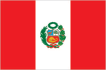
Flag description
three equal, vertical bands of red (hoist side), white, and red with the coat of arms centered in the white band; the coat of arms features a shield bearing a vicuna (representing fauna), a cinchona tree (the source of quinine, signifying flora), and a yellow cornucopia spilling out coins (denoting mineral wealth); red recalls blood shed for independence, white symbolizes peace
Government type
presidential republic
Independence
28 July 1821 (from Spain)
International law organization participation
accepts compulsory ICJ jurisdiction with reservations; accepts ICCt jurisdiction
International organization participation
APEC, BIS, CAN, CD, CELAC, EITI (compliant country), FAO, G-24, G-77, IADB, IAEA, IBRD, ICAO, ICC (NGOs), ICCt, ICRM, IDA, IFAD, IFC, IFRCS, IHO, ILO, IMF, IMO, IMSO, Interpol, IOC, IOM, IPU, ISO, ITSO, ITU, ITUC (NGOs), LAES, LAIA, Mercosur (associate), MIGA, MINUSTAH, MONUSCO, NAM, OAS, OPANAL, OPCW, Pacific Alliance, PCA, SICA (observer), UN, UNAMID, UNASUR, UNCTAD, UNESCO, UNHCR, UNIDO, Union Latina, UNISFA, UNMISS, UNOCI, UNWTO, UPU, WCO, WFTU (NGOs), WHO, WIPO, WMO, WTO
Judicial branch
- Supreme Court (consists of 16 judges and divided into civil, criminal, and constitutional-social sectors) justices proposed by the National Council of the Judiciary or National Judicial Council (a 7-member independent body), nominated by the president, and confirmed by the Congress (all appointments reviewed by the Council every 7 years); justices appointed for life or until age 70 Court of Constitutional Guarantees; Superior Courts or Cortes Superiores; specialized civil, criminal, and mixed courts; 2 types of peace courts in which professional judges and selected members of the local communities preside
- highest court(s)
- Supreme Court (consists of 16 judges and divided into civil, criminal, and constitutional-social sectors)
- judge selection and term of office
- justices proposed by the National Council of the Judiciary or National Judicial Council (a 7-member independent body), nominated by the president, and confirmed by the Congress (all appointments reviewed by the Council every 7 years); justices appointed for life or until age 70
- subordinate courts
- Court of Constitutional Guarantees; Superior Courts or Cortes Superiores; specialized civil, criminal, and mixed courts; 2 types of peace courts in which professional judges and selected members of the local communities preside
Legal system
civil law system
Legislative branch
- unicameral Congress of the Republic of Peru or Congreso de la Republica del Peru (130 seats; members directly elected in multi-seat constituencies by closed party list proportional representation vote to serve 5-year terms) last held on 10 April 2016 with run-off election on 6 June 2016 (next to be held in April 2021) percent of vote by party - Fuerza Popular 36.34%, PPK 16.47%, Frente Amplio 13.94%, APP 9.23%; APRA 8.31%; AP 7.20%, other 8.51%; seats by party - Fuerza Popular 71, PPK 20, Frente Amplio 20, APP 9; APRA 5; AP 5
- description
- unicameral Congress of the Republic of Peru or Congreso de la Republica del Peru (130 seats; members directly elected in multi-seat constituencies by closed party list proportional representation vote to serve 5-year terms)
- election results
- percent of vote by party - Fuerza Popular 36.34%, PPK 16.47%, Frente Amplio 13.94%, APP 9.23%; APRA 8.31%; AP 7.20%, other 8.51%; seats by party - Fuerza Popular 71, PPK 20, Frente Amplio 20, APP 9; APRA 5; AP 5
- elections
- last held on 10 April 2016 with run-off election on 6 June 2016 (next to be held in April 2021)
National anthem
- "Himno Nacional del Peru" (National Anthem of Peru) Jose DE LA TORRE Ugarte/Jose Bernardo ALZEDO adopted 1822; the song won a national anthem contest
- lyrics/music
- Jose DE LA TORRE Ugarte/Jose Bernardo ALZEDO
- name
- "Himno Nacional del Peru" (National Anthem of Peru)
- note
- adopted 1822; the song won a national anthem contest
National holiday
Independence Day, 28 July (1821)
National symbol(s)
- vicuna (a camelid related to the llama); national colors: red, white
- vicuna (a camelid related to the llama); national colors
- red, white
Political parties and leaders
Alliance for Progress (Alianza para el Progreso) or APP [Cesar ACUNA Peralta] Broad Front (Frente Amplio; also known as El Frente Amplio por Justicia, Vida y Libertad), a coalition of left-of-center parties including Tierra y Libertad [Marco ARANA Zegarra], Ciudadanos por el Gran Cambio [Salomon LERNER Ghitis], and Fuerza Social [Susana VILLARAN de la Puente] Fuerza Popular (formerly Fuerza 2011) [Keiko FUJIMORI Higuchi] National Solidarity (Solidaridad Nacional) or SN [Luis CASTANEDA Lossio] Peru Posible or PP (a coalition of Accion Popular and Somos Peru) [Alejandro TOLEDO Manrique] Peruvian Aprista Party (Partido Aprista Peruano) or PAP [Alan GARCIA Perez] (also referred to by its original name Alianza Popular Revolucionaria Americana or APRA) Peruvian Nationalist Party [Ollanta HUMALA] Peruvians for Change (Peruanos Por el Kambio) or PPK [Pedro Pablo KUCZYNSKI] Popular Action (Accion Popular) or AP [Mesias GUEVARA Amasifuen] Popular Christian Party (Partido Popular Cristiano) or PPC [Lourdes FLORES Nano]
Political pressure groups and leaders
General Workers Confederation of Peru (Confederacion General de Trabajadores del Peru) or CGTP [Mario HUAMAN] Shining Path (Sendero Luminoso) or SL [Abimael GUZMAN Reynoso (imprisoned), Victor QUISPE Palomino (top leader at-large)] (leftist guerrilla group)
Suffrage
18 years of age; universal and compulsory until the age of 70
Economy
Agriculture - products
artichokes, asparagus, avocados, blueberries, coffee, cocoa, cotton, sugarcane, rice, potatoes, corn, plantains, grapes, oranges, pineapples, guavas, bananas, apples, lemons, pears, coca, tomatoes, mangoes, barley, medicinal plants, quinoa, palm oil, marigold, onion, wheat, dry beans; poultry, beef, pork, dairy products; guinea pigs; fish
Budget
- $56.71 billion $60.8 billion (2015 est.)
- expenditures
- $60.8 billion (2015 est.)
- revenues
- $56.71 billion
Budget surplus (+) or deficit (-)
-2.1% of GDP (2015 est.)
Central bank discount rate
5.05% (31 December 2012) 5.05% (31 December 2011)
Commercial bank prime lending rate
- 16.1% (31 December 2015 est.) 15.74% (31 December 2014 est.) domestic currency lending rate, 90 day maturity
- note
- domestic currency lending rate, 90 day maturity
Current account balance
-$8.431 billion (2015 est.) -$8.091 billion (2014 est.)
Debt - external
$67.87 billion (31 December 2015 est.) $66.47 billion (31 December 2014 est.)
Distribution of family income - Gini index
45.3 (2012) 51 (2005)
Economy - overview
Peru's economy reflects its varied topography - an arid lowland coastal region, the central high sierra of the Andes, the dense forest of the Amazon, with tropical lands bordering Colombia and Brazil. A wide range of important mineral resources are found in the mountainous and coastal areas, and Peru's coastal waters provide excellent fishing grounds. Peru is the world's second largest producer of silver and third largest producer of copper. The Peruvian economy grew by an average of 5.6% from 2009-13 with a stable exchange rate and low inflation, which in 2013 was just below the upper limit of the Central Bank target range of 1% to 3%. This growth was due partly to high international prices for Peru's metals and minerals exports, which account for almost 60% of the country's total exports. Growth slipped in 2014 and 2015, due to weaker world prices for these resources. Despite Peru's strong macroeconomic performance, dependence on minerals and metals exports and imported foodstuffs makes the economy vulnerable to fluctuations in world prices. Peru's rapid expansion coupled with cash transfers and other programs have helped to reduce the national poverty rate by 28 percentage points since 2002, but inequality persists and continues to pose a challenge for the Ollanta HUMALA administration, which has championed a policy of social inclusion and a more equitable distribution of income. Poor infrastructure hinders the spread of growth to Peru's non-coastal areas. The HUMALA administration passed several economic stimulus packages in 2014 to bolster growth, including reforms to environmental regulations in order to spur investment in Peru’s lucrative mining sector, a move that was opposed by some environmental groups. However, in 2015, mining investment fell as global commodity prices remained low and social conflicts plagued the sector. Peru's free trade policy has continued under the HUMALA administration; since 2006, Peru has signed trade deals with the US, Canada, Singapore, China, Korea, Mexico, Japan, the EU, the European Free Trade Association, Chile, Thailand, Costa Rica, Panama, Venezuela, concluded negotiations with Guatemala and the Trans-Pacific Partnership, and begun trade talks with Honduras, El Salvador, India, Indonesia, and Turkey. Peru also has signed a trade pact with Chile, Colombia, and Mexico, called the Pacific Alliance, that seeks integration of services, capital, investment and movement of people. Since the US-Peru Trade Promotion Agreement entered into force in February 2009, total trade between Peru and the US has doubled.
Exchange rates
nuevo sol (PEN) per US dollar - 3.185 (2015 est.) 2.8383 (2014 est.) 2.8383 (2013 est.) 2.64 (2012 est.) 2.7541 (2011 est.)
Exports
$34.16 billion (2015 est.) $39.53 billion (2014 est.)
Exports - commodities
copper, gold, lead, zinc, tin, iron ore, molybdenum, silver; crude petroleum and petroleum products, natural gas; coffee, asparagus and other vegetables, fruit, apparel and textiles, fishmeal, fish, chemicals, fabricated metal products and machinery, alloys
Exports - partners
China 22.1%, US 15.2%, Switzerland 8.1%, Canada 7% (2015)
Fiscal year
calendar year
GDP - composition, by end use
- 63.5% 13% 24.3% 1.6% 21.1% -23.6% (2015 est.)
- exports of goods and services
- 21.1%
- government consumption
- 13%
- household consumption
- 63.5%
- imports of goods and services
- -23.6% (2015 est.)
- investment in fixed capital
- 24.3%
- investment in inventories
- 1.6%
GDP - composition, by sector of origin
- 7.3% 34.6% 58.1% (2015 est.)
- agriculture
- 7.3%
- industry
- 34.6%
- services
- 58.1% (2015 est.)
GDP - per capita (PPP)
- $12,200 (2015 est.) $12,000 (2014 est.) $11,900 (2013 est.) data are in 2015 US dollars
- note
- data are in 2015 US dollars
GDP - real growth rate
3.3% (2015 est.) 2.4% (2014 est.) 5.9% (2013 est.)
GDP (official exchange rate)
$192.1 billion (2015 est.)
GDP (purchasing power parity)
- $389.1 billion (2015 est.) $376.9 billion (2014 est.) $368.1 billion (2013 est.) data are in 2015 US dollars
- note
- data are in 2015 US dollars
Gross national saving
21.6% of GDP (2015 est.) 22.3% of GDP (2014 est.) 23.7% of GDP (2013 est.)
Household income or consumption by percentage share
- 1.4% 36.1% (2010 est.)
- highest 10%
- 36.1% (2010 est.)
- lowest 10%
- 1.4%
Imports
$36.99 billion (2015 est.) $40.48 billion (2014 est.)
Imports - commodities
petroleum and petroleum products, chemicals, plastics, machinery, vehicles, TV sets, power shovels, front-end loaders, telephones and telecommunication equipment, iron and steel, wheat, corn, soybean products, paper, cotton, vaccines and medicines
Imports - partners
China 22.7%, US 20.7%, Brazil 5.1%, Mexico 4.5% (2015)
Industrial production growth rate
1.5% (2015 est.)
Industries
mining and refining of minerals; steel, metal fabrication; petroleum extraction and refining, natural gas and natural gas liquefaction; fishing and fish processing, cement, glass, textiles, clothing, food processing, beer, soft drinks, rubber, machinery, electrical machinery, chemicals, furniture
Inflation rate (consumer prices)
- 3.5% (2015 est.) 3.2% (2014 est.) data are for metropolitan Lima, annual average
- note
- data are for metropolitan Lima, annual average
Labor force
- 16.64 million individuals older than 14 years of age (2015 est.)
- note
- individuals older than 14 years of age (2015 est.)
Labor force - by occupation
- 25.8% 17.4% 56.8% (2011)
- agriculture
- 25.8%
- industry
- 17.4%
- services
- 56.8% (2011)
Market value of publicly traded shares
$153.4 billion (31 December 2015 est.) $121.6 billion (31 December 2014 est.) $160.9 billion (31 December 2013 est.)
Population below poverty line
25.8% (2012 est.)
Public debt
- 23.3% of GDP (2015 est.) 20.1% of GDP (2014 est.) data cover general government debt, and includes debt instruments issued by government entities other than the treasury; the data exclude treasury debt held by foreign entities; the data include debt issued by subnational entities
- note
- data cover general government debt, and includes debt instruments issued by government entities other than the treasury; the data exclude treasury debt held by foreign entities; the data include debt issued by subnational entities
Reserves of foreign exchange and gold
$61.59 billion (31 December 2015 est.) $62.51 billion (31 December 2014 est.)
Stock of broad money
$91.26 billion (31 December 2014 est.) $84.1 billion (31 December 2013 est.)
Stock of direct foreign investment - abroad
$2.815 billion (31 December 2015 est.) $4.127 billion (31 December 2014 est.)
Stock of direct foreign investment - at home
$86.11 billion (31 December 2015 est.) $79.71 billion (31 December 2014 est.)
Stock of domestic credit
$49.92 billion (31 December 2015 est.) $48.12 billion (31 December 2014 est.)
Stock of narrow money
$29.86 billion (31 December 2015 est.) $32.93 billion (31 December 2014 est.)
Taxes and other revenues
29.5% of GDP (2015 est.)
Unemployment rate
- 5.2% (2015 est.) 5.5% (2014 est.) data are for metropolitan Lima; widespread underemployment
- note
- data are for metropolitan Lima; widespread underemployment
Energy
Carbon dioxide emissions from consumption of energy
41 million Mt (2013 est.)
Crude oil - exports
14,770 bbl/day (2013 est.)
Crude oil - imports
84,280 bbl/day (2013 est.)
Crude oil - production
58,010 bbl/day (2015 est.)
Crude oil - proved reserves
700 million bbl (1 January 2016 es)
Electricity - consumption
39 billion kWh (2014 est.)
Electricity - exports
13 million kWh (2014 est.)
Electricity - from fossil fuels
63.2% of total installed capacity (2012 est.)
Electricity - from hydroelectric plants
35.9% of total installed capacity (2012 est.)
Electricity - from nuclear fuels
0% of total installed capacity (2012 est.)
Electricity - from other renewable sources
0.9% of total installed capacity (2012 est.)
Electricity - imports
5 million kWh (2013 est.)
Electricity - installed generating capacity
12 million kW (2014 est.)
Electricity - production
44 billion kWh (2014 est.)
Electricity access
- 2,900,000 91% 98% 73% (2013)
- electrification - rural areas
- 73% (2013)
- electrification - total population
- 91%
- electrification - urban areas
- 98%
- population without electricity
- 2,900,000
Natural gas - consumption
7.66 billion cu m (2014 est.)
Natural gas - exports
5.24 billion cu m (2014 est.)
Natural gas - imports
0 cu m (2013 est.)
Natural gas - production
12.9 billion cu m (2014 est.)
Natural gas - proved reserves
414.1 billion cu m (1 January 2016 es)
Refined petroleum products - consumption
229,000 bbl/day (2014 est.)
Refined petroleum products - exports
103,400 bbl/day (2013 est.)
Refined petroleum products - imports
75,330 bbl/day (2013 est.)
Refined petroleum products - production
208,400 bbl/day (2013 est.)
Communications
Broadcast media
10 major TV networks of which only one, Television Nacional de Peru, is state owned; multi-channel cable TV services are available; in excess of 2,000 radio stations including a substantial number of indigenous language stations (2010)
Internet country code
.pe
Internet users
- 12.452 million 40.9% (July 2015 est.)
- percent of population
- 40.9% (July 2015 est.)
- total
- 12.452 million
Telephone system
- adequate for most requirements; nationwide microwave radio relay system and a domestic satellite system with 12 earth stations fixed-line teledensity is only about 10 per 100 persons; mobile-cellular teledensity, spurred by competition among multiple providers, exceeds 110 telephones per 100 persons country code - 51; the South America-1 (SAM-1) and Pan American (PAN-AM) submarine cable systems provide links to parts of Central and South America, the Caribbean, and US; satellite earth stations - 2 Intelsat (Atlantic Ocean) (2015)
- domestic
- fixed-line teledensity is only about 10 per 100 persons; mobile-cellular teledensity, spurred by competition among multiple providers, exceeds 110 telephones per 100 persons
- general assessment
- adequate for most requirements; nationwide microwave radio relay system and a domestic satellite system with 12 earth stations
- international
- country code - 51; the South America-1 (SAM-1) and Pan American (PAN-AM) submarine cable systems provide links to parts of Central and South America, the Caribbean, and US; satellite earth stations - 2 Intelsat (Atlantic Ocean) (2015)
Telephones - fixed lines
- 2,912,316 10 (July 2015 est.)
- subscriptions per 100 inhabitants
- 10 (July 2015 est.)
- total subscriptions
- 2,912,316
Telephones - mobile cellular
- 34.236 million 112 (July 2015 est.)
- subscriptions per 100 inhabitants
- 112 (July 2015 est.)
- total
- 34.236 million
Transportation
Airports
191 (2013)
Airports - with paved runways
- 5 (2013)
- 1,524 to 2,437 m
- 16
- 2,438 to 3,047 m
- 21
- 914 to 1,523 m
- 12
- over 3,047 m
- 5
- total
- 59
- under 914 m
- 5 (2013)
Airports - with unpaved runways
- 82 (2013)
- 1,524 to 2,437 m
- 19
- 2,438 to 3,047 m
- 1
- 914 to 1,523 m
- 30
- total
- 132
- under 914 m
- 82 (2013)
Civil aircraft registration country code prefix
OB (2016)
Heliports
5 (2013)
Merchant marine
- cargo 2, chemical tanker 5, liquefied gas 2, petroleum tanker 13 8 (Chile 6, Ecuador 1, Spain 1) 9 (Panama 9) (2010)
- by type
- cargo 2, chemical tanker 5, liquefied gas 2, petroleum tanker 13
- foreign-owned
- 8 (Chile 6, Ecuador 1, Spain 1)
- registered in other countries
- 9 (Panama 9) (2010)
- total
- 22
National air transport system
- 13,907,948 223,643,434 mt-km (2015)
- annual freight traffic on registered air carriers
- 223,643,434 mt-km (2015)
- annual passenger traffic on registered air carriers
- 13,907,948
- inventory of registered aircraft operated by air carriers
- 35
- number of registered air carriers
- 7
Pipelines
extra heavy crude 786 km; gas 1,526 km; liquid petroleum gas 679 km; oil 1,033 km; refined products 15 km (2013)
Ports and terminals
- Callao, Matarani, Paita Iquitos, Pucallpa, Yurimaguas (Amazon) Conchan oil terminal, La Pampilla oil terminal Callao (1,616,365)
- container port(s) (TEUs)
- Callao (1,616,365)
- major seaport(s)
- Callao, Matarani, Paita
- oil terminals
- Conchan oil terminal, La Pampilla oil terminal
- river port(s)
- Iquitos, Pucallpa, Yurimaguas (Amazon)
Railways
- 1,854.4 km 1,730.4 km 1.435-m gauge (34 km electrified) 124 km 0.914-m gauge (2014)
- narrow gauge
- 124 km 0.914-m gauge (2014)
- standard gauge
- 1,730.4 km 1.435-m gauge (34 km electrified)
- total
- 1,854.4 km
Roadways
- 140,672 km (18,699 km paved) includes 24,593 km of national roads (14,748 km paved), 24,235 km of departmental roads (2,340 km paved), and 91,844 km of local roads (1,611 km paved) (2012)
- note
- includes 24,593 km of national roads (14,748 km paved), 24,235 km of departmental roads (2,340 km paved), and 91,844 km of local roads (1,611 km paved) (2012)
- total
- 140,672 km (18,699 km paved)
Waterways
8,808 km (8,600 km of navigable tributaries on the Amazon system and 208 km on Lago Titicaca) (2011)
Military and Security
Military branches
Peruvian Army (Ejercito Peruano), Peruvian Navy (Marina de Guerra del Peru, MGP; includes naval air, naval infantry, and Coast Guard), Air Force of Peru (Fuerza Aerea del Peru, FAP) (2013)
Military expenditures
1.28% of GDP (2012) 1.15% of GDP (2011) 1.28% of GDP (2010)
Military service age and obligation
18-50 years of age for male and 18-45 years of age for female voluntary military service; no conscription (2012)
Transnational Issues
Disputes - international
Chile and Ecuador rejected Peru's November 2005 unilateral legislation to shift the axis of their joint treaty-defined maritime boundaries along the parallels of latitude to equidistance lines which favor Peru; organized illegal narcotics operations in Colombia have penetrated Peru's shared border; Peru rejects Bolivia's claim to restore maritime access through a sovereign corridor through Chile along the Peruvian border
Illicit drugs
until 1996 the world's largest coca leaf producer, Peru is now the world's second largest producer of coca leaf, though it lags far behind Colombia; cultivation of coca in Peru was estimated at 40,000 hectares in 2009, a slight decrease over 2008; second largest producer of cocaine, estimated at 225 metric tons of potential pure cocaine in 2009; finished cocaine is shipped out from Pacific ports to the international drug market; increasing amounts of base and finished cocaine, however, are being moved to Brazil, Chile, Argentina, and Bolivia for use in the Southern Cone or transshipment to Europe and Africa; increasing domestic drug consumption
Refugees and internally displaced persons
- 60,000 (civil war from 1980-2000; most IDPs are indigenous peasants in Andean and Amazonian regions; as of 2011, no new information on the situation of these IDPs) (2015)
- IDPs
- 60,000 (civil war from 1980-2000; most IDPs are indigenous peasants in Andean and Amazonian regions; as of 2011, no new information on the situation of these IDPs) (2015)