1998 Edition
CIA World Factbook 1998 (Internet Archive)
Geography
Area
total: 11.9 sq km land: 11.9 sq km water: 0 sq km
Area-comparative
about 20 times the size of The Mall in Washington, DC
Climate
equatorial, hot, and very rainy
Coastline
14.5 km
Elevation extremes
lowest point: Pacific Ocean 0 m highest point: unnamed location 2 m
Environment-current issues
NA
Environment-international agreements
party to: NA signed, but not ratified: NA
Geographic coordinates
5 52 N, 162 06 W
Geography-note
about 50 islets covered with dense vegetation, coconut trees, and balsa-like trees up to 30 meters tall
Irrigated land
0 sq km (1993)
Land boundaries
0 km
Land use
arable land: 0% permanent crops: 0% permanent pastures: 0% forests and woodland: 100% other: 0%
Location
Oceania, atoll in the North Pacific Ocean, about one-half of the way from Hawaii to American Samoa
Map references
Oceania
Maritime claims
exclusive economic zone: 200 nm territorial sea: 12 nm
Natural hazards
NA
Natural resources
none
Terrain
very low
People and Society
Population
uninhabited
Government
Country name
conventional long form: none conventional short form: Palmyra Atoll
Data code
LQ
Dependency status
incorporated territory of the US; privately owned, but administered from Washington, DC by the Office of Insular Affairs, US Department of the Interior
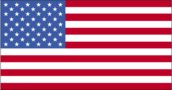
Flag description
the flag of the US is used
Legal system
NA
Economy
Economy-overview
no economic activity
Transportation
Airports
airstrip has been overgrown by vegetation and is no longer serviceable Airports-with unpaved runways: total: 1 1,524 to 2,437 m: 1 (1997 est.)
Highways
much of the road and many causeways built during World War II are unserviceable and overgrown Ports and harbors: West Lagoon
Military and Security
Military-note
defense is the responsibility of the US
Transnational Issues
Disputes-international
none