1996 Edition
CIA World Factbook 1996 (Project Gutenberg)
Introduction
Description
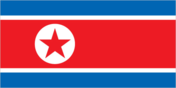
three horizontal bands of blue (top), red (triple width), and blue; the red band is edged in white; on the hoist side of the red band is a white disk with a red five-pointed star
Location
40 00 N, 127 00 E -- Eastern Asia, northern half of the Korean Peninsula bordering the Korea Bay and the Sea of Japan, between China and South Korea Flag ----
Geography
Area
- comparative area
- slightly smaller than Mississippi
- land area
- 120,410 sq km
- total area
- 120,540 sq km
Climate
temperate with rainfall concentrated in summer
Coastline
2,495 km
Environment
- current issues
- localized air pollution attributable to inadequate industrial controls; water pollution; inadequate supplies of potable water
- international agreements
- party to - Antarctic Treaty, Biodiversity, Climate Change, Environmental Modification, Ship Pollution; signed, but not ratified - Antarctic-Environmental Protocol, Law of the Sea, Ozone Layer Protection
- natural hazards
- late spring droughts often followed by severe flooding; occasional typhoons during the early fall
Geographic coordinates
40 00 N, 127 00 E
Geographic note
strategic location bordering China, South Korea, and Russia; mountainous interior is isolated, nearly inaccessible, and sparsely populated
International disputes
short section of boundary with China is indefinite; Demarcation Line with South Korea
Irrigated land
14,000 sq km (1989)
Land boundaries
- border countries
- China 1,416 km, South Korea 238 km, Russia 19 km
- total
- 1,673 km
Land use
- arable land
- 18%
- forest and woodland
- 74%
- meadows and pastures
- 0%
- other
- 7%
- permanent crops
- 1%
Location
Eastern Asia, northern half of the Korean Peninsula bordering the Korea Bay and the Sea of Japan, between China and South Korea
Map references
Asia
Maritime claims
- exclusive economic zone
- 200 nm
- military boundary line
- 50 nm in the Sea of Japan and the exclusive economic zone limit in the Yellow Sea where all foreign vessels and aircraft without permission are banned
- territorial sea
- 12 nm
Natural resources
coal, lead, tungsten, zinc, graphite, magnesite, iron ore, copper, gold, pyrites, salt, fluorspar, hydropower
Terrain
- mostly hills and mountains separated by deep, narrow valleys; coastal plains wide in west, discontinuous in east
- highest point
- Paektu-san 2,744 m
- lowest point
- Sea of Japan 0 m
People and Society
Age structure
0-14 years: 30% (male 3,605,972; female 3,465,038) 15-64 years: 66% (male 7,871,783; female 7,956,935) 65 years and over: 4% (male 355,284; female 649,112) (July 1996 est.)
Birth rate
22.86 births/1,000 population (1996 est.)
Death rate
5.45 deaths/1,000 population (1996 est.)
Ethnic divisions
racially homogeneous
Infant mortality rate
25.9 deaths/1,000 live births (1996 est.)
Languages
Korean
Life expectancy at birth
- female
- 73.57 years (1996 est.)
- male
- 67.23 years
- total population
- 70.32 years
Literacy
- age 15 and over can read and write Korean (1990 est.)
- female
- 99%
- male
- 99%
- total population
- 99%
Nationality
- adjective
- Korean
- noun
- Korean(s)
Net migration rate
0 migrant(s)/1,000 population (1996 est.)
Population
23,904,124 (July 1996 est.)
Population growth rate
1.74% (1996 est.)
Religions
- Buddhism and Confucianism, some Christianity and syncretic Chondogyo
- note
- autonomous religious activities now almost nonexistent; government-sponsored religious groups exist to provide illusion of religious freedom
Sex ratio
- all ages
- 0.98 male(s)/female (1996 est.)
- at birth
- 1.05 male(s)/female
- under 15 years
- 1.04 male(s)/female 15-64 years: 0.99 male(s)/female 65 years and over: 0.55 male(s)/female
Total fertility rate
2.31 children born/woman (1996 est.)
Government
Administrative divisions
9 provinces (do, singular and plural) and 3 special cities* (si, singular and plural); Chagang-do (Chagang Province), Hamgyong-bukto (North Hamgyong Province), Hamgyong-namdo (South Hamgyong Province), Hwanghae-bukto (North Hwanghae Province), Hwanghae-namdo (South Hwanghae Province), Kaesong-si* (Kaesong City), Kangwon-do (Kangwon Province), Namp'o-si* (Namp'o City), P'yongan-bukto (North P'yongan Province), P'yongan-namdo (South P'yongan Province), P'yongyang-si* (P'yongyang City), Yanggang-do (Yanggang Province)
Capital
P'yongyang
Constitution
adopted 1948, completely revised 27 December 1972, revised again in April 1992
Data code
KN
Diplomatic representation in US
none; note - North Korea has a Permanent Mission to the UN in New York, headed by PAK Kil-yon
Executive branch
- cabinet
- State Administration Council was appointed by the Supreme People's Assembly
- chief of state
- KIM Chong-il [defacto]; note - President KIM Il-song was reelected without opposition 24 May 1990 and died 8 July 1994 leaving his son KIM Chong-il as designated successor; however the son has not assumed the titles that his father held and no new elections have been held or scheduled
- head of government
- Premier KANG Song-san (since NA December 1992) was elected by the Supreme People's Assembly
Flag
three horizontal bands of blue (top), red (triple width), and blue; the red band is edged in white; on the hoist side of the red band is a white disk with a red five-pointed star
Independence
- 9 September 1948
- note
- 15 August 1945, date of independence from the Japanese and celebrated in North Korea as National Liberation Day
International organization participation
ESCAP, FAO, G-77, ICAO, ICRM, IFAD, IFRCS, IMO, Intelsat (nonsignatory user), IOC, ISO, ITU, NAM, UN, UNCTAD, UNESCO, UNIDO, UPU, WFTU, WHO, WIPO, WMO, WToO
Judicial branch
Central Court, judges are elected by the Supreme People's Assembly
Legal system
based on German civil law system with Japanese influences and Communist legal theory; no judicial review of legislative acts; has not accepted compulsory ICJ jurisdiction
Legislative branch
unicameral
Name of country
- abbreviation
- DPRK
- conventional long form
- Democratic People's Republic of Korea
- conventional short form
- North Korea
- local long form
- Choson-minjujuui-inmin-konghwaguk
- local short form
- none
- note
- the North Koreans generally use the term "Choson" to refer to their country
National holiday
DPRK Foundation Day, 9 September (1948)
Political parties and leaders
major party - Korean Workers' Party (KWP), KIM Chong-il, secretary, Central Committee; Korean Social Democratic Party, KIM Pyong-sik, chairman; Chondoist Chongu Party, YU Mi-yong, chairwoman
Suffrage
17 years of age; universal
Supreme People's Assembly (Ch'oego Inmin Hoeui)
elections last held 7-9 April 1990 (next to be held NA); results - percent of vote by party NA; seats - (687 total) the KWP approves a single list of candidates who are elected without opposition; minor parties hold a few seats
Type of government
Communist state; Stalinist dictatorship
US diplomatic representation
none
Economy
Agriculture
rice, corn, potatoes, soybeans, pulses; cattle, pigs, pork, eggs
Budget
- expenditures
- $19.3 billion, including capital expenditures of $NA (1992 est.)
- revenues
- $19.3 billion
Currency
1 North Korean won (Wn) = 100 chon
Economic aid
- note
- small amounts of grant aid from Japan and other countries
- recipient
- ODA, $NA
Economic overview
More than 90% of this command economy is socialized; agricultural land is collectivized; and state-owned industry produces 95% of manufactured goods. State control of economic affairs is unusually tight even for a communist country because of the small size and homogeneity of the society and the strict rule of KIM Il-song in the past and now his son, KIM Chong-il. Economic growth during the period 1984-88 averaged 2%-3%, but output declined by an average of 4%-5% annually during 1989-95 because of systemic problems and disruptions in socialist-style economic relations and technological links with the former USSR and China. The leadership has insisted on maintaining its high level of military outlays from a shrinking economic pie. Moreover, a serious drawdown in inventories and critical shortages in the energy sector have led to increasing interruptions in industrial production. Abundant mineral resources and hydropower have formed the basis of industrial development since World War II. Manufacturing is centered on heavy industry, including military industry, with light industry lagging far behind. Despite the use of improved seed varieties, expansion of irrigation, and the heavy use of fertilizers, North Korea has not yet become self-sufficient in food production. Indeed, a shortage of arable lands, several years of poor harvests, and a cumbersome distribution system have resulted in chronic food shortages. The year 1995 was marked by serious summer floods that worsened an already tenuous food situation. Substantial grain shipments from Japan and South Korea offset a portion of the losses. North Korea remains far behind South Korea in economic development and living standards.
Electricity
- capacity
- 9,500,000 kW
- consumption per capita
- 2,053 kWh (1993)
- production
- 50 billion kWh
Exchange rates
North Korean won (Wn) per US$1 - 2.15 (May 1994), 2.13 (May 1992), 2.14 (September 1991), 2.1 (January 1990), 2.3 (December 1989)
Exports
- $840 million (f.o.b., 1994 est.)
- commodities
- minerals, metallurgical products, agricultural and fishery products, manufactures (including armaments)
- partners
- China, Japan, South Korea, Germany, Hong Kong, Russia
External debt
$8 billion (1992 est.)
Fiscal year
calendar year
GDP
purchasing power parity - $21.5 billion (1995 est.)
GDP composition by sector
- agriculture
- 25%
- industry
- 60%
- services
- 15% (1995 est.)
GDP per capita
$920 (1995 est.)
GDP real growth rate
-5% (1995 est.)
Imports
- $1.27 billion (f.o.b., 1994 est.)
- commodities
- petroleum, grain, coking coal, machinery and equipment, consumer goods
- partners
- China, Japan, Hong Kong, Germany, Russia, Singapore
Industrial production growth rate
-7% to -9% (1992 est.)
Industries
military products; machine building, electric power, chemicals; mining (coal, iron ore, magnesite, graphite, copper, zinc, lead, and precious metals), metallurgy; textiles, food processing
Inflation rate (consumer prices)
NA%
Labor force
- 9.615 million
- by occupation
- agricultural 36%, nonagricultural 64%
Unemployment rate
NA%
Communications
Branches
Korean People's Army (includes Army, Navy, Air Force), Civil Security Forces
Defense expenditures
exchange rate conversion - $5 billion to $7 billion, 25% to 33% of GDP (1995 est.)
Manpower availability
- males age 15-49
- 6,844,035
- males fit for military service
- 4,143,713
- males reach military age (18) annually
- 194,922 (1996 est.)
Radio broadcast stations
AM 18, FM 0, shortwave 0
Radios
3.5 million
Telephone system
- system is believed to be available principally for government business
- domestic
- NA
- international
- satellite earth stations - 1 Intelsat (Indian Ocean) and 1 Intersputnik (Indian Ocean Region); other international connections through Moscow and Beijing
Telephones
30,000 (1990 est.)
Television broadcast stations
11
Televisions
400,000 (1992 est.) Defense
Transportation
Airports
- total
- 49
- with paved runways 1 524 to 2 437 m
- 2
- with paved runways 2 438 to 3 047 m
- 15
- with paved runways 914 to 1 523 m
- 1
- with paved runways over 3 047 m
- 2
- with paved runways under 914 m
- 2
- with unpaved runways 1 524 to 2 437 m
- 5
- with unpaved runways 2 438 to 3 047 m
- 4
- with unpaved runways 914 to 1 523 m
- 12
- with unpaved runways under 914 m
- 6 (1994 est.)
Highways
- paved
- 4,500 km
- total
- 30,000 km
- unpaved
- 25,500 km
Merchant marine
- note
- North Korea owns an additional 4 ships (1,000 GRT or over) totaling approximately 34,782 DWT operating under the registries of Hondurus and Poland (1995 est.)
- ships by type
- bulk 9, cargo 71, combination bulk 1, oil tanker 3, passenger 2, passenger-cargo 1, short-sea passenger 1
- total
- 88 ships (1,000 GRT or over) totaling 712,480 GRT/1,140,923 DWT
Pipelines
crude oil 37 km
Ports
Ch'ongjin, Haeju, Hungnam (Hamhung), Kimch'aek, Kosong, Najin, Namp'o, Sinuiju, Songnim, Sonbong (formerly Unggi), Ungsang, Wonsan
Railways
- narrow gauge
- 665 km 0.762-m gauge (1989)
- standard gauge
- 4,250 km 1.435-m gauge (3,397 km electrified; 159 km double track)
- total
- 4,915 km
Waterways
2,253 km; mostly navigable by small craft only