2019 Edition
CIA World Factbook 2019 Archive (Wayback Machine)
Introduction
Background
The Pacific coast of Nicaragua was settled as a Spanish colony from Panama in the early 16th century. Independence from Spain was declared in 1821 and the country became an independent republic in 1838. Britain occupied the Caribbean Coast in the first half of the 19th century, but gradually ceded control of the region in subsequent decades. Violent opposition to governmental manipulation and corruption spread to all classes by 1978 and resulted in a short-lived civil war that brought a civic-military coalition, spearheaded by the Marxist Sandinista guerrillas led by Daniel ORTEGA Saavedra to power in 1979. Nicaraguan aid to leftist rebels in El Salvador prompted the US to sponsor anti-Sandinista contra guerrillas through much of the 1980s. After losing free and fair elections in 1990, 1996, and 2001, former Sandinista President Daniel ORTEGA was elected president in 2006, 2011, and most recently in 2016. Municipal, regional, and national-level elections since 2008 have been marred by widespread irregularities. Democratic institutions have weakened under the ORTEGA administration as the president has garnered full control over all branches of government, especially after cracking down on a nationwide antigovernment protest movement in 2018.
Geography
Area
- Land
- 119,990 sq km
- Total
- 130,370 sq km
- Water
- 10,380 sq km
Area Comparative
slightly larger than Pennsylvania; slightly smaller than New York state
Climate
tropical in lowlands, cooler in highlands
Coastline
910 km
Elevation
- Highest Point
- Mogoton 2,085 m
- Lowest Point
- Pacific Ocean 0 m
- Mean Elevation
- 298 m
Environment Current Issues
deforestation; soil erosion; water pollution; drought
Environment International Agreements
- Party To
- Biodiversity, Climate Change, Climate Change-Kyoto Protocol, Desertification, Endangered Species, Environmental Modification, Hazardous Wastes, Law of the Sea, Ozone Layer Protection, Ship Pollution, Wetlands, Whaling
- Signed But Not Ratified
- none of the selected agreements
Geographic Coordinates
13 00 N, 85 00 W
Geography Note
largest country in Central America; contains the largest freshwater body in Central America, Lago de Nicaragua
Irrigated Land
1,990 sq km (2012)
Land Boundaries
- Border Countries
- Costa Rica 313 km, Honduras 940 km
- Total
- 1,253 km
Land Use
- Agricultural Land
- 42.2% (2011 est.)
- Agricultural Land Arable Land
- 12.5% (2011 est.)
- Agricultural Land Permanent Crops
- 2.5% (2011 est.)
- Agricultural Land Permanent Pasture
- 27.2% (2011 est.)
- Forest
- 25.3% (2011 est.)
- Other
- 32.5% (2011 est.)
Location
Central America, bordering both the Caribbean Sea and the North Pacific Ocean, between Costa Rica and Honduras
Map References
Central America and the Caribbean
Maritime Claims
- Contiguous Zone
- 24 nm
- Continental Shelf
- natural prolongation
- Territorial Sea
- 12 nm
Natural Hazards
destructive earthquakes; volcanoes; landslides; extremely susceptible to hurricanesvolcanism: significant volcanic activity; Cerro Negro (728 m), which last erupted in 1999, is one of Nicaragua's most active volcanoes; its lava flows and ash have been known to cause significant damage to farmland and buildings; other historically active volcanoes include Concepcion, Cosiguina, Las Pilas, Masaya, Momotombo, San Cristobal, and Telica
Natural Resources
gold, silver, copper, tungsten, lead, zinc, timber, fish
Population Distribution
the overwhelming majority of the population resides in the western half of the country, with much of the urban growth centered in the capital city of Managua; coastal areas also show large population clusters
Terrain
extensive Atlantic coastal plains rising to central interior mountains; narrow Pacific coastal plain interrupted by volcanoes
People and Society
Age Structure
- 0 14 Years
- 26.65% (male 827,585 /female 794,086)
- 15 24 Years
- 20.67% (male 632,847 /female 624,811)
- 25 54 Years
- 41.04% (male 1,186,467 /female 1,310,957)
- 55 64 Years
- 6.19% (male 173,674 /female 202,765)
- 65 Years And Over
- 5.46% (male 147,324 /female 184,697) (2018 est.)
Birth Rate
17.5 births/1,000 population (2018 est.)
Children Under The Age Of 5 Years Underweight
4.6% (2012)
Contraceptive Prevalence Rate
80.4% (2011/12)
Current Health Expenditure
8.7% (2016)
Death Rate
5.2 deaths/1,000 population (2018 est.)
Demographic Profile
Despite being one of the poorest countries in Latin America, Nicaragua has improved its access to potable water and sanitation and has ameliorated its life expectancy, infant and child mortality, and immunization rates. However, income distribution is very uneven, and the poor, agriculturalists, and indigenous people continue to have less access to healthcare services. Nicaragua's total fertility rate has fallen from around 6 children per woman in 1980 to below replacement level today, but the high birth rate among adolescents perpetuates a cycle of poverty and low educational attainment.Nicaraguans emigrate primarily to Costa Rica and to a lesser extent the United States. Nicaraguan men have been migrating seasonally to Costa Rica to harvest bananas and coffee since the early 20th century. Political turmoil, civil war, and natural disasters from the 1970s through the 1990s dramatically increased the flow of refugees and permanent migrants seeking jobs, higher wages, and better social and healthcare benefits. Since 2000, Nicaraguan emigration to Costa Rica has slowed and stabilized. Today roughly 300,000 Nicaraguans are permanent residents of Costa Rica - about 75% of the foreign population - and thousands more migrate seasonally for work, many illegally.
Dependency Ratios
- Elderly Dependency Ratio
- 7.8 (2015 est.)
- Potential Support Ratio
- 12.8 (2015 est.)
- Total Dependency Ratio
- 54.1 (2015 est.)
- Youth Dependency Ratio
- 46.3 (2015 est.)
Drinking Water Source
- Improved Rural
- 69.4% of population
- Improved Total
- 87% of population
- Improved Urban
- 99.3% of population
- Unimproved Rural
- 30.6% of population
- Unimproved Total
- 13% of population (2015 est.)
- Unimproved Urban
- 0.7% of population
Education Expenditures
4.3% of GDP (2017)
Ethnic Groups
mestizo (mixed Amerindian and white) 69%, white 17%, black 9%, Amerindian 5%
HIV/AIDS Adult Prevalence Rate
0.2% (2018 est.)
HIV/AIDS Deaths
200 (2018 est.)
HIV/AIDS People Living With HIV/AIDS
9,400 (2018 est.)
Hospital Bed Density
0.9 beds/1,000 population (2014)
Infant Mortality Rate
- Female
- 15 deaths/1,000 live births
- Male
- 20.4 deaths/1,000 live births
- Total
- 17.7 deaths/1,000 live births (2018 est.)
Languages
Spanish (official) 95.3%, Miskito 2.2%, Mestizo of the Caribbean coast 2%, other 0.5% (2005 est.)
Life Expectancy at Birth
- Female
- 76.1 years
- Male
- 71.5 years
- Total Population
- 73.7 years (2018 est.)
Literacy
- Definition
- age 15 and over can read and write
- Female
- 83.2% (2015)
- Male
- 82.4%
- Total Population
- 82.8%
Major Infectious Diseases
- Degree Of Risk
- high (2016)
- Food Or Waterborne Diseases
- bacterial diarrhea, hepatitis A, and typhoid fever (2016)
- Vectorborne Diseases
- dengue fever and malaria (2016)
Major Urban Areas Population
1.055 million MANAGUA (capital) (2019)
Maternal Mortality Rate
198 deaths/100,000 live births (2017 est.)
Median Age
- Female
- 27.1 years
- Male
- 25.3 years
- Total
- 26.2 years (2018 est.)
Mother's Mean Age at First Birth
19.2 years (2011/12 est.)
Nationality
- Adjective
- Nicaraguan
- Noun
- Nicaraguan(s)
Net Migration Rate
-2.6 migrant(s)/1,000 population (2018 est.)
Obesity Adult Prevalence Rate
23.7% (2016)
Physicians Density
1.01 physicians/1,000 population (2018)
Population
6,085,213 (July 2018 est.)
Population Growth Rate
0.97% (2018 est.)
Religions
Roman Catholic 50%, Evangelical 33.2%, other 2.9%, unspecified 13.2%, none 0.7% (2017 est.)
Sanitation Facility Access
- Improved Rural
- 55.7% of population (2015 est.)
- Improved Total
- 67.9% of population (2015 est.)
- Improved Urban
- 76.5% of population (2015 est.)
- Unimproved Rural
- 44.3% of population (2015 est.)
- Unimproved Total
- 32.1% of population (2015 est.)
- Unimproved Urban
- 23.5% of population (2015 est.)
Sex Ratio
- 0 14 Years
- 1.04 male(s)/female
- 15 24 Years
- 1.01 male(s)/female
- 25 54 Years
- 0.91 male(s)/female
- 55 64 Years
- 0.86 male(s)/female
- 65 Years And Over
- 0.8 male(s)/female
- At Birth
- 1.05 male(s)/female
- Total Population
- 0.95 male(s)/female (2018 est.)
Total Fertility Rate
1.87 children born/woman (2018 est.)
Unemployment Youth Ages 15 24
- Female
- 12.9% (2014 est.)
- Male
- 6.4%
- Total
- 8.5%
Urbanization
- Rate Of Urbanization
- 1.45% annual rate of change (2015-20 est.)
- Urban Population
- 58.8% of total population (2019)
Government
Administrative Divisions
15 departments (departamentos, singular - departamento) and 2 autonomous regions* (regiones autonomistas, singular - region autonoma); Boaco, Carazo, Chinandega, Chontales, Costa Caribe Norte*, Costa Caribe Sur*, Esteli, Granada, Jinotega, Leon, Madriz, Managua, Masaya, Matagalpa, Nueva Segovia, Rio San Juan, Rivas
Capital
- Geographic Coordinates
- 12 08 N, 86 15 W
- Name
- Managua
- Time Difference
- UTC-6 (1 hour behind Washington, DC, during Standard Time)
Citizenship
- Citizenship By Birth
- yes
- Citizenship By Descent Only
- yes
- Dual Citizenship Recognized
- no, except in cases where bilateral agreements exist
- Residency Requirement For Naturalization
- 4 years
Constitution
- Amendments
- proposed by the president of the republic or assent of at least half of the National Assembly membership; passage requires approval by 60% of the membership of the next elected Assembly and promulgation by the president of the republic; amended several times, last in 2014 (2018)
- History
- several previous; latest adopted 19 November 1986, effective 9 January 1987
Country Name
- Conventional Long Form
- Republic of Nicaragua
- Conventional Short Form
- Nicaragua
- Etymology
- Nicarao was the name of the largest indigenous settlement at the time of Spanish arrival; conquistador Gil GONZALEZ Davila, who explored the area (1622-23), combined the name of the community with the Spanish word "agua" (water), referring to the two large lakes in the west of the country (Lake Managua and Lake Nicaragua)
- Local Long Form
- Republica de Nicaragua
- Local Short Form
- Nicaragua
Diplomatic Representation From The Us
- Chief Of Mission
- Ambassador Kevin K. SULLIVAN (since 18 December 2018)
- Embassy
- Kilometer 5.5 Carretera Sur, Managua
- Fax
- [505] 2252-7250
- Mailing Address
- American Embassy Managua, APO AA 34021
- Telephone
- [505] 2252-7100, 2252-7888; 2252-7100 or 8767-7100 (after hours)
Diplomatic Representation In The Us
- Chancery
- 1627 New Hampshire Avenue NW, Washington, DC 20009
- Chief Of Mission
- Ambassador Francisco Obadiah CAMPBELL Hooker (since 28 June 2010)
- Consulate's General
- Houston, Los Angeles, Miami, New York, San Francisco
- Fax
- [1] (202) 939-6545
- Telephone
- [1] (202) 939-6570, 6573
Executive Branch
- Cabinet
- Council of Ministers appointed by the president
- Chief Of State
- President Jose Daniel ORTEGA Saavedra (since 10 January 2007); Vice President Rosario MURILLO Zambrana (since 10 January 2017); note - the president is both chief of state and head of government
- Election Results
- Jose Daniel ORTEGA Saavedra reelected president; percent of vote - Jose Daniel ORTEGA Saavedra (FSLN) 72.4%, Maximino RODRIGUEZ (PLC) 15%, Jose del Carmen ALVARADO (PLI) 4.5%, Saturnino CERRATO Hodgson (ALN) 4.3%, other 3.7%
- Elections Appointments
- president and vice president directly elected on the same ballot by simple majority popular vote for a 5-year term (no term limits as of 2014); election last held on 6 November 2016 (next to be held by November 2021)
- Head Of Government
- President Jose Daniel ORTEGA Saavedra (since 10 January 2007); Vice President Rosario MURILLO Zambrana (since 10 January 2017)
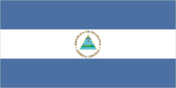
Flag Description
three equal horizontal bands of blue (top), white, and blue with the national coat of arms centered in the white band; the coat of arms features a triangle encircled by the words REPUBLICA DE NICARAGUA on the top and AMERICA CENTRAL on the bottom; the banner is based on the former blue-white-blue flag of the Federal Republic of Central America; the blue bands symbolize the Pacific Ocean and the Caribbean Sea, while the white band represents the land between the two bodies of water
Government Type
presidential republic
Independence
15 September 1821 (from Spain)
International Law Organization Participation
accepts compulsory ICJ jurisdiction with reservations; non-party state to the ICCt
International Organization Participation
BCIE, CACM, CD, CELAC, FAO, G-77, IADB, IAEA, IBRD, ICAO, ICRM, IDA, IFAD, IFC, IFRCS, ILO, IMF, IMO, Interpol, IOC, IOM, IPU, ISO (correspondent), ITSO, ITU, ITUC (NGOs), LAES, LAIA (observer), MIGA, NAM, OAS, OPANAL, OPCW, PCA, Petrocaribe, SICA, UN, UNCTAD, UNESCO, UNHCR, UNIDO, Union Latina, UNWTO, UPU, WCO, WHO, WIPO, WMO, WTO
Judicial Branch
- Highest Courts
- Supreme Court or Corte Suprema de Justicia (consists of 16 judges organized into administrative, civil, criminal, and constitutional chambers)
- Judge Selection And Term Of Office
- Supreme Court judges elected by the National Assembly to serve 5-year staggered terms
- Subordinate Courts
- Appeals Court; first instance civil, criminal, and labor courts; military courts are independent of the Supreme Court
Legal System
civil law system; Supreme Court may review administrative acts
Legislative Branch
- Description
- unicameral National Assembly or Asamblea Nacional (92 seats; 70 members in multi-seat constituencies and 20 members in a single nationwide constituency directly elected by proportional representation vote; 2 seats reserved for the previous president and the runner-up candidate in the previous presidential election; members serve 5-year terms)
- Election Results
- percent of vote by party - NA; seats by party - FSLN 71, PLC 14, ALN 2, PLI 2, APRE 1, PC 1, YATAMA 1; composition - men 50, women 42, percent of women 45.7%
- Elections
- last held on 6 November 2016 (next to be held by November 2021)
National Anthem
- Lyrics Music
- Salomon Ibarra MAYORGA/traditional, arranged by Luis Abraham DELGADILLO
- Name
- "Salve a ti, Nicaragua" (Hail to Thee, Nicaragua)
National Holiday
Independence Day, 15 September (1821)
National Symbol S
turquoise-browed motmot (bird); national colors: blue, white
Political Parties And Leaders
Alliance for the Republic or APRE [Carlos CANALES] Conservative Party or PC [Alfredo CESAR] Independent Liberal Party or PLI [Jose del Carmen ALVARADO] Liberal Constitutionalist Party or PLC [Maria Haydee OSUNA] Nicaraguan Liberal Alliance or ALN [Alejandro MEJIA Ferreti] Sandinista National Liberation Front or FSLN [Jose Daniel ORTEGA Saavedra] Sandinista Renovation Movement or MRS [Suyen BARAHONA] Sons of Mother Earth or YATAMA [Brooklyn RIVERA]
Suffrage
16 years of age; universal
Economy
Agriculture Products
coffee, bananas, sugarcane, rice, corn, tobacco, cotton, sesame, soya, beans, beef, veal, pork, poultry, dairy products, shrimp, lobsters, peanuts
Budget
- Expenditures
- 4.15 billion (2017 est.)
- Revenues
- 3.871 billion (2017 est.)
Budget Surplus Or Deficit
-2% (of GDP) (2017 est.)
Central Bank Discount Rate
- 31 December 2010
- 3%
Commercial Bank Prime Lending Rate
- 31 December 2016
- 11.44%
- 31 December 2017
- 10.8%
Current Account Balance
- 2016
- -$989 million
- 2017
- -$694 million
Debt External
- 31 December 2016
- $10.87 billion
- 31 December 2017
- $11.31 billion
Distribution Of Family Income Gini Index
- 2009
- 45.8
- 2014
- 47.1
Economy Overview
Nicaragua, the poorest country in Central America and the second poorest in the Western Hemisphere, has widespread underemployment and poverty. GDP growth of 4.5% in 2017 was insufficient to make a significant difference. Textiles and agriculture combined account for nearly 50% of Nicaragua's exports. Beef, coffee, and gold are Nicaragua’s top three export commodities.The Dominican Republic-Central America-United States Free Trade Agreement has been in effect since April 2006 and has expanded export opportunities for many Nicaraguan agricultural and manufactured goods.In 2013, the government granted a 50-year concession with the option for an additional 50 years to a newly formed Chinese-run company to finance and build an inter-oceanic canal and related projects, at an estimated cost of $50 billion. The canal construction has not started.
Exchange Rates
- 2013
- 26.01
- 2014
- 27.257
- 2015
- 28.678
- 2016
- 28.678
- 2017
- 30.11
- Currency
- cordobas (NIO) per US dollar -
Exports
- 2016
- $3.772 billion
- 2017
- $3.819 billion
Exports Commodities
coffee, beef, gold, sugar, peanuts, shrimp and lobster, tobacco, cigars, automobile wiring harnesses, textiles, apparel
Exports Partners
US 44.2%, El Salvador 6.4%, Venezuela 5.5%, Costa Rica 5.5% (2017)
Fiscal Year
calendar year
GDP Composition By End Use
- Exports Of Goods And Services
- 41.2% (2017 est.)
- Government Consumption
- 15.3% (2017 est.)
- Household Consumption
- 69.9% (2017 est.)
- Imports Of Goods And Services
- -55.4% (2017 est.)
- Investment In Fixed Capital
- 28.1% (2017 est.)
- Investment In Inventories
- 1.7% (2017 est.)
GDP Composition By Sector Of Origin
- Agriculture
- 15.5% (2017 est.)
- Industry
- 24.4% (2017 est.)
- Services
- 60% (2017 est.)
GDP Official Exchange Rate
$13.81 billion (2017 est.)
GDP Per Capita Ppp
- 2015
- $5,500
- 2016
- $5,600
- 2017
- $5,900
GDP Purchasing Power Parity
- 2015
- $33.17 billion
- 2016
- $34.71 billion
- 2017
- $36.4 billion
GDP Real Growth Rate
- 2015
- 4.8%
- 2016
- 4.7%
- 2017
- 4.9%
Gross National Saving
- 2015
- 23.6% of GDP
- 2016
- 23.2% of GDP
- 2017
- 24% of GDP
Household Income Or Consumption By Percentage Share
- Highest 10
- 47.1% (2014)
- Lowest 10
- 1.8%
Imports
- 2016
- $6.384 billion
- 2017
- $6.613 billion
Imports Commodities
consumer goods, machinery and equipment, raw materials, petroleum products
Imports Partners
US 20.8%, China 14.3%, Mexico 11.1%, Costa Rica 7.9%, Guatemala 7%, El Salvador 5.6% (2017)
Industrial Production Growth Rate
3.5% (2017 est.)
Industries
food processing, chemicals, machinery and metal products, knit and woven apparel, petroleum refining and distribution, beverages, footwear, wood, electric wire harness manufacturing, mining
Inflation Rate Consumer Prices
- 2016
- 3.5%
- 2017
- 3.9%
Labor Force
3.046 million (2017 est.)
Labor Force By Occupation
- Agriculture
- 31%
- Industry
- 18%
- Services
- 50% (2011 est.)
Market Value Of Publicly Traded Shares
- 31 December 2014
- $995 million
- 31 December 2015
- $1.209 billion
- 31 December 2016
- $1.568 billion
Population Below Poverty Line
29.6% (2015 est.)
Public Debt
- 2016
- 31.2% of GDP
- 2017
- 33.3% of GDP
Reserves Of Foreign Exchange And Gold
- 31 December 2016
- $2.448 billion
- 31 December 2017
- $2.758 billion
Stock Of Broad Money
- 31 December 2016
- $1.043 billion
- 31 December 2017
- $1.162 billion
Stock Of Domestic Credit
- 31 December 2016
- $6.159 billion
- 31 December 2017
- $6.461 billion
Stock Of Narrow Money
- 31 December 2016
- $1.043 billion
- 31 December 2017
- $1.162 billion
Taxes And Other Revenues
28% (of GDP) (2017 est.)
Unemployment Rate
- 2016
- 6.2%
- 2017
- 6.4%
Energy
Carbon Dioxide Emissions From Consumption Of Energy
5.405 million Mt (2017 est.)
Crude Oil Exports
0 bbl/day (2015 est.)
Crude Oil Imports
16,180 bbl/day (2015 est.)
Crude Oil Production
0 bbl/day (2018 est.)
Crude Oil Proved Reserves
0 bbl (1 January 2018 est.)
Electricity Access
- Electrification Rural Areas
- 56.6% (2016)
- Electrification Total Population
- 81.8% (2016)
- Electrification Urban Areas
- 99.2% (2016)
Electricity Consumption
3.59 billion kWh (2016 est.)
Electricity Exports
17.87 million kWh (2016 est.)
Electricity From Fossil Fuels
56% of total installed capacity (2016 est.)
Electricity From Hydroelectric Plants
9% of total installed capacity (2017 est.)
Electricity From Nuclear Fuels
0% of total installed capacity (2017 est.)
Electricity From Other Renewable Sources
35% of total installed capacity (2017 est.)
Electricity Imports
205 million kWh (2016 est.)
Electricity Installed Generating Capacity
1.551 million kW (2016 est.)
Electricity Production
4.454 billion kWh (2016 est.)
Natural Gas Consumption
0 cu m (2017 est.)
Natural Gas Exports
0 cu m (2017 est.)
Natural Gas Imports
0 cu m (2017 est.)
Natural Gas Production
0 cu m (2017 est.)
Natural Gas Proved Reserves
0 cu m (1 January 2015 est.)
Refined Petroleum Products Consumption
37,000 bbl/day (2016 est.)
Refined Petroleum Products Exports
460 bbl/day (2015 est.)
Refined Petroleum Products Imports
20,120 bbl/day (2015 est.)
Refined Petroleum Products Production
14,720 bbl/day (2015 est.)
Communications
Broadband Fixed Subscriptions
- Subscriptions Per 100 Inhabitants
- 3 (2017 est.)
- Total
- 210,124
Broadcast Media
multiple terrestrial TV stations, supplemented by cable TV in most urban areas; nearly all are government-owned or affiliated; more than 300 radio stations, both government-affiliated and privately owned (2019)
Internet Country Code
.ni
Internet Users
- Percent Of Population
- 24.6% (July 2016 est.)
- Total
- 1,466,152
Telephone System
- Domestic
- since privatization, access to fixed-line and mobile-cellular services has improved; fixed-line teledensity roughly 6 per 100 persons; mobile-cellular telephone subscribership has increased to 136 per 100 persons (2018)
- General Assessment
- system being upgraded by foreign investment; nearly all installed telecommunications capacity now uses digital technology, owing to investments since privatization of the formerly state-owned telecommunications company; lowest fixed-line teledensity and mobile penetration in Central America; a Russian state corporation is operating in the area; LTE service in 60 towns and cities (2018)
- International
- country code - 505; landing point for the ARCOS fiber-optic submarine cable which provides connectivity to South and Central America, parts of the Caribbean, and the US; satellite earth stations - 1 Intersputnik (Atlantic Ocean region) and 1 Intelsat (Atlantic Ocean) (2019)
Telephones Fixed Lines
- Subscriptions Per 100 Inhabitants
- 6 (2017 est.)
- Total Subscriptions
- 375,856
Telephones Mobile Cellular
- Subscriptions Per 100 Inhabitants
- 136 (2017 est.)
- Total Subscriptions
- 8,179,876
Transportation
Airports
147 (2013)
Airports With Paved Runways
- 1 524 To 2 437 M
- 2 (2017)
- 2 438 To 3 047 M
- 3 (2017)
- 914 To 1 523 M
- 3 (2017)
- Total
- 12 (2017)
- Under 914 M
- 4 (2017)
Airports With Unpaved Runways
- 1 524 To 2 437 M
- 1 (2013)
- 914 To 1 523 M
- 15 (2013)
- Total
- 135 (2013)
- Under 914 M
- 119 (2013)
Civil Aircraft Registration Country Code Prefix
YN (2016)
Merchant Marine
- By Type
- general cargo 1, oil tanker 1, other 3 (2018)
- Total
- 5
National Air Transport System
- Annual Freight Traffic On Registered Air Carriers
- 0 mt-km (2015)
- Annual Passenger Traffic On Registered Air Carriers
- 61,031 (2015)
- Inventory Of Registered Aircraft Operated By Air Carriers
- 2 (2015)
- Number Of Registered Air Carriers
- 1 (2015)
Pipelines
54 km oil (2013)
Ports And Terminals
Bluefields, Corinto
Roadways
- Paved
- 3,346 km (2014)
- Total
- 23,897 km (2014)
- Unpaved
- 20,551 km (2014)
Waterways
2,220 km (navigable waterways as well as the use of the large Lake Managua and Lake Nicaragua; rivers serve only the sparsely populated eastern part of the country) (2011)
Military and Security
Military And Security Forces
Army of Nicaragua (Ejercito de Nicaragua, EN; includes Navy, Air Force) (2019)
Military Expenditures
- 2014
- 0.69% of GDP
- 2015
- 0.78% of GDP
- 2016
- 0.64% of GDP
- 2017
- 0.62% of GDP
- 2018
- 0.61% of GDP
Military Service Age And Obligation
18-30 years of age for voluntary military service; no conscription; tour of duty 18-36 months; requires Nicaraguan nationality and 6th-grade education (2012)
Transnational Issues
Disputes International
the 1992 ICJ ruling for El Salvador and Honduras advised a tripartite resolution to establish a maritime boundary in the Gulf of Fonseca, which considers Honduran access to the Pacific; Nicaragua and Costa Rica regularly file border dispute cases over the delimitations of the San Juan River and the northern tip of Calero Island to the ICJ; there is an ongoing case in the ICJ to determine Pacific and Atlantic ocean maritime borders as well as land borders; in 2009, the ICJ ruled that Costa Rican vessels carrying out police activities could not use the river, but official Costa Rican vessels providing essential services to riverside inhabitants and Costa Rican tourists could travel freely on the river; in 2011, the ICJ provisionally ruled that both countries must remove personnel from the disputed area; in 2013, the ICJ rejected Nicaragua's 2012 suit to halt Costa Rica's construction of a highway paralleling the river on the grounds of irreparable environmental damage; in 2013, the ICJ, regarding the disputed territory, ordered that Nicaragua should refrain from dredging or canal construction and refill and repair damage caused by trenches connecting the river to the Caribbean and upheld its 2010 ruling that Nicaragua must remove all personnel; in early 2014, Costa Rica brought Nicaragua to the ICJ over offshore oil concessions in the disputed region; Nicaragua filed a case against Colombia in 2013 over the delimitation of the Continental shelf beyond the 200 nautical miles from the Nicaraguan coast, as well as over the alleged violation by Colombia of Nicaraguan maritime space in the Caribbean Sea
Illicit Drugs
transshipment point for cocaine destined for the US and transshipment point for arms-for-drugs dealing