2013 Edition
CIA World Factbook 2013 Archive (HTML)
Introduction
Background
Almost five centuries as a Portuguese colony came to a close with independence in 1975. Large-scale emigration, economic dependence on South Africa, a severe drought, and a prolonged civil war hindered the country's development until the mid 1990s. The ruling Front for the Liberation of Mozambique (Frelimo) party formally abandoned Marxism in 1989, and a new constitution the following year provided for multiparty elections and a free market economy. A UN-negotiated peace agreement between Frelimo and rebel Mozambique National Resistance (Renamo) forces ended the fighting in 1992. In December 2004, Mozambique underwent a delicate transition as Joaquim CHISSANO stepped down after 18 years in office. His elected successor, Armando Emilio GUEBUZA, promised to continue the sound economic policies that have encouraged foreign investment. President GUEBUZA was reelected to a second term in October 2009. However, the elections were flawed by voter fraud, questionable disqualification of candidates, and Frelimo use of government resources during the campaign. As a result, Freedom House removed Mozambique from its list of electoral democracies.
Geography
Area
- 799,380 sq km 786,380 sq km 13,000 sq km
- total
- 799,380 sq km
- water
- 13,000 sq km
Area - comparative
slightly less than twice the size of California
Climate
tropical to subtropical
Coastline
2,470 km
Elevation extremes
- Indian Ocean 0 m Monte Binga 2,436 m
- highest point
- Monte Binga 2,436 m
- lowest point
- Indian Ocean 0 m
Environment - current issues
a long civil war and recurrent drought in the hinterlands have resulted in increased migration of the population to urban and coastal areas with adverse environmental consequences; desertification; pollution of surface and coastal waters; elephant poaching for ivory is a problem
Environment - international agreements
- Biodiversity, Climate Change, Climate Change-Kyoto Protocol, Desertification, Endangered Species, Hazardous Wastes, Law of the Sea, Ozone Layer Protection, Ship Pollution, Wetlands none of the selected agreements
- party to
- Biodiversity, Climate Change, Climate Change-Kyoto Protocol, Desertification, Endangered Species, Hazardous Wastes, Law of the Sea, Ozone Layer Protection, Ship Pollution, Wetlands
- signed, but not ratified
- none of the selected agreements
Freshwater withdrawal (domestic/industrial/agricultural)
- 0.88 cu km/yr (26%/4%/70%) 46.05 cu m/yr (2005)
- per capita
- 46.05 cu m/yr (2005)
- total
- 0.88 cu km/yr (26%/4%/70%)
Geographic coordinates
18 15 S, 35 00 E
Geography - note
the Zambezi flows through the north-central and most fertile part of the country
Irrigated land
1,181 sq km (2003)
Land boundaries
- 4,571 km Malawi 1,569 km, South Africa 491 km, Swaziland 105 km, Tanzania 756 km, Zambia 419 km, Zimbabwe 1,231 km
- border countries
- Malawi 1,569 km, South Africa 491 km, Swaziland 105 km, Tanzania 756 km, Zambia 419 km, Zimbabwe 1,231 km
- total
- 4,571 km
Land use
- 6.51% 0.25% 93.24% (2011)
- arable land
- 6.51%
- other
- 93.24% (2011)
- permanent crops
- 0.25%
Location
Southeastern Africa, bordering the Mozambique Channel, between South Africa and Tanzania
Map references
Africa
Maritime claims
- 12 nm 200 nm
- exclusive economic zone
- 200 nm
- territorial sea
- 12 nm
Natural hazards
severe droughts; devastating cyclones and floods in central and southern provinces
Natural resources
coal, titanium, natural gas, hydropower, tantalum, graphite
Terrain
mostly coastal lowlands, uplands in center, high plateaus in northwest, mountains in west
Total renewable water resources
217.1 cu km (2011)
People and Society
Age structure
- 45.5% (male 5,515,341/female 5,457,336) 21.1% (male 2,469,221/female 2,610,720) 27% (male 3,035,069/female 3,461,519) 3.5% (male 396,186/female 442,237) 2.9% (male 325,955/female 383,085) (2013 est.)
- 0-14 years
- 45.5% (male 5,515,341/female 5,457,336)
- 15-24 years
- 21.1% (male 2,469,221/female 2,610,720)
- 25-54 years
- 27% (male 3,035,069/female 3,461,519)
- 55-64 years
- 3.5% (male 396,186/female 442,237)
- 65 years and over
- 2.9% (male 325,955/female 383,085) (2013 est.)
Birth rate
39.08 births/1,000 population (2013 est.)
Child labor - children ages 5-14
- 1,369,080 22 % (2008 est.)
- percentage
- 22 % (2008 est.)
- total number
- 1,369,080
Children under the age of 5 years underweight
18.3% (2008)
Contraceptive prevalence rate
11.6% (2011)
Death rate
12.57 deaths/1,000 population (2013 est.)
Dependency ratios
- 94.8 % 88.4 % 6.4 % 15.6 (2013)
- elderly dependency ratio
- 6.4 %
- potential support ratio
- 15.6 (2013)
- total dependency ratio
- 94.8 %
- youth dependency ratio
- 88.4 %
Drinking water source
- urban: 77% of population rural: 29% of population total: 47% of population urban: 23% of population rural: 71% of population total: 53% of population (2010 est.)
- rural
- 71% of population
- total
- 53% of population (2010 est.)
- urban
- 23% of population
Education expenditures
5% of GDP (2006)
Ethnic groups
African 99.66% (Makhuwa, Tsonga, Lomwe, Sena, and others), Europeans 0.06%, Euro-Africans 0.2%, Indians 0.08%
Health expenditures
6.6% of GDP (2011)
HIV/AIDS - adult prevalence rate
11.5% (2009 est.)
HIV/AIDS - deaths
74,000 (2009 est.)
HIV/AIDS - people living with HIV/AIDS
1.4 million (2009 est.)
Hospital bed density
0.7 beds/1,000 population (2011)
Infant mortality rate
- 74.63 deaths/1,000 live births 76.78 deaths/1,000 live births 72.43 deaths/1,000 live births (2013 est.)
- female
- 72.43 deaths/1,000 live births (2013 est.)
- total
- 74.63 deaths/1,000 live births
Languages
Emakhuwa 25.3%, Portuguese (official) 10.7%, Xichangana 10.3%, Cisena 7.5%, Elomwe 7%, Echuwabo 5.1%, other Mozambican languages 30.1%, other 4% (1997 census)
Life expectancy at birth
- 52.29 years 51.54 years 53.06 years (2013 est.)
- female
- 53.06 years (2013 est.)
- total population
- 52.29 years
Literacy
- age 15 and over can read and write 56.1% 70.8% 42.8% (2010 est.)
- definition
- age 15 and over can read and write
- female
- 42.8% (2010 est.)
- male
- 70.8%
- total population
- 56.1%
Major infectious diseases
- very high bacterial and protozoal diarrhea, hepatitis A, and typhoid fever malaria and dengue fever schistosomiasis rabies (2013)
- animal contact disease
- rabies (2013)
- degree of risk
- very high
- food or waterborne diseases
- bacterial and protozoal diarrhea, hepatitis A, and typhoid fever
- vectorborne diseases
- malaria and dengue fever
- water contact disease
- schistosomiasis
Major urban areas - population
MAPUTO (capital) 1.589 million; Matola 761,000 (2009)
Maternal mortality rate
490 deaths/100,000 live births (2010)
Median age
- 16.8 years 16.2 years 17.5 years (2013 est.)
- female
- 17.5 years (2013 est.)
- male
- 16.2 years
- total
- 16.8 years
Mother's mean age at first birth
18.8 (2003 est.)
Nationality
- Mozambican(s) Mozambican
- adjective
- Mozambican
- noun
- Mozambican(s)
Net migration rate
-2.07 migrant(s)/1,000 population (2013 est.)
Obesity - adult prevalence rate
4.9% (2008)
Physicians density
0.03 physicians/1,000 population (2008)
Population
24,096,669 (July 2013 est.) estimates for this country explicitly take into account the effects of excess mortality due to AIDS; this can result in lower life expectancy, higher infant mortality, higher death rates, lower population growth rates, and changes in the distribution of population by age and sex than would otherwise be expected
Population growth rate
2.44% (2013 est.)
Religions
Catholic 28.4%, Protestant 27.7% (Zionist Christian 15.5%, Evangelical Pentecostal 10.9%, Anglican 1.3%), Muslim 17.9%, other 7.2%, none 18.7% (1997 census)
Sanitation facility access
- urban: 38% of population rural: 5% of population total: 18% of population urban: 62% of population rural: 95% of population total: 82% of population (2010 est.)
- rural
- 95% of population
- total
- 82% of population (2010 est.)
- urban
- 62% of population
School life expectancy (primary to tertiary education)
- 10 years 10 years 9 years (2011)
- female
- 9 years (2011)
- male
- 10 years
- total
- 10 years
Sex ratio
- 1.02 male(s)/female 1.01 male(s)/female 0.93 male(s)/female 0.88 male(s)/female 0.89 male(s)/female 0.85 male(s)/female 0.95 male(s)/female (2013 est.)
- 0-14 years
- 1.01 male(s)/female
- 15-24 years
- 0.93 male(s)/female
- 25-54 years
- 0.88 male(s)/female
- 55-64 years
- 0.89 male(s)/female
- 65 years and over
- 0.85 male(s)/female
- at birth
- 1.02 male(s)/female
- total population
- 0.95 male(s)/female (2013 est.)
Total fertility rate
5.34 children born/woman (2013 est.)
Urbanization
- 31.2% of total population (2011) 3.05% annual rate of change (2010-15 est.)
- rate of urbanization
- 3.05% annual rate of change (2010-15 est.)
- urban population
- 31.2% of total population (2011)
Government
Administrative divisions
10 provinces (provincias, singular - provincia), 1 city (cidade)*; Cabo Delgado, Gaza, Inhambane, Manica, Maputo, Cidade de Maputo*, Nampula, Niassa, Sofala, Tete, Zambezia
Capital
- Maputo 25 57 S, 32 35 E UTC+2 (7 hours ahead of Washington, DC during Standard Time)
- geographic coordinates
- 25 57 S, 32 35 E
- name
- Maputo
- time difference
- UTC+2 (7 hours ahead of Washington, DC during Standard Time)
Constitution
previous 1975, 1990; latest adopted 16 November 2004, effective 21 December 2004; note - draft amendments planned for parliamentary review in late 2013 (2013)
Country name
- Republic of Mozambique Mozambique Republica de Mocambique Mocambique Portuguese East Africa
- conventional long form
- Republic of Mozambique
- conventional short form
- Mozambique
- former
- Portuguese East Africa
- local long form
- Republica de Mocambique
- local short form
- Mocambique
Diplomatic representation from the US
- Ambassador Douglas M. GRIFFITHS (6 July 2012) Avenida Kenneth Kuanda 193, Maputo P. O. Box 783, Maputo [258] (21) 492797 [258] (21) 490114
- chief of mission
- Ambassador Douglas M. GRIFFITHS (6 July 2012)
- embassy
- Avenida Kenneth Kuanda 193, Maputo
- FAX
- [258] (21) 490114
- mailing address
- P. O. Box 783, Maputo
- telephone
- [258] (21) 492797
Diplomatic representation in the US
- Ambassador Amelia Narciso Matos SUMBANA (since 2 November 2009) 1525 New Hampshire Avenue NW, Washington, DC 20036 [1] (202) 293-7146 [1] (202) 835-0245
- chancery
- 1525 New Hampshire Avenue NW, Washington, DC 20036
- chief of mission
- Ambassador Amelia Narciso Matos SUMBANA (since 2 November 2009)
- FAX
- [1] (202) 835-0245
- telephone
- [1] (202) 293-7146
Executive branch
- President Armando Emilio GUEBUZA (since 2 February 2005) Prime Minister Alberto Clementino Antonio VAQUINA (since 8 October 2012) Cabinet president elected by popular vote for a five-year term (eligible for three terms); election last held on 28 October 2009 (next to be held in 2014); prime minister appointed by the president Armando GUEBUZA reelected president; percent of vote - Armando GUEBUZA 76.3%, Afonso DHLAKAMA 14.9%, Daviz SIMANGO 8.8%
- cabinet
- Cabinet
- chief of state
- President Armando Emilio GUEBUZA (since 2 February 2005)
- election results
- Armando GUEBUZA reelected president; percent of vote - Armando GUEBUZA 76.3%, Afonso DHLAKAMA 14.9%, Daviz SIMANGO 8.8%
- elections
- president elected by popular vote for a five-year term (eligible for three terms); election last held on 28 October 2009 (next to be held in 2014); prime minister appointed by the president
- head of government
- Prime Minister Alberto Clementino Antonio VAQUINA (since 8 October 2012)
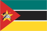
Flag description
three equal horizontal bands of green (top), black, and yellow with a red isosceles triangle based on the hoist side; the black band is edged in white; centered in the triangle is a yellow five-pointed star bearing a crossed rifle and hoe in black superimposed on an open white book; green represents the riches of the land, white peace, black the African continent, yellow the country's minerals, and red the struggle for independence; the rifle symbolizes defense and vigilance, the hoe refers to the country's agriculture, the open book stresses the importance of education, and the star represents Marxism and internationalism
Government type
republic
Independence
25 June 1975 (from Portugal)
International law organization participation
has not submitted an ICJ jurisdiction declaration; non-party state to the ICCt
International organization participation
ACP, AfDB, AU, C, CD, CPLP, EITI (compliant country), FAO, G-77, IAEA, IBRD, ICAO, ICC (NGOs), ICRM, IDA, IDB, IFAD, IFC, IFRCS, IHO, ILO, IMF, IMO, IMSO, Interpol, IOC, IOM, IPU, ISO (correspondent), ITSO, ITU, ITUC (NGOs), MIGA, NAM, OIC, OIF (observer), OPCW, SADC, UN, UNCTAD, UNESCO, UNHCR, UNIDO, Union Latina, UNISFA, UNWTO, UPU, WCO, WFTU (NGOs), WHO, WIPO, WMO, WTO
Judicial branch
- Supreme Court (consists of the court president, vice president, and 5 judges); Constitutional Council (consists of 7 judges) note - the Higher Council of the Judiciary is responsible for judiciary management and discipline Supreme Court president and vice president appointed by Mozambique president in consultation with the Higher Council of the Judiciary (CSMJ) and with ratification by the legislature; other judges elected by the legislature; judges serve 5-year renewable terms; Constitutional Council judges appointed - 1 by the president, 5 by the legislature, and 1 by the CSMJ; judges serve 5-year nonrenewable terms Administrative Court (capital city only); provincial courts or Tribunais Judicias de Provincia; District Courts or Tribunais Judicias de Districto; customs courts; maritime courts; courts marshal; labor courts; community courts
- highest court(s)
- Supreme Court (consists of the court president, vice president, and 5 judges); Constitutional Council (consists of 7 judges)
- judge selection and term of office
- Supreme Court president and vice president appointed by Mozambique president in consultation with the Higher Council of the Judiciary (CSMJ) and with ratification by the legislature; other judges elected by the legislature; judges serve 5-year renewable terms; Constitutional Council judges appointed - 1 by the president, 5 by the legislature, and 1 by the CSMJ; judges serve 5-year nonrenewable terms
- subordinate courts
- Administrative Court (capital city only); provincial courts or Tribunais Judicias de Provincia; District Courts or Tribunais Judicias de Districto; customs courts; maritime courts; courts marshal; labor courts; community courts
Legal system
mixed legal system of Portuguese civil law, Islamic law, and customary law
Legislative branch
- unicameral Assembly of the Republic or Assembleia da Republica (250 seats; members directly elected by popular vote to serve five-year terms) last held on 28 October 2009 (next to be held in 2014) percent of vote by party - FRELIMO 74.7%, RENAMO 17.7%, MDM 3.9%, other 3.7%; seats by party - FRELIMO 191, RENAMO 51, MDM 8
- election results
- percent of vote by party - FRELIMO 74.7%, RENAMO 17.7%, MDM 3.9%, other 3.7%; seats by party - FRELIMO 191, RENAMO 51, MDM 8
- elections
- last held on 28 October 2009 (next to be held in 2014)
National anthem
- "Patria Amada" (Lovely Fatherland) Salomao J. MANHICA/unknown adopted 2002
- lyrics/music
- Salomao J. MANHICA/unknown
- name
- "Patria Amada" (Lovely Fatherland)
National holiday
Independence Day, 25 June (1975)
Political parties and leaders
Democratic Movement of Mozambique (Movimento Democratico de Mocambique) or MDM [Daviz SIMANGO] Front for the Liberation of Mozambique (Frente de Liberatacao de Mocambique) or FRELIMO [Armando Emilio GUEBUZA] Mozambique National Resistance (Resistencia Nacional Mocambicana) or RENAMO [Afonso DHLAKAMA]
Political pressure groups and leaders
Mozambican League of Human Rights (Liga Mocambicana dos Direitos Humanos) or LDH [Alice MABOTE, president]
Suffrage
18 years of age; universal
Economy
Agriculture - products
cotton, cashew nuts, sugarcane, tea, cassava (tapioca), corn, coconuts, sisal, citrus and tropical fruits, potatoes, sunflowers; beef, poultry
Budget
- $4.115 billion $4.707 billion (2012 est.)
- expenditures
- $4.707 billion (2012 est.)
- revenues
- $4.115 billion
Budget surplus (+) or deficit (-)
-4.2% of GDP (2012 est.)
Central bank discount rate
9.5% (17 January 2013 est.) 3.25% (31 December 2010 est.)
Commercial bank prime lending rate
16.81% (31 December 2012 est.) 19.1% (31 December 2011 est.)
Current account balance
$-5.168 billion (2012 est.) $-2.996 billion (2011 est.)
Debt - external
$4.7 billion (31 December 2012 est.) $4.097 billion (31 December 2011 est.)
Distribution of family income - Gini index
45.6 (2008) 47.3 (2002)
Economy - overview
At independence in 1975, Mozambique was one of the world's poorest countries. Socialist mismanagement and a brutal civil war from 1977-92 exacerbated the situation. In 1987, the government embarked on a series of macroeconomic reforms designed to stabilize the economy. These steps, combined with donor assistance and with political stability since the multi-party elections in 1994, have led to dramatic improvements in the country's growth rate. Fiscal reforms, including the introduction of a value-added tax and reform of the customs service, have improved the government's revenue collection abilities. In spite of these gains, Mozambique remained dependent upon foreign assistance for 40% of its 2012 annual budget and over half the population remained below the poverty line. Subsistence agriculture continues to employ the vast majority of the country's work force and smallholder agricultural productivity and productivity growth is weak. A substantial trade imbalance persists although aluminum production from the Mozal smelter has significantly boosted export earnings in recent years. In 2012, The Mozambican government took over Portugal's last remaining share in the Cahora Bassa Hydroelectricity Company (HCB), a signficant contributor to the Southern African Power Pool. The government has plans to expand the Cahora Bassa Dam and build additional dams to increase its electricity exports and fulfill the needs of its burgeoning domestic industries. Mozambique's once substantial foreign debt has been reduced through forgiveness and rescheduling under the IMF's Heavily Indebted Poor Countries (HIPC) and Enhanced HIPC initiatives, and is now at a manageable level. In July 2007, the US government's Millennium Challenge Corporation (MCC) signed a $506.9 million Compact with Mozambique. Compact projects will end in September 2013 and are focusing on improving sanitation, roads, agriculture, and the business regulation environment in an effort to spur economic growth in the four northern provinces of the country. Citizens rioted in September 2010, after fuel, water, electricity, and bread price increases were announced. In an attempt to lessen the negative impact on people, the government implemented subsidies, decreased taxes and tariffs, and instituted other fiscal measures. Mozambique grew at an average annual rate of 6%-8% in the decade up to 2012, one of Africa's strongest performances. Mozambique's ability to attract large investment projects in natural resources is expected to fuel continued high growth in coming years. Revenues from these vast resources, including natural gas, coal, titanium and hydroelectric capacity, could overtake donor assistance within five years.
Exchange rates
meticais (MZM) per US dollar - 28.38 (2012 est.) 29.08 (2011 est.) 33.96 (2010 est.) 26.28 (2009) 24.13 (2008)
Exports
$3.47 billion (2012 est.) $3.118 billion (2011 est.)
Exports - commodities
aluminum, prawns, cashews, cotton, sugar, citrus, timber; bulk electricity
Exports - partners
South Africa 31.3%, Belgium 12.8%, China 9%, Italy 7.9%, Spain 6.2%, India 5.8% (2012)
Fiscal year
calendar year
GDP - composition, by end use
- 75.4% 13.7% 31.7% -1.2% 29.5% -49.1% (2012 est.)
- exports of goods and services
- 29.5%
- government consumption
- 13.7%
- household consumption
- 75.4%
- imports of goods and services
- -49.1%
- investment in fixed capital
- 31.7%
- investment in inventories
- -1.2%
GDP - composition, by sector of origin
- 29.9% 24.6% 45.5% (2012 est.)
- agriculture
- 29.9%
- industry
- 24.6%
- services
- 45.5% (2012 est.)
GDP - per capita (PPP)
$1,200 (2012 est.) $1,100 (2011 est.) $1,000 (2010 est.) data are in 2012 US dollars
GDP - real growth rate
7.4% (2012 est.) 7.3% (2011 est.) 7.1% (2010 est.)
GDP (official exchange rate)
$14.05 billion (2012 est.)
GDP (purchasing power parity)
$25.95 billion (2012 est.) $24.16 billion (2011 est.) $22.51 billion (2010 est.) data are in 2012 US dollars
Gross national saving
-4.6% of GDP (2012 est.) 0.8% of GDP (2011 est.) 5.4% of GDP (2010 est.)
Household income or consumption by percentage share
- 1.9% 36.7% (2008)
- highest 10%
- 36.7% (2008)
- lowest 10%
- 1.9%
Imports
$6.168 billion (2012 est.) $5.368 billion (2011 est.)
Imports - commodities
machinery and equipment, vehicles, fuel, chemicals, metal products, foodstuffs, textiles
Imports - partners
South Africa 30.5%, China 12.3%, India 11.6%, US 5.1%, Portugal 4.8%, Australia 4.5% (2012)
Industrial production growth rate
13% (2012 est.)
Industries
aluminum, petroleum products, chemicals (fertilizer, soap, paints), textiles, cement, glass, asbestos, tobacco, food, beverages
Inflation rate (consumer prices)
2.1% (2012 est.) 10.4% (2011 est.)
Labor force
10.29 million (2012 est.)
Labor force - by occupation
- 81% 6% 13% (1997 est.)
- agriculture
- 81%
- industry
- 6%
- services
- 13% (1997 est.)
Market value of publicly traded shares
$NA
Population below poverty line
52% (2009 est.)
Public debt
42.2% of GDP (2012 est.) 39.3% of GDP (2011 est.)
Reserves of foreign exchange and gold
$2.77 billion (31 December 2012 est.) $2.469 billion (31 December 2011 est.)
Stock of broad money
$5.268 billion (31 December 2011 est.) $4.095 billion (31 December 2010 est.)
Stock of domestic credit
$3.951 billion (31 December 2012 est.) $3.392 billion (31 December 2011 est.)
Stock of narrow money
$4.335 billion (31 December 2012 est.) $3.574 billion (31 December 2011 est.)
Taxes and other revenues
29.3% of GDP (2012 est.)
Unemployment rate
17% (2007 est.) 21% (1997 est.)
Energy
Carbon dioxide emissions from consumption of energy
3.426 million Mt (2011 est.)
Crude oil - exports
0 bbl/day (2010 est.)
Crude oil - imports
0 bbl/day (2010 est.)
Crude oil - production
20 bbl/day (2012 est.)
Crude oil - proved reserves
0 bbl (1 January 2013 es)
Electricity - consumption
10.19 billion kWh (2012 est.)
Electricity - exports
9.462 billion kWh (2012 est.)
Electricity - from fossil fuels
0.1% of total installed capacity (2012 est.)
Electricity - from hydroelectric plants
99.9% of total installed capacity (2012 est.)
Electricity - from nuclear fuels
0% of total installed capacity (2012 est.)
Electricity - from other renewable sources
0% of total installed capacity (2012 est.)
Electricity - imports
8.537 billion kWh (2012 est.)
Electricity - installed generating capacity
2.428 million kW (2010 est.)
Electricity - production
14.83 billion kWh (2012 est.)
Natural gas - consumption
80 million cu m (2010 est.)
Natural gas - exports
3.3 billion cu m (2011 est.)
Natural gas - imports
0 cu m (2011 est.)
Natural gas - production
3.82 billion cu m (2011 est.)
Natural gas - proved reserves
127.4 billion cu m (1 January 2013 es)
Refined petroleum products - consumption
19,580 bbl/day (2011 est.)
Refined petroleum products - exports
953.4 bbl/day (2010 est.)
Refined petroleum products - imports
16,140 bbl/day (2010 est.)
Refined petroleum products - production
991.6 bbl/day (2010 est.)
Communications
Broadcast media
1 state-run TV station supplemented by private TV station; Portuguese state TV's African service, RTP Africa, and Brazilian-owned TV Miramar are available; state-run radio provides nearly 100% territorial coverage and broadcasts in multiple languages; a number of privately owned and community-operated stations; transmissions of multiple international broadcasters are available (2007)
Internet country code
.mz
Internet hosts
89,737 (2012)
Internet users
613,600 (2009)
Telephone system
- a fair telecommunications system that is shackled with a heavy state presence, lack of competition, and high operating costs and charges stagnation in the fixed-line network contrasts with rapid growth in the mobile-cellular network; mobile-cellular coverage now includes all the main cities and key roads, including those from Maputo to the South African and Swaziland borders, the national highway through Gaza and Inhambane provinces, the Beira corridor, and from Nampula to Nacala; extremely low fixed-line teledensity; despite significant growth in mobile-cellular services, teledensity remains low at about 35 per 100 persons country code - 258; landing point for the EASSy and SEACOM fiber-optic submarine cable systems; satellite earth stations - 5 Intelsat (2 Atlantic Ocean and 3 Indian Ocean) (2011)
- domestic
- stagnation in the fixed-line network contrasts with rapid growth in the mobile-cellular network; mobile-cellular coverage now includes all the main cities and key roads, including those from Maputo to the South African and Swaziland borders, the national highway through Gaza and Inhambane provinces, the Beira corridor, and from Nampula to Nacala; extremely low fixed-line teledensity; despite significant growth in mobile-cellular services, teledensity remains low at about 35 per 100 persons
- general assessment
- a fair telecommunications system that is shackled with a heavy state presence, lack of competition, and high operating costs and charges
- international
- country code - 258; landing point for the EASSy and SEACOM fiber-optic submarine cable systems; satellite earth stations - 5 Intelsat (2 Atlantic Ocean and 3 Indian Ocean) (2011)
Telephones - main lines in use
88,100 (2012)
Telephones - mobile cellular
8.108 million (2012)
Transportation
Airports
98 (2013)
Airports - with paved runways
- 4 (2013)
- 1,524 to 2,437 m
- 9
- 2,438 to 3,047 m
- 2
- 914 to 1,523 m
- 5
- over 3,047 m
- 1
- total
- 21
- under 914 m
- 4 (2013)
Airports - with unpaved runways
- 38 (2013)
- 1,524 to 2,437 m
- 9
- 2,438 to 3,047 m
- 1
- 914 to 1,523 m
- 29
- total
- 77
Merchant marine
- cargo 2 2 (Belgium 2) (2010)
- foreign-owned
- 2 (Belgium 2) (2010)
- total
- 2
Pipelines
gas 972 km; refined products 278 km (2013)
Ports and terminals
Beira, Maputo, Nacala
Railways
- 4,787 km 4,787 km 1.067-m gauge (2008)
- total
- 4,787 km
Roadways
- 30,331 km 6,303 km 24,028 km (2009)
- total
- 30,331 km
- unpaved
- 24,028 km (2009)
Waterways
460 km (Zambezi River navigable to Tete and along Cahora Bassa Lake) (2010)
Military and Security
Manpower available for military service
- 4,613,367 (2010 est.)
- males age 16-49
- 4,613,367 (2010 est.)
Manpower fit for military service
- 2,677,473 2,941,073 (2010 est.)
- females age 16-49
- 2,941,073 (2010 est.)
- males age 16-49
- 2,677,473
Manpower reaching militarily significant age annually
- 274,602 280,008 (2010 est.)
- female
- 280,008 (2010 est.)
- male
- 274,602
Military branches
- Mozambique Armed Defense Forces (Forcas Armadas de Defesa de Mocambique, FADM): Mozambique Army, Mozambique Navy (Marinha de Guerra de Mocambique, MGM), Mozambique Air Force (Forca Aerea de Mocambique, FAM) (2012)
- Mozambique Armed Defense Forces (Forcas Armadas de Defesa de Mocambique, FADM)
- Mozambique Army, Mozambique Navy (Marinha de Guerra de Mocambique, MGM), Mozambique Air Force (Forca Aerea de Mocambique, FAM) (2012)
Military expenditures
0.6% of GDP (2012)
Military service age and obligation
registration for military service is mandatory for all males and females at 18 years of age; 18-35 years of age for selective compulsory military service; 18 years of age for voluntary service; 2-year service obligation; women may serve as officers or enlisted (2012)
Transnational Issues
Disputes - international
South Africa has placed military units to assist police operations along the border of Lesotho, Zimbabwe, and Mozambique to control smuggling, poaching, and illegal migration
Illicit drugs
southern African transit point for South Asian hashish and heroin, and South American cocaine probably destined for the European and South African markets; producer of cannabis (for local consumption) and methaqualone (for export to South Africa); corruption and poor regulatory capability make the banking system vulnerable to money laundering, but the lack of a well-developed financial infrastructure limits the country's utility as a money-laundering center