1996 Edition
CIA World Factbook 1996 (Project Gutenberg)
Introduction
Description
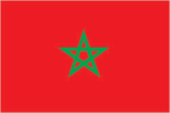
red with a green pentacle (five-pointed, linear star) known as Solomon's seal in the center of the flag; green is the traditional color of Islam
Location
32 00 N, 5 00 W -- Northern Africa, bordering the North Atlantic Ocean and the Mediterranean Sea, between Algeria and Western Sahara Flag ----
Geography
Area
- comparative area
- slightly larger than California
- land area
- 446,300 sq km
- total area
- 446,550 sq km
Climate
Mediterranean, becoming more extreme in the interior
Coastline
1,835 km
Environment
- current issues
- land degradation/desertification (soil erosion resulting from farming of marginal areas, overgrazing, destruction of vegetation); water supplies contaminated by raw sewage; siltation of reservoirs; oil pollution of coastal waters
- international agreements
- party to - Biodiversity, Climate Change, Endangered Species, Marine Dumping, Marine Life Conservation, Nuclear Test Ban, Ozone Layer Protection, Ship Pollution, Wetlands; signed, but not ratified - Desertification, Environmental Modification, Law of the Sea
- natural hazards
- northern mountains geologically unstable and subject to earthquakes; periodic droughts
Geographic coordinates
32 00 N, 5 00 W
Geographic note
strategic location along Strait of Gibraltar
International disputes
claims and administers Western Sahara, but sovereignty is unresolved and the UN is attempting to hold a referendum on the issue; the UN-administered cease-fire has been in effect since September 1991; Spain controls five places of sovereignty (plazas de soberania) on and off the coast of Morocco - the coastal enclaves of Ceuta and Melilla which Morocco contests as well as the islands of Penon de Alhucemas, Penon de Velez de la Gomera, and Islas Chafarinas
Irrigated land
12,650 sq km (1989 est.)
Land boundaries
- border countries
- Algeria 1,559 km, Western Sahara 443 km
- note
- excludes the length of the boundary between the places of sovereignty and Morocco
- total
- 2,002 km
Land use
- arable land
- 18%
- forest and woodland
- 12%
- meadows and pastures
- 28%
- other
- 41%
- permanent crops
- 1%
Location
Northern Africa, bordering the North Atlantic Ocean and the Mediterranean Sea, between Algeria and Western Sahara
Map references
Africa
Maritime claims
- contiguous zone
- 24 nm
- continental shelf
- 200-m depth or to the depth of exploitation
- exclusive economic zone
- 200 nm
- territorial sea
- 12 nm
Natural resources
phosphates, iron ore, manganese, lead, zinc, fish, salt
Terrain
- northern coast and interior are mountainous with large areas of bordering plateaus, intermontane valleys, and rich coastal plains
- highest point
- Jebel Toubkal 4,165 m
- lowest point
- Sebkha Tah -55 m
People and Society
Age structure
0-14 years: 38% (male 5,696,731; female 5,522,077) 15-64 years: 58% (male 8,577,918; female 8,700,521) 65 years and over: 4% (male 613,712; female 668,197) (July 1996 est.)
Birth rate
27.39 births/1,000 population (1996 est.)
Death rate
5.77 deaths/1,000 population (1996 est.)
Ethnic divisions
Arab-Berber 99.1%, other 0.7%, Jewish 0.2%
Infant mortality rate
43.2 deaths/1,000 live births (1996 est.)
Languages
Arabic (official), Berber dialects, French often the language of business, government, and diplomacy
Life expectancy at birth
- female
- 71.61 years (1996 est.)
- male
- 67.53 years
- total population
- 69.52 years
Literacy
- age 15 and over can read and write (1995 est.)
- female
- 31%
- male
- 56.6%
- total population
- 43.7%
Nationality
- adjective
- Moroccan
- noun
- Moroccan(s)
Net migration rate
-1.08 migrant(s)/1,000 population (1996 est.)
Population
29,779,156 (July 1996 est.)
Population growth rate
2.05% (1996 est.)
Religions
Muslim 98.7%, Christian 1.1%, Jewish 0.2%
Sex ratio
- all ages
- 1 male(s)/female (1996 est.)
- at birth
- 1.05 male(s)/female
- under 15 years
- 1.03 male(s)/female 15-64 years: 0.99 male(s)/female 65 years and over: 0.92 male(s)/female
Total fertility rate
3.58 children born/woman (1996 est.)
Government
Administrative divisions
36 provinces and 5 wilayas*; Agadir, Al Hoceima, Assa-Zag, Azilal, Beni Mellal, Ben Slimane, Boulemane, Casablanca*, Chaouen, El Jadida, El Kelaa des Srarhna, Er Rachidia, Essaouira, Es Smara, Fes*, Figuig, Guelmim, Ifrane, Kenitra, Khemisset, Khenifra, Khouribga, Laayoune, Larache, Marrakech*, Meknes*, Nador, Ouarzazate, Oujda, Rabat-Sale*, Safi, Settat, Sidi Kacem, Tanger, Tan-Tan, Taounate, Taroudannt, Tata, Taza, Tetouan, Tiznit
Capital
Rabat
Chamber of Representatives (Majlis Nawab)
two-thirds elected by direct, universal suffrage and one-third by an electoral college of government, professional, and labor representatives; direct, popular elections last held 15 June 1993 (next to be held NA 1999); results - percent of vote by party NA; seats - (333 total, 222 directly elected) USFP 48, IP 43, MP 33, RNI 28, UC 27, PND 14, MNP 14, PPS 6, PDI 3, SAP 2, PA 2, OADP 2; indirect, special interest elections last held 17 September 1993 (next to be held NA 1999); results - percent of vote by party NA; seats - (333 total, 111 indirectly elected) UC 27, MP 18, RNI 13, MNP 11, PND 10, IP 7, Party of Shura and Istiqlal 6, USFP 4, PPS 4, CDT 4, UTM 3, UGTM 2, SAP 2
Constitution
10 March 1972, revised 4 September 1992
Data code
MO
Diplomatic representation in US
- chancery
- 1601 21st Street NW, Washington, DC 20009
- chief of mission
- Ambassador Mohamed BENAISSA
- telephone
- [1] (202) 462-7979 through 7982
Executive branch
- cabinet
- Council of Ministers was appointed by the king
- chief of state
- King HASSAN II (since 3 March 1961) is a hereditary monarch
- head of government
- Prime Minister Abdellatif FILALI (since 29 May 1994) was appointed by the king
FAX
- [1] (202) 265-0161
- [212] (7) 76 56 61
- consulate(s) general
- New York
- consulate(s) general
- Casablanca
Flag
red with a green pentacle (five-pointed, linear star) known as Solomon's seal in the center of the flag; green is the traditional color of Islam
Independence
2 March 1956 (from France)
International organization participation
ABEDA, ACCT (associate), AfDB, AFESD, AL, AMF, AMU, CCC, EBRD, ECA, FAO, G-77, IAEA, IBRD, ICAO, ICC, ICFTU, ICRM, IDA, IDB, IFAD, IFC, IFRCS, ILO, IMF, IMO, Intelsat, Interpol, IOC, IOM (observer), ISO, ITU, NAM, OAS (observer), OIC, OSCE (partner), UN, UNAVEM III, UNCTAD, UNESCO, UNHCR, UNIDO, UPU, WHO, WIPO, WMO, WToO, WTrO
Judicial branch
Supreme Court, judges are appointed on the recommendation of the Supreme Council of the Judiciary, presided over by the king
Legal system
based on Islamic law and French and Spanish civil law system; judicial review of legislative acts in Constitutional Chamber of Supreme Court
Legislative branch
unicameral
Name of country
- conventional long form
- Kingdom of Morocco
- conventional short form
- Morocco
- local long form
- Al Mamlakah al Maghribiyah
- local short form
- Al Maghrib
National holiday
National Day, 3 March (1961) (anniversary of King HASSAN II's accession to the throne)
Political parties and leaders
- independents
- National Rally of Independents (RNI), Ahmed OSMAN; Democracy and Istiqlal Party (PDI), leader NA; Action Party (PA), Abdullah SENHAJI; Non-Obedience Candidates (SAP), leader NA labor unions and community organizations (indirect elections: Democratic Confederation of Labor (CDT), Nabir AMAOUI; General Union of Moroccan Workers (UGTM), Abderrazzak AFILAL; Moroccan Union of Workers (UTM), leader NA; Party of Shura and Istiqlal, leader NA
- opposition
- Socialist Union of Popular Forces (USFP), Mohammad al-YAZGHI; Istiqlal Party (IP), M'Hamed BOUCETTA; Party of Progress and Socialism (PPS), Ali YATA; Organization of Democratic and Popular Action (OADP), Mohamed Ben SAID
- pro-government
- Constitutional Union (UC), Maati BOUABID; Popular Movement (MP), Mohamed LAENSER; National Democratic Party (PND), Mohamed Arsalane EL-JADIDI; National Popular Movement (MNP), Mahjoubi AHARDANE
Suffrage
21 years of age; universal
Type of government
constitutional monarchy
US diplomatic representation
- chief of mission
- Ambassador Marc C. GINSBERG
- embassy
- 2 Avenue de Marrakech, Rabat
- mailing address
- PSC 74, Box 003, APO AE 09718
- telephone
- [212] (7) 76 22 65
Economy
Agriculture
barley, wheat, citrus, wine, vegetables, olives; livestock
Budget
- expenditures
- $8.9 billion, including capital expenditures of $NA (1994 est.)
- revenues
- $8.1 billion
Currency
1 Moroccan dirham (DH) = 100 centimes
Economic aid
- note
- $2.8 billion debt canceled by Saudi Arabia (1991)
- recipient
- ODA, $297 million (1993)
Economic overview
- Morocco faces the typical problems of developing countries - restraining government spending, reducing constraints on private activity and foreign trade, and keeping inflation within bounds. Since the early 1980s the government has pursued an economic program toward these objectives with the support of the IMF, the World Bank, and the Paris Club of creditors. The
- economy has substantial assets to draw on
- the world's largest phosphate reserves, diverse agricultural and fishing resources, a sizable tourist industry, a growing manufacturing sector, and remittances from Moroccans working abroad. A severe drought in 1992-93 depressed economic activity and held down exports. Real GDP contracted by 4.4% in 1992 and 1.1% in 1993. Despite these setbacks, initiatives to relax capital controls, strengthen the banking sector, and privatize state enterprises went forward in 1993-94. Favorable rainfall in 1994 boosted agricultural production by 40%. In 1995, Morocco suffered from a drought said to be the worst in 30 years. Servicing the large debt, high unemployment, and vulnerability to external economic forces remain long-term problems for Morocco.
Electricity
- capacity
- 2,620,000 kW
- consumption per capita
- 361 kWh (1993)
- production
- 9.9 billion kWh
Exchange rates
Moroccan dirhams (DH) per US$1 - 8.607 (January 1996), 8.540 (1995), 9.203 (1994), 9.299 (1993), 8.538 (1992), 8.707 (1991)
Exports
- $4 billion (f.o.b., 1994)
- commodities
- food and beverages 30%, semiprocessed goods 23%, consumer goods 21%, phosphates 17%
- partners
- EC 70%, Japan 5%, US 4%, Libya 3%, India 2% (1993)
External debt
$20.5 billion (1994 est.)
Fiscal year
calendar year
GDP
purchasing power parity - $87.4 billion (1995 est.)
GDP composition by sector
- agriculture
- 14.3%
- industry
- 32.2%
- services
- 53.5% (1993 est.)
GDP per capita
$3,000 (1995 est.)
GDP real growth rate
-6.5% (1995 est.)
Illicit drugs
illicit producer of hashish; trafficking on the increase for both domestic and international drug markets; shipments of hashish mostly directed to Western Europe; transit point for cocaine from South America destined for Western Europe
Imports
- $7.2 billion (c.i.f., 1994)
- commodities
- capital goods 24%, semiprocessed goods 22%, raw materials 16%, fuel and lubricants 16%, food and beverages 13%, consumer goods 9%
- partners
- EC 59%, US 8%, Saudi Arabia 5%, UAE 3%, Russia 2% (1993)
Industrial production growth rate
0.1%
Industries
phosphate rock mining and processing, food processing, leather goods, textiles, construction, tourism
Inflation rate (consumer prices)
5.4% (1994)
Labor force
- 7.4 million
- by occupation
- agriculture 50%, services 26%, industry 15%, other 9% (1985)
Unemployment rate
16% (1994 est.)
Communications
Branches
Royal Moroccan Army, Royal Moroccan Navy, Royal Moroccan Air Force, Royal Gendarmerie, Auxiliary Forces
Defense expenditures
exchange rate conversion - $1.38 billion, 4.1% of GDP (1995)
Manpower availability
- males age 15-49
- 7,541,745
- males fit for military service
- 4,782,028
- males reach military age (18) annually
- 330,344 (1996 est.)
Radio broadcast stations
AM 20, FM 7, shortwave 0
Radios
5.527 million (1992 est.)
Telephone system
- domestic
- good system composed of open-wire lines, cables, and microwave radio relay links; principal centers are Casablanca and Rabat; secondary centers are Fes, Marrakech, Oujda, Tangier, and Tetouan
- international
- 5 submarine cables; satellite earth stations - 2 Intelsat (Atlantic Ocean) and 1 Arabsat; microwave radio relay to Gibraltar, Spain, and Western Sahara; coaxial cable and microwave radio relay to Algeria; participant in Medarabtel
Telephones
270,100 (1987 est.)
Television broadcast stations
26 (repeaters 26)
Televisions
1.21 million (1993 est.) Defense
Transportation
Airports
- total
- 63
- with paved runways 1 524 to 2 437 m
- 7
- with paved runways 2 438 to 3 047 m
- 4
- with paved runways 914 to 1 523 m
- 2
- with paved runways over 3 047 m
- 11
- with paved runways under 914 m
- 12
- with unpaved runways 1 524 to 2 437 m
- 11
- with unpaved runways 2 438 to 3 047 m
- 1
- with unpaved runways 914 to 1 523 m
- 15 (1995 est.)
Heliports
1 (1995 est.)
Highways
- paved
- 29,440 km (including 73 km of expressways)
- total
- 59,474 km
- unpaved
- 30,034 km (1991 est.)
Merchant marine
- ships by type
- cargo 8, chemical tanker 7, container 2, oil tanker 4, refrigerated cargo 9, roll-on/roll-off cargo 6, short-sea passenger 1 (1995 est.)
- total
- 37 ships (1,000 GRT or over) totaling 175,962 GRT/257,449 DWT
Pipelines
crude oil 362 km; petroleum products 491 km (abandoned); natural gas 241 km
Ports
Agadir, Al Jadida, Casablanca, El Jorf Lasfar, Kenitra, Mohammedia, Nador, Rabat, Safi, Tangier; also Spanish-controlled Ceuta and Melilla
Railways
- standard gauge
- 1,907 km 1.435-m gauge (1003 km electrified; 246 km double track) (1994)
- total
- 1,907 km