2011 Edition
CIA World Factbook 2011 Archive (HTML)
Introduction
Background
The use of the name Montenegro began in the 15th century when the Crnojevic dynasty began to rule the Serbian principality of Zeta; over subsequent centuries Montenegro was able to maintain its independence from the Ottoman Empire. From the 16th to 19th centuries, Montenegro became a theocracy ruled by a series of bishop princes; in 1852, it was transformed into a secular principality. After World War I, Montenegro was absorbed by the Kingdom of Serbs, Croats, and Slovenes, which became the Kingdom of Yugoslavia in 1929; at the conclusion of World War II, it became a constituent republic of the Socialist Federal Republic of Yugoslavia. When the latter dissolved in 1992, Montenegro federated with Serbia, first as the Federal Republic of Yugoslavia and, after 2003, in a looser union of Serbia and Montenegro. In May 2006, Montenegro invoked its right under the Constitutional Charter of Serbia and Montenegro to hold a referendum on independence from the state union. The vote for severing ties with Serbia exceeded 55% - the threshold set by the EU - allowing Montenegro to formally declare its independence on 3 June 2006.
Geography
Area
- 13,812 sq km 13,452 sq km 360 sq km
- total
- 13,812 sq km
- water
- 360 sq km
Area - comparative
slightly smaller than Connecticut
Climate
Mediterranean climate, hot dry summers and autumns and relatively cold winters with heavy snowfalls inland
Coastline
293.5 km
Elevation extremes
- Adriatic Sea 0 m Bobotov Kuk 2,522 m
- highest point
- Bobotov Kuk 2,522 m
- lowest point
- Adriatic Sea 0 m
Environment - current issues
pollution of coastal waters from sewage outlets, especially in tourist-related areas such as Kotor
Environment - international agreements
- Air Pollution, Biodiversity, Climate Change, Climate Change-Kyoto Protocol, Desertification, Hazardous Wastes, Law of the Sea, Marine Dumping, Marine Life Conservation, Ozone Layer Protection, Ship Pollution none of the selected agreements
- party to
- Air Pollution, Biodiversity, Climate Change, Climate Change-Kyoto Protocol, Desertification, Hazardous Wastes, Law of the Sea, Marine Dumping, Marine Life Conservation, Ozone Layer Protection, Ship Pollution
- signed, but not ratified
- none of the selected agreements
Geographic coordinates
42 30 N, 19 18 E
Geography - note
strategic location along the Adriatic coast
Irrigated land
22 sq km (2008)
Land boundaries
- 625 km Albania 172 km, Bosnia and Herzegovina 225 km, Croatia 25 km, Kosovo 79 km, Serbia 124 km
- border countries
- Albania 172 km, Bosnia and Herzegovina 225 km, Croatia 25 km, Kosovo 79 km, Serbia 124 km
- total
- 625 km
Land use
- 13.7% 1% 85.3%
- arable land
- 13.7%
- other
- 85.3%
- permanent crops
- 1%
Location
Southeastern Europe, between the Adriatic Sea and Serbia
Map references
Europe
Maritime claims
- 12 nm defined by treaty
- continental shelf
- defined by treaty
- territorial sea
- 12 nm
Natural hazards
destructive earthquakes
Natural resources
bauxite, hydroelectricity
Terrain
highly indented coastline with narrow coastal plain backed by rugged high limestone mountains and plateaus
People and Society
Age structure
- 15.5% (male 50,060/female 52,823) 71% (male 244,057/female 225,620) 13.5% (male 35,551/female 53,696) (2011 est.)
- 0-14 years
- 15.5% (male 50,060/female 52,823)
- 15-64 years
- 71% (male 244,057/female 225,620)
- 65 years and over
- 13.5% (male 35,551/female 53,696) (2011 est.)
Birth rate
11 births/1,000 population (2011 est.)
Children under the age of 5 years underweight
2.2% (2006)
Death rate
8.89 deaths/1,000 population (July 2011 est.)
Drinking water source
- urban: 100% of population rural: 96% of population total: 98% of population urban: 0% of population rural: 4% of population total: 2% of population (2008)
- rural
- 4% of population
- total
- 2% of population (2008)
- urban
- 0% of population
Education expenditures
NA
Ethnic groups
Montenegrin 43%, Serbian 32%, Bosniak 8%, Albanian 5%, other (Muslims, Croats, Roma (Gypsy)) 12% (2003 census)
Hospital bed density
3.98 beds/1,000 population (2007)
Languages
Serbian 63.6%, Montenegrin (official) 22%, Bosnian 5.5%, Albanian 5.3%, unspecified 3.7% (2003 census)
Major cities - population
PODGORICA (capital) 144,000 (2009)
Major infectious diseases
- intermediate bacterial diarrhea Crimean Congo hemorrhagic fever (2009)
- degree of risk
- intermediate
- food or waterborne diseases
- bacterial diarrhea
- vectorborne disease
- Crimean Congo hemorrhagic fever (2009)
Maternal mortality rate
15 deaths/100,000 live births (2008)
Median age
- 37.8 years 36.5 years 39.2 years (2011 est.)
- female
- 39.2 years (2011 est.)
- male
- 36.5 years
- total
- 37.8 years
Nationality
- Montenegrin(s) Montenegrin
- adjective
- Montenegrin
- noun
- Montenegrin(s)
Population
661,807 (July 2011 est.)
Population growth rate
-0.705% (2011 est.)
Religions
Orthodox 74.2%, Muslim 17.7%, Catholic 3.5%, other 0.6%, unspecified 3%, atheist 1% (2003 census)
Sanitation facility access
- urban: 96% of population rural: 86% of population total: 92% of population urban: 4% of population rural: 14% of population total: 8% of population (2008)
- rural
- 14% of population
- total
- 8% of population (2008)
- urban
- 4% of population
School life expectancy (primary to tertiary education)
NA
Sex ratio
- 1.072 male(s)/female 0.95 male(s)/female 1.08 male(s)/female 0.67 male(s)/female 0.99 male(s)/female (2011 est.)
- 15-64 years
- 1.08 male(s)/female
- 65 years and over
- 0.67 male(s)/female
- at birth
- 1.072 male(s)/female
- total population
- 0.99 male(s)/female (2011 est.)
- under 15 years
- 0.95 male(s)/female
Urbanization
- 61% of total population (2010) 0.1% annual rate of change (2010-15 est.)
- rate of urbanization
- 0.1% annual rate of change (2010-15 est.)
- urban population
- 61% of total population (2010)
Government
Administrative divisions
21 municipalities (opstine, singular - opstina); Andrijevica, Bar, Berane, Bijelo Polje, Budva, Cetinje, Danilovgrad, Herceg Novi, Kolasin, Kotor, Mojkovac, Niksic, Plav, Pljevlja, Pluzine, Podgorica, Rozaje, Savnik, Tivat, Ulcinj, Zabljak
Capital
- Podgorica 42 26 N, 19 16 E UTC+1 (6 hours ahead of Washington, DC during Standard Time) +1 hr, begins last Sunday in March; ends last Sunday in October
- daylight saving time
- +1 hr, begins last Sunday in March; ends last Sunday in October
- geographic coordinates
- 42 26 N, 19 16 E
- name
- Podgorica
- time difference
- UTC+1 (6 hours ahead of Washington, DC during Standard Time)
Constitution
approved 19 October 2007 (by the Assembly)
Country name
- none Montenegro none Crna Gora People's Republic of Montenegro, Socialist Republic of Montenegro, Republic of Montenegro
- conventional long form
- none
- conventional short form
- Montenegro
- former
- People's Republic of Montenegro, Socialist Republic of Montenegro, Republic of Montenegro
- local long form
- none
- local short form
- Crna Gora
Diplomatic representation from the US
- Ambassador (vacant); Charge d'Affaires Benjamin LOWENTHAL Ljubljanska bb, 81000 Podgorica, Montenegro use embassy street address [382] 81 225 417 [382] 81 241 358
- chief of mission
- Ambassador (vacant); Charge d'Affaires Benjamin LOWENTHAL
- embassy
- Ljubljanska bb, 81000 Podgorica, Montenegro
- FAX
- [382] 81 241 358
- mailing address
- use embassy street address
- telephone
- [382] 81 225 417
Diplomatic representation in the US
- Ambassador Srdjan DARMANOVIC 1610 New Hampshire Avenue NW, Washington, DC, 20009 [1] (202) 234-6108 [1] (202) 234-6109 New York
- chancery
- 1610 New Hampshire Avenue NW, Washington, DC, 20009
- chief of mission
- Ambassador Srdjan DARMANOVIC
- consulate(s) general
- New York
- FAX
- [1] (202) 234-6109
- telephone
- [1] (202) 234-6108
Executive branch
- President Filip VUJANOVIC (since 6 April 2008) Prime Minister Igor LUKSIC (since 29 December 2010) Ministries act as cabinet president elected by direct vote for five-year term (eligible for a second term); election last held on 6 April 2008 (next to be held in 2013); prime minister proposed by president, accepted by Assembly Filip VUJANOVIC reelected president; Filip VUJANOVIC 51.9%, Andrija MANDIC 19.6%, Nebojsa MEDOJEVIC 16.6%, Srdan MILIC 11.9%
- cabinet
- Ministries act as cabinet
- chief of state
- President Filip VUJANOVIC (since 6 April 2008)
- election results
- Filip VUJANOVIC reelected president; Filip VUJANOVIC 51.9%, Andrija MANDIC 19.6%, Nebojsa MEDOJEVIC 16.6%, Srdan MILIC 11.9%
- elections
- president elected by direct vote for five-year term (eligible for a second term); election last held on 6 April 2008 (next to be held in 2013); prime minister proposed by president, accepted by Assembly
- head of government
- Prime Minister Igor LUKSIC (since 29 December 2010)
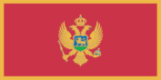
Flag description
a red field bordered by a narrow golden-yellow stripe with the Montenegrin coat of arms centered; the arms consist of a double-headed golden eagle - symbolizing the unity of church and state - surmounted by a crown; the eagle holds a golden scepter in its right claw and a blue orb in its left; the breast shield over the eagle shows a golden lion passant on a green field in front of a blue sky; the lion is symbol of episcopal authority and harks back to the three and a half centuries that Montenegro was ruled as a theocracy
Government type
republic
Independence
3 June 2006 (from Serbia and Montenegro)
International law organization participation
has not submitted an ICJ jurisdiction declaration; accepts ICCt jurisdiction
International organization participation
CE, CEI, EAPC, EBRD, FAO, IAEA, IBRD, ICAO, ICRM, IDA, IFC, IFRCS, ILO, IMF, IMO, IMSO, Interpol, IOC, IOM, IPU, ISO (correspondent), ITSO, ITU, ITUC, MIGA, NAM (observer), OIF (observer), OPCW, OSCE, PCA, PFP, SECI, UN, UNCTAD, UNESCO, UNHCR, UNIDO, UNMIL, UNWTO, UPU, WCO, WHO, WIPO, WMO, WTO (observer)
Judicial branch
Constitutional Court (five judges serve nine-year terms); Supreme Court (judges have life tenure)
Legal system
civil law
Legislative branch
- unicameral Assembly (81 seats; members elected by direct vote to serve four-year terms; note - seats increased from 74 seats in 2006) last held on 29 March 2009 (next to be held in 2013) percent of vote by party - Coalition for European Montenegro 51.94%, SNP 16.83%, NOVA 9.22%, PZP 6.03%, other (including Albanian minority parties) 15.98%; seats by party - Coalition for European Montenegro 48, SNP 16, NOVA 8, PZP 5, Albanian minority parties 4
- election results
- percent of vote by party - Coalition for European Montenegro 51.94%, SNP 16.83%, NOVA 9.22%, PZP 6.03%, other (including Albanian minority parties) 15.98%; seats by party - Coalition for European Montenegro 48, SNP 16, NOVA 8, PZP 5, Albanian minority parties 4
- elections
- last held on 29 March 2009 (next to be held in 2013)
National anthem
- "Oj, svijetla majska zoro" (Oh, Bright Dawn of May) Sekula DRLJEVIC/unknown, arranged by Zarko MIKOVIC adopted 2004; the anthem's music is based on a Montenegrin folk song
- lyrics/music
- Sekula DRLJEVIC/unknown, arranged by Zarko MIKOVIC
- name
- "Oj, svijetla majska zoro" (Oh, Bright Dawn of May)
National holiday
National Day, 13 July (1878)
National symbol(s)
double-headed eagle
Political parties and leaders
Albanian Alternative or AA [Vesel SINISHTAJ]; Coalition for European Montenegro (bloc) [Milo DJUKANOVIC] (includes Democratic Party of Socialists or DPS [Milo DJUKANOVIC], Social Democratic Party or SDP [Ranko KRIVOKAPIC], Bosniak Party of BS [Rafet HUSOVIC], and Croatian Civic Initiative or HGI [Marija VUCINOVIC); Coalition SNP-NS-DSS (bloc) (includes Socialist People's Party or SNP [Srdjan MILIC], People's Party of Montenegro or NS [Predrag POPOVIC], and Democratic Serbian Party of Montenegro or DSS [Ranko KADIC]); Democratic League-Party of Democratic Prosperity or SPP [Mehmet BARDHIJ]; Democratic Union of Albanians or DUA [Ferhat DINOSHA]; For a Different Montenegro (bloc) [Goran BATRICEVIC] (includes Democratic Center or DC [Goran BATRICEVIC] and Liberal Party of Montenegro or LP [Miodrag ZIVKOVIC]); FORCA [Nazif CUNGU]; Movement for Changes or PZP [Nebojsa MEDOJEVIC]; National Coalition (includes People's Party of Montenegro or NS [Predrag POPOVIC] and Democratic Serbian Party of Montenegro or DSS [Ranko KADIC]); New Serb Democracy or NOVA [Andrija MANDIC]; Socialist People's Party of Montenegro or SNP [Srdjan MILIC]
Suffrage
18 years of age; universal
Economy
Agriculture - products
tobacco, potatoes, citrus fruits, olives, grapes; sheep
Budget
- $NA $NA
- expenditures
- $NA
- revenues
- $NA
Commercial bank prime lending rate
9.53% (31 December 2010 est.) 9.36% (31 December 2009 est.)
Current account balance
-$1.102 billion (2007 est.)
Debt - external
$650 million (2006)
Distribution of family income - Gini index
30 (2008) 30 (2003)
Economy - overview
Montenegro severed its economy from federal control and from Serbia during the MILOSEVIC era and maintained its own central bank, adopted the Deutchmark, then the euro - rather than the Yugoslav dinar - as official currency, collected customs tariffs, and managed its own budget. The dissolution of the loose political union between Serbia and Montenegro in 2006 led to separate membership in several international financial institutions, such as the European Bank for Reconstruction and Development. In January 2007, Montenegro joined the World Bank and IMF. Montenegro is pursuing its own membership in the World Trade Organization and signed a Stabilization and Association agreement with the European Union in October 2007. The European Council granted candidate country status to Montenegro at the December 2010 session. Unemployment and regional disparities in development are key political and economic problems. Montenegro has privatized its large aluminum complex - the dominant industry - as well as most of its financial sector, and has begun to attract foreign direct investment in the tourism sector. The global financial crisis has had a significant negative impact on the economy, due to the ongoing credit crunch, a decline in the real estate sector, and a fall in aluminum exports.
Electricity - consumption
2.474 billion kWh (2008 est.)
Electricity - exports
0 kWh (2009 est.)
Electricity - imports
0 kWh (2009 est.)
Electricity - production
2.66 billion kWh (2008 est.)
Exchange rates
euros (EUR) per US dollar - 0.755 (2010) 0.72 (2009) 0.6827 (2008) 0.7345 (2007) 0.7964 (2006)
Exports
$171.3 million (2003)
Exports - partners
Italy 27.9%, Greece 21.6%, Slovenia 11.3%, Hungary 8.5%, US 7.6%, Egypt 4.8% (2009)
GDP - composition by sector
- NA% NA% NA%
- agriculture
- NA%
- industry
- NA%
- services
- NA%
GDP - per capita (PPP)
$10,100 (2010 est.) $9,900 (2009 est.) $10,400 (2008 est.) data are in 2010 US dollars
GDP - real growth rate
1.1% (2010 est.) -5.7% (2009 est.) 6.9% (2008 est.)
GDP (official exchange rate)
$4.017 billion (2010 est.)
GDP (purchasing power parity)
$6.724 billion (2010 est.) $6.653 billion (2009 est.) $7.055 billion (2008 est.) data are in 2010 US dollars
Household income or consumption by percentage share
- 3.6% 24.1% (2008)
- highest 10%
- 24.1% (2008)
- lowest 10%
- 3.6%
Imports
$601.7 million (2003)
Imports - partners
Italy 17.2%, Slovenia 14.4%, Germany 9.9%, China 7.8%, Austria 7.7%, Russia 6.1%, Greece 4%, Hungary 4% (2009)
Industries
steelmaking, aluminum, agricultural processing, consumer goods, tourism
Inflation rate (consumer prices)
3.4% (2007)
Investment (gross fixed)
30.5% of GDP (2006 est.)
Labor force
259,100 (2004)
Labor force - by occupation
- 2% 30% 68% (2004 est.)
- agriculture
- 2%
- industry
- 30%
- services
- 68% (2004 est.)
Market value of publicly traded shares
$3.604 billion (31 December 2010) $4.289 billion (31 December 2009) $2.863 billion (31 December 2008)
Natural gas - consumption
NA cu m (2009 est.)
Natural gas - exports
0 cu m (2009 est.)
Natural gas - imports
0 cu m (2009 est.)
Natural gas - production
0 cu m (2009 est.)
Natural gas - proved reserves
0 cu m (1 January 2011 est.)
Oil - consumption
4,000 bbl/day (2010 est.)
Oil - exports
0 bbl/day (2009 est.)
Oil - imports
3,149 bbl/day (2009 est.)
Oil - production
0 bbl/day (2010 est.)
Oil - proved reserves
0 bbl (1 January 2011 est.)
Population below poverty line
7% (2007 est.)
Public debt
38% of GDP (2006)
Reserves of foreign exchange and gold
$NA
Stock of broad money
$1.406 billion (31 December 2008) $1.446 billion (31 December 2007)
Stock of domestic credit
$3.29 billion (31 December 2009) $3.771 billion (31 December 2008)
Stock of narrow money
$816.8 million (31 December 2008) $1.172 billion (31 December 2007)
Unemployment rate
14.7% (2007 est.)
Communications
Broadcast media
state-owned national radio-TV broadcaster operates 2 terrestrial television networks, 1 satellite TV channel, and 2 radio networks; roughly a dozen privately-owned TV broadcasters operate networks nationally, regionally, and locally; in addition to the 2 state-owned national radio networks, roughly 50 privately-owned radio stations and networks broadcast (2007)
Internet country code
.me
Internet hosts
6,247 (2010)
Internet users
280,000 (2009)
Telephone system
- modern telecommunications system with access to European satellites GSM mobile-cellular service, available through multiple providers with national coverage, is growing country code - 382; 2 international switches connect the national system
- domestic
- GSM mobile-cellular service, available through multiple providers with national coverage, is growing
- general assessment
- modern telecommunications system with access to European satellites
- international
- country code - 382; 2 international switches connect the national system
Telephones - main lines in use
169,500 (2010)
Telephones - mobile cellular
1.17 million (2010)
Transportation
Airports
5 (2010)
Airports - with paved runways
- 1 (2010)
- 1,524 to 2,437 m
- 1
- 2,438 to 3,047 m
- 2
- total
- 4
- under 914 m
- 1 (2010)
Airports - with unpaved runways
- 1 (2010)
- 914 to 1,523 m
- 1 (2010)
- total
- 1
Heliports
1 (2010)
Merchant marine
- cargo 1, passenger/cargo 1 5 (Bahamas 2, Honduras 2, Slovakia 1) (2010)
- registered in other countries
- 5 (Bahamas 2, Honduras 2, Slovakia 1) (2010)
- total
- 2
Ports and terminals
Bar
Railways
- 250 km 250 km 1.435-m gauge (169 km electrified) (2010)
- total
- 250 km
Roadways
- 7,624 km 5,097 km 2,527 km (2010)
- total
- 7,624 km
- unpaved
- 2,527 km (2010)
Military and Security
Manpower fit for military service
- 149,159 131,823 (2010 est.)
- females age 16-49
- 131,823 (2010 est.)
- males age 16-49
- 149,159
Manpower reaching militarily significant age annually
- 3,120 3,677 (2010 est.)
- female
- 3,677 (2010 est.)
- male
- 3,120
Military branches
- Armed Forces of the Republic of Montenegro: Army of Montenegro (includes Montenegrin Navy (Mornarica Crne Gore, MCG)), Air Force (2011)
- Armed Forces of the Republic of Montenegro
- Army of Montenegro (includes Montenegrin Navy (Mornarica Crne Gore, MCG)), Air Force (2011)
Military service age and obligation
compulsory national military service abolished August 2006
Transnational Issues
Disputes - international
none
Refugees and internally displaced persons
- 7,000 (Kosovo); note - mostly ethnic Serbs and Roma who fled Kosovo in 1999 16,192 (ethnic conflict in 1999 and riots in 2004) (2007)
- IDPs
- 16,192 (ethnic conflict in 1999 and riots in 2004) (2007)
- refugees (country of origin)
- 7,000 (Kosovo); note - mostly ethnic Serbs and Roma who fled Kosovo in 1999