1989 Edition
CIA World Factbook 1989 (Internet Archive)
Geography
Climate
tropical, but moderated by prevailing easterly winds
Coastline
1 5 km
Comparative area
about nine times the size of The Mall in Washington, DC
Contiguous zone
1 2 nm
Continental shelf
200 m
Environment
coral atoll
Extended economic zone
200 nm
Land boundaries
none
Land use
0% arable land; 0% permanent crops; 0% meadows and pastures; 0% forest and woodland; 100% other
Natural resources
fish and wildlife
Note
located 2,350 km west-northwest of Honolulu at the western end of Hawaiian Islands group, about one-third of the way between Honolulu and Tokyo; closed to the public
Terrain
low, nearly level
Territorial sea
12 nm
Total area
5.2 km2; land area: 5.2 km2; includes Eastern Island and Sand Island
Total area
3 km p regional map \
People and Society
Population
453 US military personnel (1989)
Government
Diplomatic representation
none (territory of the US)
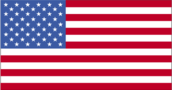
Flag
the US flag is used
Long-form name
none
Type
unincorporated territory of the US administered by the US Navy, under command of the Barbers Point Naval Air Station in Hawaii and managed cooperatively by the US Navy and the Fish and Wildlife Service of the US Department of the Interior as part of the National Wildlife Refuge System
Economy
Overview
The economy is based on providing support services for US naval operations located on the islands. All food and manufactured goods must be imported.
Communications
Airports
3 total; 2 usable; 1 with permanent-surface runways; none with runways over 2,439 m; 2 with runways 1, 220-2,439 m Defense Forces
Highways
32 km total
Note
defense is the responsibility of the US
Pipelines
7.8 km
Ports
Sand Island