1996 Edition
CIA World Factbook 1996 (Project Gutenberg)
Introduction
Description
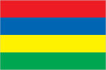
four equal horizontal bands of red (top), blue, yellow, and green
Location
20 17 S, 57 33 E -- Southern Africa, island in the Indian Ocean, east of Madagascar Flag ----
Geography
Area
- comparative area
- almost 11 times the size of Washington, DC
- land area
- 1,850 sq km
- note
- includes Agalega Islands, Cargados Carajos Shoals (Saint Brandon), and Rodrigues
- total area
- 1,860 sq km
Climate
tropical, modified by southeast trade winds; warm, dry winter (May to November); hot, wet, humid summer (November to May)
Coastline
177 km
Environment
- current issues
- water pollution
- international agreements
- party to - Biodiversity, Climate Change, Endangered Species, Environmental Modification, Hazardous Wastes, Law of the Sea, Marine Life Conservation, Nuclear Test Ban, Ozone Layer Protection, Whaling; signed, but not ratified - Desertification
- natural hazards
- cyclones (November to April); almost completely surrounded by reefs that may pose maritime hazards
Geographic coordinates
20 17 S, 57 33 E
International disputes
claims the island of Diego Garcia in UK-administered British Indian Ocean Territory; claims French-administered Tromelin Island
Irrigated land
170 sq km (1989 est.)
Land boundaries
0 km
Land use
- arable land
- 54%
- forest and woodland
- 31%
- meadows and pastures
- 4%
- other
- 7%
- permanent crops
- 4%
Location
Southern Africa, island in the Indian Ocean, east of Madagascar
Map references
World
Maritime claims
- continental shelf
- 200 nm or to the edge of the continental margin
- exclusive economic zone
- 200 nm
- territorial sea
- 12 nm
Natural resources
arable land, fish
Terrain
- small coastal plain rising to discontinuous mountains encircling central plateau
- highest point
- Piton de la Petite Riviere Noire 828 m
- lowest point
- Indian Ocean 0 m
People and Society
Age structure
0-14 years: 27% (male 157,174; female 152,980) 15-64 years: 67% (male 379,840; female 383,295) 65 years and over: 6% (male 27,429; female 39,538) (July 1996 est.)
Birth rate
18.97 births/1,000 population (1996 est.)
Death rate
6.67 deaths/1,000 population (1996 est.)
Ethnic divisions
Indo-Mauritian 68%, Creole 27%, Sino-Mauritian 3%, Franco-Mauritian 2%
Infant mortality rate
17.2 deaths/1,000 live births (1996 est.)
Languages
English (official), Creole, French, Hindi, Urdu, Hakka, Bojpoori
Life expectancy at birth
- female
- 74.33 years (1996 est.)
- male
- 66.72 years
- total population
- 70.53 years
Literacy
- age 15 and over can read and write (1995 est.)
- female
- 78.8%
- male
- 87.1%
- total population
- 82.9%
Nationality
- adjective
- Mauritian
- noun
- Mauritian(s)
Net migration rate
0 migrant(s)/1,000 population (1996 est.)
Population
1,140,256 (July 1996 est.)
Population growth rate
1.23% (1996 est.)
Religions
Hindu 52%, Christian 28.3% (Roman Catholic 26%, Protestant 2.3%), Muslim 16.6%, other 3.1%
Sex ratio
- all ages
- 0.98 male(s)/female (1996 est.)
- at birth
- 1 male(s)/female
- under 15 years
- 1.03 male(s)/female 15-64 years: 0.99 male(s)/female 65 years and over: 0.69 male(s)/female
Total fertility rate
2.24 children born/woman (1996 est.)
Government
Administrative divisions
9 districts and 3 dependencies*; Agalega Islands*, Black River, Cargados Carajos*, Flacq, Grand Port, Moka, Pamplemousses, Plaines Wilhems, Port Louis, Riviere du Rempart, Rodrigues*, Savanne
Capital
Port Louis
Constitution
12 March 1968; amended 12 March 1992
Data code
MP
Diplomatic representation in US
- chancery
- Suite 441, 4301 Connecticut Avenue NW, Washington, DC 20008
- chief of mission
- Ambassador Anund Priyay NEEWOOR
- telephone
- [1] (202) 244-1491, 1492
Executive branch
- cabinet
- Council of Ministers was appointed by the president on recommendation of the prime minister
- chief of state
- President Cassam UTEEM (since 1 July 1992) and Vice President Rabindranath GHURBURRON (since 1 July 1992) were elected for five-year terms by the National Assembly
- head of government
- Prime Minister Navin RAMGOOLAM (since 27 December 1995) and Deputy Prime Minister Paul BERENGER (since 27 December 1995) were appointed by the president and are responsible to the National Assembly
FAX
- [1] (202) 966-0983
- [230] 208-9534
Flag
four equal horizontal bands of red (top), blue, yellow, and green
Independence
12 March 1968 (from UK)
International organization participation
ACCT, ACP, AfDB, C, CCC, ECA, FAO, G-77, IAEA, IBRD, ICAO, ICFTU, ICRM, IDA, IFAD, IFC, IFRCS, ILO, IMF, IMO, Inmarsat, Intelsat, Interpol, IOC, ISO (correspondent), ITU, NAM, OAU, PCA, SADC, UN, UNCTAD, UNESCO, UNIDO, UPU, WCL, WFTU, WHO, WIPO, WMO, WToO, WTrO
Judicial branch
Supreme Court
Legal system
based on French civil law system with elements of English common law in certain areas
Legislative Assembly
elections last held on 20 December 1995 (next to be held by December 2000); results - MMM/MLP 65%, MSM/RMM 20%, other 15%; seats - (66 total; 62 elected, 4 appointed) MLP 35, MMM 25, allies of MLP and MMM on Rodrigues Island 2; appointed were Rodrigues Movement 2, Gaetan Duval Party 1, Hizballah 1
Legislative branch
unicameral
Name of country
- conventional long form
- Republic of Mauritius
- conventional short form
- Mauritius
National holiday
Independence Day, 12 March (1968)
Other political or pressure groups
various labor unions
Political parties and leaders
- government coalition
- MLP/MMM alliance - Mauritian Labor Party (MLP), Navin RAMGOOLAM; Mauritian Militant Movement (MMM), Paul BERENGER
- opposition
- Organization of the People of Rodrigues (OPR), Louis Serge CLAIR; Rodrigues Movement, Nicolas VONMALLY; Gaetan Duval Party, Gaetan DUVAL; Hizbullah, Imam Mustapha BEEHARRY; Militant Socialist Movement (MSM); Mauritian Militant Resurgence (MMR)
Suffrage
18 years of age; universal
Type of government
parliamentary democracy
US diplomatic representation
- chief of mission
- Ambassador Leslie M. ALEXANDER
- embassy
- 4th Floor, Rogers House, John Kennedy Street, Port Louis
- mailing address
- use embassy street address
- telephone
- [230] 208-2347, 208-2354, 208-9763 through 9767
Economy
Agriculture
sugarcane, tea, corn, potatoes, bananas, pulses; cattle, goats; fish
Budget
- expenditures
- $567 million, including capital expenditures of $143 million (FY92/93 est.)
- revenues
- $653 million
Currency
1 Mauritian rupee (MauR) = 100 cents
Economic aid
- recipient
- ODA, $NA
Economic overview
Since independence in 1968, Mauritius has developed from a low income, agriculturally based economy to middle income diversified economy with growing industrial and tourist sectors. For most of the period, annual growth has been of the order of 5% to 6%. This remarkable achievement has been reflected in increased life expectancy, lowered infant mortality, and a much improved infrastructure. Sugarcane is grown on about 90% of the cultivated land area and accounts for 40% of export earnings. The government's development strategy centers on industrialization (with a view to modernization and to exports), agricultural diversification, and tourism. Economic performance in 1991-93 continued strong with solid real growth and low unemployment.
Electricity
- capacity
- 340,000 kW
- consumption per capita
- 777 kWh (1993)
- production
- 920 million kWh
Exchange rates
Mauritian rupees (MauRs) per US$1 - 17.842 (January 1996), 17.386 (1995), 17.960 (1994), 17.648 (1993), 15.563 (1992), 15.652 (1991)
Exports
- $1.3 billion (f.o.b., 1994)
- commodities
- textiles 44%, sugar 40%, light manufactures 10%
- partners
- EU and US have preferential treatment, EU 77%, US 15%
External debt
$996.8 million (1993 est.)
Fiscal year
1 July - 30 June
GDP
purchasing power parity - $10.9 billion (1995 est.)
GDP composition by sector
- agriculture
- NA%
- industry
- NA%
- services
- NA%
GDP per capita
$9,600 (1995 est.)
GDP real growth rate
2.7% (1995 est.)
Illicit drugs
illicit producer of cannabis for the international drug trade; heroin consumption and transshipment are growing problems
Imports
- $1.9 billion (f.o.b., 1994)
- commodities
- manufactured goods 50%, capital equipment 17%, foodstuffs 13%, petroleum products 8%, chemicals 7%
- partners
- EU, US, South Africa, Japan
Industrial production growth rate
5.8% (1992)
Industries
food processing (largely sugar milling), textiles, wearing apparel, chemicals, metal products, transport equipment, nonelectrical machinery, tourism
Inflation rate (consumer prices)
9.4% (1993 est.)
Labor force
- 335,000
- by occupation
- government services 29%, agriculture and fishing 27%, manufacturing 22%, other 22%
Unemployment rate
2.4% (1991 est.)
Communications
Branches
National Police Force (includes the paramilitary Special Mobile Force or SMF, Special Support Units or SSU, and National Coast Guard)
Defense expenditures
exchange rate conversion - $11.2 million, 0.4% of GDP (FY92/93)
Manpower availability
- males age 15-49
- 327,403
- males fit for military service
- 166,466 (1996 est.)
Radio broadcast stations
AM 2, FM 0, shortwave 0
Radios
395,000 (1992 est.)
Telephone system
- small system with good service
- domestic
- primarily microwave radio relay
- international
- satellite earth station - 1 Intelsat (Indian Ocean); new microwave link to Reunion; HF radiotelephone links to several countries
Telephones
65,000 (1985 est.)
Television broadcast stations
4 (1987 est.)
Televisions
151,096 (1991 est.) Defense
Transportation
Airports
- total
- 4
- with paved runways 2 438 to 3 047 m
- 1
- with paved runways 914 to 1 523 m
- 1
- with paved runways under 914 m
- 2 (1995 est.)
Highways
- paved
- 1,703 km (including 29 km of expressways)
- total
- 1,831 km
- unpaved
- 128 km (1991 est.)
Merchant marine
- ships by type
- bulk 1, cargo 9, container 4, liquefied gas tanker 1, oil tanker 1, passenger-cargo 1 (1995 est.)
- total
- 17 ships (1,000 GRT or over) totaling 221,446 GRT/308,478 DWT
Ports
Port Louis
Railways
0 km