2010 Edition
CIA World Factbook 2010 (Project Gutenberg)
Introduction
Background
Independent from France in 1960, Mauritania annexed the southern third of the former Spanish Sahara (now Western Sahara) in 1976 but relinquished it after three years of raids by the Polisario guerrilla front seeking independence for the territory. Maaouya Ould Sid Ahmed TAYA seized power in a coup in 1984 and ruled Mauritania with a heavy hand for more than two decades. A series of presidential elections that he held were widely seen as flawed. A bloodless coup in August 2005 deposed President TAYA and ushered in a military council that oversaw a transition to democratic rule. Independent candidate Sidi Ould Cheikh ABDALLAHI was inaugurated in April 2007 as Mauritania's first freely and fairly elected president. His term ended prematurely in August 2008 when a military junta led by General Mohamed Ould Abdel AZIZ deposed him and ushered in a military council government. AZIZ was subsequently elected president in July 2009. The country continues to experience ethnic tensions among its black population (Afro-Mauritanians) and white and black Moor (Arab-Berber) communities, and is having to confront a growing terrorism threat by al-Qa'ida in the Islamic Maghreb (AQIM).
Geography
Area
- land
- 1,030,700 sq km
- total
- 1,030,700 sq km
- water
- 0 sq km
Area - comparative
slightly larger than three times the size of New Mexico
Climate
desert; constantly hot, dry, dusty
Coastline
754 km
Elevation extremes
- highest point
- Kediet Ijill 915 m
- lowest point
- Sebkhet Te-n-Dghamcha -5 m
Environment - current issues
overgrazing, deforestation, and soil erosion aggravated by drought are contributing to desertification; limited natural fresh water resources away from the Senegal, which is the only perennial river; locust infestation
Environment - international agreements
- party to
- Biodiversity, Climate Change, Climate Change-Kyoto Protocol, Desertification, Endangered Species, Hazardous Wastes, Law of the Sea, Ozone Layer Protection, Ship Pollution, Wetlands, Whaling signed, but not ratified: none of the selected agreements
Freshwater withdrawal (domestic/industrial/agricultural)
- per capita
- 554 cu m/yr (2000)
- total
- 1.7 cu km/yr (9%/3%/88%)
Geographic coordinates
20 00 N, 12 00 W
Geography - note
most of the population is concentrated in the cities of Nouakchott and Nouadhibou and along the Senegal River in the southern part of the country
Irrigated land
490 sq km (2002)
Land boundaries
- border countries
- Algeria 463 km, Mali 2,237 km, Senegal 813 km, Western Sahara 1,561 km
- total
- 5,074 km
Land use
- arable land
- 0.2%
- other
- 99.79% (2005)
- permanent crops
- 0.01%
Location
Northern Africa, bordering the North Atlantic Ocean, between Senegal and Western Sahara
Map references
Africa
Maritime claims
- contiguous zone
- 24 nm
- continental shelf
- 200 nm or to the edge of the continental margin
- exclusive economic zone
- 200 nm
- territorial sea
- 12 nm
Natural hazards
hot, dry, dust/sand-laden sirocco wind blows primarily in March and April; periodic droughts
Natural resources
iron ore, gypsum, copper, phosphate, diamonds, gold, oil, fish
Terrain
mostly barren, flat plains of the Sahara; some central hills
Total renewable water resources
11.4 cu km (1997)
People and Society
Age structure
0-14 years: 41% (male 643,436/female 638,793) 15-64 years: 55.7% (male 818,778/female 923,046) 65 years and over: 3.4% (male 44,836/female 60,597) (2010 est.)
Birth rate
33.67 births/1,000 population (2010 est.)
Death rate
9 deaths/1,000 population (July 2010 est.)
Education expenditures
4.4% of GDP (2008)
Ethnic groups
mixed Moor/black 40%, Moor 30%, black 30%
HIV/AIDS - adult prevalence rate
0.8% (2007 est.)
HIV/AIDS - deaths
fewer than 1,000 (2007 est.)
HIV/AIDS - people living with HIV/AIDS
14,000 (2007 est.)
Infant mortality rate
- female
- 56.6 deaths/1,000 live births (2010 est.)
- male
- 67.13 deaths/1,000 live births
- total
- 61.94 deaths/1,000 live births
Languages
Arabic (official and national), Pulaar, Soninke, Wolof (all national languages), French, Hassaniya
Life expectancy at birth
- female
- 62.99 years (2010 est.)
- male
- 58.57 years
- total population
- 60.75 years
Literacy
- definition: age 15 and over can read and write
- female
- 43.4% (2000 census)
- male
- 59.5%
- total population
- 51.2%
Major infectious diseases
- animal contact disease
- rabies (2009)
- degree of risk
- high
- food or waterborne diseases
- bacterial and protozoal diarrhea, hepatitis A, and typhoid fever
- respiratory disease
- meningococcal meningitis
- vectorborne diseases
- malaria and Rift Valley fever
Median age
- female
- 20.2 years (2010 est.)
- male
- 18.5 years
- total
- 19.3 years
Nationality
- adjective
- Mauritanian
- noun
- Mauritanian(s)
Net migration rate
-0.94 migrant(s)/1,000 population (2010 est.)
Population
3,205,060 (July 2010 est.)
Population growth rate
2.373% (2010 est.)
Religions
Muslim 100%
School life expectancy (primary to tertiary education)
- female
- 8 years (2007)
- male
- 8 years
- total
- 8 years
Sex ratio
- at birth
- 1.03 male(s)/female under 15 years: 1.01 male(s)/female 15-64 years: 0.89 male(s)/female 65 years and over: 0.74 male(s)/female
- total population
- 0.93 male(s)/female (2010 est.)
Total fertility rate
4.37 children born/woman (2010 est.)
Urbanization
- rate of urbanization
- 3% annual rate of change (2005-10 est.)
- urban population
- 41% of total population (2008)
Government
Administrative divisions
13 regions (wilayas, singular - wilaya); Adrar, Assaba, Brakna, Dakhlet Nouadhibou, Gorgol, Guidimaka, Hodh ech Chargui, Hodh El Gharbi, Inchiri, Nouakchott, Tagant, Tiris Zemmour, Trarza
Capital
- geographic coordinates
- 18 07 N, 16 02 W
- name
- Nouakchott
- time difference
- UTC 0 (5 hours ahead of Washington, DC during Standard Time)
Constitution
12 July 1991
Country name
- conventional long form
- Islamic Republic of Mauritania
- conventional short form
- Mauritania
- local long form
- Al Jumhuriyah al Islamiyah al Muritaniyah
- local short form
- Muritaniyah
Diplomatic representation from the US
- chief of mission
- Ambassador Mark M. BOULWARE
- embassy
- 288 Rue Abdallaye, Rue 42-100 (between Presidency building and Spanish Embassy), Nouakchott
- FAX
- [222] 525-1592
- mailing address
- BP 222, Nouakchott
- telephone
- [222] 525-2660 through 2663
Diplomatic representation in the US
- chancery
- 2129 Leroy Place NW, Washington, DC 20008
- chief of mission
- Ambassador Mohamed Lemine EL HAYCEN
- FAX
- [1] (202) 319-2623
- telephone
- [1] (202) 232-5700 through 5701
Executive branch
- cabinet
- Council of Ministers (For more information visit the World Leaders website )
- chief of state
- President Mohamed Ould Abdel AZIZ (since 5 August 2009); note - AZIZ, who deposed democratically elected President Sidi Ould Cheikh ABDELLAHI in a coup and installed himself as President of the High State Council on 6 August 2008, retired from the military and stepped down from the Presidency in April 2009 to run for president; he was elected president in an election held on 18 July 2009
- election results
- percent of vote - Mohamed Ould Abdel AZIZ 52.6%, Messaoud Ould BOULKHEIR 16.3%, Ahmed Ould DADDAH 13.7%, Other 17.4%
- elections
- following the August 2008 coup, the High State Council planned to hold a new presidential election in June 2009; the election was subsequently rescheduled to 18 July 2009 following the Dakar Accords, which brought Mauritania back to constitutional rule; under Mauritania's constitution, the president elected by popular vote for a five-year term; election last held on 18 July 2009 (next to be held by 2014)
- head of government
- Prime Minister Moulaye Ould Mohamed LAGHDAF (since 14 August 2008)
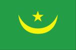
Flag description
green with a yellow five-pointed star above a yellow, horizontal crescent; the closed side of the crescent is down; the crescent, star, and color green are traditional symbols of Islam; the gold color stands for the sands of the Sahara
Government type
military junta
Independence
28 November 1960 (from France)
International organization participation
ABEDA, ACP, AfDB, AFESD, AMF, AMU, AU, CAEU, FAO, G-77, IAEA, IBRD, ICAO, ICRM, IDA, IDB, IFAD, IFC, IFRCS, ILO, IMF, IMO, Interpol, IOC, IOM, IPU, ISO (correspondent), ITSO, ITU, ITUC, LAS, MIGA, NAM, OIC, OIF, OPCW, UN, UNCTAD, UNESCO, UNIDO, UNWTO, UPU, WCO, WHO, WIPO, WMO, WTO
Judicial branch
Supreme Court or Cour Supreme; Court of Appeals; lower courts
Legal system
a combination of Islamic law and French civil law; has not accepted compulsory ICJ jurisdiction
Legislative branch
- bicameral legislature consists of the Senate or Majlis al-Shuyukh (56 seats; 53 members elected by municipal leaders and 3 members elected for Mauritanians abroad to serve six-year terms; a portion of seats up for election every two years) and the National Assembly or Al Jamiya Al Wataniya (95 seats; members elected by popular vote to serve five-year terms)
- election results
- Senate - percent of vote by party - NA; seats by party - CPM (Coalition of Majority Parties) 45, COD (Coordination of Democratic Opposition) 7, RNRD-TAWASSOUL 4; National Assembly - percent of vote by party - NA; seats by party - CPM 63 (UPR 50, PRDR 7, UDP 3, HATEM-PMUC 2, RD 1), COD 27 (RFD 9, UFP 6, APP 6, PNDD-ADIL 6), RNRD-TAWASSOUL 4, FP 1
- elections
- Senate - last held on November 2009; National Assembly - last held on 19 November and 3 December 2006 (next to be held in 2011)
National anthem
- lyrics/music
- Baba Ould CHEIKH/traditional, arranged by Tolia NIKIPROWETZKY note: adopted 1960; the unique rhythm of the Mauritanian anthem makes it particularly challenging to sing
- name
- "Hymne National de la Republique Islamique de Mauritanie" (National Anthem of the Islamic Republic of Mauritania)
National holiday
Independence Day, 28 November (1960)
Political parties and leaders
Alternative or El-Badil [Mohamed Yahdhi Ould MOCTAR HACEN]; Coalition of Majority Parties or CPM (parties supporting the regime including PRDR, UPR, RD, HATEM-PMUC, UCD); Coordination of Democratic Opposition or COD (coalition of opposition political parties opposed to the government including APP, RFD, UFP, PNDD-ADIL, Alternative or El-Badil); Democratic Renewal or RD [Moustapha Ould ABDEIDARRAHMANE]; Mauritanian Party for Unity and Change or HATEM-PMUC [Saleh Ould HANENA]; National Pact for Democracy and Development or PNDD-ADIL [Yahya Ould Ahmed Ould WAGHEF] (independents formerly supporting President Abdellahi); National Rally for Freedom, Democracy and Equality or RNDLE; National Rally for Reform and Development/RNRD-TAWASSOUL [Mohamed Jamil MANSOUR] (moderate Islamists); Popular Front or FP [Ch'bih Ould CHEIKH MALAININE]; Popular Progressive Alliance or APP [Messoud Ould BOULKHEIR]; Rally of Democratic Forces or RFD [Ahmed Ould DADDAH]; Republican Party for Democracy and Renewal or PRDR [Mintata Mint HDEID]; Socialist and Democratic Unity Party or PUDS; Union for Democracy and Progress or UDP [Naha Mint MOUKNASS]; Union for the Republic or UPR; Union of Democratic Center or UCD [Cheikh Sid'Ahmed Ould BABA]; Union of the Forces for Progress or UFP [Mohamed Ould MAOULOUD];
Political pressure groups and leaders
- General Confederation of Mauritanian Workers or CGTM [Abdallahi Ould MOHAMED, secretary general]; Independent Confederation of Mauritanian Workers or CLTM [Samory Ould BEYE]; Mauritanian Workers Union or UTM [Mohamed Ely Ould BRAHIM, secretary general]
- other
- Arab nationalists; Ba'thists; Islamists
Suffrage
18 years of age; universal
Economy
Agriculture - products
dates, millet, sorghum, rice, corn; cattle, sheep
Central bank discount rate
NA% (31 December 2009) 12% (31 December 2007)
Commercial bank prime lending rate
NA%
Current account balance
-$184 million (2007 est.)
Debt - external
$NA
Distribution of family income - Gini index
39 (2000) 37.3 (1995)
Economy - overview
Half the population still depends on agriculture and livestock for a livelihood, even though many of the nomads and subsistence farmers were forced into the cities by recurrent droughts in the 1970s and 1980s. Mauritania has extensive deposits of iron ore, which account for nearly 40% of total exports. The nation's coastal waters are among the richest fishing areas in the world but overexploitation by foreigners threatens this key source of revenue. The country's first deepwater port opened near Nouakchott in 1986. Before 2000, drought and economic mismanagement resulted in a buildup of foreign debt. In February 2000, Mauritania qualified for debt relief under the Heavily Indebted Poor Countries (HIPC) initiative and nearly all of its foreign debt has since been forgiven. A new investment code approved in December 2001 improved the opportunities for direct foreign investment. Mauritania and the IMF agreed to a three-year Poverty Reduction and Growth Facility (PRGF) arrangement in 2006. Mauritania made satisfactory progress, but the IMF, World Bank, and other international actors suspended assistance and investment in Mauritania after the August 2008 coup. Since the presidential election in July 2009, donors have resumed assistance. Oil prospects, while initially promising, have largely failed to materialize, and the government has placed a priority on attracting private investment to spur economic growth. The Government also emphasizes reduction of poverty, improvement of health and education, and privatization of the economy.
Electricity - consumption
386.2 million kWh (2007 est.)
Electricity - exports
0 kWh (2008 est.)
Electricity - imports
0 kWh (2008 est.)
Electricity - production
415.3 million kWh (2007 est.)
Exchange rates
ouguiyas (MRO) per US dollar - 261.5 (2010 est.), 262.4 (2009), 238.2 (2008), 258.6 (2007), 271.3 (2006)
Exports
$1.395 billion (2006)
Exports - commodities
iron ore, fish and fish products, gold, copper, petroleum
Exports - partners
China 42.06%, Italy 9.71%, Japan 7.57%, Cote d'Ivoire 6.16%, Spain 5.63%, Netherlands 4.32% (2009)
GDP - composition by sector
- agriculture
- 12.5%
- industry
- 46.7%
- services
- 40.7% (2008 est.)
GDP - per capita (PPP)
$2,100 (2010 est.) $2,100 (2009 est.) $2,100 (2008 est.) note: data are in 2010 US dollars
GDP - real growth rate
5% (2010 est.) -1% (2009 est.) 3.5% (2008 est.)
GDP (official exchange rate)
$3.486 billion (2010 est.)
GDP (purchasing power parity)
$6.8 billion (2010 est.) $6.476 billion (2009 est.) $6.542 billion (2008 est.) note: data are in 2010 US dollars
Household income or consumption by percentage share
lowest 10%: 2.5% highest 10%: 29.5% (2000)
Imports
$1.475 billion (2006)
Imports - commodities
machinery and equipment, petroleum products, capital goods, foodstuffs, consumer goods
Imports - partners
France 14.3%, Netherlands 10.33%, China 9.94%, Brazil 5.58%, Belgium 4.87%, Germany 4.04%, Spain 4.02% (2009)
Industrial production growth rate
2% (2000 est.)
Industries
fish processing, oil production, mining of iron ore, gold, and copper note: gypsum deposits have never been exploited
Inflation rate (consumer prices)
7.3% (2007 est.)
Labor force
1.318 million (2007)
Labor force - by occupation
- agriculture
- 50%
- industry
- 10%
- services
- 40% (2001 est.)
Market value of publicly traded shares
$NA
Natural gas - consumption
0 cu m (2008 est.)
Natural gas - exports
0 cu m (2008 est.)
Natural gas - imports
0 cu m (2008 est.)
Natural gas - production
0 cu m (2008 est.)
Natural gas - proved reserves
28.32 billion cu m (1 January 2010 est.)
Oil - consumption
20,000 bbl/day (2009 est.)
Oil - exports
30,620 bbl/day (2007 est.)
Oil - imports
20,610 bbl/day (2007 est.)
Oil - production
16,510 bbl/day (2009 est.)
Oil - proved reserves
100 million bbl (1 January 2010 est.)
Population below poverty line
40% (2004 est.)
Stock of domestic credit
$NA
Unemployment rate
30% (2008 est.) 20% (2004 est.)
Communications
Broadcast media
broadcast media state-owned; 1 state-run TV and 1 state-run radio network; Television de Mauritanie, the state-run TV station, has an additional 6 regional TV stations that provide local programming (2008)
Internet country code
.mr
Internet hosts
23 (2010)
Internet users
75,000 (2009)
Telephone system
- domestic
- Mauritel, the national telecommunications company, was privatized in 2001 but remains the monopoly provider of fixed-line services; fixed-line teledensity 2 per 100 persons; mobile-cellular network coverage extends mainly to urban areas with a teledensity of 70 per 100 persons; mostly cable and open-wire lines; a domestic satellite telecommunications system links Nouakchott with regional capitals
- general assessment
- limited system of cable and open-wire lines, minor microwave radio relay links, and radiotelephone communications stations; mobile-cellular services expanding rapidly
- international
- country code - 222; satellite earth stations - 3 (1 Intelsat - Atlantic Ocean, 2 Arabsat); optical-fiber and Asymmetric Digital Subscriber Line (ADSL) cables for internet access (2008)
Telephones - main lines in use
74,500 (2009)
Telephones - mobile cellular
2.182 million (2009)
Transportation
Airports
28 (2010)
Airports - with paved runways
- total
- 9 2,438 to 3,047 m: 5 1,524 to 2,437 m: 4 (2010)
Airports - with unpaved runways
- total
- 19 1,524 to 2,437 m: 9 914 to 1,523 m: 8 under 914 m: 2 (2010)
Ports and terminals
Nouadhibou, Nouakchott
Railways
- 728 km
- standard gauge
- 728 km 1.435-m gauge (2008)
Roadways
- paved
- 2,966 km
- total
- 11,066 km
- unpaved
- 8,100 km (2006)
Waterways
some navigation possible on Senegal River (2010)
Military and Security
Manpower available for military service
males age 16-49: 699,028 females age 16-49: 783,108 (2010 est.)
Manpower fit for military service
males age 16-49: 464,959 females age 16-49: 562,765 (2010 est.)
Manpower reaching militarily significant age annually
- female
- 36,035 (2010 est.)
- male
- 35,322
Military branches
- Mauritanian Armed Forces
- Army, Mauritanian Navy (Marine Mauritanienne; includes naval infantry), Islamic Air Force of Mauritania (Force Aerienne Islamique de Mauritanie, FAIM) (2010)
Military expenditures
5.5% of GDP (2006)
Military service age and obligation
18 years of age (est.); conscript service obligation - 2 years; majority of servicemen believed to be volunteers; service in Air Force and Navy is voluntary (2006)
Transnational Issues
Disputes - international
Mauritanian claims to Western Sahara remain dormant
Trafficking in persons
- current situation
- Mauritania is a source and destination country for children trafficked for forced labor and sexual exploitation; slavery-related practices, rooted in ancestral master-slave relationships, continue to exist in isolated parts of the country; Mauritanian boys called talibe are trafficked within the country by religious teachers for forced begging; children are also trafficked by street gangs within the country that force them to steal, beg, and sell drugs; girls are trafficked internally for domestic servitude and sexual exploitation; women and children from neighboring states are trafficked into Mauritania for purposes of forced begging, domestic servitude, and sexual exploitation
- tier rating
- Tier 3 - the Government of Mauritania does not fully comply with the minimum standards for the elimination of trafficking and is not making significant efforts to do so; the government did not show evidence of overall progress in prosecuting and punishing trafficking offenders, protecting trafficking victims, and preventing new incidents of trafficking during the past year; progress that the previous government demonstrated in 2007 through enactment of strengthened anti-slavery legislation and deepened political will to eliminate slavery and trafficking has stalled; law enforcement efforts to address human trafficking including traditional slavery practices decreased (2009) page last updated on January 26, 2011 ======================================================================