2020 Edition
factbook.json (GitHub)
Introduction
Background
Present-day Mali is named after the Mali Empire that ruled the region between the 13th and 16th centuries. At its peak in the 14th century, it was the largest and wealthiest empire in West Africa and controlled an area about twice the size of modern-day France. Primarily a trading empire, Mali derived its wealth from gold and maintained several goldfields and trade routes in the Sahel. The empire also influenced West African culture through the spread of its language, laws, and customs, but by the 16th century, it had fragmented into mostly small chiefdoms. The Songhai Empire, previously a Mali dependency centered in Timbuktu, gained prominence in the 15th and 16th centuries. Under Songhai rule, Timbuktu became a large commercial center, well-known for its scholarship and religious teaching. Timbuktu remains a center of culture in West Africa today. In the late 16th century, the Songhai Empire fell to Moroccan invaders and disintegrated into independent sultanates and kingdoms. France, expanding from Senegal, seized control of the area in the 1890s and incorporated it into French West Africa as French Sudan. In 1960, French Sudan gained independence from France and became the Mali Federation. When Senegal withdrew after only a few months, the remaining area was renamed the Republic of Mali. Mali saw 31 years of dictatorship until 1991, when a military coup led by Amadou Toumani TOURE ousted the government, established a new constitution, and instituted a multi-party democracy. Alpha Oumar KONARE won Mali's first two democratic presidential elections in 1992 and 1997. In keeping with Mali's two-term constitutional limit, he stepped down in 2002 and was succeeded by Amadou Toumani TOURE, who won a second term in 2007. In 2012, rising ethnic tensions and an influx of fighters -- some linked to Al-Qa’ida -- from Libya led to a rebellion and military coup. Following the coup, rebels expelled the military from the country’s three northern regions, allowing terrorist organizations to develop strongholds in the area. With a 2013 French-led military intervention, the Malian government managed to retake most of the north. However, the government’s grasp in the region remains weak with local militias, terrorists, and insurgent groups competing for control. In 2015, the Malian Government and northern rebels signed an internationally mediated peace accord. Despite a 2017 target for implementation of the agreement, the signatories have made little progress. Terrorist groups were left out of the peace process, and terrorist attacks remain common. Ibrahim Boubacar KEITA won the Malian presidential elections in 2013 and 2018. Aside from security and logistic shortfalls, international observers deemed these elections credible. Terrorism, banditry, ethnic-based violence, and extra-judicial military killings plagued the country during KEITA’s second term. In 2020, the military arrested KEITA, his prime minister, and other senior members of the government and established a military junta called the National Committee for the Salvation of the People (CNSP). The junta then established a transition government and appointed Bah N’DAW, a retired army officer and former defense minister, as interim president and Colonel Assimi GOITA, the coup leader and chairman of the CNSP, as interim vice president. The transition government’s charter allowed it to rule for up to 18 months before calling a general election. In 2021, GOITA led a military takeover, arresting the interim president after a Cabinet shake-up removed GOITA’s key allies. GOITA was sworn in as transition president, and Choguel Kokalla MAIGA was sworn in as prime minister. In 2022, the Economic Community of West African States (ECOWAS) imposed sanctions on the transition government, and member states closed their borders with Mali after the transition government presented a five-year extension to the electoral calendar. The transition government and ECOWAS agreed to a new two-year timeline, which would have included presidential elections in February 2024, but the transition government postponed the elections indefinitely in September 2023 and withdrew from ECOWAS in January 2024.
Geography
Area
- land
- 1,220,190 sq km
- total
- 1,240,192 sq km
- water
- 20,002 sq km
Area - comparative
slightly less than twice the size of Texas
Climate
subtropical to arid; hot and dry (February to June); rainy, humid, and mild (June to November); cool and dry (November to February)
Coastline
0 km (landlocked)
Elevation
- highest point
- Hombori Tondo 1,155 m
- lowest point
- Senegal River 23 m
- mean elevation
- 343 m
Geographic coordinates
17 00 N, 4 00 W
Geography - note
landlocked; divided into three natural zones: the southern, cultivated Sudanese; the central, semiarid Sahelian; and the northern, arid Saharan
Irrigated land
3,780 sq km (2012)
Land boundaries
- border countries
- Algeria 1,359 km; Burkina Faso 1,325 km; Cote d'Ivoire 599 km; Guinea 1,062 km; Mauritania 2,236 km; Niger 838 km, Senegal 489 km
- total
- 7,908 km
Land use
- agricultural land
- 35.5% (2023 est.)
- agricultural land: arable land
- arable land: 6.8% (2023 est.)
- agricultural land: permanent crops
- permanent crops: 0.2% (2023 est.)
- agricultural land: permanent pasture
- permanent pasture: 28.4% (2023 est.)
- forest
- 8.8% (2023 est.)
- other
- 55.8% (2023 est.)
Location
interior Western Africa, southwest of Algeria, north of Guinea, Cote d'Ivoire, and Burkina Faso, west of Niger
Major aquifers
Lullemeden-Irhazer Basin, Taodeni-Tanezrouft Basin
Major lakes (area sq km)
- fresh water lake(s)
- Lac Faguibine - 590 sq km note - the Niger River is the only source of water for the lake; in recent years the lake is dry
Major rivers (by length in km)
Niger (shared with Guinea [s], Niger, and Nigeria [m]) - 4,200 km; Senegal (shared with Guinea [s], Senegal, and Mauritania [m]) - 1,641 km note: [s] after country name indicates river source; [m] after country name indicates river mouth
Major watersheds (area sq km)
- Atlantic Ocean drainage
- Niger (2,261,741 sq km), Senegal (456,397 sq km), Volta (410,991 sq km)
Map references
Africa
Maritime claims
none (landlocked)
Natural hazards
hot, dust-laden harmattan haze common during dry seasons; recurring droughts; occasional Niger River flooding
Natural resources
gold, phosphates, kaolin, salt, limestone, uranium, gypsum, granite, hydropower
Population distribution
the overwhelming majority of the population lives in the southern half of the country, with greater density along the border with Burkina Faso, as shown in this population distribution map
Terrain
mostly flat to rolling northern plains covered by sand; savanna in south, rugged hills in northeast
People and Society
Age structure
- 0-14 years
- 46.8% (male 5,175,714/female 5,114,128)
- 15-64 years
- 50.1% (male 5,178,742/female 5,842,456)
- 65 years and over
- 3.1% (2024 est.) (male 334,299/female 345,268)
Alcohol consumption per capita
- beer
- 0.09 liters of pure alcohol (2019 est.)
- other alcohols
- 0.49 liters of pure alcohol (2019 est.)
- spirits
- 0.02 liters of pure alcohol (2019 est.)
- total
- 0.6 liters of pure alcohol (2019 est.)
- wine
- 0 liters of pure alcohol (2019 est.)
Birth rate
39.44 births/1,000 population (2025 est.)
Child marriage
- men married by age 18
- 2.1% (2018)
- women married by age 15
- 15.9% (2018)
- women married by age 18
- 53.7% (2018)
Children under the age of 5 years underweight
15% (2024 est.)
Currently married women (ages 15-49)
79.2% (2018 est.)
Death rate
7.87 deaths/1,000 population (2025 est.)
Dependency ratios
- elderly dependency ratio
- 6.2 (2025 est.)
- potential support ratio
- 16.2 (2025 est.)
- total dependency ratio
- 98.5 (2025 est.)
- youth dependency ratio
- 92.3 (2025 est.)
Drinking water source
- improved: rural
- rural: 74.4% of population (2022 est.)
- improved: total
- total: 83.6% of population (2022 est.)
- improved: urban
- urban: 94.7% of population (2022 est.)
- unimproved: rural
- rural: 25.6% of population (2022 est.)
- unimproved: total
- total: 16.4% of population (2022 est.)
- unimproved: urban
- urban: 5.3% of population (2022 est.)
Education expenditure
- Education expenditure (% GDP)
- 4.2% of GDP (2023 est.)
- Education expenditure (% national budget)
- 17.8% national budget (2024 est.)
Ethnic groups
Bambara 33.3%, Fulani (Peuhl) 13.3%, Sarakole/Soninke/Marka 9.8%, Senufo/Manianka 9.6%, Malinke 8.8%, Dogon 8.7%, Sonrai 5.9%, Bobo 2.1%, Tuareg/Bella 1.7%, other Malian 6%, from members of Economic Community of West Africa 0.4%, other 0.3% (2018 est.)
Gross reproduction rate
2.59 (2025 est.)
Health expenditure
- Health expenditure (as % of GDP)
- 4.5% of GDP (2021)
- Health expenditure (as % of national budget)
- 5.7% of national budget (2022 est.)
Hospital bed density
0.2 beds/1,000 population (2018 est.)
Infant mortality rate
- female
- 52 deaths/1,000 live births
- male
- 62.6 deaths/1,000 live births
- total
- 55.8 deaths/1,000 live births (2025 est.)
Languages
Bambara (official), French 17.2%, Peuhl/Foulfoulbe/Fulani 9.4%, Dogon 7.2%, Maraka/Soninke 6.4%, Malinke 5.6%, Sonrhai/Djerma 5.6%, Minianka 4.3%, Tamacheq 3.5%, Senoufo 2.6%, Bobo 2.1%, other 6.3%, unspecified 0.7% (2009 est.)
Life expectancy at birth
- female
- 65.6 years
- male
- 60.9 years
- total population
- 63.2 years (2024 est.)
Literacy
- female
- 25.7% (2018 est.)
- male
- 46.2% (2018 est.)
- total population
- 35.5% (2018 est.)
Major urban areas - population
2.929 million BAMAKO (capital) (2023)
Maternal mortality ratio
367 deaths/100,000 live births (2023 est.)
Median age
- female
- 17.1 years
- male
- 15.7 years
- total
- 16.5 years (2025 est.)
Mother's mean age at first birth
19.2 years (2018 est.)
Nationality
- adjective
- Malian
- noun
- Malian(s)
Net migration rate
-2.82 migrant(s)/1,000 population (2025 est.)
Obesity - adult prevalence rate
8.6% (2016)
Physician density
0.19 physicians/1,000 population (2023)
Population
- female
- 11,635,092
- male
- 10,999,331
- total
- 22,634,423 (2025 est.)
Population growth rate
2.88% (2025 est.)
Religions
Muslim 93.9%, Christian 2.8%, animist 0.7%, none 2.5% (2018 est.)
Sanitation facility access
- improved: rural
- rural: 49.3% of population (2022 est.)
- improved: total
- total: 67.2% of population (2022 est.)
- improved: urban
- urban: 88.6% of population (2022 est.)
- unimproved: rural
- rural: 50.7% of population (2022 est.)
- unimproved: total
- total: 32.8% of population (2022 est.)
- unimproved: urban
- urban: 11.4% of population (2022 est.)
School life expectancy (primary to tertiary education)
- female
- 6 years (2017 est.)
- male
- 8 years (2017 est.)
- total
- 7 years (2017 est.)
Sex ratio
- 0-14 years
- 1.01 male(s)/female
- 15-64 years
- 0.89 male(s)/female
- 65 years and over
- 0.97 male(s)/female
- at birth
- 1.03 male(s)/female
- total population
- 0.95 male(s)/female (2024 est.)
Tobacco use
- female
- 0.6% (2025 est.)
- male
- 13.1% (2025 est.)
- total
- 6.9% (2025 est.)
Total fertility rate
5.26 children born/woman (2025 est.)
Urbanization
- rate of urbanization
- 4.57% annual rate of change (2020-25 est.)
- urban population
- 46.2% of total population (2023)
Government
Administrative divisions
19 regions (régions, singular - région), 1 district*; Bamako*, Bandiagara, Bougouni, Dioila, Douentza, Gao, Kayes, Kidal, Kita, Koulikoro, Koutiala, Menaka, Mopti, Nara, Nioro, San, Segou, Sikasso, Taoudenni, Tombouctou (Timbuktu)
Capital
- etymology
- the origin of the name is unclear, but it comes from the Bambara language and can refer either to a crocodile or to a person's name
- geographic coordinates
- 12 39 N, 8 00 W
- name
- Bamako
- time difference
- UTC 0 (5 hours ahead of Washington, DC, during Standard Time)
Citizenship
- citizenship by birth
- no
- citizenship by descent only
- at least one parent must be a citizen of Mali
- dual citizenship recognized
- yes
- residency requirement for naturalization
- 5 years
Constitution
- history
- several previous; latest drafted 13 October 2022 and submitted to Transition President Assimi GOITA; final draft completed 1 March 2023; approved by referendum 18 June 2023; validated by Constitutional Court 22 July 2023
Country name
- conventional long form
- Republic of Mali
- conventional short form
- Mali
- etymology
- name derives from the Mali Empire of the 13th to 16th centuries A.D.; the Mali name may come from a local ethnic group, the Malinke, whose name is derived from the words ma, meaning "mother," and dink, meaning "child" -- a reference to the matrilinear descent of Malinke families
- former
- French Sudan, Sudanese Republic, Mali Federation
- local long form
- République de Mali
- local short form
- Mali
Diplomatic representation from the US
- chief of mission
- Ambassador Rachna KORHONEN (since 16 March 2023)
- email address and website
- ACSBamako@state.gov https://ml.usembassy.gov/
- embassy
- ACI 2000, Rue 243, (located off the Roi Bin Fahad Aziz Bridge west of the Bamako central district), Porte 297, Bamako
- FAX
- [223] 20-70-24-79
- mailing address
- 2050 Bamako Place, Washington DC 20521-2050
- telephone
- [223] 20-70-23-00
Diplomatic representation in the US
- chancery
- 2130 R Street NW, Washington, DC 20008
- chief of mission
- Ambassador Sékou BERTHE (since 16 September 2022)
- email address and website
- administration@maliembassy.us https://www.maliembassy.us/
- FAX
- [1] (202) 332-6603
- telephone
- [1] (202) 332-2249
Executive branch
- cabinet
- Council of Ministers appointed by the prime minister
- chief of state
- Transition President Assimi GOITA (since 7 June 2021)
- election results
- 2018: Ibrahim Boubacar KEITA reelected president in second round; percent of vote in first round - Ibrahim Boubacar KEITA (RPM) 41.7%, Soumaila CISSE (URD) 17.8%, other 40.5%; percent of vote in second round - Ibrahim Boubacar KEITA 67.2%, Soumaila CISSE 32.8%
- election/appointment process
- president directly elected by absolute-majority popular vote in 2 rounds, if needed, for a 5-year term (eligible for a second term); prime minister appointed by the president
- head of government
- Transition Prime Minister Abdoulaye MAIGA (since 22 November 2024)
- most recent election date
- 29 July 2018, with runoff on 12 August 2018
Flag
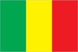
description: three equal vertical bands of green (left side), yellow, and red history: uses the colors of the Pan-African movement
Government type
semi-presidential republic
Independence
22 September 1960 (from France)
International law organization participation
has not submitted an ICJ jurisdiction declaration; accepts ICCt jurisdiction
International organization participation
ACP, AfDB, AU (suspended), CD, EITI (compliant country), FAO, FZ, G-77, IAEA, IBRD, ICAO, ICCt, ICRM, IDA, IDB, IFAD, IFC, IFRCS, ILO, IMF, Interpol, IOC, IOM, IPU, ISO, ITSO, ITU, ITUC (NGOs), MIGA, MINUSCA, MONUSCO, NAM, OIC, OPCW, UN, UNCTAD, UNDP, UNESCO, UNFPA, UNHCR, UNIDO, UNOPS, UN Women, UNWTO, UPU, WADB (regional), WAEMU, World Bank Group, WCO, WFTU (NGOs), WHO, WIPO, WMO, WTO
Judicial branch
- highest court(s)
- Supreme Court or Cour Suprême (consists of 19 judges organized into judicial, administrative, and accounting sections); Constitutional Court (consists of 9 judges)
- judge selection and term of office
- Supreme Court judges appointed by the Ministry of Justice to serve 5-year terms; Constitutional Court judges selected - 3 each by the president, the National Assembly, and the Supreme Council of the Magistracy; members serve single renewable 7-year terms
- subordinate courts
- Court of Appeal; High Court of Justice (jurisdiction limited to cases of high treason or criminal offenses by the president or ministers while in office); administrative courts (first instance and appeal); commercial courts; magistrate courts; labor courts; juvenile courts; special court of state security
Legal system
civil law system based on the French civil law model and influenced by customary law; Constitutional Court reviews legislative acts
Legislative branch
- chamber name
- Transitional National Council (Conseil national de transition)
- electoral system
- plurality/majority
- expected date of next election
- December 2030
- legislative structure
- unicameral
- legislature name
- Transitional National Council (Conseil national de transition)
- most recent election date
- 12/5/2020
- number of seats
- 147 (all appointed)
- percentage of women in chamber
- 30.1%
- scope of elections
- full renewal
National anthem(s)
- history
- adopted 1962
- lyrics/music
- Seydou Badian KOUYATE/Banzoumana SISSOKO
- title
- "Le Mali" (Mali)
National color(s)
green, yellow, red
National heritage
- selected World Heritage Site locales
- Old Towns of Djenné (c); Timbuktu (c); Cliff of Bandiagara (Land of the Dogons) (m); Tomb of Askia (c)
- total World Heritage Sites
- 4 (3 cultural, 1 mixed)
National holiday
Independence Day, 22 September (1960)
National symbol(s)
Great Mosque of Djenne
Political parties
African Solidarity for Democracy and Independence or SADI Alliance for Democracy and Progress or ADP-Maliba Alliance for Democracy in Mali-Pan-African Party for Liberty, Solidarity, and Justice or ADEMA-PASJ Alliance for the Solidarity of Mali-Convergence of Patriotic Forces or ASMA-CFP Convergence for the Development of Mali or CODEM Democratic Alliance for Peace or ADP-Maliba Movement for Mali or MPM Party for National Renewal (also Rebirth or Renaissance or PARENA) Rally for Mali or RPM Social Democratic Convention or CDS Union for Democracy and Development or UDD Union for Republic and Democracy or URD Yéléma
Suffrage
18 years of age; universal
Economy
Agricultural products
maize, rice, millet, sorghum, onions, okra, sugarcane, cotton, mangoes/guavas, sweet potatoes (2023)
Budget
- expenditures
- $3.563 billion (2020 est.)
- revenues
- $2.841 billion (2020 est.)
Current account balance
- Current account balance 2021
- -$1.469 billion (2021 est.)
- Current account balance 2022
- -$1.475 billion (2022 est.)
- Current account balance 2023
- -$1.61 billion (2023 est.)
Debt - external
- Debt - external 2023
- $4.085 billion (2023 est.)
Economic overview
low-income Saharan economy; recession due to COVID-19 and political instability; extreme poverty; environmentally fragile; high public debt; agricultural and gold exporter; terrorism and warfare are common
Exchange rates
- Currency
- Communaute Financiere Africaine francs (XOF) per US dollar -
- Exchange rates 2020
- 575.586 (2020 est.)
- Exchange rates 2021
- 554.531 (2021 est.)
- Exchange rates 2022
- 623.76 (2022 est.)
- Exchange rates 2023
- 606.57 (2023 est.)
- Exchange rates 2024
- 606.345 (2024 est.)
Exports
- Exports 2021
- $5.381 billion (2021 est.)
- Exports 2022
- $5.855 billion (2022 est.)
- Exports 2023
- $6.13 billion (2023 est.)
Exports - commodities
gold, cotton, oil seeds, fertilizers, gum resins (2023)
Exports - partners
UAE 73%, Switzerland 15%, Australia 5%, China 1%, Uganda 1% (2023)
GDP - composition, by end use
- exports of goods and services
- 22.5% (2024 est.)
- government consumption
- 13.1% (2024 est.)
- household consumption
- 71.9% (2024 est.)
- imports of goods and services
- -28.4% (2024 est.)
- investment in fixed capital
- 21.6% (2024 est.)
- investment in inventories
- -0.7% (2024 est.)
GDP - composition, by sector of origin
- agriculture
- 33.4% (2024 est.)
- industry
- 22.7% (2024 est.)
- services
- 36.7% (2024 est.)
GDP (official exchange rate)
$26.588 billion (2024 est.)
Gini Index coefficient - distribution of family income
- Gini Index coefficient - distribution of family income 2021
- 35.7 (2021 est.)
Household income or consumption by percentage share
- highest 10%
- 28.3% (2021 est.)
- lowest 10%
- 3.2% (2021 est.)
Imports
- Imports 2021
- $7.596 billion (2021 est.)
- Imports 2022
- $7.942 billion (2022 est.)
- Imports 2023
- $8.066 billion (2023 est.)
Imports - commodities
refined petroleum, broadcasting equipment, cement, cotton fabric, plastic products (2023)
Imports - partners
Cote d'Ivoire 25%, Senegal 19%, China 12%, France 5%, Burkina Faso 4% (2023)
Industrial production growth rate
-2.4% (2024 est.)
Industries
food processing; construction; phosphate and gold mining
Inflation rate (consumer prices)
- Inflation rate (consumer prices) 2022
- 9.6% (2022 est.)
- Inflation rate (consumer prices) 2023
- 2.1% (2023 est.)
- Inflation rate (consumer prices) 2024
- 3.2% (2024 est.)
Labor force
9.126 million (2024 est.)
Population below poverty line
44.6% (2021 est.)
Public debt
- Public debt 2016
- 36% of GDP (2016 est.)
Real GDP (purchasing power parity)
- Real GDP (purchasing power parity) 2022
- $64.8 billion (2022 est.)
- Real GDP (purchasing power parity) 2023
- $67.857 billion (2023 est.)
- Real GDP (purchasing power parity) 2024
- $71.253 billion (2024 est.)
Real GDP growth rate
- Real GDP growth rate 2022
- 3.5% (2022 est.)
- Real GDP growth rate 2023
- 4.7% (2023 est.)
- Real GDP growth rate 2024
- 5% (2024 est.)
Real GDP per capita
- Real GDP per capita 2022
- $2,800 (2022 est.)
- Real GDP per capita 2023
- $2,900 (2023 est.)
- Real GDP per capita 2024
- $2,900 (2024 est.)
Remittances
- Remittances 2021
- 4.9% of GDP (2021 est.)
- Remittances 2022
- 4.9% of GDP (2022 est.)
- Remittances 2023
- 4.2% of GDP (2023 est.)
Taxes and other revenues
12% (of GDP) (2020 est.)
Unemployment rate
- Unemployment rate 2022
- 2.4% (2022 est.)
- Unemployment rate 2023
- 3% (2023 est.)
- Unemployment rate 2024
- 3.1% (2024 est.)
Youth unemployment rate (ages 15-24)
- female
- 3.9% (2024 est.)
- male
- 4% (2024 est.)
- total
- 4% (2024 est.)
Energy
Coal
- imports
- 36 metric tons (2023 est.)
Electricity
- consumption
- 4.261 billion kWh (2023 est.)
- exports
- 661.63 million kWh (2023 est.)
- imports
- 880 million kWh (2023 est.)
- installed generating capacity
- 1.222 million kW (2023 est.)
- transmission/distribution losses
- 320.616 million kWh (2023 est.)
Electricity access
- electrification - rural areas
- 18.3%
- electrification - total population
- 53% (2022 est.)
- electrification - urban areas
- 99.7%
Electricity generation sources
- biomass and waste
- 1.6% of total installed capacity (2023 est.)
- fossil fuels
- 57.3% of total installed capacity (2023 est.)
- hydroelectricity
- 37.6% of total installed capacity (2023 est.)
- solar
- 3.5% of total installed capacity (2023 est.)
Energy consumption per capita
- Total energy consumption per capita 2023
- 4.307 million Btu/person (2023 est.)
Petroleum
- refined petroleum consumption
- 46,000 bbl/day (2023 est.)
Communications
Broadband - fixed subscriptions
- subscriptions per 100 inhabitants
- 1 (2022 est.)
- total
- 179,000 (2022 est.)
Broadcast media
national public TV broadcaster; 2 privately owned companies provide subscription services to foreign multi-channel TV packages; national public radio broadcaster supplemented by a large number of privately owned and community broadcast stations; transmissions of multiple international broadcasters are available (2019)
Internet country code
.ml
Internet users
- percent of population
- 35% (2023 est.)
Telephones - fixed lines
- subscriptions per 100 inhabitants
- 1 (2022 est.)
- total subscriptions
- 307,000 (2022 est.)
Telephones - mobile cellular
- subscriptions per 100 inhabitants
- 112 (2022 est.)
- total subscriptions
- 25.9 million (2022 est.)
Transportation
Airports
30 (2025)
Civil aircraft registration country code prefix
TZ, TT
Heliports
4 (2025)
Railways
- narrow gauge
- 593 km (2014) 1.000-m gauge
- total
- 593 km (2014)
Military and Security
Military - note
the FAMa is responsible for the defense of the country’s sovereignty and territory, but also has some domestic security duties, including the maintenance of public order and support to law enforcement; it also participates in socio-economic development projects; the military has traditionally played a large role in Mali’s politics; prior to the coup in August 2020 and military takeover in May 2021, it had intervened in the political arena at least five times since the country gained independence in 1960 (1968, 1976, 1978, 1991, 2012) the FAMa and other security forces are actively engaged in combat operations against several insurgent/terrorist groups affiliated with al-Qa'ida and the Islamic State of Iraq and ash-Sham (ISIS), as well as other armed rebel organizations, communal militias, and criminal bands spread across the central, northern, and southern regions of the country; a large portion of the country--up to 50% by some estimates--is outside of government control the FAMa and the remainder of the security forces collapsed in 2012 during the fighting against Tuareg rebels and Islamic militants and were rebuilt beginning in 2013 with external assistance from the EU and the UN; the UN Multidimensional Integrated Stabilization Mission in Mali (MINUSMA) and the EU Training Mission in Mali (EUTM) ended their missions in 2023 and 2024, respectively; France intervened militarily in Mali in 2013 to assist with regaining the northern half of the country from rebel and Islamic militant groups; French troops withdrew in 2022; since 2021, Mali has increased security ties with Russia, which has provided equipment, training, and other forms of military support (2025)
Military and security forces
Malian Armed Forces (Forces Armées Maliennes or FAMa): Army (l’Armée de Terre), Air Force (l’Armée de l’Air); National Guard (la Garde Nationale du Mali); National Gendarmerie of Mali (Gendarmerie Nationale du Mali) (2025)
Military and security service personnel strengths
information varies; estimated 35-40,000 active FAMa, Gendarmerie, and National Guard (2025)
Military equipment inventories and acquisitions
the FAMa's inventory includes mostly Soviet-era weapons and equipment along with smaller quantities of more modern material from a variety of suppliers, including France, Russia, South Africa, Türkiye, and the UAE (2025)
Military expenditures
- Military Expenditures 2020
- 3.4% of GDP (2020 est.)
- Military Expenditures 2021
- 3.4% of GDP (2021 est.)
- Military Expenditures 2022
- 3.5% of GDP (2022 est.)
- Military Expenditures 2023
- 4% of GDP (2023 est.)
- Military Expenditures 2024
- 4.3% of GDP (2024 est.)
Military service age and obligation
18 years of age for men and women for selective compulsory and voluntary military service; 24-month compulsory service obligation (2025)
Transnational Issues
Refugees and internally displaced persons
- IDPs
- 378,363 (2024 est.)
- refugees
- 135,827 (2024 est.)
Terrorism
Terrorist group(s)
Ansar al-Dine; Islamic State of Iraq and ash-Sham in the Greater Sahara (ISIS-GS); Jama'at Nusrat al-Islam wal-Muslimin (JNIM); al-Mulathamun Battalion (al-Mourabitoun)
Environment
Carbon dioxide emissions
- from coal and metallurgical coke
- 83 metric tonnes of CO2 (2023 est.)
- from petroleum and other liquids
- 6.858 million metric tonnes of CO2 (2023 est.)
- total emissions
- 6.858 million metric tonnes of CO2 (2023 est.)
Environmental issues
deforestation; soil erosion; desertification; loss of pasture land; inadequate supplies of potable water
International environmental agreements
- party to
- Biodiversity, Climate Change, Climate Change-Kyoto Protocol, Climate Change-Paris Agreement, Comprehensive Nuclear Test Ban, Desertification, Endangered Species, Hazardous Wastes, Law of the Sea, Ozone Layer Protection, Tropical Timber 2006, Wetlands, Whaling
- signed, but not ratified
- Nuclear Test Ban
Particulate matter emissions
48.5 micrograms per cubic meter (2019 est.)
Total renewable water resources
120 billion cubic meters (2022 est.)
Total water withdrawal
- agricultural
- 5.075 billion cubic meters (2022 est.)
- industrial
- 4 million cubic meters (2022 est.)
- municipal
- 107 million cubic meters (2022 est.)
Waste and recycling
- municipal solid waste generated annually
- 1.937 million tons (2024 est.)
- percent of municipal solid waste recycled
- 10.4% (2022 est.)