2013 Edition
CIA World Factbook 2013 Archive (HTML)
Introduction
Background
The Sudanese Republic and Senegal became independent of France in 1960 as the Mali Federation. When Senegal withdrew after only a few months, what formerly made up the Sudanese Republic was renamed Mali. Rule by dictatorship was brought to a close in 1991 by a military coup that ushered in a period of democratic rule. President Alpha KONARE won Mali's first two democratic presidential elections in 1992 and 1997. In keeping with Mali's two-term constitutional limit, he stepped down in 2002 and was succeeded by Amadou TOURE, who was elected to a second term in 2007 elections that were widely judged to be free and fair. Malian returnees from Libya in 2011 exacerbated tensions in northern Mali, and Tuareg ethnic militias started a rebellion in January 2012. Low- and mid-level soldiers, frustrated with the poor handling of the rebellion overthrew TOURE on 22 March. Intensive mediation efforts led by the Economic Community of West African States (ECOWAS) returned power to a civilian administration in April with the appointment of interim President Dioncounda TRAORE. The post-coup chaos led to rebels expelling the Malian military from the three northern regions of the country and allowed Islamic militants to set up strongholds. Hundreds of thousands of northern Malians fled the violence to southern Mali and neighboring countries, exacerbating regional food insecurity in host communities. A military intervention to retake the three northern regions began in January 2013 and within a month most of the north had been retaken. In a democratic presidential election conducted in July and August of 2013, Ibrahim Boubacar KEITA was elected president.
Geography
Area
- 1,240,192 sq km 1,220,190 sq km 20,002 sq km
- total
- 1,240,192 sq km
- water
- 20,002 sq km
Area - comparative
slightly less than twice the size of Texas
Climate
subtropical to arid; hot and dry (February to June); rainy, humid, and mild (June to November); cool and dry (November to February)
Coastline
0 km (landlocked)
Elevation extremes
- Senegal River 23 m Hombori Tondo 1,155 m
- highest point
- Hombori Tondo 1,155 m
- lowest point
- Senegal River 23 m
Environment - current issues
deforestation; soil erosion; desertification; inadequate supplies of potable water; poaching
Environment - international agreements
- Biodiversity, Climate Change, Climate Change-Kyoto Protocol, Desertification, Endangered Species, Hazardous Wastes, Law of the Sea, Ozone Layer Protection, Wetlands, Whaling none of the selected agreements
- party to
- Biodiversity, Climate Change, Climate Change-Kyoto Protocol, Desertification, Endangered Species, Hazardous Wastes, Law of the Sea, Ozone Layer Protection, Wetlands, Whaling
- signed, but not ratified
- none of the selected agreements
Freshwater withdrawal (domestic/industrial/agricultural)
- 6.55 cu km/yr (9%/1%/90%) 545.4 cu m/yr (2000)
- per capita
- 545.4 cu m/yr (2000)
- total
- 6.55 cu km/yr (9%/1%/90%)
Geographic coordinates
17 00 N, 4 00 W
Geography - note
- landlocked; divided into three natural zones: the southern, cultivated Sudanese; the central, semiarid Sahelian; and the northern, arid Saharan
- landlocked; divided into three natural zones
- the southern, cultivated Sudanese; the central, semiarid Sahelian; and the northern, arid Saharan
Irrigated land
2,358 sq km (2003)
Land boundaries
- 7,243 km Algeria 1,376 km, Burkina Faso 1,000 km, Guinea 858 km, Cote d'Ivoire 532 km, Mauritania 2,237 km, Niger 821 km, Senegal 419 km
- border countries
- Algeria 1,376 km, Burkina Faso 1,000 km, Guinea 858 km, Cote d'Ivoire 532 km, Mauritania 2,237 km, Niger 821 km, Senegal 419 km
- total
- 7,243 km
Land use
- 5.53% 0.1% 94.37% (2011)
- arable land
- 5.53%
- other
- 94.37% (2011)
- permanent crops
- 0.1%
Location
interior Western Africa, southwest of Algeria, north of Guinea, Cote d'Ivoire, and Burkina Faso, west of Niger
Map references
Africa
Maritime claims
none (landlocked)
Natural hazards
hot, dust-laden harmattan haze common during dry seasons; recurring droughts; occasional Niger River flooding
Natural resources
gold, phosphates, kaolin, salt, limestone, uranium, gypsum, granite, hydropower bauxite, iron ore, manganese, tin, and copper deposits are known but not exploited
Terrain
mostly flat to rolling northern plains covered by sand; savanna in south, rugged hills in northeast
Total renewable water resources
100 cu km (2011)
People and Society
Age structure
- 47.7% (male 3,824,877/female 3,794,196) 19% (male 1,439,032/female 1,587,072) 26.6% (male 1,980,766/female 2,270,676) 3.7% (male 297,365/female 295,495) 3% (male 240,681/female 238,722) (2013 est.)
- 0-14 years
- 47.7% (male 3,824,877/female 3,794,196)
- 15-24 years
- 19% (male 1,439,032/female 1,587,072)
- 25-54 years
- 26.6% (male 1,980,766/female 2,270,676)
- 55-64 years
- 3.7% (male 297,365/female 295,495)
- 65 years and over
- 3% (male 240,681/female 238,722) (2013 est.)
Birth rate
46.06 births/1,000 population (2013 est.)
Child labor - children ages 5-14
- 1,485,027 36 % (2010 est.)
- percentage
- 36 % (2010 est.)
- total number
- 1,485,027
Children under the age of 5 years underweight
27.9% (2006)
Contraceptive prevalence rate
8.2% (2006)
Death rate
13.55 deaths/1,000 population (2013 est.)
Dependency ratios
- 100.7 % 95.1 % 5.6 % 17.9 (2013)
- elderly dependency ratio
- 5.6 %
- potential support ratio
- 17.9 (2013)
- total dependency ratio
- 100.7 %
- youth dependency ratio
- 95.1 %
Drinking water source
- urban: 87% of population rural: 51% of population total: 64% of population urban: 13% of population rural: 49% of population total: 36% of population (2010 est.)
- rural
- 49% of population
- total
- 36% of population (2010 est.)
- urban
- 13% of population
Education expenditures
4.8% of GDP (2011)
Ethnic groups
Mande 50% (Bambara, Malinke, Soninke), Peul 17%, Voltaic 12%, Songhai 6%, Tuareg and Moor 10%, other 5%
Health expenditures
6.8% of GDP (2011)
HIV/AIDS - adult prevalence rate
1% (2009 est.)
HIV/AIDS - deaths
4,400 (2009 est.)
HIV/AIDS - people living with HIV/AIDS
76,000 (2009 est.)
Hospital bed density
0.1 beds/1,000 population (2010)
Infant mortality rate
- 106.49 deaths/1,000 live births 113.23 deaths/1,000 live births 99.56 deaths/1,000 live births (2013 est.)
- female
- 99.56 deaths/1,000 live births (2013 est.)
- total
- 106.49 deaths/1,000 live births
Languages
French (official), Bambara 46.3%, Peul/foulfoulbe 9.4%, Dogon 7.2%, Maraka/soninke 6.4%, Malinke 5.6%, Sonrhai/djerma 5.6%, Minianka 4.3%, Tamacheq 3.5%, Senoufo 2.6%, unspecified 0.6%, other 8.5%
Life expectancy at birth
- 54.55 years 52.75 years 56.41 years (2013 est.)
- female
- 56.41 years (2013 est.)
- total population
- 54.55 years
Literacy
- age 15 and over can read and write 33.4% 43.1% 24.6% (2011 est.)
- definition
- age 15 and over can read and write
- female
- 24.6% (2011 est.)
- male
- 43.1%
- total population
- 33.4%
Major infectious diseases
- very high bacterial and protozoal diarrhea, hepatitis A, and typhoid fever malaria and dengue fever schistosomiasis meningococcal meningitis rabies (2013)
- animal contact disease
- rabies (2013)
- degree of risk
- very high
- food or waterborne diseases
- bacterial and protozoal diarrhea, hepatitis A, and typhoid fever
- respiratory disease
- meningococcal meningitis
- vectorborne diseases
- malaria and dengue fever
- water contact disease
- schistosomiasis
Major urban areas - population
BAMAKO (capital) 1.628 million (2009)
Maternal mortality rate
540 deaths/100,000 live births (2010)
Median age
- 16 years 15.4 years 16.6 years (2013 est.)
- female
- 16.6 years (2013 est.)
- male
- 15.4 years
- total
- 16 years
Mother's mean age at first birth
18.6 (2006 est.)
Nationality
- Malian(s) Malian
- adjective
- Malian
- noun
- Malian(s)
Net migration rate
-2.41 migrant(s)/1,000 population (2013 est.)
Obesity - adult prevalence rate
4.3% (2008)
Physicians density
0.08 physicians/1,000 population (2010)
Population
15,968,882 (July 2013 est.)
Population growth rate
3.01% (2013 est.)
Religions
Muslim 94.8%, Christian 2.4%, Animist 2%, none 0.5%, unspecified 0.3% (2009 Census)
Sanitation facility access
- urban: 35% of population rural: 14% of population total: 22% of population urban: 65% of population rural: 86% of population total: 78% of population (2010 est.)
- rural
- 86% of population
- total
- 78% of population (2010 est.)
- urban
- 65% of population
School life expectancy (primary to tertiary education)
- 8 years 8 years 7 years (2011)
- female
- 7 years (2011)
- male
- 8 years
- total
- 8 years
Sex ratio
- 1.03 male(s)/female 1.01 male(s)/female 0.91 male(s)/female 0.88 male(s)/female 1.01 male(s)/female 1.01 male(s)/female 0.95 male(s)/female (2013 est.)
- 0-14 years
- 1.01 male(s)/female
- 15-24 years
- 0.91 male(s)/female
- 25-54 years
- 0.88 male(s)/female
- 55-64 years
- 1.01 male(s)/female
- 65 years and over
- 1.01 male(s)/female
- at birth
- 1.03 male(s)/female
- total population
- 0.95 male(s)/female (2013 est.)
Total fertility rate
6.25 children born/woman (2013 est.)
Urbanization
- 34.9% of total population (2011) 4.77% annual rate of change (2010-15 est.)
- rate of urbanization
- 4.77% annual rate of change (2010-15 est.)
- urban population
- 34.9% of total population (2011)
Government
Administrative divisions
8 regions (regions, singular - region), 1 district*; District de Bamako*, Gao, Kayes, Kidal, Koulikoro, Mopti, Segou, Sikasso, Tombouctou (Timbuktu)
Capital
- Bamako 12 39 N, 8 00 W UTC 0 (5 hours ahead of Washington, DC during Standard Time)
- geographic coordinates
- 12 39 N, 8 00 W
- name
- Bamako
- time difference
- UTC 0 (5 hours ahead of Washington, DC during Standard Time)
Constitution
several previous; latest drafted August 1991, approved by referendum 12 January 1992, effective 25 February 1992; amended 1999; note - suspended briefly in 2012 (2011)
Country name
- Republic of Mali Mali Republique de Mali Mali French Sudan and Sudanese Republic
- conventional long form
- Republic of Mali
- conventional short form
- Mali
- former
- French Sudan and Sudanese Republic
- local long form
- Republique de Mali
- local short form
- Mali
Diplomatic representation from the US
- Ambassador Mary Beth LEONARD (since 7 November 2011) located just off the Roi Bin Fahad Aziz Bridge just west of the Bamako central district ACI 2000, Rue 243, Porte 297, Bamako [223] 2070-2300 [223] 2070-2479
- chief of mission
- Ambassador Mary Beth LEONARD (since 7 November 2011)
- embassy
- located just off the Roi Bin Fahad Aziz Bridge just west of the Bamako central district
- FAX
- [223] 2070-2479
- mailing address
- ACI 2000, Rue 243, Porte 297, Bamako
- telephone
- [223] 2070-2300
Diplomatic representation in the US
- Ambassador Al Maamoun Baba Lamine KEITA (since 8 January 2013) 2130 R Street NW, Washington, DC 20008 [1] (202) 332-2249, 939-8950 [1] (202) 332-6603
- chancery
- 2130 R Street NW, Washington, DC 20008
- chief of mission
- Ambassador Al Maamoun Baba Lamine KEITA (since 8 January 2013)
- FAX
- [1] (202) 332-6603
- telephone
- [1] (202) 332-2249, 939-8950
Executive branch
- President Ibrahim Boubacar KEITA (since 4 September 2013) Prime Minister Oumar Tatum LY (since 5 September 2013) Council of Ministers appointed by the prime minister president elected by popular vote for a five-year term (eligible for a second term); the election scheduled for 29 April 2012 and delayed following the March 2012 coup took place 28 July 2013 and a runoff election was held on 11 August 2013; prime minister appointed by the president Ibrahim Boubacar KEITA elected president in a runoff election; percent of vote Ibrahim Boubacar KEITA 77.6%, Soumaila CISSE 22.4%
- cabinet
- Council of Ministers appointed by the prime minister
- chief of state
- President Ibrahim Boubacar KEITA (since 4 September 2013)
- election results
- Ibrahim Boubacar KEITA elected president in a runoff election; percent of vote Ibrahim Boubacar KEITA 77.6%, Soumaila CISSE 22.4%
- elections
- president elected by popular vote for a five-year term (eligible for a second term); the election scheduled for 29 April 2012 and delayed following the March 2012 coup took place 28 July 2013 and a runoff election was held on 11 August 2013; prime minister appointed by the president
- head of government
- Prime Minister Oumar Tatum LY (since 5 September 2013)
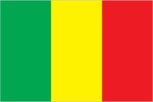
Flag description
three equal vertical bands of green (hoist side), yellow, and red uses the popular Pan-African colors of Ethiopia; the colors from left to right are the same as those of neighboring Senegal (which has an additional green central star) and the reverse of those on the flag of neighboring Guinea
Government type
republic
Independence
22 September 1960 (from France)
International law organization participation
has not submitted an ICJ jurisdiction declaration; accepts ICCt jurisdiction
International organization participation
ACP, AfDB, AU, CD, ECOWAS, EITI (compliant country), FAO, FZ, G-77, IAEA, IBRD, ICAO, ICRM, IDA, IDB, IFAD, IFC, IFRCS, ILO, IMF, Interpol, IOC, IOM, IPU, ISO, ITSO, ITU, ITUC (NGOs), MIGA, MONUSCO, NAM, OIC, OIF, OPCW, UN, UNAMID, UNCTAD, UNESCO, UNIDO, UNMIL, UNMISS, UNWTO, UPU, WADB (regional), WAEMU, WCO, WFTU (NGOs), WHO, WIPO, WMO, WTO
Judicial branch
- Supreme Court or Cour Supreme (consists of 19 members organized into 3 civil chambers and a criminal chamber); Constitutional Court (consists of 9 members) Supreme Court members appointed by the Ministry of Justice to serve 5-year terms; Constitutional Court members selected - 3 each by the president, the National Assembly, and the Supreme Council of the Magistracy; members serve single renewable 7-year terms High Court of Justice (jurisdiction limited to cases of high treason or criminal offenses by the president or ministers while in office)
- highest court(s)
- Supreme Court or Cour Supreme (consists of 19 members organized into 3 civil chambers and a criminal chamber); Constitutional Court (consists of 9 members)
- judge selection and term of office
- Supreme Court members appointed by the Ministry of Justice to serve 5-year terms; Constitutional Court members selected - 3 each by the president, the National Assembly, and the Supreme Council of the Magistracy; members serve single renewable 7-year terms
- subordinate courts
- High Court of Justice (jurisdiction limited to cases of high treason or criminal offenses by the president or ministers while in office)
Legal system
civil law system based on the French civil law model and influenced by customary law; judicial review of legislative acts in Constitutional Court
Legislative branch
- unicameral National Assembly or Assemblee Nationale (147 seats; members elected by popular vote to serve five-year terms) last held on 1 and 22 July 2007 (July 2012 election delayed following the military coup and now scheduled for 24 November 2013) percent of vote by party - NA; seats by party - ADP coalition 113 (ADEMA 51, URD 34, MPR 8, CNID 7, UDD 3, and other 10), FDR coalition 15 (RPM 11, PARENA 4), SADI 4, independent 15
- election results
- percent of vote by party - NA; seats by party - ADP coalition 113 (ADEMA 51, URD 34, MPR 8, CNID 7, UDD 3, and other 10), FDR coalition 15 (RPM 11, PARENA 4), SADI 4, independent 15
- elections
- last held on 1 and 22 July 2007 (July 2012 election delayed following the military coup and now scheduled for 24 November 2013)
National anthem
- "Le Mali" (Mali) Seydou Badian KOUYATE/Banzoumana SISSOKO adopted 1962; the anthem is also known as "Pour L'Afrique et pour toi, Mali" (For Africa and for You, Mali) and "A ton appel Mali" (At Your Call, Mali)
- lyrics/music
- Seydou Badian KOUYATE/Banzoumana SISSOKO
- name
- "Le Mali" (Mali)
National holiday
Independence Day, 22 September (1960)
Political parties and leaders
African Solidarity for Democracy and Independence or SADI [Oumar MARIKO, secretary general] Alliance for Democracy or ADEMA [Diounconda TRAORE] Alliance for Democracy and Progress or ADP (a coalition of political parties including ADEMA and URD formed in December 2006 to support the presidential candidacy of Amadou TOURE) Alliance for Democratic Change (political group comprised mainly of Tuareg from Mali's northern region) Convergence 2007 [Soumeylou Boubeye MAIGA] Convergence for the development of Mali or CODEM [Housseyni GUINDO] Front for Democracy and the Republic or FDR (a coalition of political parties including RPM and PARENA formed to oppose the presidential candidacy of Amadou TOURE) National Congress for Democratic Initiative or CNID [Mountaga TALL] Party for Democracy and Progress or PDP [Mady KONATE] Party for National Renewal or PARENA [Tiebile DRAME] Patriotic Movement for Renewal or MPR [Choguel MAIGA] Rally for Democracy and Labor or RDT [Amadou Ali NIANGADOU] Rally for Mali or RPM [Ibrahim Boubacar KEITA] Sudanese Union/African Democratic Rally or US/RDA [Mamadou Basir GOLOGO] Union for Democracy and Development or UDD [Moussa Balla COULIBALY] Union for Republic and Democracy or URD [Soumaila CISSE]
Political pressure groups and leaders
- the army; Islamic authorities; state-run cotton company CMDT
- other
- the army; Islamic authorities; state-run cotton company CMDT
Suffrage
18 years of age; universal
Economy
Agriculture - products
cotton, millet, rice, corn, vegetables, peanuts; cattle, sheep, goats
Budget
- $1.821 billion $1.948 billion (2012 est.)
- expenditures
- $1.948 billion (2012 est.)
- revenues
- $1.821 billion
Budget surplus (+) or deficit (-)
-1.2% of GDP (2012 est.)
Central bank discount rate
16% (31 December 2010 est.) 4.25% (31 December 2009 est.)
Commercial bank prime lending rate
9.3% (31 December 2012 est.) 9% (31 December 2011 est.)
Current account balance
$-737.5 million (2012 est.) $-1.122 billion (2011 est.)
Debt - external
$3.041 billion (31 December 2012 est.) $2.931 billion (31 December 2011 est.)
Distribution of family income - Gini index
40.1 (2001) 50.5 (1994)
Economy - overview
Among the 25 poorest countries in the world, Mali is a landlocked country highly dependent on gold mining and agricultural exports for revenue. The country's fiscal status fluctuates with gold and agricultural commodity prices and the harvest. Mali remains dependent on foreign aid. Economic activity is largely confined to the riverine area irrigated by the Niger River and about 65% of its land area is desert or semidesert. About 10% of the population is nomadic and about 80% of the labor force is engaged in farming and fishing. Industrial activity is concentrated on processing farm commodities. The government in 2011 completed an IMF extended credit facility program that has helped the economy grow, diversify, and attract foreign investment. Mali is developing its cotton and iron ore extraction industries to diversify foreign exchange revenue away from gold. Mali has invested in tourism but security issues are hurting the industry. Mali experienced economic growth of about 5% per year between 1996-2010, but the global recession and a military coup caused a decline in output in 2012. The interim government slashed public spending in the context of a declining state of security and declining international aid.
Exchange rates
Communaute Financiere Africaine francs (XOF) per US dollar - 510.53 (2012 est.) 471.87 (2011 est.) 495.28 (2010 est.) 472.19 (2009) 447.81 (2008)
Exports
$2.756 billion (2012 est.) $2.373 billion (2011 est.)
Exports - commodities
cotton, gold, livestock
Exports - partners
China 52.9%, Malaysia 11%, Indonesia 5.3%, India 4.1% (2012)
Fiscal year
calendar year
GDP - composition, by end use
- 66.3% 12.6% 27.8% 0.6% 26.5% -33.8% (2012 est.)
- exports of goods and services
- 26.5%
- government consumption
- 12.6%
- household consumption
- 66.3%
- imports of goods and services
- -33.8%
- investment in fixed capital
- 27.8%
- investment in inventories
- 0.6%
GDP - composition, by sector of origin
- 38.7% 23.9% 37.4% (2012 est.)
- agriculture
- 38.7%
- industry
- 23.9%
- services
- 37.4% (2012 est.)
GDP - per capita (PPP)
$1,100 (2012 est.) $1,100 (2011 est.) $1,100 (2010 est.) data are in 2012 US dollars
GDP - real growth rate
-1.2% (2012 est.) 2.7% (2011 est.) 5.8% (2010 est.)
GDP (official exchange rate)
$10.18 billion (2012 est.)
GDP (purchasing power parity)
$17.79 billion (2012 est.) $18 billion (2011 est.) $17.52 billion (2010 est.) data are in 2012 US dollars
Gross national saving
21.6% of GDP (2012 est.) 12.1% of GDP (2011 est.) 8.5% of GDP (2010 est.)
Household income or consumption by percentage share
- 3.5% 25.8% (2010 est.)
- highest 10%
- 25.8% (2010 est.)
- lowest 10%
- 3.5%
Imports
$2.794 billion (2012 est.) $2.78 billion (2011 est.)
Imports - commodities
petroleum, machinery and equipment, construction materials, foodstuffs, textiles
Imports - partners
France 11.2%, Senegal 9.9%, Cote dIvoire 8.7%, China 8.6% (2012)
Industrial production growth rate
NA%
Industries
food processing; construction; phosphate and gold mining
Inflation rate (consumer prices)
5.4% (2012 est.) 2.9% (2011 est.)
Labor force
3.241 million (2007 est.)
Labor force - by occupation
- 80% 20% (2005 est.)
- agriculture
- 80%
- industry and services
- 20% (2005 est.)
Market value of publicly traded shares
$NA
Population below poverty line
36.1% (2005 est.)
Public debt
27.5% of GDP (2012 est.) 27.7% of GDP (2011 est.)
Stock of broad money
$3.401 billion (31 December 2012 est.) $2.929 billion (31 December 2011 est.)
Stock of direct foreign investment - abroad
$848.2 million (31 December 2012 est.) $503 million (31 December 2011 est.)
Stock of direct foreign investment - at home
$2.545 billion (31 December 2012 est.) $2.34 billion (31 December 2011 est.)
Stock of domestic credit
$2.102 billion (31 December 2012 est.) $1.669 billion (31 December 2011 est.)
Stock of narrow money
$2.583 billion (31 December 2012 est.) $2.156 billion (31 December 2011 est.)
Taxes and other revenues
17.9% of GDP (2012 est.)
Unemployment rate
30% (2004 est.)
Energy
Carbon dioxide emissions from consumption of energy
742,300 Mt (2011 est.)
Crude oil - exports
0 bbl/day (2010 est.)
Crude oil - imports
0 bbl/day (2010 est.)
Crude oil - production
0 bbl/day (2012 est.)
Crude oil - proved reserves
0 bbl (1 January 2013 es)
Electricity - consumption
483.6 million kWh (2010 est.)
Electricity - exports
0 kWh (2012 est.)
Electricity - from fossil fuels
48.4% of total installed capacity (2010 est.)
Electricity - from hydroelectric plants
51.6% of total installed capacity (2010 est.)
Electricity - from nuclear fuels
0% of total installed capacity (2010 est.)
Electricity - from other renewable sources
0% of total installed capacity (2010 est.)
Electricity - imports
0 kWh (2012 est.)
Electricity - installed generating capacity
304,000 kW (2010 est.)
Electricity - production
520 million kWh (2010 est.)
Natural gas - consumption
0 cu m (2010 est.)
Natural gas - exports
0 cu m (2011 est.)
Natural gas - imports
0 cu m (2011 est.)
Natural gas - production
0 cu m (2011 est.)
Natural gas - proved reserves
0 cu m (1 January 2013 es)
Refined petroleum products - consumption
4,994 bbl/day (2011 est.)
Refined petroleum products - exports
0 bbl/day (2010 est.)
Refined petroleum products - imports
4,698 bbl/day (2010 est.)
Refined petroleum products - production
0 bbl/day (2010 est.)
Communications
Broadcast media
national public TV broadcaster; 2 privately owned companies provide subscription services to foreign multi-channel TV packages; national public radio broadcaster supplemented by a large number of privately owned and community broadcast stations; transmissions of multiple international broadcasters are available (2007)
Internet country code
.ml
Internet hosts
437 (2012)
Internet users
249,800 (2009)
Telephone system
- domestic system unreliable but improving; increasing use of local radio loops to extend network coverage to remote areas fixed-line subscribership remains less than 1 per 100 persons; mobile-cellular subscribership has increased sharply to about 70 per 100 persons country code - 223; satellite communications center and fiber-optic links to neighboring countries; satellite earth stations - 2 Intelsat (1 Atlantic Ocean, 1 Indian Ocean) (2010)
- domestic
- fixed-line subscribership remains less than 1 per 100 persons; mobile-cellular subscribership has increased sharply to about 70 per 100 persons
- general assessment
- domestic system unreliable but improving; increasing use of local radio loops to extend network coverage to remote areas
- international
- country code - 223; satellite communications center and fiber-optic links to neighboring countries; satellite earth stations - 2 Intelsat (1 Atlantic Ocean, 1 Indian Ocean) (2010)
Telephones - main lines in use
112,000 (2012)
Telephones - mobile cellular
14.613 million (2012)
Transportation
Airports
25 (2013)
Airports - with paved runways
- 1 (2013)
- 1,524 to 2,437 m
- 2
- 2,438 to 3,047 m
- 4
- 914 to 1,523 m
- 1 (2013)
- over 3,047 m
- 1
- total
- 8
Airports - with unpaved runways
- 5 (2013)
- 1,524 to 2,437 m
- 3
- 914 to 1,523 m
- 9
- total
- 17
Heliports
2 (2013)
Ports and terminals
Koulikoro
Railways
- 593 km 593 km 1.000-m gauge (2008)
- total
- 593 km
Roadways
- 22,474 km 5,522 km 16,952 km (2009)
- total
- 22,474 km
- unpaved
- 16,952 km (2009)
Waterways
1,800 km (downstream of Koulikoro; low water levels on the River Niger cause problems in dry years; in the months before the rainy season the river is not navigable by commercial vessels) (2011)
Military and Security
Manpower available for military service
- 2,848,412 2,981,106 (2010 est.)
- females age 16-49
- 2,981,106 (2010 est.)
- males age 16-49
- 2,848,412
Manpower fit for military service
- 1,825,779 1,968,563 (2010 est.)
- females age 16-49
- 1,968,563 (2010 est.)
- males age 16-49
- 1,825,779
Manpower reaching militarily significant age annually
- 158,031 159,733 (2010 est.)
- female
- 159,733 (2010 est.)
- male
- 158,031
Military branches
- Malian Armed Forces: Army (Armee de Terre), Republic of Mali Air Force (Force Aerienne de la Republique du Mali, FARM), National Guard (Garde National du Mali) (2013)
- Malian Armed Forces
- Army (Armee de Terre), Republic of Mali Air Force (Force Aerienne de la Republique du Mali, FARM), National Guard (Garde National du Mali) (2013)
Military expenditures
1.3% of GDP (2012)
Military service age and obligation
18 years of age for selective compulsory and voluntary military service; conscript service obligation - 2 years (2012)
Transnational Issues
Disputes - international
demarcation is underway with Burkina Faso
Refugees and internally displaced persons
- 12,904 (Mauritania) (2012) 283,726 (Tuareg rebellion since 2012) (2013)
- IDPs
- 283,726 (Tuareg rebellion since 2012) (2013)
- refugees (country of origin)
- 12,904 (Mauritania) (2012)
Trafficking in persons
- Mali is a source, transit, and destination country for men, women, and children subjected to forced labor and sex trafficking; women and girls are forced into domestic servitude, agricultural labor, and support roles in gold mines, as well as subjected to sex trafficking; Malian boys are found in conditions of forced labor in agricultural settings, gold mines, and the informal commercial sector, as well as forced begging both within Mali and neighboring countries; Malians and other Africans who travel through Mali to Mauritania, Algeria, or Libya in hopes of reaching Europe are particularly at risk of becoming victims of human trafficking; men and boys, primarily of Songhai ethnicity, are subjected to the longstanding practice of debt bondage in the salt mines of Taoudenni in northern Mali; some members of Mali's black Tamachek community are subjected to traditional slavery-related practices, and this involuntary servitude reportedly has extended to their children; reports indicate that non-governmental armed groups operating in northern Mali recruited children as combatants, cooks, porters, guards, spies, and sex slaves Tier 2 Watch List - Mali does not fully comply with the minimum standards for the elimination of trafficking; however, it is making significant efforts to do so; although the government enacted a comprehensive anti-trafficking law in 2012, it did not demonstrate evidence of overall increasing efforts to address human trafficking over the previous year; the government has failed to prosecute or convict any trafficking offenders, has not provided any direct services to victims, and has not made any tangible prevention efforts; the government continues to cite a lack of personnel and resources as reasons for its inability to adequately identify and rescue child victims of forced labor in the mining industry (2013)
- current situation
- Mali is a source, transit, and destination country for men, women, and children subjected to forced labor and sex trafficking; women and girls are forced into domestic servitude, agricultural labor, and support roles in gold mines, as well as subjected to sex trafficking; Malian boys are found in conditions of forced labor in agricultural settings, gold mines, and the informal commercial sector, as well as forced begging both within Mali and neighboring countries; Malians and other Africans who travel through Mali to Mauritania, Algeria, or Libya in hopes of reaching Europe are particularly at risk of becoming victims of human trafficking; men and boys, primarily of Songhai ethnicity, are subjected to the longstanding practice of debt bondage in the salt mines of Taoudenni in northern Mali; some members of Mali's black Tamachek community are subjected to traditional slavery-related practices, and this involuntary servitude reportedly has extended to their children; reports indicate that non-governmental armed groups operating in northern Mali recruited children as combatants, cooks, porters, guards, spies, and sex slaves
- tier rating
- Tier 2 Watch List - Mali does not fully comply with the minimum standards for the elimination of trafficking; however, it is making significant efforts to do so; although the government enacted a comprehensive anti-trafficking law in 2012, it did not demonstrate evidence of overall increasing efforts to address human trafficking over the previous year; the government has failed to prosecute or convict any trafficking offenders, has not provided any direct services to victims, and has not made any tangible prevention efforts; the government continues to cite a lack of personnel and resources as reasons for its inability to adequately identify and rescue child victims of forced labor in the mining industry (2013)