1993 Edition
CIA World Factbook 1993 (Project Gutenberg)
Geography
Area
total area: 1.24 million km2 land area: 1.22 million km2 comparative area: slightly less than twice the size of Texas
Climate
subtropical to arid; hot and dry February to June; rainy, humid, and mild June to November; cool and dry November to February
Coastline
0 km (landlocked)
Environment
hot, dust-laden harmattan; haze common during dry seasons; desertification
International disputes
the disputed international boundary between Burkina and Mali was submitted to the International Court of Justice (ICJ) in October 1983 and the ICJ issued its final ruling in December 1986, which both sides agreed to accept; Burkina and Mali are proceeding with boundary demarcation, including the tripoint with Niger
Irrigated land
50 km2 (1989 est.)
Land boundaries
total 7,243 km, Algeria 1,376 km, Burkina 1,000 km, Guinea 858 km, Cote d'Ivoire 532 km, Mauritania 2,237 km, Niger 821 km, Senegal 419 km
Land use
arable land: 2% permanent crops: 0% meadows and pastures: 25% forest and woodland: 7% other: 66%
Location
Western Africa, between Mauritania and Niger
Map references
Africa, Standard Time Zones of the World
Maritime claims
none; landlocked
Natural resources
gold, phosphates, kaolin, salt, limestone, uranium, bauxite, iron ore, manganese, tin, and copper deposits are known but not exploited
Note
landlocked
Terrain
mostly flat to rolling northern plains covered by sand; savanna in south, rugged hills in northeast
People and Society
Birth rate
51.73 births/1,000 population (1993 est.)
Death rate
20.81 deaths/1,000 population (1993 est.)
Ethnic divisions
Mande 50% (Bambara, Malinke, Sarakole), Peul 17%, Voltaic 12%, Songhai 6%, Tuareg and Moor 10%, other 5%
Infant mortality rate
108 deaths/1,000 live births (1993 est.)
Labor force
2.666 million (1986 est.) by occupation: agriculture 80%, services 19%, industry and commerce 1% (1981) note: 50% of population of working age (1985)
Languages
French (official), Bambara 80%, numerous African languages
Life expectancy at birth
total population: 45.45 years male: 43.89 years female: 47.06 years (1993 est.)
Literacy
age 15 and over can read and write (1990) total population: 32% male: 41% female: 24%
Nationality
noun: Malian(s) adjective: Malian
Net migration rate
-4.35 migrant(s)/1,000 population (1993 est.)
Population
8,868,617 (July 1993 est.)
Population growth rate
2.66% (1993 est.)
Religions
Muslim 90%, indigenous beliefs 9%, Christian 1%
Total fertility rate
7.33 children born/woman (1993 est.)
Government
Administrative divisions
8 regions (regions, singular - region); Gao, Kayes, Kidal, Koulikoro, Mopti, Segou, Sikasso, Tombouctou
Capital
Bamako
Chief of State
President Alpha Oumar KONARE (since 8 June 1992)
Constitution
new constitution adopted in constitutional referendum in January 1992
Digraph
ML
Diplomatic representation in US
chief of mission: Ambassador Siragatou Ibrahim CISSE chancery: 2130 R Street NW, Washington, DC 20008 telephone: (202) 332-2249 or 939-8950
Executive branch
Transition Committee for the Salvation of the People (CTSP) composed of 25 members, predominantly civilian
FAX
[233] 228059
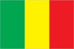
Flag
three equal vertical bands of green (hoist side), yellow, and red; uses the popular pan-African colors of Ethiopia
Head of Government
Prime Minister Younoussi TOURE (since 8 June 1992)
Independence
22 September 1960 (from France)
Judicial branch
Supreme Court (Cour Supreme)
Legal system
based on French civil law system and customary law; judicial review of legislative acts in Constitutional Section of Court of State; has not accepted compulsory ICJ jurisdiction
Legislative branch
unicameral National Assembly
Member of
ACCT, ACP, AfDB, CCC, CEAO, ECA, ECOWAS, FAO, FZ, G-77, IAEA, IBRD, ICAO, IDA, IDB, IFAD, IFC, ILO, IMF, INTELSAT, INTERPOL, IOC, ITU, LORCS, NAM, OAU, OIC, UN, UNCTAD, UNESCO, UNIDO, UPU, WADB, WCL, WHO, WIPO, WMO, WTO
Names
conventional long form: Republic of Mali conventional short form: Mali local long form: Republique de Mali local short form: Mali former: French Sudan
National Assembly
last held on 8 March 1992 (next to be held NA); results - percent of vote by party NA; seats - (total 116) Adema 76, CNID 9, US/RAD 8, Popular Movement for the Development of the Republic of West Africa 6, RDP 4, UDD 4, RDT 3, UFDP 3, PDP 2, UMDD 1
National holiday
Anniverary of the Proclamation of the Republic, 22 September (1960)
Political parties and leaders
Alliance for Democracy (Adema), Alpha Oumar KONARE; National Committee for Democratic Initiative (CNID), Mountaga TALL; Sudanese Union/African Democratic Rally (US/RAD), Baba Hakib HAIDARA and Treoule Mamadon KONATE; Popular Movement for the Development of the Republic of West Africa; Rally for Democracy and Progress (RDP), Almamy SYLLA; Union for Democracy and Development (UDD), Moussa Balla COULIBALY; Rally for Democracy and Labor (RDT); Union of Democratic Forces for Progress (UFDP), Col. Youssouf TRAORE; Party for Democracy and Progress (PDP), Idrissa TRAORE; Malian Union for Democracy and Development (UMDD)
President
last held in April 1992; Alpha KONARE was elected in runoff race against Montaga TALL
Suffrage
21 years of age; universal
Type
republic
US diplomatic representation
chief of mission: Ambassador Herbert Donald GELBER embassy: Rue Rochester NY and Rue Mohamed V., Bamako mailing address: B. P. 34, Bamako telephone: [223] 225470
Economy
Agriculture
accounts for 50% of GDP; most production based on small subsistence farms; cotton and livestock products account for over 70% of exports; other crops - millet, rice, corn, vegetables, peanuts; livestock - cattle, sheep, goats
Budget
revenues $329 million; expenditures $519 million, including capital expenditures of $178 (1989 est.)
Currency
1 CFA franc (CFAF) = 100 centimes
Economic aid
US commitments, including Ex-Im (FY70-89), $349 million; Western (non-US) countries, ODA and OOF bilateral commitments (1970-89), $3,020 million; OPEC bilateral aid (1979-89), $92 million; Communist countries (1970-89), $190 million
Electricity
260,000 kW capacity; 750 million kWh produced, 90 kWh per capita (1991)
Exchange rates
Communaute Financiere Africaine francs (CFAF) per US$1 - 274.06 (January 1993), 264.69 (1992), 282.11 (1991), 272.26 (1990), 319.01 (1989), 297.85 (1988)
Exports
$320 million (f.o.b., 1991 est.) commodities: livestock, peanuts, dried fish, cotton, skins partners: mostly franc zone and Western Europe
External debt
$2.6 billion (1991 est.)
Fiscal year
calendar year
Imports
$390 million (f.o.b., 1991 est.) commodities: textiles, vehicles, petroleum products, machinery, sugar, cereals partners: mostly franc zone and Western Europe
Industrial production
growth rate 15.0% (1990 est.); accounts for 10.0% of GDP
Industries
small local consumer goods and processing, construction, phosphate, gold, fishing
Inflation rate (consumer prices)
1.4% (1991 est.)
National product
GDP - exchange rate conversion - $2.3 billion (1991 est.)
National product per capita
$265 (1991 est.)
National product real growth rate
-0.2% (1991 est.)
Overview
Mali is among the poorest countries in the world, with about 70% of its land area desert or semidesert. Economic activity is largely confined to the riverine area irrigated by the Niger. About 10% of the population live as nomads and some 80% of the labor force is engaged in agriculture and fishing. Industrial activity is concentrated on processing farm commodities. In consultation with international lending agencies, the government has adopted a structural adjustment program for 1992-95, aiming at GDP annual growth of 4.6%, inflation of no more than 2.5% on average, and a substantial reduction in the external current account deficit.
Unemployment rate
NA%
Communications
Airports
total: 34 usable: 27 with permanent-surface runways: 8 with runways over 3,659 m: with runways 2,440-3,659 m: 5 with runways 1,220-2,439 m: 10
Highways
about 15,700 km total; 1,670 km paved, 3,670 km gravel and improved earth, 10,360 km unimproved earth
Inland waterways
1,815 km navigable
Railroads
642 km 1.000-meter gauge; linked to Senegal's rail system through Kayes
Telecommunications
domestic system poor but improving; provides only minimal service with radio relay, wire, and radio communications stations; expansion of radio relay in progress; 11,000 telephones; broadcast stations - 2 AM, 2 FM, 2 TV; satellite earth stations - 1 Atlantic Ocean INTELSAT and 1 Indian Ocean INTELSAT
Military and Security
Branches
Army, Air Force, Gendarmerie, Republican Guard, National Police (Surete Nationale)
Defense expenditures
exchange rate conversion - $41 million, 2% of GDP (1989)
Manpower availability
males age 15-49 1,749,662; fit for military service 995,554 (1993 est.); no conscription