2014 Edition
CIA World Factbook 2014 Archive (HTML)
Introduction
Background
Established in 1891, the British protectorate of Nyasaland became the independent nation of Malawi in 1964. After three decades of one-party rule under President Hastings Kamuzu BANDA the country held multiparty elections in 1994, under a provisional constitution that came into full effect the following year. President Bingu wa MUTHARIKA, elected in May 2004 after a failed attempt by the previous president to amend the constitution to permit another term, struggled to assert his authority against his predecessor and subsequently started his own party, the Democratic Progressive Party (DPP) in 2005. MUTHARIKA was reelected to a second term in May 2009. He oversaw some economic improvement in his first term, but was accused of economic mismanagement and poor governance in his second term. He died abruptly in April 2012 and was succeeded by his vice president, Joyce BANDA, who had earlier started her own party, the People's Party (PP). Population growth, increasing pressure on agricultural lands, corruption, and the scourge of HIV/AIDS pose major problems for Malawi.
Geography
Area
- 118,484 sq km 94,080 sq km 24,404 sq km
- total
- 118,484 sq km
- water
- 24,404 sq km
Area - comparative
slightly smaller than Pennsylvania
Climate
sub-tropical; rainy season (November to May); dry season (May to November)
Coastline
0 km (landlocked)
Elevation extremes
- junction of the Shire River and international boundary with Mozambique 37 m Sapitwa (Mount Mlanje) 3,002 m
- highest point
- Sapitwa (Mount Mlanje) 3,002 m
- lowest point
- junction of the Shire River and international boundary with Mozambique 37 m
Environment - current issues
deforestation; land degradation; water pollution from agricultural runoff, sewage, industrial wastes; siltation of spawning grounds endangers fish populations
Environment - international agreements
- Biodiversity, Climate Change, Climate Change-Kyoto Protocol, Desertification, Endangered Species, Environmental Modification, Hazardous Wastes, Marine Life Conservation, Ozone Layer Protection, Ship Pollution, Wetlands Law of the Sea
- party to
- Biodiversity, Climate Change, Climate Change-Kyoto Protocol, Desertification, Endangered Species, Environmental Modification, Hazardous Wastes, Marine Life Conservation, Ozone Layer Protection, Ship Pollution, Wetlands
- signed, but not ratified
- Law of the Sea
Freshwater withdrawal (domestic/industrial/agricultural)
- 1.36 cu km/yr (11%/4%/86%) 99.86 cu m/yr (2005)
- per capita
- 99.86 cu m/yr (2005)
- total
- 1.36 cu km/yr (11%/4%/86%)
Geographic coordinates
13 30 S, 34 00 E
Geography - note
landlocked; Lake Nyasa, some 580 km long, is the country's most prominent physical feature; it contains more fish species than any other lake on earth
Irrigated land
735 sq km (2006)
Land boundaries
- 2,881 km Mozambique 1,569 km, Tanzania 475 km, Zambia 837 km
- border countries
- Mozambique 1,569 km, Tanzania 475 km, Zambia 837 km
- total
- 2,881 km
Land use
- 30.38% 1.1% 68.52% (2011)
- arable land
- 30.38%
- other
- 68.52% (2011)
- permanent crops
- 1.1%
Location
Southern Africa, east of Zambia, west and north of Mozambique
Map references
Africa
Maritime claims
none (landlocked)
Natural hazards
NA
Natural resources
limestone, arable land, hydropower, unexploited deposits of uranium, coal, and bauxite
Terrain
narrow elongated plateau with rolling plains, rounded hills, some mountains
Total renewable water resources
17.28 cu km (2011)
People and Society
Age structure
- 46.9% (male 4,056,810/female 4,100,841) 20.2% (male 1,748,919/female 1,765,212) 27.1% (male 2,329,952/female 2,371,274) 3.1% (male 256,034/female 280,997) 2.7% (male 206,923/female 260,506) (2014 est.)
- 0-14 years
- 46.9% (male 4,056,810/female 4,100,841)
- 15-24 years
- 20.2% (male 1,748,919/female 1,765,212)
- 25-54 years
- 27.1% (male 2,329,952/female 2,371,274)
- 55-64 years
- 3.1% (male 256,034/female 280,997)
- 65 years and over
- 2.7% (male 206,923/female 260,506) (2014 est.)
Birth rate
41.8 births/1,000 population (2014 est.)
Child labor - children ages 5-14
- 993,318 26 % (2006 est.)
- percentage
- 26 % (2006 est.)
- total number
- 993,318
Children under the age of 5 years underweight
13.8% (2010)
Contraceptive prevalence rate
46.1% (2010)
Death rate
8.74 deaths/1,000 population (2014 est.)
Dependency ratios
- 93.3 % 87 % 6.3 % 16 (2014 est.)
- elderly dependency ratio
- 6.3 %
- potential support ratio
- 16 (2014 est.)
- total dependency ratio
- 93.3 %
- youth dependency ratio
- 87 %
Drinking water source
- urban: 94.6% of population rural: 83.2% of population total: 85% of population urban: 5.4% of population rural: 16.8% of population total: 15% of population (2012 est.)
- rural
- 16.8% of population
- total
- 15% of population (2012 est.)
- urban
- 5.4% of population
Education expenditures
5.4% of GDP (2011)
Ethnic groups
Chewa 32.6%, Lomwe 17.6%, Yao 13.5%, Ngoni 11.5%, Tumbuka 8.8%, Nyanja 5.8%, Sena 3.6%, Tonga 2.1%, Ngonde 1%, other 3.5%
Health expenditures
8.4% of GDP (2011)
HIV/AIDS - adult prevalence rate
10.8% (2012 est.)
HIV/AIDS - deaths
45,600 (2012 est.)
HIV/AIDS - people living with HIV/AIDS
1,129,800 (2012 est.)
Hospital bed density
1.3 beds/1,000 population (2011)
Infant mortality rate
- 48.01 deaths/1,000 live births 54.94 deaths/1,000 live births 40.98 deaths/1,000 live births (2014 est.)
- female
- 40.98 deaths/1,000 live births (2014 est.)
- total
- 48.01 deaths/1,000 live births
Languages
English (official), Chichewa (common), Chinyanja, Chiyao, Chitumbuka, Chilomwe, Chinkhonde, Chingoni, Chisena, Chitonga, Chinyakyusa, Chilambya
Life expectancy at birth
- 59.99 years 58.04 years 61.97 years (2014 est.)
- female
- 61.97 years (2014 est.)
- total population
- 59.99 years
Literacy
- age 15 and over can read and write 74.8% 81.1% 68.5% (2010 est.)
- definition
- age 15 and over can read and write
- female
- 68.5% (2010 est.)
- male
- 81.1%
- total population
- 74.8%
Major infectious diseases
- very high bacterial and protozoal diarrhea, hepatitis A, and typhoid fever malaria and dengue fever schistosomiasis rabies (2013)
- animal contact disease
- rabies (2013)
- degree of risk
- very high
- food or waterborne diseases
- bacterial and protozoal diarrhea, hepatitis A, and typhoid fever
- vectorborne diseases
- malaria and dengue fever
- water contact disease
- schistosomiasis
Major urban areas - population
LILONGWE (capital) 772,000 (2011)
Maternal mortality rate
460 deaths/100,000 live births (2010)
Median age
- 16.3 years 16.2 years 16.4 years (2014 est.)
- female
- 16.4 years (2014 est.)
- male
- 16.2 years
- total
- 16.3 years
Mother's mean age at first birth
18.9 median age at first birth among women 25-29 (2010 est.)
Nationality
- Malawian(s) Malawian
- adjective
- Malawian
- noun
- Malawian(s)
Net migration rate
0.25 migrant(s)/1,000 population (2014 est.)
Obesity - adult prevalence rate
4.3% (2008)
Physicians density
0.02 physicians/1,000 population (2008)
Population
17,377,468 estimates for this country explicitly take into account the effects of excess mortality due to AIDS; this can result in lower life expectancy, higher infant mortality, higher death rates, lower population growth rates, and changes in the distribution of population by age and sex than would otherwise be expected (July 2014 est.)
Population growth rate
3.33% (2014 est.)
Religions
Christian 82.6%, Muslim 13%, other 1.9%, none 2.5% (2008 est.)
Sanitation facility access
- urban: 22.3% of population rural: 8% of population total: 10.3% of population urban: 77.7% of population rural: 92% of population total: 89.7% of population (2012 est.)
- rural
- 92% of population
- total
- 89.7% of population (2012 est.)
- urban
- 77.7% of population
School life expectancy (primary to tertiary education)
- 11 years 11 years 11 years (2011)
- female
- 11 years (2011)
- male
- 11 years
- total
- 11 years
Sex ratio
- 1.02 male(s)/female 0.99 male(s)/female 0.99 male(s)/female 0.98 male(s)/female 0.98 male(s)/female 0.75 male(s)/female 0.99 male(s)/female (2014 est.)
- 0-14 years
- 0.99 male(s)/female
- 15-24 years
- 0.99 male(s)/female
- 25-54 years
- 0.98 male(s)/female
- 55-64 years
- 0.98 male(s)/female
- 65 years and over
- 0.75 male(s)/female
- at birth
- 1.02 male(s)/female
- total population
- 0.99 male(s)/female (2014 est.)
Total fertility rate
5.66 children born/woman (2014 est.)
Urbanization
- 15.7% of total population (2011) 4.2% annual rate of change (2010-15 est.)
- rate of urbanization
- 4.2% annual rate of change (2010-15 est.)
- urban population
- 15.7% of total population (2011)
Government
Administrative divisions
28 districts; Balaka, Blantyre, Chikwawa, Chiradzulu, Chitipa, Dedza, Dowa, Karonga, Kasungu, Likoma, Lilongwe, Machinga, Mangochi, Mchinji, Mulanje, Mwanza, Mzimba, Neno, Ntcheu, Nkhata Bay, Nkhotakota, Nsanje, Ntchisi, Phalombe, Rumphi, Salima, Thyolo, Zomba
Capital
- Lilongwe 13 58 S, 33 47 E UTC+2 (7 hours ahead of Washington, DC, during Standard Time)
- geographic coordinates
- 13 58 S, 33 47 E
- name
- Lilongwe
- time difference
- UTC+2 (7 hours ahead of Washington, DC, during Standard Time)
Constitution
previous 1953 (preindependence), 1966; latest drafted January to May 1994, approved 16 May 1994, entered into force 18 May 1995; amended several times, last in 2013 (2013)
Country name
- Republic of Malawi Malawi Dziko la Malawi Malawi British Central African Protectorate, Nyasaland Protectorate, Nyasaland
- conventional long form
- Republic of Malawi
- conventional short form
- Malawi
- former
- British Central African Protectorate, Nyasaland Protectorate, Nyasaland
- local long form
- Dziko la Malawi
- local short form
- Malawi
Diplomatic representation from the US
- Ambassador Jeanine E. JACKSON (since 11 September 2011) 16 Jomo Kenyatta Road, Lilongwe 3 P. O. Box 30016, Lilongwe 3, Malawi [265] (1) 773-166 [265] (1) 770-471
- chief of mission
- Ambassador Jeanine E. JACKSON (since 11 September 2011)
- embassy
- 16 Jomo Kenyatta Road, Lilongwe 3
- FAX
- [265] (1) 770-471
- mailing address
- P. O. Box 30016, Lilongwe 3, Malawi
- telephone
- [265] (1) 773-166
Diplomatic representation in the US
- Ambassador Stephen Dick Tennyson MATENSE (since 10 September 2010) 2408 Massachusetts Avenue NW, Washington, DC 20008 [1] (202) 721-0270 [1] (202) 721-0288
- chancery
- 2408 Massachusetts Avenue NW, Washington, DC 20008
- chief of mission
- Ambassador Stephen Dick Tennyson MATENSE (since 10 September 2010)
- FAX
- [1] (202) 721-0288
- telephone
- [1] (202) 721-0270
Executive branch
- President Arthur Peter MUTHARIKA (since 31 May 2014); Vice President Saulos CHILIMA (since 31 May 2014); note - the president is both chief of state and head of government President Arthur Peter MUTHARIKA (since 31 May 2014); Vice President Saulos CHILIMA (since 31 May 2014) 26-32-member Cabinet named by the president president elected by popular vote for a five-year term (eligible for a second term); election last held on 20 May 2014 (next to be held in May 2019) Peter MUTHARIKA elected president; percent of vote - Peter MUTHARIKA 36.4%, Lazarus CHAKWERA 27.8%, Joyce BANDA 20.2%, Atupele MULUZI 13.7%, other 1.9%
- cabinet
- 26-32-member Cabinet named by the president
- chief of state
- President Arthur Peter MUTHARIKA (since 31 May 2014); Vice President Saulos CHILIMA (since 31 May 2014); note - the president is both chief of state and head of government
- election results
- Peter MUTHARIKA elected president; percent of vote - Peter MUTHARIKA 36.4%, Lazarus CHAKWERA 27.8%, Joyce BANDA 20.2%, Atupele MULUZI 13.7%, other 1.9%
- elections
- president elected by popular vote for a five-year term (eligible for a second term); election last held on 20 May 2014 (next to be held in May 2019)
- head of government
- President Arthur Peter MUTHARIKA (since 31 May 2014); Vice President Saulos CHILIMA (since 31 May 2014)
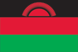
Flag description
three equal horizontal bands of black (top), red, and green with a radiant, rising, red sun centered on the black band; black represents the native peoples, red the blood shed in their struggle for freedom, and green the color of nature; the rising sun represents the hope of freedom for the continent of Africa
Government type
multiparty democracy
Independence
6 July 1964 (from the UK)
International law organization participation
accepts compulsory ICJ jurisdiction with reservations; accepts ICCt jurisdiction
International organization participation
ACP, AfDB, AU, C, CD, COMESA, FAO, G-77, IAEA, IBRD, ICAO, ICRM, IDA, IFAD, IFC, IFRCS, ILO, IMF, IMO, Interpol, IOC, IPU, ISO (correspondent), ITSO, ITU, ITUC (NGOs), MIGA, MINURSO, MONUSCO, NAM, OPCW, SADC, UN, UNAMID, UNCTAD, UNESCO, UNIDO, UNOCI, UNWTO, UPU, WCO, WFTU (NGOs), WHO, WIPO, WMO, WTO
Judicial branch
- Supreme Court of Appeal (consists of the chief justice and at least 3 judges) Supreme Court chief justice appointed by the president and confirmed by the National Assembly; other judges appointed by the president upon recommendation of the Judicial Service Commission, which regulates judicial officers; judges serve until age 65 High Court; magistrate courts; Industrial Relations Court; district and city traditional or local courts
- highest court(s)
- Supreme Court of Appeal (consists of the chief justice and at least 3 judges)
- judge selection and term of office
- Supreme Court chief justice appointed by the president and confirmed by the National Assembly; other judges appointed by the president upon recommendation of the Judicial Service Commission, which regulates judicial officers; judges serve until age 65
- subordinate courts
- High Court; magistrate courts; Industrial Relations Court; district and city traditional or local courts
Legal system
mixed legal system of English common law and customary law; judicial review of legislative acts in the Supreme Court of Appeal
Legislative branch
- unicameral National Assembly (193 seats; members elected by popular vote to serve five-year terms) last held on 19 May 2009 (next to be held 20 May 2014) percent of vote by party - NA; seats by party - DPP 114, MCP 26, UDF 17, independents 32, other 4
- election results
- percent of vote by party - NA; seats by party - DPP 114, MCP 26, UDF 17, independents 32, other 4
- elections
- last held on 19 May 2009 (next to be held 20 May 2014)
National anthem
- "Mulungu dalitsa Malawi" (Oh God Bless Our Land of Malawi) Michael-Fredrick Paul SAUKA adopted 1964
- lyrics/music
- Michael-Fredrick Paul SAUKA
- name
- "Mulungu dalitsa Malawi" (Oh God Bless Our Land of Malawi)
National holiday
Independence Day (Republic Day), 6 July (1964)
Political parties and leaders
Alliance for Democracy or AFORD [Godfrey SHAWA] Chipani Cha Fuko or CCP [Davis KATSONGA PHIRI] Christian Liberation Party or CONU [Sylvester CHABUKA] Democratic Progressive Party or DPP [Peter MUTHARIKA] Malawi Congress Party or MCP [Lazarus CHAKWERA] Malawi Democratic Party or MDP [Kampelo KALUA] Malawi Forum for Unity and Development or MAFUNDE [George MNESA] National Rainbow Coalition or NARC [Loveness GONDWE] National Salvation Front or NASAF [James NYONDO] Nthanda Congress Party or NCP [Dr. Chakhumbila KHAILA] New Labour Party or NLP [Friday JUMBE] New Republican Party [Gwanda CHAKUWAMBA] People's Party or PP [Joyce BANDA] People's Progressive Movement or PPM [Mark Katsonga PHIRI] People's Transformation Movement or PETRA [Kamuzu CHIBAMBO] Umodzi Party or UP [John CHISI] United Democratic Front or UDF [Atupele MULUZI] United Independent Party or UIP [Helen SINGH]
Political pressure groups and leaders
Council for NGOs in Malawi or CONGOMA (human rights, democracy, and development) Human Rights Consultative Committee or HRCC (human rights) Malawi Economic Justice Network or MEJN (pro economic growth, development, government accountability) Malawi Law Society (an umbrella organization of all lawyers in Malawi) Public Affairs Committee or PAC (promotes democracy, development, peace and unity)
Suffrage
18 years of age; universal
Economy
Agriculture - products
tobacco, sugarcane, cotton, tea, corn, potatoes, cassava (manioc, tapioca), sorghum, pulses, groundnuts, Macadamia nuts; cattle, goats
Budget
- $1.347 billion $1.4 billion (2013 est.)
- expenditures
- $1.4 billion (2013 est.)
- revenues
- $1.347 billion
Budget surplus (+) or deficit (-)
-1.4% of GDP (2013 est.)
Central bank discount rate
15% (31 December 2009) 15% (31 December 2008)
Commercial bank prime lending rate
29.5% (31 December 2013 est.) 32.4% (31 December 2012 est.)
Current account balance
-$280.1 million (2013 est.) -$315.1 million (2012 est.)
Debt - external
$1.556 billion (31 December 2013 est.) $1.354 billion (31 December 2012 est.)
Distribution of family income - Gini index
39 (2004)
Economy - overview
Landlocked Malawi ranks among the world's most densely populated and least developed countries. The economy is predominately agricultural with about 80% of the population living in rural areas. Agriculture, which has benefited from fertilizer subsidies since 2006, accounts for one-third of GDP and 90% of export revenues. The performance of the tobacco sector is key to short-term growth as tobacco accounts for more than half of exports. The economy depends on substantial inflows of economic assistance from the IMF, the World Bank, and individual donor nations. In 2006, Malawi was approved for relief under the Heavily Indebted Poor Countries (HIPC) program. In December 2007, the US granted Malawi eligibility status to receive financial support within the Millennium Challenge Corporation (MCC) initiative. The government faces many challenges including developing a market economy, improving educational facilities, facing up to environmental problems, dealing with the rapidly growing problem of HIV/AIDS, and satisfying foreign donors that fiscal discipline is being tightened. Between 2005 and 2009 President BANDA'S government exhibited improved financial discipline under the guidance of Finance Minister Goodall GONDWE and signed a three year IMF Poverty Reduction and Growth Facility (PRGF) worth $56 million. The government announced infrastructure projects that could yield improvements, such as a new oil pipeline for better fuel access, and the potential for a waterway link through Mozambican rivers to the ocean for better transportation options. Since 2009, however, Malawi has experienced some setbacks, including a general shortage of foreign exchange, which has damaged its ability to pay for imports, and fuel shortages that hinder transportation and productivity. Investment has fallen continuously for several years and in 2013 amounted to just 13% of GDP. The government has failed to address barriers to investment such as unreliable power, water shortages, poor telecommunications infrastructure, and the high costs of services. Donors, who provided an average of 36% of government revenue in the past five years, suspended general budget support for Malawi in 2011 due to a negative IMF review and governance issues.
Exchange rates
Malawian kwachas (MWK) per US dollar - 342.1 (2013 est.) 249.11 (2012 est.) 150.49 (2010 est.) 141.14 (2009) 142.41 (2008)
Exports
$1.427 billion (2013 est.) $1.224 billion (2012 est.)
Exports - commodities
tobacco 53%, tea, sugar, cotton, coffee, peanuts, wood products, apparel
Exports - partners
Canada 10.6%, Zimbabwe 9.3%, Germany 7.3%, South Africa 6.6%, Russia 6.5%, US 6.1%, China 4.2% (2012)
Fiscal year
1 July - 30 June
GDP - composition, by end use
- 73.6% 20.7% 13% 1.9% 29.2% -38.4% (2013 est.)
- exports of goods and services
- 29.2%
- government consumption
- 20.7%
- household consumption
- 73.6%
- imports of goods and services
- -38.4%
- investment in fixed capital
- 13%
- investment in inventories
- 1.9%
GDP - composition, by sector of origin
- 29.4% 18.9% 51.7% (2013 est.)
- agriculture
- 29.4%
- industry
- 18.9%
- services
- 51.7% (2013 est.)
GDP - per capita (PPP)
$900 (2013 est.) $900 (2012 est.) $900 (2011 est.) data are in 2013 US dollars
GDP - real growth rate
5% (2013 est.) 1.9% (2012 est.) 4.3% (2011 est.)
GDP (official exchange rate)
$3.683 billion (2013 est.)
GDP (purchasing power parity)
$15.02 billion (2013 est.) $14.3 billion (2012 est.) $14.04 billion (2011 est.) data are in 2013 US dollars
Gross national saving
8.2% of GDP (2013 est.) 8.2% of GDP (2012 est.) 1.9% of GDP (2011 est.)
Household income or consumption by percentage share
- 3% 31.9% (2004)
- highest 10%
- 31.9% (2004)
- lowest 10%
- 3%
Imports
$2.42 billion (2013 est.) $2.151 billion (2012 est.)
Imports - commodities
food, petroleum products, semi-manufactures, consumer goods, transportation equipment
Imports - partners
South Africa 27%, China 16.6%, India 8.7%, Zambia 8.5%, Tanzania 5.1%, US 4.3% (2012)
Industrial production growth rate
2.8% (2013 est.)
Industries
tobacco, tea, sugar, sawmill products, cement, consumer goods
Inflation rate (consumer prices)
26.9% (2013 est.) 21.4% (2012 est.)
Labor force
5.747 million (2007 est.)
Labor force - by occupation
- 90% 10% (2003 est.)
- agriculture
- 90%
- industry and services
- 10% (2003 est.)
Market value of publicly traded shares
$753.6 million (31 December 2012 est.) $1.384 billion (31 December 2011) $NA (31 December 2010 est.)
Population below poverty line
53% (2004)
Public debt
50.8% of GDP (2013 est.) 62.7% of GDP (2012 est.)
Reserves of foreign exchange and gold
$364.2 million (31 December 2013 est.) $246 million (31 December 2012 est.)
Stock of broad money
$1.494 billion (31 December 2013 est.) $1.153 billion (31 December 2012 est.)
Stock of direct foreign investment - abroad
$NA
Stock of direct foreign investment - at home
$NA
Stock of domestic credit
$1.243 billion (31 December 2013 est.) $1.128 billion (31 December 2012 est.)
Stock of narrow money
$585.3 million (31 December 2013 est.) $457.6 million (31 December 2012 est.)
Taxes and other revenues
36.6% of GDP (2013 est.)
Unemployment rate
NA%
Energy
Carbon dioxide emissions from consumption of energy
956,900 Mt (2011 est.)
Crude oil - exports
0 bbl/day (2010 est.)
Crude oil - imports
0 bbl/day (2010 est.)
Crude oil - production
200 bbl/day (2012 est.)
Crude oil - proved reserves
0 bbl (1 January 2013 est.)
Electricity - consumption
1.835 billion kWh (2010 est.)
Electricity - exports
0 kWh (2012 est.)
Electricity - from fossil fuels
0.3% of total installed capacity (2010 est.)
Electricity - from hydroelectric plants
99.7% of total installed capacity (2010 est.)
Electricity - from nuclear fuels
0% of total installed capacity (2010 est.)
Electricity - from other renewable sources
0% of total installed capacity (2010 est.)
Electricity - imports
0 kWh (2012 est.)
Electricity - installed generating capacity
287,000 kW (2010 est.)
Electricity - production
1.973 billion kWh (2010 est.)
Natural gas - consumption
0 cu m (2010 est.)
Natural gas - exports
0 cu m (2011 est.)
Natural gas - imports
0 cu m (2011 est.)
Natural gas - production
0 cu m (2011 est.)
Natural gas - proved reserves
0 cu m (1 January 2013 est.)
Refined petroleum products - consumption
12,060 bbl/day (2011 est.)
Refined petroleum products - exports
0 bbl/day (2010 est.)
Refined petroleum products - imports
6,059 bbl/day (2010 est.)
Refined petroleum products - production
0 bbl/day (2010 est.)
Communications
Broadcast media
radio is the main broadcast medium; privately-owned Zodiac radio has the widest national broadcasting reach, followed by state-run radio; about a dozen private and community radio stations broadcast in cities and towns around the country; the largest TV network is government-owned, but two private TV networks now broadcast in urban areas and more plan to begin broadcasting in 2014; relays of multiple international broadcasters are available (2014)
Internet country code
.mw
Internet hosts
1,099 (2012)
Internet users
716,400 (2009)
Telephone system
- rudimentary; privatization of Malawi Telecommunications (MTL), a necessary step in bringing improvement to telecommunications services, completed in 2006 limited fixed-line subscribership of about 1 per 100 persons; mobile-cellular services are expanding but network coverage is limited and is based around the main urban areas; mobile-cellular subscribership about 25 per 100 persons country code - 265; satellite earth stations - 2 Intelsat (1 Indian Ocean, 1 Atlantic Ocean) (2010)
- domestic
- limited fixed-line subscribership of about 1 per 100 persons; mobile-cellular services are expanding but network coverage is limited and is based around the main urban areas; mobile-cellular subscribership about 25 per 100 persons
- general assessment
- rudimentary; privatization of Malawi Telecommunications (MTL), a necessary step in bringing improvement to telecommunications services, completed in 2006
- international
- country code - 265; satellite earth stations - 2 Intelsat (1 Indian Ocean, 1 Atlantic Ocean) (2010)
Telephones - main lines in use
227,300 (2012)
Telephones - mobile cellular
4.42 million (2012)
Transportation
Airports
32 (2013)
Airports - with paved runways
- 4 (2013)
- 1,524 to 2,437 m
- 2
- 914 to 1,523 m
- 4 (2013)
- over 3,047 m
- 1
- total
- 7
Airports - with unpaved runways
- 13 (2013)
- 1,524 to 2,437 m
- 1
- 914 to 1,523 m
- 11
- total
- 25
Ports and terminals
- Chipoka, Monkey Bay, Nkhata Bay, Nkhotakota, Chilumba
- lake port(s)
- Chipoka, Monkey Bay, Nkhata Bay, Nkhotakota, Chilumba
Railways
- 797 km 797 km 1.067-m gauge (2008)
- total
- 797 km
Roadways
- 15,450 km 6,951 km 8,499 km (2011)
- total
- 15,450 km
- unpaved
- 8,499 km (2011)
Waterways
700 km (on Lake Nyasa [Lake Malawi] and Shire River) (2010)
Military and Security
Manpower available for military service
- 3,514,809 (2010 est.)
- males age 16-49
- 3,514,809 (2010 est.)
Manpower fit for military service
- 2,132,909 2,043,925 (2010 est.)
- females age 16-49
- 2,043,925 (2010 est.)
- males age 16-49
- 2,132,909
Manpower reaching militarily significant age annually
- 183,683 183,028 (2010 est.)
- female
- 183,028 (2010 est.)
- male
- 183,683
Military branches
- Malawi Defense Forces (MDF): Army (includes Air Wing, Marine Unit) (2012)
- Malawi Defense Forces (MDF)
- Army (includes Air Wing, Marine Unit) (2012)
Military expenditures
0.93% of GDP (2012) 0.79% of GDP (2011) 0.93% of GDP (2010)
Military service age and obligation
18 years of age for voluntary military service; high school equivalent required for enlisted recruits and college equivalent for officer recruits; initial engagement is 7 years for enlisted personnel and 10 years for officers (2014)
Transnational Issues
Disputes - international
dispute with Tanzania over the boundary in Lake Nyasa (Lake Malawi) and the meandering Songwe River; Malawi contends that the entire lake up to the Tanzanian shoreline is its territory, while Tanzania claims the border is in the center of the lake; the conflict was reignited in 2012 when Malawi awarded a license to a British company for oil exploration in the lake