2007 Edition
CIA World Factbook 2007 (Project Gutenberg)
Introduction
Administrative divisions
6 provinces (faritany); Antananarivo, Antsiranana, Fianarantsoa, Mahajanga, Toamasina, Toliara
Age structure
0-14 years: 44.8% (male 4,171,821/female 4,158,288) 15-64 years: 52.2% (male 4,809,173/female 4,900,675) 65 years and over: 3% (male 249,414/female 306,098) (2006 est.)
Agriculture - products
coffee, vanilla, sugarcane, cloves, cocoa, rice, cassava (tapioca), beans, bananas, peanuts; livestock products
Airports
116 (2006)
Airports - with paved runways
- over 3,047 m
- 1 2,438 to 3,047 m: 2 1,524 to 2,437 m: 4 914 to 1,523 m: 20
- total
- 29
- under 914 m
- 2 (2006)
Airports - with unpaved runways
- total
- 87 1,524 to 2,437 m: 2 914 to 1,523 m: 42
- under 914 m
- 43 (2006)
Area
- land
- 581,540 sq km
- total
- 587,040 sq km
- water
- 5,500 sq km
Area - comparative
slightly less than twice the size of Arizona
Background
Formerly an independent kingdom, Madagascar became a French colony in 1896, but regained its independence in 1960. During 1992-93, free presidential and National Assembly elections were held, ending 17 years of single-party rule. In 1997, in the second presidential race, Didier RATSIRAKA, the leader during the 1970s and 1980s, was returned to the presidency. The 2001 presidential election was contested between the followers of Didier RATSIRAKA and Marc RAVALOMANANA, nearly causing secession of half of the country. In April 2002, the High Constitutional Court announced RAVALOMANANA the winner. Geography Madagascar
Birth rate
41.41 births/1,000 population (2006 est.)
Budget
- expenditures
- $1.147 billion; including capital expenditures of $331 million (2006 est.)
- revenues
- $879.9 million
Capital
- geographic coordinates
- 18 52 S, 47 30 E
- name
- Antananarivo
- time difference
- UTC+3 (8 hours ahead of Washington, DC during Standard Time)
Climate
tropical along coast, temperate inland, arid in south
Coastline
4,828 km
Constitution
19 August 1992 by national referendum
Country name
- conventional long form
- Republic of Madagascar
- conventional short form
- Madagascar
- former
- Malagasy Republic
- local long form
- Republique de Madagascar/Repoblikan'i Madagasikara
- local short form
- Madagascar/Madagasikara
Currency (code)
Madagascar ariary (MGA)
Currency code
MGF
Current account balance
$-504 million (2006 est.)
Death rate
11.11 deaths/1,000 population (2006 est.)
Debt - external
$4.6 billion (2002)
Diplomatic representation from the US
- chief of mission
- Ambassador James D. MCGEE
- embassy
- 14-16 Rue Rainitovo, Antsahavola, Antananarivo 101
- mailing address
- B. P. 620, Antsahavola, Antananarivo
- telephone
- [261] (20) 22-212-57, 22-212-73, 22-209-56
Diplomatic representation in the US
- chancery
- 2374 Massachusetts Avenue NW, Washington, DC 20008
- chief of mission
- Ambassador Narisoa RAJAONARIVONY
- telephone
- [1] (202) 265-5525, 5526
Disputes - international
claims Bassas da India, Europa Island, Glorioso Islands, and Juan de Nova Island (all administered by France)
Distribution of family income - Gini index
47.5 (2001)
Economic aid - recipient
$354 million (2001)
Economy - overview
Having discarded past socialist economic policies, Madagascar has since the mid 1990s followed a World Bank- and IMF-led policy of privatization and liberalization. This strategy placed the country on a slow and steady growth path from an extremely low level. Agriculture, including fishing and forestry, is a mainstay of the economy, accounting for more than one-fourth of GDP and employing 80% of the population. Exports of apparel have boomed in recent years primarily due to duty-free access to the United States. Deforestation and erosion, aggravated by the use of firewood as the primary source of fuel, are serious concerns. President RAVALOMANANA has worked aggressively to revive the economy following the 2002 political crisis, which triggered a 12% drop in GDP that year. Poverty reduction and combating corruption will be the centerpieces of economic policy for the next few years.
Electricity - consumption
915.1 million kWh (2004)
Electricity - exports
0 kWh (2004)
Electricity - imports
0 kWh (2004)
Electricity - production
984 million kWh (2004)
Electricity - production by source
- fossil fuel
- 36.1%
- hydro
- 63.9%
- nuclear
- 0%
- other
- 0% (2001)
Elevation extremes
- highest point
- Maromokotro 2,876 m
- lowest point
- Indian Ocean 0 m
Environment - current issues
soil erosion results from deforestation and overgrazing; desertification; surface water contaminated with raw sewage and other organic wastes; several endangered species of flora and fauna unique to the island
Environment - international agreements
- party to
- Biodiversity, Climate Change, Climate Change-Kyoto Protocol, Desertification, Endangered Species, Hazardous Wastes, Law of the Sea, Marine Life Conservation, Ozone Layer Protection, Wetlands
- signed, but not ratified
- none of the selected agreements
Ethnic groups
Malayo-Indonesian (Merina and related Betsileo), Cotiers (mixed African, Malayo-Indonesian, and Arab ancestry - Betsimisaraka, Tsimihety, Antaisaka, Sakalava), French, Indian, Creole, Comoran
Exchange rates
Malagasy ariary per US dollar - 2,167.5 (2006), 2,003 (2005), 1,868.9 (2004), 1,238.3 (2003), 1,366.4 (2002)
Executive branch
- cabinet
- Council of Ministers appointed by the prime minister
- chief of state
- President Marc RAVALOMANANA (since 6 May 2002)
- election results
- percent of vote - Marc RAVALOMANANA (TIM) 54.8%, Jean LAHINIRIKO 11.7%, Roland RATSIRAKA 10.1%, Herizo RAZAFIMAHALEO (LEADER-Fanilo) 9.1%, Norbert RATSIRAHONANA (AVI) 4.2%, Ny Hasina ANDRIAMANJATO 4.2%, Elia RAVELOMANANTSOA 2.6%, Pety RAKOTONIAINA 1.7%, other 1.6%
- elections
- president elected by popular vote for a five-year term (eligible for a second term); election last held 3 December 2006 (next to be held December 2011); prime minister appointed by the president
- head of government
- Prime Minister Jacques SYLLA (27 May 2002)
Exports
$993.5 million f.o.b. (2006 est.)
Exports - commodities
coffee, vanilla, shellfish, sugar, cotton cloth, chromite, petroleum products
Exports - partners
France 31.5%, US 31%, Germany 8.8% (2005)
FAX
- [1] (202) 265-3034
- [261] (20) 22-345-39
- consulate(s) general
- New York
Fiscal year
calendar year Communications Madagascar
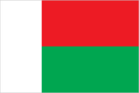
Flag description
two equal horizontal bands of red (top) and green with a vertical white band of the same width on hoist side Economy Madagascar
GDP - composition by sector
- agriculture
- 26.9%
- industry
- 16.5%
- services
- 56.6% (2006 est.)
GDP - per capita (PPP)
$900 (2006 est.)
GDP - real growth rate
5.5% (2006 est.)
GDP (official exchange rate)
$5.097 billion (2006 est.)
GDP (purchasing power parity)
$17.27 billion (2006 est.)
Geographic coordinates
20 00 S, 47 00 E
Geography - note
world's fourth-largest island; strategic location along Mozambique Channel People Madagascar
Government type
republic
HIV/AIDS - adult prevalence rate
1.7% (2003 est.)
HIV/AIDS - deaths
7,500 (2003 est.)
HIV/AIDS - people living with HIV/AIDS
140,000 (2003 est.)
Household income or consumption by percentage share
- highest 10%
- 29% (1999)
- lowest 10%
- 3%
Illicit drugs
illicit producer of cannabis (cultivated and wild varieties) used mostly for domestic consumption; transshipment point for heroin This page was last updated on 8 February, 2007
Imports
$1.544 billion f.o.b. (2006 est.)
Imports - commodities
capital goods, petroleum, consumer goods, food
Imports - partners
France 16.7%, China 10.6%, Iran 8%, Mauritius 6.6%, Hong Kong 5%, South Africa 4.9% (2005)
Independence
26 June 1960 (from France)
Industrial production growth rate
3% (2000 est.)
Industries
meat processing, seafood, soap, breweries, tanneries, sugar, textiles, glassware, cement, automobile assembly plant, paper, petroleum, tourism
Infant mortality rate
- female
- 66.84 deaths/1,000 live births (2006 est.)
- male
- 83.34 deaths/1,000 live births
- total
- 75.21 deaths/1,000 live births
Inflation rate (consumer prices)
12% (2006 est.)
International organization participation
ACCT, ACP, AfDB, AU, COMESA, FAO, G-77, IAEA, IBRD, ICAO, ICC, ICCt (signatory), ICRM, IDA, IFAD, IFC, IFRCS, ILO, IMF, IMO, InOC, Interpol, IOC, IOM, IPU, ISO (correspondent), ITU, ITUC, MIGA, NAM, OIF, OPCW, SADC, UN, UNCTAD, UNESCO, UNHCR, UNIDO, UNWTO, UPU, WCL, WCO, WFTU, WHO, WIPO, WMO, WTO
Internet country code
.mg
Internet hosts
1,504 (2006)
Internet Service Providers (ISPs)
2 (2000)
Internet users
90,000 (2005) Transportation Madagascar
Investment (gross fixed)
26.3% of GDP (2006 est.)
Irrigated land
10,860 sq km (2003)
Judicial branch
Supreme Court or Cour Supreme; High Constitutional Court or Haute Cour Constitutionnelle
Labor force
7.3 million (2000)
Land boundaries
0 km
Land use
- arable land
- 5.03%
- other
- 93.95% (2005)
- permanent crops
- 1.02%
Languages
French (official), Malagasy (official)
Legal system
based on French civil law system and traditional Malagasy law; accepts compulsory ICJ jurisdiction, with reservations
Legislative branch
- bicameral legislature consists of a National Assembly or Assemblee Nationale (160 seats; members are directly elected by popular vote to serve four-year terms) and a Senate or Senat (100 seats; two-thirds of the seats filled by regional assemblies whose members will be elected by popular vote; the remaining one-third of the seats appointed by the president; all members will serve four-year terms)
- election results
- National Assembly - percent of vote by party - NA%; seats by party - TIM 103, FP 22, AREMA 3, LEADER/Fanilo 2, RPSD 5, others 3, independents 22
- elections
- National Assembly - last held 15 December 2002 (next to be held in 2007)
Life expectancy at birth
- female
- 59.82 years (2006 est.)
- male
- 54.93 years
- total population
- 57.34 years
Literacy
- definition
- age 15 and over can read and write
- female
- 62.5% (2003 est.) Government Madagascar
- male
- 75.5%
- total population
- 68.9%
Location
Southern Africa, island in the Indian Ocean, east of Mozambique
Major infectious diseases
- degree of risk
- high
- food or waterborne diseases
- bacterial and protozoal diarrhea, hepatitis A, and typhoid fever
- vectorborne diseases
- malaria and plague are high risks in some locations
- water contact disease
- schistosomiasis (2007)
Manpower available for military service
- females age 18-49
- 3,551,447 (2005 est.)
- males age 18-49
- 3,542,797
Manpower fit for military service
- females age 18-49
- 2,408,810 (2005 est.)
- males age 18-49
- 2,218,662
Manpower reaching military service age annually
- females age 18-49
- 184,833 (2005 est.)
- males age 18-49
- 187,000
Map references
Africa
Maritime claims
- contiguous zone
- 24 nm
- continental shelf
- 200 nm or 100 nm from the 2,500-m deep isobath
- exclusive economic zone
- 200 nm
- territorial sea
- 12 nm
Median age
- female
- 17.7 years (2006 est.)
- male
- 17.3 years
- total
- 17.5 years
Merchant marine
- by type
- cargo 5, passenger 2, petroleum tanker 2 (2006)
- total
- 9 ships (1000 GRT or over) 13,896 GRT/18,466 DWT
Military expenditures - dollar figure
$329 million (2005 est.)
Military expenditures - percent of GDP
7.2% (2005 est.) Transnational Issues Madagascar
Military service age and obligation
18-50 years of age; conscript service obligation - 18 months (either military or equivalent civil service) (2004)
National holiday
Independence Day, 26 June (1960)
Nationality
- adjective
- Malagasy
- noun
- Malagasy (singular and plural)
Natural gas - consumption
0 cu m (2004 est.)
Natural gas - production
0 cu m (2004 est.)
Natural gas - proved reserves
0 cu m (1 January 2005 est.)
Natural hazards
periodic cyclones, drought, and locust infestation
Natural resources
graphite, chromite, coal, bauxite, salt, quartz, tar sands, semiprecious stones, mica, fish, hydropower
Net migration rate
0 migrant(s)/1,000 population (2006 est.)
Oil - consumption
14,500 bbl/day (2004 est.)
Oil - exports
NA bbl/day (2001)
Oil - imports
NA bbl/day (2001)
Oil - production
90.59 bbl/day (2004 est.)
Oil - proved reserves
0 bbl (1 January 2002)
People's Armed Forces
Intervention Force, Development Force, and Aeronaval Force (navy and air); National Gendarmerie
Political parties and leaders
Association for the Rebirth of Madagascar or AREMA [Pierrot RAJAONARIVO]; Economic Liberalism and Democratic Action for National Recovery or LEADER/Fanilo [Herizo RAZAFIMAHALEO]; Fihaonana Party or FP [Guy-Willy RAZANAMASY]; I Love Madagascar or TIM [Marc RAVALOMANANA]; Renewal of the Social Democratic Party or RPSD [Evariste MARSON]
Political pressure groups and leaders
Committee for the Defense of Truth and Justice or KMMR; Committee for National Reconciliation or CRN [Albert Zafy]; National Council of Christian Churches or FFKM
Population
18,595,469 (July 2006 est.)
Population below poverty line
50% (2004 est.)
Population growth rate
3.03% (2006 est.)
Ports and terminals
Antsiranana, Mahajanga, Toamasina, Toliara Military Madagascar
Radio broadcast stations
AM 2 (plus a number of repeater stations), FM 9, shortwave 6 (2001)
Radios
3.05 million (1997)
Railways
- narrow gauge
- 854 km 1.000-m gauge (2005)
- total
- 854 km
Religions
indigenous beliefs 52%, Christian 41%, Muslim 7%
Reserves of foreign exchange and gold
$563 million (2006 est.)
Roadways
- paved
- 5,780 km
- total
- 49,827 km
- unpaved
- 44,047 km (1999)
Sex ratio
- at birth
- 1.03 male(s)/female
- total population
- 0.99 male(s)/female (2006 est.)
- under 15 years
- 1 male(s)/female 15-64 years: 0.98 male(s)/female 65 years and over: 0.82 male(s)/female
Suffrage
18 years of age; universal
Telephone system
- domestic
- open-wire lines, coaxial cables, microwave radio relay, and tropospheric scatter links connect regions
- general assessment
- system is above average for the region
- international
- country code - 261; submarine cable to Bahrain; satellite earth stations - 1 Intelsat (Indian Ocean) and 1 Intersputnik (Atlantic Ocean region)
Telephones - main lines in use
66,900 (2005)
Telephones - mobile cellular
504,700 (2005)
Television broadcast stations
1 (plus 36 repeaters) (2001)
Televisions
325,000 (1997)
Terrain
narrow coastal plain, high plateau and mountains in center
Total fertility rate
5.62 children born/woman (2006 est.)
Waterways
600 km (2005)