2001 Edition
CIA World Factbook 2001 (Project Gutenberg)
Introduction
Administrative divisions
25 municipalities (baladiyat, singular - baladiyah); Ajdabiya, Al 'Aziziyah, Al Fatih, Al Jabal al Akhdar, Al Jufrah, Al Khums, Al Kufrah, An Nuqat al Khams, Ash Shati', Awbari, Az Zawiyah, Banghazi, Darnah, Ghadamis, Gharyan, Misratah, Murzuq, Sabha, Sawfajjin, Surt, Tarabulus, Tarhunah, Tubruq, Yafran, Zlitan; note - the 25 municipalities may have been replaced by 13 regions
Age structure
0-14 years: 35.41% (male 947,645; female 907,854) 15-64 years: 60.64% (male 1,645,085; female 1,533,066) 65 years and over: 3.95% (male 101,701; female 105,248) (2001 est.)
Agriculture - products
wheat, barley, olives, dates, citrus, vegetables, peanuts, soybeans; cattle
Airports
136 (2000 est.)
Airports - with paved runways
total: 58 over 3,047 m: 23 2,438 to 3,047 m: 6 1,524 to 2,437 m: 22 914 to 1,523 m: 5 under 914 m: 2 (2000 est.)
Airports - with unpaved runways
total: 78 over 3,047 m: 4 2,438 to 3,047 m: 2 1,524 to 2,437 m: 14 914 to 1,523 m: 40 under 914 m: 18 (2000 est.) Libya Military
Area
total: 1,759,540 sq km land: 1,759,540 sq km water: 0 sq km
Area - comparative
slightly larger than Alaska
Background
Since he took power in a 1969 military coup, Col. Muammar Abu Minyar al-QADHAFI has espoused his own political system - a combination of socialism and Islam - which he calls the Third International Theory. Viewing himself as a revolutionary leader, he used oil funds during the 1970s and 1980s to promote his ideology outside Libya, even supporting subversives and terrorists abroad to hasten the end of Marxism and capitalism. Libyan military adventures failed, e.g., the prolonged foray of Libyan troops into the Aozou Strip in northern Chad was finally repulsed in 1987. Libyan support for terrorism decreased after UN sanctions were imposed in 1992. Those sanctions were suspended in April 1999. Libya Geography
Birth rate
27.67 births/1,000 population (2001 est.)
Budget
revenues: $6.85 billion expenditures: $4.4 billion, including capital expenditures of $NA (2000 est.)
Capital
Tripoli
Climate
Mediterranean along coast; dry, extreme desert interior
Coastline
1,770 km
Constitution
11 December 1969, amended 2 March 1977
Country name
conventional long form: Great Socialist People's Libyan Arab Jamahiriya conventional short form: Libya local long form: Al Jumahiriyah al Arabiyah al Libiyah ash Shabiyah al Ishtirakiyah al Uzma local short form: none
Currency
Libyan dinar (LYD)
Currency code
LYD
Death rate
3.51 deaths/1,000 population (2001 est.)
Debt - external
$4.1 billion (2000 est.)
Diplomatic representation from the US
the US suspended all embassy activities in Tripoli on 2 May 1980
Diplomatic representation in the US
Libya does not have an embassy in the US
Disputes - international
Libya claims about 19,400 sq km in northern Niger and also a part of southeastern Algeria
Economic aid - recipient
$8.4 million (1995)
Economy - overview
The socialist-oriented economy depends primarily upon revenues from the oil sector, which contributes practically all export earnings and about one-quarter of GDP. These oil revenues and a small population give Libya one of the highest per capita GDPs in Africa, but little of this income flows down to the lower orders of society. In this statist society, import restrictions and inefficient resource allocations have led to periodic shortages of basic goods and foodstuffs. The nonoil manufacturing and construction sectors, which account for about 20% of GDP, have expanded from processing mostly agricultural products to include the production of petrochemicals, iron, steel, and aluminum. Climatic conditions and poor soils severely limit agricultural output, and Libya imports about 75% of its food requirements. Higher oil prices in 1999 and 2000 led to an increase in export revenues, which improved macroeconomic balances and helped to stimulate the economy. Following the suspension of UN sanctions in 1999, Libya has been trying to increase its attractiveness to foreign investors, and several foreign companies have visited in search of contracts.
Electricity - consumption
17.577 billion kWh (1999)
Electricity - exports
0 kWh (1999)
Electricity - imports
0 kWh (1999)
Electricity - production
18.9 billion kWh (1999)
Electricity - production by source
fossil fuel: 100% hydro: 0% nuclear: 0% other: 0% (1999)
Elevation extremes
lowest point: Sabkhat Ghuzayyil -47 m highest point: Bikku Bitti 2,267 m
Environment - current issues
desertification; very limited natural fresh water resources; the Great Manmade River Project, the largest water development scheme in the world, is being built to bring water from large aquifers under the Sahara to coastal cities
Environment - international agreements
party to: Climate Change, Desertification, Marine Dumping, Ozone Layer Protection, Wetlands signed, but not ratified: Biodiversity, Law of the Sea, Nuclear Test Ban Libya People
Ethnic groups
Berber and Arab 97%, Greeks, Maltese, Italians, Egyptians, Pakistanis, Turks, Indians, Tunisians
Exchange rates
Libyan dinars per US dollar - 0.5101 (January 2001), 0.5081 (2000), 0.4616 (1999), 0.3785 (1998), 0.3891 (1997), 0.3651 (1996) note: Libya currently has two rates for foreign trade; one for government operations and foreign companies and one for Libyan individuals (0.45 dinars per US dollar in December 1998)
Executive branch
chief of state: Revolutionary Leader Col. Muammar Abu Minyar al-QADHAFI (since 1 September 1969); note - holds no official title, but is de facto chief of state head of government: Secretary of the General People's Committee (Premier) Mubarak al-SHAMEKH (since 2 March 2000) cabinet: General People's Committee established by the General People's Congress elections: national elections are indirect through a hierarchy of people's committees; head of government elected by the General People's Congress; election last held 2 March 2000 (next to be held NA) election results: Mubarak al-SHAMEKH elected premier; percent of General People's Congress vote - NA%
Exports
$13.9 billion (f.o.b., 2000 est.)
Exports - commodities
crude oil, refined petroleum products
Exports - partners
Italy 33%, Germany 24%, Spain 10%, France 5%, Turkey 4%, Tunisia 4% (1999)
Fiscal year
calendar year Libya Communications
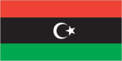
Flag description
plain green; green is the traditional color of Islam (the state religion) Libya Economy
GDP
purchasing power parity - $45.4 billion (2000 est.)
GDP - composition by sector
agriculture: 7% industry: 47% services: 46% (1997 est.)
GDP - per capita
purchasing power parity - $8,900 (2000 est.)
GDP - real growth rate
6.5% (2000 est.)
Geographic coordinates
25 00 N, 17 00 E
Government type
Jamahiriya (a state of the masses) in theory, governed by the populace through local councils; in fact, a military dictatorship
Highways
total: 24,484 km paved: 6,800 km unpaved: 17,684 km (1996)
HIV/AIDS - adult prevalence rate
0.05% (1999 est.)
HIV/AIDS - deaths
NA
HIV/AIDS - people living with HIV/AIDS
NA
Household income or consumption by percentage share
lowest 10%: NA% highest 10%: NA%
Imports
$7.6 billion (f.o.b., 2000 est.)
Imports - commodities
machinery, transport equipment, food, manufactured goods
Imports - partners
Italy 24%, Germany 12%, Tunisia 9%, UK 7%, France 6%, South Korea 5% (1999)
Independence
24 December 1951 (from Italy)
Industrial production growth rate
NA%
Industries
petroleum, food processing, textiles, handicrafts, cement
Infant mortality rate
28.99 deaths/1,000 live births (2001 est.)
Inflation rate (consumer prices)
18.5% (2000 est.)
International organization participation
ABEDA, AfDB, AFESD, AL, AMF, AMU, CAEU, CCC, ECA, FAO, G-77, IAEA, IBRD, ICAO, ICRM, IDA, IDB, IFAD, IFC, IFRCS, ILO, IMF, IMO, Inmarsat, Intelsat, Interpol, IOC, ISO, ITU, MONUC, NAM, OAPEC, OAU, OIC, OPEC, UN, UNCTAD, UNESCO, UNIDO, UPU, WFTU, WHO, WIPO, WMO, WToO
Internet country code
.ly
Internet Service Providers (ISPs)
1 (2000)
Internet users
7,500 (2000) Libya Transportation
Irrigated land
4,700 sq km (1993 est.)
Judicial branch
Supreme Court
Labor force
1.5 million (2000 est.)
Labor force - by occupation
services and government 54%, industry 29%, agriculture 17% (1997 est.)
Land boundaries
total: 4,383 km border countries: Algeria 982 km, Chad 1,055 km, Egypt 1,150 km, Niger 354 km, Sudan 383 km, Tunisia 459 km
Land use
arable land: 1% permanent crops: 0% permanent pastures: 8% forests and woodland: 0% other: 91% (1993 est.)
Languages
Arabic, Italian, English, all are widely understood in the major cities
Legal system
based on Italian civil law system and Islamic law; separate religious courts; no constitutional provision for judicial review of legislative acts; has not accepted compulsory ICJ jurisdiction
Legislative branch
unicameral General People's Congress (NA seats; members elected indirectly through a hierarchy of people's committees)
Life expectancy at birth
total population: 75.65 years male: 73.53 years female: 77.88 years (2001 est.)
Literacy
definition: age 15 and over can read and write total population: 76.2% male: 87.9% female: 63% (1995 est.) Libya Government
Location
Northern Africa, bordering the Mediterranean Sea, between Egypt and Tunisia
Map references
Africa
Maritime claims
territorial sea: 12 NM note: Gulf of Sidra closing line - 32 degrees, 30 minutes north
Merchant marine
total: 28 ships (1,000 GRT or over) totaling 399,725 GRT/654,843 DWT ships by type: cargo 10, chemical tanker 1, liquefied gas 3, petroleum tanker 6, roll on/roll off 4, short-sea passenger 4 (2000 est.)
Military branches
Army, Navy, Air and Air Defense Command
Military expenditures - dollar figure
$1.3 billion (FY99/00)
Military expenditures - percent of GDP
3.9% (FY99/00) Libya Transnational Issues
Military manpower - availability
males age 15-49: 1,459,400 (2001 est.)
Military manpower - fit for military service
males age 15-49: 866,012 (2001 est.)
Military manpower - military age
17 years of age
Military manpower - reaching military age annually
males: 61,694 (2001 est.)
National holiday
Revolution Day, 1 September (1969)
Nationality
noun: Libyan(s) adjective: Libyan
Natural hazards
hot, dry, dust-laden ghibli is a southern wind lasting one to four days in spring and fall; dust storms, sandstorms
Natural resources
petroleum, natural gas, gypsum
Net migration rate
0 migrant(s)/1,000 population (2001 est.)
Pipelines
crude oil 4,383 km; petroleum products 443 km (includes liquefied petroleum gas or LPG 256 km); natural gas 1,947 km
Political parties and leaders
none
Political pressure groups and leaders
various Arab nationalist movements with almost negligible memberships may be functioning clandestinely, as well as some Islamic elements
Population
5,240,599 note: includes 662,669 non-nationals, of which an estimated 500,000 or more are Africans living in Libya (July 2001 est.)
Population below poverty line
NA%
Population growth rate
2.42% (2001 est.)
Ports and harbors
Al Khums, Banghazi, Darnah, Marsa al Burayqah, Misratah, Ra's Lanuf, Tobruk, Tripoli, Zuwarah
Radio broadcast stations
AM 17, FM 4, shortwave 3 (1998)
Radios
1.35 million (1997)
Railways
note: Libya has had no railroad in operation since 1965, all previous systems having been dismantled; current plans are to construct a 1.435-m standard gauge line from the Tunisian frontier to Tripoli and Misratah, then inland to Sabha, center of a mineral-rich area, but there has been little progress; other plans made jointly with Egypt would establish a rail line from As Sallum, Egypt, to Tobruk with completion originally set for mid-1994; Libya signed contracts with two private companies - Bahne of Egypt and Jez Sistemas Ferroviarios of Spain - in 1998 for the supply of crossings and pointwork (1001)
Religions
Sunni Muslim 97%
Sex ratio
at birth: 1.05 male(s)/female under 15 years: 1.04 male(s)/female 15-64 years: 1.07 male(s)/female 65 years and over: 0.97 male(s)/female total population: 1.06 male(s)/female (2001 est.)
Suffrage
18 years of age; universal and compulsory
Telephone system
general assessment: telecommunications system is being modernized; mobile cellular telephone system became operational in 1996 domestic: microwave radio relay, coaxial cable, cellular, tropospheric scatter, and a domestic satellite system with 14 earth stations international: satellite earth stations - 4 Intelsat, NA Arabsat, and NA Intersputnik; submarine cables to France and Italy; microwave radio relay to Tunisia and Egypt; tropospheric scatter to Greece; participant in Medarabtel (1999)
Telephones - main lines in use
380,000 (1996)
Telephones - mobile cellular
NA
Television broadcast stations
12 (plus one low-power repeater) (1998)
Televisions
730,000 (1997)
Terrain
mostly barren, flat to undulating plains, plateaus, depressions
Total fertility rate
3.64 children born/woman (2001 est.)
Unemployment rate
30% (2000 est.)
Waterways
none