1984 Edition
CIA World Factbook 1984 (Internet Archive)
Geography
Airfields
83 total, 81 usable; 2 with permanent-surface runways; 1 with runways 2,440-3,659 m, 5 with runways 1,2202,439 m
Branches
- Armed Forces of Liberia, Liberia National Coast Guard
- paramount political power and authority rests with the Secretariat of the General People's Congress, which theoretically functions as a parliament with a cabinet called the General People's Committee
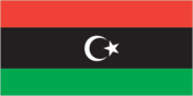
Capital
Tripoli
Civil air
3 major transport aircraft
Coastline
1,770km People
Communists
no organized party, negligible membership Libya (continued)
Elections
representatives to the General People's Congress are drawn from popularly elected municipal committees
Ethnic divisions
97% Berber and Arab with some black stock; some Greeks, Maltese, Jews, Italians, Egyptians, Pakistanis, Turks, Indians, and Tunisians
Government leaders
Col. Mu'ammar Abu Minyar al-QADHAFI (no official title; runs country and is treated as chief of state); Miftah al-Ista 'UMAR, Secretary of the General People's Congress (chief of state in theory but not treated as such)
Highways
8,524 km total; 804 km bituminous treated, 2,055 km gravel, 4,731 km improved earth, and remainder unimproved earth
Inland waterways
no significant waterways
Labor force
1.5 million, of which about 550,000 are resident foreigners Government
Land boundaries
4,345 km Water
Language
Arabic; Italian and English widely understood in major cities
Legal system
based on Italian civil law system and Islamic law; separate religious courts; no constitutional provision for judicial review of legislative acts; legal education at Law School at University of Libya at Benghazi; has not accepted compulsory ICJ jurisdiction
Limits of territorial waters (claimed)
12 nm (except for Gulf of Sidra where sovereignty is claimed and northern limit of jurisdiction fixed at 32°30'N and the unilaterally proclaimed 100 nm zone around Tripoli)
Literacy
50%
Military budget
for fiscal year ending 30 June 1983, $23.2 million; 5.5% of central government budget fSee reference map VII) Land 1,758,610 km2; 93% desert, waste, or urban; 6% agricultural; 1% forest
Military manpower
males 15-49, 467,000; 252,000 fit for military service; no conscription
National holiday
Independence Day, 1 September
Nationality
noun — Libyan(s); adjective — Libyan
Official name
Socialist People's Libyan Arab Jamahiriya
Political parties
none
Political subdivisions
10 administrative provinces closely controlled by central government
Population
3,684,000 (July 1984), average annual growth rate 5.2%
Ports
1 major (Monrovia), 4 minor
Railroads
499 km total; 354 km 1.435-meter standard gauge, 145 km 1.067-meter narrow gauge; all lines single track; rail systems owned and operated by foreign steel and financial interests in conjunction with Liberian Government
Religion
97% Sunni Muslim
Suffrage
universal adult
Telecommunications
telephone and telegraph service via radio-relay network; main center is Monrovia; 7,700 telephones (0.5 per 100 popl.); 3 AM, 4 FM, and 5 TV stations; Atlantic Ocean satellite station Defense Forces
Type
republic; major overhaul of the constitution and government structure in March 1977 established a system of popular congresses, which theoretically controls the ruling General Secretariat