1996 Edition
CIA World Factbook 1996 (Project Gutenberg)
Introduction
Description
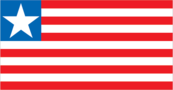
11 equal horizontal stripes of red (top and bottom) alternating with white; there is a white five-pointed star on a blue square in the upper hoist-side corner; the design was based on the US flag
Location
6 30 N, 9 30 W -- Western Africa, bordering the North Atlantic Ocean, between Cote d'Ivoire and Sierra Leone Flag ----
Geography
Area
- comparative area
- slightly larger than Tennessee
- land area
- 96,320 sq km
- total area
- 111,370 sq km
Climate
tropical; hot, humid; dry winters with hot days and cool to cold nights; wet, cloudy summers with frequent heavy showers
Coastline
579 km
Environment
- current issues
- tropical rain forest subject to deforestation; soil erosion; loss of biodiversity; pollution of rivers from the dumping of iron ore tailings and of coastal waters from oil residue and raw sewage
- international agreements
- party to - Endangered Species, Nuclear Test Ban, Ship Pollution, Tropical Timber 83, Tropical Timber 94; signed, but not ratified - Biodiversity, Climate Change, Environmental Modification, Law of the Sea, Marine Dumping, Marine Life Conservation
- natural hazards
- dust-laden harmattan winds blow from the Sahara (December to March)
Geographic coordinates
6 30 N, 9 30 W
International disputes
none
Irrigated land
20 sq km (1989 est.)
Land boundaries
- border countries
- Guinea 563 km, Cote d'Ivoire 716 km, Sierra Leone 306 km
- total
- 1,585 km
Land use
- arable land
- 1%
- forest and woodland
- 39%
- meadows and pastures
- 2%
- other
- 55%
- permanent crops
- 3%
Location
Western Africa, bordering the North Atlantic Ocean, between Cote d'Ivoire and Sierra Leone
Map references
Africa
Maritime claims
- territorial sea
- 200 nm
Natural resources
iron ore, timber, diamonds, gold
Terrain
- mostly flat to rolling coastal plains rising to rolling plateau and low mountains in northeast
- highest point
- Mount Wuteve 1,380 m
- lowest point
- Atlantic Ocean 0 m
People and Society
Age structure
0-14 years: 45% (male 475,138; female 470,970) 15-64 years: 52% (male 557,855; female 532,143) 65 years and over: 3% (male 35,544; female 38,139) (July 1996 est.)
Birth rate
42.72 births/1,000 population (1996 est.)
Death rate
11.95 deaths/1,000 population (1996 est.)
Ethnic divisions
indigenous African tribes 95% (including Kpelle, Bassa, Gio, Kru, Grebo, Mano, Krahn, Gola, Gbandi, Loma, Kissi, Vai, and Bella), Americo-Liberians 5% (descendants of former slaves)
Infant mortality rate
108.1 deaths/1,000 live births (1996 est.)
Languages
English 20% (official), Niger-Congo language group about 20 local languages come from this group
Life expectancy at birth
- female
- 61.22 years (1996 est.)
- male
- 56.05 years
- total population
- 58.59 years
Literacy
- age 15 and over can read and write (1995 est.)
- female
- 22.4%
- male
- 53.9%
- total population
- 38.3%
Nationality
- adjective
- Liberian
- noun
- Liberian(s)
Net migration rate
- -9.48 migrant(s)/1,000 population (1996 est.)
- note
- until the Ghanaian-led peace negotiations are successful, many Liberian refugees will be unable to return from exile
Population
2,109,789 (July 1996 est.)
Population growth rate
2.13% (1996 est.)
Religions
traditional 70%, Muslim 20%, Christian 10%
Sex ratio
- all ages
- 1.03 male(s)/female (1996 est.)
- at birth
- 1.03 male(s)/female
- under 15 years
- 1.01 male(s)/female 15-64 years: 1.05 male(s)/female 65 years and over: 0.93 male(s)/female
Total fertility rate
6.23 children born/woman (1996 est.)
Government
Administrative divisions
13 counties; Bomi, Bong, Grand Bassa, Grand Cape Mount, Grand Gedeh, Grand Kru, Lofa, Margibi, Maryland, Montserrado, Nimba, River Cess, Sinoe
Capital
Monrovia
Constitution
6 January 1986
Data code
LI
Diplomatic representation in US
- chancery
- 5201 16th Street NW, Washington, DC 20011
- chief of mission
- Ambassador (vacant); Charge d'Affaires Konah K. BLACKETT
- consulate(s) general
- New York
- telephone
- [1] (202) 723-0437
Executive branch
- cabinet
- Cabinet was selected by the leaders of the major factions in the civil war
- chief of state and head of government
- Chairman of the Council of State Wilton SANKAWULO (since NA September 1995); president was to be elected for a six-year term by universal suffrage at the end of 1995; election last held 15 October 1985 (next to be held NA August 1996); results - Samuel Kanyon DOE (NDPL) 50.9%, Jackson DOE (LAP) 26.4%, other 22.7%
- note
- constitutional government ended in September 1990 when President Samuel Kanyon DOE was killed by rebel forces; civil war ensued and in August 1995 the Abuja peace accord was signed by the major warring factions; a transitional coalition government under Wilton SANKAWULO was formed in September 1995; presidential elections are scheduled for August 1996
FAX
[231] 226-148
Flag
11 equal horizontal stripes of red (top and bottom) alternating with white; there is a white five-pointed star on a blue square in the upper hoist-side corner; the design was based on the US flag
Independence
26 July 1847
International organization participation
ACP, AfDB, CCC, ECA, ECOWAS, FAO, G-77, IAEA, IBRD, ICAO, ICFTU, ICRM, IDA, IFAD, IFC, IFRCS, ILO, IMF, IMO, Inmarsat, Intelsat (nonsignatory user), Interpol, IOC, IOM (observer), ITU, NAM, OAU, UN, UNCTAD, UNESCO, UNIDO, UPU, WCL, WFTU, WHO, WIPO, WMO
Judicial branch
Supreme Court
Legal system
dual system of statutory law based on Anglo-American common law for the modern sector and customary law based on unwritten tribal practices for indigenous sector
Legislative branch
- unicameral Transitional Legislative Assembly, the members of which are appointed by the leaders of the major factions in the civil war
- note
- the former bicameral legislature no longer exists and is unlikely to be reconstituted soon
Name of country
- conventional long form
- Republic of Liberia
- conventional short form
- Liberia
National holiday
Independence Day, 26 July (1847)
Political parties and leaders
National Democratic Party of Liberia (NDPL), Augustus CAINE, chairman; Liberian Action Party (LAP), Emmanuel KOROMAH, chairman; Unity Party (UP), Joseph KOFA, chairman; United People's Party (UPP), Gabriel Baccus MATTHEWS, chairman; National Patriotic Party (NPP), Charles TAYLOR, chairman; Liberian Peoples Party (LPP), Dusty WOLOKOLLIE, chairman
Suffrage
18 years of age; universal
Type of government
republic
US diplomatic representation
- chief of mission
- Ambassador (vacant); Chief of Mission William MILAM
- embassy
- 111 United Nations Drive, Monrovia
- mailing address
- P. O. Box 100098, Mamba Point, Monrovia
- telephone
- [231] 226-370
Economy
Agriculture
rubber, coffee, cocoa, rice, cassava (tapioca), palm oil, sugarcane, bananas; sheep, goats; timber
Budget
- expenditures
- $285 million, including capital expenditures of $NA (1994 est.)
- revenues
- $225 million
Currency
1 Liberian dollar (L$) = 100 cents
Economic aid
- recipient
- ODA, $NA
Economic overview
Civil war since 1990 has destroyed much of Liberia's economy, especially the infrastructure in and around Monrovia. Businessmen have fled the country, taking capital and expertise with them. Many will not return. Richly endowed with water, mineral resources, forests, and a climate favorable to agriculture, Liberia had been a producer and exporter of basic products, while local manufacturing, mainly foreign owned, had been small in scope. Political instability threatens prospects for economic reconstruction and repatriation of some 750,000 Liberian refugees who have fled to neighboring countries. The continued political turmoil has prevented restoration of normal economic life, including the re-establishment of a strong central government with effective economic development programs. The economy deteriorated further in 1995.
Electricity
- capacity
- 330,000 kW
- consumption per capita
- 143 kWh (1993)
- production
- 440 million kWh
Exchange rates
Liberian dollars (L$) per US$1 - 1.0000 (officially fixed rate since 1940); market exchange rate of US$1 - L$50 (October 1995), L$7 (January 1992), market rate floats against the US dollar
Exports
- $530 million (f.o.b., 1994 est.)
- commodities
- iron ore 61%, rubber 20%, timber 11%, coffee
- partners
- US, EC, Netherlands, Singapore
External debt
$1.9 billion (1993 est.)
Fiscal year
calendar year
GDP
purchasing power parity - $2.3 billion (1994 est.)
GDP composition by sector
- agriculture
- NA%
- industry
- NA%
- services
- NA%
GDP per capita
$770 (1994 est.)
GDP real growth rate
0% (1994 est.)
Illicit drugs
increasingly a transshipment point for heroin and cocaine
Imports
- NA (c.i.f., 1994 est.)
- commodities
- mineral fuels, chemicals, machinery, transportation equipment, manufactured goods; rice and other foodstuffs
- partners
- US, EC, Japan, China, Netherlands, ECOWAS, South Korea
Industrial production growth rate
NA% (1993-94)
Industries
rubber processing, food processing, construction materials, furniture, palm oil processing, iron ore, diamonds
Inflation rate (consumer prices)
50% (1994 est.)
Labor force
- 510,000 including 220,000 in the monetary economy
- by occupation
- agriculture 70.5%, services 10.8%, industry and commerce 4.5%, other 14.2%
- note
- non-African foreigners hold about 95% of the top-level management and engineering jobs
Unemployment rate
NA%
Communications
Branches
NA; the ultimate structure of the Liberian military force will depend on who is the victor in the ongoing civil war
Defense expenditures
exchange rate conversion - $14 million, 2.9% of GDP (1993)
Manpower availability
- males age 15-49
- 479,274
- males fit for military service
- 256,200 (1996 est.)
Radio broadcast stations
AM 3, FM 4, shortwave 0
Radios
622,000 (1992 est.)
Telephone system
- telephone and telegraph service via microwave radio relay network; main center is Monrovia; most telecommunications services inoperable due to insurgency movement
- domestic
- NA
- international
- satellite earth station - 1 Intelsat (Atlantic Ocean)
Telephones
less than 25,000 (1991 est.)
Television broadcast stations
5 (1987 est.)
Televisions
51,000 (1992 est.) Defense
Transportation
Airports
- total
- 39
- with paved runways 1 524 to 2 437 m
- 1
- with paved runways over 3 047 m
- 1
- with paved runways under 914 m
- 29
- with unpaved runways 1 524 to 2 437 m
- 2
- with unpaved runways 914 to 1 523 m
- 6 (1995 est.)
Highways
- paved
- 600 km
- total
- 10,029 km
- unpaved
- 9,429 km (1987 est.)
Merchant marine
- note
- a flag of convenience registry; includes ships from 59 countries among which are US 253, Japan 172, Norway 165, Germany 149, Greece 137, Hong Kong 114, UK 78, China 49, Monaco 41, and Cyprus 34 (1995 est.)
- ships by type
- barge carrier 2, bulk 411, cargo 121, chemical tanker 108, combination bulk 28, combination ore/oil 56, container 143, liquefied gas tanker 77, multifunction large-load carrier 1, oil tanker 463, passenger 42, passenger-cargo 1, refrigerated cargo 64, roll-on/roll-off cargo 23, short-sea passenger 4, specialized tanker 9, vehicle carrier 48
- total
- 1,601 ships (1,000 GRT or over) totaling 59,449,296 GRT/98,819,081 DWT
Ports
Buchanan, Greenville, Harper, Monrovia
Railways
- narrow gauge
- 145 km 1.067-m gauge
- standard gauge
- 345 km 1.435-m gauge
- total
- 490 km (single track); note - three rail systems owned and operated by foreign steel and financial interests in conjunction with Liberian Government; one of these, the Lamco Railroad, closed in 1989 after iron ore production ceased; the other two have been shut down by the civil war