1996 Edition
CIA World Factbook 1996 (Project Gutenberg)
Introduction
Description
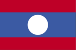
three horizontal bands of red (top), blue (double width), and red with a large white disk centered in the blue band
Location
18 00 N, 105 00 E -- Southeastern Asia, northeast of Thailand Flag ----
Geography
Area
- comparative area
- slightly larger than Utah
- land area
- 230,800 sq km
- total area
- 236,800 sq km
Climate
tropical monsoon; rainy season (May to November); dry season (December to April)
Coastline
0 km (landlocked)
Environment
- current issues
- deforestation; soil erosion; a majority of the population does not have access to potable water
- international agreements
- party to - Environmental Modification, Nuclear Test Ban; signed, but not ratified - Climate Change, Desertification, Law of the Sea
- natural hazards
- floods, droughts, and blight
Geographic coordinates
18 00 N, 105 00 E
Geographic note
landlocked
International disputes
boundary dispute with Thailand
Irrigated land
1,554 sq km (1992 est.)
Land boundaries
- border countries
- Burma 235 km, Cambodia 541 km, China 423 km, Thailand 1,754 km, Vietnam 2,130 km
- total
- 5,083 km
Land use
- arable land
- 4%
- forest and woodland
- 58%
- meadows and pastures
- 3%
- other
- 35%
- permanent crops
- 0%
Location
Southeastern Asia, northeast of Thailand
Map references
Southeast Asia
Maritime claims
none (landlocked)
Natural resources
timber, hydropower, gypsum, tin, gold, gemstones
Terrain
- mostly rugged mountains; some plains and plateaus
- highest point
- Phou Bia 2,817 m
- lowest point
- Mekong River 70 m
People and Society
Age structure
0-14 years: 45% (male 1,142,825; female 1,114,628) 15-64 years: 51% (male 1,237,660; female 1,316,591) 65 years and over: 4% (male 75,748; female 88,320) (July 1996 est.)
Birth rate
41.94 births/1,000 population (1996 est.)
Death rate
13.83 deaths/1,000 population (1996 est.)
Ethnic divisions
Lao Loum (lowland) 68%, Lao Theung (upland) 22%, Lao Soung (highland) including the Hmong ("Meo") and the Yao (Mien) 9%, ethnic Vietnamese/Chinese 1%
Infant mortality rate
96.8 deaths/1,000 live births (1996 est.)
Languages
Lao (official), French, English, and various ethnic languages
Life expectancy at birth
- female
- 54.31 years (1996 est.)
- male
- 51.14 years
- total population
- 52.69 years
Literacy
- age 15 and over can read and write (1995 est.)
- female
- 44.4%
- male
- 69.4%
- total population
- 56.6%
Nationality
- adjective
- Lao or Laotian
- noun
- Lao(s) or Laotian(s)
Net migration rate
0 migrant(s)/1,000 population (1996 est.)
Population
4,975,772 (July 1996 est.)
Population growth rate
2.81% (1996 est.)
Religions
Buddhist 60%, animist and other 40%
Sex ratio
- all ages
- 0.98 male(s)/female (1996 est.)
- at birth
- 1.05 male(s)/female
- under 15 years
- 1.02 male(s)/female 15-64 years: 0.94 male(s)/female 65 years and over: 0.86 male(s)/female
Total fertility rate
5.87 children born/woman (1996 est.)
Government
Administrative divisions
16 provinces (khoueng, singular and plural) and 1 municipality* (kampheng nakhon, singular and plural); Attapu, Bokeo, Bolikhamxai, Champasak, Houaphan, Khammouan, Louangnamtha, Louangphabang, Oudomxai, Phongsali, Salavan, Savannakhet, Viangchan*, Viangchan, Xaignabouli, Xekong, Xiangkhoang
Capital
Vientiane
Constitution
promulgated 14 August 1991
Data code
LA
Diplomatic representation in US
- chancery
- 2222 S Street NW, Washington, DC 20008
- chief of mission
- Ambassador HIEM PHOMMACHANH
- telephone
- [1] (202) 332-6416, 6417
Executive branch
- cabinet
- Council of Ministers was appointed by the president, approved by the National Assembly
- chief of state
- President NOUHAK PHOUMSAVAN (since 25 November 1992) was elected for a five-year term by the National Assembly
- head of government
- Prime Minister Gen. KHAMTAI SIPHANDON (since 15 August 1991) was appointed for a five-year term by the president with the approval of the National Assembly; Deputy Prime Minister KHAMPHOUI KEOBOUALAPHA (since NA)
FAX
- [1] (202) 332-4923
- [856] (21) 212584
Flag
three horizontal bands of red (top), blue (double width), and red with a large white disk centered in the blue band
Independence
19 July 1949 (from France)
International organization participation
ACCT, AsDB, ASEAN (observer), CP, ESCAP, FAO, G-77, IBRD, ICAO, ICRM, IDA, IFAD, IFC, IFRCS, ILO, IMF, Intelsat (nonsignatory user), Interpol, IOC, ITU, Mekong Group, NAM, PCA, UN, UNCTAD, UNESCO, UNIDO, UPU, WFTU, WHO, WIPO, WMO, WToO, WTrO (observer)
Judicial branch
People's Supreme Court, the president of the People's Supreme Court is elected by the National Assembly on the recommendation of the National Assembly Standing Committee, the vice president of the People's Supreme Court and the judges are appointed by the National Assembly Standing Committee
Legal system
based on traditional customs, French legal norms and procedures, and Socialist practice
Legislative branch
unicameral
Name of country
- conventional long form
- Lao People's Democratic Republic
- conventional short form
- Laos
- local long form
- Sathalanalat Paxathipatai Paxaxon Lao
- local short form
- none
National Assembly
members elected for five-year terms; elections last held 20 December 1992 (next to be held NA 1997); results - percent of vote NA; seats - (85 total) LPRP 85
National holiday
National Day, 2 December (1975) (proclamation of the Lao People's Democratic Republic)
Other political or pressure groups
noncommunist political groups proscribed; most opposition leaders fled the country in 1975
Political parties and leaders
Lao People's Revolutionary Party (LPRP), KHAMTAI Siphandon, party president; other parties proscribed
Suffrage
18 years of age; universal
Type of government
Communist state
US diplomatic representation
- chief of mission
- Ambassador Victor L. TOMSETH
- embassy
- Rue Bartholonie, B.P. 114, Vientiane
- mailing address
- American Embassy, Box V, APO AP 96546
- telephone
- [856] (21) 212581, 212582, 212585
Economy
Agriculture
sweet potatoes, vegetables, corn, coffee, sugarcane, cotton; water buffalo, pigs, cattle, poultry
Budget
- expenditures
- $351 million, including capital expenditures of $NA (1994)
- revenues
- $198 million
Currency
1 new kip (NK) = 100 at
Economic aid
- recipient
- ODA, $NA
Economic overview
The government of Laos - one of the few remaining official communist states - has been decentralizing control and encouraging private enterprise since 1986. The results, starting from an extremely low base, have been striking - growth has averaged 7.5% annually since 1988. Even so, Laos is a landlocked country with a primitive infrastructure. It has no railroads, a rudimentary road system, and limited external and internal telecommunications. Electricity is available in only a few urban areas. Subsistence agriculture accounts for half of GDP and provides 80% of total employment. The predominant crop is rice. In non-drought years, Laos is self-sufficient overall in food, but each year flood, pests, and localized drought cause shortages in various parts of the country. For the foreseeable future the economy will continue to depend on aid from the IMF and other international sources; aid from the former USSR/Eastern Europe has been cut sharply. As in many developing countries, deforestation and soil erosion will hamper efforts to maintain the high rate of GDP growth.
Electricity
- capacity
- 260,000 kW
- consumption per capita
- 44 kWh (1993)
- production
- 870 million kWh
Exchange rates
new kips (NK) per US$1 - 920 (1995), 717 (1994 est.), 720 (July 1993), 710 (May 1992), 710 (December 1991), 700 (September 1990), 576 (1989)
Exports
- $278 million (f.o.b., 1994)
- commodities
- electricity, wood products, coffee, tin, garments
- partners
- Thailand, Japan, France, Germany, Netherlands
External debt
$2 billion (1995 est.)
Fiscal year
1 October - 30 September
GDP
purchasing power parity - $5.2 billion (1995 est.)
GDP composition by sector
- agriculture
- 50%
- industry
- 17%
- services
- 33% (1993)
GDP per capita
$1,100 (1995 est.)
GDP real growth rate
8% (1995 est.)
Illicit drugs
world's third largest opium producer (180 metric tons from nearly 20,000 hectares in 1995); heroin producer; increasingly used as transshipment point for heroin produced in Burma; illicit producer of cannabis
Imports
- $486 million (c.i.f., 1994)
- commodities
- food, fuel oil, consumer goods, manufactures
- partners
- Thailand, China, Japan, France, US
Industrial production growth rate
7.5% (1992 est.)
Industries
tin and gypsum mining, timber, electric power, agricultural processing, construction
Inflation rate (consumer prices)
20% (1995 est.)
Labor force
- 1 million-1.5 million
- by occupation
- agriculture 80% (1992 est.)
Unemployment rate
21% (1992 est.)
Communications
Branches
Lao People's Army (LPA; includes riverine naval and militia elements), Air Force, National Police Department
Defense expenditures
exchange rate conversion - $105 million, 8.1% of GDP (FY92/93)
Manpower availability
- males age 15-49
- 1,087,264
- males fit for military service
- 586,664
- males reach military age (18) annually
- 53,250 (1996 est.)
Radio broadcast stations
AM 10, FM 0, shortwave 0
Radios
560,000 (1992 est.)
Telephone system
- service to general public very poor; radiotelephone communications network provides generally erratic service to government users
- domestic
- radiotelephone communications
- international
- satellite earth station - 1 Intersputnik (Indian Ocean Region)
Telephones
6,600 (1991 est.)
Television broadcast stations
2
Televisions
32,000 (1993 est.) Defense
Transportation
Airports
- total
- 39
- with paved runways 1 524 to 2 437 m
- 5
- with paved runways 914 to 1 523 m
- 3
- with paved runways over 3 047 m
- 1
- with paved runways under 914 m
- 16
- with unpaved runways 1 524 to 2 437 m
- 1
- with unpaved runways 914 to 1 523 m
- 13 (1995 est.)
Highways
- paved
- 2,261 km
- total
- 14,130 km
- unpaved
- 11,869 km (1992 est.)
Merchant marine
- total
- 1 cargo ship (1,000 GRT or over) totaling 2,370 GRT/3,000 DWT (1995 est.)
Pipelines
petroleum products 136 km
Ports
none
Railways
0 km
Waterways
about 4,587 km, primarily Mekong and tributaries; 2,897 additional kilometers are sectionally navigable by craft drawing less than 0.5 m