1996 Edition
CIA World Factbook 1996 (Project Gutenberg)
Introduction
Description
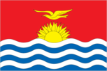
the upper half is red with a yellow frigate bird flying over a yellow rising sun, and the lower half is blue with three horizontal wavy white stripes to represent the ocean
Location
1 25 N, 173 00 E -- Oceania, group of islands in the Pacific Ocean, straddling the equator and the International Date Line, about one-half of the way from Hawaii to Australia Flag ----
Geography
Area
- comparative area
- four times the size of Washington, DC
- land area
- 717 sq km
- note
- includes three island groups - Gilbert Islands, Line Islands, Phoenix Islands
- total area
- 717 sq km
Climate
tropical; marine, hot and humid, moderated by trade winds
Coastline
1,143 km
Environment
- current issues
- heavy pollution in lagoon of south Tarawa atoll due to heavy migration mixed with traditional practices such as lagoon latrines and open-pit dumping; ground water at risk
- international agreements
- party to - Biodiversity, Climate Change, Endangered Species, Marine Dumping, Ozone Layer Protection, Whaling
- natural hazards
- typhoons can occur any time, but usually November to March; occasional tornadoes
Geographic coordinates
1 25 N, 173 00 E
Geographic note
20 of the 33 islands are inhabited; Banaba (Ocean Island) in Kiribati is one of the three great phosphate rock islands in the Pacific Ocean - the others are Makatea in French Polynesia and Nauru
International disputes
none
Irrigated land
NA sq km
Land boundaries
0 km
Land use
- arable land
- 0%
- forest and woodland
- 3%
- meadows and pastures
- 0%
- other
- 46%
- permanent crops
- 51%
Location
Oceania, group of islands in the Pacific Ocean, straddling the equator and the International Date Line, about one-half of the way from Hawaii to Australia
Map references
Oceania
Maritime claims
- exclusive economic zone
- 200 nm
- territorial sea
- 12 nm
Natural resources
phosphate (production discontinued in 1979)
Terrain
- mostly low-lying coral atolls surrounded by extensive reefs
- highest point
- unnamed location on Banaba 81 m
- lowest point
- Pacific Ocean 0 m
People and Society
Age structure
0-14 years: NA 15-64 years: NA 65 years and over: NA
Birth rate
27.13 births/1,000 population (1996 est.)
Death rate
7.9 deaths/1,000 population (1996 est.)
Ethnic divisions
Micronesian
Infant mortality rate
52.9 deaths/1,000 live births (1996 est.)
Languages
English (official), Gilbertese
Life expectancy at birth
- female
- 64.03 years (1996 est.)
- male
- 60.25 years
- total population
- 62.02 years
Literacy
NA
Nationality
- adjective
- I-Kiribati
- noun
- I-Kiribati (singular and plural)
Net migration rate
-0.31 migrant(s)/1,000 population (1996 est.)
Population
80,919 (July 1996 est.)
Population growth rate
1.89% (1996 est.)
Religions
Roman Catholic 52.6%, Protestant (Congregational) 40.9%, Seventh-Day Adventist, Baha'i, Church of God, Mormon 6% (1985)
Sex ratio
- all ages
- NA male(s)/female
- at birth
- NA male(s)/female
- under 15 years
- NA male(s)/female 15-64 years: NA male(s)/female 65 years and over: NA male(s)/female
Total fertility rate
3.21 children born/woman (1996 est.)
Government
Administrative divisions
- 3 units; Gilbert Islands, Line Islands, Phoenix Islands
- note
- in addition, there are 6 districts (Banaba, Central Gilberts, Line Islands, Northern Gilberts, Southern Gilberts, Tarawa) and 21 island councils (Abaiang, Abemama, Aranuka, Arorae, Banaba, Beru, Butaritari, Kanton, Kiritimati, Kuria, Maiana, Makin, Marakei, Nikunau, Nonouti, Onotoa, Tabiteuea, Tabuaeran, Tamana, Tarawa, Teraina; note - one council for each of the inhabited islands)
Capital
Tarawa
Constitution
12 July 1979
Data code
KR
Diplomatic representation in US
Kiribati does not have an embassy in the US
Executive branch
- cabinet
- Cabinet was appointed by the president from among the members of the House of Assembly
- chief of state and head of government
- President (Beretitenti) Teburoro TITO (since 1 October 1994) was elected by popular vote; note - the House of Assembly chooses the presidential candidates from among their members and then those candidates compete in a general election; election last held 30 September 1994 (next to be held by NA 1999); results - Teburoro TITO 51.2%, Tewareka TENTOA 18.3%, Roniti TEIWAKI 16.0%, Peter Taberannang TIMEON 14.5%; Vice President (Kauoman-ni-Beretitenti) Tewareka TENTOA (since 12 October 1994) was appointed by the president
Flag
the upper half is red with a yellow frigate bird flying over a yellow rising sun, and the lower half is blue with three horizontal wavy white stripes to represent the ocean
House of Assembly (Maneaba Ni Maungatabu)
elections last held 22 July 1994 (next to be held by NA 1999); results - percent of vote by party NA; seats - (40 total, 39 elected) Maneaban Te Mauri 13, National Progressive Party 7, independents 19
Independence
12 July 1979 (from UK)
International organization participation
ACP, AsDB, C, ESCAP, IBRD, ICAO, ICFTU, IDA, IFC, IMF, Intelsat (nonsignatory user), Interpol, ITU, Sparteca, SPC, SPF, UNESCO, UPU, WHO
Judicial branch
Court of Appeal, judges at all levels are appointed by the president; High Court, judges at all levels are appointed by the president
Legal system
NA
Legislative branch
unicameral
Name of country
- conventional long form
- Republic of Kiribati
- conventional short form
- Kiribati
- former
- Gilbert Islands
- note
- pronounced kiribas
National holiday
Independence Day, 12 July (1979)
Political parties and leaders
- National Progressive Party, Teatao TEANNAKI; Christian Democratic Party, Teburoro TITO; New Movement Party, leader NA; Liberal Party, Tewareka TENTOA; Maneaban Te Mauri Party, Roniti TEIWAKI
- note
- there is no tradition of formally organized political parties in Kiribati; they more closely resemble factions or interest groups because they have no party headquarters, formal platforms, or party structures
Suffrage
18 years of age; universal
Type of government
republic
US diplomatic representation
the US does not have an embassy in Kiribati; the ambassador to Fiji is accredited to Kiribati
Economy
Agriculture
copra, taro, breadfruit, sweet potatoes, vegetables; fish
Budget
- expenditures
- $54.3 million, including capital expenditures of $NA (1995 est.)
- revenues
- $32.5 million
Currency
1 Australian dollar ($A) = 100 cents
Economic aid
- recipient
- ODA, $NA
Economic overview
A remote country of 33 scattered coral atolls, Kiribati has few national resources. Commercially viable phosphate deposits were exhausted at the time of independence in 1979. Copra and fish now represent the bulk of production and exports. The economy has fluctuated widely in recent years. Real GDP growth has declined from about 10% in 1988 to about 2.6% in 1995. Economic development is constrained by a shortage of skilled workers, weak infrastructure, and remoteness from international markets. The financial sector is at an early stage of development. Foreign financial aid, largely from the UK and Japan, is a critical supplement to GDP, equal in amount to 25%-50% of GDP in recent years.
Electricity
- capacity
- 5,000 kW
- consumption per capita
- 131 kWh (1993)
- production
- 13 million kWh
Exchange rates
Australian dollars ($A) per US$1 - 1.3477 (January 1996), 1.3486 (1995), 1.3667 (1994), 1.4704 (1993), 1.3600 (1992), 1.2835 (1991)
Exports
- $6.3 million (f.o.b., 1995 est.)
- commodities
- copra 50%, seaweed 16%, fish 15%
- partners
- Denmark, Fiji, US
External debt
$2 million (December 1989 est.)
Fiscal year
NA
GDP
purchasing power parity - $68 million (1995 est.)
GDP composition by sector
- agriculture
- NA%
- industry
- NA%
- services
- NA%
GDP per capita
$860 (1995 est.)
GDP real growth rate
2.6% (1995 est.)
Imports
- $38.6 million (c.i.f., 1995 est.)
- commodities
- foodstuffs, machinery and equipment, miscellaneous manufactured goods, fuel
- partners
- Australia 40%, Japan 18%, Fiji 17%, NZ 6%, US 4% (1991)
Industrial production growth rate
0.7% (1992 est.)
Industries
fishing, handicrafts
Inflation rate (consumer prices)
5.5% (1994 est.)
Labor force
7,870 economically active, not including subsistence farmers (1985 est.)
Unemployment rate
2%; underemployment 70% (1992 est.)
Communications
Branches
no regular military forces; Police Force (carries out law enforcement functions and paramilitary duties; small police posts are on all islands)
Defense expenditures
$NA, NA% of GDP
Manpower availability
- males age 15-49
- NA
- males fit for military service
- NA
Radio broadcast stations
AM 1, FM 0, shortwave 0
Radios
15,000 (1992 est.)
Telephone system
- domestic
- NA
- international
- satellite earth station - 1 Intelsat (Pacific Ocean)
Telephones
1,400 (1984 est.)
Television broadcast stations
0 (1988 est.)
Televisions
0 (1988 est.) Defense
Transportation
Airports
- total
- 20
- with paved runways 1 524 to 2 437 m
- 4
- with paved runways under 914 m
- 5
- with unpaved runways 914 to 1 523 m
- 11 (1995 est.)
Highways
- paved
- NA km
- total
- 640 km (1987 est.)
- unpaved
- NA km
Merchant marine
- ships by type
- oil tanker 1, short-sea passenger 1 (1995 est.)
- total
- 2 ships (1,000 GRT or over) totaling 3,248 GRT/4,496 DWT
Ports
Banaba, Betio, English Harbor, Kanton
Railways
0 km
Waterways
small network of canals, totaling 5 km, in Line Islands