2003 Edition
CIA World Factbook 2003 (Project Gutenberg)
Introduction
Administrative divisions
- 14 provinces (oblystar, singular - oblys) and 3 cities* (qala, singular - qalasy); Almaty Oblysy, Almaty Qalasy*, Aqmola Oblysy (Astana), Aqtobe Oblysy, Astana Qalasy*, Atyrau Oblysy, Batys Qazaqstan Oblysy (Oral), Bayqongyr Qalasy*, Mangghystau Oblysy (Aqtau), Ongtustik Qazaqstan Oblysy (Shymkent), Pavlodar Oblysy, Qaraghandy Oblysy, Qostanay Oblysy, Qyzylorda Oblysy, Shyghys Qazaqstan Oblysy (Oskemen), Soltustik Qazaqstan Oblysy (Petropavlovsk), Zhambyl Oblysy (Taraz)
- note
- administrative divisions have the same names as their administrative centers (exceptions have the administrative center name following in parentheses); in 1995 the Governments of Kazakhstan and Russia entered into an agreement whereby Russia would lease for a period of 20 years an area of 6,000 sq km enclosing the Baykonur space launch facilities and the city of Bayqongyr (Baykonyr, formerly Leninsk)
Age structure
0-14 years: 25.4% (male 2,161,510; female 2,089,780) 15-64 years: 66.8% (male 5,425,545; female 5,769,457) 65 years and over: 7.9% (male 458,379; female 859,124) (2003 est.)
Agriculture - products
grain (mostly spring wheat), cotton; livestock
Airports
488 (2002)
Airports - with paved runways
- over 3,047 m
- 7 2,438 to 3,047 m: 26 1,524 to 2,437 m: 14 914 to 1,523 m: 4
- total
- 60
- under 914 m
- 9 (2002)
Airports - with unpaved runways
- over 3,047 m
- 11 2,438 to 3,047 m: 19 1,524 to 2,437 m: 44 914 to 1,523 m: 103
- total
- 428
- under 914 m
- 251 (2002) Military Kazakhstan
Area
- land
- 2,669,800 sq km
- total
- 2,717,300 sq km
- water
- 47,500 sq km
Area - comparative
slightly less than four times the size of Texas
Background
Native Kazakhs, a mix of Turkic and Mongol nomadic tribes who migrated into the region in the 13th century, were rarely united as a single nation. The area was conquered by Russia in the 18th century and Kazakhstan became a Soviet Republic in 1936. During the 1950s and 1960s agricultural "Virgin Lands" program, Soviet citizens were encouraged to help cultivate Kazakhstan's northern pastures. This influx of immigrants (mostly Russians, but also some other deported nationalities) skewed the ethnic mixture and enabled non-Kazakhs to outnumber natives. Independence has caused many of these newcomers to emigrate. Current issues include: developing a cohesive national identity; expanding the development of the country's vast energy resources and exporting them to world markets; achieving a sustainable economic growth outside the oil, gas, and mining sectors; and strengthening relations with neighboring states and other foreign powers. Geography Kazakhstan
Birth rate
18.36 births/1,000 population (2003 est.)
Budget
- expenditures
- $5.1 billion, including capital expenditures of $NA (2001 est.)
- revenues
- $4.2 billion
Capital
Astana; note - the government moved from Almaty to Astana in December 1998
Climate
continental, cold winters and hot summers, arid and semiarid
Coastline
0 km (landlocked); note - Kazakhstan borders the Aral Sea, now split into two bodies of water (1,070 km), and the Caspian Sea (1,894 km)
Constitution
adopted by national referendum 30 August 1995; first post-independence constitution was adopted 28 January 1993
Country name
- conventional long form
- Republic of Kazakhstan
- conventional short form
- Kazakhstan
- former
- Kazakh Soviet Socialist Republic
- local long form
- Qazaqstan Respublikasy
- local short form
- none
Currency
tenge (KZT)
Currency code
KZT
Death rate
10.78 deaths/1,000 population (2003 est.)
Debt - external
$6.6 billion (2002 est.)
Diplomatic representation from the US
- chief of mission
- Ambassador Larry C. NAPPER
- embassy
- 99/97A Furmanova Street, Almaty, Republic of Kazakhstan 480091
- mailing address
- use embassy street address
- telephone
- [7] (3272) 63-39-21, 63-13-75, 50-76-23, 50-76-27 (emergency number)
Diplomatic representation in the US
- chief of mission
- Ambassador Kanat B. SAUDABAYEV
Disputes - international
Kazakhstan and China have resolved their border dispute and are working to delimit their large open borders to control population migration, illegal activities, and trade; delimitation of boundary with Russia is scheduled for completion in 2003 - delimitations with Turkmenistan and Uzbekistan are complete with demarcations underway - delimitation with Kyrgyzstan is largely complete; equidistant seabed treaties have been signed with Azerbaijan and Russia in the Caspian Sea but no resolution has been made on dividing the water column among any of the littoral states; no resolution of Caspian seabed boundary with Turkmenistan
Distribution of family income - Gini index
35.4 (1996)
Economic aid - recipient
$610 million in US assistance programs, 1992-2000
Economy - overview
Kazakhstan, the largest of the former Soviet republics in territory, excluding Russia, possesses enormous fossil fuel reserves as well as plentiful supplies of other minerals and metals. It also is a large agricultural - livestock and grain - producer. Kazakhstan's industrial sector rests on the extraction and processing of these natural resources and also on a growing machine-building sector specializing in construction equipment, tractors, agricultural machinery, and some defense items. The breakup of the USSR in December 1991 and the collapse in demand for Kazakhstan's traditional heavy industry products resulted in a short-term contraction of the economy, with the steepest annual decline occurring in 1994. In 1995-97, the pace of the government program of economic reform and privatization quickened, resulting in a substantial shifting of assets into the private sector. Kazakhstan enjoyed double-digit growth in 2000-01 - and a solid 9.5% in 2002 - thanks largely to its booming energy sector, but also to economic reform, good harvests, and foreign investment. The opening of the Caspian Consortium pipeline in 2001, from western Kazakhstan's Tengiz oilfield to the Black Sea, substantially raised export capacity. The country has embarked upon an industrial policy designed to diversify the economy away from overdependence on the oil sector, by developing light industry. Additionally, the policy aims to reduce the influence of foreign investment and foreign personnel; the government has engaged in several disputes with foreign oil companies over the terms of production agreements, and tensions continue.
Electricity - consumption
48.36 billion kWh (2001)
Electricity - exports
3.6 billion kWh (2001)
Electricity - imports
3.2 billion kWh (2001)
Electricity - production
52.43 billion kWh (2001)
Electricity - production by source
- fossil fuel
- 84.3%
- hydro
- 15.7%
- nuclear
- 0%
- other
- 0% (2001)
Elevation extremes
- highest point
- Khan Tangiri Shyngy (Pik Khan-Tengri) 6,995 m
- lowest point
- Vpadina Kaundy -132 m
Environment - current issues
radioactive or toxic chemical sites associated with its former defense industries and test ranges throughout the country pose health risks for humans and animals; industrial pollution is severe in some cities; because the two main rivers which flowed into the Aral Sea have been diverted for irrigation, it is drying up and leaving behind a harmful layer of chemical pesticides and natural salts; these substances are then picked up by the wind and blown into noxious dust storms; pollution in the Caspian Sea; soil pollution from overuse of agricultural chemicals and salination from poor infrastructure and wasteful irrigation practices
Environment - international agreements
- party to
- Air Pollution, Biodiversity, Climate Change, Desertification, Endangered Species, Ozone Layer Protection, Ship Pollution
- signed, but not ratified
- Climate Change-Kyoto Protocol
Ethnic groups
Kazakh (Qazaq) 53.4%, Russian 30%, Ukrainian 3.7%, Uzbek 2.5%, German 2.4%, Uighur 1.4%, other 6.6% (1999 census)
Exchange rates
tenge per US dollar - 153.28 (2002), 146.74 (2001), 142.13 (2000), 119.52 (1999), 78.3 (1998)
Executive branch
- cabinet
- Council of Ministers appointed by the president
- chief of state
- President Nursultan A. NAZARBAYEV (chairman of the Supreme Soviet from 22 February 1990, elected president 1 December 1991)
- decree
- only he can initiate constitutional amendments, appoint and dismiss the government, dissolve Parliament, call referenda at his discretion, and appoint administrative heads of regions and cities
- election results
- Nursultan A. NAZARBAYEV reelected president; percent of vote - Nursultan A. NAZARBAYEV 81.7%, Serikbolsyn ABDILDIN 12.1%, Gani KASYMOV 4.7%, Engels GABBASSOV 1.5%
- elections
- president elected by popular vote for a seven-year term; election last held 10 January 1999, a year before it was previously scheduled (next to be held NA 2006); note - President NAZARBAYEV's previous term was extended to 2000 by a nationwide referendum held 30 April 1995; prime minister and first deputy prime minister appointed by the president
- head of government
- Prime Minister Daniyal AKHMETOV (since 13 June 2003)
- note
- President NAZARBAYEV expanded his presidential powers by
Exports
$10.3 billion f.o.b. (2002 est.)
Exports - commodities
oil and oil products 58%, ferrous metals 24%, chemicals 5%, machinery 3%, grain, wool, meat, coal (2001)
Exports - partners
Russia 16.2%, Bermuda 12.1%, China 11.3%, Germany 8.8%, Italy 5.5%, Ukraine 4.9%, France 4% (2002)
FAX
- [1] (202) 232-5845
- [7] (3272) 63-38-83
- chancery
- 1401 16th Street NW, Washington, DC 20036
- consulate(s)
- New York
- telephone
- [1] (202) 232-5488
Fiscal year
calendar year Communications Kazakhstan
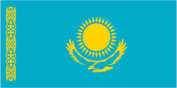
Flag description
sky blue background representing the endless sky and a gold sun with 32 rays soaring above a golden steppe eagle in the center; on the hoist side is a "national ornamentation" in gold Economy Kazakhstan
GDP
purchasing power parity - $120 billion (2002 est.)
GDP - composition by sector
- agriculture
- 9%
- industry
- 40%
- services
- 51% (2002 est.)
GDP - per capita
purchasing power parity - $7,200 (2002 est.)
GDP - real growth rate
9.5% (2002 est.)
Geographic coordinates
48 00 N, 68 00 E
Geography - note
landlocked; Russia leases approximately 6,000 sq km of territory enclosing the Baykonur Cosmodrome People Kazakhstan
Government type
republic
Highways
- paved
- 77,020 km
- total
- 81,331 km
- unpaved
- 4,311 km (2000)
HIV/AIDS - adult prevalence rate
0.1% (2001 est.)
HIV/AIDS - deaths
less than 300 (2001 est.)
HIV/AIDS - people living with HIV/AIDS
6,000 (2001 est.)
Household income or consumption by percentage share
- highest 10%
- 27.3% (2001)
- lowest 10%
- 2.8%
Illicit drugs
significant illicit cultivation of cannabis for CIS markets, as well as limited cultivation of opium poppy and ephedra (for the drug ephedrine); limited government eradication of illicit crops; transit point for Southwest Asian narcotics bound for Russia and the rest of Europe This page was last updated on 18 December, 2003
Imports
$9.6 billion f.o.b. (2002 est.)
Imports - commodities
machinery and equipment 41%, metal products 28%, foodstuffs 8% (2001)
Imports - partners
Russia 37.1%, US 9.3%, China 9.3%, Germany 9.1% (2002)
Independence
16 December 1991 (from the Soviet Union)
Industrial production growth rate
10% (2002 est.)
Industries
oil, coal, iron ore, manganese, chromite, lead, zinc, copper, titanium, bauxite, gold, silver, phosphates, sulfur, iron and steel; tractors and other agricultural machinery, electric motors, construction materials
Infant mortality rate
- female
- 53.83 deaths/1,000 live births (2003 est.)
- male
- 63.41 deaths/1,000 live births
- total
- 58.73 deaths/1,000 live births
Inflation rate (consumer prices)
6% (2002 est.)
International organization participation
AsDB, CIS, EAPC, EBRD, ECE, ECO, ESCAP, FAO, IAEA, IBRD, ICAO, IDA, IDB, IFAD, IFC, IFRCS (associate), ILO, IMF, IMO, Interpol, IOC, IOM, ISO, ITU, NAM (observer), NSG, OAS (observer), OIC, OPCW, OSCE, PFP, SCO, UN, UNCTAD, UNESCO, UNIDO, UPU, WCL, WFTU, WHO, WIPO, WMO, WToO, WTrO (observer)
Internet country code
.kz
Internet Service Providers (ISPs)
10 (with their own international channels) (2001)
Internet users
100,000 (2002) Transportation Kazakhstan
Irrigated land
23,320 sq km (1998 est.)
Judicial branch
Supreme Court (44 members); Constitutional Council (7 members)
Labor force
8.4 million (1999)
Labor force - by occupation
industry 30%, agriculture 20%, services 50% (2002 est.)
Land boundaries
- border countries
- China 1,533 km, Kyrgyzstan 1,051 km, Russia 6,846 km, Turkmenistan 379 km, Uzbekistan 2,203 km
- total
- 12,012 km
Land use
- arable land
- 11.23%
- other
- 88.72% (1998 est.)
- permanent crops
- 0.05%
Languages
Kazakh (Qazaq, state language) 64.4%, Russian (official, used in everyday business, designated the "language of interethnic communication") 95% (2001 est.)
Legal system
based on civil law system
Legislative branch
- bicameral Parliament consists of the Senate (39 seats - previously 47 seats; 7 senators are appointed by the president; other members are popularly elected, two from each of the 14 oblasts, the capital of Astana, and the city of Almaty, to serve six-year terms) and the Majilis (77 seats; 10 out of the 77 Majilis members are elected from the winning party's lists; members are popularly elected to serve five-year terms)
- election results
- note - the election results are for the old Senate structure; Senate - percent of vote by party - NA%; seats by party - NA; 16 seats up for election in 1999, candidates nominated by local councils; Majilis - percent of vote by party - NA%; seats by party - Otan 23, Civic Party 13, Communist Party 3, Agrarian Party 3, People's Cooperative Party 1, independents 34; note - most independent candidates are affiliated with parastatal enterprises and other pro-government institutions
- elections
- Senate - (indirect) last held 17 September 1999 (next to be held NA December 2005); Majilis - last held 10 and 24 October and 26 December 1999 (next to be held NA 2004)
Life expectancy at birth
- female
- 69.06 years (2003 est.)
- male
- 58.16 years
- total population
- 63.48 years
Literacy
- definition
- age 15 and over can read and write
- female
- 97.7% (1999 est.) Government Kazakhstan
- male
- 99.1%
- total population
- 98.4%
Location
Central Asia, northwest of China; a small portion west of the Ural River in eastern-most Europe
Map references
Asia
Maritime claims
none (landlocked)
Median age
- female
- 29.7 years (2002)
- male
- 26.6 years
- total
- 28.2 years
Merchant marine
- convenience
- US 1 (2002 est.)
- note
- includes a foreign-owned ship registered here as a flag of
- ships by type
- roll on/roll off 1
- total
- 1 ships (1,000 GRT or over) 1,064 GRT/646 DWT
Military branches
Ground Forces, Air and Air Defense Forces, Naval Force, Border Service, Republican Guard
Military expenditures - dollar figure
$221.8 million (Ministry of Defense expenditures) (FY02)
Military expenditures - percent of GDP
0.9% (Ministry of Defense expenditures) (FY02) Transnational Issues Kazakhstan
Military manpower - availability
- males age 15-49
- 4,580,754 (2003 est.)
Military manpower - fit for military service
- males age 15-49
- 3,658,815 (2003 est.)
Military manpower - military age
18 years of age (2003 est.)
Military manpower - reaching military age annually
- males
- 174,111 (2003 est.)
National holiday
Republic Day, 25 October (1990)
Nationality
- adjective
- Kazakhstani
- noun
- Kazakhstani(s)
Natural gas - consumption
14.3 billion cu m (2001 est.)
Natural gas - exports
4.1 billion cu m (2001 est.)
Natural gas - imports
8.3 billion cu m (2001 est.)
Natural gas - production
10.08 billion cu m (2001 est.)
Natural gas - proved reserves
920.3 billion cu m (37257)
Natural hazards
earthquakes in the south, mudslides around Almaty
Natural resources
major deposits of petroleum, natural gas, coal, iron ore, manganese, chrome ore, nickel, cobalt, copper, molybdenum, lead, zinc, bauxite, gold, uranium
Net migration rate
-5.89 migrant(s)/1,000 population (2003 est.)
Oil - consumption
195,000 bbl/day (2001 est.)
Oil - exports
NA (2001)
Oil - imports
NA (2001)
Oil - production
798,200 bbl/day (2001 est.)
Oil - proved reserves
2.709 billion bbl (37257)
Pipelines
condensate 640 km; gas 10,527 km; oil 9,771 km; refined products 1,187 km; water 1,465 km (2003)
Political parties and leaders
- Agrarian Party [Romin MADINOV]; Ak Zhol Party "White Road" [Bulat ABILOV, Uraz ZHANDOSOV, Zhanat YERTLESOVA, cofounders]; AUL "Village" [leader NA]; Civic Party [Azat PERUASHEV, first secretary]; Communist Party or KPK [Serikbolsyn ABDILDIN, first secretary]; Otan "Fatherland" [Gani YESIMOV, chairman]; Patriots' Party [Gani KASYMOV]
- note
- only seven parties in Kazakhstan have been registered under the new political party law passed in July 2002
Political pressure groups and leaders
Adil-Soz [Tamara KALEYEVA]; Alash [Sabet-Kazy AKATAY]; AZAMAT "Citizen" Movement [Petr SVOIK, Murat AUEZOV, and Galym ABILSEITOV, cochairmen]; Democratic Choice of Kazakhstan [Galymzhan ZHAKIYANOV, Nurzhan SUBKHANBERDIN, cochairmen]; Labor and Worker's Movement [Madel ISMAILOV, chairman]; Kazakhstan International Bureau on Human Rights [Yevgeniy ZHOVTIS, executive director]; Orleu "Development" Movement [Seidakhmet KUTTYKADAM]; Pensioners Movement or Pokoleniye [Irina SAVOSTINA, chairwoman]; People's Congress of Kazakhstan of NKK [Olzhas SULEIMENOV, chairman]; People's Cooperative Party of Kazakhstan [Umirzak SARSENOV]; Republican People's Party of Kazakhstan or RNPK [Akezhan KAZHEGELDIN]; Socialist Party [Petr SVOIK]
Population
16,763,795 (July 2003 est.)
Population below poverty line
26% (2001 est.)
Population growth rate
0.17% (2003 est.)
Ports and harbors
Aqtau (Shevchenko), Atyrau (Gur'yev), Oskemen (Ust-Kamenogorsk), Pavlodar, Semey (Semipalatinsk)
Radio broadcast stations
AM 60, FM 17, shortwave 9 (1998)
Radios
6.47 million (1997)
Railways
- broad gauge
- 13,601 km 1.520-m gauge (3,661 km electrified) (2002)
- total
- 13,601 km
Religions
Muslim 47%, Russian Orthodox 44%, Protestant 2%, other 7%
Sex ratio
- at birth
- 1.05 male(s)/female
- total population
- 0.92 male(s)/female (2003 est.)
- under 15 years
- 1.03 male(s)/female 15-64 years: 0.94 male(s)/female 65 years and over: 0.53 male(s)/female
Suffrage
18 years of age; universal
Telephone system
- domestic
- intercity by landline and microwave radio relay; mobile cellular systems are available in most of Kazakhstan
- general assessment
- service is poor; equipment antiquated
- international
- international traffic with other former Soviet republics and China carried by landline and microwave radio relay and with other countries by satellite and by the Trans-Asia-Europe (TAE) fiber-optic cable; satellite earth stations - 2 Intelsat
Telephones - main lines in use
1.92 million (2001)
Telephones - mobile cellular
400,000 (2001)
Television broadcast stations
12 (plus nine repeaters) (1998)
Televisions
3.88 million (1997)
Terrain
extends from the Volga to the Altai Mountains and from the plains in western Siberia to oases and desert in Central Asia
Total fertility rate
2.16 children born/woman (2003 est.)
Unemployment rate
8.8% (2002 est.)
Waterways
- 3,900 km
- note
- on the Syr Darya (Syrdariya) and Ertis (Irtysh) rivers