1996 Edition
CIA World Factbook 1996 (Project Gutenberg)
Introduction
Description
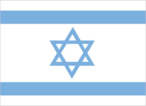
white with a blue hexagram (six-pointed linear star) known as the Magen David (Shield of David) centered between two equal horizontal blue bands near the top and bottom edges of the flag
Location
31 30 N, 34 45 E -- Middle East, bordering the Mediterranean Sea, between Egypt and Lebanon Flag ----
Note
The territories occupied by Israel since the 1967 war are not included in the data below. In keeping with the framework established at the Madrid Conference in October 1991, bilateral negotiations are being conducted between Israel and Palestinian representatives, and Israel and Syria, to achieve a permanent settlement between them. On 25 April 1982, Israel withdrew from the Sinai pursuant to the 1979 Israel-Egypt Peace treaty. Outstanding territorial and other disputes with Jordan were resolved in the 26 October 1994 Israel-Jordan Treaty of Peace. Map ---
Geography
Area
- comparative area
- slightly larger than New Jersey
- land area
- 20,330 sq km
- total area
- 20,770 sq km
Climate
temperate; hot and dry in southern and eastern desert areas
Coastline
273 km
Environment
- current issues
- limited arable land and natural fresh water resources pose serious constraints; desertification; air pollution from industrial and vehicle emissions; groundwater pollution from industrial and domestic waste, chemical fertilizers, and pesticides
- international agreements
- party to - Biodiversity, Endangered Species, Hazardous Wastes, Nuclear Test Ban, Ozone Layer Protection, Ship Pollution; signed, but not ratified - Climate Change, Desertification, Marine Life Conservation
- natural hazards
- sandstorms may occur during spring and summer
Geographic coordinates
31 30 N, 34 45 E
Geographic note
there are 202 Israeli settlements and civilian land use sites in the West Bank, 42 in the Israeli-occupied Golan Heights, 24 in the Gaza Strip, and 26 in East Jerusalem (August 1995 est.)
International disputes
West Bank and Gaza Strip are Israeli occupied with current status subject to the Israeli-Palestinian Interim Agreement - permanent status to be determined through further negotiation; Golan Heights is Israeli occupied; Israeli troops in southern Lebanon since June 1982
Irrigated land
2,140 sq km (1989)
Land boundaries
- border countries
- Egypt 255 km, Gaza Strip 51 km, Jordan 238 km, Lebanon 79 km, Syria 76 km, West Bank 307 km
- total
- 1,006 km
Land use
- arable land
- 17%
- forest and woodland
- 6%
- meadows and pastures
- 40%
- other
- 32%
- permanent crops
- 5%
Location
Middle East, bordering the Mediterranean Sea, between Egypt and Lebanon
Map references
Middle East
Maritime claims
- continental shelf
- to depth of exploitation
- territorial sea
- 12 nm
Natural resources
copper, phosphates, bromide, potash, clay, sand, sulfur, asphalt, manganese, small amounts of natural gas and crude oil
Terrain
- Negev desert in the south; low coastal plain; central mountains; Jordan Rift Valley
- highest point
- Har Meron 1,208 m
- lowest point
- Dead Sea -408 m
People and Society
Age structure
0-14 years: 29% (male 793,712; female 756,735) 15-64 years: 62% (male 1,670,082; female 1,669,481) 65 years and over: 9% (male 230,082; female 301,903) (July 1996 est.)
Birth rate
20.31 births/1,000 population (1996 est.)
Death rate
6.26 deaths/1,000 population (1996 est.)
Ethnic divisions
Jewish 82% (Israel-born 50%, Europe/Americas/Oceania-born 20%, Africa-born 7%, Asia-born 5%), non-Jewish 18% (mostly Arab) (1993 est.)
Infant mortality rate
8.5 deaths/1,000 live births (1996 est.)
Languages
Hebrew (official), Arabic used officially for Arab minority, English most commonly used foreign language
Life expectancy at birth
- female
- 79.96 years (1996 est.)
- male
- 76.16 years
- total population
- 78.01 years
Literacy
- age 15 and over can read and write (1992 est.)
- female
- 93%
- male
- 97%
- total population
- 95%
Nationality
- adjective
- Israeli
- noun
- Israeli(s)
Net migration rate
7.03 migrant(s)/1,000 population (1996 est.)
Population
- 5,421,995 (July 1996 est.)
- note
- includes 127,600 Israeli settlers in the West Bank, 14,800 in the Israeli-occupied Golan Heights, 5,000 in the Gaza Strip, and 153,700 in East Jerusalem (August 1995 est.)
Population growth rate
2.11% (1996 est.)
Religions
Judaism 82%, Islam 14% (mostly Sunni Muslim), Christian 2%, Druze and other 2%
Sex ratio
- all ages
- 0.99 male(s)/female (1996 est.)
- at birth
- 1.05 male(s)/female
- under 15 years
- 1.05 male(s)/female 15-64 years: 1 male(s)/female 65 years and over: 0.76 male(s)/female
Total fertility rate
2.77 children born/woman (1996 est.)
Government
Administrative divisions
6 districts (mehozot, singular - mehoz); Central, Haifa, Jerusalem, Northern, Southern, Tel Aviv
Capital
- Jerusalem
- note
- Israel proclaimed Jerusalem as its capital in 1950, but the US, like nearly all other countries, maintains its Embassy in Tel Aviv
Constitution
no formal constitution; some of the functions of a constitution are filled by the Declaration of Establishment (1948), the basic laws of the parliament (Knesset), and the Israeli citizenship law
Data code
IS
Diplomatic representation in US
- chancery
- 3514 International Drive NW, Washington, DC 20008
- chief of mission
- Ambassador Itamar RABINOVICH
- telephone
- [1] (202) 364-5500
Executive branch
- cabinet
- Cabinet was selected from and approved by the Knesset
- chief of state
- President Ezer WEIZMAN (since 13 May 1993) was elected for a five-year term by the Knesset; election last held 24 March 1993 (next to be held NA March 1998); results - Ezer WEIZMAN elected by Knesset
- head of government
- Prime Minister Shimon PERES (since 15 November 1995) was appointed by the president following the assassination of Prime Minister Yitzhak RABIN
FAX
- [1] (202) 364-5610
- [972] (3) 517-3227
- consulate(s) general
- Atlanta, Boston, Chicago, Houston, Los Angeles, Miami, New York, Philadelphia, and San Francisco
- consulate(s) general
- Jerusalem
Flag
white with a blue hexagram (six-pointed linear star) known as the Magen David (Shield of David) centered between two equal horizontal blue bands near the top and bottom edges of the flag
Independence
14 May 1948 (from League of Nations mandate under British administration)
International organization participation
AG (observer), BSEC (observer), CCC, CE (observer), CERN (observer), EBRD, ECE, FAO, IADB, IAEA, IBRD, ICAO, ICC, ICFTU, IDA, IFAD, IFC, ILO, IMF, IMO, Intelsat, Interpol, IOC, IOM, ISO, ITU, OAS (observer), OSCE (partner), PCA, UN, UNCTAD, UNESCO, UNHCR, UNIDO, UPU, WHO, WIPO, WMO, WToO, WTrO
Judicial branch
Supreme Court
Legal system
mixture of English common law, British Mandate regulations, and, in personal matters, Jewish, Christian, and Muslim legal systems; in December 1985, Israel informed the UN Secretariat that it would no longer accept compulsory ICJ jurisdiction
Legislative branch
- unicameral
- parliament (Knesset)
- elections last held NA June 1992 (next to be held 29 May 1996); results - percent of vote by party NA; seats - (120 total) Labor 44, Likud 32, MERETZ 12, Tzomet 8, National Religious Party 6, SHAS 6, United Torah Jewry 4, Democratic Front for Peace and Equality (Hadash) 3, Moledet 3, Arab Democratic Party 2; note - the distribution of seats as of January 1996 is as follows - Labor Party 45, Likud bloc 33, MERETZ 12, National Religious Party 6, SHAS 6, Tzomet 5, United Torah Jewry 4, Democratic Front for Peace and Equality (Hadash) 3, Moledet 2, Arab Democratic Party 2, Yi'ud 1 (in coalition), Right of Israel 1
Name of country
- conventional long form
- State of Israel
- conventional short form
- Israel
- local long form
- Medinat Yisra'el
- local short form
- Yisra'el
National holiday
Independence Day, 14 May 1948 (Israel declared independence on 14 May 1948, but the Jewish calendar is lunar and the holiday may occur in April or May)
Other political or pressure groups
Gush Emunim, Israeli nationalists advocating Jewish settlement on the West Bank and Gaza Strip; Peace Now supports territorial concessions in the West Bank and is critical of government's Lebanon policy
Political parties and leaders
- members of the government
- Labor Party, Prime Minister Shimon PERES; MERETZ, Minister of Environment Yossi SARID; Yi'ud, Gonen SEGEV not in coalition but voting with the government: Democratic Front for Peace and Equality (Hadash), Hashim MAHAMID; Arab Democratic Party, Abd al Wahab DARAWSHAH
- note
- Israel currently has a coalition government comprising three parties that hold 58 seats of the Knesset's 120 seats
- opposition parties
- Likud Party, Binyamin NETANYAHU; Tzomet, Rafael EITAN; National Religious Party, Zevulun HAMMER; United Torah Jewry, Avraham SHAPIRA; Moledet, Rehavam ZEEVI; Peace Guard (independent), Shaul GUTMAN; SHAS, Arieh DERI; Right of Israel, leader NA
Suffrage
18 years of age; universal
Type of government
republic
US diplomatic representation
- chief of mission
- Ambassador Martin S. INDYK
- embassy
- 71 Hayarkon Street, Tel Aviv
- mailing address
- PSC 98, Box 100, APO AE 09830
- telephone
- [972] (3) 519-7575
Economy
Agriculture
citrus and other fruits, vegetables, cotton; beef, poultry, dairy products
Budget
- expenditures
- $53 billion, including capital expenditures of $NA (1996)
- revenues
- $41 billion
Currency
1 new Israeli shekel (NIS) = 100 new agorot
Economic aid
- recipient
- total receipts $12.14 billion of which $11.38 billion from the US (1990-93)
Economic overview
Israel has a market economy with substantial government participation. It depends on imports of crude oil, grains, raw materials, and military equipment. Despite limited natural resources, Israel has intensively developed its agricultural and industrial sectors over the past 20 years. Industry employs about 22% of Israeli workers, agriculture, forestry, and fishing 3.5%, and services the rest. Israel is largely self-sufficient in food production except for grains. Diamonds, high-technology equipment, and agricultural products (fruits and vegetables) are leading exports. Israel usually posts current account deficits, which are covered by large transfer payments from abroad and by foreign loans. Roughly half of the government's external debt is owed to the US, which is its major source of economic and military aid. To earn needed foreign exchange, Israel has been targeting high-technology niches in international markets, such as medical scanning equipment. The influx of Jewish immigrants from the former USSR, which topped 525,000 during the period 1990-95, increased unemployment, intensified housing problems, and strained the government budget. At the same time, the immigrants bring to the economy valuable scientific and professional expertise.
Electricity
- capacity
- 4,140,000 kW
- consumption per capita
- 4,290 kWh (1993)
- production
- 23 billion kWh
Exchange rates
new Israeli shekels (NIS) per US$1 - 3.1295 (January 1996), 3.0113 (1995), 3.0111 (1994), 2.8301 (1993), 2.4591 (1992), 2.2791 (1991)
Exports
- $28.4 billion (f.o.b., 1995 est.)
- commodities
- machinery and equipment, cut diamonds, chemicals, textiles and apparel, agricultural products, metals
- partners
- US, EU, Japan
External debt
$18.5 billion (1995 est.)
Fiscal year
calendar year (since 1 January 1992)
GDP
purchasing power parity - $80.1 billion (1995 est.)
GDP composition by sector
- agriculture
- 3.5%
- industry
- 22%
- services
- 74.5%
GDP per capita
$15,500 (1995 est.)
GDP real growth rate
7.1% (1995 est.)
Illicit drugs
increasingly concerned about cocaine and heroin abuse and trafficking
Imports
- $40.1 billion (c.i.f., 1995 est.)
- commodities
- military equipment, investment goods, rough diamonds, oil, other productive inputs, consumer goods
- partners
- EU, US, Japan
Industrial production growth rate
10.3% (1995 est.)
Industries
food processing, diamond cutting and polishing, textiles and apparel, chemicals, metal products, military equipment, transport equipment, electrical equipment, potash mining, high-technology electronics, tourism
Inflation rate (consumer prices)
10.1% (1995)
Labor force
- 1.9 million (1992)
- by occupation
- public services 29.3%, industry 22.1%, commerce 13.9%, finance and business 10.4%, personal and other services 7.4%, construction 6.5%, transport, storage, and communications 6.3%, agriculture, forestry, and fishing 3.5%, other 0.6% (1992)
Unemployment rate
6.3% (1995 est.)
Communications
Branches
Israel Defense Forces (includes ground, naval, and air components), Pioneer Fighting Youth (Nahal), Frontier Guard, Chen (women); note - historically there have been no separate Israeli military services
Defense expenditures
exchange rate conversion - $9.2 billion, about 9.8% of GDP (1996)
Manpower availability
- females age 15-49
- 1,363,986
- females fit for military service
- 1,112,947
- females reach military age (18) annually
- 48,176 (1996 est.)
- males age 15-49
- 1,390,603
- males fit for military service
- 1,139,137
- males reach military age (18) annually
- 50,508
Radio broadcast stations
AM 9, FM 45, shortwave 0
Radios
2.25 million (1993 est.)
Telephone system
- most highly developed system in the Middle East although not the largest
- domestic
- good system of coaxial cable and microwave radio relay
- international
- 3 submarine cables; satellite earth stations - 3 Intelsat (2 Atlantic Ocean and 1 Indian Ocean)
Telephones
2.425 million (1990 est.)
Television broadcast stations
20
Televisions
1.5 million (1993 est.) Defense
Transportation
Airports
- total
- 50
- with paved runways 1 524 to 2 437 m
- 7
- with paved runways 2 438 to 3 047 m
- 6
- with paved runways 914 to 1 523 m
- 8
- with paved runways over 3 047 m
- 2
- with paved runways under 914 m
- 22
- with unpaved runways 1 524 to 2 437 m
- 2
- with unpaved runways 914 to 1 523 m
- 3 (1995 est.)
Heliports
2 (1995 est.)
Highways
- paved
- 13,461 km (including 56 km of expressways)
- total
- 13,461 km
- unpaved
- 0 km (1992 est.)
Merchant marine
- ships by type
- cargo 5, container 20, refrigerated cargo 2, roll-on/roll-off cargo 1 (1995 est.)
- total
- 28 ships (1,000 GRT or over) totaling 577,747 GRT/701,459 DWT
Pipelines
crude oil 708 km; petroleum products 290 km; natural gas 89 km
Ports
Ashdod, Ashqelon, Elat, Hadera, Haifa, Tel Aviv-Yafo
Railways
- standard gauge
- 526 km 1.435-m gauge
- total
- 526 km