2016 Edition
CIA World Factbook 2016 Archive (HTML)
Introduction
Background
The UK transferred these uninhabited, barren, sub-Antarctic islands to Australia in 1947. Populated by large numbers of seal and bird species, the islands have been designated a nature preserve.
Geography
Area
- 412 sq km 412 sq km 0 sq km
- land
- 412 sq km
- total
- 412 sq km
- water
- 0 sq km
Area - comparative
slightly more than two times the size of Washington, DC
Climate
antarctic
Coastline
101.9 km
Elevation
- NA lowest point: Indian Ocean 0 m highest point: Mawson Peak on Big Ben volcano 2,745 m
- elevation extremes
- lowest point: Indian Ocean 0 m
- highest point
- Mawson Peak on Big Ben volcano 2,745 m
- mean elevation
- NA
Environment - current issues
NA
Geographic coordinates
53 06 S, 72 31 E
Geography - note
Mawson Peak on Heard Island is the highest Australian mountain (at 2,745 meters, it is taller than Mt. Kosciuszko in Australia proper), and one of only two active volcanoes located in Australian territory, the other being McDonald Island; in 1992, McDonald Island broke its dormancy and began erupting; it has erupted several times since, most recently in 2005
Land boundaries
0 km
Land use
- 0% arable land 0%; permanent crops 0%; permanent pasture 0% 0% 100% (2011 est.)
- agricultural land
- 0%
- forest
- 0%
- other
- 100% (2011 est.)
Location
islands in the Indian Ocean, about two-thirds of the way from Madagascar to Antarctica
Map references
Antarctic Region
Maritime claims
- 12 nm 200 nm
- exclusive fishing zone
- 200 nm
- territorial sea
- 12 nm
Natural hazards
Mawson Peak, an active volcano, is on Heard Island
Natural resources
fish
Terrain
Heard Island - 80% ice-covered, bleak and mountainous, dominated by a large massif (Big Ben) and an active volcano (Mawson Peak); McDonald Islands - small and rocky
People and Society
Population
uninhabited
Government
Country name
- Territory of Heard Island and McDonald Islands Heard Island and McDonald Islands HIMI named after American Captain John HEARD, who sighted the island on 25 November 1853, and American Captain William McDONALD, who discovered the islands on 4 January 1854
- abbreviation
- HIMI
- conventional long form
- Territory of Heard Island and McDonald Islands
- conventional short form
- Heard Island and McDonald Islands
- etymology
- named after American Captain John HEARD, who sighted the island on 25 November 1853, and American Captain William McDONALD, who discovered the islands on 4 January 1854
Dependency status
territory of Australia; administered from Canberra by the Department of Sustainability, Environment, Water, Population and Communities (Australian Antarctic Division)
Diplomatic representation from the US
none (territory of Australia)
Diplomatic representation in the US
none (territory of Australia)
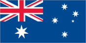
Flag description
the flag of Australia is used
Legal system
the laws of Australia, where applicable, apply
Economy
Economy - overview
The islands have no indigenous economic activity, but the Australian Government allows limited fishing in the surrounding waters. Visits to Heard Island typically focus on terrestrial and marine research and infrequent private expeditions.
Communications
Internet country code
.hm
Transportation
Ports and terminals
none; offshore anchorage only
Military and Security
Military - note
defense is the responsibility of Australia; Australia conducts fisheries patrols
Transnational Issues
Disputes - international
none