1999 Edition
CIA World Factbook 1999 (Internet Archive)
Geography
Area
total: 412 sq km land: 412 sq km water: 0 sq km
Area--comparative
slightly more than 2 times the size of Washington, DC
Climate
antarctic
Coastline
101.9 km
Elevation extremes
lowest point: Indian Ocean 0 m highest point: Big Ben 2,745 m
Environment--current issues
NA
Environment--international agreements
party to: NA signed, but not ratified: NA
Geographic coordinates
53 06 S, 72 31 E
Geography--note
primarily used for research stations
Irrigated land
0 sq km (1993)
Land boundaries
0 km
Land use
arable land: 0% permanent crops: 0% permanent pastures: 0% forests and woodland: 0% other: 100%
Location
Southern Africa, islands in the Indian Ocean, about two-thirds of the way from Madagascar to Antarctica
Map references
Antarctic Region
Maritime claims
exclusive fishing zone: 200 nm territorial sea: 3 nm
Natural hazards
Heard Island is dominated by a dormant volcano called Big Ben
Natural resources
none
Terrain
Heard Island--bleak and mountainous, with a quiescent volcano; McDonald Islands--small and rocky
People and Society
Population
uninhabited
Government
Country name
conventional long form: Territory of Heard Island and McDonald Islands conventional short form: Heard Island and McDonald Islands
Data code
HM
Dependency status
territory of Australia; administered from Canberra by the Department of the Environment, Sport and Territories
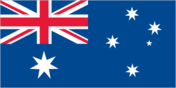
Flag description
the flag of Australia is used
Legal system
NA Diplomatic representation in the US: none (territory of Australia) Diplomatic representation from the US: none (territory of Australia)
Economy
Economy--overview
no economic activity
Military and Security
Military--note
defense is the responsibility of Australia
Transnational Issues
Disputes--international
none