1996 Edition
CIA World Factbook 1996 (Project Gutenberg)
Countries
256
Data Records
32,906
Categories
7
Source
CIA World Factbook 1996 (Project Gutenberg)
Introduction
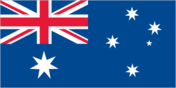
Description
the flag of Australia is used
Location
53 06 S, 72 31 E -- Southern Africa, islands in the Indian Ocean, about two-thirds of the way from Madagascar to Antarctica Flag ----
Geography
Area
- comparative area
- 1.5 times the size of Washington, DC
- land area
- 412 sq km
- total area
- 412 sq km
Climate
antarctic
Coastline
101.9 km
Environment
- current issues
- NA
- international agreements
- NA
- natural hazards
- Heard Island is dominated by a dormant volcano called Big Ben
Geographic coordinates
53 06 S, 72 31 E
Geographic note
primarily used for research stations
International disputes
none
Irrigated land
0 sq km
Land boundaries
0 km
Land use
- arable land
- 0%
- forest and woodland
- 0%
- meadows and pastures
- 0%
- other
- 100%
- permanent crops
- 0%
Location
Southern Africa, islands in the Indian Ocean, about two-thirds of the way from Madagascar to Antarctica
Map references
Antarctic Region
Maritime claims
- exclusive fishing zone
- 200 nm
- territorial sea
- 3 nm
Natural resources
none
Terrain
- Heard Island - bleak and mountainous, with a quiescent volcano; McDonald Islands - small and rocky
- highest point
- Big Ben 2,745 m
- lowest point
- Indian Ocean 0 m
People and Society
Population
uninhabited
Government
Capital
none; administered from Canberra, Australia
Data code
HM
Flag
the flag of Australia is used
Independence
none (territory of Australia)
Name of country
- conventional long form
- Territory of Heard Island and McDonald Islands
- conventional short form
- Heard Island and McDonald Islands
Type of government
territory of Australia administered by the Ministry for Environment, Sport, and Territories
Economy
Economic overview
no economic activity
Transportation
Defense note
defense is the responsibility of Australia
Ports
none; offshore anchorage only Defense