2019 Edition
CIA World Factbook 2019 Archive (Wayback Machine)
Introduction
Background
Spain ceded Guam to the US in 1898. Captured by the Japanese in 1941, it was retaken by the US three years later. The military installations on the island are some of the most strategically important US bases in the Pacific; they also constitute the island’s most important source of income and economic stability.
Geography
Area
- Land
- 544 sq km
- Total
- 544 sq km
- Water
- 0 sq km
Area Comparative
three times the size of Washington, DC
Climate
tropical marine; generally warm and humid, moderated by northeast trade winds; dry season (January to June), rainy season (July to December); little seasonal temperature variation
Coastline
125.5 km
Elevation
- Highest Point
- Mount Lamlam 406 m
- Lowest Point
- Pacific Ocean 0 m
Environment Current Issues
fresh water scarcity; reef damage; inadequate sewage treatment; extermination of native bird populations by the rapid proliferation of the brown tree snake, an exotic, invasive species
Geographic Coordinates
13 28 N, 144 47 E
Geography Note
largest and southernmost island in the Mariana Islands archipelago and the largest island in Micronesia; strategic location in western North Pacific Ocean
Irrigated Land
2 sq km (2012)
Land Boundaries
0 km
Land Use
- Agricultural Land
- 33.4% (2011 est.)
- Agricultural Land Arable Land
- 1.9% (2011 est.)
- Agricultural Land Permanent Crops
- 16.7% (2011 est.)
- Agricultural Land Permanent Pasture
- 14.8% (2011 est.)
- Forest
- 47.9% (2011 est.)
- Other
- 18.7% (2011 est.)
Location
Oceania, island in the North Pacific Ocean, about three-quarters of the way from Hawaii to the Philippines
Map References
Oceania
Maritime Claims
- Exclusive Economic Zone
- 200 nm
- Territorial Sea
- 12 nm
Natural Hazards
frequent squalls during rainy season; relatively rare but potentially destructive typhoons (June to December)
Natural Resources
aquatic wildlife (supporting tourism), fishing (largely undeveloped)
Population Distribution
no large cities exist on the island, though large villages (municipalities) attract much of the population; the largest of these is Dededo
Terrain
volcanic origin, surrounded by coral reefs; relatively flat coralline limestone plateau (source of most fresh water), with steep coastal cliffs and narrow coastal plains in north, low hills in center, mountains in south
People and Society
Age Structure
- 0 14 Years
- 27.48% (male 23,893 /female 22,207)
- 15 24 Years
- 16.4% (male 14,692 /female 12,816)
- 25 54 Years
- 37.18% (male 32,170 /female 30,207)
- 55 64 Years
- 10.05% (male 8,627 /female 8,236)
- 65 Years And Over
- 8.9% (male 6,947 /female 7,977) (2018 est.)
Birth Rate
19.4 births/1,000 population (2018 est.)
Death Rate
6 deaths/1,000 population (2018 est.)
Dependency Ratios
- Elderly Dependency Ratio
- 13.6 (2015 est.)
- Potential Support Ratio
- 7.4 (2015 est.)
- Total Dependency Ratio
- 52.3 (2015 est.)
- Youth Dependency Ratio
- 38.8 (2015 est.)
Drinking Water Source
- Improved Rural
- 99.5% of population
- Improved Total
- 99.5% of population
- Improved Urban
- 99.5% of population
- Unimproved Rural
- 0.5% of population
- Unimproved Total
- 0.5% of population (2015 est.)
- Unimproved Urban
- 0.5% of population
Ethnic Groups
Chamorro 37.3%, Filipino 26.3%, white 7.1%, Chuukese 7%, Korean 2.2%, other Pacific Islander 2%, other Asian 2%, Chinese 1.6%, Palauan 1.6%, Japanese 1.5%, Pohnpeian 1.4%, mixed 9.4%, other 0.6% (2010 est.)
Infant Mortality Rate
- Female
- 12.1 deaths/1,000 live births
- Male
- 11.8 deaths/1,000 live births
- Total
- 11.9 deaths/1,000 live births (2018 est.)
Languages
English 43.6%, Filipino 21.2%, Chamorro 17.8%, other Pacific island languages 10%, Asian languages 6.3%, other 1.1% (2010 est.)
Life Expectancy at Birth
- Female
- 78.9 years
- Male
- 73.9 years
- Total Population
- 76.4 years (2018 est.)
Major Urban Areas Population
147,000 HAGATNA (capital) (2018)
Median Age
- Female
- 29.9 years
- Male
- 28.4 years
- Total
- 29.1 years (2018 est.)
Nationality
- Adjective
- Guamanian
- Noun
- Guamanian(s) (US citizens)
Net Migration Rate
-11 migrant(s)/1,000 population (2018 est.)
Population
167,772 (July 2018 est.)
Population Growth Rate
0.23% (2018 est.)
Religions
Roman Catholic 85%, other 15% (1999 est.)
Sanitation Facility Access
- Improved Rural
- 89.8% of population (2015 est.)
- Improved Total
- 89.8% of population (2015 est.)
- Improved Urban
- 89.8% of population (2015 est.)
- Unimproved Rural
- 10.2% of population (2015 est.)
- Unimproved Total
- 10.2% of population (2015 est.)
- Unimproved Urban
- 10.2% of population (2015 est.)
Sex Ratio
- 0 14 Years
- 1.08 male(s)/female
- 15 24 Years
- 1.15 male(s)/female
- 25 54 Years
- 1.06 male(s)/female
- 55 64 Years
- 1.05 male(s)/female
- 65 Years And Over
- 0.87 male(s)/female
- At Birth
- 1.07 male(s)/female
- Total Population
- 1.06 male(s)/female (2018 est.)
Total Fertility Rate
2.92 children born/woman (2018 est.)
Unemployment Youth Ages 15 24
- Female
- 28.9% (2011 est.)
- Male
- 29.7%
- Total
- 29.4%
Urbanization
- Rate Of Urbanization
- 0.92% annual rate of change (2015-20 est.)
- Urban Population
- 94.9% of total population (2019)
Government
Administrative Divisions
none (territory of the US)
Capital
- Geographic Coordinates
- 13 28 N, 144 44 E
- Name
- Hagatna (Agana)
- Time Difference
- UTC+10 (15 hours ahead of Washington, DC, during Standard Time)
Citizenship
see United States
Constitution
- Amendments
- amended many times, last in 2015 (2017)
- History
- effective 1 July 1950 (Guam Act of 1950 serves as a constitution)
Country Name
- Abbreviation
- GU
- Conventional Long Form
- none
- Conventional Short Form
- Guam
- Etymology
- the native Chamorro name for the island "Guahan" (meaning "we have" or "ours") was changed to Guam in the 1898 Treaty of Paris, whereby Spain relinquished Guam, Cuba, Puerto Rico, and the Philippines to the US
- Local Long Form
- none
- Local Short Form
- Guahan
Dependency Status
unincorporated organized territory of the US with policy relations between Guam and the federal government under the jurisdiction of the Office of Insular Affairs, US Department of the Interior
Diplomatic Representation From The Us
none (territory of the US)
Diplomatic Representation In The Us
none (territory of the US)
Executive Branch
- Cabinet
- Cabinet appointed by the governor with the consent of the Legislature
- Chief Of State
- President Donald J. TRUMP (since 20 January 2017); Vice President Michael R. PENCE (since 20 January 2017)
- Election Results
- Lourdes LEON GUERRERO elected governor; percent of vote - Lourdes LEON GUERRERO (Democratic Party) 50.7%, Ray TENORIO (Republican Party) 26.4%; Josh TENORIO (Democratic Party) elected lieutenant governor
- Elections Appointments
- president and vice president indirectly elected on the same ballot by an Electoral College of 'electors' chosen from each state to serve a 4-year term (eligible for a second term); under the US Constitution, residents of unincorporated territories, such as Guam, do not vote in elections for US president and vice president; however, they may vote in Democratic and Republican presidential primary elections; governor and lieutenant governor elected on the same ballot by absolute majority vote in 2 rounds if needed for a 4-year term (eligible for 2 consecutive terms); election last held on 6 November 2018 (next to be held in November 2022)
- Head Of Government
- Governor Lourdes LEON GUERRERO (since 7 January 2019); Lieutenant Governor Josh TENORIO (since 7 January 2019)
Flag Description
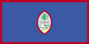
territorial flag is dark blue with a narrow red border on all four sides; centered is a red-bordered, pointed, vertical ellipse containing a beach scene, a proa or outrigger canoe with sail, and a palm tree with the word GUAM superimposed in bold red letters; the proa is sailing in Agana Bay with the promontory of Punta Dos Amantes, near the capital, in the background; the shape of the central emblem is that of a Chamorro sling stone, used as a weapon for defense or hunting; blue represents the sea and red the blood shed in the struggle against oppression
Government Type
republican form of government with separate executive, legislative, and judicial branches; unincorporated organized territory of the US with local self-government
Independence
none (territory of the US)
International Organization Participation
AOSIS (observer), IOC, PIF (observer), SPC, UPU
Judicial Branch
- Highest Courts
- Supreme Court of Guam (consists of 3 justices); note - appeals beyond the Supreme Court of Guam are referred to the US Supreme Court
- Judge Selection And Term Of Office
- justices appointed by the governor and confirmed by the Guam legislature; justices appointed for life subject to retention election every 10 years
- Subordinate Courts
- Superior Court of Guam - includes several divisions; US Federal District Court for the District of Guam (a US territorial court; appeals beyond this court are heard before the US Court of Appeals for the Ninth Circuit)
Legal System
common law modeled on US system; US federal laws apply
Legislative Branch
- Description
- unicameral Legislature of Guam or Liheslaturan Guahan (15 seats; members elected in a single countrywide constituency by simple majority vote to serve 2-year terms)
- Election Results
- percent of vote by party - NA; seats by party - Democratic Party 10, Republican Party 5; composition - men 5, women 10, percent of women 66.7%
- Elections
- last held on 6 November 2018 (next to be held in November 2020)
National Anthem
- Lyrics Music
- Ramon Manalisay SABLAN [English], Lagrimas UNTALAN [Chamoru]/Ramon Manalisay SABLAN
- Name
- "Fanohge Chamoru" (Stand Ye Guamanians)
National Holiday
Discovery Day (or Magellan Day), first Monday in March (1521)
National Symbol S
coconut tree; national colors: deep blue, red
Political Parties And Leaders
Democratic Party [Joaquin "Kin" PEREZ] Republican Party [Jerry CRISOSTOMO]
Suffrage
18 years of age; universal; note - Guamanians are US citizens but do not vote in US presidential elections
Economy
Agriculture Products
fruits, copra, vegetables; eggs, pork, poultry, beef
Budget
- Expenditures
- 1.299 billion (2016 est.)
- Revenues
- 1.24 billion (2016 est.)
Budget Surplus Or Deficit
-1% (of GDP) (2016 est.)
Debt External
NA
Economy Overview
US national defense spending is the main driver of Guam’s economy, followed closely by tourism and other services. Guam serves as a forward US base for the Western Pacific and is home to thousands of American military personnel. Total federal spending (defense and non-defense) amounted to $1.988 billion in 2016, or 34.2 of Guam’s GDP. Of that total, federal grants and cover-over payments amounted to $3444.1 million in 2016, or 35.8% of Guam’s total revenues for the fiscal year. In 2016, Guam’s economy grew 0.3%. Despite slow growth, Guam’s economy has been stable over the last decade. National defense spending cushions the island’s economy against fluctuations in tourism. Service exports, mainly spending by foreign tourists in Guam, amounted to over $1 billion for the first time in 2016, or 17.8% of GDP.
Exchange Rates
the US dollar is used
Exports
- 2015
- $1.046 billion
- 2016
- $1.124 billion
Exports Commodities
transshipments of refined petroleum products, construction materials, fish, foodstuffs and beverages
Exports Partners
Palau 13.6% (2017)
Fiscal Year
1 October - 30 September
GDP Composition By End Use
- Exports Of Goods And Services
- 19.4% (2016 est.)
- Government Consumption
- 55% (2016 est.)
- Household Consumption
- 56.2% (2016 est.)
- Imports Of Goods And Services
- -51.2% (2016 est.)
- Investment In Fixed Capital
- 20.6% (2016 est.)
- Investment In Inventories
- NA (2016 est.)
GDP Composition By Sector Of Origin
- Services
- 58.4% NA (2015 est.)
GDP Official Exchange Rate
$5.793 billion (2016 est.) (2016 est.)
GDP Per Capita Ppp
- 2014
- $34,400
- 2015
- $35,200
- 2016
- $35,600
GDP Purchasing Power Parity
- 2014
- $5.531 billion
- 2015
- $5.697 billion
- 2016
- $5.793 billion
GDP Real Growth Rate
- 2014
- 1.6%
- 2015
- 0.5%
- 2016
- 0.4%
Imports
- 2015
- $3.054 billion
- 2016
- $2.964 billion
Imports Commodities
petroleum and petroleum products, food, manufactured goods
Imports Partners
Singapore 41.7%, Japan 30.6%, Hong Kong 10.6% (2017)
Industries
national defense, tourism, construction, transshipment services, concrete products, printing and publishing, food processing, textiles
Inflation Rate Consumer Prices
- 2016
- 0%
- 2017
- 1%
Labor Force
73,210 (2016 est.)
Labor Force By Occupation
- Agriculture
- 0.3%
- Industry
- 21.6%
- Services
- 78.1% (2013 est.)
Population Below Poverty Line
23% (2001 est.)
Public Debt
- 2013
- 32.1% of GDP
- 2016
- 22.1% of GDP
Taxes And Other Revenues
21.4% (of GDP) (2016 est.)
Unemployment Rate
- 2016
- 3.9%
- 2017
- 4.5%
Energy
Carbon Dioxide Emissions From Consumption Of Energy
2.214 million Mt (2017 est.)
Crude Oil Exports
0 bbl/day (2015 est.)
Crude Oil Imports
0 bbl/day (2015 est.)
Crude Oil Production
0 bbl/day (2018 est.)
Crude Oil Proved Reserves
0 bbl (1 January 2018 est.)
Electricity Access
100% (2016)
Electricity Consumption
1.601 billion kWh (2016 est.)
Electricity Exports
0 kWh (2016 est.)
Electricity From Fossil Fuels
94% of total installed capacity (2016 est.)
Electricity From Hydroelectric Plants
0% of total installed capacity (2017 est.)
Electricity From Nuclear Fuels
0% of total installed capacity (2017 est.)
Electricity From Other Renewable Sources
6% of total installed capacity (2017 est.)
Electricity Imports
0 kWh (2016 est.)
Electricity Installed Generating Capacity
560,000 kW (2016 est.)
Electricity Production
1.722 billion kWh (2016 est.)
Natural Gas Consumption
0 cu m (2017 est.)
Natural Gas Exports
0 cu m (2017 est.)
Natural Gas Imports
0 cu m (2017 est.)
Natural Gas Production
0 cu m (2017 est.)
Natural Gas Proved Reserves
0 cu m (1 January 2014 est.)
Refined Petroleum Products Consumption
14,000 bbl/day (2016 est.)
Refined Petroleum Products Exports
0 bbl/day (2015 est.)
Refined Petroleum Products Imports
13,500 bbl/day (2015 est.)
Refined Petroleum Products Production
0 bbl/day (2015 est.)
Communications
Broadcast Media
about a dozen TV channels, including digital channels; multi-channel cable TV services are available; roughly 20 radio stations
Internet Country Code
.gu
Internet Users
- Percent Of Population
- 77% (July 2016 est.)
- Total
- 125,328
Telephone System
- Domestic
- three major companies provide both fixed-line and mobile services, as well as access to the Internet; fixed-line 42 per 100 and 113 per 100 for mobile-cellular (2018)
- General Assessment
- modern system, integrated with US facilities for direct dialing, including free use of 800 numbers (2018)
- International
- country code - 1-671; major landing points for Atisa, HANTRU1, HK-G, JGA-N, JGA-S, PIPE-1, SEA-US, SxS, Tata TGN-Pacific, AJC, GOKI, AAG, AJC and Mariana-Guam Cable submarine cables between Asia, Australia, and the US (Guam is a transpacific communications hub for major carriers linking the US and Asia); satellite earth stations - 2 Intelsat (Pacific Ocean) (2019)
Telephones Fixed Lines
- Subscriptions Per 100 Inhabitants
- 42 (July 2016 est.)
- Total Subscriptions
- 68,000
Telephones Mobile Cellular
- Subscriptions Per 100 Inhabitants
- 113 (July 2016 est.)
- Total Subscriptions
- 181,000
Transportation
Airports
5 (2013)
Airports With Paved Runways
- 2 438 To 3 047 M
- 1 (2017)
- 914 To 1 523 M
- 1 (2017)
- Over 3 047 M
- 2 (2017)
- Total
- 4 (2017)
Airports With Unpaved Runways
- Total
- 1 (2013)
- Under 914 M
- 1 (2013)
Merchant Marine
- By Type
- other 3 (2018)
- Total
- 3
Ports And Terminals
Apra Harbor
Roadways
1,045 km (2008)
Military and Security
Military Note
defense is the responsibility of the US
Transnational Issues
Disputes International
none