1996 Edition
CIA World Factbook 1996 (Project Gutenberg)
Introduction
Description
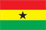
three equal horizontal bands of red (top), yellow, and green with a large black five-pointed star centered in the yellow band; uses the popular pan-African colors of Ethiopia; similar to the flag of Bolivia, which has a coat of arms centered in the yellow band
Location
8 00 N, 2 00 W -- Western Africa, bordering the North Atlantic Ocean, between Cote d'Ivoire and Togo Flag ----
Geography
Area
- comparative area
- slightly smaller than Oregon
- land area
- 230,020 sq km
- total area
- 238,540 sq km
Climate
tropical; warm and comparatively dry along southeast coast; hot and humid in southwest; hot and dry in north
Coastline
539 km
Environment
- current issues
- recent drought in north severely affecting agricultural activities; deforestation; overgrazing; soil erosion; poaching and habitat destruction threatens wildlife populations; water pollution; inadequate supplies of potable water
- international agreements
- party to - Biodiversity, Climate Change, Endangered Species, Environmental Modification, Law of the Sea, Nuclear Test Ban, Ozone Layer Protection, Ship Pollution, Tropical Timber 83, Tropical Timber 94, Wetlands, Whaling; signed, but not ratified - Desertification, Marine Life Conservation
- natural hazards
- dry, dusty, harmattan winds occur from January to March; droughts
Geographic coordinates
8 00 N, 2 00 W
Geographic note
Lake Volta is the world's largest artificial lake; northeasterly harmattan wind (January to March)
International disputes
none
Irrigated land
80 sq km (1989)
Land boundaries
- border countries
- Burkina Faso 548 km, Cote d'Ivoire 668 km, Togo 877 km
- total
- 2,093 km
Land use
- arable land
- 5%
- forest and woodland
- 37%
- meadows and pastures
- 15%
- other
- 36%
- permanent crops
- 7%
Location
Western Africa, bordering the North Atlantic Ocean, between Cote d'Ivoire and Togo
Map references
Africa
Maritime claims
- contiguous zone
- 24 nm
- continental shelf
- 200 nm
- exclusive economic zone
- 200 nm
- territorial sea
- 12 nm
Natural resources
gold, timber, industrial diamonds, bauxite, manganese, fish, rubber
Terrain
- mostly low plains with dissected plateau in south-central area
- highest point
- Mount Afadjato 880 m
- lowest point
- Atlantic Ocean 0 m
People and Society
Age structure
0-14 years: 43% (male 3,856,673; female 3,819,946) 15-64 years: 54% (male 4,658,142; female 4,814,060) 65 years and over: 3% (male 262,159; female 287,291) (July 1996 est.)
Birth rate
35 births/1,000 population (1996 est.)
Death rate
11.15 deaths/1,000 population (1996 est.)
Ethnic divisions
black African 99.8% (major tribes - Akan 44%, Moshi-Dagomba 16%, Ewe 13%, Ga 8%), European and other 0.2%
Infant mortality rate
80.3 deaths/1,000 live births (1996 est.)
Languages
English (official), African languages (including Akan, Moshi-Dagomba, Ewe, and Ga)
Life expectancy at birth
- female
- 58.22 years (1996 est.)
- male
- 54.18 years
- total population
- 56.17 years
Literacy
- age 15 and over can read and write (1995 est.)
- female
- 53.5%
- male
- 75.9%
- total population
- 64.5%
Nationality
- adjective
- Ghanaian
- noun
- Ghanaian(s)
Net migration rate
-0.94 migrant(s)/1,000 population (1996 est.)
Population
17,698,271 (July 1996 est.)
Population growth rate
2.29% (1996 est.)
Religions
indigenous beliefs 38%, Muslim 30%, Christian 24%, other 8%
Sex ratio
- all ages
- 0.98 male(s)/female (1996 est.)
- at birth
- 1.03 male(s)/female
- under 15 years
- 1.01 male(s)/female 15-64 years: 0.97 male(s)/female 65 years and over: 0.91 male(s)/female
Total fertility rate
4.59 children born/woman (1996 est.)
Government
Administrative divisions
10 regions; Ashanti, Brong-Ahafo, Central, Eastern, Greater Accra, Northern, Upper East, Upper West, Volta, Western
Capital
Accra
Constitution
new constitution approved 28 April 1992
Data code
GH
Diplomatic representation in US
- chancery
- 3512 International Drive NW, Washington, DC 20008
- chief of mission
- Ambassador Ekwow SPIO-GARBRAH
- telephone
- [1] (202) 686-4520
Executive branch
- cabinet
- Cabinet; president nominates members subject to approval by the Parliament
- chief of state and head of government
- President Jerry John RAWLINGS (since 3 November 1992); elected for a four-year term by direct universal suffrage; the president can appoint a vice president; election last held 3 November 1992 (next to be held NA December 1996)
FAX
- [1] (202) 686-4527
- [233] (21) 775747
- consulate(s) general
- New York
Flag
three equal horizontal bands of red (top), yellow, and green with a large black five-pointed star centered in the yellow band; uses the popular pan-African colors of Ethiopia; similar to the flag of Bolivia, which has a coat of arms centered in the yellow band
Independence
6 March 1957 (from UK)
International organization participation
ACP, AfDB, C, CCC, ECA, ECOWAS, FAO, G-24, G-77, IAEA, IBRD, ICAO, ICFTU, ICRM, IDA, IFAD, IFC, IFRCS, ILO, IMF, IMO, Intelsat, Interpol, IOC, IOM (observer), ITU, MINURSO, NAM, OAU, UN, UNAMIR, UNCRO, UNCTAD, UNESCO, UNIDO, UNIFIL, UNIKOM, UNPREDEP, UNPROFOR, UNU, UPU, WCL, WFTU, WHO, WIPO, WMO, WToO, WTrO
Judicial branch
Supreme Court
Legal system
based on English common law and customary law; has not accepted compulsory ICJ jurisdiction
Legislative branch
unicameral
Name of country
- conventional long form
- Republic of Ghana
- conventional short form
- Ghana
- former
- Gold Coast
National holiday
Independence Day, 6 March (1957)
Parliament
elections last held 29 December 1992 (next to be held NA December 1996); results - opposition boycotted the election, the National Democratic Congress won 198 of the total 200 seats and 2 seats were won by independents; because of interim bye-elections, the National Democratic Congress and its remaining coalition partner, Every Ghanian Living Everywhere (EGLE), now control 189 seats; former coalition partner, NCP, has 8 seats; independents hold 3
Political parties and leaders
National Democratic Congress (NDC), Jerry John RAWLINGS; New Patriotic Party (NPP), Peter Ala ADJETY; People's Heritage Party (PHP), Alex ERSKINE; National Convention Party (NCP), Kow ARKAAH; Every Ghanian Living Everywhere (EGLE), Ashang OKINE; Peoples Convention Party (PCP), B.K. NKETSIA; Peoples National Convention (PNC), Alhaji Asuma BANDA
Suffrage
18 years of age; universal
Type of government
constitutional democracy
US diplomatic representation
- chief of mission
- Ambassador Edward BRYNN
- embassy
- Ring Road East, East of Danquah Circle, Accra
- mailing address
- P. O. Box 194, Accra
- telephone
- [233] (21) 775348
Economy
Agriculture
cocoa, rice, coffee, cassava (tapioca), peanuts, corn, shea nuts, bananas; timber
Budget
- expenditures
- $1.2 billion, including capital expenditures of $178 million (1993)
- revenues
- $1.05 billion
Currency
1 new cedi (C) = 100 pesewas
Economic aid
- recipient
- ODA, $472 million (1993)
Economic overview
Well endowed with natural resources, Ghana has twice the per capita output of the poorer countries in West Africa. Heavily reliant on international assistance, Ghana has made steady progress in liberalizing its economy since 1983. Overall growth continued at a rate of approximately 5% in 1995, due largely to increased gold, timber, and cocoa production - major sources of foreign exchange. The economy, however, continues to revolve around subsistence agriculture, which accounts for almost half of GDP and employs 55% of the work force, mainly small landholders. Public sector wage increases, regional peacekeeping commitments, and the containment of internal unrest in the underdeveloped north have placed substantial demands on the government's budget and have led to inflationary deficit financing, depreciation of the cedi, and rising public discontent with Ghana's austerity program.
Electricity
- capacity
- 1,180,000 kW
- consumption per capita
- 323 kWh (1993)
- production
- 6.1 billion kWh
Exchange rates
new cedis per US$1 - 1,246.11 (September 1995), 956.71 (1994), 649.06 (1993), 437.09 (1992), 367.83 (1991)
Exports
- $1 billion (f.o.b., 1993 est.)
- commodities
- cocoa 40%, gold, timber, tuna, bauxite, aluminum, manganese ore, and diamonds
- partners
- Germany , US , UK , Netherlands , Japan (1995)
External debt
$4.6 billion (December 1993 est.)
Fiscal year
calendar year
GDP
purchasing power parity - $25.1 billion (1995 est.)
GDP composition by sector
- agriculture
- 47%
- industry
- 16%
- services
- 37% (1994 est.)
GDP per capita
$1,400 (1995 est.)
GDP real growth rate
5% (1995 est.)
Illicit drugs
illicit producer of cannabis for the international drug trade; transit hub for Southwest and Southeast Asian heroin destined for Europe and the US
Imports
- $1.7 billion (f.o.b., 1993 est.)
- commodities
- petroleum, consumer goods, foods, intermediate goods, capital equipment
- partners
- UK, US, Germany, Japan, Netherlands (1995)
Industrial production growth rate
2.8% (1994 est.)
Industries
mining, lumbering, light manufacturing, aluminum, food processing
Inflation rate (consumer prices)
69% (1995 est.)
Labor force
- 3.7 million
- by occupation
- agriculture and fishing 54.7%, industry 18.7%, sales and clerical 15.2%, professional 3.7%, services, transportation, and communications 7.7%
Unemployment rate
10% (1993 est.)
Communications
Branches
Army, Navy, Air Force, Police Force, Palace Guard, Civil Defense
Defense expenditures
exchange rate conversion - $30 million, 0.8% of GDP (1994)
Manpower availability
- males age 15-49
- 4,135,538
- males fit for military service
- 2,303,423
- males reach military age (18) annually
- 176,332 (1996 est.)
Radio broadcast stations
AM 4, FM 1, shortwave 0
Radios
NA
Telephone system
- poor to fair system
- domestic
- primarily microwave radio relay
- international
- satellite earth station - 1 Intelsat (Atlantic Ocean)
Telephones
70,000 (1988 est.)
Television broadcast stations
4 (repeaters 8)
Televisions
250,000 (1993 est.) Defense
Transportation
Airports
- total
- 12
- with paved runways 1 524 to 2 437 m
- 1
- with paved runways 2 438 to 3 047 m
- 3
- with paved runways 914 to 1 523 m
- 2
- with paved runways under 914 m
- 2
- with unpaved runways 1 524 to 2 437 m
- 2
- with unpaved runways 914 to 1 523 m
- 2 (1995 est.)
Highways
- paved
- 7,476 km (including 21 km of expressways)
- total
- 38,145 km
- unpaved
- 30,669 km (1990 est.)
Merchant marine
- ships by type
- cargo 2, refrigerated cargo 1 (1995 est.)
- total
- 3 ships (1,000 GRT or over) totaling 27,427 GRT/35,894 DWT
Pipelines
none
Ports
Takoradi, Tema
Railways
- narrow gauge
- 953 km 1.067-m gauge; 32 km double track
- total
- 953 km; note - undergoing major renovation (1995 est.)
Waterways
Volta, Ankobra, and Tano Rivers provide 168 km of perennial navigation for launches and lighters; Lake Volta provides 1,125 km of arterial and feeder waterways