2007 Edition
CIA World Factbook 2007 (Project Gutenberg)
Introduction
Administrative divisions
26 governorates (muhafazat, singular - muhafazah); Ad Daqahliyah, Al Bahr al Ahmar, Al Buhayrah, Al Fayyum, Al Gharbiyah, Al Iskandariyah, Al Isma'iliyah, Al Jizah, Al Minufiyah, Al Minya, Al Qahirah, Al Qalyubiyah, Al Wadi al Jadid, As Suways, Ash Sharqiyah, Aswan, Asyut, Bani Suwayf, Bur Sa'id, Dumyat, Janub Sina', Kafr ash Shaykh, Matruh, Qina, Shamal Sina', Suhaj
Age structure
0-14 years: 32.6% (male 13,172,641/female 12,548,346) 15-64 years: 62.9% (male 25,102,754/female 24,519,698) 65 years and over: 4.5% (male 1,510,280/female 2,033,288) (2006 est.)
Area
- land
- 995,450 sq km
- total
- 1,001,450 sq km
- water
- 6,000 sq km
Area - comparative
slightly more than three times the size of New Mexico
Background
The regularity and richness of the annual Nile River flood, coupled with semi-isolation provided by deserts to the east and west, allowed for the development of one of the world's great civilizations. A unified kingdom arose circa 3200 B.C., and a series of dynasties ruled in Egypt for the next three millennia. The last native dynasty fell to the Persians in 341 B.C., who in turn were replaced by the Greeks, Romans, and Byzantines. It was the Arabs who introduced Islam and the Arabic language in the 7th century and who ruled for the next six centuries. A local military caste, the Mamluks took control about 1250 and continued to govern after the conquest of Egypt by the Ottoman Turks in 1517. Following the completion of the Suez Canal in 1869, Egypt became an important world transportation hub, but also fell heavily into debt. Ostensibly to protect its investments, Britain seized control of Egypt's government in 1882, but nominal allegiance to the Ottoman Empire continued until 1914. Partially independent from the UK in 1922, Egypt acquired full sovereignty following World War II. The completion of the Aswan High Dam in 1971 and the resultant Lake Nasser have altered the time-honored place of the Nile River in the agriculture and ecology of Egypt. A rapidly growing population (the largest in the Arab world), limited arable land, and dependence on the Nile all continue to overtax resources and stress society. The government has struggled to ready the economy for the new millennium through economic reform and massive investment in communications and physical infrastructure. Geography Egypt
Birth rate
22.94 births/1,000 population (2006 est.)
Capital
- daylight saving time
- +1hr, begins last Friday in April; ends last Thursday in September
- geographic coordinates
- 30 03 N, 31 15 E
- name
- Cairo
- time difference
- UTC+2 (7 hours ahead of Washington, DC during Standard Time)
Climate
desert; hot, dry summers with moderate winters
Coastline
2,450 km
Constitution
11 September 1971; amended 22 May 1980 and 25 May 2005
Country name
- conventional long form
- Arab Republic of Egypt
- conventional short form
- Egypt
- former
- United Arab Republic (with Syria)
- local long form
- Jumhuriyat Misr al-Arabiyah
- local short form
- Misr
Death rate
5.23 deaths/1,000 population (2006 est.)
Elevation extremes
- highest point
- Mount Catherine 2,629 m
- lowest point
- Qattara Depression -133 m
Environment - current issues
agricultural land being lost to urbanization and windblown sands; increasing soil salination below Aswan High Dam; desertification; oil pollution threatening coral reefs, beaches, and marine habitats; other water pollution from agricultural pesticides, raw sewage, and industrial effluents; very limited natural fresh water resources away from the Nile, which is the only perennial water source; rapid growth in population overstraining the Nile and natural resources
Environment - international agreements
- party to
- Biodiversity, Climate Change, Climate Change-Kyoto Protocol, Desertification, Endangered Species, Environmental Modification, Hazardous Wastes, Law of the Sea, Marine Dumping, Ozone Layer Protection, Ship Pollution, Tropical Timber 83, Tropical Timber 94, Wetlands
- signed, but not ratified
- none of the selected agreements
Ethnic groups
Egyptian 98%, Berber, Nubian, Bedouin, and Beja 1%, Greek, Armenian, other European (primarily Italian and French) 1%
Executive branch
- cabinet
- Cabinet appointed by the president
- chief of state
- President Mohammed Hosni MUBARAK (since 14 October 1981)
- election results
- Hosni MUBARAK reelected president; percent of vote - Hosni MUBARAK 88.6%, Ayman NOUR 7.6%, Noman GOMAA 2.9%
- elections
- president elected by popular vote for six-year term (no term limits); note - a national referendum in May 2005 approved a constitutional amendment that changed the presidential election to a multicandidate popular vote; previously the president was nominated by the People's Assembly and the nomination was validated by a national, popular referendum; last referendum held 26 September 1999; first election under terms of constitutional amendment held 7 September 2005; next election scheduled for 2011
- head of government
- Prime Minister Ahmed NAZIF (since 9 July 2004)
Geographic coordinates
27 00 N, 30 00 E
Geography - note
controls Sinai Peninsula, only land bridge between Africa and remainder of Eastern Hemisphere; controls Suez Canal, a sea link between Indian Ocean and Mediterranean Sea; size, and juxtaposition to Israel, establish its major role in Middle Eastern geopolitics; dependence on upstream neighbors; dominance of Nile basin issues; prone to influxes of refugees People Egypt
Government type
republic
HIV/AIDS - adult prevalence rate
less than 0.1% (2001 est.)
HIV/AIDS - deaths
700 (2003 est.)
HIV/AIDS - people living with HIV/AIDS
12,000 (2001 est.)
Independence
28 February 1922 (from UK)
Infant mortality rate
- female
- 30.58 deaths/1,000 live births (2006 est.)
- male
- 32.04 deaths/1,000 live births
- total
- 31.33 deaths/1,000 live births
Irrigated land
34,220 sq km (2003)
Judicial branch
Supreme Constitutional Court
Land boundaries
- border countries
- Gaza Strip 11 km, Israel 266 km, Libya 1,115 km, Sudan 1,273 km
- total
- 2,665 km
Land use
- arable land
- 2.92%
- other
- 96.58% (2005)
- permanent crops
- 0.5%
Languages
Arabic (official), English and French widely understood by educated classes
Legal system
based on English common law, Islamic law, and Napoleonic codes; judicial review by Supreme Court and Council of State (oversees validity of administrative decisions); accepts compulsory ICJ jurisdiction, with reservations
Legislative branch
- bicameral system consists of the People's Assembly or Majlis al-Sha'b (454 seats; 444 elected by popular vote, 10 appointed by the president; members serve five-year terms) and the Advisory Council or Majlis al-Shura - which functions only in a consultative role (264 seats; 176 elected by popular vote, 88 appointed by the president; members serve six-year terms; mid-term elections for half of the elected members)
- election results
- People's Assembly - percent of vote by party - NA; seats by party - NDP 311, NWP 6, Tagammu 2, Tomorrow Party 1, independents 112 (12 seats to be determined by rerun elections, 10 seats appointed by President); Advisory Council - percent of vote by party - NA; seats by party - NA
- elections
- People's Assembly - three-phase voting - last held 7 and 20 November, 1 December 2005;(next to be held November-December 2010); Advisory Council - last held May-June 2004 (next to be held May-June 2007)
Life expectancy at birth
- female
- 73.93 years (2006 est.)
- male
- 68.77 years
- total population
- 71.29 years
Literacy
- definition
- age 15 and over can read and write
- female
- 46.9% (2003 est.) Government Egypt
- male
- 68.3%
- total population
- 57.7%
Location
Northern Africa, bordering the Mediterranean Sea, between Libya and the Gaza Strip, and the Red Sea north of Sudan, and includes the Asian Sinai Peninsula
Map references
Africa
Maritime claims
- contiguous zone
- 24 nm
- continental shelf
- 200-m depth or to the depth of exploitation
- exclusive economic zone
- 200 nm
- territorial sea
- 12 nm
Median age
- female
- 24.3 years (2006 est.)
- male
- 23.6 years
- total
- 24 years
National holiday
Revolution Day, 23 July (1952)
Nationality
- adjective
- Egyptian
- noun
- Egyptian(s)
Natural hazards
periodic droughts; frequent earthquakes, flash floods, landslides; hot, driving windstorm called khamsin occurs in spring; dust storms, sandstorms
Natural resources
petroleum, natural gas, iron ore, phosphates, manganese, limestone, gypsum, talc, asbestos, lead, zinc
Net migration rate
-0.21 migrant(s)/1,000 population (2006 est.)
Political parties and leaders
- National Democratic Party or NDP [Mohammed Hosni MUBARAK (governing party)]; National Progressive Unionist Grouping or Tagammu [Rifaat EL-SAID]; New Wafd Party or NWP [Mahmoud ABAZA]; Tomorrow Party [Naji AL-GHATRIFI]
- note
- formation of political parties must be approved by the
Population
78,887,007 (July 2006 est.)
Population growth rate
1.75% (2006 est.)
Religions
Muslim (mostly Sunni) 90%, Coptic 9%, other Christian 1%
Sex ratio
- at birth
- 1.05 male(s)/female
- total population
- 1.02 male(s)/female (2006 est.)
- under 15 years
- 1.05 male(s)/female 15-64 years: 1.02 male(s)/female 65 years and over: 0.74 male(s)/female
Suffrage
18 years of age; universal and compulsory
Terrain
vast desert plateau interrupted by Nile valley and delta
Total fertility rate
2.83 children born/woman (2006 est.)
Government
Agriculture - products
cotton, rice, corn, wheat, beans, fruits, vegetables; cattle, water buffalo, sheep, goats
Airports
88 (2006)
Airports - with paved runways
- over 3,047 m
- 13 2,438 to 3,047 m: 38 1,524 to 2,437 m: 16
- total
- 72
- under 914 m
- 5 (2006)
Airports - with unpaved runways
- total
- 16 2,438 to 3,047 m: 1 1,524 to 2,437 m: 3 914 to 1,523 m: 5
- under 914 m
- 7 (2006)
Budget
- expenditures
- $31.83 billion; including capital expenditures of $2.7 billion (2006 est.)
- revenues
- $21.32 billion
Currency (code)
Egyptian pound (EGP)
Currency code
EGP
Current account balance
$2.697 billion (2006 est.)
Debt - external
$29.59 billion (30 June 2006 est.)
Diplomatic representation from the US
- chief of mission
- Ambassador Francis J. RICCIARDONE, Jr.
- embassy
- 8 Kamal El Din Salah St., Garden City, Cairo
- mailing address
- Unit 64900, Box 15, APO AE 09839-4900
- telephone
- [20] (2) 797-3300
Diplomatic representation in the US
- chancery
- 3521 International Court NW, Washington, DC 20008
- chief of mission
- Ambassador Nabil FAHMY
- telephone
- [1] (202) 895-5400
Disputes - international
Egypt and Sudan retain claims to administer the two triangular areas that extend north and south of the 1899 Treaty boundary along the 22nd Parallel, but have withdrawn their military presence; Egypt is developing the Hala'ib Triangle north of the Treaty line; since the attack on Taba and other Egyptian resort towns on the Red Sea in October 2004, Egypt vigilantly monitors the Sinai and borders with Israel and the Gaza Strip; Egypt does not extend domestic asylum to some 70,000 persons who identify themselves as Palestinians but who largely lack UNRWA assistance and, until recently, UNHCR recognition as refugees
Distribution of family income - Gini index
34.4 (2001)
Economic aid - recipient
ODA, $1.12 billion (2002)
Economy - overview
Occupying the northeast corner of the African continent, Egypt is bisected by the highly fertile Nile valley, where most economic activity takes place. In the last 30 years, the government has reformed the highly centralized economy it inherited from President NASSER. In 2005, Prime Minister Ahmed NAZIF reduced personal and corporate tax rates, reduced energy subsidies, and privatized several enterprises. The stock market boomed, and GDP grew about 5% per year in 2005-06. Despite these achievements, the government has failed to raise living standards for the average Egyptian, and has had to continue providing subsidies for basic necessities. The subsidies have contributed to a growing budget deficit - more than 10% of GDP each year - and represent a significant drain on the economy. Foreign direct investment remains low. To achieve higher GDP growth the NAZIF government will need to continue its aggressive pursuit of reform, especially in the energy sector. Egypt's export sectors - particularly natural gas - have bright prospects.
Electricity - consumption
84.49 billion kWh (2004)
Electricity - exports
1 billion kWh (2004)
Electricity - imports
200 million kWh (2004)
Electricity - production
91.72 billion kWh (2004)
Electricity - production by source
- fossil fuel
- 81%
- hydro
- 19%
- nuclear
- 0%
- other
- 0% (2001)
Exchange rates
Egyptian pounds per US dollar - 5.75 (2006), 5.78 (2005), 6.1962 (2004), 5.8509 (2003), 4.4997 (2002)
Exports
$24.22 billion f.o.b. (2006 est.)
Exports - commodities
crude oil and petroleum products, cotton, textiles, metal products, chemicals
Exports - partners
US 13%, Italy 9.2%, Spain 7.7%, Syria 5.5%, France 4.9%, Germany 4.8%, Saudi Arabia 4.7%, UK 4% (2005)
FAX
- [1] (202) 244-4319
- [20] (2) 797-3200
- consulate(s) general
- Chicago, Houston, New York, San Francisco
Fiscal year
1 July - 30 June Communications Egypt
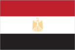
Flag description
three equal horizontal bands of red (top), white, and black; the national emblem (a gold Eagle of Saladin facing the hoist side with a shield superimposed on its chest above a scroll bearing the name of the country in Arabic) centered in the white band; design is based on the Arab Liberation flag and similar to the flag of Syria, which has two green stars, Iraq, which has three green stars (plus an Arabic inscription) in a horizontal line centered in the white band, and Yemen, which has a plain white band Economy Egypt
GDP - composition by sector
- agriculture
- 14.7%
- industry
- 35.5%
- services
- 49.8% (2006 est.)
GDP - per capita (PPP)
$4,200 (2006 est.)
GDP - real growth rate
5.7% (2006 est.)
GDP (official exchange rate)
$84.51 billion (2006 est.)
GDP (purchasing power parity)
$328.1 billion (2006 est.)
Heliports
3 (2006)
Household income or consumption by percentage share
- highest 10%
- 25% (1995)
- lowest 10%
- 4.4%
Illicit drugs
transit point for Southwest Asian and Southeast Asian heroin and opium moving to Europe, Africa, and the US; transit stop for Nigerian couriers; concern as money-laundering site due to lax enforcement of financial regulations This page was last updated on 8 February, 2007
Imports
$35.86 billion f.o.b. (2006 est.)
Imports - commodities
machinery and equipment, foodstuffs, chemicals, wood products, fuels
Imports - partners
US 10.5%, Germany 7%, China 6.4%, France 6.3%, Italy 5.7%, Saudi Arabia 4.8% (2005)
Industrial production growth rate
5.1% (2006 est.)
Industries
textiles, food processing, tourism, chemicals, pharmaceuticals, hydrocarbons, construction, cement, metals, light manufactures
Inflation rate (consumer prices)
6.5% (2006 est.)
International organization participation
ABEDA, ACCT, AfDB, AFESD, AMF, AU, BSEC (observer), CAEU, COMESA, EBRD, FAO, G-15, G-24, G-77, IAEA, IBRD, ICAO, ICC, ICCt (signatory), ICRM, IDA, IDB, IFAD, IFC, IFRCS, IHO, ILO, IMF, IMO, Interpol, IOC, IOM, IPU, ISO, ITU, LAS, MIGA, MINURSO, MONUC, NAM, OAPEC, OAS (observer), OIC, OIF, ONUB, OSCE (partner), PCA, UN, UNCTAD, UNESCO, UNHCR, UNIDO, UNITAR, UNMIL, UNMIS, UNOMIG, UNRWA, UNWTO, UPU, WCO, WFTU, WHO, WIPO, WMO, WTO
Internet country code
.eg
Internet hosts
2,254 (2006)
Internet Service Providers (ISPs)
50 (2000)
Internet users
5 million (2005) Transportation Egypt
Investment (gross fixed)
19.2% of GDP (2006 est.)
Labor force
21.8 million (2006 est.)
Labor force - by occupation
- agriculture
- 32%
- industry
- 17%
- services
- 51% (2001 est.)
Manpower available for military service
- females age 18-49
- 17,683,904 (2005 est.)
- males age 18-49
- 18,347,560
Manpower fit for military service
- females age 18-49
- 14,939,378 (2005 est.)
- males age 18-49
- 15,540,234
Manpower reaching military service age annually
- females age 18-49
- 764,176 (2005 est.)
- males age 18-49
- 802,920
Merchant marine
- by type
- bulk carrier 14, cargo 33, container 2, passenger/cargo 5, petroleum tanker 13, roll on/roll off 9
- foreign-owned
- 9 (Denmark 1, Greece 6, Lebanon 2)
- registered in other countries
- 49 (Bolivia 2, Cambodia 8, Georgia 8, Honduras 4, North Korea 2, Panama 16, Saint Vincent and the Grenadines 3, Sao Tome and Principe 1, Saudi Arabia 2, Sierra Leone 1, Thailand 1, unknown 1) (2006)
- total
- 76 ships (1000 GRT or over) 987,524 GRT/1,467,139 DWT
Military branches
Army, Navy, Air Force, Air Defense Command
Military expenditures - dollar figure
$2.44 billion (2003)
Military expenditures - percent of GDP
3.4% (2004) Transnational Issues Egypt
Military service age and obligation
18 years of age for conscript military service; three-year service obligation (2001)
Natural gas - consumption
31.46 billion cu m (2004 est.)
Natural gas - exports
1.1 billion cu m (2004 est.)
Natural gas - imports
0 cu m (2004 est.)
Natural gas - production
32.56 billion cu m (2004 est.)
Natural gas - proved reserves
1.657 trillion cu m (1 January 2005 est.)
Oil - consumption
590,000 bbl/day (2004 est.)
Oil - exports
134,000 bbl/day (2004 est.)
Oil - imports
NA bbl/day (2001)
Oil - production
700,000 bbl/day (2005 est.)
Oil - proved reserves
2.6 billion bbl (2006 est.)
Pipelines
condensate 464 km; condensate/gas 94 km; gas 6,021 km; liquid petroleum gas 897 km; oil 5,120 km; oil/gas/water 36 km; refined products 897 km (2006)
Political pressure groups and leaders
despite a constitutional ban against religious-based parties, the technically illegal Muslim Brotherhood constitutes Hosni MUBARAK's potentially most significant political opposition; MUBARAK tolerated limited political activity by the Brotherhood for his first two terms, but moved more aggressively since then to block its influence; civic society groups are sanctioned, but constrained in practical terms; trade unions and professional associations are officially sanctioned
Population below poverty line
20% (2005 est.)
Ports and terminals
Alexandria, Damietta, El Dekheila, Port Said, Suez, Zeit Military Egypt
Public debt
102.9% of GDP (2006 est.)
Radio broadcast stations
AM 42 (plus 15 repeaters), FM 14, shortwave 3 (1999)
Radios
20.5 million (1997)
Railways
- standard gauge
- 5,063 km 1.435-m gauge (62 km electrified) (2005)
- total
- 5,063 km
Refugees and internally displaced persons
- refugees (country of origin)
- 100,000 (Iraq), 70,255 (Palestinian Territories), 13,446 (Sudan) (2006)
Reserves of foreign exchange and gold
$26.3 billion (2006 est.)
Roadways
- paved
- 74,820 km
- total
- 92,370 km
- unpaved
- 17,550 km (2004)
Telephone system
- domestic
- principal centers at Alexandria, Cairo, Al Mansurah, Ismailia, Suez, and Tanta are connected by coaxial cable and microwave radio relay
- general assessment
- large system; underwent extensive upgrading during 1990s and is reasonably modern; Internet access and cellular service are available
- international
- country code - 20; satellite earth stations - 2 Intelsat (Atlantic Ocean and Indian Ocean), 1 Arabsat, and 1 Inmarsat; 5 coaxial submarine cables; tropospheric scatter to Sudan; microwave radio relay to Israel; a participant in Medarabtel
Telephones - main lines in use
10,396,100 (2005)
Telephones - mobile cellular
14,045,134 (2005)
Television broadcast stations
98 (September 1995)
Televisions
7.7 million (1997)
Trafficking in persons
- current situation
- Egypt is a transit country for women trafficked from Eastern Europe to Israel for the purpose of sexual exploitation; these women generally arrive as tourists and are subsequently trafficked through the Sinai Desert by Bedouin tribes; men and women from sub-Saharan Africa and Asia are believed to be trafficked through the Sinai Desert to Israel and Europe for labor exploitation; some Egyptian children from rural areas are trafficked within the country to work as domestic servants or laborers in the agriculture industry
- tier rating
- Tier 2 Watch List - Egypt is placed on the Tier 2 Watch List for its failure to show evidence of increasing efforts to address trafficking over the past year, particularly in the area of law enforcement
Unemployment rate
10.3% (2006 est.)
Waterways
- 3,500 km
- note
- includes Nile River, Lake Nasser, Alexandria-Cairo Waterway, and numerous smaller canals in delta; Suez Canal (193.5 km including approaches) navigable by oceangoing vessels drawing up to 17.68 m (2005)