1996 Edition
CIA World Factbook 1996 (Project Gutenberg)
Introduction
Description
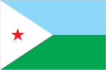
two equal horizontal bands of light blue (top) and light green with a white isosceles triangle based on the hoist side bearing a red five-pointed star in the center
Location
11 30 N, 43 00 E -- Eastern Africa, bordering the Gulf of Aden and the Red Sea, between Eritrea and Somalia Flag ----
Geography
Area
- comparative area
- slightly larger than Massachusetts
- land area
- 21,980 sq km
- total area
- 22,000 sq km
Climate
desert; torrid, dry
Coastline
314 km
Environment
- current issues
- inadequate supplies of potable water; desertification
- international agreements
- party to - Biodiversity, Climate Change, Endangered Species, Law of the Sea, Ship Pollution; signed, but not ratified - Desertification
- natural hazards
- earthquakes; droughts; occasional cyclonic disturbances from the Indian Ocean bring heavy rains and flash floods
Geographic coordinates
11 30 N, 43 00 E
Geographic note
strategic location near world's busiest shipping lanes and close to Arabian oilfields; terminus of rail traffic into Ethiopia; a vast wasteland
International disputes
none
Irrigated land
NA sq km
Land boundaries
- border countries
- Eritrea 113 km, Ethiopia 337 km, Somalia 58 km
- total
- 508 km
Land use
- arable land
- 0%
- forest and woodland
- 0%
- meadows and pastures
- 9%
- other
- 91%
- permanent crops
- 0%
Location
Eastern Africa, bordering the Gulf of Aden and the Red Sea, between Eritrea and Somalia
Map references
Africa
Maritime claims
- contiguous zone
- 24 nm
- exclusive economic zone
- 200 nm
- territorial sea
- 12 nm
Natural resources
geothermal areas
Terrain
- coastal plain and plateau separated by central mountains
- highest point
- Mousa Alli 2,028 m
- lowest point
- Asal -155 m
People and Society
Age structure
0-14 years: 43% (male 91,687; female 91,242) 15-64 years: 55% (male 123,699; female 110,530) 65 years and over: 2% (male 5,389; female 5,095) (July 1996 est.)
Birth rate
42.5 births/1,000 population (1996 est.)
Death rate
15.26 deaths/1,000 population (1996 est.)
Ethnic divisions
Somali 60%, Afar 35%, French, Arab, Ethiopian, and Italian 5%
Infant mortality rate
106.7 deaths/1,000 live births (1996 est.)
Languages
French (official), Arabic (official), Somali, Afar
Life expectancy at birth
- female
- 52.12 years (1996 est.)
- male
- 48.24 years
- total population
- 50.15 years
Literacy
- age 15 and over can read and write (1995 est.)
- female
- 32.7%
- male
- 60.3%
- total population
- 46.2%
Nationality
- adjective
- Djiboutian
- noun
- Djiboutian(s)
Net migration rate
-12.28 migrant(s)/1,000 population (1996 est.)
Population
427,642 (July 1996 est.)
Population growth rate
1.5% (1996 est.)
Religions
Muslim 94%, Christian 6%
Sex ratio
- all ages
- 1.07 male(s)/female (1996 est.)
- at birth
- 1.03 male(s)/female
- under 15 years
- 1 male(s)/female 15-64 years: 1.12 male(s)/female 65 years and over: 1.06 male(s)/female
Total fertility rate
6.08 children born/woman (1996 est.)
Government
Administrative divisions
5 districts (cercles, singular - cercle); 'Ali Sabih, Dikhil, Djibouti, Obock, Tadjoura
Capital
Djibouti
Chamber of Deputies (Chambre des Deputes)
elections last held 18 December 1992; results - RPP (the ruling party) dominated; seats - (65 total) RPP 65
Constitution
multiparty constitution approved in referendum 4 September 1992
Data code
DJ
Diplomatic representation in US
- chancery
- Suite 515, 1156 15th Street NW, Washington, DC 20005
- chief of mission
- Ambassador ROBLE Olhaye Oudine
- telephone
- [1] (202) 331-0270
Executive branch
- cabinet
- Council of Ministers is responsible to the president
- chief of state
- President HASSAN GOULED Aptidon (since 24 June 1977); election last held 7 May 1993 (next to be held NA 1999); results - President HASSAN GOULED reelected to a six-year term by universal suffrage
- head of government
- Prime Minister BARKAT Gourad Hamadou (since 30 September 1978)
FAX
- [1] (202) 331-0302
- [253] 35 39 40
Flag
two equal horizontal bands of light blue (top) and light green with a white isosceles triangle based on the hoist side bearing a red five-pointed star in the center
Independence
27 June 1977 (from France)
International organization participation
ACCT, ACP, AfDB, AFESD, AL, ECA, FAO, G-77, IBRD, ICAO, ICRM, IDA, IDB, IFAD, IFC, IFRCS, IGADD, ILO, IMF, IMO, Intelsat (nonsignatory user), Interpol, IOC, ITU, NAM, OAU, OIC, UN, UNAMIR, UNCTAD, UNESCO, UNIDO, UNMIH, UPU, WFTU, WHO, WMO, WTrO
Judicial branch
Supreme Court (Cour Supreme)
Legal system
based on French civil law system, traditional practices, and Islamic law
Legislative branch
unicameral
Name of country
- conventional long form
- Republic of Djibouti
- conventional short form
- Djibouti
- former
- French Territory of the Afars and Issas, French Somaliland
National holiday
Independence Day, 27 June (1977)
Other political or pressure groups
Front for the Restoration of Unity and Democracy (FRUD) and affiliates; Movement for Unity and Democracy (MUD)
Political parties and leaders
- other parties
- Democratic Renewal Party (PRD), Mohamed Jama ELABE; Democratic National Party (PND), ADEN Robleh Awaleh
- ruling party
- People's Progress Assembly (RPP), Hassan GOULED Aptidon
Suffrage
NA years of age; universal adult
Type of government
republic
US diplomatic representation
- chief of mission
- Ambassador Martin L. CHESHES
- embassy
- Plateau du Serpent, Boulevard Marechal Joffre, Djibouti
- mailing address
- B. P. 185, Djibouti
- telephone
- [253] 35 39 95
Economy
Agriculture
fruits, vegetables; goats, sheep, camels
Budget
- expenditures
- $201 million, including capital expenditures of $16 million (1993 est.)
- revenues
- $164 million
Currency
1 Djiboutian franc (DF) = 100 centimes
Economic aid
- recipient
- ODA, $NA
Economic overview
The economy is based on service activities connected with the country's strategic location and status as a free trade zone in northeast Africa. Two-thirds of the inhabitants live in the capital city, the remainder being mostly nomadic herders. Scanty rainfall limits crop production to fruits and vegetables, and most food must be imported. Djibouti provides services as both a transit port for the region and an international transshipment and refueling center. It has few natural resources and little industry. The nation is, therefore, heavily dependent on foreign assistance (an important supplement to GDP) to help support its balance of payments and to finance development projects. An unemployment rate of over 30% continues to be a major problem. Per capita consumption dropped an estimated 35% over the last six years because of recession, civil war, and a high population growth rate (including immigrants and refugees).
Electricity
- capacity
- 90,000 kW
- consumption per capita
- 398 kWh (1993)
- production
- 170 million kWh
Exchange rates
Djiboutian francs (DF) per US$1 - 177.721 (fixed rate since 1973)
Exports
- $184 million (f.o.b., 1994 est.)
- commodities
- hides and skins, coffee (in transit)
- partners
- Somalia 48%, Yemen 42%
External debt
$227 million (1993 est.)
Fiscal year
calendar year
GDP
purchasing power parity - $500 million (1994 est.)
GDP composition by sector
- agriculture
- 3%
- industry
- 21%
- services
- 76% (1993 est.)
GDP per capita
$1,200 (1994 est.)
GDP real growth rate
-3% (1994 est.)
Imports
- $384 million (f.o.b., 1994 est.)
- commodities
- foods, beverages, transport equipment, chemicals, petroleum products
- partners
- France, UK, Saudi Arabia, Bahrain, South Korea
Industrial production growth rate
NA%
Industries
limited to a few small-scale enterprises, such as dairy products and mineral-water bottling
Inflation rate (consumer prices)
6% (1993 est.)
Labor force
- 282,000
- by occupation
- agriculture 75%, industry 11%, services 14% (1991 est.)
Unemployment rate
over 30% (1994 est.)
Communications
Branches
Djibouti National Army (includes Navy and Air Force), National Security Force (Force Nationale de Securite), National Police Force
Defense expenditures
exchange rate conversion - $26 million, NA% of GDP (1989)
Manpower availability
- males age 15-49
- 102,528
- males fit for military service
- 60,076 (1996 est.)
Radio broadcast stations
AM 2, FM 2, shortwave 0
Radios
NA
Telephone system
- telephone facilities in the city of Djibouti are adequate as are the microwave radio relay connections to outlying areas of the country
- domestic
- microwave radio relay network
- international
- submarine cable to Saudi Arabia; satellite earth stations - 1 Intelsat (Indian Ocean) and 1 Arabsat
Telephones
7,200 (1986 est.)
Television broadcast stations
1
Televisions
17,000 (1993 est.) Defense
Transportation
Airports
- total
- 11
- with paved runways 2 438 to 3 047 m
- 1
- with paved runways over 3 047 m
- 1
- with paved runways under 914 m
- 2
- with unpaved runways 1 524 to 2 437 m
- 2
- with unpaved runways 914 to 1 523 m
- 5 (1995 est.)
Highways
- paved
- 363 km
- total
- 2,879 km
- unpaved
- 2,516 km (1991 est.)
Merchant marine
- total
- 1 cargo ship (1,000 GRT or over) totaling 1,369 GRT/3,030 DWT (1995 est.)
Ports
Djibouti
Railways
- narrow gauge
- 97 km 1.000-m gauge
- total
- 97 km (Djibouti segment of the Addis Ababa-Djibouti railroad)